
Mori Atlas logo
National parkÎle aux Fouquets

A low lying coral islet study in the reef waters of south-east Mauritius

Île aux Fouquets National Park: Mapped Coral Geography and Maritime Heritage Landscape

Île aux Fouquets is a compact, uninhabited coral islet located in the Indian Ocean off the coast of Mauritius. As a protected national park, it features a distinct coralline geology and the ruins of a nineteenth-century lighthouse, standing as a landmark against the backdrop of the reef and nearby islets. This geography reveals a fragile maritime heritage, where limestone terrain and seabird habitats define the character of this small but significant protected area.

coral islandnational parklighthouse ruinsislet parkseabirdsmarine ecosystem
A flat, minimalist vector-style illustration of a dramatic mountain valley landscape featuring a waterfall cascading down a cliff into a river, framed by evergreen trees in the foreground.

Île aux Fouquets

National park

Park overview

Structured park overview, official facts, and landscape profile for Île aux Fouquets

Île aux Fouquets park facts, protected area profile, and essential visitor context

Review the core facts for Île aux Fouquets, including designation, size, terrain, visitor scale, habitats, and operating context in one park-focused overview.

About Île aux Fouquets

Île aux Fouquets sits a few kilometers offshore from Mauritius, in the stretch of sea between the main island and the historical approaches to Grand Port. As one of several small islets dotted along the Mauritian coast, it belongs to a maritime landscape shaped as much by coral geology and reef systems as by the human history that played out among these waters.

Although the island itself is tiny, its surroundings carry considerable weight in the regional story. To the south lies one of the few real openings in the surrounding coral reef, a passage large enough for larger ships to enter or leave, which historically made this stretch of sea strategically important. Nearby islands such as Ilot Vacoas and Île de la Passe further enrich the maritime setting, and a prominent coastal feature, Lion Mountain, is visible from the island.

For the modern visitor, Île aux Fouquets is a quiet, uninhabited place whose appeal lies in a combination of views, heritage, and ecological restraint. There is no resident population, but the island offers a clear vantage point over neighbouring islets and the coast, and its lighthouse ruin continues to anchor its identity as a place where human maritime ambition, colonial history, and natural isolation meet on a very small piece of land.

Quick facts and research context for Île aux Fouquets

Île aux Fouquets is a roughly 2.49 hectare coral island located about five kilometers off the south-east coast of Mauritius, in the general vicinity of Ilot Vacoas and Île de la Passe. It holds Islet National Park status under Mauritian law, granted on June 5, 2004.

The island has no permanent population and is notable for its pure coral origin, its association with breeding terns, and the surviving ruin of a lighthouse erected by the British in 1864. It lies near the only opening in the surrounding reef large enough for bigger vessels to pass through.

Protection and recognition

Examine the recorded protection scope and established designation timeline for Île aux Fouquets.

Île aux Fouquets Protection Status and Designated Area History

Historical records trace the established protection timeline and mixed conservation scope of Île aux Fouquets back to 2004. Structured regulatory tracking details official designation data and international recognition metrics for the protected landscape.

Protection details

Protection scope
Mixed
Designated year
2004
Transboundary protection
No
Park context

Deeper park guide and search-rich context for Île aux Fouquets

Île aux Fouquets history, landscape, wildlife, and travel context

Explore Île aux Fouquets through its history, landscape character, ecosystems, wildlife, conservation priorities, cultural context, and seasonal travel timing in a structured park guide built for atlas discovery and search intent.

Why Île aux Fouquets stands out

Île aux Fouquets is best known as a compact offshore island that combines ecological, navigational, and historical significance. Its coral make-up and small size place it firmly within the family of uninhabited Mauritian islets protected under the national park framework. The island is also strongly associated with its nineteenth-century lighthouse, whose ruined 1864 structure remains a listed building and a recognizable landmark. Together, the coral setting, seabird history, lighthouse ruins, and proximity to Grand Port make it a small but richly layered site.
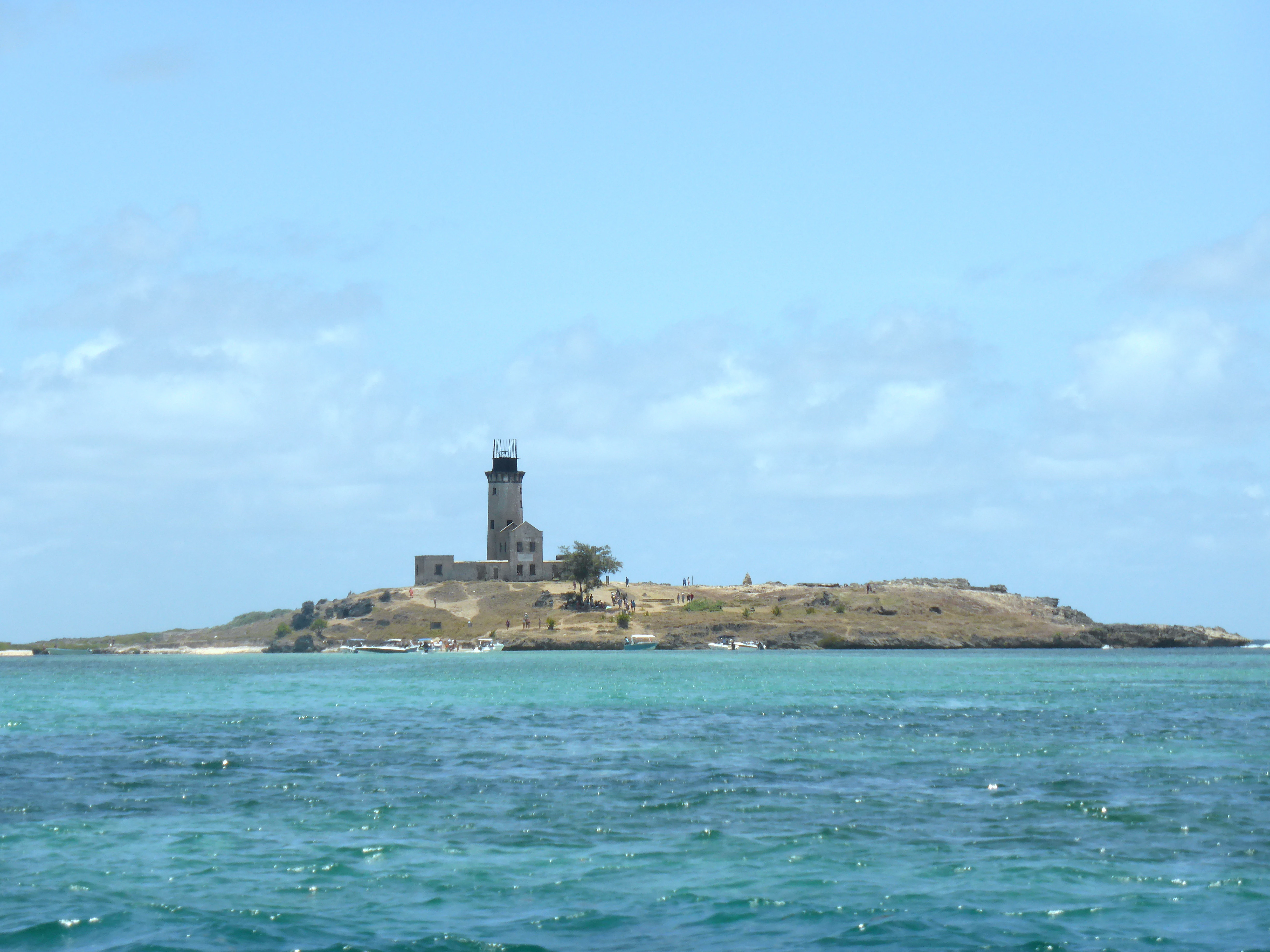
A distant view of Île aux Fouquets island featuring a weathered stone lighthouse, surrounded by turquoise ocean waters under a clear blue sky.
The historical lighthouse on Île aux Fouquets, Mauritius.

Île aux Fouquets history and protected-area timeline

The recorded human history of Île aux Fouquets begins in 1694, when a group of refugee Huguenots, led by the French adventurer François Leguat, were banished to the island by the Dutch governor of Mauritius. The men had originally attempted to build a Protestant community called Eden on Rodrigues, some 580 kilometers to the east, but abandoned that project in spite of the island's fertility, reportedly out of loneliness. They sailed to Mauritius on a self-built barge without an anchor or compass. After arriving safely, an unspecified conflict with the Dutch authorities led to their exile on the then largely treeless Île aux Fouquets, before they were eventually moved on to Java.

In 1810, the waters around the island became the backdrop for the naval Battle of Grand Port, one of the major French victories of the Napoleonic maritime campaigns. Although the engagement itself occurred near rather than on the island, it cemented the area's place in regional military and colonial memory.

After the British takeover of Mauritius, the imperial administration erected a lighthouse on Île aux Fouquets in 1864 to assist navigation through the nearby reef passage. The lighthouse has since fallen into ruin, but the structure remains a listed building and an important reminder of the island's long-standing role as a maritime landmark.

Île aux Fouquets landscape and geographic character

Île aux Fouquets is a very small, low-lying coral island in the Indian Ocean. Its geology is purely coralline, an outcome of reef-building processes rather than volcanic or continental origins, which gives it a distinctive place among the islands around Mauritius where larger landforms are typically volcanic.

The surrounding seascape is defined by the coral reef that fringes the Mauritian coast, broken in this area by a notable opening to the south that allows larger vessels to pass between the open ocean and the more sheltered waters closer to shore. From the island, views extend across neighbouring islets, including Ilot Vacoas and Île de la Passe, and toward the Mauritian mainland, where the silhouette of Lion Mountain forms a striking coastal landmark.

The interior of the island itself is minimal in scale: there are no inhabitants, no permanent freshwater system of note, and only sparse vegetation. The terrain is essentially a coral platform topped by the heritage structure of the ruined lighthouse, whose position still frames how the island is seen from the sea.

Île aux Fouquets ecosystems, habitats, and plant life

The natural character of Île aux Fouquets is shaped above all by its coral origin and its position within the broader reef ecosystem along the south-east coast of Mauritius. Because the island is uninhabited and designated as an Islet National Park, it functions as a protected fragment of the coastal marine environment rather than a self-contained inland ecosystem.

Historically, the island was closely associated with seabirds, particularly terns, which reportedly bred in caves on the island and were known locally as fouquets. This association is widely accepted as the origin of the island's name, as recorded by the German zoologist Karl August Möbius.

The vegetation cover is limited, consistent with a small, dry coral islet that has historically been described as largely treeless. Its value within the national park framework lies less in dense biodiversity and more in its role as a protected stepping stone within the offshore island chain, where seabird activity, coral geology, and reef-margin conditions can be maintained with minimal human disturbance.

Île aux Fouquets wildlife and species highlights

The wildlife profile of Île aux Fouquets is closely bound to its identity as a seabird island. The tern species once referred to as fouquet by local fishermen bred in caves on the island and is credited with giving the islet its name, underlining the long-standing importance of the island as a nesting site for marine birds.

Beyond its seabird connection, the island is best understood as part of the wider reef and coastal ecosystem of south-east Mauritius rather than as a standalone wildlife refuge. Its small size and minimal vegetation limit terrestrial diversity, while its marine surroundings support the reef habitats typical of the region.

Designation as an Islet National Park in 2004 reflects an understanding that even very small offshore islands contribute meaningfully to the maintenance of seabird populations and reef-margin ecosystems in the Mascarenhas region.

Île aux Fouquets conservation status and protection priorities

Île aux Fouquets has been formally protected under Mauritian law as an Islet National Park since June 5, 2004. The designation places the island within a national framework specifically designed for small uninhabited islets, recognizing that even very small protected fragments of land can play an important role in maintaining reef-margin ecosystems, seabird habitat, and coastal biodiversity along the Mauritian coast.

Its conservation significance rests less on size than on position. The island sits within a reef system whose health depends on protected nodes like Île aux Fouquets, where human pressure can be kept to a minimum and natural processes such as seabird breeding can continue with limited disturbance.

At the same time, the island carries a conservation heritage dimension: the ruined 1864 lighthouse is a listed structure, so its preserved state is part of the island's protected identity, blurring the line between natural and cultural heritage management on a very small scale.

Île aux Fouquets cultural meaning and human context

The cultural layer of Île aux Fouquets is unusually rich for an island of its size. The late seventeenth-century episode involving François Leguat and the Huguenot refugees gives it an early place in the wider European story of the Mascarene Islands, when Protestant exile communities were attempting to settle in isolated parts of the Indian Ocean.

The island is also tied to one of the most important naval engagements of the Napoleonic era through the 1810 Battle of Grand Port, fought in the surrounding waters. Although the battle was not fought on the island itself, its proximity firmly associates Île aux Fouquets with this chapter of Franco-British colonial conflict.

The British-built lighthouse of 1864, now a ruin but still a listed structure, anchors a third cultural strand: the maritime and navigational heritage of the south-east coast, in which small islets played an outsized role as landmarks and aids to navigation through the otherwise enclosed reef.

Top sights and standout views in Île aux Fouquets

Among the standout features of Île aux Fouquets, its pure coral geology and very small footprint set it apart from the larger volcanic islands that dominate Mauritian geography. The island's role as a former seabird refuge, with terns historically nesting in its caves, is another defining trait.

The heritage lighthouse ruin from 1864 and the layered history stretching from Huguenot exile in 1694 to the 1810 Battle of Grand Port make the island a remarkably concentrated record of the Indian Ocean's maritime past. Proximity to Ilot Vacoas, Île de la Passe, and Lion Mountain adds further geographical depth to what is otherwise a tiny patch of land.

Best time to visit Île aux Fouquets

Like much of Mauritius, the south-east coastal area around Île aux Fouquets follows a tropical climate with a warm wet season and a cooler dry season. The dry season, broadly running from roughly the May-to-November window, generally offers calmer seas, clearer views toward the mainland, and more comfortable conditions for boat-based excursions, which is typically how the island is reached.

The wetter summer months can bring heavier seas and more variable visibility, although the lush surrounding waters remain a constant feature. Because the island is uninhabited and reef-fringed, any visit depends on sea conditions rather than on a developed visitor calendar, and calm weather is the most important factor for a meaningful experience.
Monthly climate preview

Long-term representative point measurements tracking monthly temperature and precipitation cycles

Île aux Fouquets Climate Normals, Annual Temperature and Precipitation Rhythm

Representative coordinate records show an annual temperature range spanning from milder winter months to warmer summer periods alongside distinct monthly precipitation variations. Examining the complete twelve-month climatology profile provides deeper insight into measured temperature averages and rainfall patterns across the park.
Annual mean25 °C
22 °C27 °C
Jan27°
Feb27°
Mar27°
Apr26°
May25°
Jun23°
Jul22°
Aug22°
Sep22°
Oct23°
Nov25°
Dec26°
Warmest month
February

27.1 °C

Coolest month
August

21.9 °C

Wettest month
February

4.2 mm/day

Driest month
July

1 mm/day

Park location guide

Geography guide, regional context, and park location map for Île aux Fouquets

Île aux Fouquets park geography, regions, and map view in Mauritius

Understand where Île aux Fouquets sits in Mauritius through a broader geographic reading of the surrounding landscape, nearby location context, and its mapped position within the national park landscape.

How Île aux Fouquets fits into Mauritius

Mauritius is an island nation in the Indian Ocean and part of the Mascarene Islands. The country gained independence from Britain in 1968 and became a republic in 1992. It is characterized by a diverse population of primarily Indian and Creole descent, with English and French as official languages and Mauritian Creole as the dominant spoken language.

Wider geography shaping Île aux Fouquets in Mauritius

Mauritius is located in the Indian Ocean approximately 2,000 km east of Africa and east of Madagascar. The main island is volcanic in origin, and the country also includes the islands of Rodrigues, Agaléga, and St. Brandon (Cargados Carajos shoals). The territory is part of the Mascarene Islands, with nearby Réunion being a French overseas department.

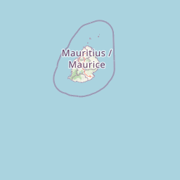
Map view of Île aux Fouquets

Use this park location map to pinpoint Île aux Fouquets in Mauritius, understand its exact geographic position, and read its mapped placement within the surrounding landscape more clearly.

Pigeon | © OpenStreetMap contributors

Explore photographic records of the coral platform, lighthouse ruins, and surrounding reef environment.

Île aux Fouquets Photos and Landscape Scenery: Visualizing the Protected Coral Island

Visual documentation reveals the distinct low-lying coral terrain and ruined nineteenth-century lighthouse defining the protected island environment. Examining these coastal and marine views provides deeper context for understanding the geography of the surrounding reef ecosystem.

A distant view of Île aux Fouquets island featuring a weathered stone lighthouse, surrounded by turquoise ocean waters under a clear blue sky.

Park atlas

Compare surrounding reef habitats, offshore islets, and coastal reserves

Exploring Other Parks and Protected Areas Near Île aux Fouquets

Browse protected areas and marine reserves situated near Île aux Fouquets to examine connected regional ecosystems and reef landscapes. Comparing neighboring coastal parks provides deeper geographic context for understanding the wider island environment.
Nature reserveMauritius
About 5.3 km away#1 closest

Southwest

Ile aux Aigrettes: Exploring the Protected Coral Coastal Landscape of Mauritius

A critical nature reserve and rewilding site in the Grand Port bay

Ile aux Aigrettes represents a unique geographic outpost off the south-east coast of Mauritius, defined by its flat coral limestone terrain. As a protected nature reserve, it offers insights into the recovery of rare dry coastal forest ecosystems and the ongoing scientific efforts to maintain endemic biodiversity on a small maritime scale.

Area
0.27 km²
Established
1965
Relief
Lowland
Access
Easy access
Nature reserveGrand Port District
About 8.3 km away#2 closest

Northwest

Vallée de Ferney Nature Reserve: Protected Mountain Landscapes in the Grand Port District

Indigenous rainforest, volcanic terrain, and conservation refuge

Located in the Bambou mountains of southeastern Mauritius, Vallée de Ferney is a 200-hectare nature reserve known for its protected indigenous rainforest and ongoing rewilding projects. As a key conservation site in the Grand Port District, the reserve offers a look at rare endemic species and the unique moisture-loving vegetation of the island's eastern volcanic series. Explore the mapped boundaries and natural terrain of this significant protected landscape.

Area
2 km²
Established
2006
Relief
Mountain
Climate
Tropical
Nature reserveMauritius
About 27 km away#3 closest

West

Monvert Nature Park: Exploring Protected Indigenous Landscapes in Mauritius

Regenerated highland forest and endemic flora reserve

Located in the central highlands of Mauritius near Curepipe, Monvert Nature Park protects a significant portion of recovering indigenous woodland. The park functions as a major botanical conservation site, featuring an arboretum with over 150 endemic species and a network of nature trails that traverse its unique highland terrain. This reserve offers a grounded look at the island's botanical diversity and ongoing forest restoration efforts.

Relief
Upland
Climate
Subtropical
Access
Easy access
Scope
Terrestrial
Watercolor illustration of a forest scene with trees, ferns, and distant mountains
National parkMauritius
About 28 km away#4 closest

North

Bras d'Eau National Park: Mauritius National Park Protected Landscape Discovery

Explore coastal terrain, endemic species habitats, and wetland geography.

Bras d'Eau National Park, situated on Mauritius, offers an in-depth look at a protected coastal lowland landscape vital for conservation. This national park showcases remnant forest patches critical for endemic flora and fauna, complemented by a unique system of four mares, including the mangrove-rich Mare sarcelle. Its mapped geography provides context for island ecosystems and serves as a key location for understanding Mauritius's protected natural areas.

Area
4.97 km²
Established
2011
Relief
Lowland
Climate
Tropical
Watercolor painting showing mountains in the distance, a body of water, and green vegetation in the foreground
National parkMauritius
About 32 km away#5 closest

West

Black River Gorges National Park: Key Protected Landscape and National Park in Mauritius

Explore mapped boundaries and endemic wildlife conservation in the southwest highlands.

Black River Gorges National Park is the largest protected area on Mauritius, critically preserving native rainforest and unique endemic species. This national park encompasses approximately 67.54 square kilometers, showcasing varied ecosystems from humid upland forests to marshy heathlands within its rugged highland terrain. The park's geography, characterized by deep gorges and steep slopes, provides essential habitats and plays a crucial role in the island's conservation efforts, making it a significant site for understanding Mauritius's natural heritage.

Area
67.54 km²
Established
1994
Relief
Upland
Climate
Tropical
A minimalist watercolor painting showing green rolling hills and distant terrain on a white background.
Nature reserveMoka District
About 34 km away#6 closest

Northwest

Le Pouce Nature Reserve: Volcanic Geography and Protected Upland Habitat in Mauritius

A rugged basalt peak in the Moka District mountain range.

Le Pouce Nature Reserve guards a critical 0.69 square kilometer patch of upland forest on the slopes of the third highest mountain in Mauritius. This protected area is recognized for its dramatic volcanic terrain and as the rare surviving home for the critically endangered Le Pouce Mountain Screwpine, providing an essential window into the island's unique ecological and geological history within the Moka Range.

Area
0.69 km²
Established
1951
Relief
Mountain
Climate
Tropical
A soft watercolor painting of a rolling landscape with green trees and hills in the background on a white background.
Nature reserveChamarel
About 43 km away#7 closest

West

Ebony Forest Nature Reserve: A Detailed Atlas of Chamarel's Restored Protected Landscapes

Indigenous forest restoration in southwest Mauritius

Ebony Forest stands as a primary nature reserve in the Chamarel hills of Mauritius, where extensive restoration efforts have reclaimed native semi-dry forest and upland ecosystems. This site offers an essential look at the island's endemic biodiversity through its protected ebony stands and rehabilitated slopes, making it a key component of the broader southwestern Mauritian conservation network.

Established
2017
Relief
Upland
Climate
Tropical
Access
Easy access
A minimalist, flat vector illustration showing a colorful island scene with a waterfall, forest, and surrounding water.
Protected areaRivière du Rempart District
About 58 km away#8 closest

North

Île Plate: Protected Area Geography and Natural Features in Rivière du Rempart District

Island biodiversity and volcanic landscapes in northern Mauritius

Île Plate is a compact island covering approximately 2.5 square kilometres, notable for its basalt geology and status as a protected area. It anchors a wider system of islets, offering a rich study of indigenous vegetation, seabird habitats, and tangible maritime history in the Indian Ocean.

Area
2.53 km²
Relief
Lowland
Access
Moderate access
Scope
Mixed

Common questions about visiting, size, designation, and location context for Île aux Fouquets

Île aux Fouquets FAQs for park facts, access, geography, and protected area context

Find quick answers about Île aux Fouquets, including protected-area facts, park geography, trail and visitor context, and how the park fits into its surrounding country and regional landscape.
MoriAtlas Explorer

Continue Your Protected Areas Search Across the Global Atlas

Deepen your exploration by continuing the structured search for national parks and protected areas worldwide. Utilize the comprehensive filtering capabilities to compare different conservation landscapes and refine your understanding of global park geography. Discover more about the distribution and characteristics of protected natural areas.

Global natural geography