
Mori Atlas logo
Nature reserveLe Pouce Nature Reserve

A historic basalt lava dome peak in Mauritius featuring rare endemic flora and high-altitude panoramic views.

Le Pouce Nature Reserve: Mapped Volcanic Terrain and Protected Landscapes in the Moka District

Le Pouce Nature Reserve anchors the northwest flank of the iconic thumb shaped peak within the Moka Range of Mauritius. This protected area preserves critical upland volcanic habitat and serves as a vital refuge for endemic plant species set against the rugged backdrop of the central highlands. The landscape remains a significant site of historical interest and geological study, rising sharply as a basalt lava dome that offers extensive views across the surrounding plateaus and towards the coast.

volcanic landscapelava domemountain hikemountain summitMoka Rangesmall nature reserve
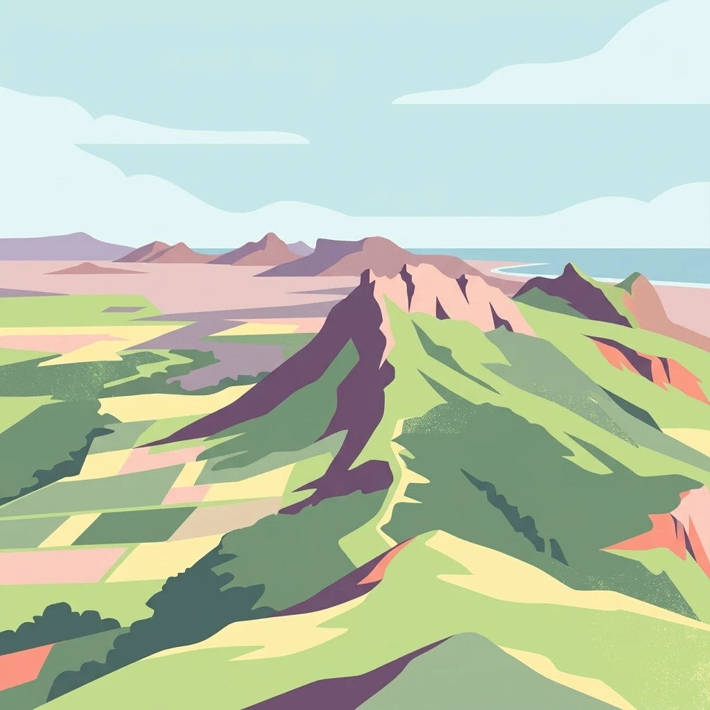
A stylized digital illustration of a mountainous landscape, featuring a prominent, craggy peak in the center surrounded by green slopes, fields, and a distant coastline under a light blue sky.

Le Pouce Nature Reserve

Nature reserve

Park overview

Structured park overview, official facts, and landscape profile for Le Pouce Nature Reserve

Le Pouce Nature Reserve park facts, protected area profile, and essential visitor context

Review the core facts for Le Pouce Nature Reserve, including designation, size, terrain, visitor scale, habitats, and operating context in one park-focused overview.

About Le Pouce Nature Reserve

Le Pouce Nature Reserve sits on a volcanic landmark that has become a defining feature of the Mauritian landscape. The mountain itself is part of the Moka Range, a chain of peaks formed from basalt lava flows that originated in the deep geological history of the Mascarene volcanic belt. Although the range is no longer active, its eroded slopes and exposed rock still carry the imprint of eruptions that shaped Mauritius millions of years ago. The nature reserve focuses on the northwest flank, where elevation, slope, and remaining native vegetation combine to form one of the few upland habitats on the island that retain elements of the original ecosystem.

The reserve is unusual in both its size and its biological weight. Its modest footprint stands in contrast to its outsized importance for plant conservation, particularly for a single pandanus species found nowhere else on earth. The surrounding mountain is also a cultural and recreational landmark, climbed by Charles Darwin in 1836 and today visited by hikers seeking views across Port Louis and the central plateau. Few protected areas in Mauritius link a nationally recognized geographic icon with such a narrow but critical conservation mission.

Because Le Pouce lies in the populated Moka District near the capital, the reserve exists at the intersection of rural upland, historical hiking trail, and active biodiversity protection. Its management is shaped less by the need to protect vast tracts of wilderness and more by the need to defend a tiny but globally irreplaceable slice of native flora from the pressures of invasive species and habitat loss that affect the rest of the island's uplands.

Quick facts and research context for Le Pouce Nature Reserve

Le Pouce is the third tallest mountain in Mauritius at 812 meters, located in the Moka District close to the village of La Laura-Malenga. It is the second highest peak in the Moka Range, a basalt lava dome that emerged from volcanic activity around ten million years ago and is no longer active. The Le Pouce Nature Reserve was established in 1951 and protects 0.69 square kilometers on the mountain's northwest flank, making it one of the older and smaller formally protected areas on the island. The reserve is most notable for hosting the only known wild individuals of the endemic Le Pouce Mountain Screwpine, a species considered critically endangered.

Protection and recognition

Terrestrial conservation framework and formal recognition records

Le Pouce Nature Reserve Protection Status and Territorial Designation

Le Pouce Nature Reserve maintains a documented terrestrial protection scope within the regional conservation network. Formal records outline the designated framework, management parameters, and international recognition data associated with the protected landscape.

Protection details

Protection scope
Terrestrial
Transboundary protection
No
Park context

Deeper park guide and search-rich context for Le Pouce Nature Reserve

Le Pouce Nature Reserve history, landscape, wildlife, and travel context

Explore Le Pouce Nature Reserve through its history, landscape character, ecosystems, wildlife, conservation priorities, cultural context, and seasonal travel timing in a structured park guide built for atlas discovery and search intent.

Why Le Pouce Nature Reserve stands out

Le Pouce is best known for two very different reasons. As a mountain, it is famous for its thumb-shaped peak and for being one of the most accessible and rewarding hikes in Mauritius, with panoramic views over Port Louis and the central highlands. As a protected area, the surrounding nature reserve is known for the extraordinary conservation status of the Le Pouce Mountain Screwpine, an endemic pandanus reduced to just two surviving male plants within its boundaries. The combination of a recognizable volcanic landmark and a globally significant micro-refuge of endemic flora gives the site a unique dual identity.
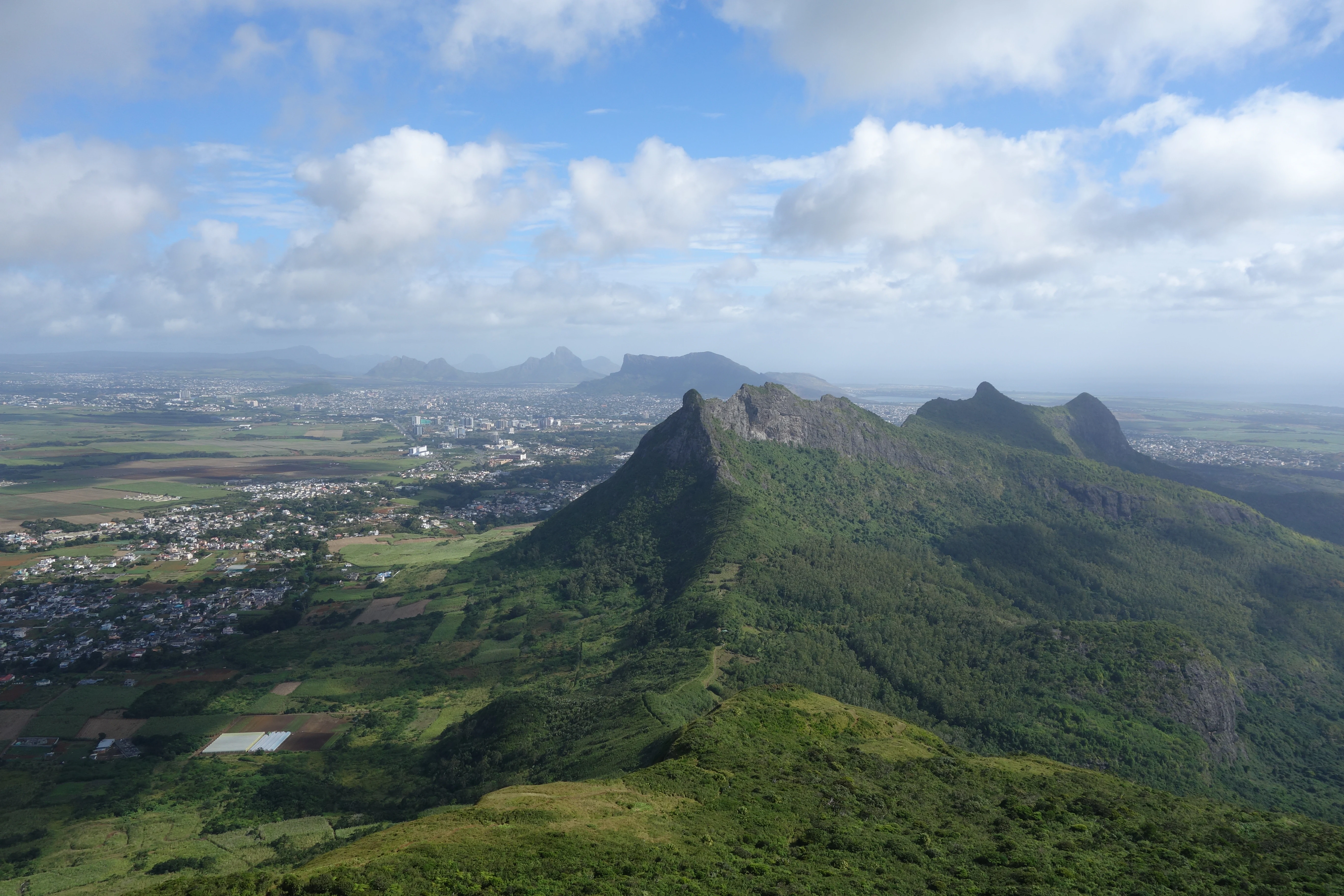
High altitude view from the summit of a mountain ridge, looking down over green forested hills, agricultural fields, and a distant town, under a blue sky with scattered clouds.
A panoramic view from the summit of Le Pouce, overlooking the lush landscape and the town of Moka in the valley below.

Le Pouce Nature Reserve history and protected-area timeline

The mountain that hosts the reserve has a deep geological history. Le Pouce and the surrounding Moka Range emerged from volcanic activity roughly ten million years ago, formed when basalt lava domes pushed upward from the Mascarene volcanic belt. Over millions of years, erosion shaped the distinctive thumb-like summit that gives the peak its name, while the slopes gradually developed into a mosaic of native forest and later, selectively invaded by introduced plants.

The mountain entered the wider scientific record on 2 May 1836, when Charles Darwin ascended Le Pouce during the second voyage of the HMS Beagle. In his journal, Darwin described the peak as a thumb-like projection rising close behind Port Louis and used the climb to develop his observations about the structure of Mauritius, including the oval central lava platform that gives the island much of its character. His account remains one of the earliest detailed European descriptions of the Mauritian highlands.

Le Pouce Nature Reserve itself was formally created in 1951 as a small dedicated protected area on the mountain's northwest flank. Its establishment reflected both rising awareness of erosion and invasive species in the Mauritian uplands and the growing recognition that the remaining native habitat fragments on these volcanic peaks needed formal protection. The reserve has since become a focal point for conservation attention because of a single endemic plant, Le Pouce Mountain Screwpine, whose only known surviving individuals grow within its boundaries.

Le Pouce Nature Reserve landscape and geographic character

Le Pouce is a sharp, steep volcanic peak rising to 812 meters in the central highlands of Mauritius, distinguished by a thumb-shaped summit that is clearly visible from the surrounding lowlands and from Port Louis, the national capital. The peak forms the second-highest point of the Moka Range, a basalt lava dome system whose slopes and ridges trace the contours of ancient lava flows that cooled and hardened ten million years ago.

The terrain around the reserve is rugged and steep, with trails that climb sharply up the northwest flank of the mountain. From the summit, the landscape opens into broad panoramic views across the central plateau of Mauritius, with sightlines reaching Port Louis, Moka, Beau-Bassin Rose-Hill, and across the wider island to neighboring peaks such as Pieter Both. The combination of compact summit area, steep flanks, and elevated viewpoints gives Le Pouce a strongly defined silhouette and a dramatic sense of exposure for hikers and visitors who reach the top.
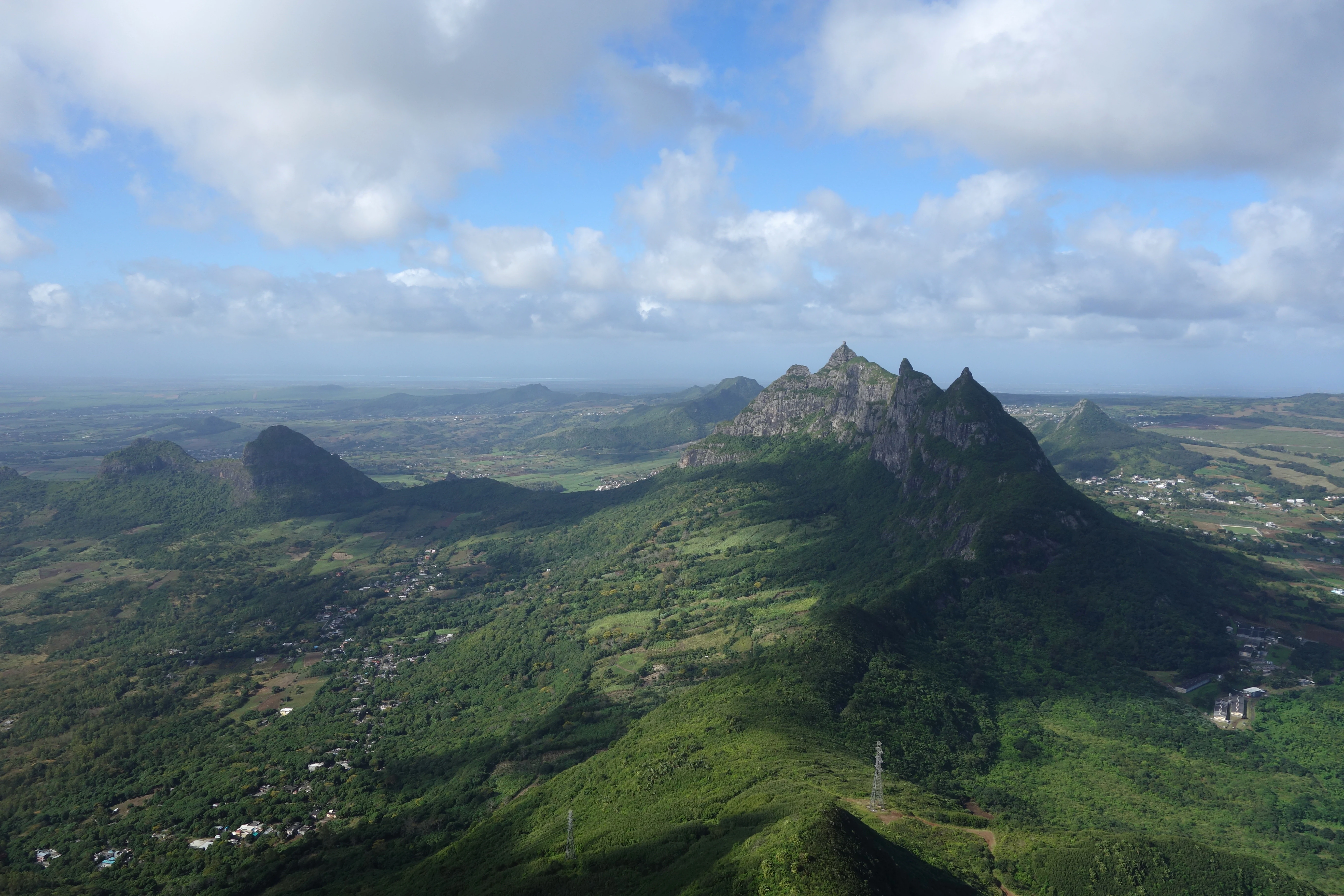
A wide aerial landscape view taken from a high mountain peak looking out over a lush green tropical valley towards a rugged, prominent mountain peak in the distance under a partly cloudy sky.
A view from the summit of Le Pouce mountain looking towards the distinctive peak of Pieter Both in Mauritius.

Le Pouce Nature Reserve ecosystems, habitats, and plant life

The natural environment of Le Pouce reflects the broader ecological story of Mauritius: a volcanic island whose original forests have largely been replaced by human-influenced and invasive vegetation. The slopes of the mountain are heavily overgrown with introduced guava and acacia, two species that have spread widely across the Mauritian uplands and displaced native flora. As a result, the natural habitat of the reserve exists more as small fragments of original ecosystem than as continuous forest stands.

Within these fragmented patches, however, conditions still allow for specialized native species to persist. Elevation, slope exposure, and the relatively undisturbed character of certain rocky areas have helped preserve plant communities that have disappeared elsewhere on the island. The reserve functions as a refuge, designed to hold onto these remaining native pockets against ongoing invasion, rather than as a large-scale recreation of lost habitat. This fragmented, relict character defines much of the nature experience in and around Le Pouce.
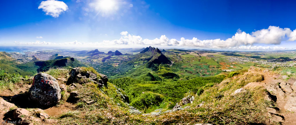
A wide-angle panoramic view taken from a rocky mountain peak looking down over a lush, green valley and rolling hills under a bright blue sky with scattered clouds.
A panoramic view overlooking the landscape from the summit of Le Pouce mountain.

Le Pouce Nature Reserve wildlife and species highlights

The Le Pouce Nature Reserve is best understood not for its animal populations but for its extraordinary botanical rarity. The reserve is the only known location in the world where the Le Pouce Mountain Screwpine, a pandanus species scientifically known as Pandanus pseudomontanus, survives in the wild. Just two individual plants of this species are known to exist, both of them within the boundaries of the reserve, and both male, which places the species at extremely high risk of extinction since female plants needed for reproduction appear to be lost.

IUCN has potentially assessed this screwpine as critically endangered, even though it is not yet officially listed on the Red List. The species is considered endemic to Le Pouce itself, meaning its entire evolutionary footprint is tied to this single mountain habitat. The reserve's wildlife profile, therefore, centers on a profoundly narrow but globally significant botanical survivor rather than on broader animal communities typical of larger protected areas.
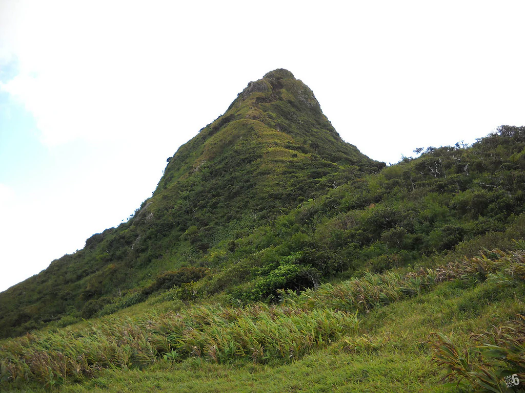
A view looking up toward the steep, grass-covered, and forested peak of Le Pouce mountain in Mauritius.
The prominent thumb-shaped summit of Le Pouce mountain.

Le Pouce Nature Reserve conservation status and protection priorities

Conservation at Le Pouce Nature Reserve is fundamentally a story about scale versus significance. Although the protected area covers just 0.69 square kilometers, it safeguards habitat for species found nowhere else on earth. The reserve was established in 1951 to protect a section of the mountain's northwest flank where native vegetation and endemic species could still survive, and over the decades it has taken on increasing importance as invasive guava and acacia have spread across much of the rest of the Moka Range.

The most defining conservation issue at the site is the survival of Pandanus pseudomontanus, the Le Pouce Mountain Screwpine. With only two known male plants remaining in the entire reserve and no known females, the species faces an extremely high risk of extinction and represents one of the rarest plant populations on any protected volcanic island. The reserve therefore serves a dual conservation role: protecting a recognizable fragment of upland habitat and maintaining the only known wild refuge of a species whose entire future now depends on the survival of these two individuals.

Le Pouce Nature Reserve cultural meaning and human context

Le Pouce holds a distinctive place in Mauritian cultural memory. The mountain has long been a symbol of the central highlands, its thumb-shaped peak a familiar landmark visible from Port Louis and the surrounding districts. Its ascent by Charles Darwin in 1836 added a layer of international scientific history, anchoring the peak in global discussions of island geology and the early development of evolutionary thinking.

In modern Mauritian life, the mountain functions as a recreational and communal space. Hiking Le Pouce is a common weekend activity, and the trail is accessible from both Port Louis and Moka. The nature reserve that protects part of its slopes reflects a parallel ethic of environmental care, marking the mountain as both a shared outdoor experience and a place of formal ecological responsibility within the country's national identity.
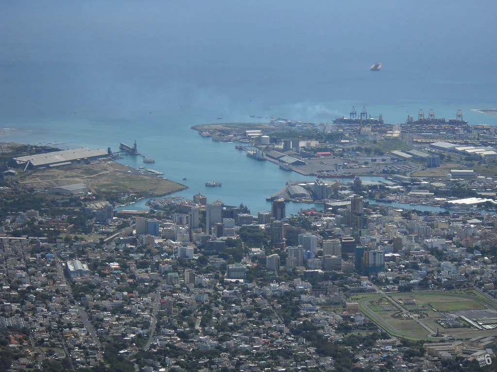
An elevated, wide-angle aerial view of the Port Louis cityscape, harbor, and coastline taken from a high mountain peak.
A bird,s eye view of the city and harbor of Port Louis, Mauritius, seen from the summit of Le Pouce.

Top sights and standout views in Le Pouce Nature Reserve

Le Pouce Nature Reserve combines one of Mauritius's most recognizable volcanic landmarks with a globally significant conservation mission. Its thumb-shaped summit offers some of the broadest panoramic views on the island, encompassing Port Louis, Moka, and the wider central plateau. The reserve protects the only known wild population of the Le Pouce Mountain Screwpine, a critically endangered endemic pandanus reduced to two surviving male plants. The site's links to Charles Darwin's 1836 ascent further emphasize its standing as both a natural and a historical landmark.

Best time to visit Le Pouce Nature Reserve

Le Pouce can be climbed year-round, but conditions are most comfortable during the cooler, drier months on Mauritius, when the central highlands are less humid and trail surfaces are easier to manage. The wetter tropical months bring heavier rainfall, muddier trails, and reduced visibility from the summit, which can diminish the panoramic views over Port Louis and the Moka Range.

Cooler mornings during the dry season tend to offer sharp, clear views from the thumb-shaped peak, while softer afternoon light highlights the contours of the basalt lava dome and the rest of the central plateau. The hike is steep but does not require technical climbing gear, making the choice of season more important for comfort and visibility than for safety. Wildlife viewing in the reserve itself is limited, since its main conservation value is botanical rather than faunal, but the broader Moka Range shows lush green vegetation during the wet months and more open, sunlit character during the dry season.
Monthly climate preview

Long-term temperature and precipitation averages across the year

Le Pouce Nature Reserve Climate Normals and Annual Weather Rhythm

Le Pouce Nature Reserve records mean monthly temperatures ranging from 22.47 to 27.33 degrees Celsius alongside variable precipitation rates spanning from 0.84 to 4.09 millimeters per day. Reviewing the complete twelve-month climatology profile reveals comprehensive variations in baseline thermal and moisture conditions.
Annual mean25 °C
22 °C27 °C
Jan27°
Feb27°
Mar27°
Apr26°
May25°
Jun24°
Jul23°
Aug22°
Sep23°
Oct24°
Nov25°
Dec26°
Warmest month
February

27.3 °C

Coolest month
August

22.5 °C

Wettest month
February

4.1 mm/day

Driest month
September

0.8 mm/day

Park location guide

Geography guide, regional context, and park location map for Le Pouce Nature Reserve

Le Pouce Nature Reserve park geography, regions, and map view in Mauritius

Understand where Le Pouce Nature Reserve sits in Mauritius through a broader geographic reading of the surrounding landscape, nearby location context, and its mapped position within the national park landscape.

How Le Pouce Nature Reserve fits into Mauritius

Mauritius is an island nation in the Indian Ocean and part of the Mascarene Islands. The country gained independence from Britain in 1968 and became a republic in 1992. It is characterized by a diverse population of primarily Indian and Creole descent, with English and French as official languages and Mauritian Creole as the dominant spoken language.

Wider geography shaping Le Pouce Nature Reserve in Mauritius

Mauritius is located in the Indian Ocean approximately 2,000 km east of Africa and east of Madagascar. The main island is volcanic in origin, and the country also includes the islands of Rodrigues, Agaléga, and St. Brandon (Cargados Carajos shoals). The territory is part of the Mascarene Islands, with nearby Réunion being a French overseas department.

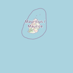
Map view of Le Pouce Nature Reserve

Use this park location map to pinpoint Le Pouce Nature Reserve in Mauritius, understand its exact geographic position, and read its mapped placement within the surrounding landscape more clearly.

Pigeon | © OpenStreetMap contributors

Location context for Le Pouce Nature Reserve

Moka District

Visual reference for the Moka Range summit, native upland habitats, and island panoramas.

Le Pouce Nature Reserve Photos: Landscapes, Scenery, and Volcanic Terrain

Visual documentation captures the rugged volcanic terrain, steep upland slopes, and endemic flora protected within Le Pouce Nature Reserve. Detailed photography reveals the unique topography of the thumb shaped summit and surrounding Mauritian highlands.

High altitude view from the summit of a mountain ridge, looking down over green forested hills, agricultural fields, and a distant town, under a blue sky with scattered clouds.

High angle aerial view looking down from a mountain peak over a green, rocky ridgeline, with a sprawling town and the ocean visible in the distant background under a partly cloudy blue sky.

A wide aerial landscape view taken from a high mountain peak looking out over a lush green tropical valley towards a rugged, prominent mountain peak in the distance under a partly cloudy sky.

A wide-angle panoramic view taken from a rocky mountain peak looking down over a lush, green valley and rolling hills under a bright blue sky with scattered clouds.

A view looking up toward the steep, grass-covered, and forested peak of Le Pouce mountain in Mauritius.

A dirt hiking trail leads through green, grassy fields toward the distinctive, rocky peak of Le Pouce mountain under a partially cloudy blue sky.

An elevated, wide-angle aerial view of the Port Louis cityscape, harbor, and coastline taken from a high mountain peak.

Park atlas

Compare regional volcanic landscapes and connected conservation zones across the highlands.

Explore Parks Near Le Pouce Nature Reserve and Surrounding Protected Areas

Visitors exploring Le Pouce Nature Reserve can continue browsing adjacent volcanic landforms and upland habitats across the surrounding region. Comparing neighboring protected areas provides deeper context on regional topography, endemic flora habitats, and island ecosystems.
Nature reserveMauritius
About 16 km away#1 closest

South

Monvert Nature Park: Exploring Protected Indigenous Landscapes in Mauritius

Regenerated highland forest and endemic flora reserve

Located in the central highlands of Mauritius near Curepipe, Monvert Nature Park protects a significant portion of recovering indigenous woodland. The park functions as a major botanical conservation site, featuring an arboretum with over 150 endemic species and a network of nature trails that traverse its unique highland terrain. This reserve offers a grounded look at the island's botanical diversity and ongoing forest restoration efforts.

Relief
Upland
Climate
Subtropical
Access
Easy access
Scope
Terrestrial
Watercolor painting showing mountains in the distance, a body of water, and green vegetation in the foreground
National parkMauritius
About 17 km away#2 closest

Southwest

Black River Gorges National Park: Key Protected Landscape and National Park in Mauritius

Explore mapped boundaries and endemic wildlife conservation in the southwest highlands.

Black River Gorges National Park is the largest protected area on Mauritius, critically preserving native rainforest and unique endemic species. This national park encompasses approximately 67.54 square kilometers, showcasing varied ecosystems from humid upland forests to marshy heathlands within its rugged highland terrain. The park's geography, characterized by deep gorges and steep slopes, provides essential habitats and plays a crucial role in the island's conservation efforts, making it a significant site for understanding Mauritius's natural heritage.

Area
67.54 km²
Established
1994
Relief
Upland
Climate
Tropical
Watercolor illustration of a forest scene with trees, ferns, and distant mountains
National parkMauritius
About 21 km away#3 closest

East

Bras d'Eau National Park: Mauritius National Park Protected Landscape Discovery

Explore coastal terrain, endemic species habitats, and wetland geography.

Bras d'Eau National Park, situated on Mauritius, offers an in-depth look at a protected coastal lowland landscape vital for conservation. This national park showcases remnant forest patches critical for endemic flora and fauna, complemented by a unique system of four mares, including the mangrove-rich Mare sarcelle. Its mapped geography provides context for island ecosystems and serves as a key location for understanding Mauritius's protected natural areas.

Area
4.97 km²
Established
2011
Relief
Lowland
Climate
Tropical
Nature reserveGrand Port District
About 26 km away#4 closest

Southeast

Vallée de Ferney Nature Reserve: Protected Mountain Landscapes in the Grand Port District

Indigenous rainforest, volcanic terrain, and conservation refuge

Located in the Bambou mountains of southeastern Mauritius, Vallée de Ferney is a 200-hectare nature reserve known for its protected indigenous rainforest and ongoing rewilding projects. As a key conservation site in the Grand Port District, the reserve offers a look at rare endemic species and the unique moisture-loving vegetation of the island's eastern volcanic series. Explore the mapped boundaries and natural terrain of this significant protected landscape.

Area
2 km²
Established
2006
Relief
Mountain
Climate
Tropical
A soft watercolor painting of a rolling landscape with green trees and hills in the background on a white background.
Nature reserveChamarel
About 31 km away#5 closest

Southwest

Ebony Forest Nature Reserve: A Detailed Atlas of Chamarel's Restored Protected Landscapes

Indigenous forest restoration in southwest Mauritius

Ebony Forest stands as a primary nature reserve in the Chamarel hills of Mauritius, where extensive restoration efforts have reclaimed native semi-dry forest and upland ecosystems. This site offers an essential look at the island's endemic biodiversity through its protected ebony stands and rehabilitated slopes, making it a key component of the broader southwestern Mauritian conservation network.

Established
2017
Relief
Upland
Climate
Tropical
Access
Easy access
Nature reserveMauritius
About 33 km away#6 closest

Southeast

Ile aux Aigrettes: Exploring the Protected Coral Coastal Landscape of Mauritius

A critical nature reserve and rewilding site in the Grand Port bay

Ile aux Aigrettes represents a unique geographic outpost off the south-east coast of Mauritius, defined by its flat coral limestone terrain. As a protected nature reserve, it offers insights into the recovery of rare dry coastal forest ecosystems and the ongoing scientific efforts to maintain endemic biodiversity on a small maritime scale.

Area
0.27 km²
Established
1965
Relief
Lowland
Access
Easy access
A horizontal watercolor painting showing green coastal vegetation, a small waterway, and distant hills under a soft sky.
National parkMauritius
About 34 km away#7 closest

Southeast

Île aux Fouquets National Park: Coral Islet Geography and Lighthouse Heritage in Mauritius

Protected maritime landscape and offshore reef terrain

This compact coral island represents a critical piece of the national park system in Mauritius. Known for its distinct limestone geology and nineteenth-century lighthouse ruins, it provides a unique window into the maritime history and offshore reef ecosystems of the Indian Ocean, contrasting with the volcanic landforms of the mainland.

Area
0.025 km²
Established
2004
Relief
Lowland
Access
Remote access
A minimalist, flat vector illustration showing a colorful island scene with a waterfall, forest, and surrounding water.
Protected areaRivière du Rempart District
About 38 km away#8 closest

Northeast

Île Plate: Protected Area Geography and Natural Features in Rivière du Rempart District

Island biodiversity and volcanic landscapes in northern Mauritius

Île Plate is a compact island covering approximately 2.5 square kilometres, notable for its basalt geology and status as a protected area. It anchors a wider system of islets, offering a rich study of indigenous vegetation, seabird habitats, and tangible maritime history in the Indian Ocean.

Area
2.53 km²
Relief
Lowland
Access
Moderate access
Scope
Mixed

Common questions about visiting, size, designation, and location context for Le Pouce Nature Reserve

Le Pouce Nature Reserve FAQs for park facts, access, geography, and protected area context

Find quick answers about Le Pouce Nature Reserve, including protected-area facts, park geography, trail and visitor context, and how the park fits into its surrounding country and regional landscape.
MoriAtlas Explorer

Continue Your Protected Areas Search Across the Global Atlas

Deepen your exploration by continuing the structured search for national parks and protected areas worldwide. Utilize the comprehensive filtering capabilities to compare different conservation landscapes and refine your understanding of global park geography. Discover more about the distribution and characteristics of protected natural areas.

Global natural geography