
Mori Atlas logo
Nature reserveVallée de Ferney

A vital conservation landscape and mountain valley refuge in the Grand Port District featuring restored forest terrain

Vallée de Ferney Nature Reserve: Mapping Protected Indigenous Rainforests in the Bambou Mountains of Mauritius

(La Vallée de Ferney)

Vallée de Ferney represents one of the most significant remnants of indigenous Mauritian rainforest, encompassing roughly 200 hectares of protected land within the wind-facing slopes of the Bambou mountains. This nature reserve serves as a critical refuge for endemic species and a model for ecological restoration in the Grand Port District. By integrating rare forest habitats with active conservation programs, the reserve preserves a unique volcanic landscape mosaic that remains essential to the natural heritage of southeastern Mauritius.

indigenous rainforestforest reservewildlife refugerewildingendemic speciesbirdwatching
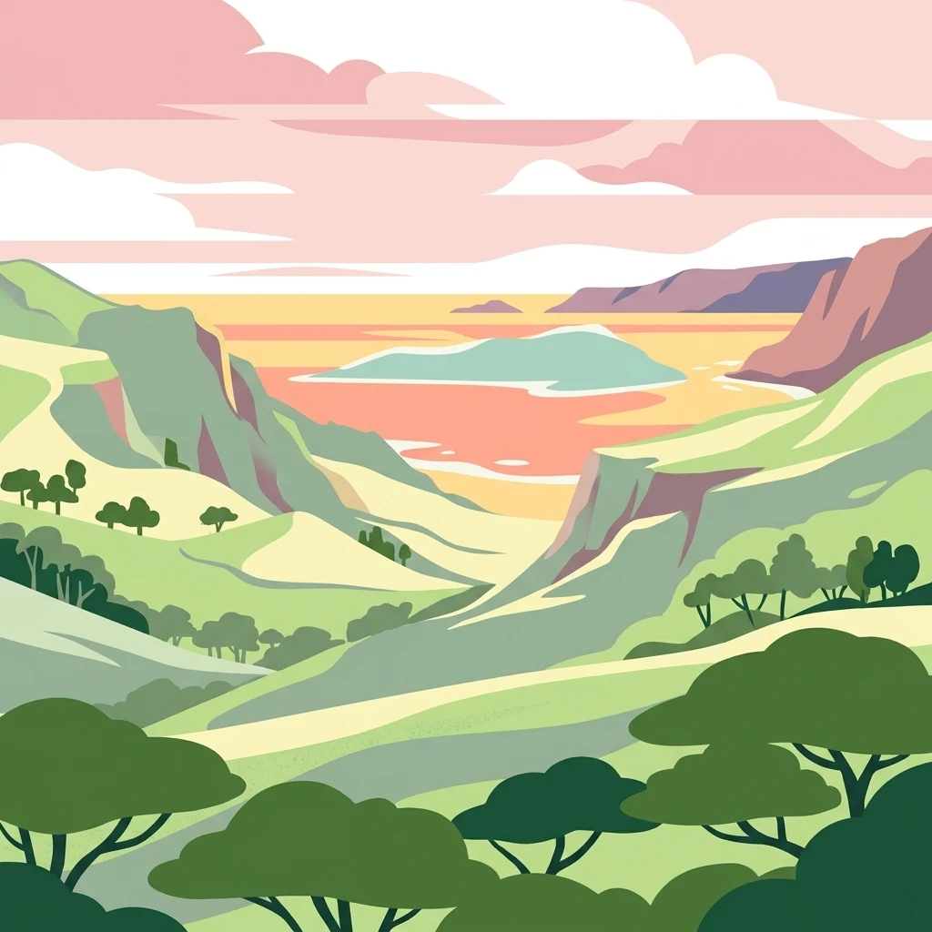
A digital illustration of a green valley framed by rolling hills, leading toward a calm sea under a soft pink and orange sunset sky.

Vallée de Ferney

Nature reserve

Park overview

Structured park overview, official facts, and landscape profile for Vallée de Ferney

Vallée de Ferney park facts, protected area profile, and essential visitor context

Review the core facts for Vallée de Ferney, including designation, size, terrain, visitor scale, habitats, and operating context in one park-focused overview.

About Vallée de Ferney

La Vallée de Ferney occupies a wind-facing valley in the Bambou mountains of southeastern Mauritius, in the Grand Port District just north of the coastal town of Mahébourg. Its roughly 200 hectares lie on Tertiary volcanic formations with acidic and clay soils, and the valley's humid year-round climate supports a remnant of native rainforest in a landscape that has otherwise been heavily modified by agriculture and development.

The reserve's identity is shaped by both its ecological value and its origin story. In 2004, awareness of the valley's biodiversity grew sharply when plans for a major highway would have required clearing forest and tunnelling through parts of the area. Surveys led by the local Environment Monitoring Committee revealed several species that were new to science, along with others believed to have gone extinct, including Pandanus iceryi and Pandanus macrostigma. Local activism and petitions ultimately succeeded in redirecting the road away from the valley, a turning point that led directly to the creation of La Vallée de Ferney Conservation Trust at the end of 2006.

Ecologically, the reserve is one of the last fragments of indigenous Mauritian forest still standing. Its partially rehabilitated rainforests harbour large numbers of plant species, most of which are classified as endangered or vulnerable. Eugenia bojeri, a critically endangered plant, was first described from the valley. Among the fauna, the reserve protects the endangered Mauritius kestrel and the Mauritian flying fox, a large megabat, while Javan rusa and wild boar are present as exotic species. Future programs include reintroducing the endangered pink pigeon and echo parakeet, expanding propagation of endemic plants, and releasing giant tortoises into the core conservation zone to assist in natural forest regeneration.

The site's approach combines preservation with public engagement. Near the valley entrance sits a small stone museum about the area's history, alongside gardens of edible and useful plants. Higher in the valley, an old hunting lodge has been converted into a restaurant and visitor complex, with the Ferney Nature Lodge offering accommodation. Daily kestrel feedings, a nursery selling endemic and endangered plants to local visitors, and an Aldabra giant tortoise enclosure, together make the reserve a working model of how a privately driven conservation trust in Mauritius can link ecological recovery with public education.

Quick facts and research context for Vallée de Ferney

La Vallée de Ferney is a roughly 200 hectare forest and wildlife reserve in the Bambou mountains of southeastern Mauritius, north of Mahébourg in the Grand Port District. It is managed by the La Vallée de Ferney Conservation Trust in partnership with the Mauritian Wildlife Foundation and local authorities, and was formally established at the end of 2006 after a campaign to divert a planned highway away from the valley. The reserve protects partially rehabilitated indigenous rainforest on wind-facing, geologically old volcanic terrain, and is one of the last remaining fragments of native habitat on an island where less than two percent of the original indigenous ecosystems survive.

Protection and recognition

Examine the terrestrial protection scope and documented designation records

Vallee de Ferney Protection Status and Designated Conservation Context

Vallee de Ferney maintains a documented terrestrial protection scope within its designated conservation framework. Review the recorded management status and formal recognition data associated with this protected landscape.

Protection details

Protection scope
Terrestrial
Transboundary protection
No
Park context

Deeper park guide and search-rich context for Vallée de Ferney

Vallée de Ferney history, landscape, wildlife, and travel context

Explore Vallée de Ferney through its history, landscape character, ecosystems, wildlife, conservation priorities, cultural context, and seasonal travel timing in a structured park guide built for atlas discovery and search intent.

Why Vallée de Ferney stands out

La Vallée de Ferney is best known as the site where several species once thought extinct, including two Pandanus species, were rediscovered during biodiversity surveys, and as one of the last refuges of indigenous Mauritian rainforest. The reserve is also recognised for its pioneering mix of conservation, ecological restoration, and public access, with a visitor complex, nursery for endemic plants, and programs that use giant tortoises to help regenerate native forest. Daily public feedings of the endangered Mauritius kestrel have become one of the valley's most distinctive visitor experiences.
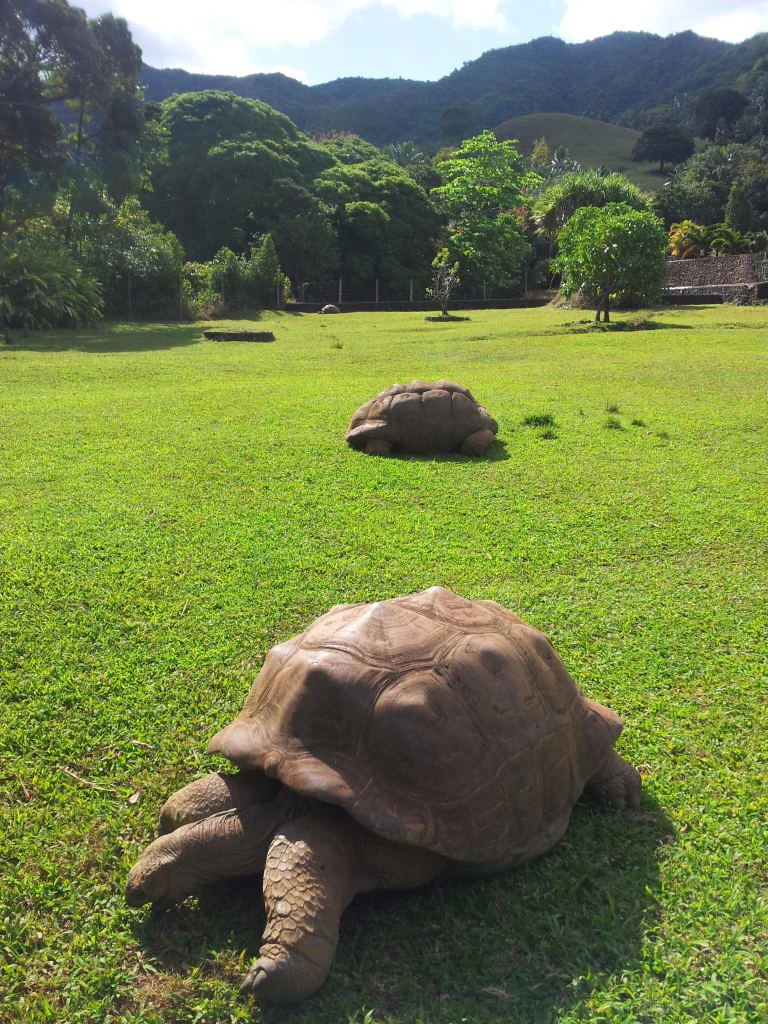
Two large brown Aldabra giant tortoises in the foreground and midground on a green grassy field with a lush forest and mountains in the background.
Aldabra giant tortoises grazing in the open grassy fields of Vallée de Ferney nature reserve.

Vallée de Ferney history and protected-area timeline

La Vallée de Ferney emerged as a formal conservation site only in the twenty-first century, but its modern creation is rooted in a struggle over a planned highway. The valley's biodiversity first drew national attention in 2004, when surveys linked to a proposed road project revealed that the area hosted species new to science and others long thought extinct. Community activism, supported by scientific findings from the Environment Monitoring Committee, led to the highway being successfully rerouted away from the valley.

In late 2006, the landowners, the Mauritian Wildlife Foundation, and local authorities came together to establish La Vallée de Ferney Conservation Trust, formalising the valley as a dedicated conservation and restoration area for indigenous Mauritian forest. From the outset the trust focused on rewilding and reintroductions, supported by ongoing weeding of invasive alien plants and large-scale propagation of native species.

Later additions shaped the visitor experience. An old hunting lodge higher in the valley was converted into a restaurant and visitor complex, the Ferney Nature Lodge was added for overnight stays, and a small stone museum near the entrance was built to interpret the valley's natural and human history. These facilities, alongside a plant nursery and a giant tortoise enclosure, turned the reserve into both an ecological recovery site and one of the more accessible indigenous forest experiences in Mauritius.

Vallée de Ferney landscape and geographic character

La Vallée de Ferney sits in the Bambou mountains of southeastern Mauritius, forming a wind-facing valley north of the coastal town of Mahébourg. Its terrain is built on old Tertiary volcanic series, with a mix of acidic and clay soils that support the residual indigenous forests the reserve is known for. The valley's position toward the prevailing winds gives it a humid climate throughout the year, an important factor for the moisture-loving native vegetation that has survived here.

From the entrance near the B28 road, the valley rises steadily, with hiking circuits threading through the forest and reaching a series of look-out points that frame views toward the coast. Île aux Aigrettes can be seen in the distance from higher vantage points, reinforcing the valley's sense of connection with Mauritius's broader coastal and offshore landscapes. Old farm buildings near the entrance hint at earlier land use, while the upper valley, where the visitor complex sits, retains the character of a more secluded montane setting on the edge of the Bambou range.

Beyond its boundaries, the adjacent Vallée de l'Est conservation area adds another 70 hectares of rare highland forest, extending the native landscape footprint around La Vallée de Ferney and reinforcing its role as a key component of southeastern Mauritius's surviving mountain forest mosaic.
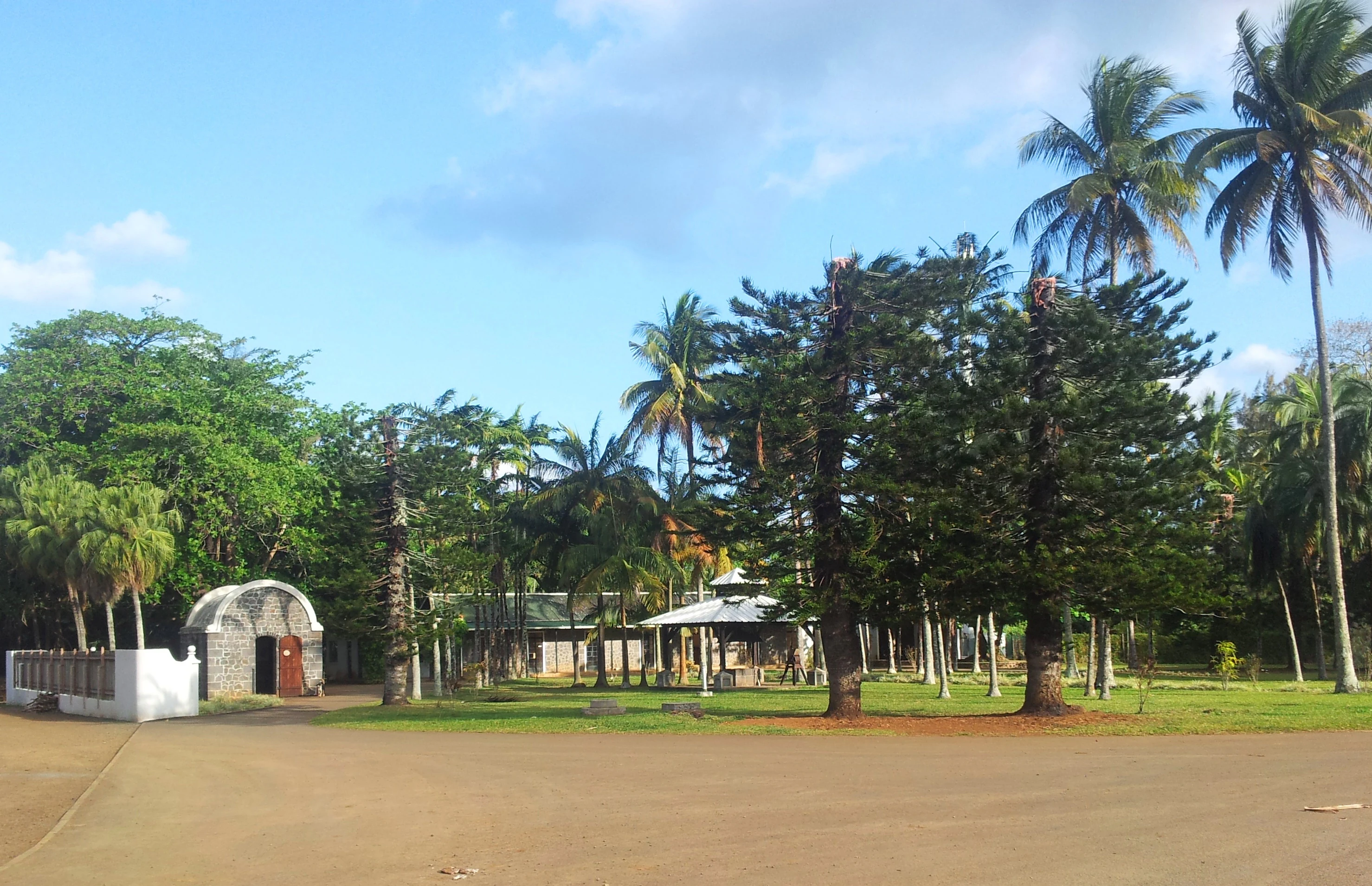
A view of historic stone and white-walled farm buildings surrounded by palm trees and pine-like trees in a garden setting.
Historic farm buildings located within the Vallee de Ferney nature reserve.

Vallée de Ferney ecosystems, habitats, and plant life

The vegetation of La Vallée de Ferney is dominated by partially rehabilitated indigenous rainforest, with the canopy and understorey made up largely of native species that have become rare or threatened elsewhere in Mauritius. The valley's humid conditions, windward exposure, and old volcanic soils combine to support an unusually intact sample of the island's original flora, where many plants are classified as endangered or vulnerable.

Several plant species are particularly important to the valley's identity. Two Pandanus species thought to have been lost were rediscovered here, including Pandanus iceryi, while the critically endangered Eugenia bojeri was first described from the site. The reserve also hosts collections of useful and edible plants in gardens near the entrance, as well as a working nursery that propagates endemic and endangered species for sale and for restoration plantings.

Restoration ecology is a central theme. Ongoing work focuses on re-establishing indigenous plant communities in degraded parts of the valley, removing invasive alien plants, and preparing habitat for the reintroduction of native fauna. The planned release of Aldabra giant tortoises into the core zone is intended to use their grazing pressure to assist in the regeneration of native forest structures, echoing ecological processes lost from the island.
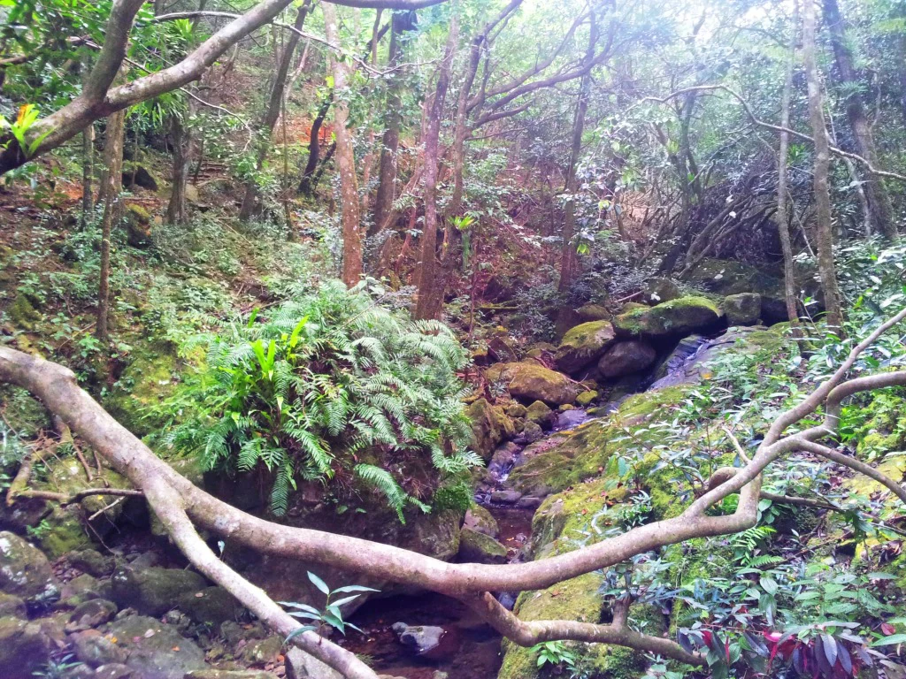
A dense, green forest scene with a small rocky stream flowing through moss-covered boulders and indigenous vegetation.
A lush, indigenous forest interior within the Vallee de Ferney nature reserve, featuring mossy rocks and a small stream.

Vallée de Ferney wildlife and species highlights

La Vallée de Ferney shelters several species of high conservation value, many of them being emblematic of Mauritius's broader biodiversity crisis. The Mauritius kestrel, once one of the rarest birds in the world, is kept here and is presented to visitors through a daily public feeding. The reserve also provides habitat for the endangered Mauritian flying fox, a large megabat that roosts in forested valleys of the island's southeast.

The valley's plant-focused rediscovery story has had clear wildlife implications. Surveys that revealed previously unknown and presumed extinct plant species also confirmed the ecological importance of the area for associated fauna. The trust is preparing for reintroductions of two more endangered endemic birds, the pink pigeon and the echo parakeet, both of which are flagship species for native forest restoration on the island. The presence of Aldabra giant tortoises at the site, both in enclosures near the visitor complex and planned for release into the core conservation zone, adds a distinctive ecological layer: their grazing is expected to help reshape the understorey and accelerate the recovery of native forest.

Alongside native fauna, the reserve also supports populations of exotic species, notably Javan rusa and wild boar. Their presence reflects the wider challenge facing Mauritian conservation, where long-established introduced species continue to interact with the small fragments of native habitat that remain.

Vallée de Ferney conservation status and protection priorities

La Vallée de Ferney carries strong conservation significance because of what it preserves and how it was created. The reserve sits within an island context where less than two percent of the original indigenous ecosystems remain intact, making its forested valley a disproportionately important refuge of native biodiversity. Several species thought extinct have been rediscovered within its boundaries, and at least one critically endangered plant was first described from the valley, underscoring the scientific as well as ecological value of the site.

The reserve's conservation model combines private land stewardship, NGO expertise, and community backing. The La Vallée de Ferney Conservation Trust, established at the end of 2006, works alongside the Mauritian Wildlife Foundation and local authorities to manage restoration, invasive species control, and species reintroductions. Practical projects include large-scale propagation of indigenous and endemic plants, systematic weeding of invasive alien vegetation, and the planned reintroduction of pink pigeons, echo parakeets, and giant tortoises, all aimed at restoring ecological balance to the native forests.

The trust's work is amplified by neighbouring protected areas, particularly the Vallée de l'Est conservation area, which contributes an additional 70 hectares of rare highland forest protection in the same region. Together, La Vallée de Ferney and its surroundings form a key part of Mauritius's effort to link surviving native forest fragments into a more resilient conservation landscape.

Vallée de Ferney cultural meaning and human context

La Vallée de Ferney sits in a region of Mauritius with deep colonial and maritime history, just inland from Mahébourg, one of the island's oldest towns and a place long associated with trade, naval encounters, and rural settlement. The valley's own history reflects this layered land use, with old farm buildings near its entrance and an old hunting lodge higher up indicating how the surrounding landscape was long worked and used before becoming a reserve.

The valley's modern story has given it a strong local identity as a community-led conservation site. The 2004 campaign to reroute a planned highway through the area brought residents, landowners, and conservation organisations together, and that civic momentum shaped the creation of the trust in 2006. The reserve's small stone museum, gardens of edible and useful plants, and locally themed plant nursery all speak to an effort to connect visitors with the kind of everyday plant knowledge and rural heritage that has long characterised the Mauritian countryside.

Today the reserve functions as both an ecological and a cultural meeting point, offering Mauritian visitors, in particular, access to native forest, native food plants, and reintroduced species that their grandparents would once have seen across the island.

Top sights and standout views in Vallée de Ferney

One of the last surviving fragments of indigenous Mauritian rainforest, set in a wind-facing valley of the Bambou mountains near Mahébourg.

The place where several species, including two Pandanus, were rediscovered after being thought extinct, and where the critically endangered Eugenia bojeri was first described.

A working conservation trust combining private land stewardship, the Mauritian Wildlife Foundation, and local communities, with ongoing rewilding through endemic plant propagation and giant tortoise releases.

A rare accessible introduction to Mauritius's endemic fauna, including a daily public feeding of the endangered Mauritius kestrel, Aldabra giant tortoises, and plans for reintroducing pink pigeons and echo parakeets.

A visitor experience that layers hiking, a small museum of local history, gardens of useful plants, and an inviting visitor complex converted from an old hunting lodge.

Best time to visit Vallée de Ferney

La Vallée de Ferney's climate is humid throughout the year, as the valley is wind-facing on Mauritius's southeastern mountains, so conditions for hiking and forest exploration stay broadly favourable in any season. Cooler and drier months typically suit walking the longer circuits and enjoying the look-out points with clearer coastal views out toward Île aux Aigrettes, when forest trails are at their most comfortable and bird and tortoise viewing are easier to combine.

The reserve is shaded and supported by indigenous forest, so even in warmer months the river valley offers a notably cooler microclimate than the surrounding lowlands near Mahébourg. Visitors interested in rewilding work and plant propagation may find the cooler, slightly drier period especially rewarding, when the nursery and restoration sites are more comfortable to walk between. Daily kestrel feedings, tortoise encounters, and access to the museum and visitor complex make the timing of a visit less critical than at sites that depend on narrow seasonal peaks.
Monthly climate preview

Long-term representative temperature and precipitation averages recorded at Grand Port District

Vallée de Ferney Climate Normals and Annual Weather Rhythm

Historical climate records for Vallée de Ferney show consistent annual temperature variations and distinct monthly precipitation patterns based on multi-year NASA power data. Examining the complete twelve-month meteorological profile reveals detailed average minimum and maximum thresholds across the protected landscape.
Annual mean25 °C
22 °C27 °C
Jan27°
Feb27°
Mar27°
Apr26°
May25°
Jun23°
Jul22°
Aug22°
Sep22°
Oct23°
Nov25°
Dec26°
Warmest month
February

27.1 °C

Coolest month
August

21.9 °C

Wettest month
February

4.2 mm/day

Driest month
July

1 mm/day

Park location guide

Geography guide, regional context, and park location map for Vallée de Ferney

Vallée de Ferney park geography, regions, and map view in Mauritius

Understand where Vallée de Ferney sits in Mauritius through a broader geographic reading of the surrounding landscape, nearby location context, and its mapped position within the national park landscape.

How Vallée de Ferney fits into Mauritius

Mauritius is an island nation in the Indian Ocean and part of the Mascarene Islands. The country gained independence from Britain in 1968 and became a republic in 1992. It is characterized by a diverse population of primarily Indian and Creole descent, with English and French as official languages and Mauritian Creole as the dominant spoken language.

Wider geography shaping Vallée de Ferney in Mauritius

Mauritius is located in the Indian Ocean approximately 2,000 km east of Africa and east of Madagascar. The main island is volcanic in origin, and the country also includes the islands of Rodrigues, Agaléga, and St. Brandon (Cargados Carajos shoals). The territory is part of the Mascarene Islands, with nearby Réunion being a French overseas department.

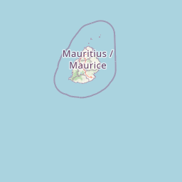
Map view of Vallée de Ferney

Use this park location map to pinpoint Vallée de Ferney in Mauritius, understand its exact geographic position, and read its mapped placement within the surrounding landscape more clearly.

Pigeon | © OpenStreetMap contributors

Location context for Vallée de Ferney

Grand Port District

Examine the terrain, native habitats, and protected mountain scenery defining the reserve

Vallée de Ferney Photos and Landscape Scenery: Visualizing Mauritius Forest Reserves

Visual documentation of Vallée de Ferney reveals the rugged volcanic terrain, humid mountain forests, and rare native habitats preserved within the Bambou range. Photographic records provide clear visual context for understanding the protected landscapes and ongoing ecological restoration across the reserve.

Two large brown Aldabra giant tortoises in the foreground and midground on a green grassy field with a lush forest and mountains in the background.

A wide landscape view of rolling green hills covered in lush forest and open meadows, leading down to a calm turquoise bay under a cloudy sky.

A view of historic stone and white-walled farm buildings surrounded by palm trees and pine-like trees in a garden setting.

A dense, green forest scene with a small rocky stream flowing through moss-covered boulders and indigenous vegetation.

Park atlas

Compare regional forest reserves and connected conservation landscapes across southeastern Mauritius.

Explore Protected Areas and Parks Near Vallée de Ferney in the Bambou Mountains

Browse nearby national parks and protected areas to understand the wider mountain forest mosaic surrounding Vallée de Ferney. Compare regional conservation landscapes and trace similar island ecosystems across the surrounding district.
Nature reserveMauritius
About 7 km away#1 closest

Southeast

Ile aux Aigrettes: Exploring the Protected Coral Coastal Landscape of Mauritius

A critical nature reserve and rewilding site in the Grand Port bay

Ile aux Aigrettes represents a unique geographic outpost off the south-east coast of Mauritius, defined by its flat coral limestone terrain. As a protected nature reserve, it offers insights into the recovery of rare dry coastal forest ecosystems and the ongoing scientific efforts to maintain endemic biodiversity on a small maritime scale.

Area
0.27 km²
Established
1965
Relief
Lowland
Access
Easy access
A horizontal watercolor painting showing green coastal vegetation, a small waterway, and distant hills under a soft sky.
National parkMauritius
About 8.3 km away#2 closest

Southeast

Île aux Fouquets National Park: Coral Islet Geography and Lighthouse Heritage in Mauritius

Protected maritime landscape and offshore reef terrain

This compact coral island represents a critical piece of the national park system in Mauritius. Known for its distinct limestone geology and nineteenth-century lighthouse ruins, it provides a unique window into the maritime history and offshore reef ecosystems of the Indian Ocean, contrasting with the volcanic landforms of the mainland.

Area
0.025 km²
Established
2004
Relief
Lowland
Access
Remote access
Nature reserveMauritius
About 19 km away#3 closest

West

Monvert Nature Park: Exploring Protected Indigenous Landscapes in Mauritius

Regenerated highland forest and endemic flora reserve

Located in the central highlands of Mauritius near Curepipe, Monvert Nature Park protects a significant portion of recovering indigenous woodland. The park functions as a major botanical conservation site, featuring an arboretum with over 150 endemic species and a network of nature trails that traverse its unique highland terrain. This reserve offers a grounded look at the island's botanical diversity and ongoing forest restoration efforts.

Relief
Upland
Climate
Subtropical
Access
Easy access
Scope
Terrestrial
Watercolor illustration of a forest scene with trees, ferns, and distant mountains
National parkMauritius
About 24 km away#4 closest

North

Bras d'Eau National Park: Mauritius National Park Protected Landscape Discovery

Explore coastal terrain, endemic species habitats, and wetland geography.

Bras d'Eau National Park, situated on Mauritius, offers an in-depth look at a protected coastal lowland landscape vital for conservation. This national park showcases remnant forest patches critical for endemic flora and fauna, complemented by a unique system of four mares, including the mangrove-rich Mare sarcelle. Its mapped geography provides context for island ecosystems and serves as a key location for understanding Mauritius's protected natural areas.

Area
4.97 km²
Established
2011
Relief
Lowland
Climate
Tropical
Watercolor painting showing mountains in the distance, a body of water, and green vegetation in the foreground
National parkMauritius
About 25 km away#5 closest

West

Black River Gorges National Park: Key Protected Landscape and National Park in Mauritius

Explore mapped boundaries and endemic wildlife conservation in the southwest highlands.

Black River Gorges National Park is the largest protected area on Mauritius, critically preserving native rainforest and unique endemic species. This national park encompasses approximately 67.54 square kilometers, showcasing varied ecosystems from humid upland forests to marshy heathlands within its rugged highland terrain. The park's geography, characterized by deep gorges and steep slopes, provides essential habitats and plays a crucial role in the island's conservation efforts, making it a significant site for understanding Mauritius's natural heritage.

Area
67.54 km²
Established
1994
Relief
Upland
Climate
Tropical
A minimalist watercolor painting showing green rolling hills and distant terrain on a white background.
Nature reserveMoka District
About 26 km away#6 closest

Northwest

Le Pouce Nature Reserve: Volcanic Geography and Protected Upland Habitat in Mauritius

A rugged basalt peak in the Moka District mountain range.

Le Pouce Nature Reserve guards a critical 0.69 square kilometer patch of upland forest on the slopes of the third highest mountain in Mauritius. This protected area is recognized for its dramatic volcanic terrain and as the rare surviving home for the critically endangered Le Pouce Mountain Screwpine, providing an essential window into the island's unique ecological and geological history within the Moka Range.

Area
0.69 km²
Established
1951
Relief
Mountain
Climate
Tropical
A soft watercolor painting of a rolling landscape with green trees and hills in the background on a white background.
Nature reserveChamarel
About 36 km away#7 closest

West

Ebony Forest Nature Reserve: A Detailed Atlas of Chamarel's Restored Protected Landscapes

Indigenous forest restoration in southwest Mauritius

Ebony Forest stands as a primary nature reserve in the Chamarel hills of Mauritius, where extensive restoration efforts have reclaimed native semi-dry forest and upland ecosystems. This site offers an essential look at the island's endemic biodiversity through its protected ebony stands and rehabilitated slopes, making it a key component of the broader southwestern Mauritian conservation network.

Established
2017
Relief
Upland
Climate
Tropical
Access
Easy access
A minimalist, flat vector illustration showing a colorful island scene with a waterfall, forest, and surrounding water.
Protected areaRivière du Rempart District
About 54 km away#8 closest

North

Île Plate: Protected Area Geography and Natural Features in Rivière du Rempart District

Island biodiversity and volcanic landscapes in northern Mauritius

Île Plate is a compact island covering approximately 2.5 square kilometres, notable for its basalt geology and status as a protected area. It anchors a wider system of islets, offering a rich study of indigenous vegetation, seabird habitats, and tangible maritime history in the Indian Ocean.

Area
2.53 km²
Relief
Lowland
Access
Moderate access
Scope
Mixed

Common questions about visiting, size, designation, and location context for Vallée de Ferney

Vallée de Ferney FAQs for park facts, access, geography, and protected area context

Find quick answers about Vallée de Ferney, including protected-area facts, park geography, trail and visitor context, and how the park fits into its surrounding country and regional landscape.
MoriAtlas Explorer

Continue Your Protected Areas Search Across the Global Atlas

Deepen your exploration by continuing the structured search for national parks and protected areas worldwide. Utilize the comprehensive filtering capabilities to compare different conservation landscapes and refine your understanding of global park geography. Discover more about the distribution and characteristics of protected natural areas.

Global natural geography