
Named stones
Park geography
A detailed look at the island-based geography, elevation, and coastal land classification.
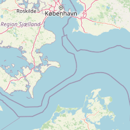
Jasmund National Park Geographic Profile: Mapped Boundaries, Terrain, and Natural Features
Analyze the formal geographic data for Jasmund National Park situated within the Mecklenburg-Vorpommern region of Germany. This profile maps the 30 square kilometer area, covering island terrain, coastal cliffs, and internal features ranging from the Piekberg peak to various streams and forest wetlands.
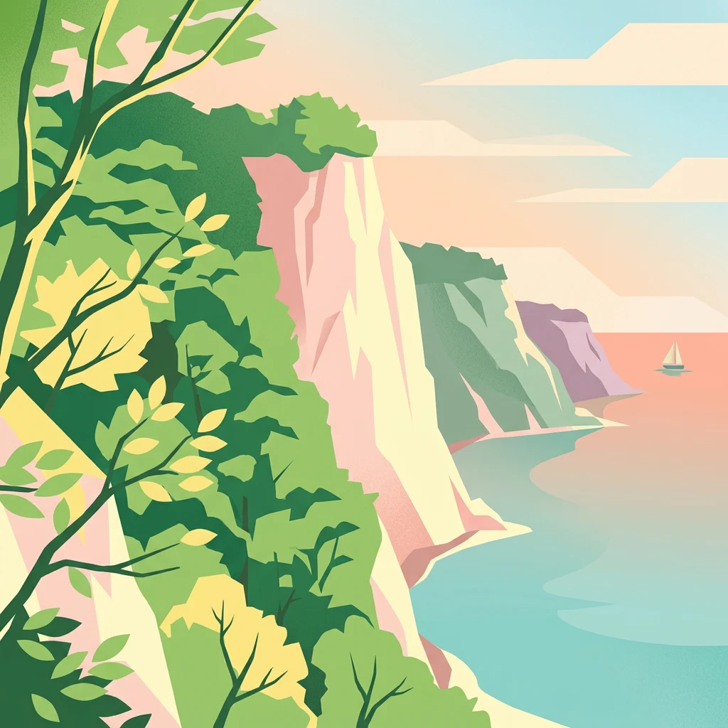
Germany's smallest national park protecting the iconic chalk cliffs of Rügen
Jasmund National Park
Jasmund National Park is a nature reserve located on the Jasmund peninsula in the northeastern part of Rügen island, off Germany's Baltic Sea coast in the state of Mecklenburg-Vorpommern. Established in September 1990 by the final government of East Germany just months before German reunification, it is the smallest national park in Germany, covering approximately 30 square kilometers. The park is internationally renowned for its dramatic white chalk cliffs that rise sharply from the Baltic Sea, with the iconic Königsstuhl (King's Chair) standing 118 meters above the water as the tallest cliff in Germany. Behind the cliffs lies one of the most significant primeval beech forests in Europe, a continuation of forests that have existed since the last Ice Age. In 2011, portions of this ancient forest were inscribed on the UNESCO World Heritage List as part of the Ancient and Primeval Beech Forests of the Carpathians and Other Regions of Europe, recognizing the forest's undisturbed ecological character and its significance to European natural history.
- Location
- Germany
- Park type
- National park
- Established
- 1990
- Area
- 30 km²
- Highest point
- 161 m
Location overview
Island and coastal protected areas of Mecklenburg-Vorpommern
Jasmund National Park: Coastal and Island Geography in Germany
Jasmund National Park is situated within the Mecklenburg-Vorpommern region of Germany. The coastal and island park status defines its geographic footprint within a single national jurisdiction.
- Countries
- Germany
- Regions
- Mecklenburg-Vorpommern
- Primary location
- Mecklenburg-Vorpommern
- Geographic setting
- Coastal · Island
Boundary and coordinates
Exploring the spatial footprint and 30 square kilometer terrain extent
Jasmund National Park Geographic Boundaries and Mapped Limits
Detailed spatial mapping outlines the geographic limits and coastal shape of the protected reserve. Accompanying coordinates and calculated area details clarify the center point and spatial span of the park.
- Boundary area
- 32.1 km²
- Boundary perimeter
- 54.8 km
- Northernmost point
- 54.5903° N
- Southernmost point
- 54.5167° N
- Easternmost point
- 13.6902° E
- Westernmost point
- 13.564° E
- Geographic centre
- 54.5525° N, 13.6468° E
- North–south span
- 8.2 km
- East–west span
- 8.2 km
Elevation and terrain
Upland topography with recorded peaks, viewpoints, and streams
Jasmund National Park Terrain and Elevation Profile
Recorded park facts establish an upland terrain classification reaching a maximum elevation of 161 meters. Linked feature cards document specific viewpoints, streams, and geological formations located within the protected area.
- Maximum elevation
- 161 m
- Highest point
- 161 m
Selected named natural features
Viewpoints
Victoria-Sicht
Viewpoints
Karin-Christiane-Sicht
60 m high
Viewpoints
Ernst-Moritz-Arndt Aussicht
Islands
Rügen
Viewpoints
Schöne Sicht auf Sassnitz
Environmental setting
Temperate broadleaf forest, coastal relief, and upland terrain profiles
Jasmund National Park Environmental Settings and Mapped Classifications
Recorded landscape features and habitat types provide complementary ways to read the physical setting of Jasmund National Park. Structured categories connect recorded environmental types to relevant atlas destinations across the protected territory.
- Relief
- Upland
- Climate
- Temperate
- Water
- Minor water
- Forest cover
- Mostly forested
- Seasonality
- Year-round
Landscape features
Cliffs · Forest · Coast · Beach
Habitat types
Temperate broadleaf forest · Coastal habitat · Wetland
Park atlas
Examine national parks and protected areas across Mecklenburg-Vorpommern, deepening the geographic context around Jasmund National Park.
Discover Related National Parks and Protected Areas Near Jasmund National Park
After Jasmund National Park, explore other national parks and protected areas throughout Mecklenburg-Vorpommern, including diverse coastal landscapes, ancient beech forests, and wetlands. Compare varying conservation approaches and geographic spread of protected landscapes within this northeastern German state, for a comprehensive understanding of regional natural heritage.
National parkMecklenburg-Vorpommern
21 km away#1 closest
West

Western Pomerania Lagoon Area National Park: Detailed Geographic and Protected Landscape Context
Explore its mapped boundaries and unique Baltic Sea coastal geography.
Western Pomerania Lagoon Area National Park is a vital protected landscape in Mecklenburg-Vorpommern, renowned for its complex network of peninsulas, islands, and extremely shallow brackish 'bodden' waters. This page serves as an atlas entry, detailing the park's geographic features, its distinctive wind-driven water level fluctuations, and its ecological importance as a major migratory bird staging area. Users can investigate the mapped extent of this significant German national park and understand its unique place within the regional geography.
- Area
- 805 km²
- Established
- 1990
- IUCN
- II
- Relief
- Lowland
Nature reservePoland
57 km away#2 closest
Southeast

Ostoja na Zatoce Pomorskiej: Mapping the Pomeranian Bay Marine Nature Reserve
Extensive marine protected landscape in the Baltic Sea
Ostoja na Zatoce Pomorskiej encompasses over 243,000 hectares of the southern Baltic Sea, serving as a primary marine nature reserve for the Polish coast. The sanctuary is defined by complex underwater features such as shallow sandy banks, gravel plains, and the prominent Odrzańska Ławica, which collectively support essential migratory waterbird populations and protected aquatic species within the European ecological network.
- Area
- 2,430.59 km²
- Established
- 2009
- Relief
- Lowland
- Scope
- Marine
Protected landscapeMecklenburg-Vorpommern
About 66 km away#3 closest
South
Naturpark Insel Usedom: Geography and Protected Landscape Atlas
Coastal cliffs, lagoon systems, and diverse forest terrain in Mecklenburg-Vorpommern
Naturpark Insel Usedom encompasses the German side of Usedom Island, offering a condensed landscape that bridges the Baltic Sea with inland brackish lagoons. This protected area integrates sandy shorelines, steep moraine cliffs, and varied wetland habitats, making it an essential subject for understanding the ecological and geographic character of northeastern Germany.
- Area
- 632 km²
- Established
- 1999
- Relief
- Lowland
- Climate
- Temperate
National parkWest Pomeranian Voivodeship
80 km away#4 closest
Southeast
Wolin National Park: Coastal Protected Landscape and Glacial Terrain in West Pomeranian Voivodeship
Explore Poland's first marine national park and its dynamic geography.
Wolin National Park offers a profound look into Poland's protected coastal geography. This national park in the West Pomeranian Voivodeship is distinguished by its high sea cliffs, inclusion of Baltic Sea and Szczecin Lagoon waters as Poland's first marine protected area, and a landscape sculpted by glacial moraines. Discover the park's complex delta systems, ancient forests, and the mapped terrain that supports significant bird migration, providing a rich focus for atlas exploration.
- Area
- 109.37 km²
- Established
- 1960
- IUCN
- II
- Visitors
- 1.5M annual
National parkZachodniopomorskie Voivodeship
80 km away#5 closest
Southeast
Woliński Park Narodowy: Atlas Overview of Protected Coastal and Marine Environments
Examining moraine landscapes and marine park boundaries.
Woliński Park Narodowy stands as a critical protected area in the Zachodniopomorskie Voivodeship, blending terrestrial moraine ridges with marine ecosystems. This atlas entry provides geographic context for its coastal cliffs, inland lake district, and the expansive river delta that supports rare avian species.
- Area
- 109.37 km²
- Established
- 1960
- Visitors
- 1.5M annual
- Relief
- Upland
Protected areaZachodniopomorskie
81 km away#6 closest
Southeast
Ujście Odry i Zalew Szczeciński: Protected Area Geography and Estuarine Landscape Mapping
Coastal lagoons, riverine deltas, and island habitats in Zachodniopomorskie.
This extensive protected area offers a comprehensive view of the Oder estuary as it meets the Baltic Sea. The landscape comprises broad lagoons, branching river channels, and coastal islands that provide crucial habitat for migratory waterbirds and sustain a rare brackish water ecosystem. Use this geographic entry to analyze the boundaries, terrain, and interconnected waterways of this major Polish nature site.
- Area
- 526.12 km²
- Established
- 2008
- Relief
- Lowland
- Scope
- Mixed
Protected areaWest Pomeranian Voivodeship
94 km away#7 closest
Southeast
Wybrzeże Trzebiatowskie Protected Area: Coastal Wetlands and Baltic Shoreline Map
A diverse wetland corridor in the West Pomeranian Voivodeship.
Wybrzeże Trzebiatowskie represents a significant stretch of the Baltic coastline, characterized by a narrow and elongated geographic profile. The protected landscape highlights a complex interplay of lagoon lakes, river floodplains, and classic dune systems, providing critical habitat within the broader West Pomeranian regional geography.
- Area
- 317.576 km²
- Established
- 2007
- Relief
- Lowland
- Scope
- Mixed

Nature reserveZachodniopomorskie
99 km away#8 closest
Southeast
Trzebiatowsko-Kołobrzeski Pas Nadmorski: Protected Coastal Habitat and Regional Geography
Nature reserve covering Baltic dunes, wetlands, and estuaries.
Spanning across the Szczecin Coastal Plain, this extensive nature reserve protects vital coastal habitats, including rare dune sequences, brackish lagoons, and bog forests. The area serves as a critical geographic corridor for migratory bird species and diverse sand-loving plant communities in the Zachodniopomorskie region of Poland.
- Area
- 174.69 km²
- Established
- 2008
- Relief
- Lowland
- Climate
- Temperate
MoriAtlas Explorer
Continue exploring Jasmund National Park's geographic and landscape context
Delve deeper into the mapped terrain and protected boundaries of Jasmund National Park. Understand how this iconic landscape fits within the regional geography of Mecklenburg-Vorpommern and contributes to the broader atlas of natural areas. Continue your discovery of protected lands with MoriAtlas, focusing on the unique geological and ecological significance of this German national park.
Browse next
Global natural geography
Explore related park routes
Explore MoriAtlas Global ParksBrowse All MoriAtlas ParksGlobal Park Map DiscoveryMoriAtlas: Browse All CountriesBrowse All MoriAtlas ContinentsNational Park Environment AtlasGrand Canyon National Park AtlasYellowstone National Park AtlasYosemite National Park Atlas and GeographySerengeti National Park AtlasGalápagos National Park Protected LandscapeBanff National Park Geography and AtlasKruger National Park Atlas EntryUluṟu-Kata Tjuṯa National Park AtlasExplore Uluru-Kata Tjuta National Park GeographyPlitvice Lakes National Park AtlasFiordland National Park Protected LandscapeGreat Smoky Mountains National Park AtlasAfghanistan National Parks and Protected AreasAlbania National Parks and Protected AreasAlgeria National Parks and Protected AreasAmerican Samoa National Parks and Protected AreasAndorra National Parks and Protected AreasAngola National Parks and Protected AreasAntarctica National Parks and Protected AreasAntigua and Barbuda Park List