Mori Atlas logo
National parkJasmund National Park

Discover the protected landscape of Rügen island within Mecklenburg-Vorpommern's atlas.

Jasmund National Park: Germany's Iconic Chalk Cliffs and Primeval Beech Forests

(Nationalpark Jasmund)

Jasmund National Park, situated on the Jasmund peninsula of Rügen island in Mecklenburg-Vorpommern, Germany, stands as a remarkable protected landscape renowned for its dramatic white chalk cliffs and significant primeval beech forests. This national park offers a unique geographic profile, characterized by the iconic Königsstuhl cliff rising from the Baltic Sea and the extensive, undisturbed old-growth forests inland. Explore its distinct natural heritage and mapped boundaries through MoriAtlas, understanding its context within the broader German natural atlas.

chalk cliffsbeech forestBaltic Sea coastlineUNESCO World Heritage siteold-growth forestcoastal erosion
Illustration of coastal cliffs with vegetation and ocean view

Jasmund National Park

National park

Park overview

Structured park overview, official facts, and landscape profile for Jasmund National Park

Jasmund National Park park facts, protected area profile, and essential visitor context
Review the core facts for Jasmund National Park, including designation, size, terrain, visitor scale, habitats, and operating context in one park-focused overview.

About Jasmund National Park

Jasmund National Park occupies the northeastern portion of the Jasmund peninsula on Rügen island, Germany's largest island located in the Baltic Sea off the coast of Mecklenburg-Vorpommern. The park was established on September 12, 1990, by the government of East Germany as part of a national park program that sought to protect outstanding natural areas in the former GDR. It remains Germany's smallest national park by area, yet it contains one of the most visually striking landscapes in the country.

The park's defining feature is its chalk coastline, where white limestone cliffs rise dramatically from the blue waters of the Baltic Sea. These cliffs, composed of sedimentary chalk formed approximately 70 million years ago during the Late Cretaceous period, extend along the coast for several kilometers. The ongoing erosion process means the cliffs are dynamic, with sections periodically collapsing into the sea—a reminder of the geological forces that continue to shape this landscape.

Behind the cliffs lies the Stubnitz, a forested ridge that supports one of Europe's most significant stands of old-growth beech forest. These forests have developed over millennia without significant human intervention, creating complex ecological communities that provide habitat for numerous rare species. The forest floor features numerous water-filled depressions formed during the last Ice Age as dead-ice holes, which have developed into unique wetland habitats supporting specialized plant and animal communities.

The park also includes inland areas in the west containing the former Quoltitz chalk quarries, as well as meadows, moors, and dry grasslands that add to the ecological diversity of the protected area.

Quick facts and research context for Jasmund National Park

Jasmund National Park sits on the Jasmund peninsula of Rügen, Germany's largest island, in the Baltic Sea. The park encompasses the Stubnitz ridge with its primeval beech forest, dramatic chalk cliffs stretching along the coast, and inland areas of former quarries, meadows, and moors. The highest point in the park is Piekberg at 161 meters, while the Königsstuhl cliff reaches 118 meters above sea level. As Germany's smallest national park, it was established in 1990 and gained UNESCO World Heritage status in 2011 for its ancient beech forests. The park is part of a broader network of European old-growth beech forests spanning multiple countries.

Park context

Deeper park guide and search-rich context for Jasmund National Park

Jasmund National Park history, landscape, wildlife, and travel context
Explore Jasmund National Park through its history, landscape character, ecosystems, wildlife, conservation priorities, cultural context, and seasonal travel timing in a structured park guide built for atlas discovery and search intent.

Why Jasmund National Park stands out

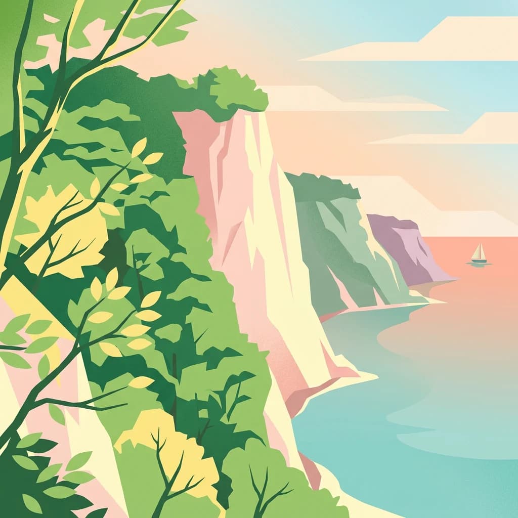
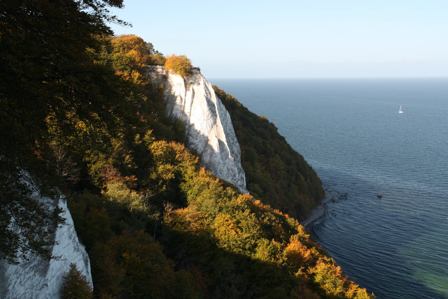
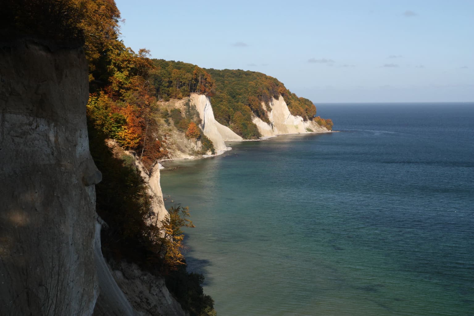
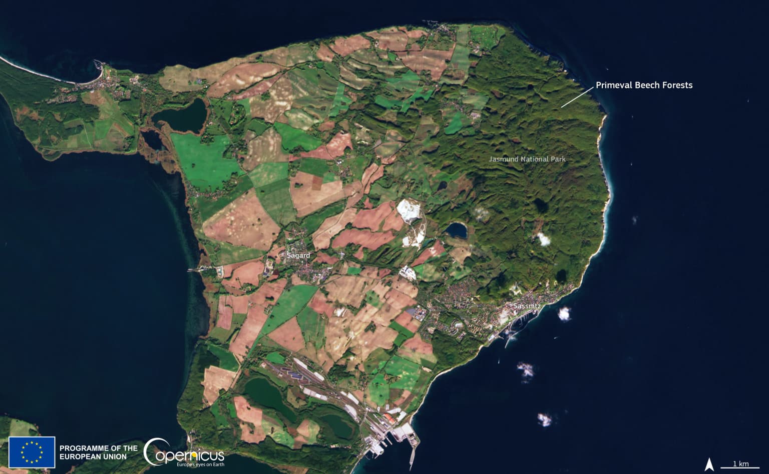
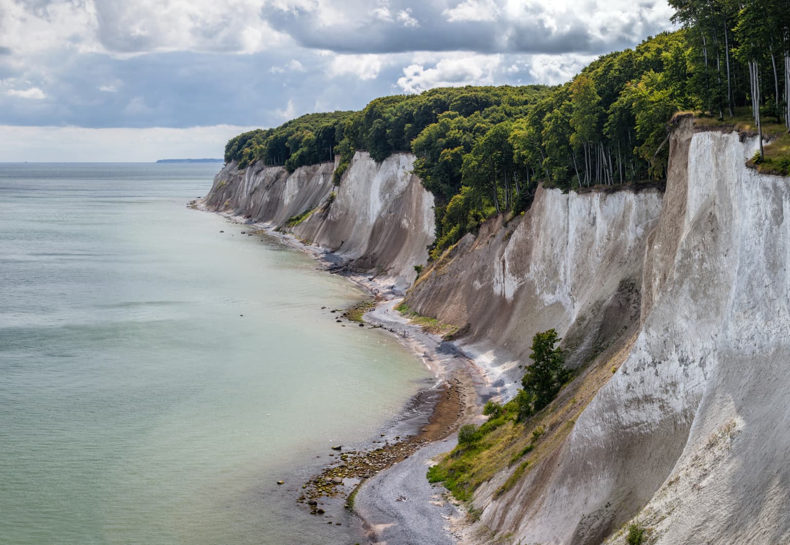
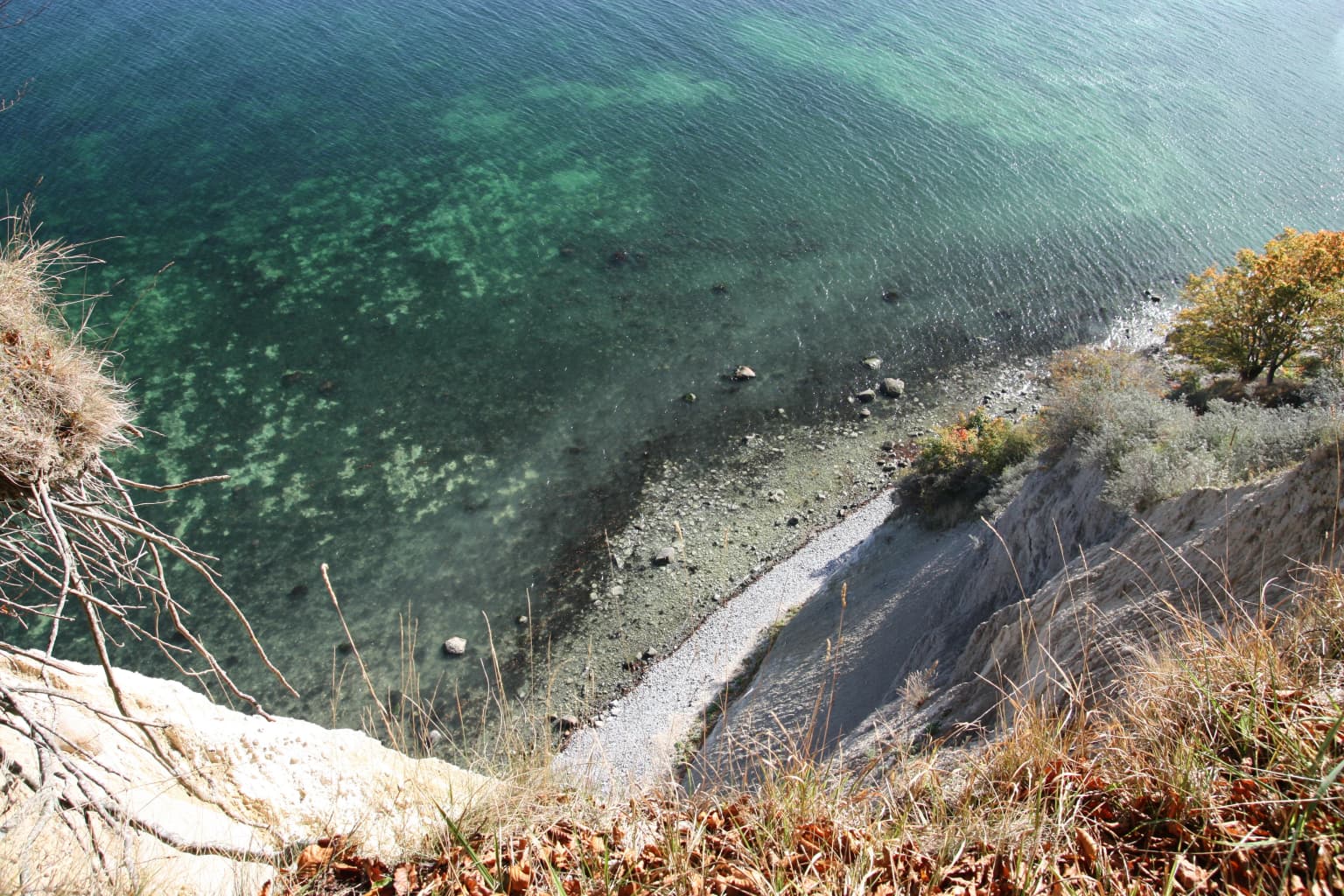
Jasmund National Park is best known for its spectacular white chalk cliffs, which are the largest and most dramatic in Germany. The Königsstuhl, rising 118 meters above the Baltic Sea, is the park's most recognizable landmark and a symbol of the Rügen landscape. The park is also celebrated for its ancient primeval beech forests, which represent one of the last remaining old-growth forest ecosystems in Europe. The distinctive white cliffs, shaped by constant coastal erosion, create one of the most recognizable coastal landscapes in Northern Europe.

White chalk cliffs descending to the sea with dense forested hillside showing autumn colors
White chalk cliffs overlooking the sea with autumn forested hillside at Jasmund National Park

Jasmund National Park history and protected-area timeline

The chalk deposits of the Jasmund peninsula have been exploited for centuries, with quarrying operations active in the region for many years. In 1926, when plans emerged to reopen a previously closed chalk quarry along the coast north of Sassnitz, the coastal area was designated as a nature reserve to prevent industrial development. This early protection established the foundation for the area's conservation status.

The modern national park was created on September 12, 1990, during the final months of the German Democratic Republic. This came as part of a comprehensive national park program initiated by East German authorities to protect representative natural landscapes throughout the country. The establishment occurred just months before German reunification in October 1990, making Jasmund one of the last protected areas established under the GDR government.

In 2011, the beech forests of Jasmund were added to the UNESCO World Heritage List as an extension to the existing Primeval Beech Forests of Europe site. This international recognition acknowledged the forest's ecological significance and its role as a living record of post-Ice Age forest development in Europe.

Jasmund National Park landscape and geographic character

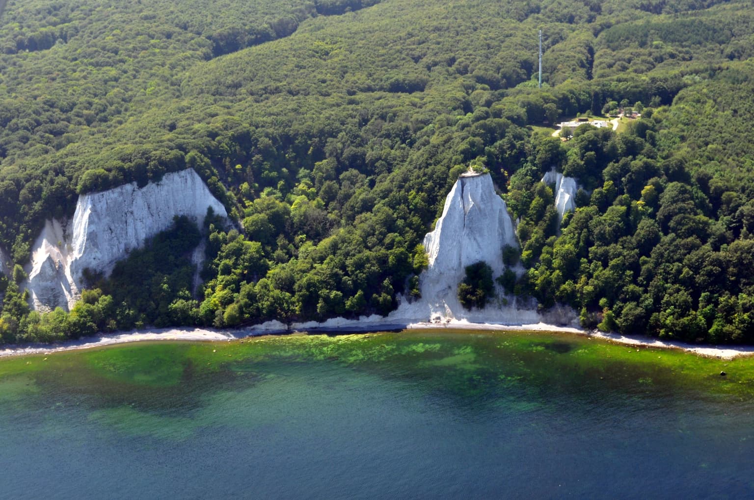
The landscape of Jasmund National Park is defined by the dramatic contrast between its white chalk cliffs and the forested ridge behind them. The chalk cliffs, part of the Rügen Chalk geological formation, rise steeply from the Baltic Sea, with the most impressive section reaching 118 meters at the Königsstuhl. These Cretaceous-age limestone formations are among the most significant geological features in Northern Europe.

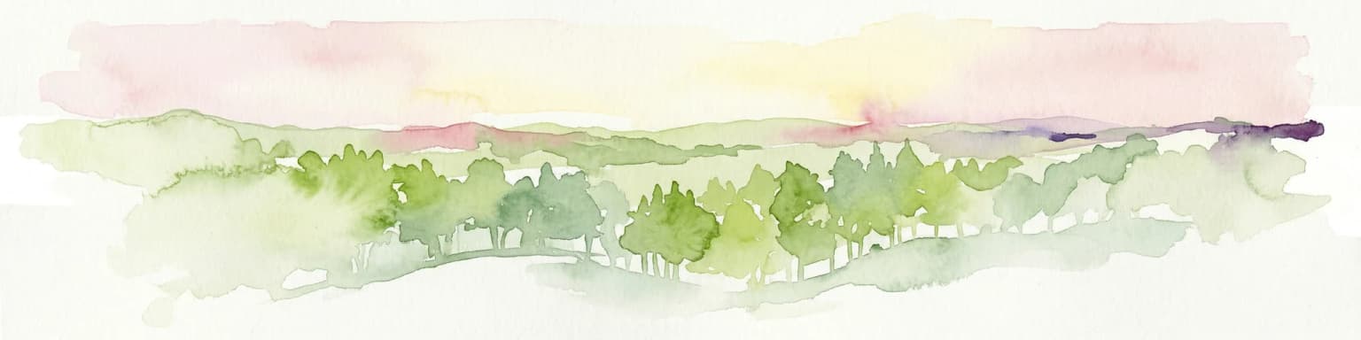
The inland landscape centers on the Stubnitz, a forested ridge that rises to 161 meters at Piekberg, the highest point on Rügen island. This ridge is blanketed in ancient beech forest that has never been clear-cut, creating a landscape that resembles prehistoric European forests. The forest contains numerous small water bodies and depressions formed as ice-age dead-ice melted, leaving hollows that now support wetland communities.

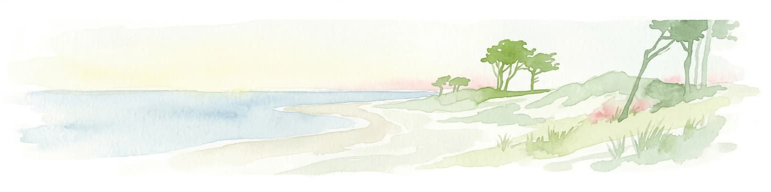
The western portion of the park features a different character, with former chalk quarries, open meadows, peat bogs, and dry grasslands. Several streams originate in the park's moors and flow through the landscape before cascading over the chalk cliffs to reach the Baltic Sea, creating rare waterfalls in this lowland region. The coastal waters extending 500 meters from the shore are also included within the park's boundaries.

Aerial view of white chalk cliffs, dense green forest, and turquoise water along the coastline
Aerial view of the chalk cliffs and forested coastline of Jasmund National Park

Jasmund National Park ecosystems, habitats, and plant life

Jasmund National Park supports a remarkable diversity of habitats within its relatively small area, from marine coastline to ancient forest and wetland systems. The primeval beech forests represent one of the most significant old-growth forest ecosystems in Europe, with trees that have developed in near-natural conditions for centuries. These forests create a complex habitat structure with standing dead wood, fallen logs, and varied microclimates that support specialized ecological communities.

The forest floor contains numerous kesselmoore, bog complexes formed in the ice-age depressions that dot the landscape. These wetland areas, along with streams flowing through the Stubnitz, support communities of black alder and provide critical habitat for moisture-loving species. The unusual presence of the alpine strudelwurm, a species typically found in mountain streams, in the park's lowland waters demonstrates the unique ecological character of these habitats.

The chalk cliffs and coastline support specialized plant communities adapted to the harsh coastal environment, while the dry grasslands and former quarry areas provide conditions for different vegetation types including rare orchid species such as the lady's slipper orchid.

White chalk cliffs along the coast with forested land above and calm blue sea in the background
White chalk cliffs of Jasmund National Park on the island of Rügen, Germany

Jasmund National Park wildlife and species highlights

The diverse habitats of Jasmund National Park support a rich community of wildlife, with particular significance attached to several rare and specialized species. The old-growth forests provide essential habitat for cavity-nesting birds and species dependent on dead wood, while the open areas and cliffs support different ecological communities.

Birdlife is diverse and includes impressive species such as the white-tailed eagle, which hunts along the coastline, and the peregrine falcon, one of the fastest animals in the world. The common kingfisher can be observed hunting in the clear streams that flow through the forest, while house martins nest in the chalk cliff faces. However, due to the high number of visitors to the park, some sensitive species like the peregrine falcon and white-tailed eagle have become increasingly difficult to observe.

The invertebrate community is exceptionally rich, with approximately 1,000 beetle species recorded in the park. The Kreideeule, a cream-colored noctuid moth, has its only German population in Jasmund, making it a species of particular conservation concern. The park's streams and wetlands support distinctive communities including species more typical of mountainous regions.

Satellite image of Jasmund National Park showing coastal peninsula with forested areas, agricultural fields, and water bodies
Satellite map view of Jasmund National Park showing forested areas and coastal geography

Jasmund National Park conservation status and protection priorities

Jasmund National Park represents one of Germany's most important conservation areas, protecting both internationally significant geological features and irreplaceable ecological systems. The chalk cliffs, as Germany's largest and most dramatic, were recognized in 2006 as a National Geotope, highlighting their geological significance. The ongoing natural erosion processes that reshape the cliffs make them an important site for understanding coastal geological dynamics.

The ancient beech forests gained international recognition through their UNESCO World Heritage inscription in 2011, acknowledging them as outstanding examples of Europe's primeval forest heritage. These forests demonstrate the ecological processes that shaped European forests following the last Ice Age and provide reference ecosystems for understanding forest dynamics.

The park's management focuses on allowing natural processes to proceed with minimal intervention while providing opportunities for public appreciation of the landscape. Visitor management is a central challenge, given the popularity of the Königsstuhl viewpoint, which attracts hundreds of thousands of visitors annually. The National Park Authority works to balance conservation objectives with public access, employing visitor guidance systems and a well-developed trail network.

Jasmund National Park cultural meaning and human context

The dramatic landscape of Jasmund has inspired artists for centuries and holds cultural significance beyond its ecological value. The chalk cliffs of Rügen were immortalized in Caspar David Friedrich's famous 1818 painting "Chalk Cliffs on Rügen," though modern research suggests the view more closely resembles the smaller Stubbenkammer rather than the Wissower Klinken as previously assumed.

The area has a long history of human use, particularly through chalk quarrying that shaped parts of the landscape. The establishment of the nature reserve in 1926 reflected growing awareness of the need to protect the coastline from industrial development, setting a precedent for the later national park designation.

Chalk cliffs rising from the Baltic Sea coast with dense forest on top and a narrow path along the shoreline
Chalk cliffs and forested coastline along the Baltic Sea at Jasmund National Park

Top sights and standout views in Jasmund National Park

The Königsstuhl (King's Chair) is the park's centerpiece, a 118-meter white chalk cliff offering panoramic views over the Baltic Sea and the surrounding coastline. The platform at the Königsstuhl receives approximately 300,000 visitors annually who come to experience one of Northern Europe's most impressive coastal viewpoints. The visitor center opened in 2004 provides educational context about the park's geology, ecology, and conservation significance.

The primeval beech forests of the Stubnitz represent one of Europe's most significant old-growth forest ecosystems, recognized by UNESCO World Heritage status. The 12-kilometer Hochuferweg trail follows the cliff tops from Sassnitz through the park, passing the remains of the collapsed Wissower Klinken, the Victoria-Sicht viewpoint, and the Königsstuhl before reaching Lohme at the park's northern edge.

White chalk cliffs with turquoise water and rocky shoreline
White chalk cliffs overlooking the sea at Jasmund National Park

Best time to visit Jasmund National Park

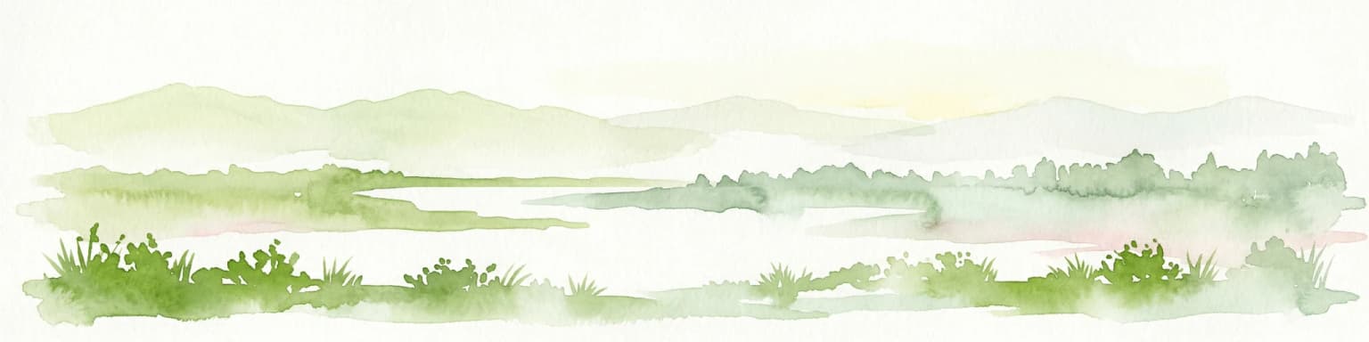
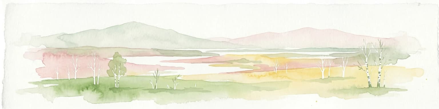
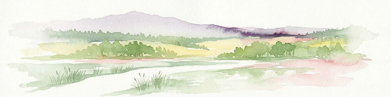
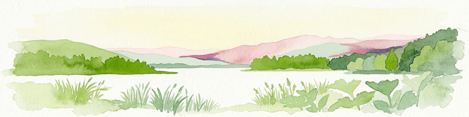
The park can be experienced throughout the year, with each season offering different characteristics. The white chalk cliffs are particularly striking on overcast days when the contrast between the white limestone and gray skies is most pronounced, and during winter when snow caps the cliffs. Spring brings fresh green foliage to the beech forests and migrating birds, while autumn creates atmospheric conditions in the forest as leaves change color. Summer months see the highest visitor numbers, particularly around the Königsstuhl area, so visiting during shoulder seasons may offer a more peaceful experience.

Park location guide

Geography guide, regional context, and park location map for Jasmund National Park

Jasmund National Park park geography, regions, and map view in Germany
Understand where Jasmund National Park sits in Germany through a broader geographic reading of the surrounding landscape, nearby location context, and its mapped position within the national park landscape.

How Jasmund National Park fits into Germany

Germany is a federal republic in Western and Central Europe with a population of over 83 million across sixteen constituent states. It is Europe's largest economy by nominal GDP and a major global exporter and importer. The capital is Berlin, and the country borders Denmark, Poland, Czech Republic, Austria, Switzerland, France, Luxembourg, Belgium, and the Netherlands.

Wider geography shaping Jasmund National Park in Germany

Germany is located in Western and Central Europe, spanning 357,022 km². It borders Denmark to the north, Poland and the Czech Republic to the east, Austria and Switzerland to the south, and France, Luxembourg, Belgium, and the Netherlands to the west. The country has coastlines on the Baltic Sea and North Sea to the north, with the Alps located in the southern region.

Map view of Jasmund National Park

Use this park location map to pinpoint Jasmund National Park in Germany, understand its exact geographic position, and read its mapped placement within the surrounding landscape more clearly.

Pigeon | © OpenStreetMap contributors

Location context for Jasmund National Park

Mecklenburg-Vorpommern

Visually Understand Jasmund National Park's Dramatic Coastal Geology, Ancient Beech Forests, and Unique Protected Area Scenery

Jasmund National Park Photos: Explore Dramatic Chalk Cliffs, Ancient Beech Forests, and Coastal Scenery
Explore a visual atlas of Jasmund National Park, featuring its iconic white chalk cliffs rising from the Baltic Sea and ancient UNESCO World Heritage beech forests. Examine these images to understand the park's unique landscape character, diverse habitats, and the distinct ecological environment of this renowned protected area.

White chalk cliffs descending to the sea with dense forested hillside showing autumn colors

Pebbled beach along the coast with white chalk cliffs under a blue sky

Aerial view of white chalk cliffs, dense green forest, and turquoise water along the coastline

White chalk cliffs along the coast with forested land above and calm blue sea in the background

Satellite image of Jasmund National Park showing coastal peninsula with forested areas, agricultural fields, and water bodies

A sailboat on calm blue water with white chalk cliffs covered in green trees under a clear blue sky

Chalk cliffs rising from the Baltic Sea coast with dense forest on top and a narrow path along the shoreline

White chalk cliffs with turquoise water and rocky shoreline

White chalk cliff face rising above the sea with green forested hillside and blue sky

White chalk cliffs at Wissower Klinken in Jasmund National Park with turquoise water and a distant ship

Chalk cliffs along the coast with forested hills and water

White chalk cliffs overlooking the sea with forested coastline below and a small figure of a person on the cliff face

Chalk cliffs overlooking turquoise sea with green vegetation on the sides

Waterfall flowing down a light-colored chalk cliff with rocks and pebbles on the ground below, surrounded by greenery at the cliff top

A modern building labeled 'Nationalpark-Zentrum Königsstuhl' with a curved brown roof, glass facade, and orange doors, surrounded by trees and a paved area with people walking

A dirt path in a dense forest with tall trees and a wooden fence, featuring a large tree trunk with blue and white markings in the foreground

Park atlas

Examine national parks and protected areas across Mecklenburg-Vorpommern, deepening the geographic context around Jasmund National Park.

Discover Related National Parks and Protected Areas Near Jasmund National Park
After Jasmund National Park, explore other national parks and protected areas throughout Mecklenburg-Vorpommern, including diverse coastal landscapes, ancient beech forests, and wetlands. Compare varying conservation approaches and geographic spread of protected landscapes within this northeastern German state, for a comprehensive understanding of regional natural heritage.
Watercolor illustration showing a coastal lagoon with sandy shoreline, calm water, sand dunes, and sparse vegetation including trees and grasses
National parkMecklenburg-Vorpommern

Western Pomerania Lagoon Area National Park: Detailed Geographic and Protected Landscape Context

Explore its mapped boundaries and unique Baltic Sea coastal geography.

Western Pomerania Lagoon Area National Park is a vital protected landscape in Mecklenburg-Vorpommern, renowned for its complex network of peninsulas, islands, and extremely shallow brackish 'bodden' waters. This page serves as an atlas entry, detailing the park's geographic features, its distinctive wind-driven water level fluctuations, and its ecological importance as a major migratory bird staging area. Users can investigate the mapped extent of this significant German national park and understand its unique place within the regional geography.

Area
805 km²
Established
1990
IUCN
II
Relief
Lowland
Watercolor painting depicting mountains, rivers, and green terrain
National parkWest Pomeranian Voivodeship

Wolin National Park: Coastal Protected Landscape and Glacial Terrain in West Pomeranian Voivodeship

Explore Poland's first marine national park and its dynamic geography.

Wolin National Park offers a profound look into Poland's protected coastal geography. This national park in the West Pomeranian Voivodeship is distinguished by its high sea cliffs, inclusion of Baltic Sea and Szczecin Lagoon waters as Poland's first marine protected area, and a landscape sculpted by glacial moraines. Discover the park's complex delta systems, ancient forests, and the mapped terrain that supports significant bird migration, providing a rich focus for atlas exploration.

Area
109.37 km²
Established
1960
IUCN
II
Visitors
1.5M annual
Watercolor painting of green trees on rolling hills under a pink and orange sunset
National park

Dalby Söderskog National Park: Explore Southern Sweden's Smallest Protected Deciduous Forest

Unique limestone geology, spring flowers, and mapped terrain.

Dalby Söderskog National Park, though only 36 hectares, offers exceptional botanical discovery rooted in its fertile limestone soils. This protected area in Scania, Sweden, showcases a dense deciduous forest ecosystem with remarkable diversity, particularly evident in its vibrant spring wildflower displays. Use MoriAtlas to explore the park's mapped boundaries and understand its significant role within the regional geography and broader protected landscape atlas.

Area
0.36 km²
Established
1918
IUCN
II
Relief
Lowland
National parkSkåne County

Stenshuvud National Park: Discover Skåne County's Distinctive Baltic Headland National Park

Explore broadleaf forests, heathlands, and panoramic coastal geography.

Stenshuvud National Park is a notable national park in Sweden's Skåne County, characterized by a prominent hill that rises 97 meters above the Baltic Sea. This protected landscape offers a rich diversity of habitats within a small area, including dense broadleaf forests, open heathlands, and coastal terrains. Its unique geographic position and varied ecosystems make it a key destination for exploring protected natural areas, mapped terrain, and regional landscape context within the MoriAtlas platform.

Area
3.9 km²
Established
1986
IUCN
II
Relief
Lowland
Watercolor painting of a landscape with a lake, trees, and distant hills
National parkMecklenburg-Vorpommern

Müritz National Park: Explore Protected Beech Forests and Glacial Lakelands in Mecklenburg-Vorpommern

Germany's largest national park: mapped boundaries and terrain.

Müritz National Park represents a significant protected landscape within northeastern Germany's Mecklenburg-Vorpommern region. Its expansive territory encompasses not only Germany's largest lake, Müritz, but also substantial tracts of ancient beech forests awarded UNESCO World Heritage status. Users can explore the park's glacial terrain, its intricate network of lakes and wetlands, and understand its position within the regional geography, making it a key destination for structured atlas-based discovery of German protected areas.

Area
318 km²
Established
1990
IUCN
II
Watercolor painting depicting a river flowing through a valley with green vegetation and distant mountains
National parkBrandenburg

Lower Oder Valley National Park: Unique Polder Landscape and Bird Sanctuary

Discover protected area maps and regional geography in Brandenburg

Delve into the Lower Oder Valley National Park, a national park recognized for its extraordinary polder landscape and extensive wetland ecosystems. This page provides detailed geographic context, highlighting the park's unique engineered floodplain, its role as a sanctuary for numerous bird species, and its position within the regional geography of Brandenburg. Understand the mapped boundaries and ecological importance of this exceptional protected area.

Area
103.23 km²
Established
1995
IUCN
II
Visitors
150K annual
National park

Kongernes Nordsjælland National Park: Protected Landscape Geography and Map Context

Explore North Zealand's protected natural terrain.

Delve into the protected landscape of Kongernes Nordsjælland National Park, a significant national park in Denmark's North Zealand region. This section provides a structured overview of its mapped boundaries and geographic setting, allowing for a detailed atlas-style discovery of its natural terrain. Understand how this protected area contributes to the region's conservation landscape and mapped geography.

Watercolor painting depicting a river flowing through a forested landscape with hills in the background
National parkWest Pomeranian Voivodeship

Drawa National Park: Protected Landscape and River Geography in West Pomeranian Voivodeship

Explore Poland's unique lowland river and ancient forest protected area.

Drawa National Park stands as a vital protected area within West Pomeranian Voivodeship, Poland, celebrated for its exceptional natural geography. The park's core feature is the Drawa River, which carves a distinctive path with fast-flowing currents and deep valleys, presenting a landscape more akin to mountain streams than typical lowland waterways. This area protects one of Poland's most valuable lowland river corridors, featuring ancient beech and oak forests, the rare meromictic Lake Czarne, and diverse wetland habitats. MoriAtlas facilitates structured exploration of Drawa National Park's mapped terrain and protected landscape identity.

Area
115.36 km²
Established
1990
IUCN
II
Visitors
27K annual

Common questions about visiting, size, designation, and location context for Jasmund National Park

Jasmund National Park FAQs for park facts, access, geography, and protected area context
Find quick answers about Jasmund National Park, including protected-area facts, park geography, trail and visitor context, and how the park fits into its surrounding country and regional landscape.
MoriAtlas Explorer

Continue Your Protected Areas Search Across the Global Atlas

Deepen your exploration by continuing the structured search for national parks and protected areas worldwide. Utilize the comprehensive filtering capabilities to compare different conservation landscapes and refine your understanding of global park geography. Discover more about the distribution and characteristics of protected natural areas.

Global natural geography