
Mori Atlas logo
National parkKislovodsk National Park

Mapping the transition from urban resort gardens to high altitude Caucasus foothills and peaks.

Kislovodsk National Park: A Protected Mountain Landscape in the Stavropol Krai Region of Russia

(Kislovodsky National Park)

Kislovodsk National Park occupies a unique geographic position in the North Caucasus, spanning from the Olkhovka River urban edges to the heights of the Dzhinalskiy Range. This protected area integrates formal ornamental gardens with wild forest habitats and alpine meadows, reaching elevations from 800 to 1400 meters. The terrain serves as a vital transition zone, characterized by distinctive sandstone outcrops known as the Red, Grey, and Blue Stones, providing a sculptural geological framework for the region.

urban parkNorth Caucasusspa resortterrenkur trailsmountain parkrose gardens

Kislovodsk National Park

National park

Park overview

Structured park overview, official facts, and landscape profile for Kislovodsk National Park

Kislovodsk National Park park facts, protected area profile, and essential visitor context

Review the core facts for Kislovodsk National Park, including designation, size, terrain, visitor scale, habitats, and operating context in one park-focused overview.

About Kislovodsk National Park

Kislovodsk National Park lies inside the resort city of Kislovodsk in Stavropol Krai, in the southwestern part of the Russian North Caucasus. Although it functions as an urban park at its base, its territory extends up into the surrounding mountain slopes, making it a hybrid between a managed resort landscape and a protected natural area. With a footprint approaching a thousand hectares, it is widely regarded as one of the largest urban parks in Europe, comparable in scale to famous historic royal parks such as Richmond Park in London or the grounds of the Palace of Versailles.

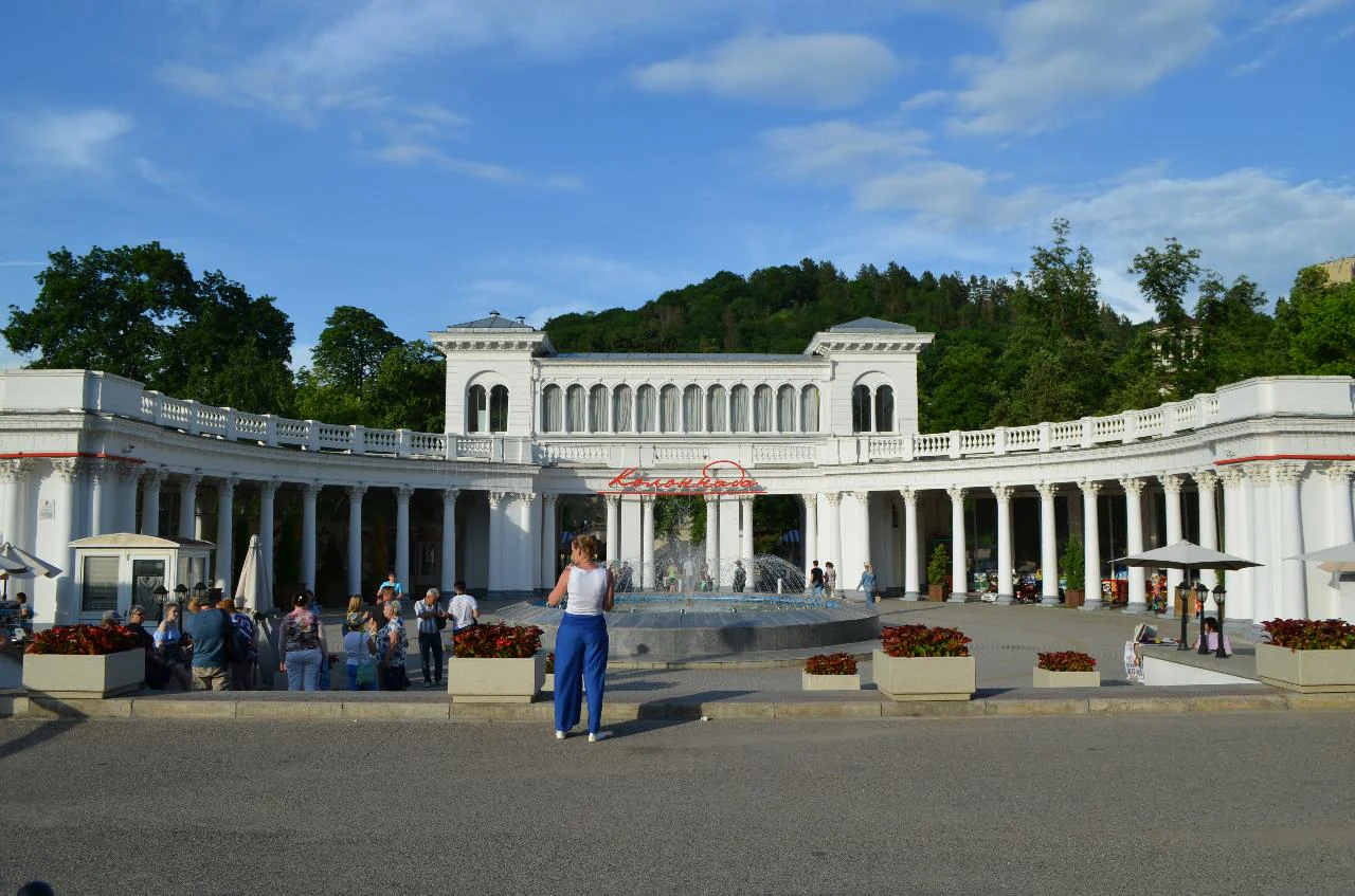
The park is organized into three connected sections that together tell a story from ornamental gardening to wild mountain scenery. The Old, or Lower Park, begins near the Narzan Gallery and continues past features such as the Mirror Pond and the Glass String fountain. The Middle, or New Park, opens with the Rose Valley and ends near the Grey Stones. The Mountain Park, which is the largest sector by area, pushes further uphill through the Red, Grey, and Blue Stones and on toward the peaks of Maloe Sedlo and Bolshoe Sedlo along the Dzhinalskiy Range.

Beyond its scenic value, Kislovodsk National Park plays a central cultural and therapeutic role in the region. The town of Kislovodsk itself is one of the oldest and most prominent Russian balneological resorts, built around the narzan mineral springs, and the park is intimately connected to that identity. In 1901, route terrenkur paths for therapeutic walking were laid out here for the first time in Russia, and the system still forms the backbone of how visitors experience the landscape today. Together, these qualities make the park a notable example of a protected area that combines ecological, recreational, and historic spa functions within a single boundary.

Quick facts and research context for Kislovodsk National Park

Kislovodsk National Park occupies around 966 hectares inside and around the city of Kislovodsk in Stavropol Krai, Russia, on the northern slopes of the Caucasus foothills. It holds IUCN Category II, national park status, and is also recognized as a federal cultural heritage site of Russia. The park is divided into three connected sectors: the historic Old or Lower Park, the Middle or New Park, and the Mountain Park, which is the largest and climbs toward the Dzhinalskiy Range and the peaks of Maloe and Bolshoe Sedlo. Its administration took on formal federal national park designation in June 2016, a change that replaced its earlier identity as the Kislovodsk Kurortny Park. The park is closely associated with the mineral waters of the region, especially the narzan springs, and remains a defining element of Kislovodsk's identity as a historic Russian spa resort.

Protection and recognition

Explore terrestrial protected area facts and management scope

Kislovodsk National Park Protection Status and Designation History

Kislovodsk National Park maintains a documented terrestrial protection status established in 2016. Structured conservation records outline the official designation history, territorial management scope, and verified recognition sources for the protected landscape.

Protection details

Protection scope
Terrestrial
Designated year
2016
Transboundary protection
No
Park context

Deeper park guide and search-rich context for Kislovodsk National Park

Kislovodsk National Park history, landscape, wildlife, and travel context

Explore Kislovodsk National Park through its history, landscape character, ecosystems, wildlife, conservation priorities, cultural context, and seasonal travel timing in a structured park guide built for atlas discovery and search intent.

Why Kislovodsk National Park stands out

Kislovodsk National Park is best known for being one of the largest urban parks in Europe and for pioneering the Russian practice of terrenkur, the system of measured therapeutic walking routes laid out in 1901 along graded mountain paths. The park combines horticultural showpieces such as the Rose Valley and the Cascade Staircase with more naturalistic mountain terrain that supports Caucasian forest species, alpine meadows, and rare wildlife like the European wildcat and golden eagle. Dramatic sandstone outcrops known as the Red Stones, Grey Stones, and Blue Stones give the landscape its visual identity and link the park directly to the geology of the Caucasus foothills.
Kislovodsk National Park history and protected-area timeline

The origins of Kislovodsk National Park reach back to the early nineteenth century, when the first plantings were carried out in 1823 on the orders of General Alexei Yermolov. Soldiers of the lower ranks created the earliest gardens along the rocky banks of the Olkhovka River, hauling fertile chernozem soil onto the stony ground to make tree planting possible. After Prince Mikhail Vorontsov became governor of the Caucasus in 1845, the development of the park expanded, with seeds, saplings, and ornamental plants arriving from the Vorontsov estates in Crimea, as well as from Tiflis, Riga, western Ukraine, and elsewhere in the North Caucasus.

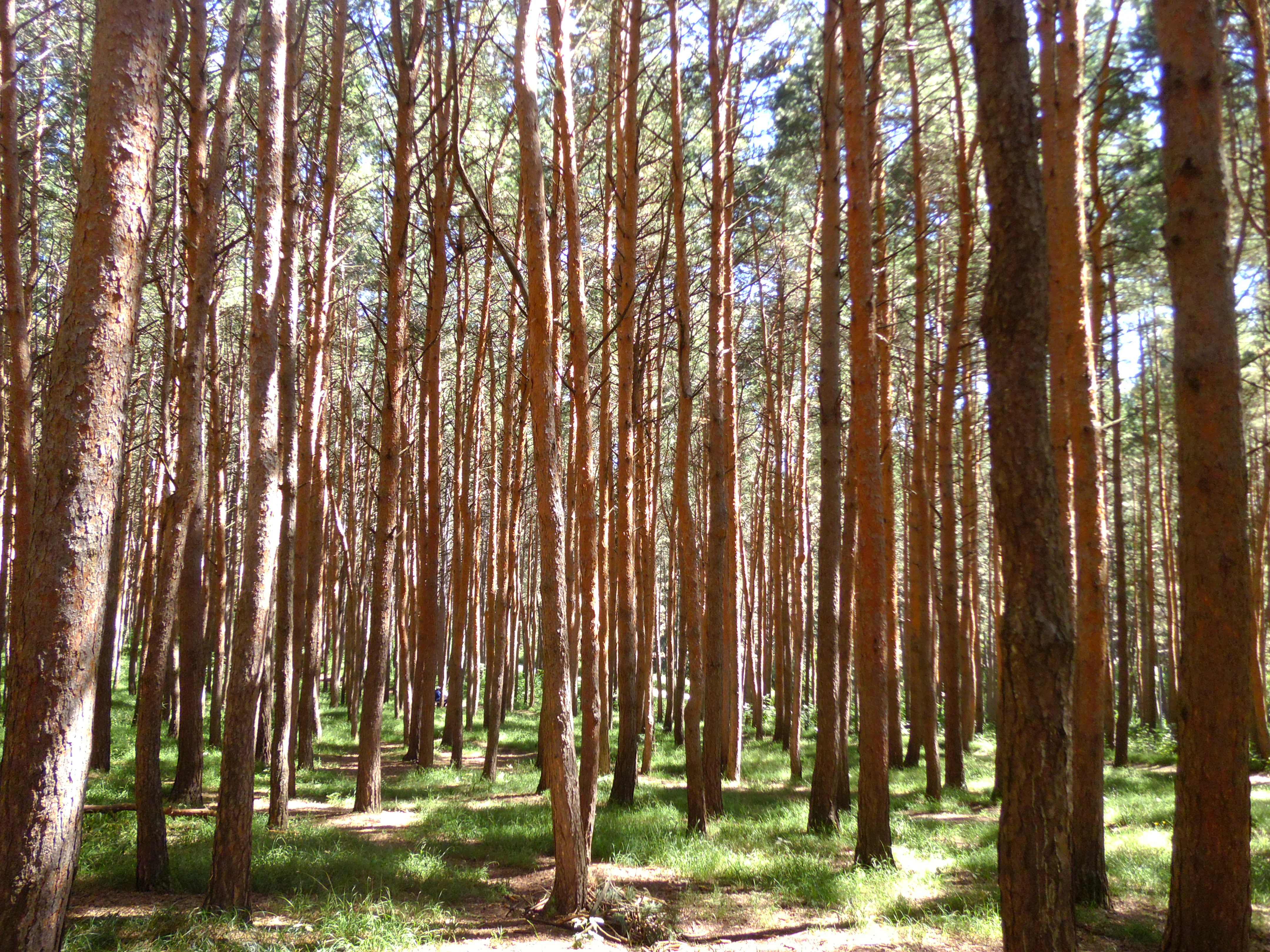
A second phase of construction is generally dated to 1903, when the landscape gardener Albert Regel supervised the creation of the Middle Park on newly acquired Cossack lands. Bare slopes were planted with Caucasian and introduced tree species including Nordmann fir, balsam fir, Caucasian pine, pedunculate oak, common ash, and both eastern and European spruce. By 1910, plantings on what is known as the Pine Hill had established the pine-covered ridge that still defines that part of the park.

The park suffered damage during the Second World War and the German occupation of Kislovodsk, but it was restored in the post-war period. In 1980, with its area at about 937 hectares, further expansion was planned to accommodate new ornamental gardens. Through the late Soviet period and the post-Soviet transition, the park lost some territory to administrative decisions, with documented reductions from 1380 hectares in 1989 to smaller managed areas in subsequent years. On 2 June 2016, the Russian government formally redesignated the area as Kislovodsk National Park of federal significance, replacing its earlier name of Kurortny Park and consolidating its status as a federal protected area.

Kislovodsk National Park landscape and geographic character

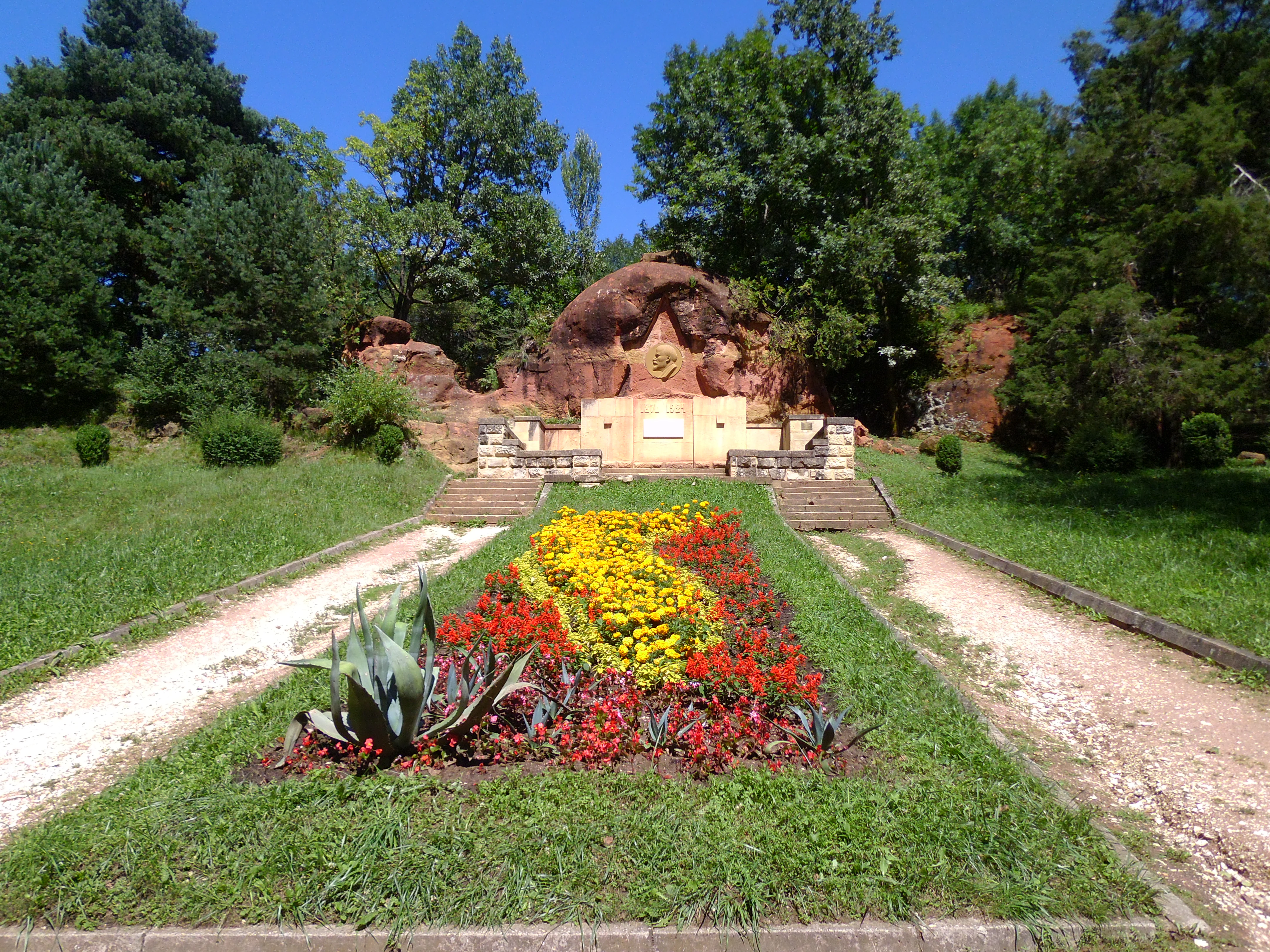
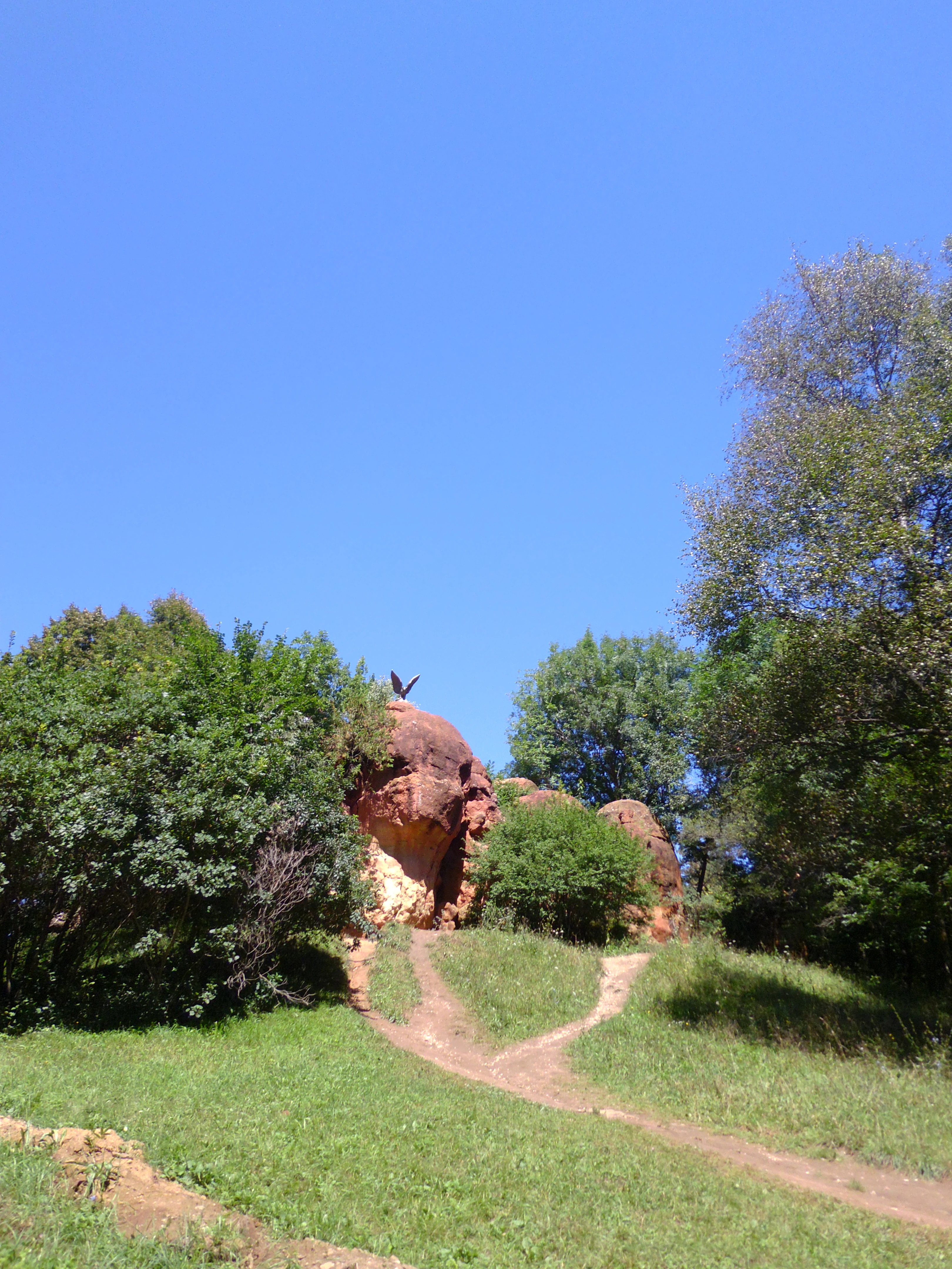
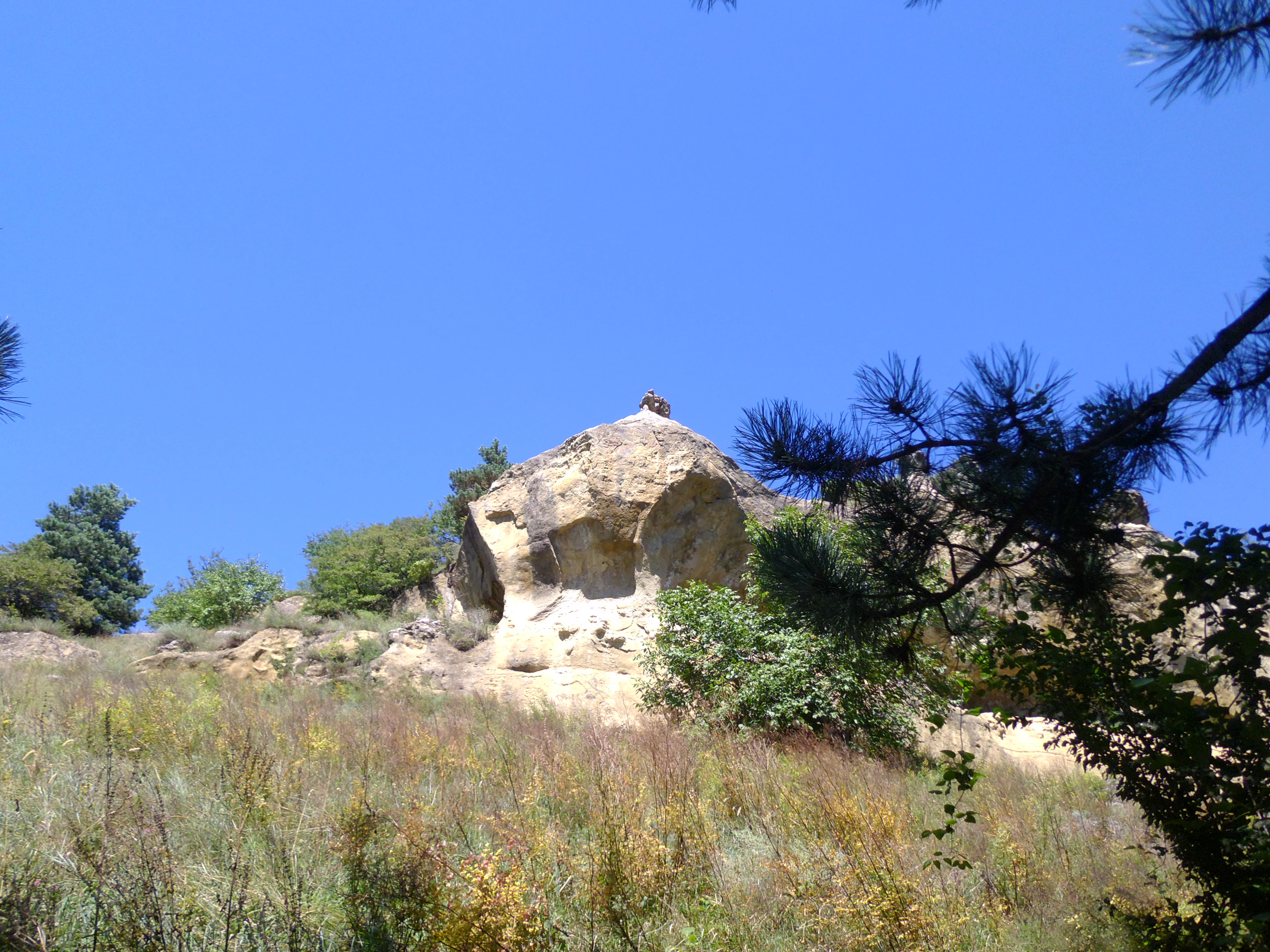
The park's landscape is unusually varied for an urban protected area, moving from formal gardens along the Olkhovka River up into the foothills and lower mountains of the Caucasus. A signature feature is the group of sandstone outcrops collectively known as the Red Stones, which appear at several points in the park. These sandstones have a distinctive reddish-brown coloration and have been shaped into a variety of forms by weathering, giving the terrain a sculptural character. Further uphill, similar rock groups continue as the Grey Stones and the Blue Stones, marking transitions into the higher, wilder parts of the park.

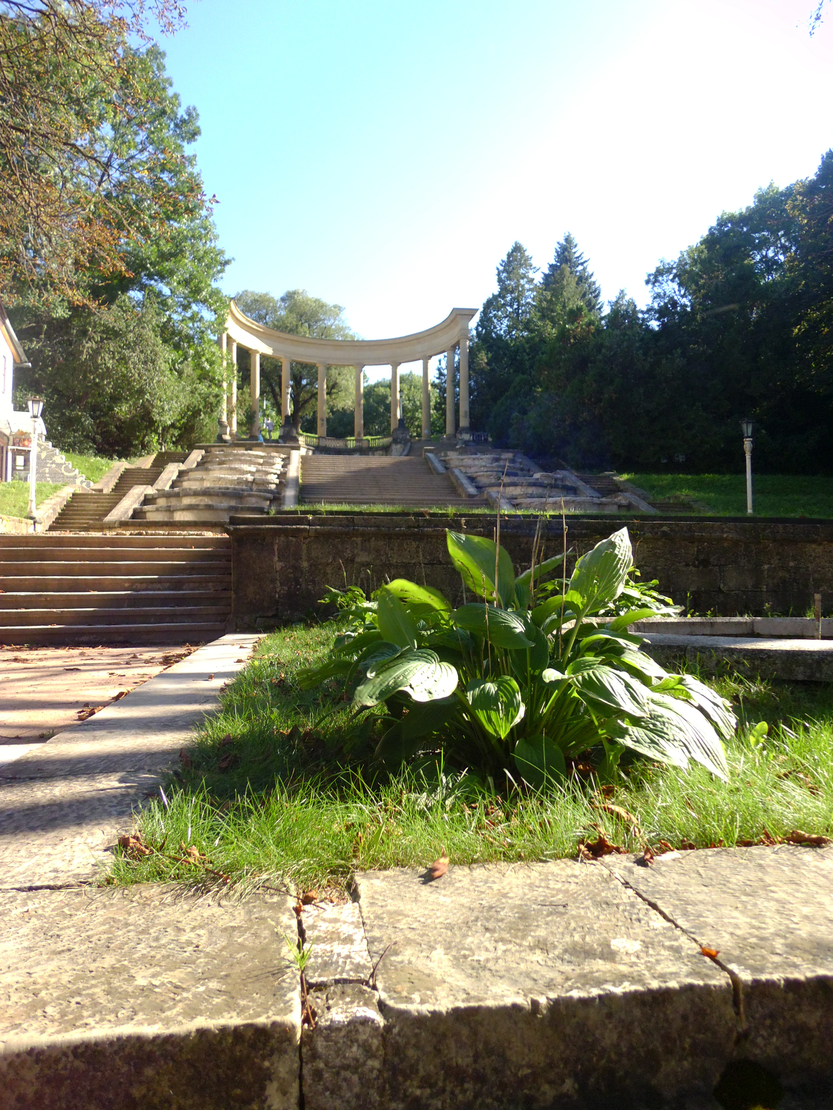
The lower elevations emphasize planted greenery and ornamental terraces, including the Cascade Staircase, the Cypress Alley, and the densely planted Rose Valley with its more than eighty rose cultivars. Higher sections open into mountain parkland and forest, with pine stands on the Pine Hill, broader forest cover in the Middle and Mountain Park sectors, and views toward the Dzhinalskiy Range. The terrain ultimately rises to the park's high points around Maloe Sedlo and Bolshoe Sedlo, which sit along the Dzhinalskiy Range and offer broad panoramas across the Kislovodsk basin. Walking routes climb from around 800 metres above sea level at the park's urban edge to around 1400 metres at the upper landmarks, giving the park a significant vertical range in a relatively compact footprint.
Kislovodsk National Park ecosystems, habitats, and plant life

Ecologically, Kislovodsk National Park bridges the world of curated resort planting and the natural vegetation of the North Caucasus foothills. The park's lower terraces hold a remarkable botanical collection, with more than 250 species and varieties of trees and shrubs representing both native Caucasian flora and introduced ornamental species, including cedars, firs, birches, pines, ashes, beeches, alders, hornbeams, maples, larches, spruces, black walnut, Chinese paulownia, and cork oak. The park also maintains ornamental nurseries and historic greenhouses where, traditionally, lemons and other citrus have been grown for spa visitors.

Above the gardens, the vegetation shifts into more naturalistic patterns. The higher sections in the subalpine zone carry extensive meadows and forests, where more than 800 species of herbaceous plants have been recorded, ranging from familiar spring bulbs and forest floor species to rare Caucasian endemics. Notable flowering plants in these areas include crocuses, squills, lilies of the valley, and Solomon's seal, alongside Red Book protected species such as the Caucasian snowdrop, the dolomite bellflower, and autumn crocus. Together, the layered gardens, planted groves, subalpine meadows, and forest patches give the park a dense botanical character uncommon for a protected landscape so closely tied to an urban centre.
Kislovodsk National Park wildlife and species highlights

The park's wildlife reflects the transition from managed urban gardens to mountain habitats. Acclimatised mammals such as squirrels, hares, and red foxes are common sights in the more accessible lower sectors, while golden jackals extend the carnivore presence into the edges of the natural areas. Birdlife is varied, with common woodland and garden species alongside less common visitors such as the black woodpecker.

In the high mountain sections of the park, especially in the subalpine zone, conditions become wilder and more typical of the Caucasus foothills. European wildcats are reported from these upper reaches, although they are exceptionally rare and elusive. Golden eagles can occasionally be observed soaring over the high meadows and the rocky crests above the planted areas. The combination of tame, human-acclimatised animals in the lower park and rare, shy species of the upper park gives the wildlife profile of the area an unusually broad character for a protected landscape attached directly to a city.
Kislovodsk National Park conservation status and protection priorities

Kislovodsk National Park plays a distinctive conservation role by protecting a substantial area of natural and semi-natural landscape within and immediately around a working Russian resort city. Its IUCN Category II, national park designation, and its additional status as a federal cultural heritage site of Russia underscore both its ecological and its cultural importance. The park safeguards a meaningful sample of northern Caucasus foothill vegetation, including native forests, subalpine meadows, and rock communities, alongside populations of protected plant species listed in the Russian Red Data Book such as the Caucasian snowdrop, the dolomite bellflower, and autumn crocus.

The conservation value is enhanced by the park's scale, which provides enough room for both intensively managed ornamental zones and more naturalistic mountain habitat. That vertical and ecological range makes the area a refuge for species that would otherwise be pressured by surrounding urban and agricultural development. The park also serves as a public-facing conservation space, since its terrenkur paths, historic gardens, and viewing points bring large numbers of visitors directly into contact with the landscapes and species that the protected area exists to maintain.

Kislovodsk National Park cultural meaning and human context

The park is inseparable from the cultural identity of Kislovodsk as one of the great Russian spa cities. Kislovodsk's fame rests on its narzan mineral springs and on the climate of its foothill location, and the national park has long been one of the principal reasons the city became a balneological and climatic resort of national importance.

The park's history is woven into the broader Russian imperial and Soviet story of the North Caucasus. Early plantings were carried out by soldiers of Yermolov, mid-nineteenth-century expansion was tied to the viceroyalty of Vorontsov, and the early twentieth-century landscape design was shaped by Albert Regel in the traditions of European landscape parks. The introduction of terrenkur to Russia in 1901 made the park a pioneer in the medical use of walking in nature, an approach that became a defining element of Kislovodsk's identity through the Soviet era. Cultural features within the park, including the Lermontov monument, the Cascade Staircase, the Glass String pavilion, and the Damsky Kapriz bridge, link the landscape to the literary and architectural memory of the Russian Caucasus.
Top sights and standout views in Kislovodsk National Park

Among the park's strongest points of identity are its sheer urban-to-mountain scale, its network of terrenkur walking routes used therapeutically for more than a century, and its rich combination of ornamental plantings and natural Caucasian forest. Geological landmarks such as the Red Stones, Grey Stones, and Blue Stones give the park a distinctive sculptural character, while the Rose Valley, the Pine Hill, and the Cascade Staircase represent its horticultural showpieces. The park's highest viewpoints near Maloe Sedlo and the summit stations around the Dzhinalskiy Range give rise to wide panoramas over Kislovodsk and the surrounding Caucasus foothills, tying the protected area directly to the visual identity of the resort city beneath it.
Best time to visit Kislovodsk National Park

The climate and vegetation of Kislovodsk and its surroundings give the park four markedly contrasting seasonal moods, and the experience of a visit changes substantially across the year. Late spring and early summer are when the crocuses, squills, snowdrops, and other spring ephemerals give way to lush foliage and the first flowering displays, while the Rose Valley and other ornamental plantings come into their full colour from mid to late summer.

Autumn brings colour shifts through the park's mixed stands of deciduous and coniferous trees and is generally regarded as a quieter and visually rich moment to walk the terrenkur routes. Winters in Kislovodsk are relatively mild for the region and often allow for year-round use of the lower park paths, though higher terrenkur routes can be affected by snow and ice. Across the year, the climate is shaped by the city's location at a relatively gentle elevation on the northern Caucasus foothills, supporting a reputation as a climatic as well as balneological resort.

Monthly climate preview

Long-term representative point measurements tracking monthly temperature and precipitation rhythms

Kislovodsk National Park Climate Normals and Annual Temperature Patterns

Kislovodsk National Park records mean monthly temperatures ranging from sub-zero winter lows to warm summer highs alongside measured daily precipitation rates across the year. Reviewing the complete twelve-month dataset clarifies the long-term climatological cycle captured at the representative elevation point.
Annual mean8 °C
-3 °C19 °C
Jan-3°
Feb-2°
Mar
Apr
May13°
Jun17°
Jul19°
Aug19°
Sep15°
Oct
Nov
Dec-1°
Warmest month
July

19.5 °C

Coolest month
January

-3.1 °C

Wettest month
June

2.8 mm/day

Driest month
January

1.1 mm/day

Park location guide

Geography guide, regional context, and park location map for Kislovodsk National Park

Kislovodsk National Park park geography, regions, and map view in Russia

Understand where Kislovodsk National Park sits in Russia through a broader geographic reading of the surrounding landscape, nearby location context, and its mapped position within the national park landscape.

How Kislovodsk National Park fits into Russia

Russia is a transcontinental nation spanning eleven time zones, bordered by fourteen countries. It is the world's largest country by area, covering 17,098,246 km². Moscow is the capital and largest city, while Saint Petersburg is the second-largest and a major cultural centre.

Wider geography shaping Kislovodsk National Park in Russia

Russia spans Eastern Europe and North Asia, covering 17,098,246 km². It shares land borders with fourteen countries, more than any other nation, and spans eleven time zones. The landscape includes vast plains, mountain ranges such as the Urals and Caucasus, and extensive coastlines along the Arctic Ocean, Pacific Ocean, Baltic Sea, Black Sea, and Caspian Sea.

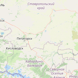
Map view of Kislovodsk National Park

Use this park location map to pinpoint Kislovodsk National Park in Russia, understand its exact geographic position, and read its mapped placement within the surrounding landscape more clearly.

Pigeon | © OpenStreetMap contributors

Location context for Kislovodsk National Park

Stavropol Krai
Park atlas

Compare regional mountain terrain and protected areas across the Caucasus foothills

Other Parks Near Kislovodsk National Park and Surrounding Protected Landscapes

Visitors exploring Kislovodsk National Park can browse nearby protected areas and related mountain reserves to compare regional conservation landscapes. Expanding the geographic scope helps connect urban park terrain with wider botanical and geological features throughout the surrounding region.
Watercolor painting of a mountainous landscape with rocky outcrops, forests, and distant hills
National parkRussia
About 1.2 km away#1 closest

Southeast

Kislovodsk National Park: Geographic and Protected Area Atlas of the Caucasus Foothills

Mapped mountain terrain and urban forest boundaries in Russia.

Trace the extensive boundaries of Kislovodsk National Park, located within the North Caucasus foothills of Russia. This overview details the park's unique structure, shifting from city-adjacent gardens to the rugged elevation of the Dzhinal Ridge, providing a clear geographic context for one of Europe's most distinctive urban protected landscapes.

Area
10 km²
Established
2016
IUCN
II
Relief
Upland
Watercolor painting of mountains, lake, and forest landscape with greenery and distant peaks
National parkKabardino-Balkaria
About 33 km away#2 closest

South

Prielbrusye National Park: Mapped Protected Landscape within Kabardino-Balkaria's Geography

Explore regional park boundaries and natural terrain context.

Prielbrusye National Park is a significant protected area featured in the MoriAtlas geographic discovery platform. This page details its identity as a national park, emphasizing its mapped boundaries and its position within the broader landscape of Kabardino-Balkaria. Users can explore the park's unique geographic context, understand its protected status, and integrate its information into a larger atlas-based understanding of regional natural territories.

Area
10,102 km²
Established
1986
IUCN
II
Relief
Mountain
Watercolor painting depicting mountains, a winding river, and green forests in a mountainous landscape
Nature reserveKarachay-Cherkess Republic
About 103 km away#3 closest

Southwest

Teberda Nature Reserve: Protected Area Mapping and Geographic Context

Explore the mapped boundaries and regional geography of this protected landscape.

Teberda Nature Reserve is a significant protected area located in the Karachay-Cherkess Republic, offering rich opportunities for geographic exploration. This page provides detailed atlas-style information, focusing on the reserve's mapped landscape and its protected-area identity. Understand the unique geographic context and contours of Teberda Nature Reserve, contributing to a structured understanding of Russia's natural protected lands.

Area
849.96 km²
Established
1936
IUCN
Ia
Visitors
200K annual
National parkNorth Ossetia-Alania
About 137 km away#4 closest

Southeast

Alaniya National Park: Protected Glacial Mountain Landscape in North Ossetia-Alania, Russia

Explore dramatic terrain and ancient heritage.

Alaniya National Park, situated in the rugged Central Caucasus Mountains of North Ossetia-Alania, Russia, is a premier example of a protected landscape defined by its dramatic glacial formations and high alpine environments. The park's geography features extensive glaciated peaks, deep valleys, and unique biodiversity. It preserves critical habitats and showcases significant archaeological sites, providing a rich context for understanding the natural and cultural history of the region through a structured atlas perspective.

Area
549 km²
Established
1998
IUCN
II
Relief
Mountain
National parkNorth Ossetia-Alania
About 137 km away#5 closest

Southeast

Alania National Park: Geographic and Protected Landscape Overview of the Central Caucasus

High mountain terrain, glacial basins, and historic Ossetian sites

Alania National Park encompasses a dramatic vertical expanse, ranging from temperate coniferous forests to the snow-covered peaks of the Caucasus Mountains. The area is defined by its complex hydrography, including over fifty glaciers, numerous glacial lakes, and powerful waterfalls carved into limestone gorges. Serving as both a nature reserve and a cultural heritage zone, this protected territory balances wild mountain ecosystems with the enduring history of the Digoria region.

Area
549.26 km²
Established
1998
IUCN
II
Relief
Mountain
Watercolor artwork depicting a waterfall cascading between forested hills with a lake in the foreground and distant mountains
National parkKrasnodar Krai
About 186 km away#6 closest

West

Sochi National Park: Mapped Geography and Protected Mountain Landscapes

A cornerstone of the Western Caucasus mountain range

Sochi National Park represents a significant protected area within Krasnodar Krai, defined by its steep elevation changes and varied mountain ecosystems. The park preserves crucial river corridors and forest terrain, stretching from the Black Sea coast to the high-altitude meadows of the Greater Caucasus. This atlas overview highlights the natural boundaries and geographic character of one of Russia's most significant conservation landscapes.

Area
1,937.37 km²
Established
1983
IUCN
II
Relief
Mountain
National parkKrasnodar Krai
About 186 km away#7 closest

West

Sochi National Park: Geographic Overview and Protected Landscape Mapping

A vertical transition from Black Sea coast to Caucasus peaks.

Sochi National Park serves as a critical protected landscape in Krasnodar Krai, characterized by a dramatic range from coastal pebble beaches to the snowy summits of the Greater Caucasus. This map-focused entry details the dense canyons, karst cave networks, and humid subtropical forests that define the region's geography and conservation value.

Area
2,086 km²
Established
1983
IUCN
II
Visitors
2.8M annual
Watercolor painting showing green and pink mountain ranges under a light yellow sky
National parkMtskheta-Mtianeti
About 186 km away#8 closest

Southeast

Kazbegi National Park: Georgia's Alpine Protected Landscape & Regional Geography

Explore its dramatic terrain and protected area boundaries.

Kazbegi National Park offers a unique glimpse into the dramatic alpine geography of the Greater Caucasus. As a protected national park in the Mtskheta-Mtianeti region, it showcases rugged terrain, high-altitude ecosystems, and significant natural features. MoriAtlas provides a structured way to understand the park's physical characteristics, its mapped presence, and its place within the broader regional atlas, highlighting the distinct landscape of this Georgian protected area.

Area
1,446.17 km²
Established
1976
IUCN
II
Relief
Mountain

Common questions about visiting, size, designation, and location context for Kislovodsk National Park

Kislovodsk National Park FAQs for park facts, access, geography, and protected area context

Find quick answers about Kislovodsk National Park, including protected-area facts, park geography, trail and visitor context, and how the park fits into its surrounding country and regional landscape.
MoriAtlas Explorer

Continue Your Protected Areas Search Across the Global Atlas

Deepen your exploration by continuing the structured search for national parks and protected areas worldwide. Utilize the comprehensive filtering capabilities to compare different conservation landscapes and refine your understanding of global park geography. Discover more about the distribution and characteristics of protected natural areas.

Global natural geography