
Mori Atlas logo
National parkAlania National Park

Mapping the vertical relief, glacial valleys, and historic cultural heritage of Northern Ossetia

Alania National Park: A High Mountain Wilderness Preserve in the Central Caucasus Range

Alania National Park protects a significant stretch of high mountain terrain in the Central Caucasus, climbing from forested river canyons to glacial summits exceeding 4,600 meters. This protected area acts as a vital laboratory for mountain ecology, housing dozens of glaciers, cascading waterfalls, and rare alpine flora. Beyond its dramatic geological features, the reserve preserves a unique integration of nature and medieval Ossetian culture, characterized by stone towers and historic sanctuary sites set within a wild, vertical landscape.

Caucasus Mountainshigh mountainsalpine meadowssubalpine forestsKoch pine forestglacial lakes
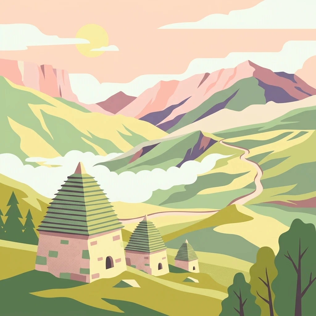
A stylized flat illustration of three stone buildings with pyramidal roofs nestled in a green mountain valley at sunrise, with layered hills in the background.

Alania National Park

National park

Park overview

Structured park overview, official facts, and landscape profile for Alania National Park

Alania National Park park facts, protected area profile, and essential visitor context

Review the core facts for Alania National Park, including designation, size, terrain, visitor scale, habitats, and operating context in one park-focused overview.

About Alania National Park

Alania National Park occupies the westernmost and highest-lying portion of the Republic of North Ossetia within the Russian Federation, guarding an exceptional cross-section of the Central Caucasus' northern slopes. Established by federal decree on 18 February 1998, the park was created specifically to preserve the unique natural complexes of this segment of the republic while supporting environmental education, scientific study, and organized tourism within its boundaries. The name "Alania" reflects the republic's official designation, North Ossetia, Alania, and connects the reserve to the broader cultural and historical identity of the Ossetian people.

The terrain covered by the park is emphatically vertical, beginning in the cool, forested canyons of the Urukh River basin and rising through birch and pine slopes into subalpine meadows, rhododendron thickets, and ultimately bare rock and ice above 4,000 meters. Access is famously restricted to a single road that climbs into the park through the dramatic Akhsinta Canyon on the Urukh, giving the area a strong sense of remoteness and gateway character. From the entrance near Matsuta village, the park extends to the south toward the North Ossetian Nature Reserve and the state border with Georgia, before swinging west along that border to the upper Bilagidon River and back north along the Urukh to the starting point.

The reserve complements the older North Ossetian State Nature Reserve, which was established in 1967 to safeguard certain species and habitats in the region, and together they form a substantial protected-area complex in the Caucasus. Because the Caucasus sits at a biogeographic crossroads, the flora and fauna found in the park include species from European forest communities, Siberian taiga elements, Mediterranean immigrants, and Central Asian alpine inhabitants. More than a thousand plant species, over 115 bird species, and around thirty-four mammal species have been documented within its borders, including the East Caucasian tur, chamois, brown bear, wild boar, Caucasian red deer, and introduced Altai squirrel.

Alongside its natural significance, the park protects a remarkable cultural landscape of inhabited mountain villages, medieval Ossetian defensive towers, cave sites, and ancient burial grounds. Visitors driving into the reserve pass through the Urukh valley toward historic settlements such as Donsifars, Kumbulta, Lezgor, and the cluster of villages around the Galiat-Dzinaga region, each with its own archaeological and architectural attractions. The park therefore functions simultaneously as a natural reserve, an outdoor recreation area, and a custodian of regional heritage, making it one of the most layered destinations among Russia's national parks in the North Caucasus.

Quick facts and research context for Alania National Park

Alania National Park was established on 18 February 1998 and is managed as a federal state institution of the same name. It lies in the Republic of North Ossetia (officially North Ossetia, Alania), within the Russian Federation, in the high-mountain southwestern corner of the republic. The park covers approximately 549 square kilometers of the northern slope of the Central Caucasus and is bordered by Georgia to the south and Kabardino-Balkaria to the west. Its territory ranges from about 1,350 meters up to the summit of Mount Uilpata at 4,646 meters, producing a continuous transition from canyon forests to glaciers and alpine barrens. The nearest major city is Vladikavkaz.

The landscape contains the Urukh River valley, the Akhsinta Canyon entrance, and several major side gorges including Bilagidon, Kharesskoye, Gebidonskoye, Karaugomskoye, and Uallagkomskoye. More than fifty glaciers and several glacial lakes shaped by them are known from the park's basins. Forests cover approximately sixty percent of the area, dominated by Koch pine and birch, while subalpine meadows and rhododendron stands develop above the tree line. The park shares a border with the North Ossetian Nature Reserve and is part of one of the most ecologically significant protected-area complexes in the North Caucasus.

Protection and recognition

Documented terrestrial protection scope and official recognition details

Alania National Park Protection Status and Conservation Records

Alania National Park maintains a documented terrestrial protection scope with verified designation records. Conservation researchers review these official management boundaries and international recognition frameworks for administrative context.

Protection details

Protection scope
Terrestrial
Transboundary protection
No
Park context

Deeper park guide and search-rich context for Alania National Park

Alania National Park history, landscape, wildlife, and travel context

Explore Alania National Park through its history, landscape character, ecosystems, wildlife, conservation priorities, cultural context, and seasonal travel timing in a structured park guide built for atlas discovery and search intent.

Why Alania National Park stands out

Alania National Park is best known for its dramatic mountain scenery at the convergence of major Caucasian ranges, combined with extensive pine-birch forests and a strong presence of traditional Ossetian cultural sites. Its most distinctive trait is the combination of vertical relief, with valley entrances near 1,350 meters and summits above 4,600 meters, that compresses dozens of microclimates and ecosystems into one protected area. The park's Urukh basin and surrounding uplands hold more than fifty glaciers, a network of glacial lakes, and prominent cascades such as the Galdoridon and Taymazi waterfalls. It is equally known for the rich blending of European, Siberian, Mediterranean, and Central Asian faunal and floral elements that the Caucasus supports. Endemic and narrowly regional plants such as dolomite bellflower, Digoria rye, and Caucasian gentian grow here alongside the East Caucasian tur and chamois in its alpine reaches. The protected area's mix of inhabited medieval villages, defensive towers, sanctuaries, and wild high-mountain terrain is another defining characteristic that visitors often associate with the park's identity.
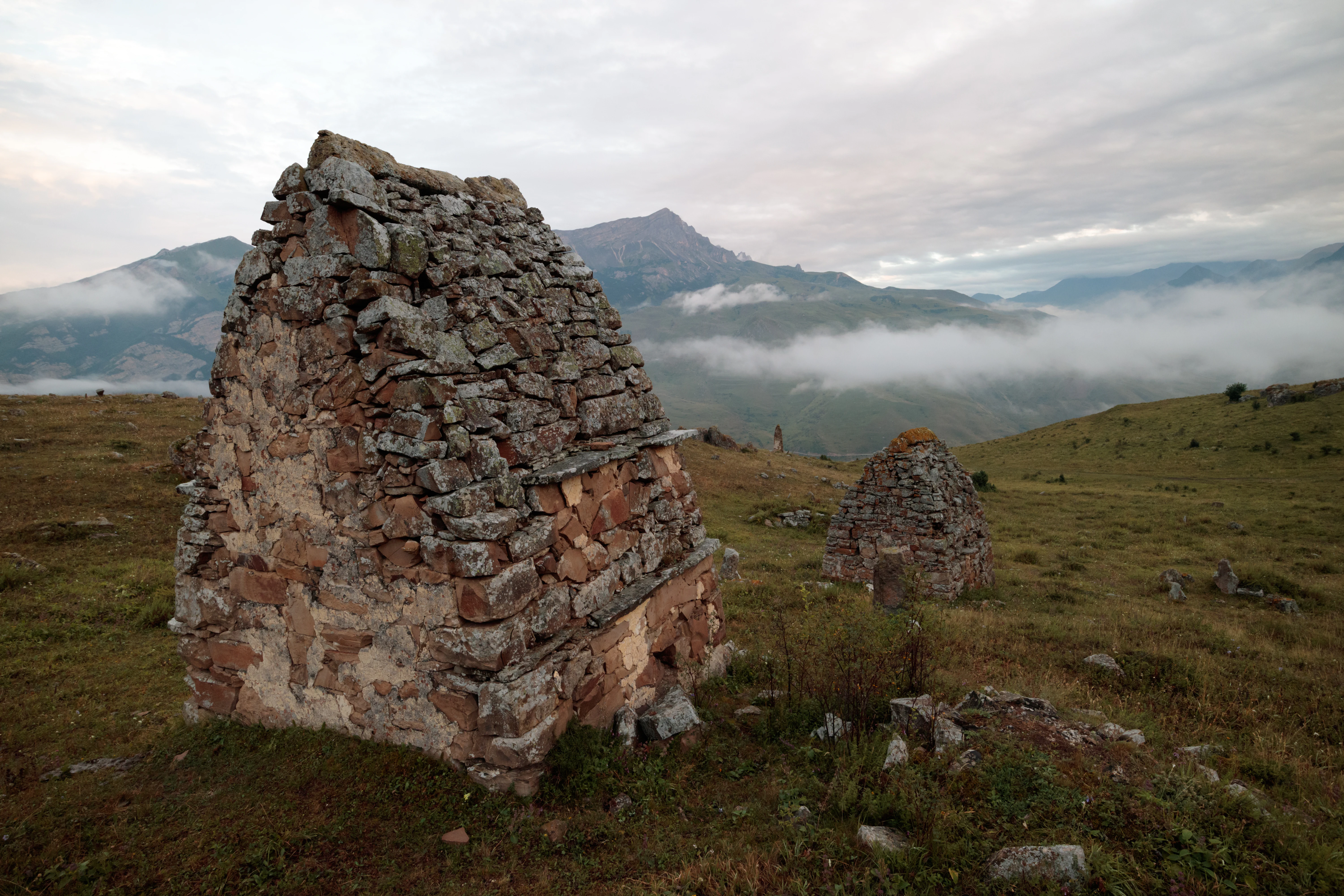
A group of ancient, weathered stone crypts with peaked roofs standing on a grassy, mountainous hillside under a cloudy sky.
Ancient stone crypts of the Lezgor Necropolis set against the mountainous backdrop of the Digor Gorge in Alania National Park.

Alania National Park history and protected-area timeline

The idea of creating a national park in North Ossetia emerged in the late 1950s, when local scientists and conservationists began arguing that the republic's mountain ecosystems deserved formal federal protection. An early practical step was taken in 1958 with the organization of the Tseyskiy refuge in the submontane and mountain zone, covering roughly thirty hectares and accompanied by a network of species-oriented hunting reserves at Zamankul, Zmeysko-Nikolayevsky, Turmon, Saur, and Mahcheskiy. In 1967, the federal North Ossetian State Nature Reserve was established to provide a higher level of protection for selected species and habitats, further strengthening the case for an additional category of reserve.

Throughout the following decades, the campaign for a national park gathered momentum through academic publications and newspaper advocacy. T. Basiev, deputy chairman of the North Ossetian branch of the All-Russian Society for Nature Conservation, and H. Gobeev, deputy head of the republic's forestry administration, championed the idea in professional circles, while articles in the newspaper Sotsialisticheskaya Osetiya, including A. S. Budun's piece on whether a national park was a luxury or a necessity and B. M. Beroev's repeated essays pressing for its creation, kept the discussion in the public eye. Students and faculty of the geography department at North Ossetian State University developed diploma projects on possible park designs, comparing options in the inter-river zone between the Ardon and Urukh rivers against locations on the lower ridges of the Greater Caucasus.

By the mid-1990s, the strongest consensus had formed around establishing the park in the westernmost, most mountainous corner of the republic, in the historical region of Mountain Digoría. On 18 February 1998 the Russian government signed the decree officially creating National Park Alania, defining it as an environmental education and scientific research institution whose territory also safeguards many natural, historical, and cultural monuments. The first director, with strong support from the republic's forestry minister K. D. Khetagurov, assembled staff, exchanged experience with operators of existing parks in neighboring Russian regions, and launched conservation campaigns such as the early "Fir Tree Campaign" against illegal logging.

Subsequent years brought the development of the park's scientific and zoning framework, including the project "Biogeographic Foundations for the Functional Zoning of National Park Alania," supported by the republic's ministry of ecology and the regional environmental fund. In April 1999 the park participated in the national "March of Parks" campaign, hosting journalists, environmental clubs, and excursion programs. Research institutions, university ecologist clubs, and environmental organizations such as the "Viola" club at North Ossetian State University contributed to defining the park's internal zoning systems. Since then, the park has continued to expand its environmental education, ecological trail development, and mountaineering infrastructure, while working with local communities on cultural heritage preservation across the protected zone.

Alania National Park landscape and geographic character

Alania National Park is essentially a vertical landscape, climbing from the narrow forested gorge of the Urukh River near 1,350 meters to the summit of Mount Uilpata at 4,646 meters, a vertical span that compresses an enormous variety of terrain into a compact area. The single road into the park climbs through the Akhsinte Canyon, a narrow and unusually dramatic limestone gorge that serves as the reserve's main gateway and visually establishes the wild character of the territory beyond. From there, the Urukh River basin opens into broader valleys, flanked by tributary gorges of Bilagidon, Kharesskoye, Gebidonskoye, Karaugomskoye, and Uallagkomskoye, each with its own side ridges and glacial cirques.

Above the forested valley walls, the relief transitions into a subalpine belt of birch woodlands, then into short-grass alpine plateaus, rock fields, and snow-and-ice terrain of the high Caucasus. Glacial activity has shaped much of the upper landscape, leaving behind steep cirque walls, moraines, hanging valleys, and a series of glacial lakes including the Mikhelai, Gularskie, Bartuiskoye, and Madzaskatsad lakes. More than fifty active glaciers remain in the park, distributed across the basins of the Urukh, Khaznidon, and Aigamugidon rivers, with named examples such as the Karaugomskiy and Tana glaciers contributing to the area's defining sense of cold and high relief.

Water is a constant feature of the terrain, expressed in powerful cascading rivers and tall waterfalls that plunge from glacial sources down through the gorge walls. Named cascades in the park and its buffer zone include Galdoridon, Taymazi, the Soldier waterfall on the Orsdon River, the Devil's Mill on Kharessodon, and the Gavized waterfall. Mountain peatlands such as Chifandzar, Kharesskiy, and Kubusskiy occupy flatter sections where meltwater accumulates, while the Donifars-Zadalessk basin hosts drier slopes with a more steppe-like character. Throughout the park, larger boulders and residual glacial erratics hint at the scale of Pleistocene glaciation that produced these forms.

Alania National Park ecosystems, habitats, and plant life

The ecological character of Alania National Park is defined by steep environmental gradients, from low-elevation canyon forests to alpine meadows, subnival rock habitats, and glacial surfaces, supporting an exceptionally diverse flora. More than a thousand plant species have been recorded within the park, including endemic and narrowly regional taxa such as dolomite bellflower, Digoria rye, Akinfiyev's kharezia, and Caucasian gentian. The forest cover, occupying roughly sixty percent of the area, is dominated by Koch pine along with grey alder and Litvinov birch, frequently forming mixed stands where rowan and aspen appear in the understory.

Above the closed canopy, the slopes give way to subalpine birch crooked woodland on northern aspects, with patches of Caucasian rhododendron adding an evergreen shrub layer. Where the forests yield to open ground at around 1,900 to 2,200 meters, classic subalpine meadows develop, populated by Alpine aster, mountain poppy, saxifrage, and gentian-like speedwell. Even higher, the Donifars-Zadalessk basin harbors a contrasting xerophytic flora of wormwood, thyme, fescue, and burnt astragalus, with juniper, wild rose, and barberry appearing as scattered shrubs in drier pockets.

Riverine environments add another layer to the park's ecological mosaic, with thickets of sea buckthorn and myricaria following stream channels and stabilizing banks. More than fifty species of medicinal plants are used locally, including burnet, shrubby cinquefoil, oregano, and common caraway. The combination of Caucasian, European, Mediterranean, and Central Asian botanical influences gives the flora a mixed identity that mirrors the geographic position of the broader Caucasus region, making the park an important refuge for plants that may be retreating elsewhere under climate pressure.

Alania National Park wildlife and species highlights

The animal life of Alania National Park reflects the same vertical and biogeographic diversity that defines its vegetation. About thirty-four mammal species have been recorded in the park, the most iconic being the East Caucasian tur, an endemic mountain goat that inhabits the cliff bands and alpine meadows of the higher ranges, and the chamois, represented here by a Caucasian subspecies. Roe deer forage through the mixed forest belts, while wild boar and brown bear make use of the more sheltered forested slopes. Smaller carnivores are common, with red fox as the most visible small predator, supported by pine and stone martens in forested and rocky habitats respectively.

The park's minority mammals include adapted specialists in cold environments such as an endemic subspecies of stoat on the boulder fields of the subalpine belt and an introduced population of Altai squirrel in the pine forests, the result of mid-twentieth-century acclimatization efforts. Shrews patrol the moist hay meadows and clearings of deciduous forests, while the attics of mountain villages in the gorges provide roosts for bats including the grey long-eared bat. More than 116 bird species have so far been recorded, including forty-two breeding species and nearly forty year-round residents, with strong representation of predator species, alpine ground birds, and forest songbirds.

Avifauna at Alania has a particular Caucasian character because the Caucasus acts as a meeting point between European, taiga, Mediterranean, and Central Asian faunas. Songbirds like the song thrush represent European influences, while Siberian taiga elements such as Tengmalm's owl, crossbill, and bullfinch extend down from the north. The red-fronted serin represents Mediterranean influences, while bearded vulture, Caucasian snowcock, and Alpine accentor descend from the Central Asian alpine avifauna. Mammals and birds together make the park a regionally important area for tracking species' range shifts and climate-driven ecological change in the North Caucasus.

Alania National Park conservation status and protection priorities

Alania National Park was explicitly established to preserve the unique natural complexes at the southwestern edge of the Republic of North Ossetia in the face of growing pressure on mountain ecosystems from logging, grazing, and unregulated tourism. Its IUCN management category is II, the standard classification for national parks, indicating that its primary purpose is to protect ecological integrity while still permitting compatible forms of public enjoyment and scientific use. The park is paired with the older, strictly protected North Osettian Nature Reserve along its southern boundary, creating a continuous gradient of protection from wilderness core to semi-developed visitor area.

Because the park's territory contains forested canyons, alpine meadows, peatlands, glacial lakes, and active glaciers, it plays an important role in protecting a wide spectrum of Caucasian habitats, including those that are sensitive to climate change. Important refuges for the East Caucasian tur, Caucasian chamois, brown bear, and Caucasian red deer lie within or adjacent to the park, giving it regional significance for the conservation of these ungulate populations. The mixed flora, including more than fifty medicinal and many narrowly endemic species, also represents a genetic reservoir that is poorly represented elsewhere in Europe and Asia.

The park has supported active environmental education and outreach from its earliest years, running public campaigns such as the fir tree conservation initiative and participating in national programs like "March of Parks". Scientific zoning of the park, developed in partnership with North Ossetian State University and various research institutions, helps direct human use away from ecologically sensitive areas. Financial support from the republic's environmental fund and the federal ministry of natural resources has underwritten both research projects and public awareness work. Over time, this combination of formal protection, scientific study, and active public engagement has positioned the park as an important conservation node within the broader Caucasus ecoregion.

Alania National Park cultural meaning and human context

Alania National Park is deeply intertwined with the culture and history of the Ossetian people, whose medieval and pre-medieval settlements, sanctuaries, and burial sites lie within and around its territory. The historical region of Mountain Digoría, the heart of the park, has been inhabited continuously for millennia, leaving behind cave shelters, fortified caves, catacomb burial grounds, sanctuaries, stone defensive towers, and crypt-tombs still visible across the landscape. Cave sites such as Digorí-izad near Zadalesks contain important paleozoological material and reflect the long continuity of human presence in these deep mountain valleys.

Medieval defensive architecture is one of the park's most visible cultural features, with named towers associated with lineages such as the Telakurovy and Tegayevy in the village of Akhsau, the Kubatiyev and Tukhayev towers in Upper Fasnal, the Abisalov tower in Mahchesk, and the Khaymanov tower in Stur-Digora. Sites such as the White Greek Castle, the Castle-Frigate at Khanaze, the church known as Satayi Obau, and the Donifar-Lezgor necropolis add archaeological depth, with many sanctuaries and tombs preserving bone material from turs, deer, chamois, and domestic animals that enable paleozoological reconstructions. These sites reflect an enduring Ossetian attachment to the land and its monuments.

Top sights and standout views in Alania National Park

The strongest features of Alania National Park are the dramatic vertical relief of its canyons and peaks, the unexpected diversity of glacial and karst features within a relatively compact area, and the close integration of natural protection with Ossetian cultural heritage. The combination of a single-road entrance through the Akhsin Canyon, more than fifty glaciers, and a classic succession from pine forest to alpine meadow makes the park a rich laboratory for mountain ecology.

Visitors are drawn to its glacial lakes, towering waterfalls such as Galdoridon and Taymazi, and historic Digor villages with their medieval stone towers and crypts. Less well known but equally defining features include the high-mountain peatlands, large glacial erratics in places like the Fastag Gorge, and the park's role as a stronghold for the East Caucasian tur and Caucasian chamois.

Best time to visit Alania National Park

Alania National Park is at its most accessible from late spring through early autumn, when the single access road through the Akhsinta Canyon is reliably open above the major snow-affected part of the season and the snowline retreats high enough to permit trekking into the alpine zone. Summer months, between June and September, bring peak wildflower display in the subalpine meadows and the warmest conditions for travel through the higher Urukh valleys, making this period the practical choice for landscape-focused visits and hiking.

Shoulder seasons outside this window tend to narrow the choice of accessible routes, with deeper snow persisting at higher elevations into spring and snow beginning to return in the upper park by October or November. Winter brings substantially more challenging conditions, with extensive snow cover, very narrow access windows, and a different visual character of the park dominated by ice and snow. Spring thaws and early autumn rains can also temporarily affect the canyon road conditions, so visitors generally find the warmest mid-summer months to be the most reliable period for reaching the park's interior landscapes.
Monthly climate preview

Long term representative temperature and precipitation patterns across the elevation profile

Alania National Park Climate Normals and Annual Weather by Month

Alania National Park records sustained sub-zero winter temperatures alongside moderate summer maximums, matched by year-round precipitation averages from NASA Power datasets. Reviewing the complete monthly climate normals unlocks detailed temperature ranges and precipitation trends across the representative coordinate.
Annual mean4 °C
-8 °C15 °C
Jan-8°
Feb-7°
Mar-3°
Apr
May
Jun12°
Jul15°
Aug15°
Sep11°
Oct
Nov-1°
Dec-6°
Warmest month
July

15 °C

Coolest month
January

-8.2 °C

Wettest month
June

3.4 mm/day

Driest month
February

1.4 mm/day

Park location guide

Geography guide, regional context, and park location map for Alania National Park

Alania National Park park geography, regions, and map view in Russia

Understand where Alania National Park sits in Russia through a broader geographic reading of the surrounding landscape, nearby location context, and its mapped position within the national park landscape.

How Alania National Park fits into Russia

Russia is a transcontinental nation spanning eleven time zones, bordered by fourteen countries. It is the world's largest country by area, covering 17,098,246 km². Moscow is the capital and largest city, while Saint Petersburg is the second-largest and a major cultural centre.

Wider geography shaping Alania National Park in Russia

Russia spans Eastern Europe and North Asia, covering 17,098,246 km². It shares land borders with fourteen countries, more than any other nation, and spans eleven time zones. The landscape includes vast plains, mountain ranges such as the Urals and Caucasus, and extensive coastlines along the Arctic Ocean, Pacific Ocean, Baltic Sea, Black Sea, and Caspian Sea.

Map view of Alania National Park

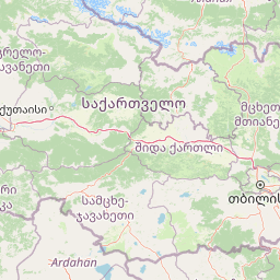
Use this park location map to pinpoint Alania National Park in Russia, understand its exact geographic position, and read its mapped placement within the surrounding landscape more clearly.

Pigeon | © OpenStreetMap contributors

Location context for Alania National Park

North Ossetia-Alania

Visual exploration of high altitude terrain, glacial valleys, and protected habitats in the Caucasus

Alania National Park Photos, Landscapes, and Mountain Scenery

Visual records capture the vertical relief, alpine meadows, and carved limestone gorges defining Alania National Park. Photographic documentation reveals the rugged protected landscape, remote mountain habitats, and glacial ecosystems spanning the reserve.

A group of ancient, weathered stone crypts with peaked roofs standing on a grassy, mountainous hillside under a cloudy sky.

A wide, hazy mountain landscape in the Caucasus with rolling green hills, a winding dirt road in the valley, and low-hanging clouds.

Park atlas

Compare adjacent high-mountain reserves and regional protected terrain

Other Parks Near Alania National Park and Related Protected Landscapes

Browsing nearby national parks and protected areas provides essential regional context for understanding the broader Central Caucasus mountain ecosystem. Comparing these adjacent reserves reveals shared glacial topography, endemic alpine species, and connected conservation landscapes.
National parkNorth Ossetia-Alania
About 0 km away#1 closest

West

Alaniya National Park: Protected Glacial Mountain Landscape in North Ossetia-Alania, Russia

Explore dramatic terrain and ancient heritage.

Alaniya National Park, situated in the rugged Central Caucasus Mountains of North Ossetia-Alania, Russia, is a premier example of a protected landscape defined by its dramatic glacial formations and high alpine environments. The park's geography features extensive glaciated peaks, deep valleys, and unique biodiversity. It preserves critical habitats and showcases significant archaeological sites, providing a rich context for understanding the natural and cultural history of the region through a structured atlas perspective.

Area
549 km²
Established
1998
IUCN
II
Relief
Mountain
Watercolor painting showing green and pink mountain ranges under a light yellow sky
National parkMtskheta-Mtianeti
About 53 km away#2 closest

Southeast

Kazbegi National Park: Georgia's Alpine Protected Landscape & Regional Geography

Explore its dramatic terrain and protected area boundaries.

Kazbegi National Park offers a unique glimpse into the dramatic alpine geography of the Greater Caucasus. As a protected national park in the Mtskheta-Mtianeti region, it showcases rugged terrain, high-altitude ecosystems, and significant natural features. MoriAtlas provides a structured way to understand the park's physical characteristics, its mapped presence, and its place within the broader regional atlas, highlighting the distinct landscape of this Georgian protected area.

Area
1,446.17 km²
Established
1976
IUCN
II
Relief
Mountain
Watercolor painting of mountains, lake, and forest landscape with greenery and distant peaks
National parkKabardino-Balkaria
About 83 km away#3 closest

Northwest

Prielbrusye National Park: Mapped Protected Landscape within Kabardino-Balkaria's Geography

Explore regional park boundaries and natural terrain context.

Prielbrusye National Park is a significant protected area featured in the MoriAtlas geographic discovery platform. This page details its identity as a national park, emphasizing its mapped boundaries and its position within the broader landscape of Kabardino-Balkaria. Users can explore the park's unique geographic context, understand its protected status, and integrate its information into a larger atlas-based understanding of regional natural territories.

Area
10,102 km²
Established
1986
IUCN
II
Relief
Mountain
Watercolor illustration of a landscape with mountains, a river, and grassy fields
National parkGeorgia
About 102 km away#4 closest

South

Borjomi-Kharagauli National Park: Protected Landscape Atlas of Georgia's Lesser Caucasus

Explore its unique forests, wildlife, and mountain terrain.

Delve into Borjomi-Kharagauli National Park, a significant protected area in Georgia's Lesser Caucasus region. This national park is renowned for its extensive old-growth forests, including rare Colchian fragments, and a remarkable concentration of endemic species. The park's dramatic mountainous terrain, spanning over 1,000 square kilometers, offers a rich tapestry of landscapes from deep valleys to alpine meadows, providing critical habitat for large mammals and contributing significantly to the region's biodiversity. Explore its mapped boundaries and geographic context for a deeper understanding of this vital conservation landscape.

Area
1,093 km²
Established
1995
IUCN
II
Relief
Mountain
Watercolor painting showing a landscape with green hills, trees, and distant mountains
National parkMtskheta-Mtianeti
About 120 km away#5 closest

East

Pshav-Khevsureti National Park: Protected Mountain Landscape and Regional Geography in Mtskheta-Mtianeti

Explore rugged terrain and alpine ecosystems in Georgia's Caucasus.

Pshav-Khevsureti National Park is a key protected area in Georgia's Mtskheta-Mtianeti region, recognized for its dramatic mountain terrain, deep river valleys, and alpine zones. Established as a national park, it safeguards the watersheds of major rivers, supporting significant wildlife and offering a compelling geographic context for atlas exploration. This protected landscape provides insight into the unique natural and cultural heritage of the Khevsureti region, making it a focal point for understanding Georgia's protected area network and mountainous geography.

Area
1,400.44 km²
Established
2014
IUCN
II
Relief
Mountain
Watercolor painting of a mountainous landscape with rocky outcrops, forests, and distant hills
National parkRussia
About 136 km away#6 closest

Northwest

Kislovodsk National Park: Geographic and Protected Area Atlas of the Caucasus Foothills

Mapped mountain terrain and urban forest boundaries in Russia.

Trace the extensive boundaries of Kislovodsk National Park, located within the North Caucasus foothills of Russia. This overview details the park's unique structure, shifting from city-adjacent gardens to the rugged elevation of the Dzhinal Ridge, providing a clear geographic context for one of Europe's most distinctive urban protected landscapes.

Area
10 km²
Established
2016
IUCN
II
Relief
Upland
A soft watercolor painting depicting a gentle mountain landscape with green forests, grassy plains, and a winding path or stream against a light background.
National parkStavropol Krai
About 137 km away#7 closest

Northwest

Kislovodsk National Park and the Mountain Landscapes of Stavropol Krai, Russia

Protected mountain terrain and urban resort geography

Tracing the vertical gradient of Kislovodsk National Park, this entry covers the park's transition from cultivated rose valleys to forested mountain ridges. Featuring sandstone formations and extensive walking trail networks, the geography showcases the intersection of Caucasus foothill ecosystems and managed resort heritage within the Stavropol Krai region.

Area
9.658 km²
Established
2016
IUCN
II
Visitors
5.1M annual
Watercolor illustration of a mountainous landscape with green forests, rolling hills, and distant mountains under a light sky
National parkGeorgia
About 140 km away#8 closest

South

Algeti National Park: Explore Georgia's Protected Coniferous Forest Landscape

Mountain terrain, protected forests, and regional geography.

Algeti National Park, located in Georgia's Kvemo Kartli region, serves as a critical protected area preserving the easternmost populations of Caucasian Spruce and Nordmann Fir. This national park features a dramatic mountainous landscape within the Trialeti Range, characterized by deeply incised valleys, flowing rivers, and extensive old-growth forest ecosystems. Users can explore the park's geographic context, mapped boundaries, and the ecological significance of its unique coniferous and mixed forests, contributing to a broader understanding of protected lands in the Caucasus.

Area
68.22 km²
Established
2007
IUCN
II
Visitors
8K annual

Common questions about visiting, size, designation, and location context for Alania National Park

Alania National Park FAQs for park facts, access, geography, and protected area context

Find quick answers about Alania National Park, including protected-area facts, park geography, trail and visitor context, and how the park fits into its surrounding country and regional landscape.
MoriAtlas Explorer

Continue Your Protected Areas Search Across the Global Atlas

Deepen your exploration by continuing the structured search for national parks and protected areas worldwide. Utilize the comprehensive filtering capabilities to compare different conservation landscapes and refine your understanding of global park geography. Discover more about the distribution and characteristics of protected natural areas.

Global natural geography