Mori Atlas logo
National parkPrielbrusye National Park

Discover the mapped boundaries and regional context of this important national park.

Prielbrusye National Park: A Protected Landscape Within Kabardino-Balkaria's Geography

(Приэльбрусье (национальный парк))

Prielbrusye National Park represents a significant protected area within the geographic tapestry of Kabardino-Balkaria. As a designated national park, its protected landscape offers a focal point for atlas-based exploration, allowing users to understand its specific boundaries, its placement within the regional geography, and its role as a mapped natural territory. This page serves as the authoritative entry point for understanding Prielbrusye National Park's identity as a distinct protected land.

Alpine EnvironmentsGlacial LandscapesCaucasus MountainsMountain ParksEndemic SpeciesHigh-Altitude Ecosystems
Illustration of a mountainous landscape featuring a snow-capped peak, river, green hills, pine trees, and rocky terrain under a partly cloudy sky

Prielbrusye National Park

National park

Park overview

Structured park overview, official facts, and landscape profile for Prielbrusye National Park

Prielbrusye National Park park facts, protected area profile, and essential visitor context
Review the core facts for Prielbrusye National Park, including designation, size, terrain, visitor scale, habitats, and operating context in one park-focused overview.

About Prielbrusye National Park

Prielbrusye National Park protects a landscape of extraordinary topographic and ecological diversity in the heart of the Caucasus Mountains. The terrain encompasses towering mountain peaks, glaciers, volcanic lava flows, lake basins, and a limited system of forested river valleys that provide the only lower-elevation habitat within this predominantly alpine protected area. The park's location along the border between Europe and Asia, combined with its dramatic elevation range of over 4,000 meters, creates a unique setting where different ecological zones meet and interact. This climatic and habitat transition zone supports remarkable species diversity, with numerous endemic plants and animals found nowhere else on Earth. The relative isolation created by steep gorges and the challenging high-altitude environment has allowed many species to evolve independently, contributing to the park's global significance for biodiversity conservation. The Caucasus region as a whole is considered one of the world's most important biodiversity hotspots, and Prielbrusye represents a core protected area within this network.

Quick facts and research context for Prielbrusye National Park

Prielbrusye National Park occupies the peaks and northern slopes of the central Caucasus Mountains, with elevations ranging from 1,400 to 5,642 meters. About 15.3 percent of the territory, approximately 155 square kilometers, is covered by glaciers or permanent snow. The park contains the headwaters of the Malka River, which originates in Elbrus's glaciers, and the Baksan River, which flows through the southern portion of the protected area. Mount Elbrus marks the western boundary of the park, adjacent to the Karachay-Cherkess Republic. The park is situated within the Caucasus mixed forests ecoregion, one of the world's most biologically diverse regions, and features an Arctic tundra climate due to its high elevations.

Park context

Deeper park guide and search-rich context for Prielbrusye National Park

Prielbrusye National Park history, landscape, wildlife, and travel context
Explore Prielbrusye National Park through its history, landscape character, ecosystems, wildlife, conservation priorities, cultural context, and seasonal travel timing in a structured park guide built for atlas discovery and search intent.

Why Prielbrusye National Park stands out

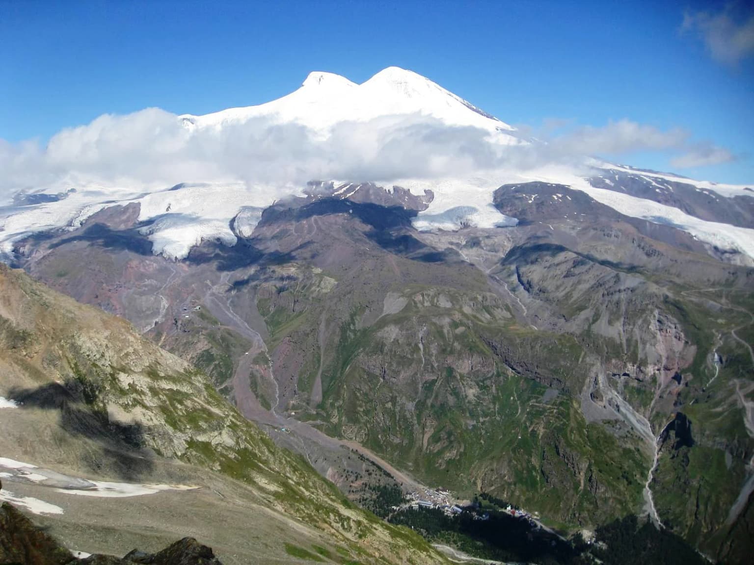
Prielbrusye is best known for surrounding Mount Elbrus, the highest and most prominent peak in Europe, which dominates the western boundary of the park. The park is renowned for its dramatic glacial landscapes, with extensive ice fields and glaciers descending from the summit. It is also recognized for its exceptional biodiversity, particularly the presence of large mammals including West Caucasian turs, East Caucasian turs, chamois, Caspian red deer, and the endangered Persian leopard. The park serves as a critical habitat for species adapted to the harsh high-altitude environment and represents one of 22 national parks across the Caucasus region, protecting approximately 1.8 percent of the broader Caucasus area.

A mountain landscape with snow-covered peaks and glaciers under a clear blue sky
Donguzorun Glacier and snow-capped mountain peaks in Prielbrusye National Park

Prielbrusye National Park history and protected-area timeline

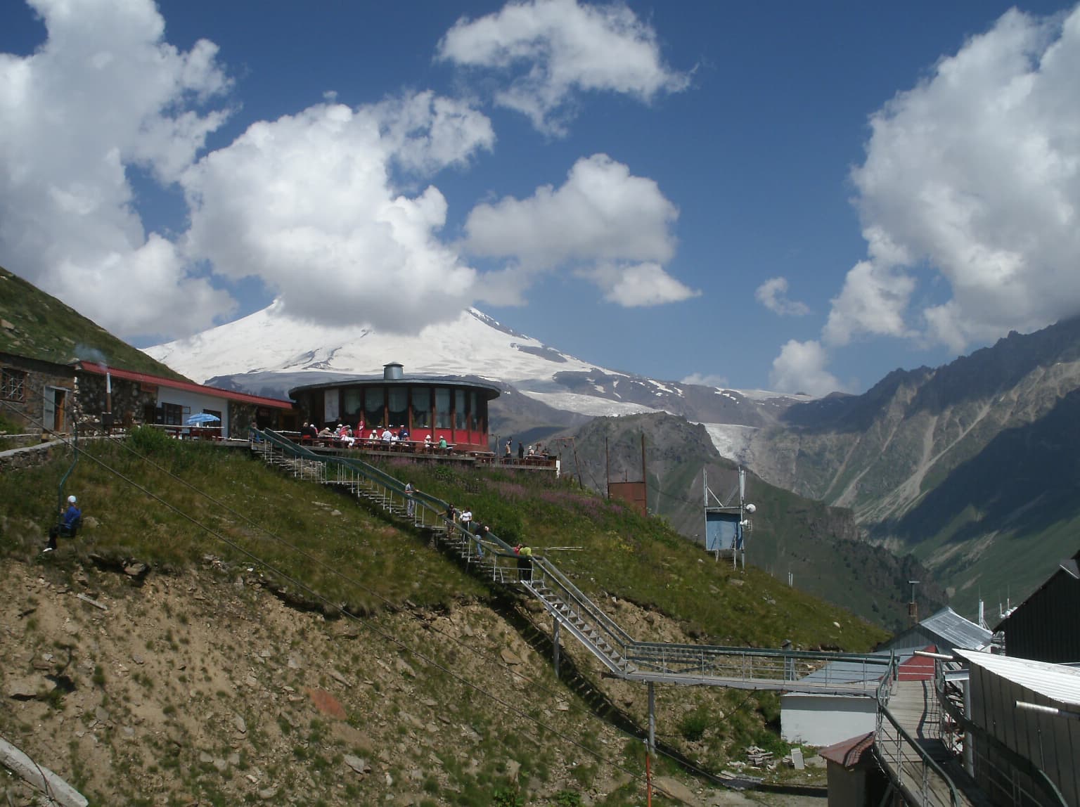
Prielbrusye National Park was established in 1986 as part of the Soviet Union's expanding network of protected areas. The creation of the park reflected growing recognition of the Caucasus Mountains' global significance for biodiversity and the need to protect the unique ecosystems surrounding Mount Elbrus, one of Europe's most iconic natural landmarks. Under the governance of Russia's Ministry of Natural Resources and Environment, the park has been managed to balance conservation objectives with sustainable use of its natural resources. The post-Soviet period has brought continued development of tourism infrastructure within the park, with facilities established in six small settlements scattered throughout the protected area. The park remains an important center for mountaineering, alpine sports, and scientific research in the Caucasus region.

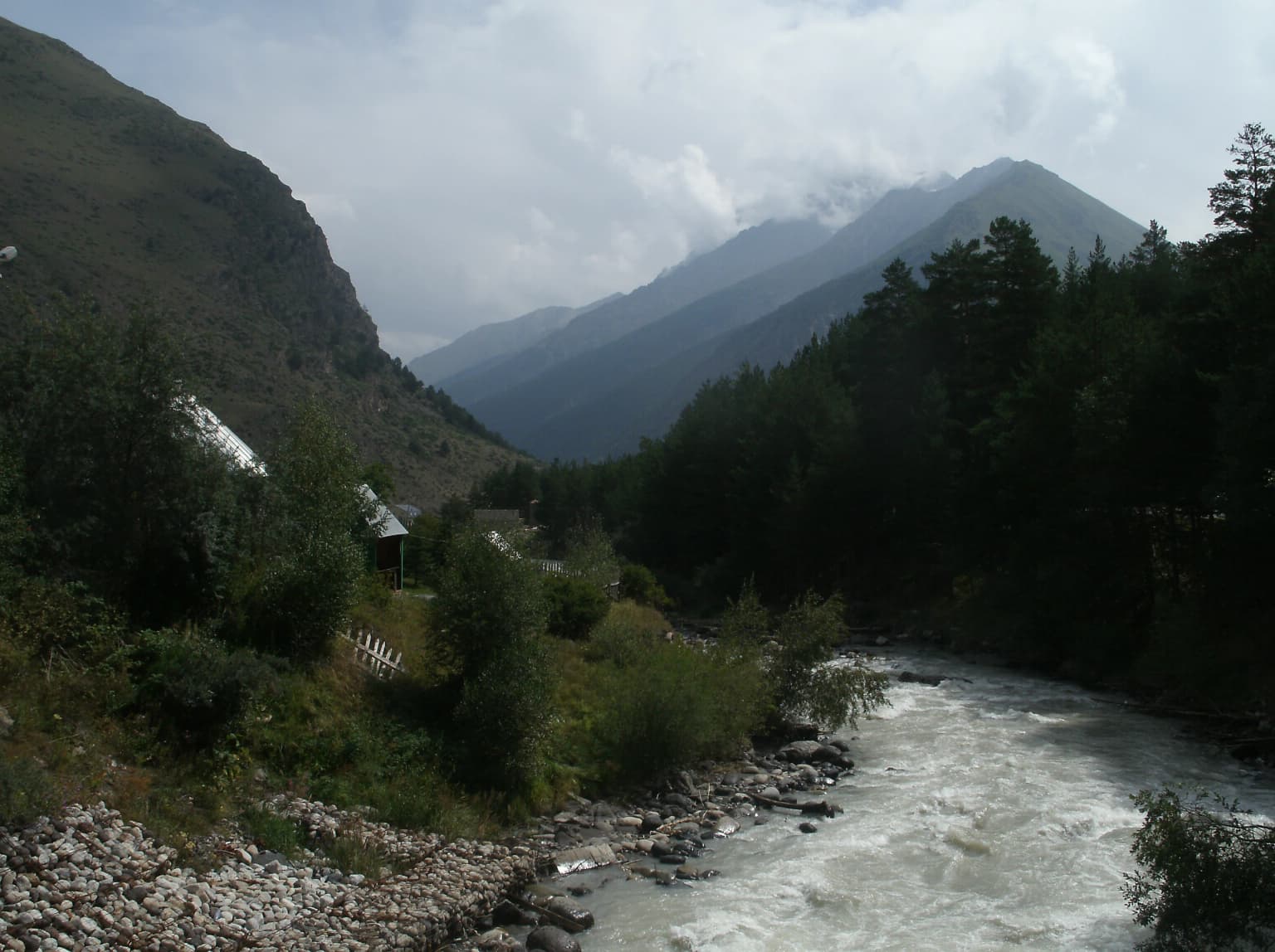
Prielbrusye National Park landscape and geographic character

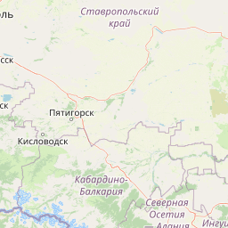
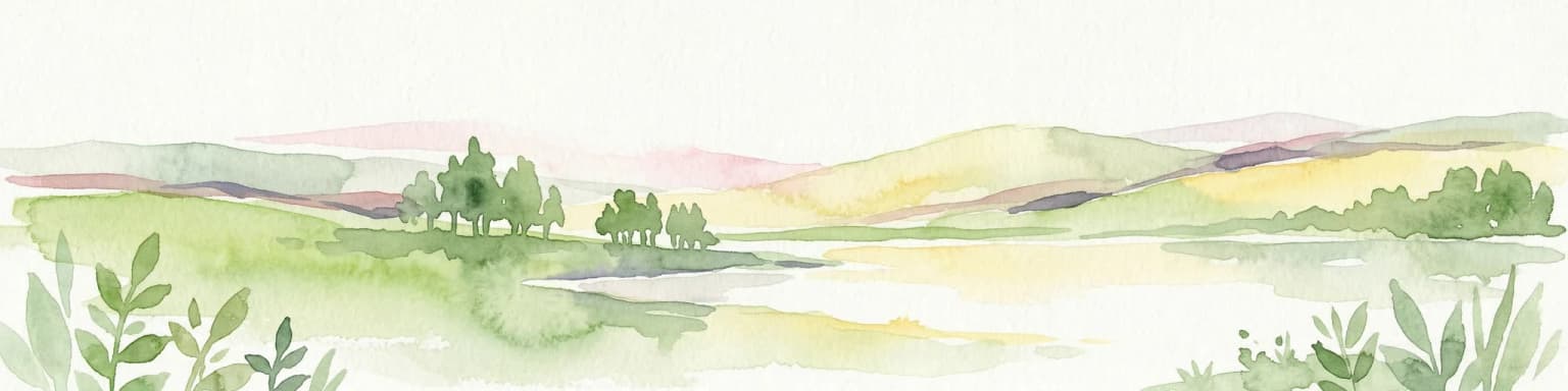
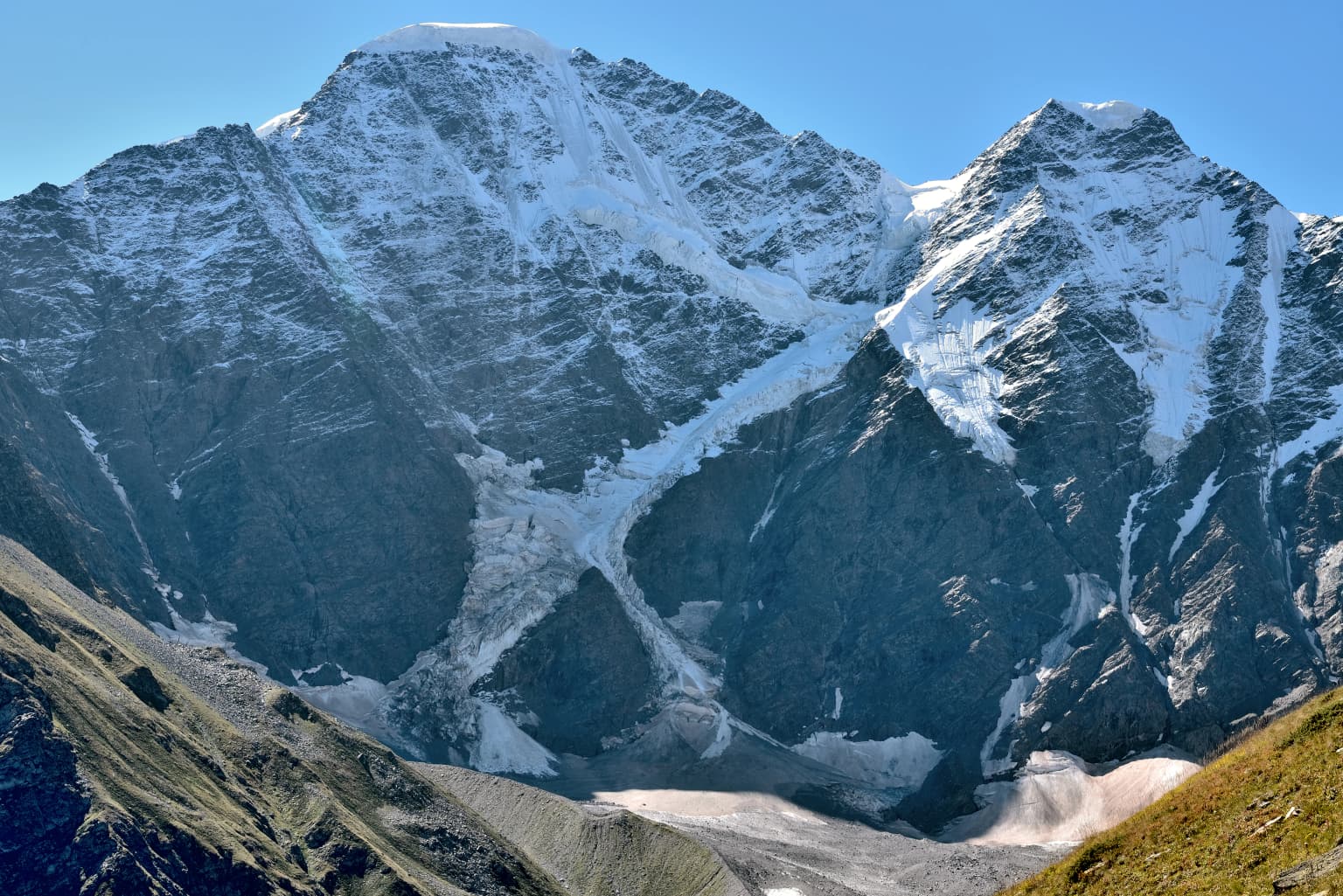
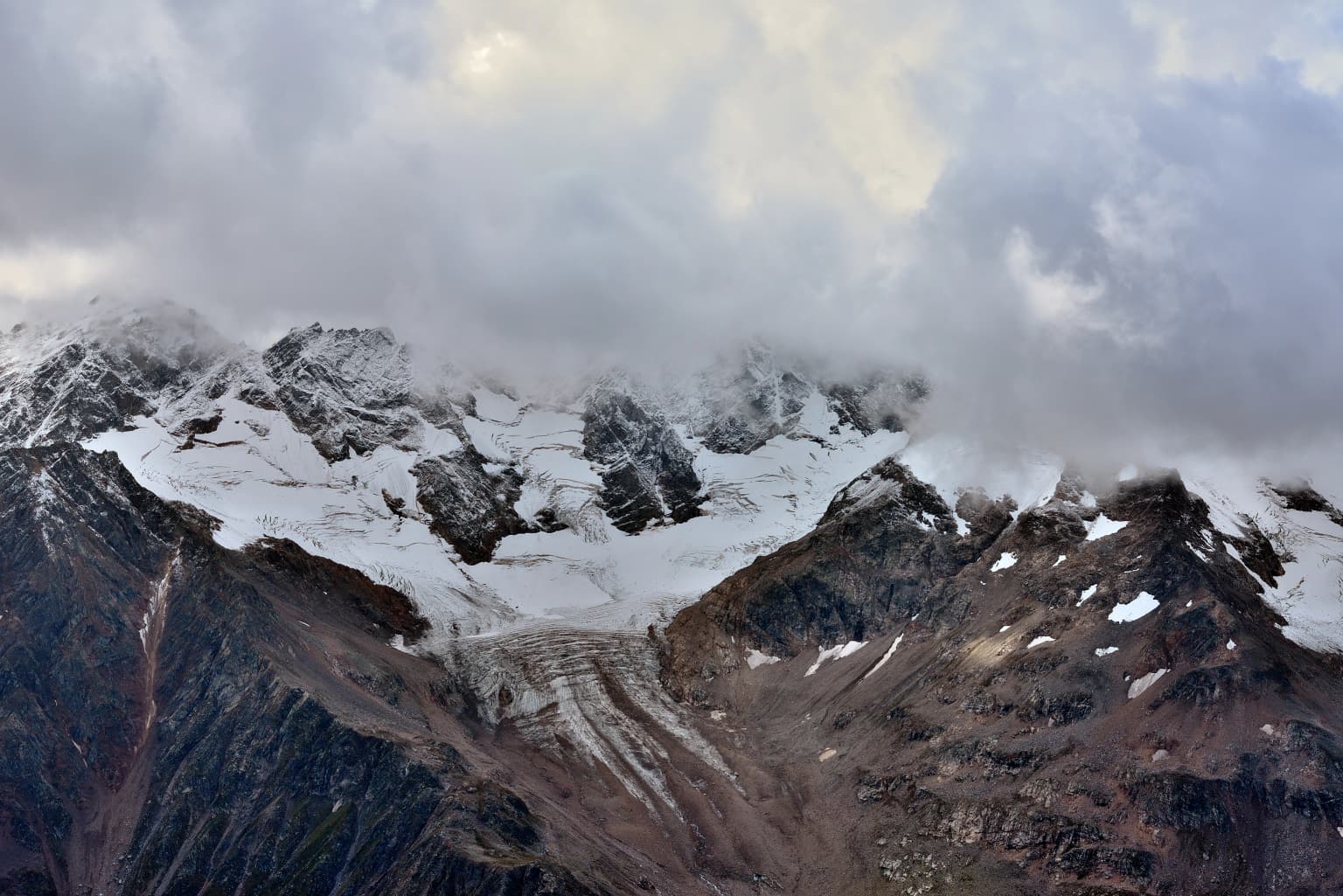
The landscape of Prielbrusye National Park is defined by the towering mass of Mount Elbrus and the surrounding peaks of the central Caucasus Mountains. The terrain rises dramatically from approximately 1,400 meters in the river valleys to 5,642 meters at Elbrus's summit, creating one of the most pronounced elevation gradients in Europe. Glaciated peaks, dramatic ridges, and steep gorges characterize the higher terrain, while the lower elevations feature forested river valleys that provide a contrast to the alpine and subnival zones above. Approximately 155 square kilometers of the park is covered by glaciers and permanent snow, with icefields descending from the Elbrus massif. The Malka River originates from Elbrus's glaciers and flows northward through a plateau below the glacial source, while the Baksan River traverses the southern tier of the park. Volcanic influences are evident in portions of the terrain, with lava flows adding to the geological complexity. The park's southern boundary follows the international border with Georgia, creating a transboundary protected area within the greater Caucasus ecosystem.

Wide scenic view of Mount Elbrus with snow-capped peaks above a valley with green slopes and rocky terrain
Mount Elbrus dominates the landscape above the Baksan Valley

Prielbrusye National Park ecosystems, habitats, and plant life

The nature of Prielbrusye is shaped fundamentally by its extreme elevation range, which creates distinct ecological zones from the forested valleys to the summit of Mount Elbrus. At the lowest elevations within the river valleys, deep coniferous forests dominated by pine establish the forest layer, with an understory of juniper, barberry, and wild rose providing dense ground cover. Wetter areas support thickets of wild raspberries, currants, and gooseberries. As elevation increases, the forest gives way to a narrow belt of broadleaf trees and shrubs in the sub-alpine zone, succeeded by alpine meadows that blanket the mountainsides during the brief summer growing season. Above this, the terrain transitions to bare rock, permanent snow, and glacial ice at the highest elevations. The park lies within the Caucasus mixed forests ecoregion, widely recognized as one of the most biologically diverse regions on the planet due to the convergence of different ecological zones and the complex topography that has fostered speciation and endemism.

Circular building on grassy hillside with people walking on stairs, Mount Elbrus snow-capped peak visible in background
Visitor center with Mount Elbrus in the background

Prielbrusye National Park wildlife and species highlights

Prielbrusye National Park supports a diverse community of large mammals adapted to the mountainous environment. The park is home to both West Caucasian turs and East Caucasian turs, two distinctive wild goat species endemic to the Caucasus region. Chamois populations inhabit the rocky slopes and alpine meadows. Caspian red deer and roe deer occupy the forested valleys and forest edges, while wild boar are found in the lower terrain. Predators include the endangered Persian leopard, gray wolves, European jackals, red foxes, and the elusive Caucasian lynx. The Syrian brown bear inhabits the park, utilizing both forest and alpine zones. The park also supports the Caucasian Mountain Ground Squirrel, a species characteristic of the high-altitude meadow habitats. This assemblage of species represents the park's conservation significance, particularly for the large carnivores and endemic ungulates that depend on the protected alpine and forest ecosystems.

Snow-covered mountain peaks with glacier visible in the mid-ground, partially obscured by clouds
Chegetkara Glacier within Prielbrusye National Park, showing snow-covered mountain peaks and glaciers partially obscured by clouds

Prielbrusye National Park conservation status and protection priorities

Prielbrusye National Park plays a critical role in the conservation of the Caucasus region's exceptional biodiversity. The park is one of 22 national parks established across the Caucasus of different nationalities, collectively protecting approximately 1.8 percent of the broader Caucasus region. This network of protected areas recognizes the global significance of the Caucasus as a biodiversity hotspot, where numerous species reach the limits of their ranges and where endemism is high due to the complex topography and climatic variation. The park's protection of the Mount Elbrus region safeguards critical habitat for endangered species including the Persian leopard, as well as the endemic Caucasian tur species. The glacial ecosystems within the park are also increasingly important as indicators of climate change impacts in mountain environments. The establishment of Prielbrusye as a national park with IUCN Category II status provides a framework for long-term conservation of these irreplaceable natural values.

Prielbrusye National Park cultural meaning and human context

The territory of Prielbrusye lies within Kabardino-Balkaria, a republic in southwestern Russia with a rich cultural heritage. The region has been inhabited for centuries by the Kabard and Balkar peoples, whose traditional livelihoods were closely tied to the mountain environment. The name Prielbrusye itself derives from Russian, meaning area by Mount Elbrus, reflecting the centrality of the mountain to regional identity. The protected area encompasses traditional settlement patterns, with six small settlements located within the park boundaries. These communities maintain connections to the land through pastoral activities and cultural practices shaped by the seasonal rhythms of the high mountain environment. The park's proximity to the border with Georgia also places it within a broader context of cross-cultural exchange and historical movement through the Caucasus mountains.

Metal-roofed mountain shelter on rocky terrain with snow-covered peaks in background
Mountain shelter with Mount Elbrus visible in the background

Top sights and standout views in Prielbrusye National Park

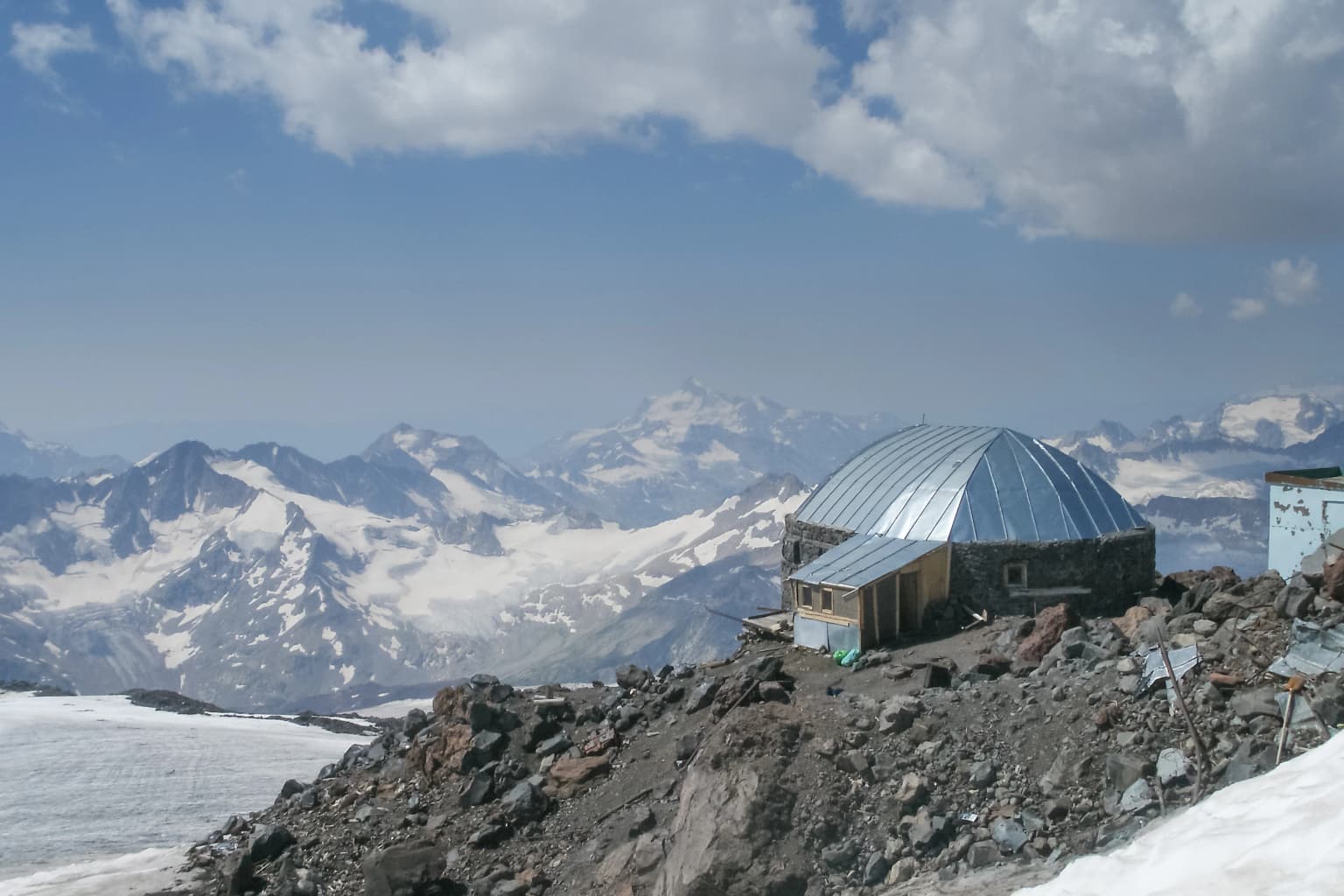
The most prominent highlight of Prielbrusye National Park is Mount Elbrus itself, a massive twin-peaked volcano that rises to 5,642 meters and stands as the highest summit in Europe. The glacier-covered slopes of the mountain provide dramatic scenery and attract mountaineers from around the world. The park's glacial landscape encompasses extensive ice fields and descending glaciers that shape the high terrain. The biodiversity of the Caucasus is represented in the park's populations of Caucasian turs, chamois, and the endangered Persian leopard. The transition from forested valleys through sub-alpine shrubland to alpine meadows and finally to rock and ice creates a visually striking vertical landscape. The cableway in the Elbrus region provides visitor access to the mountain environment, while numerous trails and climbing routes offer opportunities to explore the park's diverse terrain.

Mountain river flowing through forested valley with rocky riverbank and distant peaks
River flowing through mountain valley in Prielbrusye National Park

Best time to visit Prielbrusye National Park

The summer months from June through September offer the most accessible period for visiting Prielbrusye National Park, when the alpine meadows bloom and trail conditions are favorable for hiking and climbing. The brief summer season provides relatively warm temperatures in the valleys while the high peaks remain snow-covered. Autumn brings changing foliage colors in the forests and typically stable weather, though conditions become increasingly cold at higher elevations. Winter transforms the park into a skiing destination, with the high-altitude terrain offering alpine sports opportunities. The climate is characterized by extreme variation due to the dramatic elevation differences across the park, with conditions at summit level remaining arctic throughout the year. Spring arrives late in the high mountains and is often characterized by unstable weather. Visitors should be prepared for rapid changes in conditions regardless of the season, particularly given the park's high-altitude exposure.

Park location guide

Geography guide, regional context, and park location map for Prielbrusye National Park

Prielbrusye National Park park geography, regions, and map view in Russia
Understand where Prielbrusye National Park sits in Russia through a broader geographic reading of the surrounding landscape, nearby location context, and its mapped position within the national park landscape.

How Prielbrusye National Park fits into Russia

Russia is a transcontinental nation spanning eleven time zones, bordered by fourteen countries. It is the world's largest country by area, covering 17,098,246 km². Moscow is the capital and largest city, while Saint Petersburg is the second-largest and a major cultural centre.

Wider geography shaping Prielbrusye National Park in Russia

Russia spans Eastern Europe and North Asia, covering 17,098,246 km². It shares land borders with fourteen countries, more than any other nation, and spans eleven time zones. The landscape includes vast plains, mountain ranges such as the Urals and Caucasus, and extensive coastlines along the Arctic Ocean, Pacific Ocean, Baltic Sea, Black Sea, and Caspian Sea.

Map view of Prielbrusye National Park

Use this park location map to pinpoint Prielbrusye National Park in Russia, understand its exact geographic position, and read its mapped placement within the surrounding landscape more clearly.

Pigeon | © OpenStreetMap contributors

Location context for Prielbrusye National Park

Elbrussky DistrictKabardino-BalkariaZolsky District

Visual Atlas of Prielbrusye: High-Altitude Terrain, Glacial Features, and Protected-Area Environments

Prielbrusye National Park Photos: Explore Caucasus Mountain Landscapes and Alpine Scenery
Visually explore the dramatic glacial landscapes and towering peaks that define Prielbrusye National Park's environment. These essential images reveal the diverse high-altitude terrain, from Mount Elbrus's ice fields to forested valleys, providing crucial context for understanding this protected Caucasus mountain wilderness and its distinct ecological character.

A mountain landscape with snow-covered peaks and glaciers under a clear blue sky

Turbulent river flowing through rocky riverbed with forested mountains in background

Wide scenic view of Mount Elbrus with snow-capped peaks above a valley with green slopes and rocky terrain

Circular building on grassy hillside with people walking on stairs, Mount Elbrus snow-capped peak visible in background

Snow-covered mountain peaks with glacier visible in the mid-ground, partially obscured by clouds

Red cable car chairs suspended by cables over a dirt path, with mountainous landscape and valley in background

Metal-roofed mountain shelter on rocky terrain with snow-covered peaks in background

Mountain river flowing through forested valley with rocky riverbank and distant peaks

Park atlas

Explore the broader Caucasus Mountains region, tracing protected landscapes and comparing alpine environments.

Discover Other National Parks and Protected Areas Near Prielbrusye National Park
Continue your exploration from Prielbrusye National Park by browsing other national parks and protected areas within the central Caucasus Mountains. Compare their diverse alpine environments, glacial landscapes, and conservation focuses to understand the regional spread of protected geography and unique ecosystems.
National park

Kislovodsk National Park: A Russian National Park Defined by Protected Landscape and Geography

Explore its mapped terrain and regional natural context.

Kislovodsk National Park represents a significant protected landscape within the Russian Federation, recognized as a national park. This MoriAtlas entry focuses on its distinct geographic identity and the character of its protected territory. Discover its mapped boundaries, understand its relationship to the surrounding regional geography, and gain context for its natural landscape within a structured atlas framework. This provides a foundation for exploring its place in the broader map of protected areas.

Area
10 km²
Established
2016
IUCN
II
Watercolor painting depicting mountains, a winding river, and green forests in a mountainous landscape
Nature reserveKarachay-Cherkess Republic

Teberda Nature Reserve: Protected Area Mapping and Geographic Context

Explore the mapped boundaries and regional geography of this protected landscape.

Teberda Nature Reserve is a significant protected area located in the Karachay-Cherkess Republic, offering rich opportunities for geographic exploration. This page provides detailed atlas-style information, focusing on the reserve's mapped landscape and its protected-area identity. Understand the unique geographic context and contours of Teberda Nature Reserve, contributing to a structured understanding of Russia's natural protected lands.

Area
849.96 km²
Established
1936
IUCN
Ia
Visitors
200K annual
National parkNorth Ossetia-Alania

Alaniya National Park: Protected Glacial Mountain Landscape in North Ossetia-Alania, Russia

Explore dramatic terrain and ancient heritage.

Alaniya National Park, situated in the rugged Central Caucasus Mountains of North Ossetia-Alania, Russia, is a premier example of a protected landscape defined by its dramatic glacial formations and high alpine environments. The park's geography features extensive glaciated peaks, deep valleys, and unique biodiversity. It preserves critical habitats and showcases significant archaeological sites, providing a rich context for understanding the natural and cultural history of the region through a structured atlas perspective.

Area
549 km²
Established
1998
IUCN
II
Relief
Mountain
National parkGeorgia

Kolkheti National Park: Mapped Wetland Landscape & Protected Area in Georgia

Explore the peat bogs, coastal ecosystems, and bird migration routes.

Discover Kolkheti National Park, a key protected national park located in Georgia's western coastal region. This atlas entry focuses on the park's extensive wetland environments, including its significant peat bogs and Lake Paliastomi, highlighting its role as a critical migratory bird corridor and a unique natural landscape within the Black Sea region. Understand its geographic context and protected area boundaries.

Area
807.99 km²
Established
1998
IUCN
II
Visitors
13.7K annual
National parkGeorgia

Borjomi-Kharagauli National Park: Protected Landscape Atlas of Georgia's Lesser Caucasus

Explore its unique forests, wildlife, and mountain terrain.

Delve into Borjomi-Kharagauli National Park, a significant protected area in Georgia's Lesser Caucasus region. This national park is renowned for its extensive old-growth forests, including rare Colchian fragments, and a remarkable concentration of endemic species. The park's dramatic mountainous terrain, spanning over 1,000 square kilometers, offers a rich tapestry of landscapes from deep valleys to alpine meadows, providing critical habitat for large mammals and contributing significantly to the region's biodiversity. Explore its mapped boundaries and geographic context for a deeper understanding of this vital conservation landscape.

Area
1,093 km²
Established
1995
IUCN
II
Relief
Mountain
National parkMtskheta-Mtianeti

Kazbegi National Park: Georgia's Alpine Protected Landscape & Regional Geography

Explore its dramatic terrain and protected area boundaries.

Kazbegi National Park offers a unique glimpse into the dramatic alpine geography of the Greater Caucasus. As a protected national park in the Mtskheta-Mtianeti region, it showcases rugged terrain, high-altitude ecosystems, and significant natural features. MoriAtlas provides a structured way to understand the park's physical characteristics, its mapped presence, and its place within the broader regional atlas, highlighting the distinct landscape of this Georgian protected area.

Area
1,446.17 km²
Established
1976
IUCN
II
Relief
Mountain
Watercolor illustration of a landscape with rolling hills, forests, and a winding river.
National parkAdjara

Kintrishi National Park: Protected Colchic Forest Canyon Landscape in Adjara

Explore the mapped geographic boundaries of this unique Georgian national park.

Kintrishi National Park, located in Georgia's Adjara region, is a protected landscape renowned for its exceptionally intact Colchic deciduous forests within a steep river gorge. This area showcases dense woodland, dramatic terrain, and the unique Colchican willow species, offering rich geographic context. As a key protected area, Kintrishi National Park provides a valuable focus for atlas-based exploration of southwestern Georgia's natural heritage.

Area
186.84 km²
Established
2007
IUCN
II
Scope
Terrestrial
Watercolor illustration of a landscape with green hills, trees, and a body of water
National parkAdjara

Mtirala National Park: Protected Colchic Rainforest Landscape & Geographic Atlas

Explore Adjara's unique terrain and mapped protected boundaries.

Mtirala National Park, located in Georgia's Adjara region, is a protected national park renowned for its exceptionally high rainfall and ancient Colchic relict forests. This atlas-focused profile details the park's unique topography, its watershed between the Chakvistskali and Khoristskali rivers, and its significance as a vital ecosystem. Understand the geographic context of this protected landscape and its role in the broader Caucasus geography.

Area
281.26 km²
Established
2006
IUCN
II
Relief
Mixed relief

Common questions about visiting, size, designation, and location context for Prielbrusye National Park

Prielbrusye National Park FAQs for park facts, access, geography, and protected area context
Find quick answers about Prielbrusye National Park, including protected-area facts, park geography, trail and visitor context, and how the park fits into its surrounding country and regional landscape.
MoriAtlas Explorer

Continue Your Protected Areas Search Across the Global Atlas

Deepen your exploration by continuing the structured search for national parks and protected areas worldwide. Utilize the comprehensive filtering capabilities to compare different conservation landscapes and refine your understanding of global park geography. Discover more about the distribution and characteristics of protected natural areas.

Global natural geography