Mori Atlas logo
National parkKöprülü Canyon National Park

Explore the unique geological formations and river canyon terrain of this protected natural reserve.

Köprülü Canyon National Park: Mapped Protected Area and Geographic Landscape Atlas

Köprülü Canyon National Park stands as a significant protected area, characterized by its striking geological formations and the prominent river canyon that defines its geography. This page serves as your gateway to understanding the mapped boundaries and landscape context of Köprülü Canyon National Park within the broader atlas. Discover the natural reserve's terrain, understand its position in regional geography, and appreciate its protected status as a key element in the landscape.

canyonprotected areaTurkeynature parkMediterraneangeological formation
Stylized illustration of a canyon with a blue river, green and autumn-colored trees, and rocky cliffs under a yellow sky

Köprülü Canyon National Park

National park

Park overview

Structured park overview, official facts, and landscape profile for Köprülü Canyon National Park

Köprülü Canyon National Park park facts, protected area profile, and essential visitor context
Review the core facts for Köprülü Canyon National Park, including designation, size, terrain, visitor scale, habitats, and operating context in one park-focused overview.
Park location guide

Geography guide, regional context, and park location map for Köprülü Canyon National Park

Köprülü Canyon National Park park geography, regions, and map view in Turkey
Understand where Köprülü Canyon National Park sits in Turkey through a broader geographic reading of the surrounding landscape, nearby location context, and its mapped position within the national park landscape.

How Köprülü Canyon National Park fits into Turkey

Turkey, officially the Republic of Türkiye, is a transcontinental country located mainly in Anatolia (West Asia) with a smaller portion in East Thrace (Southeast Europe). It borders the Black Sea to the north, several countries to the east and south, and the Aegean Sea and European countries to the west. The country has a population of over 86 million and operates as a secular, Muslim-majority presidential republic with Ankara as capital and Istanbul as its largest city.

Wider geography shaping Köprülü Canyon National Park in Turkey

Turkey is a transcontinental country with the majority of its territory (about 97%) located in Anatolia (West Asia) and a smaller portion called East Thrace in Southeast Europe. It borders the Black Sea to the north, Georgia, Armenia, Azerbaijan, and Iran to the east, Iraq and Syria to the south, and the Mediterranean Sea to the southwest. To the west, Turkey borders the Aegean Sea, Greece, and Bulgaria. The terrain includes mountains, plateaus, and coastal plains, with the Taurus Mountains running along the southern coast.

Map view of Köprülü Canyon National Park

Use this park location map to pinpoint Köprülü Canyon National Park in Turkey, understand its exact geographic position, and read its mapped placement within the surrounding landscape more clearly.

Pigeon | © OpenStreetMap contributors

Explore diverse scenery, geological formations, and river environments across this Turkish protected area, offering a visual guide to its unique character.

Köprülü Canyon National Park Photos: Visualizing the Canyon, River, and Protected Landscapes
Browse a curated collection of imagery capturing the majestic canyon walls, flowing river, and surrounding natural reserves within Köprülü Canyon National Park. These visuals provide essential insight into the park's distinct topography, diverse habitats, and overall protected-area environment, aiding deeper understanding of its geographic identity.

A river flows through a narrow canyon with steep rocky cliffs and dense vegetation including green and autumn-colored trees

Park atlas

Trace the diverse protected landscapes and regional park geography surrounding Köprülü Canyon National Park.

Explore Other National Parks and Protected Landscapes Near Köprülü Canyon National Park
Browse national parks and protected areas geographically adjacent to Köprülü Canyon National Park, exploring other canyon landscapes, geological formations, and natural reserves across the surrounding region. Compare these diverse protected landscapes within their regional context, enhancing your atlas-style understanding of conservation efforts and unique natural terrain.
National parkTurkey

Derebucak Çamlık Caves National Park: Turkey's Protected Karst Caves and Landscape

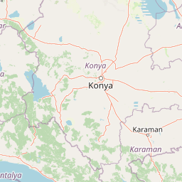
Explore Konya Province's longest cave system and its unique geological context.

Derebucak Çamlık Caves National Park is a vital protected landscape in central Turkey, celebrated for its extensive karst topography and significant cave formations. This national park encompasses thirteen unique caves and sinkholes, with Balatini Cave holding the distinction of being Konya Province's longest. The park's rugged terrain, characterized by pine forests and the Balat Stream feeding its underground systems, offers a profound look into Turkey's geological heritage and the conservation of its unique subterranean environments. MoriAtlas helps you navigate this mapped protected area.

Area
11.47 km²
Established
2022
IUCN
II
Relief
Upland
Watercolor painting showing a lake, mountains, trees, and grassy shoreline
National parkIsparta Province

Lake Kovada National Park: Mapped Protected Landscape in Isparta Province

Discover the geography and lake ecosystem of this Turkish national park.

Lake Kovada National Park offers a detailed look at a protected natural area within Turkey's Isparta Province. This page provides insights into the park's protected landscape, focusing on the central freshwater lake and its surrounding montane terrain. Explore its geographic context, mapped boundaries, and status as a significant protected area within the Taurus Mountain region, ideal for atlas-based discovery of Anatolian natural environments.

Area
65.51 km²
Established
1970
IUCN
II
Scope
Terrestrial
Watercolor illustration showing a mountainous landscape with a lake and greenery
National parkAntalya Province

Altınbeşik Cave National Park: A Karst Landscape with Turkey's Largest Subterranean Lake

Protected lands and mapped geological formations in Antalya Province.

Altınbeşik Cave National Park represents a significant protected karst landscape within Antalya Province, Turkey. The park's primary feature is the renowned Altınbeşik Cave, home to Turkey's largest subterranean lake and exceptional travertine formations. Explore the mapped geography of this unique national park, understanding its role as a critical discharge point for one of the world's longest karst aquifer systems.

Area
11.47 km²
Established
1994
IUCN
II
Relief
Mixed relief
Watercolor painting of colorful rowboats on a lake with distant mountains
National parkKonya Province

Lake Beyşehir National Park: Protected Landscape Geography and Mapped Boundaries

Discover the geography and mapped context of this national park in Konya.

Lake Beyşehir National Park is a major protected area in Turkey's Central Anatolia region, celebrated for its immense freshwater lake and diverse wetland habitats. The park's identity is strongly tied to its mapped boundaries that protect critical ecosystems, islands, and surrounding forested terrain. This page provides a detailed look at the park's geographic setting within Konya Province, serving as a valuable resource for atlas-based discovery of its unique natural and cultural landscape.

Area
868.55 km²
Established
1993
IUCN
II
Relief
Lowland
National parkAntalya Province

Mount Güllük-Termessos National Park: An Atlas View of Protected Mediterranean Landscapes

Protected national park with ancient ruins and diverse ecosystems.

Discover Mount Güllük-Termessos National Park, a key protected area within Antalya Province, Turkey. This national park is notable for its integrated cultural and natural heritage, featuring the extensive ruins of ancient Termessos and a diverse Mediterranean ecosystem supporting endangered wildlife. Its varied terrain, from lower shrublands to higher pine forests, alongside dramatic geological features like the Mecene Strait canyon, provides rich geographic context for atlas-based discovery.

Area
67.02 km²
Established
1970
IUCN
II
Relief
Mountain
Watercolor illustration of green hills, pine trees, and distant mountains under a light sky
National parkIsparta Province

Kızıldağ National Park: Protected Taurus Mountain Landscape and Atlas Context

Mapped boundaries, alpine terrain, and unique cedar forests.

Kızıldağ National Park offers a detailed look into Turkey's protected natural heritage, specifically highlighting the dramatic mountainous terrain of the Taurus Ranges. This page provides atlas-level geographic information about its mapped boundaries, the significant Dedegöl Mountain, and the rare blue-leaf cedar forests unique to this region. Understand its role as a vital conservation area within Isparta Province and the broader Mediterranean mountain ecosystem.

Area
551.06 km²
Established
1969
IUCN
II
Relief
Mountain
Watercolor illustration of a coastal landscape with mountains, water lilies, reeds, and a body of water under a pale sky
National parkAntalya Province

Beydağları Coastal National Park: Protected Landscape and Geographic Atlas

Explore mapped boundaries and natural terrain in Antalya Province.

Beydağları Coastal National Park is a significant protected national park located along the Mediterranean coast of Antalya Province, Turkey. This page provides an atlas-focused view of the park, detailing its geographic scope, the interplay of mountain and coastal landscapes, and its importance as a protected area. Users can delve into the mapped features and regional context that define this remarkable natural and historical landscape.

Area
344.25 km²
Established
1972
IUCN
II
Relief
Mountain
Watercolor painting showing a lake with hills and forest in the background
National parkTurkey

Mount Honaz National Park: Turkey's National Park Protected Area Detail

Explore mapped protected landscape and regional geography.

Mount Honaz National Park is a designated national park in Turkey, offering valuable insights into the country's protected areas and natural landscapes. This page provides a focused view of its mapped boundaries and geographic significance, enabling detailed atlas-style exploration. Understand how this protected area contributes to the regional geography of Western Anatolia and complements the broader network of natural reserves within Turkey.

IUCN
II
Scope
Terrestrial

Common questions about visiting, size, designation, and location context for Köprülü Canyon National Park

Köprülü Canyon National Park FAQs for park facts, access, geography, and protected area context
Find quick answers about Köprülü Canyon National Park, including protected-area facts, park geography, trail and visitor context, and how the park fits into its surrounding country and regional landscape.
MoriAtlas Explorer

Continue Your Protected Areas Search Across the Global Atlas

Deepen your exploration by continuing the structured search for national parks and protected areas worldwide. Utilize the comprehensive filtering capabilities to compare different conservation landscapes and refine your understanding of global park geography. Discover more about the distribution and characteristics of protected natural areas.

Global natural geography