
Rivers
Park geography
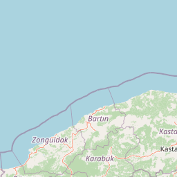
Spatial analysis covering elevation, surface area, and regional terrain context.
Geographic Profile and Mapped Boundaries of Küre Mountains National Park in Turkey
Review the detailed physical geography and spatial distribution of Küre Mountains National Park, spanning across Kastamonu and Bartın Provinces. This profile documents the recorded boundary area of 377.53 square kilometers and mean elevation of 500 meters within the broader temperate mountain landscape.
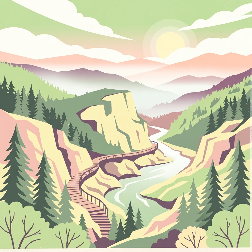
Ancient forests and karst canyons of Turkey's Black Sea highlands
Küre Mountains National Park
Küre Mountains National Park is a significant protected area in the Black Sea Region of northern Turkey, established in 2000 to preserve one of the most ecologically diverse mountain landscapes in the country. The park encompasses the Küre Mountains range, a sprawling mountain system that extends approximately 300 kilometers from the west bank of the Bartın River to the east bank of the Kızılırmak River. The core protected zone covers nearly 38,000 hectares with an average elevation of 500 meters, though the broader protected landscape with buffer zones extends to over 100,000 hectares. The park spans multiple districts across Kastamonu and Bartın provinces and represents one of Turkey's 41 national parks, recognized as a critical area for conserving humid forest ecosystems under the influence of the Black Sea climate.
- Location
- Turkey
- Park type
- National park
- Established
- 2000
- Area
- 377.5 km²
Location overview
Mapped regional placement within Kastamonu and Bartın Provinces
Geographic Location of Küre Mountains National Park in Turkey
Küre Mountains National Park lies in Turkey, spanning Kastamonu Province and Bartın Province. Administrative mapping records define the park as a domestic, inland protected territory.
- Countries
- Turkey
- Regions
- Bartın Province, Kastamonu Province
- Primary location
- Kastamonu Province
- Geographic setting
- Inland
Boundary and coordinates
A 377.53 km² outline with geographic measurements
Küre Mountains National Park mapped boundary and area
Küre Mountains National Park is represented by an outline spanning its recorded 377.53 km². This atlas geometry conveys the park’s geographic scale without claiming legally surveyed precision.
- Boundary area
- 366.5 km²
- Boundary perimeter
- 369.4 km
- Northernmost point
- 41.88° N
- Southernmost point
- 41.6069° N
- Easternmost point
- 33.2453° E
- Westernmost point
- 32.4848° E
- Geographic centre
- 41.7399° N, 32.8729° E
- North–south span
- 30.3 km
- East–west span
- 63.3 km
Elevation and terrain
Mountain terrain profiles and recorded natural features within the protected boundary
Küre Mountains National Park Elevation Summary and Terrain Geography
Recorded elevation data provides a mean relief benchmark for the mountain park landscape. Individual feature cards detail rivers, caves, and canyons located within the protected boundary.
- Mean elevation
- 500 m
Selected named natural features
Cave entrances
Asagicamli, Kemerli Magarasi
Valleys
Valla Canyon
Rivers
Şenpazar Çayı
Peaks
Zeytinlik Tepesi
Streams
Arıt Çayı
Environmental setting
Temperate mountain relief, majority forest cover, and diverse landscape features
Küre Mountains National Park Environmental Classifications and Physical Setting
Recorded classifications group forest cover, mountain relief, and temperate habitat types into complementary categories for physical setting analysis. Connected atlas destinations link each recorded environmental category to related geographic records across the protected terrain.
- Relief
- Mountain
- Climate
- Temperate
- Water
- Minor water
- Forest cover
- Mostly forested
- Seasonality
- Year-round
Landscape features
Mountains · Forest · Woodland · Canyon · Cave · Cliffs · Waterfalls
Habitat types
Temperate broadleaf forest · Temperate coniferous forest · Montane forest
Park atlas
Compare additional protected areas and regional park geography spanning the Western Black Sea mountain ecosystems.
Explore More National Parks and Protected Areas Surrounding Küre Mountains National Park
After exploring Küre Mountains National Park, you can discover other national parks and significant protected areas located across the broader Western Black Sea Region. This allows for geographical comparison of diverse mountain, forest, and karst landscapes, offering a deeper understanding of regional conservation efforts.
National parkKastamonu Province
About 77 km away#1 closest
Southeast

Mount Ilgaz National Park: A Protected Landscape at the Crossroads of Anatolian Geography
Explore unique ecosystems and mapped terrain in Kastamonu Province
Mount Ilgaz National Park offers a deep dive into a unique protected landscape where Central Anatolian and Black Sea ecosystems converge. Situated in Kastamonu Province, its rugged mountain terrain and distinct mapped boundaries showcase a rich geographic identity. This park is an essential point for understanding Turkey's biogeographic transition zones, its diverse forest ecosystems, and the regional context of the Ilgaz Mountains. Delve into its protected status and discover the interplay of climate and terrain that defines this significant natural area.
- Area
- 7.424 km²
- Established
- 1976
- IUCN
- II
- Relief
- Mountain
National parkBolu Province
About 97 km away#2 closest
Southwest
Yedigöller National Park: Bolu Province's Landslide Lake and Forested Protected Landscape
Discover mapped terrain and unique natural park geography.
Yedigöller National Park presents a distinctive protected landscape within Bolu Province, notable for its chain of seven landslide-formed lakes and extensive, dense forests. This page serves as your entry point to understanding the park's geographic distribution, mapped boundaries, and the characteristic terrain that defines this important natural area. Explore the unique ecosystem and its place within the broader regional geography through structured atlas-style discovery.
- Area
- 16.23 km²
- Established
- 1965
- IUCN
- II
- Relief
- Mixed relief
National parkTurkey
About 128 km away#3 closest
South
Soğuksu National Park: Turkey's Highland Forest Protected Landscape Discovery
Explore mapped boundaries and unique Anatolian geography.
Soğuksu National Park serves as a significant protected natural area in central Turkey, celebrated for its substantial coniferous forest ecosystem. This park showcases a transition zone between major geographic regions, offering a unique highland landscape shaped by volcanic geology. Discover its mapped protected boundaries and its role as a vital natural atlas point within the broader Turkish geography, featuring diverse terrain and important ecological elements.
- Area
- 11.87 km²
- Established
- 1959
- IUCN
- II
- Relief
- Mountain
National parkBolu Province
About 152 km away#4 closest
Southwest
Lake Abant National Park: Protected Volcanic Crater Lake & Alpine Landscape
Bolu Province, Turkey | National Park | Mapped Landscape
Lake Abant National Park is a protected national park renowned for its stunning volcanic crater lake and surrounding alpine forests within Bolu Province. This detailed entry provides insight into the park's geographic context, its unique volcanic terrain, and its status as a protected landscape. Explore the mapped boundaries and understand the ecological significance of this distinctive natural area in northwestern Turkey.
- Area
- 11.965 km²
- Established
- 2022
- IUCN
- II
- Relief
- Mountain
National parkAnkara Province
About 182 km away#5 closest
Southwest
Mount Sarıçalı National Park: Turkey's Newest Protected Mountain Landscape
Ancient forests, endemic botany, and dramatic mountain terrain.
Mount Sarıçalı National Park, located in Ankara Province, Turkey, is a testament to the nation's commitment to conservation. This protected area is celebrated for its ancient forests, with larch, Kasnak oak, and juniper trees dating back 700-800 years. Its position at the confluence of three phytogeographic zones supports a rich array of 139 endemic plant species. The park's landscape is further characterized by the striking Uyuzsuyu Waterfall and the imposing Mount Sarıçalı peak, offering a profound geographic context for atlas exploration.
- Area
- 10.24 km²
- Established
- 2021
- IUCN
- II
- Relief
- Mountain
National parkAnkara
221 km away#6 closest
South
Battle of Sakarya National Historic Park: Mapped Terrain and Protected Battlefield Significance
Central Anatolian national park and historic combat landscape.
Battle of Sakarya National Historic Park protects the crucial terrain where the Turkish War of Independence reached a turning point. Located within the geographic scope of Ankara, this national park showcases the preserved battlefield, including strategic hills, trenches, and defensive positions that shaped the conflict. It offers a unique lens for understanding military history through landscape context and mapped terrain, providing a tangible connection to one of Turkey's most significant historical sites.
- Established
- 2015
- IUCN
- II
- Scope
- Terrestrial
- Water
- No major water
National parkYozgat Province
About 242 km away#7 closest
Southeast
Yozgat Pine Grove National Park: Historic First National Park and Ancient Pine Forest
Explore the protected landscape of Turkey's original national park.
As Turkey's pioneering national park, Yozgat Pine Grove National Park offers a deep dive into a unique protected landscape. This site provides detailed geographic context for its ancient pine forest, set dramatically against the steppe terrain of Yozgat Province. Understand the park's mapped boundaries and its ecological significance as a historic conservation area. MoriAtlas facilitates a structured exploration of this important natural heritage site, highlighting its role in Turkish protected land history and its distinct regional geography.
- Area
- 2.64 km²
- Established
- 1958
- IUCN
- II
- Relief
- Highland
Nature reserveUkraine
About 327 km away#8 closest
North

Crimean Nature Reserve: Nature Reserve with Mountain Forests and Karst Geography
Explore protected area landscapes and terrain.
The Crimean Nature Reserve is a key protected area within the Crimean Mountains, recognized for its significant mountain forests and unique karst landscapes. This nature reserve encompasses a critical span of the peninsula's rugged terrain, from high mountain ridges to dramatic southern slopes. Its designation as a protected area highlights its ecological importance and its role in preserving diverse natural habitats and geological features within a regional geographic context, making it a notable destination for landscape exploration.
- Area
- 442 km²
- Established
- 1991
- IUCN
- Ia
- Relief
- Mountain
MoriAtlas Explorer
Continue Exploring the Geographic Atlas of Küre Mountains National Park and Surrounding Regions
Deepen your understanding of Küre Mountains National Park by exploring its intricate terrain and mapped protected boundaries. MoriAtlas facilitates a structured discovery of this significant national park, its unique karst features, and the broader geographic context of Kastamonu Province. Continue your atlas-based exploration to appreciate the full scope of this vital natural landscape.
Browse next
Global natural geography
Explore related park routes
Explore MoriAtlas Global ParksBrowse All MoriAtlas ParksGlobal Park Map DiscoveryMoriAtlas: Browse All CountriesBrowse All MoriAtlas ContinentsNational Park Environment AtlasGrand Canyon National Park AtlasYellowstone National Park AtlasYosemite National Park Atlas and GeographySerengeti National Park AtlasGalápagos National Park Protected LandscapeBanff National Park Geography and AtlasKruger National Park Atlas EntryUluṟu-Kata Tjuṯa National Park AtlasExplore Uluru-Kata Tjuta National Park GeographyPlitvice Lakes National Park AtlasFiordland National Park Protected LandscapeGreat Smoky Mountains National Park AtlasAfghanistan National Parks and Protected AreasAlbania National Parks and Protected AreasAlgeria National Parks and Protected AreasAmerican Samoa National Parks and Protected AreasAndorra National Parks and Protected AreasAngola National Parks and Protected AreasAntarctica National Parks and Protected AreasAntigua and Barbuda Park List