Mori Atlas logo
National parkMount Sarıçalı National Park

Discover the unique geography and ancient forest ecosystems of this protected area.

Mount Sarıçalı National Park: A Protected Mountain Landscape in Ankara Province

(Sarıçalı Dağı Milli Parkı)

Mount Sarıçalı National Park represents a significant protected landscape within Ankara Province, Turkey, centered on the 1,740-meter Mount Sarıçalı. This national park, established in 2021, spans 1,024 hectares and protects a critical intersection of phytogeographic regions, resulting in an exceptional botanical diversity of 139 endemic plant species. Explore its dramatic mountain terrain, the scenic Uyuzsuyu Waterfall, and the remarkable ancient trees that define this vital natural area.

national parksTurkeyCentral Anatoliaancient forestsendemic speciesmountain landscapes

Mount Sarıçalı National Park

National park

Park overview

Structured park overview, official facts, and landscape profile for Mount Sarıçalı National Park

Mount Sarıçalı National Park park facts, protected area profile, and essential visitor context
Review the core facts for Mount Sarıçalı National Park, including designation, size, terrain, visitor scale, habitats, and operating context in one park-focused overview.

About Mount Sarıçalı National Park

Mount Sarıçalı National Park preserves a mountainous landscape in Central Anatolia that combines geological drama with biological richness. The park's establishment in October 2021 marked a significant expansion of Turkey's national park system, adding protection to an area that had long been recognized for its natural values but lacked formal protected status. The park is administered by the Directorate-General of Nature Protection and National Parks within the Ministry of Agriculture and Forestry.

The mountain itself rises to 1,740 meters, forming a prominent landmark in the Nallıhan district. Its slopes support diverse vegetation zones reflecting the park's position at the crossroads of three major phytogeographic regions. This geographic positioning, where different plant distribution patterns meet and overlap, creates conditions for remarkable species diversity. The 936 plant species documented within the park represent a substantial proportion of Turkey's botanical heritage.

The ancient trees scattered throughout the park provide a tangible connection to centuries past. These veteran specimens—larch, Kasnak oak, and juniper—have withstood centuries of climatic variation and ecological change. Their preservation within the national park ensures that future generations can experience this living heritage. The Uyuzsuyu Waterfall adds a dynamic hydrological element to the landscape, its waters descending the steep terrain to form one of the park's most recognizable features.

Quick facts and research context for Mount Sarıçalı National Park

Mount Sarıçalı National Park occupies 1,024 hectares in Nallıhan district, Ankara Province, Turkey. The park was established in October 2021 as Turkey's 46th national park. The dominant peak reaches 1,740 meters elevation and derives its name from the barberry plant (Sarıçalı). The park contains approximately 600 monument-status trees aged 700-800 years. The Uyuzsuyu Waterfall, with a vertical drop of 50-60 meters, is a notable hydrological feature within the park boundaries.

Park context

Deeper park guide and search-rich context for Mount Sarıçalı National Park

Mount Sarıçalı National Park history, landscape, wildlife, and travel context
Explore Mount Sarıçalı National Park through its history, landscape character, ecosystems, wildlife, conservation priorities, cultural context, and seasonal travel timing in a structured park guide built for atlas discovery and search intent.

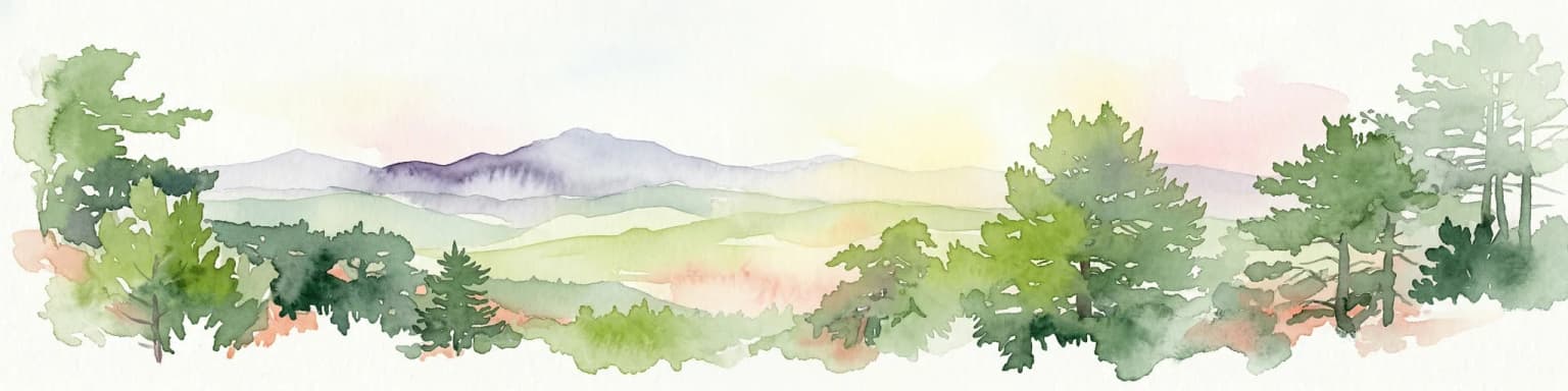
Why Mount Sarıçalı National Park stands out

Mount Sarıçalı is best known as Turkey's most recently established national park, protecting a mountain ecosystem of exceptional botanical significance. The park's defining feature is its extraordinary concentration of ancient trees, hundreds of larch, Kasnak oak, and juniper specimens that have survived for seven to eight centuries, creating a living forest archive. The intersection of three phytogeographic regions contributes to the presence of 139 endemic plant species, making the park botanically significant within Turkey's protected area network. The Uyuzsuyu Waterfall, plunging 50-60 meters through the mountain landscape, provides a dramatic natural spectacle within the park.

Mount Sarıçalı National Park history and protected-area timeline

Mount Sarıçalı National Park was officially established on 27 October 2021, becoming the 46th national park in Turkey. The designation followed recognition of the area's exceptional natural values, including its biodiversity, ancient forests, and scenic landscapes. Prior to national park status, the mountain and its surrounding area had been known locally for its natural beauty and ecological significance, with the ancient trees and waterfall serving as local landmarks.

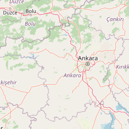
The creation of the park represented a continuation of Turkey's ongoing effort to expand its protected area network. By establishing a national park in the Nallıhan district of Ankara Province, authorities added protection to a mountainous area that had not previously been included in Turkey's formal protected areas system. The park is managed by the Directorate-General of Nature Protection and National Parks, the governmental body responsible for overseeing Turkey's national parks and nature protection areas.

Mount Sarıçalı National Park landscape and geographic character

The park occupies a mountainous terrain dominated by Mount Sarıçalı, which rises to 1,740 meters above sea level. The landscape features steep slopes, rocky outcrops, and forested areas that cover much of the mountain's flanks. The Uyuzsuyu Waterfall, with its 50-60 meter vertical drop, represents a significant hydrological feature, cascading down the mountain to create a dramatic landscape element.

The terrain reflects the geological character of Central Anatolia, with the mountain forming part of the region's elevated topography. Vegetation cover varies with elevation and aspect, ranging from forest-covered slopes to more open areas. The ancient trees—larch, Kasnak oak, and juniper—form distinctive elements of the landscape, their age and stature making them visually prominent throughout the park. The combination of forested slopes, rocky terrain, and the waterfall creates a landscape of considerable scenic variety within the protected area.

Mount Sarıçalı National Park ecosystems, habitats, and plant life

Mount Sarıçalı National Park occupies a botanically significant position in Turkey, located at the intersection of three phytogeographic regions. This geographic crossroads creates conditions that support remarkable plant diversity, with 936 species documented within the park's 1,024-hectare boundary. Of particular note are the 139 endemic plant species found in the park, species that occur nowhere else on Earth.

The vegetation includes diverse forest types and plant communities adapted to the mountain's various elevations and microclimates. The park's forests are characterized by the presence of ancient trees—specimens of larch, Kasnak oak, and juniper estimated to be 700-800 years old. These veteran trees represent significant ecological and historical value, providing habitat, structural complexity, and a direct connection to the ecological history of the region. The protection of this botanical wealth was a primary rationale for the park's establishment.

Mount Sarıçalı National Park wildlife and species highlights

The wildlife community within Mount Sarıçalı National Park includes several notable mammal species. The park provides habitat for bear, wild boar, wolf, fox, rabbit, and red deer, representing a diverse assemblage of large and medium-sized mammals. These species occupy various habitats within the park, from forested slopes to more open areas.

Beyond mammals, the park supports substantial bird diversity, with many bird species recorded within the protected area. The combination of forest habitats, open areas, and the waterfall area provides diverse ecological niches that support bird communities. The presence of predators such as wolves and bears indicates a relatively intact food web and ecological community within the park's boundaries.

Mount Sarıçalı National Park conservation status and protection priorities

Mount Sarıçalı National Park represents a significant addition to Turkey's conservation estate, protecting a mountain ecosystem of exceptional botanical importance. The park's location at the intersection of three phytogeographic regions makes it ecologically significant at a national level. The presence of 139 endemic plant species underscores the unique biological character of the area and the importance of its protection.

The ancient trees—hundreds of specimens estimated at 700-800 years old—represent a conservation priority of particular importance. These veteran trees provide ecological functions including habitat for other species, genetic reservoirs, and educational value. Their inclusion within a national park ensures ongoing protection. The establishment of the park also contributes to Turkey's commitments to biodiversity conservation and the expansion of protected area coverage.

Mount Sarıçalı National Park cultural meaning and human context

The park is located near Çulhalar village in the Nallıhan district, with the mountain serving as a local landmark for surrounding communities. The area has historical connections to local land use and traditional activities. The Turkish name Sarıçalı derives from the barberry shrub that grows on the mountain slopes, reflecting the plant's prominence in the local landscape and its role in naming this geographic feature.

Top sights and standout views in Mount Sarıçalı National Park

Mount Sarıçalı National Park stands as Turkey's newest national park, protecting an ancient mountain forest with trees aged 700-800 years. The park's 139 endemic plant species and position at the intersection of three phytogeographic regions make it botanically exceptional. The Uyuzsuyu Waterfall, dropping 50-60 meters through the mountain landscape, provides a dramatic natural feature. The presence of bear, wolf, red deer, and diverse birdlife demonstrates the park's ecological completeness.

Best time to visit Mount Sarıçalı National Park

The park can be visited throughout the year, with each season offering different characteristics. Spring and early summer bring blooming vegetation and active wildlife, while autumn offers colorful forest scenes. The summer months provide warm conditions for hiking and nature photography, which are the primary activities available in the park. Winter conditions on the mountain may be more challenging but offer different landscape experiences.

Park location guide

Geography guide, regional context, and park location map for Mount Sarıçalı National Park

Mount Sarıçalı National Park park geography, regions, and map view in Turkey
Understand where Mount Sarıçalı National Park sits in Turkey through a broader geographic reading of the surrounding landscape, nearby location context, and its mapped position within the national park landscape.

How Mount Sarıçalı National Park fits into Turkey

Turkey, officially the Republic of Türkiye, is a transcontinental country located mainly in Anatolia (West Asia) with a smaller portion in East Thrace (Southeast Europe). It borders the Black Sea to the north, several countries to the east and south, and the Aegean Sea and European countries to the west. The country has a population of over 86 million and operates as a secular, Muslim-majority presidential republic with Ankara as capital and Istanbul as its largest city.

Wider geography shaping Mount Sarıçalı National Park in Turkey

Turkey is a transcontinental country with the majority of its territory (about 97%) located in Anatolia (West Asia) and a smaller portion called East Thrace in Southeast Europe. It borders the Black Sea to the north, Georgia, Armenia, Azerbaijan, and Iran to the east, Iraq and Syria to the south, and the Mediterranean Sea to the southwest. To the west, Turkey borders the Aegean Sea, Greece, and Bulgaria. The terrain includes mountains, plateaus, and coastal plains, with the Taurus Mountains running along the southern coast.

Map view of Mount Sarıçalı National Park

Use this park location map to pinpoint Mount Sarıçalı National Park in Turkey, understand its exact geographic position, and read its mapped placement within the surrounding landscape more clearly.

Pigeon | © OpenStreetMap contributors

Location context for Mount Sarıçalı National Park

Ankara Province
Park atlas

Compare Mountain Ecosystems and Connected Conservation Landscapes Across Central Anatolia

Explore Other National Parks and Protected Areas Near Mount Sarıçalı National Park
Compare Mount Sarıçalı National Park with other protected areas across Central Anatolia to reveal diverse mountain ecosystems, ancient forests, and unique biodiversity. Map the regional spread of national parks, tracing how various conservation landscapes connect within Turkey's diverse geographic context.
Watercolor painting of a lake surrounded by green hills and trees with colorful foliage
National parkBolu Province

Lake Abant National Park: Protected Volcanic Crater Lake & Alpine Landscape

Bolu Province, Turkey | National Park | Mapped Landscape

Lake Abant National Park is a protected national park renowned for its stunning volcanic crater lake and surrounding alpine forests within Bolu Province. This detailed entry provides insight into the park's geographic context, its unique volcanic terrain, and its status as a protected landscape. Explore the mapped boundaries and understand the ecological significance of this distinctive natural area in northwestern Turkey.

Area
11.965 km²
Established
2022
Relief
Mountain
Climate
Temperate
Watercolor painting showing multiple lakes surrounded by green trees and mountains under a light sky
National parkBolu Province

Yedigöller National Park: Bolu Province's Landslide Lake and Forested Protected Landscape

Discover mapped terrain and unique natural park geography.

Yedigöller National Park presents a distinctive protected landscape within Bolu Province, notable for its chain of seven landslide-formed lakes and extensive, dense forests. This page serves as your entry point to understanding the park's geographic distribution, mapped boundaries, and the characteristic terrain that defines this important natural area. Explore the unique ecosystem and its place within the broader regional geography through structured atlas-style discovery.

Area
16.23 km²
Established
1965
IUCN
II
Relief
Mixed relief
Watercolor illustration of a forested landscape with green trees, rolling hills, and distant mountains
National parkTurkey

Soğuksu National Park: Turkey's Highland Forest Protected Landscape Discovery

Explore mapped boundaries and unique Anatolian geography.

Soğuksu National Park serves as a significant protected natural area in central Turkey, celebrated for its substantial coniferous forest ecosystem. This park showcases a transition zone between major geographic regions, offering a unique highland landscape shaped by volcanic geology. Discover its mapped protected boundaries and its role as a vital natural atlas point within the broader Turkish geography, featuring diverse terrain and important ecological elements.

Area
11.87 km²
Established
1959
Protected areaTurkey

Commander-in-Chief National Historic Park: Historic Battlefield Landscape in Turkey

Protected Area preserving pivotal geography and military history.

Commander-in-Chief National Historic Park is a designated protected area in Turkey, preserving the historic terrain of the decisive Battle of Dumlupınar. This site offers a unique glimpse into the geography and landscape that were instrumental in a key moment of the Turkish War of Independence. Explore the mapped context of this significant battlefield, understanding its role within the broader Anatolian geography and its importance as a preserved historic site.

Area
409.48 km²
Established
1981
Relief
Mixed relief
Climate
Temperate
Watercolor illustration depicting mountain ranges, green forests, and a valley with a body of water
National parkKastamonu Province

Küre Mountains National Park: Ancient Forests and Karst Canyons in Kastamonu Province

Explore Protected Landscape, Map Boundaries, and Regional Geography

Küre Mountains National Park, situated in Kastamonu Province, Turkey, offers a unique glimpse into ancient forest ecosystems and dramatic karst formations. As a protected national park, it is distinguished by its extensive canyon systems, including Horma and Valla, and significant cave networks like Ilgarini Cave. This entry provides detailed geographic context, helping users understand the park's terrain, protected boundaries, and its ecological importance within the Black Sea Region's natural landscape.

Area
377.53 km²
Established
2000
Relief
Mountain
Climate
Temperate
National parkKastamonu Province

Mount Ilgaz National Park: A Protected Landscape at the Crossroads of Anatolian Geography

Explore unique ecosystems and mapped terrain in Kastamonu Province

Mount Ilgaz National Park offers a deep dive into a unique protected landscape where Central Anatolian and Black Sea ecosystems converge. Situated in Kastamonu Province, its rugged mountain terrain and distinct mapped boundaries showcase a rich geographic identity. This park is an essential point for understanding Turkey's biogeographic transition zones, its diverse forest ecosystems, and the regional context of the Ilgaz Mountains. Delve into its protected status and discover the interplay of climate and terrain that defines this significant natural area.

Area
7.424 km²
Established
1976
IUCN
II
Relief
Mountain
Watercolor illustration of green hills, pine trees, and distant mountains under a light sky
National parkIsparta Province

Kızıldağ National Park: Protected Taurus Mountain Landscape and Atlas Context

Mapped boundaries, alpine terrain, and unique cedar forests.

Kızıldağ National Park offers a detailed look into Turkey's protected natural heritage, specifically highlighting the dramatic mountainous terrain of the Taurus Ranges. This page provides atlas-level geographic information about its mapped boundaries, the significant Dedegöl Mountain, and the rare blue-leaf cedar forests unique to this region. Understand its role as a vital conservation area within Isparta Province and the broader Mediterranean mountain ecosystem.

Area
551.06 km²
Established
1969
Relief
Mountain
Scope
Terrestrial
Watercolor painting of colorful rowboats on a lake with distant mountains
National parkKonya Province

Lake Beyşehir National Park: Protected Landscape Geography and Mapped Boundaries

Discover the geography and mapped context of this national park in Konya.

Lake Beyşehir National Park is a major protected area in Turkey's Central Anatolia region, celebrated for its immense freshwater lake and diverse wetland habitats. The park's identity is strongly tied to its mapped boundaries that protect critical ecosystems, islands, and surrounding forested terrain. This page provides a detailed look at the park's geographic setting within Konya Province, serving as a valuable resource for atlas-based discovery of its unique natural and cultural landscape.

Area
868.55 km²
Established
1993
Relief
Lowland
Climate
Temperate

Common questions about visiting, size, designation, and location context for Mount Sarıçalı National Park

Mount Sarıçalı National Park FAQs for park facts, access, geography, and protected area context
Find quick answers about Mount Sarıçalı National Park, including protected-area facts, park geography, trail and visitor context, and how the park fits into its surrounding country and regional landscape.
MoriAtlas Explorer

Continue Your Protected Areas Search Across the Global Atlas

Deepen your exploration by continuing the structured search for national parks and protected areas worldwide. Utilize the comprehensive filtering capabilities to compare different conservation landscapes and refine your understanding of global park geography. Discover more about the distribution and characteristics of protected natural areas.

Global natural geography