Mori Atlas logo
National parkUludağ National Park

Discover the dramatic terrain and unique ecosystems of this iconic Turkish protected area.

Uludağ National Park: Mapping Turkey's Oldest Protected Alpine Mountain Landscape

Uludağ National Park, established in 1961, represents Turkey's pioneering effort in protected natural areas, safeguarding the striking alpine environment of Mount Uludağ. Rising prominently in northwestern Turkey, this national park encompasses the mountain's summit region, reaching elevations that reveal dramatic rocky peaks and expansive alpine meadows. Its status as Turkey's oldest national park highlights its importance for preserving a distinctive Mediterranean alpine ecosystem and its varied terrain, offering a rich canvas for geographic and landscape atlas exploration.

national parkalpine environmentmountain landscapeprotected areaforest ecosystemwinter sports
Stylized illustration of a mountain landscape featuring a waterfall, forest, and rocky terrain under a blue sky

Uludağ National Park

National park

Park overview

Structured park overview, official facts, and landscape profile for Uludağ National Park

Uludağ National Park park facts, protected area profile, and essential visitor context
Review the core facts for Uludağ National Park, including designation, size, terrain, visitor scale, habitats, and operating context in one park-focused overview.

About Uludağ National Park

Uludağ National Park occupies a remarkable position in Turkey's protected area network as the country's oldest national park, established in 1961 to preserve the unique alpine environment of Mount Uludağ. The mountain, known historically as the Mysian Olympus, rises dramatically from the surrounding lowlands of the Marmara region to its summit at 2,543 meters, creating a vertical gradient that supports multiple distinct ecological zones. The park encompasses not only the high-altitude alpine terrain above the tree line but also the forested slopes that blanket the lower reaches of the mountain. This elevation range, combined with the region's transitional climate between Mediterranean and continental influences, results in a biodiversity-rich environment that supports both typical European mountain species and more localized Anatolian flora. The national park serves multiple functions as a conservation area, a research site for alpine ecology, and a major recreation destination for the densely populated Marmara region.

Quick facts and research context for Uludağ National Park

Uludağ National Park is located in Bursa Province, northwestern Turkey, covering the summit area of Mount Uludağ, the highest peak in the Marmara region at 2,543 meters. Established in 1961, it is Turkey's oldest national park and spans a significant alpine zone above the tree line. The mountain is a major center for winter sports and tourism, while the surrounding forests support diverse flora and fauna typical of the transition between Mediterranean and continental climates.

Park context

Deeper park guide and search-rich context for Uludağ National Park

Uludağ National Park history, landscape, wildlife, and travel context
Explore Uludağ National Park through its history, landscape character, ecosystems, wildlife, conservation priorities, cultural context, and seasonal travel timing in a structured park guide built for atlas discovery and search intent.

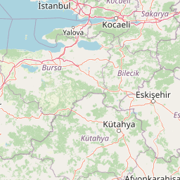
Why Uludağ National Park stands out

Uludağ is best known for its exceptional alpine environment, where pine and spruce forests give way to alpine meadows and rocky summits. The park protects one of Turkey's most important high-elevation ecosystems, home to endemic plant species adapted to the unique Mediterranean alpine conditions. The mountain's proximity to the city of Bursa makes it a heavily visited recreation area, particularly for skiing in winter and hiking during the warmer months. The contrast between the forested lower slopes and the exposed alpine zones creates a visually striking landscape.

Snow-covered mountain landscape with patches of exposed ground and scattered rocks under a partly cloudy sky
Snow-covered mountains under a partly cloudy sky in Uludağ National Park

Uludağ National Park history and protected-area timeline

The establishment of Uludağ National Park in 1961 marked a pioneering moment in Turkish conservation history, as it became the first national park designated in the country. This early recognition of Uludağ's natural significance reflected the mountain's long-standing importance in Turkish culture, science, and recreation. Prior to formal protection, the area had been recognized for its scenic and ecological value, and the establishment of the national park formalized decades of informal protection and use. Over the decades, the park has evolved alongside Turkey's growing environmental awareness, with management strategies adapting to balance conservation objectives with the high visitor pressure generated by the mountain's popularity as a ski resort and hiking destination.

Uludağ National Park landscape and geographic character

The landscape of Uludağ National Park is defined by the dramatic topography of Mount Uludağ, a massive fault-block mountain that rises abruptly from the surrounding terrain. The mountain's ridges radiate outward from a central summit, creating a complex terrain of steep slopes, rocky outcrops, and glacial valleys. Below the alpine zone, the slopes are covered in dense forests of pine and spruce, while the higher elevations feature alpine meadows interspersed with exposed rock and cliff faces. The mountain's geology, primarily composed of metamorphic and igneous rocks, contributes to the rugged character of the terrain. Throughout the park, small streams and seasonal watercourses descend from the alpine zones, feeding the lower forest ecosystems.

A panoramic view from a forested hillside overlooking Bursa city with distant mountains under a clear blue sky
Panoramic view of Bursa city from Mount Uludağ hills

Uludağ National Park ecosystems, habitats, and plant life

The ecological character of Uludağ National Park is shaped by its position at the intersection of Mediterranean and continental climate influences, creating a unique alpine environment that supports distinctive plant communities. The forested lower slopes feature dense stands of black pine and Norway spruce, which give way at higher elevations to alpine meadows characterized by diverse wildflower species. The park's position in northwestern Turkey places it along important bird migration routes, and the diverse habitats support both resident and migratory bird species. The alpine zones contain specialized plant species adapted to the harsh high-elevation conditions, including several endemic varieties that occur only in this region of Turkey.

Snow-covered mountain slopes with a winding road, scattered trees, and a blue sky with wispy clouds
Snow-covered mountain landscape with a winding road under a blue sky

Uludağ National Park wildlife and species highlights

The wildlife of Uludağ National Park reflects the park's varied habitats, from the forested lower slopes to the open alpine meadows. The forests provide shelter for mammals including red deer, wild boar, and various small mammals, while the higher elevations support species adapted to more open terrain. The birdlife is particularly notable, with the park serving as an important habitat for both resident species and migratory birds that pass through the region. Raptors such as eagles and hawks can be found hunting in the alpine zones, while the forests support a variety of songbird species.

Aerial view of Uludağ National Park showing mountain peaks, valleys, and the city of Bursa
Aerial view of Uludağ National Park with snow-capped peaks and the city of Bursa below

Uludağ National Park conservation status and protection priorities

Uludağ National Park represents one of Turkey's most significant protected alpine areas, preserving an ecosystem type that is limited in distribution across the country. The park's conservation value lies in its protection of the complete vertical gradient from lowland forest to alpine summit, maintaining ecological connectivity and the processes that sustain biodiversity. As Turkey's oldest national park, it has served as an important model for protected area management and has contributed to the country's conservation heritage. The challenges facing the park include managing the high volume of visitors, particularly during the ski season, and maintaining ecological integrity while accommodating recreational development.

Uludağ National Park cultural meaning and human context

Mount Uludağ holds deep historical significance in the region, known in antiquity as the Mysian Olympus and associated with mythological traditions in Greek and Roman culture. The mountain has been a site of human activity for millennia, with evidence of historical use as a sacred site and for resource gathering. The region surrounding the mountain has been inhabited since ancient times, and the city of Bursa at its base has been an important urban center for centuries. This long history of human presence has shaped both the cultural landscape and the relationship between local communities and the mountain environment.

Pink multi-story building with a steep gray roof surrounded by grass, trees, and a clear blue sky
Pink building with steep roof in a grassy field with trees

Top sights and standout views in Uludağ National Park

Uludağ National Park stands out as Turkey's premier alpine destination, combining significant conservation value with outstanding recreational opportunities. The mountain offers exceptional hiking through diverse ecosystems, from forested trails to alpine routes above the tree line. The winter season transforms the park into one of Turkey's most popular ski destinations, while the summer months reveal the full beauty of the alpine meadows and wildflower displays. The accessibility of the park from Bursa makes it a major destination for both domestic and international visitors seeking mountain experiences.

Panoramic view from Bakacak viewpoint showing forested hills, distant cityscape, and hazy valley under clear blue sky
View from Bakacak viewpoint in Uludağ National Park

Best time to visit Uludağ National Park

The best time to experience Uludağ National Park depends on the intended activities, with each season offering distinct advantages. Winter draws visitors for skiing and winter sports, when the alpine conditions are at their most developed. Summer and early autumn provide ideal conditions for hiking and wildlife observation, with pleasant temperatures in the mountain environment and the full display of alpine flora. The shoulder seasons of spring and late autumn offer quieter conditions and the opportunity to experience the park's transitional moods as the seasons change.

Park location guide

Geography guide, regional context, and park location map for Uludağ National Park

Uludağ National Park park geography, regions, and map view in Turkey
Understand where Uludağ National Park sits in Turkey through a broader geographic reading of the surrounding landscape, nearby location context, and its mapped position within the national park landscape.

How Uludağ National Park fits into Turkey

Turkey, officially the Republic of Türkiye, is a transcontinental country located mainly in Anatolia (West Asia) with a smaller portion in East Thrace (Southeast Europe). It borders the Black Sea to the north, several countries to the east and south, and the Aegean Sea and European countries to the west. The country has a population of over 86 million and operates as a secular, Muslim-majority presidential republic with Ankara as capital and Istanbul as its largest city.

Wider geography shaping Uludağ National Park in Turkey

Turkey is a transcontinental country with the majority of its territory (about 97%) located in Anatolia (West Asia) and a smaller portion called East Thrace in Southeast Europe. It borders the Black Sea to the north, Georgia, Armenia, Azerbaijan, and Iran to the east, Iraq and Syria to the south, and the Mediterranean Sea to the southwest. To the west, Turkey borders the Aegean Sea, Greece, and Bulgaria. The terrain includes mountains, plateaus, and coastal plains, with the Taurus Mountains running along the southern coast.

Map view of Uludağ National Park

Use this park location map to pinpoint Uludağ National Park in Turkey, understand its exact geographic position, and read its mapped placement within the surrounding landscape more clearly.

Pigeon | © OpenStreetMap contributors

Location context for Uludağ National Park

Bursa Province

Explore images showcasing Uludağ National Park's diverse terrain, from dense forests to high alpine meadows and dramatic mountain peaks.

Uludağ National Park Photos: Visualizing Turkey's Alpine Landscapes and Mountain Scenery
Explore an essential collection of Uludağ National Park photos, revealing its prominent alpine environment, dense forests, and dramatic mountain scenery. These images provide critical visual context for understanding the park's diverse habitats and the distinctive character of this protected area within Turkey's Marmara region.

Snow-covered mountain landscape with patches of exposed ground and scattered rocks under a partly cloudy sky

Snowy mountain slope with blue ski lifts and multiple skiers on a clear day

A panoramic view from a forested hillside overlooking Bursa city with distant mountains under a clear blue sky

Snow-covered mountain slopes with a winding road, scattered trees, and a blue sky with wispy clouds

Aerial view of Uludağ National Park showing mountain peaks, valleys, and the city of Bursa

Panoramic view of Bursa city with mountains in the background under a partly cloudy sky

Pink multi-story building with a steep gray roof surrounded by grass, trees, and a clear blue sky

Panoramic view from Bakacak viewpoint showing forested hills, distant cityscape, and hazy valley under clear blue sky

View of Mount Uludağ mountains, forested hills, and a small settlement with buildings under a partly cloudy sky

Snow-covered mountain peak with rocky slopes visible under partly cloudy sky

Tall evergreen trees in foreground with mountain peak visible through forested landscape under clear sky

Grassy meadow with tall grasses, pine trees, and rocky outcrops under a clear blue sky

View of Uludağ National Park with white vehicles on a road, small building, forested hills, and mountain peaks under a clear blue sky

Grassy field with scattered shrubs, pine trees, and distant mountains under a clear blue sky

Paved road leading to Uludağ National Park entrance flanked by trees with blue signboard and gate buildings visible

A stream flowing through large rocks with green vegetation and trees in the background

Park atlas

Explore the surrounding regional park geography and trace connected protected landscapes across Turkey.

Discover Other National Parks and Protected Areas Near Uludağ National Park
After exploring Uludağ National Park, browse other national parks and protected areas to understand the broader mountain and forest ecosystems of the Marmara region. Compare park geographies and conservation landscapes to trace the spread of Turkey's protected areas from a detailed regional perspective.
Watercolor illustration of a river, green fields, trees, and distant hills
National parkBalıkesir Province

Kuşcenneti National Park: Mapping Turkey's Premier Bird Sanctuary and Wetland Ecosystem

Explore the protected boundaries and avian geography of this key national park.

Kuşcenneti National Park stands as Turkey's foundational protected area for bird conservation, celebrated for its critical role as an avian migration crossroads and nesting ground. Situated in Balıkesir Province, this national park encompasses a diverse wetland ecosystem including shallow lakes, flooded willow forests, and extensive marshlands. MoriAtlas provides a detailed geographic context for Kuşcenneti National Park, highlighting its mapped protected area, unique landscape features, and profound significance for regional avian biodiversity.

Area
240.47 km²
Established
1959
IUCN
II
Visitors
2.5M annual
Protected areaTurkey

Commander-in-Chief National Historic Park: Historic Battlefield Landscape in Turkey

Protected Area preserving pivotal geography and military history.

Commander-in-Chief National Historic Park is a designated protected area in Turkey, preserving the historic terrain of the decisive Battle of Dumlupınar. This site offers a unique glimpse into the geography and landscape that were instrumental in a key moment of the Turkish War of Independence. Explore the mapped context of this significant battlefield, understanding its role within the broader Anatolian geography and its importance as a preserved historic site.

Area
409.48 km²
Established
1981
IUCN
II
Relief
Mixed relief
National parkAnkara Province

Mount Sarıçalı National Park: Turkey's Newest Protected Mountain Landscape

Ancient forests, endemic botany, and dramatic mountain terrain.

Mount Sarıçalı National Park, located in Ankara Province, Turkey, is a testament to the nation's commitment to conservation. This protected area is celebrated for its ancient forests, with larch, Kasnak oak, and juniper trees dating back 700-800 years. Its position at the confluence of three phytogeographic zones supports a rich array of 139 endemic plant species. The park's landscape is further characterized by the striking Uyuzsuyu Waterfall and the imposing Mount Sarıçalı peak, offering a profound geographic context for atlas exploration.

Area
10.24 km²
Established
2021
IUCN
II
Relief
Mountain
Watercolor painting of a lake surrounded by green hills and trees with colorful foliage
National parkBolu Province

Lake Abant National Park: Protected Volcanic Crater Lake & Alpine Landscape

Bolu Province, Turkey | National Park | Mapped Landscape

Lake Abant National Park is a protected national park renowned for its stunning volcanic crater lake and surrounding alpine forests within Bolu Province. This detailed entry provides insight into the park's geographic context, its unique volcanic terrain, and its status as a protected landscape. Explore the mapped boundaries and understand the ecological significance of this distinctive natural area in northwestern Turkey.

Area
11.965 km²
Established
2022
IUCN
II
Relief
Mountain
Watercolor painting showing green and pink mountain ranges with a body of water in the middle
National parkTurkey

Kazdağı National Park: Explore Turkey's Protected Mountainous Terrain and Forest Ecosystem

Mapped geography and protected landscape context within Turkey's Aegean region.

Kazdağı National Park is a significant protected area in Turkey, renowned for its dramatic mountain landscape encompassing Mount Ida. This park safeguards a critical subalpine forest ecosystem, characterized by diverse tree species that transition into rocky summits and alpine meadows. Understanding Kazdağı National Park's mapped boundaries provides essential insight into the regional geography, watershed protection, and the unique natural terrain found in western Turkey's Mediterranean mountain ranges, offering a solid foundation for geographic discovery.

IUCN
II
Scope
Terrestrial
Watercolor depiction of a landscape with marshes, water bodies, and distant mountains
National parkKırklareli Province

İğneada Floodplain Forests National Park: Kırklareli Province Protected Wetland Exploration

Mapped geography of a rare Turkish floodplain forest ecosystem.

İğneada Floodplain Forests National Park, located in Kırklareli Province, stands as a testament to Turkey's rare floodplain ecosystems. This protected national park features a remarkable landscape blending coastal sand dunes stretching along the Black Sea with inland lakes, marshes, and ancient deciduous forests. Its unique 'longoz' configuration and rich biodiversity offer significant value for atlas exploration, revealing the intricate interplay of landforms and water systems within this protected natural area. Discover the geographic context and mapped boundaries of this important conservation landscape.

Area
31.55 km²
Established
2007
IUCN
II
Relief
Lowland
Watercolor illustration of layered mountain ranges with green, yellow, and pink hues
National parkTurkey

Mount Spil National Park: Turkey's National Park and Protected Landscape Atlas Entry

Explore its mapped boundaries and regional geographic context.

Mount Spil National Park is presented here as a key protected area within Turkey's atlas of natural landscapes. This detail page focuses on its identity as a national park, providing a structured overview of its mapped boundaries and geographic setting. Understand its landscape context and its significance within Turkey's network of protected lands for detailed atlas exploration and geographic discovery.

IUCN
II
Scope
Mixed
Water
Minor water
Watercolor painting showing multiple lakes surrounded by green trees and mountains under a light sky
National parkBolu Province

Yedigöller National Park: Bolu Province's Landslide Lake and Forested Protected Landscape

Discover mapped terrain and unique natural park geography.

Yedigöller National Park presents a distinctive protected landscape within Bolu Province, notable for its chain of seven landslide-formed lakes and extensive, dense forests. This page serves as your entry point to understanding the park's geographic distribution, mapped boundaries, and the characteristic terrain that defines this important natural area. Explore the unique ecosystem and its place within the broader regional geography through structured atlas-style discovery.

Area
16.23 km²
Established
1965
IUCN
II
Relief
Mixed relief

Common questions about visiting, size, designation, and location context for Uludağ National Park

Uludağ National Park FAQs for park facts, access, geography, and protected area context
Find quick answers about Uludağ National Park, including protected-area facts, park geography, trail and visitor context, and how the park fits into its surrounding country and regional landscape.
MoriAtlas Explorer

Continue Your Protected Areas Search Across the Global Atlas

Deepen your exploration by continuing the structured search for national parks and protected areas worldwide. Utilize the comprehensive filtering capabilities to compare different conservation landscapes and refine your understanding of global park geography. Discover more about the distribution and characteristics of protected natural areas.

Global natural geography