Mori Atlas logo
National parkİğneada Floodplain Forests National Park

Discover the unique mapped geography of İğneada Floodplain Forests National Park in Kırklareli Province.

İğneada Floodplain Forests National Park: Turkey's Rare Floodplain Protected Landscape

(İğneada Longoz Ormanları Milli Parkı)

İğneada Floodplain Forests National Park represents a rare and ecologically vital protected area situated in Kırklareli Province, along Turkey's northwestern border. This national park showcases a complex floodplain ecosystem, locally known as 'longoz,' characterized by a unique interplay of coastal sand dunes, freshwater lakes, lagoons, marshes, and ancient deciduous forests. Its landscape is shaped by the confluence of mountain streams and proximity to the Black Sea, creating a distinctive mosaic of habitats found nowhere else in Turkey. MoriAtlas provides detailed geographic context for this protected zone, aiding exploration of its mapped boundaries and natural terrain.

Coastal wetlandsFloodplain forestsNational parkBlack Sea coastDune ecosystemsBirdwatching

İğneada Floodplain Forests National Park

National park

Park overview

Structured park overview, official facts, and landscape profile for İğneada Floodplain Forests National Park

İğneada Floodplain Forests National Park park facts, protected area profile, and essential visitor context
Review the core facts for İğneada Floodplain Forests National Park, including designation, size, terrain, visitor scale, habitats, and operating context in one park-focused overview.

About İğneada Floodplain Forests National Park

İğneada Floodplain Forests National Park occupies a unique position in Turkey's protected area network as one of the few examples of a coastal floodplain ecosystem in the country. The park's formation stems from alluvial deposits carried down from the Strandzha mountain range by numerous streams flowing toward the Black Sea. Over time, seasonal flooding created the distinctive "longoz" landscape—a Turkish term for floodplain forest that characterizes this area. The park's location in the Marmara region's East Thrace places it at the northwestern edge of Turkey, sharing its border with Bulgaria and serving as an ecological bridge between European and Anatolian biogeographic zones.

The landscape presents a remarkable diversity of habitats compressed into a relatively compact area. Moving from the Black Sea shoreline inland, visitors encounter coastal sand dunes, then a chain of lakes separated from the sea by dune barriers, followed by the floodplain forests and marshes that extend toward the mountains. This zonation creates multiple distinct ecological communities within a few kilometers. The dunes, reaching widths of 50-60 meters in places, act as a crucial boundary between marine and freshwater ecosystems. Five lakes of varying sizes—the largest being Lake Mert at 266 hectares—provide critical aquatic habitat and wintering grounds for migratory birds.

What makes this park particularly valuable is its ecological integrity and the relatively limited extent of such ecosystems globally. The combination of coastal dunes, lagoon systems, floodplain forests, and marshland represents a complete ecological gradient from marine to freshwater environments. This complexity supports remarkable biodiversity and provides ecosystem services including flood regulation, water filtration, and carbon sequestration. The park's establishment in 2007 consolidated several previously separate protected designations into a unified national park, strengthening conservation protection for this sensitive landscape.

Quick facts and research context for İğneada Floodplain Forests National Park

The park sits in East Thrace (the European part of Turkey) within Kırklareli Province, near the town of İğneada on the Bulgarian border, about 25 kilometers from Demirköy District. Five lakes exist within the park boundaries, including Lake Erikli (a lagoon that separates from the sea during summer), Lake Mert (formed at the mouth of Çavuşdere creek), and smaller lakes Saka, Hamam, and Pedina. The coastal sand dunes stretch for roughly 10 kilometers along the shore, with some dunes reaching 50-60 meters in width. The surrounding Strandzha mountains influence the park's hydrology and create the alluvial conditions that formed the floodplain. Administered by Turkey's Directorate-General of Nature Protection and National Parks, the park represents a merged protected area combining several former conservation designations.

Park context

Deeper park guide and search-rich context for İğneada Floodplain Forests National Park

İğneada Floodplain Forests National Park history, landscape, wildlife, and travel context
Explore İğneada Floodplain Forests National Park through its history, landscape character, ecosystems, wildlife, conservation priorities, cultural context, and seasonal travel timing in a structured park guide built for atlas discovery and search intent.

Why İğneada Floodplain Forests National Park stands out

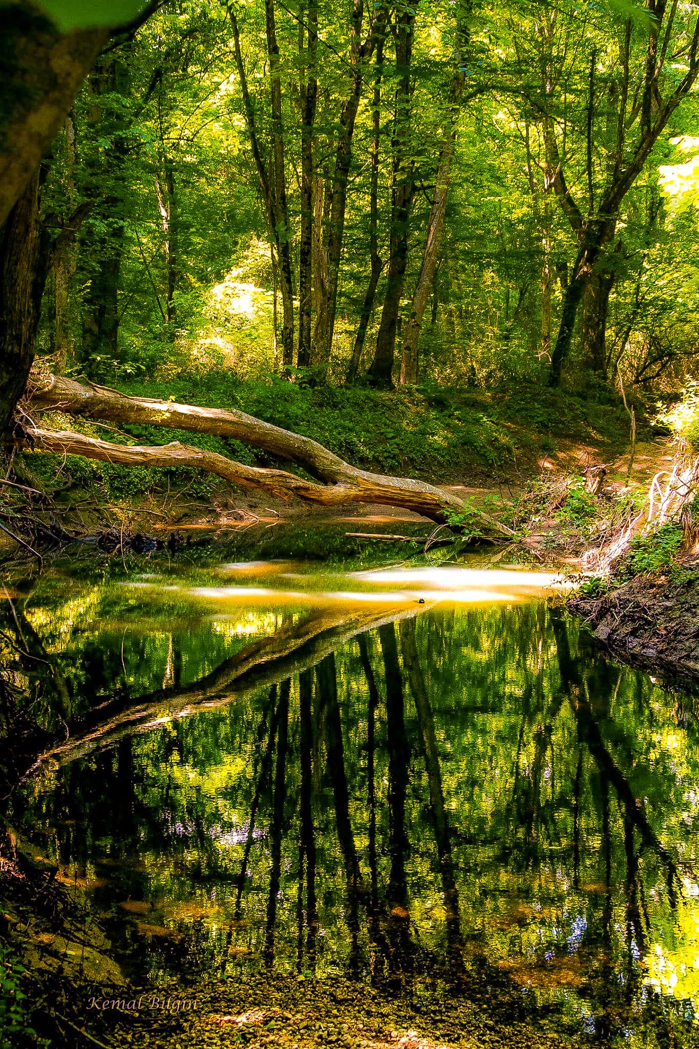
The park is best known for its rare and complex floodplain ecosystem, locally called "longoz" in Turkish, which combines marshes, swamp forests, coastal dunes, and freshwater and brackish lakes in a configuration found nowhere else in Turkey. The ten-kilometer coastal dune system supports plant species unique to the southwestern Black Sea region and is protected under international agreements. The park's five lakes, including the significant Lake Mert and the seasonal lagoon Lake Erikli, create a diverse aquatic landscape. The mixed deciduous forests featuring European ash, oak, alder, beech, and maple represent some of the last remaining floodplain forests in the region. The area serves as a critical habitat for white-tailed eagles, black storks, and numerous other bird species, making it important for ornithological conservation.

İğneada Floodplain Forests National Park history and protected-area timeline

İğneada Floodplain Forests National Park was established on November 13, 2007, becoming Turkey's 39th national park. The creation of the park involved merging areas that had previously held different conservation designations, unifying them under a single national park status to provide stronger protection for the ecosystem. The area had been recognized for its ecological significance prior to national park designation, with various protective classifications applied to different components of the landscape.

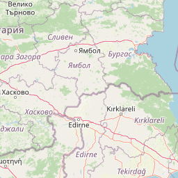
The name İğneada itself carries historical significance, derived from İne Bey—the figure who brought the area into Turkish territory during the medieval period. Over time, the settlement name evolved from its original form to the current İğneada. The park remains part of the Demirköy District of Kırklareli Province, maintaining the administrative connection to the surrounding region that has shaped both the landscape and human activity in the area. The establishment of the national park reflected growing recognition in Turkey of the need to protect unique coastal wetland ecosystems that had become increasingly rare in the Mediterranean and Black Sea regions.

İğneada Floodplain Forests National Park landscape and geographic character

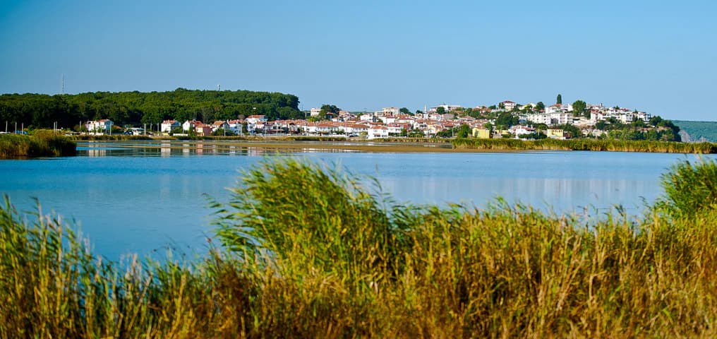
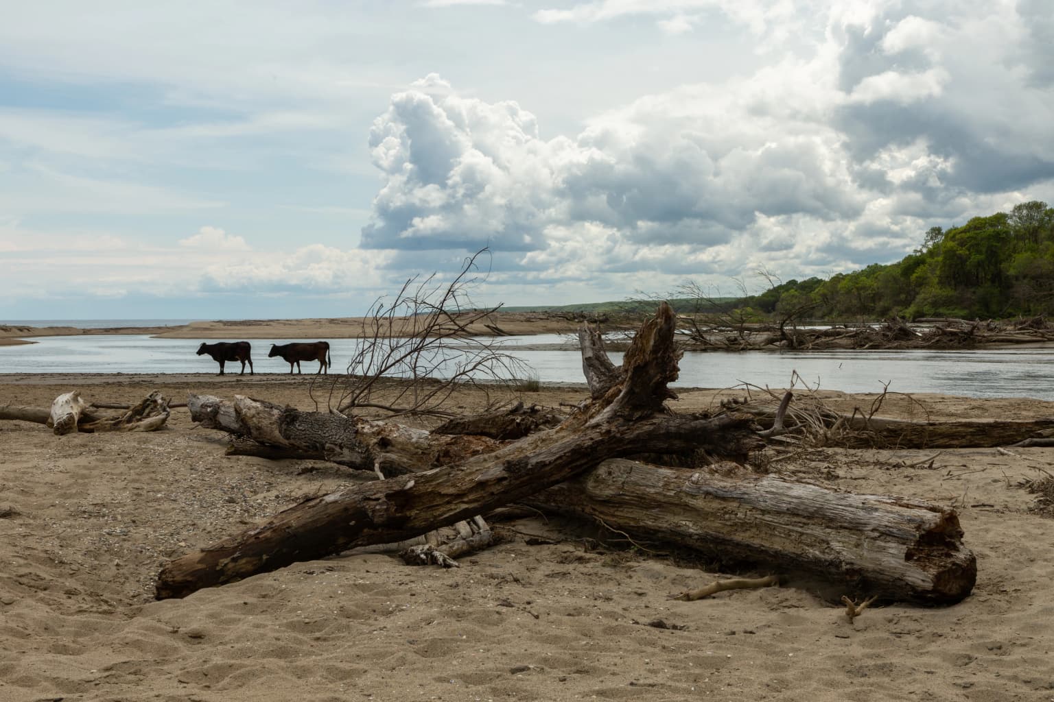
The physical landscape of İğneada Floodplain Forests National Park displays a remarkable concentration of distinct landforms within a relatively small area. The coastal zone is dominated by an extensive sand dune system that stretches approximately 10 kilometers along the Black Sea shoreline. These dunes reach widths of 50-60 meters in their broadest sections and serve as a natural barrier separating the sea from the inland wetland systems. The dune system is interrupted only by the İğneada settlement itself.

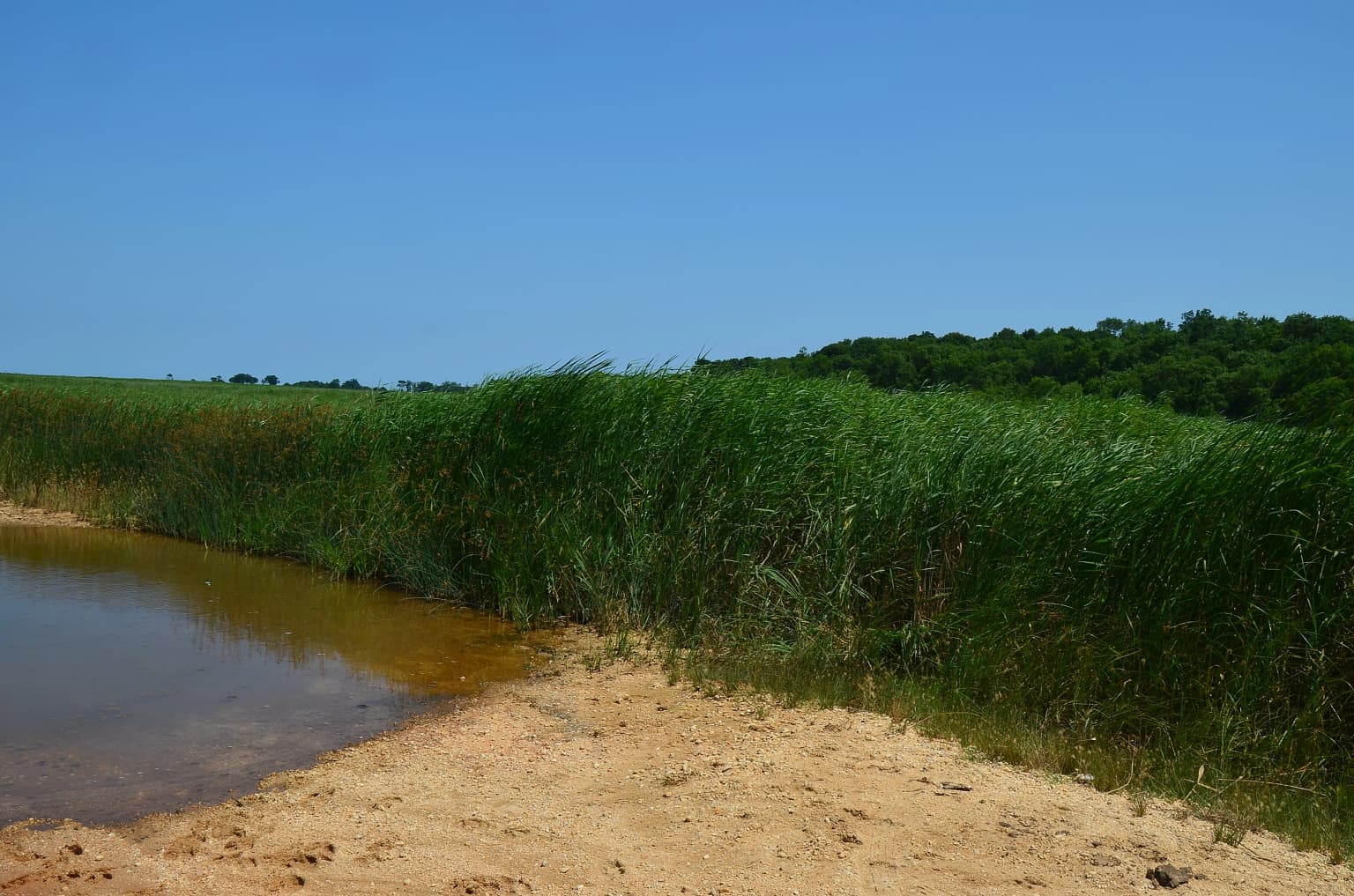
Behind the coastal dunes lies a chain of five lakes that form the aquatic core of the park. Lake Erikli functions as a lagoon, seasonally connected to the sea and becoming isolated during summer drought periods. Lake Mert, the largest at 266 hectares, was formed at the mouth of the Çavuşdere creek where it enters the Black Sea. Lake Saka occupies a position between the floodplain and dunes in the southern part of the park, while smaller lakes Hamam (19 hectares) and Pedina (10 hectares) lie inland. The surrounding terrain rises gently toward the Strandzha mountains to the south and west, where streams descending from higher ground have built up the alluvial deposits that create the floodplain conditions.

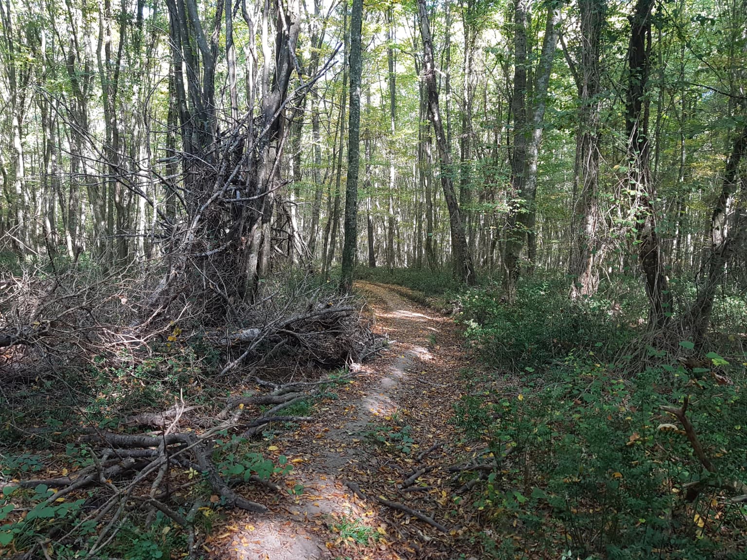
The floodplain itself represents the heart of the park's landscape, characterized by periodically flooded forests and marshy areas that change dramatically with seasonal water levels. This dynamic landscape, shaped by the interplay of mountain streams, coastal processes, and seasonal flooding, creates a constantly evolving environment.

İğneada Floodplain Forests National Park ecosystems, habitats, and plant life

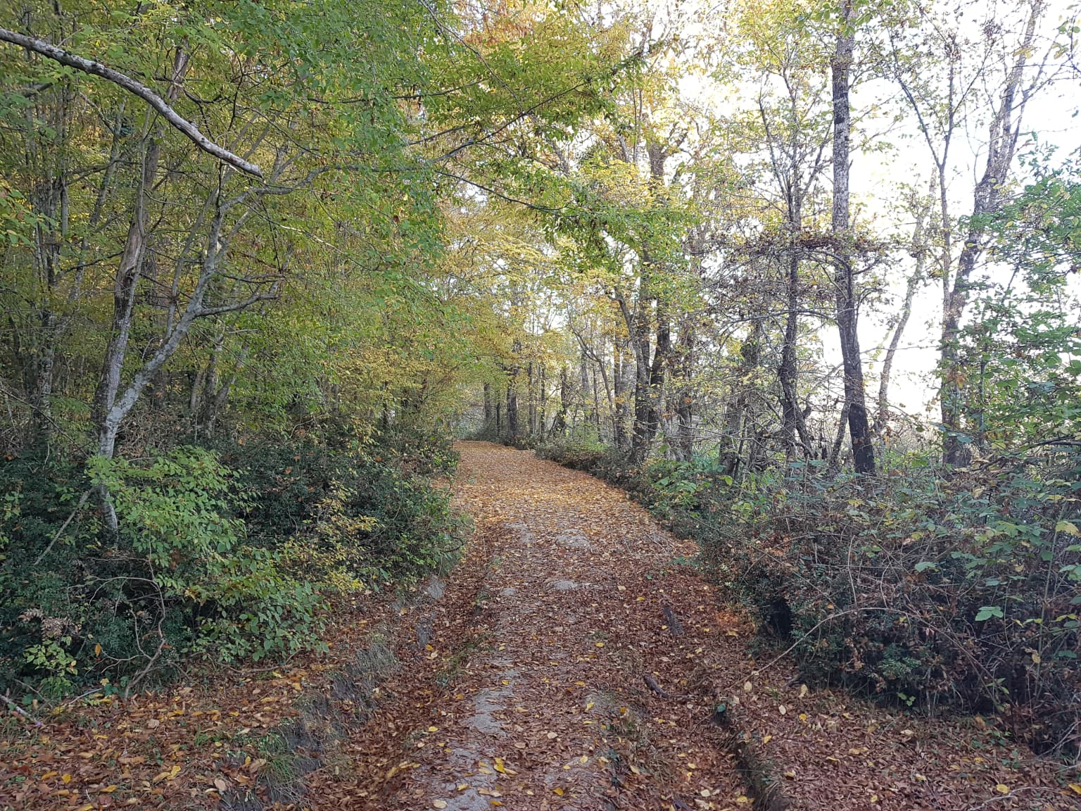
The ecological character of İğneada Floodplain Forests National Park centers on its rare floodplain forest ecosystem, locally known as "longoz," which represents one of the few remaining examples of this habitat type in Turkey. The forest composition features European ash, oak, alder, beech, and maple species forming mixed deciduous woodlands that tolerate periodic flooding. These forests are particularly notable for their rich vine flora, with climbing plants adding to the structural complexity of the woodland.

The coastal dunes support specialized plant communities unique to the southwestern Black Sea region, with species adapted to sandy, exposed conditions. The dune vegetation exists in a narrow ecological zone between the sea and the freshwater wetlands behind, creating a tension zone where maritime and terrestrial species overlap. International agreements protect these dune communities as part of the broader coastal ecosystem.

The five lakes within the park provide aquatic habitats ranging from freshwater to slightly brackish conditions, supporting diverse aquatic plant communities. The seasonal lagoon of Lake Erikli represents a particularly dynamic habitat, with its connection to the sea opening and closing with changing water levels. This variability creates productive conditions for fish, amphibians, and waterfowl. The marshes and swampy areas that fringe the lakes and floodplain add yet another habitat dimension, providing critical habitat for amphibians, water birds, and mammal species adapted to wet conditions.

İğneada Floodplain Forests National Park wildlife and species highlights

The wildlife community at İğneada Floodplain Forests National Park reflects the park's position at the intersection of European and Anatolian biogeographic zones. Among the mammal species present, the European otter inhabits the freshwater environments, while grey wolves roam the broader landscape. Wildcats, wild boars, and deer represent larger mammals, while smaller species include European pine martens, European badgers, foxes, hares, weasels, and various rodent species including the yellow-necked mouse. Bats, including the big-eared bat, occupy the forest habitats.

The bird community is particularly significant, with species such as the white-tailed eagle, black stork, grey heron, European green woodpecker, kingfisher, hoopoe, and European cuckoo recorded within the park. These species utilize the diverse habitats from forest edges to lake margins to coastal dunes. The wetlands provide critical feeding and nesting grounds for water birds, while the forests offer breeding habitat for woodpeckers and cavity-nesting species.

The aquatic environments support fish species including trout, smelt, and grey mullet in the freshwater systems, while the Black Sea coast provides seasonal fishing opportunities for species like anchovy, turbot, mackerel, and whiting. Reptile species include Hermann's tortoise, southern crested newt, various lizards, and vipers. The overall wildlife community demonstrates the ecological connectivity of the park's multiple habitat types.

İğneada Floodplain Forests National Park conservation status and protection priorities

İğneada Floodplain Forests National Park represents significant conservation value for Turkey and the broader Black Sea region due to its rare ecosystem type and the diversity of habitats contained within relatively intact boundaries. The floodplain forest ecosystem, or "longoz," is among the least represented protected ecosystem types in Turkey, making this park essential for conservation of this habitat. The coastal dune system adds another globally limited habitat type, with the plant communities protected under international conservation agreements.

The park's importance extends beyond individual habitats to encompass the entire ecological gradient from marine to freshwater environments, representing a complete coastal wetland system. This complexity supports species assemblages that depend on multiple habitat types and makes the area particularly valuable for biodiversity conservation. The presence of species such as the white-tailed eagle and black stork indicates the park's significance for birds of conservation concern.

Establishing national park status in 2007 consolidated previous conservation designations and provided stronger institutional protection through Turkey's Directorate-General of Nature Protection and National Parks. The park's location at Turkey's border with Bulgaria also positions it within broader regional conservation frameworks addressing transboundary ecosystem management.

İğneada Floodplain Forests National Park cultural meaning and human context

While İğneada Floodplain Forests National Park is primarily valued for its natural ecosystems, the area does carry cultural heritage significance tied to its history and naming. The park's name derives from İne Bey, the historical figure who incorporated the region into Turkish territory. This naming reflects the longer human history of the East Thrace region, which has seen multiple civilizations and political entities control the territory over centuries.

The contemporary settlement of İğneada, a small holiday town located within the national park boundaries, represents the human presence in this landscape. The town predates the national park designation and reflects traditional coastal settlement patterns in this region of Turkey. While not a primary cultural heritage site, the park exists within a regional context shaped by the historical trade routes and territorial changes that have characterized the Turkish-Bulgarian borderlands.

Top sights and standout views in İğneada Floodplain Forests National Park

The park's defining highlight is its rare floodplain forest ecosystem, locally called "longoz," which combines forested wetlands, coastal dunes, and a chain of five lakes in a configuration found nowhere else in Turkey. The ten-kilometer coastal sand dune system supports unique plant species and provides a striking visual boundary between sea and land. Lake Mert, at 266 hectares the largest lake, creates a major aquatic feature with its creek-fed ecosystem and seasonal connections to the Black Sea. The diverse birdlife, including white-tailed eagles and black storks, makes the park notable for ornithological interest. The relatively compact size of the park—approximately 3,155 hectares—allows visitors to experience multiple distinct ecosystems within a day's exploration.

Best time to visit İğneada Floodplain Forests National Park

The park can be visited throughout the year, though different seasons offer distinct experiences. Spring and early summer bring active wildlife activity and bird migration, with the forests leafing out and the lakes supporting abundant waterfowl. The warmer months of June through August coincide with the period when Lake Erikli becomes isolated from the sea, creating different conditions in the lagoon. Autumn offers fall foliage colors in the deciduous forests and represents another period of bird movement. Winter, while quieter, reveals the bare forest structure and can provide different perspectives on the landscape. The proximity to Istanbul makes the park accessible for day trips or longer visits from the city.

Park location guide

Geography guide, regional context, and park location map for İğneada Floodplain Forests National Park

İğneada Floodplain Forests National Park park geography, regions, and map view in Turkey
Understand where İğneada Floodplain Forests National Park sits in Turkey through a broader geographic reading of the surrounding landscape, nearby location context, and its mapped position within the national park landscape.

How İğneada Floodplain Forests National Park fits into Turkey

Turkey, officially the Republic of Türkiye, is a transcontinental country located mainly in Anatolia (West Asia) with a smaller portion in East Thrace (Southeast Europe). It borders the Black Sea to the north, several countries to the east and south, and the Aegean Sea and European countries to the west. The country has a population of over 86 million and operates as a secular, Muslim-majority presidential republic with Ankara as capital and Istanbul as its largest city.

Wider geography shaping İğneada Floodplain Forests National Park in Turkey

Turkey is a transcontinental country with the majority of its territory (about 97%) located in Anatolia (West Asia) and a smaller portion called East Thrace in Southeast Europe. It borders the Black Sea to the north, Georgia, Armenia, Azerbaijan, and Iran to the east, Iraq and Syria to the south, and the Mediterranean Sea to the southwest. To the west, Turkey borders the Aegean Sea, Greece, and Bulgaria. The terrain includes mountains, plateaus, and coastal plains, with the Taurus Mountains running along the southern coast.

Map view of İğneada Floodplain Forests National Park

Use this park location map to pinpoint İğneada Floodplain Forests National Park in Turkey, understand its exact geographic position, and read its mapped placement within the surrounding landscape more clearly.

Pigeon | © OpenStreetMap contributors

Location context for İğneada Floodplain Forests National Park

Kırklareli Province
Park atlas

Compare İğneada's unique floodplain ecosystem with other protected areas across Kırklareli Province and the wider Black Sea region.

Continue Park Discovery: Find Other Protected Areas Near İğneada Floodplain Forests National Park
Explore other protected areas, including national parks and reserves, near İğneada Floodplain Forests National Park across Turkey's Kırklareli Province and adjacent Black Sea regions. Compare varied conservation landscapes, tracing the geographic spread of distinct wetlands, coastal dunes, and diverse forested ecosystems within this ecologically significant territory.
National parkEastern Macedonia and Thrace

Dadia-Lefkimi-Soufli Forest National Park: Protected Landscape Atlas and Raptor Habitat

Mapped terrain and protected area context in Eastern Macedonia and Thrace.

This canonical entry for Dadia-Lefkimi-Soufli Forest National Park provides a structured atlas view of its protected landscape. Understand the park's geographic setting within Eastern Macedonia and Thrace, its mapped boundaries, and its significance as a critical sanctuary for raptors across Europe. Explore the diverse natural terrain that defines this protected area and its ecological importance.

Area
428 km²
Established
2006
IUCN
VI
Visitors
50K annual
National parkTurkey

Lake Gala National Park: A Key Protected Wetland Landscape in Turkey's Maritsa Delta

Discover its bird habitats and mapped geographic context.

Lake Gala National Park is a nationally significant protected area, designated in 2005 to conserve the unique wetland ecosystem of the Maritsa Delta. Encompassing the shallow lakes Pamuklu and Küçük Gala, this park spans approximately 6,090 hectares of diverse wetland and forest habitats. It is internationally recognized as a Ramsar site and serves as a critical sanctuary for over 160 bird species, making it a premier birdwatching destination in Turkey and an important locus for understanding protected landscapes within a regional geographic framework.

Area
60.9 km²
Established
2005
Relief
Lowland
Climate
Temperate
Protected areaTurkey

Ancient Troya National Park: A Mapped Protected Landscape with Deep Historical Significance

Explore the terrain and protected boundaries of this key Turkish heritage site.

Ancient Troya National Park offers a unique window into history, preserving the layers of the ancient city of Troy within its protected boundaries. Situated in Turkey, this park encompasses a significant archaeological site on a commanding hilltop, overlooking rolling Mediterranean terrain and coastal plains. Its landscape, characterized by fortified walls, gates, and the remnants of ancient structures, provides a rich context for understanding its mythological and historical importance. MoriAtlas provides detailed mapping and geographic context for this vital protected area, enhancing its atlas exploration value.

Established
1996
Relief
Lowland
Climate
Mediterranean
Access
Moderate access
Watercolor illustration showing mountains, river, and forested area
National park

Rodopi Mountain Range National Park: Greece's Largest Protected Forest Landscape Explorer

Mapped boundaries, old-growth ecosystems, and Balkan geography.

Rodopi Mountain Range National Park is a critical protected forest area in Greece, safeguarding one of Europe's last primeval forests, the Frakto Virgin Forest. As the nation's largest woodland conservation site, it showcases remarkable biodiversity and complex mountain terrain, from low-lying forests to subalpine meadows. This page provides detailed mapping context and geographic specifics for understanding this unique protected landscape and its ecological significance within the Rhodope Mountains.

Area
1,731.5 km²
Established
2009
IUCN
VI
Relief
Mountain
Protected landscapeGiurgiu County

Comana Natural Park: Protected Landscape Atlas and Regional Geography

Giurgiu County, Romania: Mapped protected area context.

Navigate the geographic features and protected landscape boundaries of Comana Natural Park, situated within Giurgiu County. This dedicated atlas entry provides a clear view of the park's mapped territory and its significance as a protected area, offering essential context for understanding its regional setting and natural terrain within Romania.

Area
249.63 km²
Established
2005
IUCN
V
Relief
Lowland
National parkLovech Province

Central Balkan National Park: Bulgaria's Majestic National Park and Protected Landscape

Explore mapped alpine terrain and ancient forests in Lovech Province.

Central Balkan National Park is a significant protected area in Bulgaria, renowned for its stunning mountain geography and exceptionally well-preserved ancient beech forests. Located within Lovech Province, the park's landscape is defined by dramatic peaks, including Botev Peak, deep canyons, and alpine meadows, offering a rich context for geographical exploration and understanding its protected status. Its ecosystem health and ecological value are underscored by multiple nature reserves and its recognition as part of a UNESCO World Heritage Site.

Area
716.69 km²
Established
1991
IUCN
II
Relief
Mountain
Watercolor painting of a lake surrounded by green hills and trees with colorful foliage
National parkBolu Province

Lake Abant National Park: Protected Volcanic Crater Lake & Alpine Landscape

Bolu Province, Turkey | National Park | Mapped Landscape

Lake Abant National Park is a protected national park renowned for its stunning volcanic crater lake and surrounding alpine forests within Bolu Province. This detailed entry provides insight into the park's geographic context, its unique volcanic terrain, and its status as a protected landscape. Explore the mapped boundaries and understand the ecological significance of this distinctive natural area in northwestern Turkey.

Area
11.965 km²
Established
2022
Relief
Mountain
Climate
Temperate
National parkAnkara Province

Mount Sarıçalı National Park: Turkey's Newest Protected Mountain Landscape

Ancient forests, endemic botany, and dramatic mountain terrain.

Mount Sarıçalı National Park, located in Ankara Province, Turkey, is a testament to the nation's commitment to conservation. This protected area is celebrated for its ancient forests, with larch, Kasnak oak, and juniper trees dating back 700-800 years. Its position at the confluence of three phytogeographic zones supports a rich array of 139 endemic plant species. The park's landscape is further characterized by the striking Uyuzsuyu Waterfall and the imposing Mount Sarıçalı peak, offering a profound geographic context for atlas exploration.

Area
10.24 km²
Established
2021
Relief
Mountain
Scope
Terrestrial

Common questions about visiting, size, designation, and location context for İğneada Floodplain Forests National Park

İğneada Floodplain Forests National Park FAQs for park facts, access, geography, and protected area context
Find quick answers about İğneada Floodplain Forests National Park, including protected-area facts, park geography, trail and visitor context, and how the park fits into its surrounding country and regional landscape.
MoriAtlas Explorer

Continue Your Protected Areas Search Across the Global Atlas

Deepen your exploration by continuing the structured search for national parks and protected areas worldwide. Utilize the comprehensive filtering capabilities to compare different conservation landscapes and refine your understanding of global park geography. Discover more about the distribution and characteristics of protected natural areas.

Global natural geography