Mori Atlas logo
National parkYedigöller National Park

Discover the unique chain of seven landslide lakes and expansive forest terrain.

Yedigöller National Park: A Protected National Park Landscape in Bolu Province, Turkey

(Yedigöller Milli Parkı)

Yedigöller National Park, situated in the mountainous Bolu Province of northern Turkey, offers a unique protected landscape defined by seven distinct lakes formed by natural landslide dams. This IUCN Category II national park provides a rich environment for exploring mapped terrain, dense forests described as an 'ocean of forest,' and diverse natural features. Understand the geographic context and discover the distinct protected area boundaries of this significant natural landscape.

LakesForest EcosystemMountain LandscapeLandslide LakesNorthern TurkeyBlack Sea Region
Stylized illustration of a lake reflecting mountains and forested hills with a bridge across the water

Yedigöller National Park

National park

Park overview

Structured park overview, official facts, and landscape profile for Yedigöller National Park

Yedigöller National Park park facts, protected area profile, and essential visitor context
Review the core facts for Yedigöller National Park, including designation, size, terrain, visitor scale, habitats, and operating context in one park-focused overview.

About Yedigöller National Park

Yedigöller National Park occupies a mountainous position in the northern part of Bolu Province, within Turkey's western Black Sea region. The park's defining feature is its chain of seven lakes, formed when landslide debris created natural barriers that trapped water in the valleys. These are barrier lakes, where rock masses from surrounding slopes slumped across valley floors, creating the impoundments. Some of the lakes are connected through subterranean seepage, adding to the complex hydrological character of the area. The terrain is rugged and heavily forested, with elevation ranging from approximately 465 meters at the lowest points to around 1,488 meters at Eğrikiriş Tepesi, the park's highest peak. Kapankaya offers a commanding vantage point for viewing the lake chain and surrounding forest. The geology of the area consists primarily of serpentine and volcanic rocks, which have contributed to the unstable slopes that enabled the landslide formation. The park lies between the major urban centers of Istanbul and Ankara, making it accessible for weekend visits from both cities, though the specific access route from the Ankara-Istanbul highway requires traveling to Yeniçağa and then north. Visitors can engage with the landscape through established trekking paths, camping areas, and viewpoint terraces that have been developed throughout the park.

Quick facts and research context for Yedigöller National Park

Yedigöller National Park is situated in Bolu Province, Turkey's western Black Sea region, at an elevation around 900 meters above sea level. The park encompasses approximately 1,623 hectares and contains seven lakes formed by landslides, named Büyükgöl, Deringöl, Seringöl, Nazlıgöl, Sazlıgöl, Incegöl, and Küçükgöl. Established in 1965, it is one of Turkey's older national parks and serves as an important protected area for the region's forest ecosystems. The park lies about 42 kilometers north of the city of Bolu and is accessible year-round, though winter access may require an alternate route via Yeniçağa-Mengen-Yazıcık. Notable features include Kapankaya peak for panoramic views, hot springs, ski facilities, and well-developed trekking infrastructure.

Park context

Deeper park guide and search-rich context for Yedigöller National Park

Yedigöller National Park history, landscape, wildlife, and travel context
Explore Yedigöller National Park through its history, landscape character, ecosystems, wildlife, conservation priorities, cultural context, and seasonal travel timing in a structured park guide built for atlas discovery and search intent.

Why Yedigöller National Park stands out

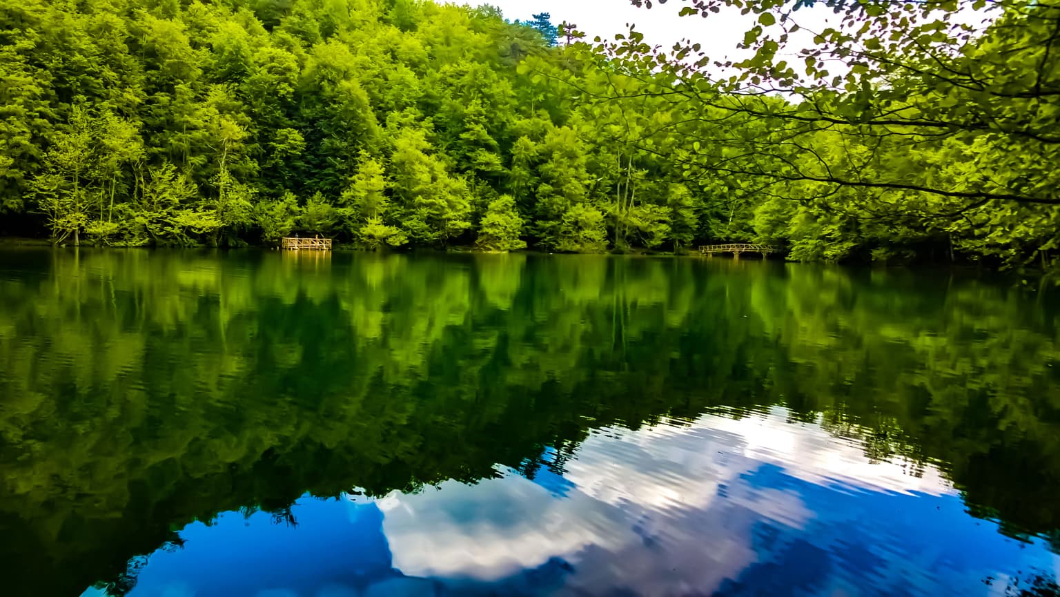
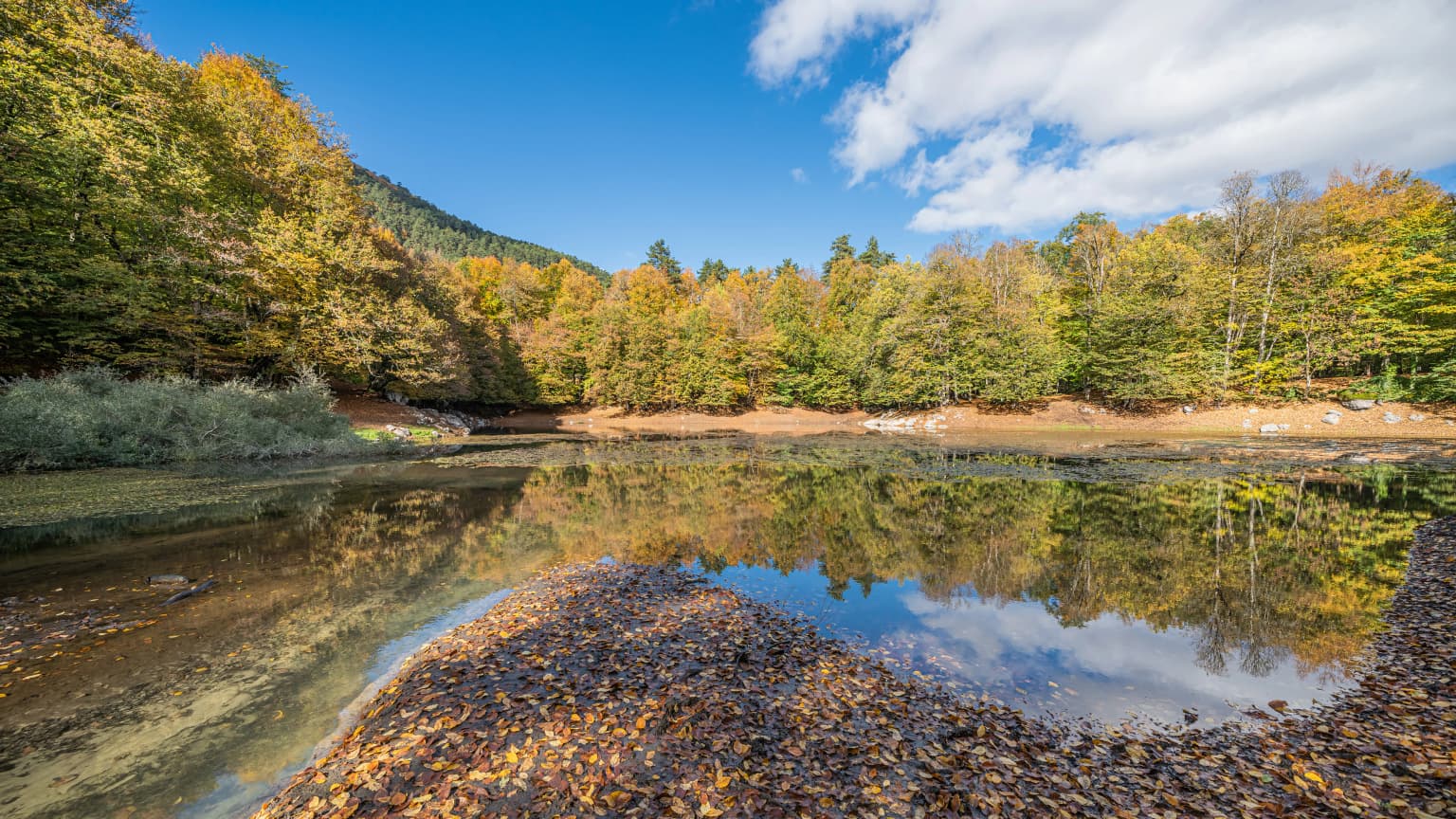
Yedigöller National Park is best known for its seven lakes, a rare hydrological feature created by landslide damming rather than glacial or volcanic activity. These lakes form a distinctive chain through the park's mountain valleys, each with its own character and setting. The park is equally celebrated for its exceptionally rich vegetation, described in Turkish sources as resembling an "ocean of forest" (Orman Denizi), where diverse tree species create extensive canopy coverage across the landscape. The combination of the lake chain, dense forests, and mountain topography creates a landscape of considerable scenic variety within a relatively compact area.

Still lake surrounded by dense green forest with cloud reflections in the water
A serene lake reflecting lush green forest in Yedigöller National Park

Yedigöller National Park history and protected-area timeline

Yedigöller was established as a national park in 1965, making it one of Turkey's earlier protected areas created under the national park system. The designation came during a period when Turkey was systematically identifying and protecting significant natural landscapes across the country. A notable development in the park's history was the establishment of Turkey's first cultural trout production station in 1969, which created a recreational fishing resource within the park. This hatchery operation contributed to the park's identity as a destination for angling while also serving conservation purposes for the lake ecosystem. The park has been developed over subsequent decades with infrastructure including trekking trails, camping facilities, rest houses, and viewpoint areas. Management has focused on balancing conservation of the forest and lake ecosystems with recreational use, including camping, hiking, photography, and day visits. The deer protection area within the park reflects specific conservation efforts to maintain populations of ungulate species.

Yedigöller National Park landscape and geographic character

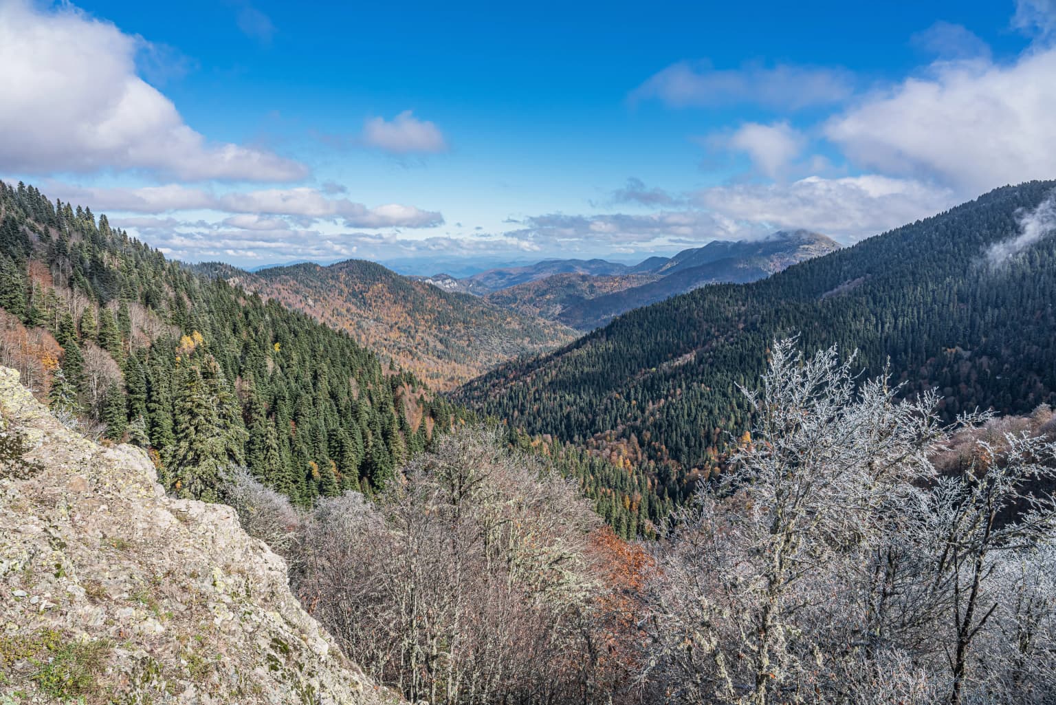
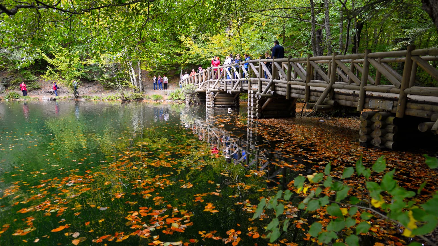
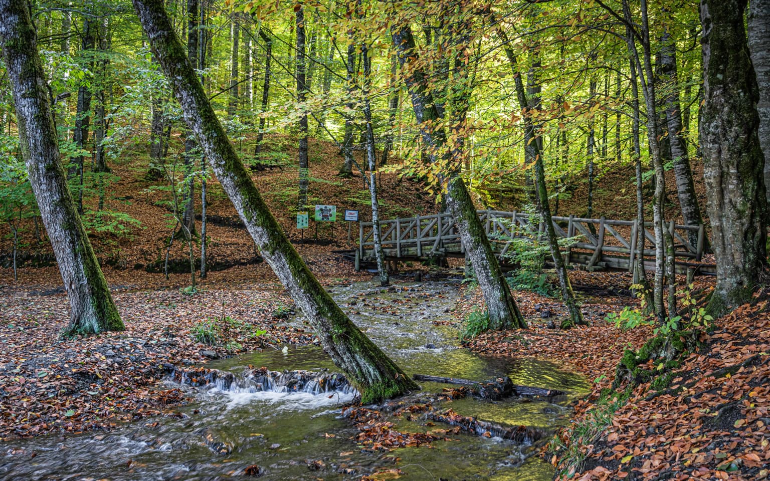
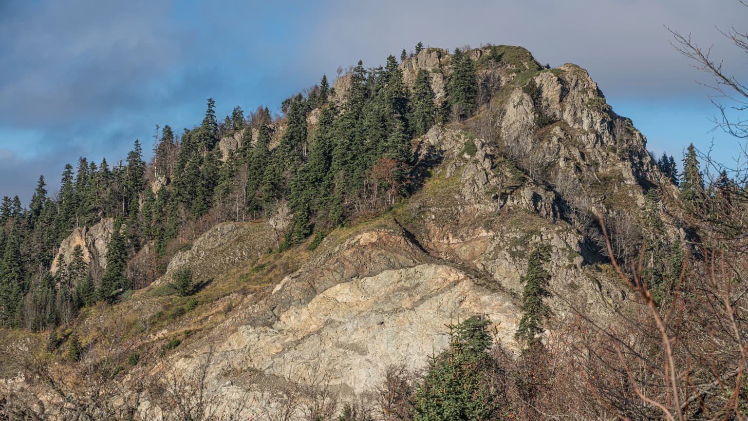
The landscape of Yedigöller National Park is defined by its mountainous terrain, dense forest coverage, and the seven lakes distributed through its valleys. The terrain features steep slopes descending from the higher ridges into the lake basins, creating a succession of enclosed valleys and open slopes. The lakes themselves range in character from larger bodies like Büyükgöl to smaller marshy impoundments, connected in some cases by surface streams and in others by underground water flow. The forest environment dominates the non-lake areas, with the tree canopy creating an extensive green cover that Turkish sources describe as an "ocean of forest." Rock outcrops and cliff formations add vertical interest to the landscape, while streams with handcrafted bridges traverse the forest floor. The highland areas offer more open terrain with meadow character, and Kapankaya provides an elevated perspective from which to appreciate the overall park structure. The combination of water, forest, and mountain creates a landscape with strong visual contrast and variety despite the relatively limited total area.

Mountain valley with forested slopes, rocky outcrop in foreground, and partly cloudy blue sky
Mountainous valley landscape with forested slopes and rocky terrain in Yedigöller National Park

Yedigöller National Park ecosystems, habitats, and plant life

Yedigöller supports a rich and diverse forest ecosystem that forms the ecological backbone of the protected area. The vegetation includes a mix of deciduous and coniferous species typical of Turkey's Black Sea region forests. Principal tree species include beech, various oak species, hornbeam, fir, spruce, black pine, and Scotch pine, creating a multi-layered canopy structure. The understory contains additional species including hornbeam, hazel, alder, lime trees, and elm. The Turkish source provides an extensive list of plant species found in the park, including numerous herbaceous plants, ferns, and aquatic species. Wetland vegetation surrounds the lakes, with species adapted to standing water conditions. The aquatic environment supports trout populations, both from natural reproduction and the hatchery operations. Water quality in the park's streams is classified as Class I and II, indicating good to moderate purity, while studies of organic matter decomposition indicate conditions ranging from oligosaprobic to beta-mesosaprobic, suggesting generally good ecological status.

A serene lake reflecting autumn trees and a clear blue sky, surrounded by forested hills with fallen leaves on the shore
Nazlıgöl Lake reflecting autumn trees in Yedigöller National Park

Yedigöller National Park wildlife and species highlights

The wildlife community of Yedigöller includes several mammal species typical of Turkey's forested mountain regions. Large mammals present in the park include red deer and roe deer, for which a dedicated protected area exists within the park to support population conservation. Wild boar are also present throughout the forested areas. Predator species include brown bears, wolves, red fox, and lynx, representing the apex and mesopredator components of the ecosystem. Smaller mammals include jungle cats, otters, and squirrels. The park's designation as a protected area has allowed wildlife populations to increase over time as protection conditions improved. The aquatic environment supports trout, both in the lakes and in the flowing streams, with a trout farm contributing to recreational fishing opportunities. The park has also been the site of new species discoveries, with several insect species from the Ephemeroptera order (mayflies) identified as new to science within the park boundaries, including Ecdyonurus starmachi, Paraleptophlebia cincta, Caenis martae, and Baetis lapponicus.

Wooden bridge over a lake with autumn leaves floating on the water, surrounded by green and yellow foliage, with people visible on the bridge and shoreline
Autumn view of Yedigöller National Park featuring a wooden bridge over a lake with colorful fallen leaves

Yedigöller National Park conservation status and protection priorities

Yedigöller National Park serves as an important protected area in Turkey's western Black Sea region, preserving a mountainous landscape with unique hydrological features. The seven lakes, formed by landslide processes, represent a rare lake formation type in Turkey and are maintained through the protected area status. The dense forest coverage represents significant carbon storage and watershed protection value, with the vegetation acting to regulate water flow and prevent erosion on the steep slopes. The park's protected area for deer demonstrates active management for specific species conservation, and the overall protection framework has enabled wildlife populations to recover and increase. Water quality monitoring indicates good ecological status in the park's streams, supporting the aquatic ecosystem and downstream water users. The establishment of the first Turkish trout hatchery in the park in 1969 reflects early recognition of the area's value for both conservation and sustainable use.

Yedigöller National Park cultural meaning and human context

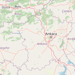
Yedigöller National Park exists within a region of Turkey with historical significance related to forest use and mountain agriculture. The park lies in the Mengen district of Bolu Province, an area traditionally characterized by forested mountain terrain and rural communities. While the park itself is managed as a protected natural area, the surrounding landscape contains villages and agricultural land uses that reflect the broader regional context of Turkey's Black Sea highlands. The park's name, translating to "seven lakes," reflects the prominent position of the lake chain in local landscape identity. Recreation activities including camping, picnicking, hiking, and photography represent the primary human engagement with the park, supported by developed infrastructure including rest houses and camping areas. The hot springs and ski facilities within the park represent additional recreational resources that attract visitors year-round.

A forest stream flowing over rocks with a wooden bridge in the background, surrounded by trees with autumn foliage.
Stream flowing into Deringöl (Deep Lake) in Yedigöller National Park, Turkey.

Top sights and standout views in Yedigöller National Park

Yedigöller National Park's seven lakes constitute its most distinctive feature, a chain of landslide-formed impoundments unique among Turkey's protected areas. The dense forest environment, described as an "ocean of forest," creates an immersive wilderness experience within relatively accessible reach of major cities. The park offers diverse activities across seasons, from summer hiking and camping to winter access challenges and ski facilities. Kapankaya peak provides a spectacular viewpoint over the entire lake chain and forested landscape. The presence of brown bears, deer populations, and other wildlife creates potential for wildlife observation, supported by the dedicated deer protection area. The trout fishing opportunities, both from the hatchery and natural populations, add a recreational dimension uncommon in most Turkish national parks.

Rocky mountain slope with dense forest and clear sky
Highland landscape in Yedigöller National Park, Turkey

Best time to visit Yedigöller National Park

Yedigöller National Park is accessible throughout the year, though the experience varies significantly across seasons. The summer months and early autumn offer the most stable access and the fullest range of recreational opportunities, with trekking paths, camping facilities, and viewpoint areas fully operational. The lakes and forest reach their fullest visual appeal during late spring through autumn, when vegetation is in full growth and the lake surfaces reflect the surrounding green canopy. Autumn brings particularly colorful foliage as the deciduous trees change, creating striking visual contrasts across the landscape. Winter access requires using the alternate route via Yeniçağa-Mengen-Yazıcık, as the direct Bolu-Yedigöller road may be closed due to snow. The ski facilities within the park make winter visits viable for winter sports enthusiasts willing to navigate the seasonal access considerations. The hot springs provide an attractive option during cooler months, offering a different perspective on the park's resources.

Park location guide

Geography guide, regional context, and park location map for Yedigöller National Park

Yedigöller National Park park geography, regions, and map view in Turkey
Understand where Yedigöller National Park sits in Turkey through a broader geographic reading of the surrounding landscape, nearby location context, and its mapped position within the national park landscape.

How Yedigöller National Park fits into Turkey

Turkey, officially the Republic of Türkiye, is a transcontinental country located mainly in Anatolia (West Asia) with a smaller portion in East Thrace (Southeast Europe). It borders the Black Sea to the north, several countries to the east and south, and the Aegean Sea and European countries to the west. The country has a population of over 86 million and operates as a secular, Muslim-majority presidential republic with Ankara as capital and Istanbul as its largest city.

Wider geography shaping Yedigöller National Park in Turkey

Turkey is a transcontinental country with the majority of its territory (about 97%) located in Anatolia (West Asia) and a smaller portion called East Thrace in Southeast Europe. It borders the Black Sea to the north, Georgia, Armenia, Azerbaijan, and Iran to the east, Iraq and Syria to the south, and the Mediterranean Sea to the southwest. To the west, Turkey borders the Aegean Sea, Greece, and Bulgaria. The terrain includes mountains, plateaus, and coastal plains, with the Taurus Mountains running along the southern coast.

Map view of Yedigöller National Park

Use this park location map to pinpoint Yedigöller National Park in Turkey, understand its exact geographic position, and read its mapped placement within the surrounding landscape more clearly.

Pigeon | © OpenStreetMap contributors

Location context for Yedigöller National Park

Bolu Province

Immerse in Yedigöller's Distinctive Lake Chain, Forested Terrain, and Diverse Habitats Through Striking Imagery

Yedigöller National Park Photos: Explore Landscapes, Scenery, and Protected Area Views
Explore Yedigöller National Park's iconic seven lakes, dense forested slopes, and distinctive mountain landscapes through a compelling collection of images. Visualizing these park environments provides essential insights into the protected area's varied terrain, ecological character, and the unique natural beauty that defines this region of Turkey.

Still lake surrounded by dense green forest with cloud reflections in the water

A lake reflecting mountains and autumn-colored trees under a clear blue sky.

Mountain valley with forested slopes, rocky outcrop in foreground, and partly cloudy blue sky

A serene lake reflecting autumn trees and a clear blue sky, surrounded by forested hills with fallen leaves on the shore

Wooden bridge over a lake with autumn leaves floating on the water, surrounded by green and yellow foliage, with people visible on the bridge and shoreline

Waterfall cascading over rocks in a forested area with scattered fallen leaves and moss-covered stones

A forest stream flowing over rocks with a wooden bridge in the background, surrounded by trees with autumn foliage.

Rocky mountain slope with dense forest and clear sky

A lake with a wooden pier extending over calm water, surrounded by trees with orange and yellow foliage, and mist rising from the water surface

A stream flowing through a forest covered in orange and brown autumn leaves with concrete bridges spanning the water

Sunlit forest trail surrounded by tall trees with orange and brown autumn leaves

Wooden bridge over a lake with fallen leaves floating on water and autumn trees reflected

Wooden two-story observation tower on rocky terrain with mountain landscape in background

Wooden picnic table on gravel beside a stream with moss-covered rocks and trees

Wooden shelter, picnic tables, and autumn leaves in a forested area of Yedigöller National Park

Tall trees with green foliage forming a canopy over a body of water

Park atlas

Trace the geographic spread of national parks and protected landscapes across Turkey's Black Sea region.

Explore Nearby National Parks and Protected Areas Beyond Yedigöller National Park
Explore other national parks and protected areas within Turkey's Black Sea region, broadening your discovery beyond Yedigöller National Park's unique lake chain and dense forest ecosystem. Compare different conservation landscapes, mapped park geography, and diverse terrain features to gain a richer regional context for protected-area exploration.
Watercolor painting of a lake surrounded by green hills and trees with colorful foliage
National parkBolu Province

Lake Abant National Park: Protected Volcanic Crater Lake & Alpine Landscape

Bolu Province, Turkey | National Park | Mapped Landscape

Lake Abant National Park is a protected national park renowned for its stunning volcanic crater lake and surrounding alpine forests within Bolu Province. This detailed entry provides insight into the park's geographic context, its unique volcanic terrain, and its status as a protected landscape. Explore the mapped boundaries and understand the ecological significance of this distinctive natural area in northwestern Turkey.

Area
11.965 km²
Established
2022
Relief
Mountain
Climate
Temperate
National parkAnkara Province

Mount Sarıçalı National Park: Turkey's Newest Protected Mountain Landscape

Ancient forests, endemic botany, and dramatic mountain terrain.

Mount Sarıçalı National Park, located in Ankara Province, Turkey, is a testament to the nation's commitment to conservation. This protected area is celebrated for its ancient forests, with larch, Kasnak oak, and juniper trees dating back 700-800 years. Its position at the confluence of three phytogeographic zones supports a rich array of 139 endemic plant species. The park's landscape is further characterized by the striking Uyuzsuyu Waterfall and the imposing Mount Sarıçalı peak, offering a profound geographic context for atlas exploration.

Area
10.24 km²
Established
2021
Relief
Mountain
Scope
Terrestrial
Watercolor illustration of a forested landscape with green trees, rolling hills, and distant mountains
National parkTurkey

Soğuksu National Park: Turkey's Highland Forest Protected Landscape Discovery

Explore mapped boundaries and unique Anatolian geography.

Soğuksu National Park serves as a significant protected natural area in central Turkey, celebrated for its substantial coniferous forest ecosystem. This park showcases a transition zone between major geographic regions, offering a unique highland landscape shaped by volcanic geology. Discover its mapped protected boundaries and its role as a vital natural atlas point within the broader Turkish geography, featuring diverse terrain and important ecological elements.

Area
11.87 km²
Established
1959
Watercolor illustration depicting mountain ranges, green forests, and a valley with a body of water
National parkKastamonu Province

Küre Mountains National Park: Ancient Forests and Karst Canyons in Kastamonu Province

Explore Protected Landscape, Map Boundaries, and Regional Geography

Küre Mountains National Park, situated in Kastamonu Province, Turkey, offers a unique glimpse into ancient forest ecosystems and dramatic karst formations. As a protected national park, it is distinguished by its extensive canyon systems, including Horma and Valla, and significant cave networks like Ilgarini Cave. This entry provides detailed geographic context, helping users understand the park's terrain, protected boundaries, and its ecological importance within the Black Sea Region's natural landscape.

Area
377.53 km²
Established
2000
Relief
Mountain
Climate
Temperate
National parkKastamonu Province

Mount Ilgaz National Park: A Protected Landscape at the Crossroads of Anatolian Geography

Explore unique ecosystems and mapped terrain in Kastamonu Province

Mount Ilgaz National Park offers a deep dive into a unique protected landscape where Central Anatolian and Black Sea ecosystems converge. Situated in Kastamonu Province, its rugged mountain terrain and distinct mapped boundaries showcase a rich geographic identity. This park is an essential point for understanding Turkey's biogeographic transition zones, its diverse forest ecosystems, and the regional context of the Ilgaz Mountains. Delve into its protected status and discover the interplay of climate and terrain that defines this significant natural area.

Area
7.424 km²
Established
1976
IUCN
II
Relief
Mountain
Protected areaTurkey

Commander-in-Chief National Historic Park: Historic Battlefield Landscape in Turkey

Protected Area preserving pivotal geography and military history.

Commander-in-Chief National Historic Park is a designated protected area in Turkey, preserving the historic terrain of the decisive Battle of Dumlupınar. This site offers a unique glimpse into the geography and landscape that were instrumental in a key moment of the Turkish War of Independence. Explore the mapped context of this significant battlefield, understanding its role within the broader Anatolian geography and its importance as a preserved historic site.

Area
409.48 km²
Established
1981
Relief
Mixed relief
Climate
Temperate
National parkYozgat Province

Yozgat Pine Grove National Park: Historic First National Park and Ancient Pine Forest

Explore the protected landscape of Turkey's original national park.

As Turkey's pioneering national park, Yozgat Pine Grove National Park offers a deep dive into a unique protected landscape. This site provides detailed geographic context for its ancient pine forest, set dramatically against the steppe terrain of Yozgat Province. Understand the park's mapped boundaries and its ecological significance as a historic conservation area. MoriAtlas facilitates a structured exploration of this important natural heritage site, highlighting its role in Turkish protected land history and its distinct regional geography.

Area
2.64 km²
Established
1958
IUCN
II
Relief
Highland
Watercolor illustration of green hills, pine trees, and distant mountains under a light sky
National parkIsparta Province

Kızıldağ National Park: Protected Taurus Mountain Landscape and Atlas Context

Mapped boundaries, alpine terrain, and unique cedar forests.

Kızıldağ National Park offers a detailed look into Turkey's protected natural heritage, specifically highlighting the dramatic mountainous terrain of the Taurus Ranges. This page provides atlas-level geographic information about its mapped boundaries, the significant Dedegöl Mountain, and the rare blue-leaf cedar forests unique to this region. Understand its role as a vital conservation area within Isparta Province and the broader Mediterranean mountain ecosystem.

Area
551.06 km²
Established
1969
Relief
Mountain
Scope
Terrestrial

Common questions about visiting, size, designation, and location context for Yedigöller National Park

Yedigöller National Park FAQs for park facts, access, geography, and protected area context
Find quick answers about Yedigöller National Park, including protected-area facts, park geography, trail and visitor context, and how the park fits into its surrounding country and regional landscape.
MoriAtlas Explorer

Continue Your Protected Areas Search Across the Global Atlas

Deepen your exploration by continuing the structured search for national parks and protected areas worldwide. Utilize the comprehensive filtering capabilities to compare different conservation landscapes and refine your understanding of global park geography. Discover more about the distribution and characteristics of protected natural areas.

Global natural geography