Mori Atlas logo
National parkKüre Mountains National Park

Discover the mapped geography and protected terrain of this significant national park in Kastamonu Province.

Küre Mountains National Park: A Protected Landscape of Ancient Forests and Karst Canyons in Turkey

(Küre Dağları Milli Parkı)

Küre Mountains National Park stands as a vital protected landscape within Turkey's Black Sea Region, specifically anchored in Kastamonu Province. This national park preserves a remarkably diverse mountain terrain, characterized by ancient, old-growth forests and a dramatic karst geology that has been sculpted into one of the country's most extensive canyon systems. As a key entity within the MoriAtlas geography platform, it offers users a detailed view of its mapped boundaries, unique landscape features, and its significance as a critical refuge for biodiversity.

National ParkForest EcosystemKarst LandscapeCanyonsCavesOld-Growth Forest
Stylized illustration of a river flowing through mountainous landscape with forested cliffs and staircase path

Küre Mountains National Park

National park

Park overview

Structured park overview, official facts, and landscape profile for Küre Mountains National Park

Küre Mountains National Park park facts, protected area profile, and essential visitor context
Review the core facts for Küre Mountains National Park, including designation, size, terrain, visitor scale, habitats, and operating context in one park-focused overview.

About Küre Mountains National Park

Küre Mountains National Park occupies a remarkable position in northern Turkey's Black Sea Region, protecting a mountain range that forms part of the larger North Anatolian mountain system. The park's establishment in 2000 marked a significant milestone in Turkey's conservation efforts, particularly for the humid forest ecosystems that characterize this coastal mountain landscape. The Küre Mountains rise prominently along the Black Sea coast, creating a dramatic backdrop of forested slopes, deep canyons, and karst formations. The area's ecological significance stems from its location at the intersection of Euro-Siberian, Mediterranean, and Irano-Turanian phytogeographical regions, resulting in a unique blend of vegetation types and species assemblages. The park serves not only as a conservation area but also as a destination for ecotourism, offering visitors opportunities to explore traditional wooden villages, experience local folklore, and discover the natural wonders of this rugged mountain landscape.

Quick facts and research context for Küre Mountains National Park

Küre Mountains National Park is located in the Black Sea Region of Turkey, spanning Kastamonu and Bartın provinces. The park was established on July 7, 2000 and covers a core zone of approximately 37,753 hectares. It is situated at coordinates 41°39′20″N 33°09′22″E. The park is managed by the Ministry of Forest and Water Management through the National Park Administration, operating under the Regional Directorate of Forestry and Water Affairs in Sinop. The area is recognized as one of the 100 Forest Hot Spots of Europe and contains significant old-growth forest formations characteristic of the humid Black Sea climate ecosystem.

Park context

Deeper park guide and search-rich context for Küre Mountains National Park

Küre Mountains National Park history, landscape, wildlife, and travel context
Explore Küre Mountains National Park through its history, landscape character, ecosystems, wildlife, conservation priorities, cultural context, and seasonal travel timing in a structured park guide built for atlas discovery and search intent.

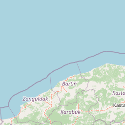
Why Küre Mountains National Park stands out

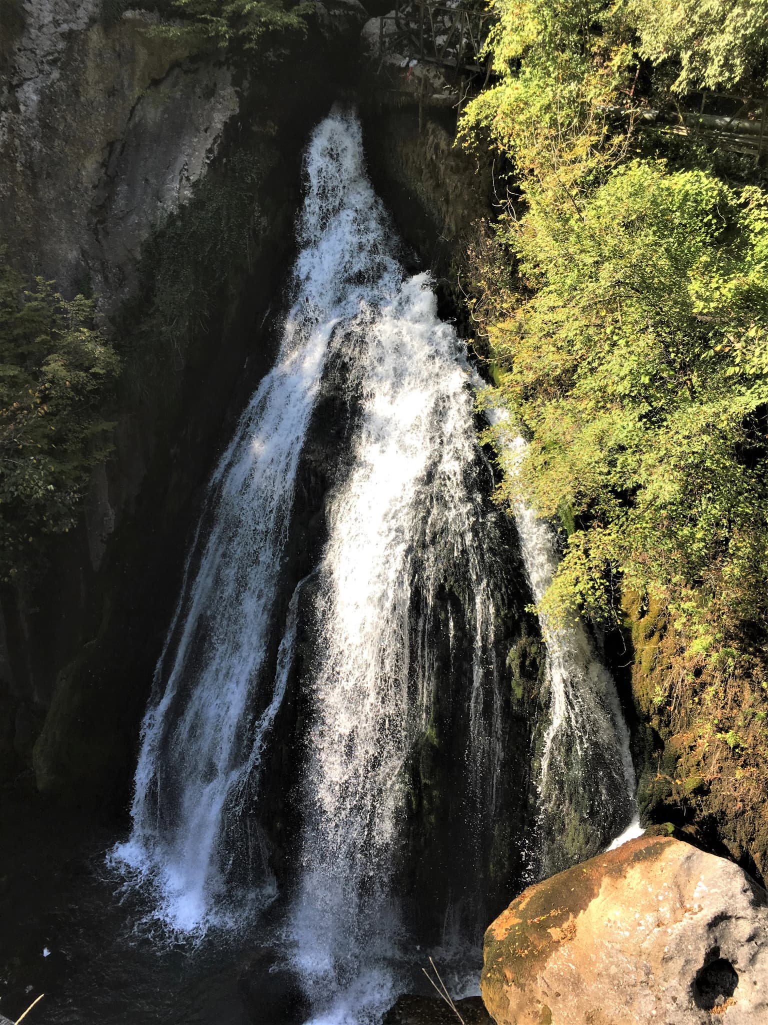
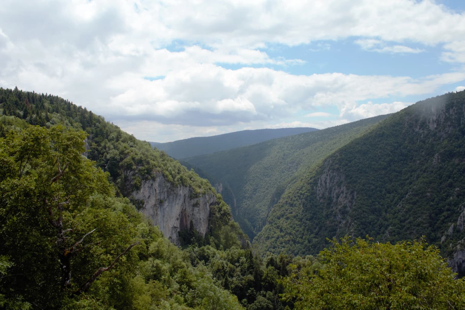
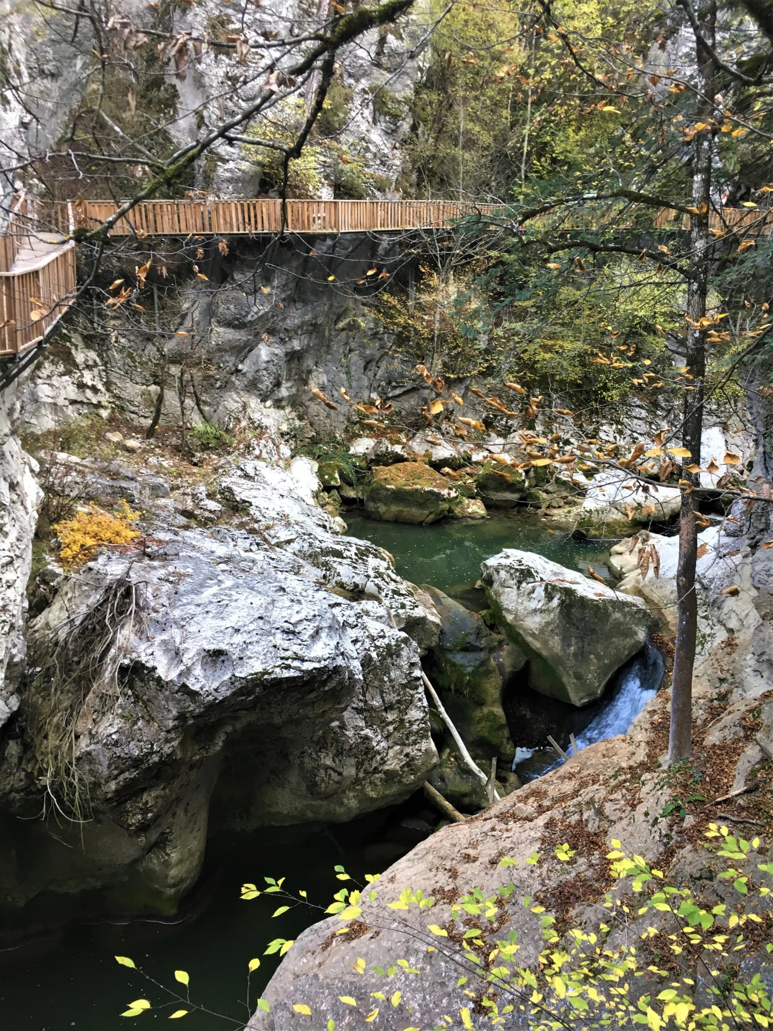
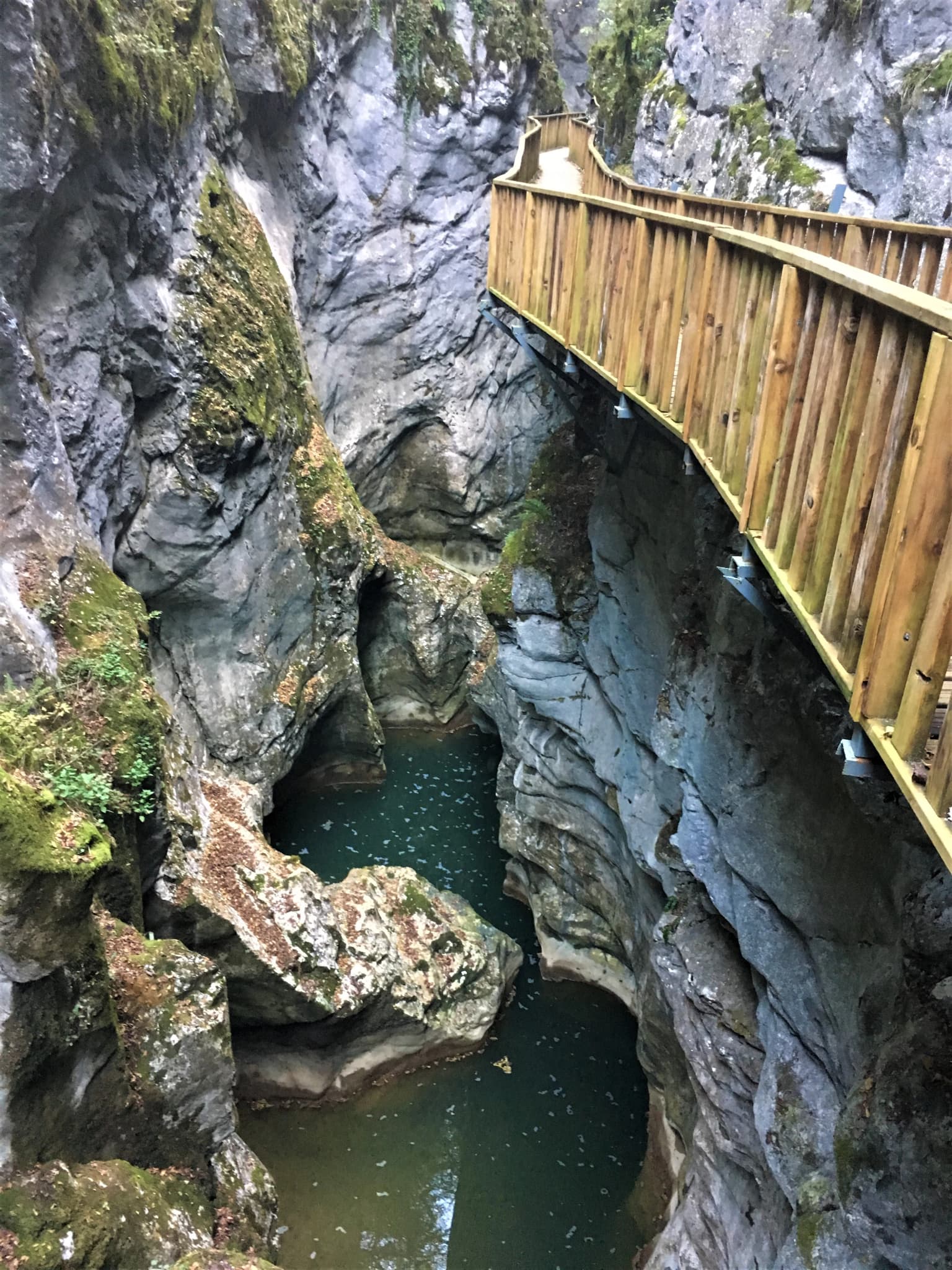
Küre Mountains National Park is best known for its exceptional old-growth forest formations and dramatic karst landscape. The mountains contain one of Turkey's most extensive canyon systems, with deep gorges known locally as 'kısıklar' carved into the limestone terrain by heavy rainfall and water erosion. The park protects diverse habitats including mixed forests of fir and beech, sea and coastal environments, grasslands, and rocky areas. It serves as a critical refuge for biodiversity in the western Black Sea Region, with 157 endemic plant species, including numerous endangered taxa. The region is also notable for its extensive cave systems, with Ilgarini Cave being among Turkey's deepest at 850 meters in length and 250 meters in depth.

Waterfall cascading down rocky cliffs with dense green foliage on the right side and a large boulder in the foreground
A tall, cascading waterfall surrounded by lush green vegetation in Küre Mountains National Park

Küre Mountains National Park history and protected-area timeline

The protection of Küre Mountains traces back to 1988 when the World Wide Fund for Nature designated the area as one of the priority regions for conservation in Turkey. This recognition came as concerns grew about the region's ecological vulnerability, particularly from copper mining and quarrying activities that were causing significant environmental damage to the mountain forests. From 1998 to 2000, the Turkish Ministry of Forestry implemented a comprehensive project focused on national park management, biodiversity conservation, and rural development, supported by the United Nations Development Programme and the Food and Agriculture Organization. This initiative led to the formal establishment of Küre Mountains National Park on July 7, 2000, with the concept of a buffer zone incorporated into Turkey's conservation framework. The park administration operates under the authority of the Regional Directorate of Forestry and Water Affairs in Sinop, governed by the National Parks Law numbered 2873. In April 2012, the park achieved PAN Parks certification as a verified protected area meeting international standards for sustainable tourism and conservation management.

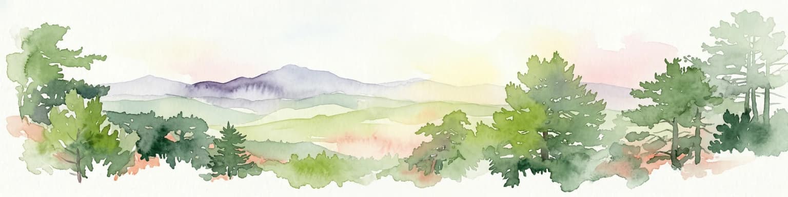
Küre Mountains National Park landscape and geographic character

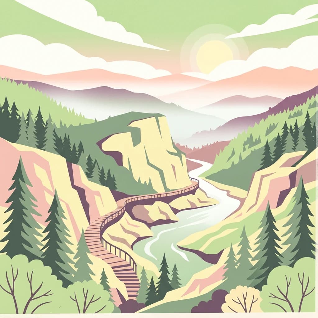
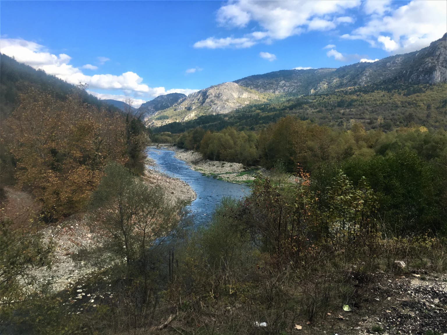
The Küre Mountains present a spectacular landscape defined by dramatic topographical variation and karst geological features. The mountain range forms part of the Western Black Sea Mountain System, with elevations rising from the coastal lowlands to create a rugged, heavily forested terrain. The most distinctive landscape features are the deep canyons that have been carved into the limestone bedrock over millennia by the region's heavy rainfall. These gorges, locally called 'kısıklar', create narrow passages with sheer walls that represent some of the most impressive canyon systems in Turkey. The landscape also encompasses numerous caves, with Ilgarini Cave standing out as one of the nation's deepest at 850 meters in length and 250 meters in depth. The terrain varies from steep mountainous slopes to valley floors carved by rushing streams and waterfalls. The combination of karst topography, abundant precipitation, and dense forest cover creates a visually stunning landscape of profound ecological value.

Wide river flowing through valley surrounded by forested mountains under blue sky with scattered clouds
River valley view within Küre Mountains National Park

Küre Mountains National Park ecosystems, habitats, and plant life

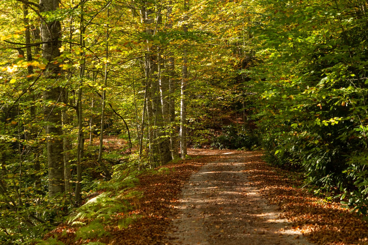
The ecological character of Küre Mountains National Park is defined by its location within the humid forest zone of the Black Sea Region, one of Turkey's most biodiverse areas. The park protects old-growth forest formations that represent some of the finest examples of Black Sea forests in the country. These forests exhibit distinct vertical zonation, transitioning from coastal vegetation including olive, myrtle, chestnut, and Turkish pine at lower elevations through mixed forests of fir and beech in the cooler middle elevations. The park's karst terrain creates additional ecological diversity through its cave systems, rocky outcrops, and canyon environments. Within the western sector of the Küre Mountains, researchers have identified 122 significant plant areas, with 157 endemic species documented, including 45 plant taxa classified as endangered. The area is recognized as one of the 100 Forest Hot Spots of Europe requiring protection, situated within 200 globally identified eco-regions by the WWF.

Dirt road covered with fallen leaves through a forest with tall trees and autumn foliage
Dirt road covered in fallen autumn leaves winding through a dense forest

Küre Mountains National Park wildlife and species highlights

Küre Mountains National Park supports a rich mammalian fauna, hosting 48 of the 160 mammal species known to occur in Turkey. The park's forests provide habitat for notable species including brown bear, roe deer, wild boar, and marten. The reintroduction of red deer in 1999, with animals brought from Bolu, marked a significant conservation achievement, as this species had been completely extirpated from Anatolia by the 1950s. Wolf tracks have recently been recorded in the park, indicating the possible return of this apex predator to the region. The diverse habitats support a wide range of vertebrate and invertebrate species, contributing to the park's significance as a biodiversity refuge in the western Black Sea Region. The old-growth forests and canyon systems create varied microhabitats that support both common and rare species.

Panoramic view of a deep green canyon with steep rocky cliffs and lush forest under a partly cloudy sky.
View from Çatak Canyon observation deck in Küre Mountains National Park.

Küre Mountains National Park conservation status and protection priorities

The establishment of Küre Mountains National Park represents a critical conservation achievement for Turkey's Black Sea Region. The park was designated as a priority protection area by the World Wide Fund for Nature in 1988, recognizing the exceptional ecological value of these humid forest ecosystems. The area is considered one of the 100 Forest Hot Spots of Europe and falls within 200 globally identified eco-regions by WWF. The park's certification as a PAN Parks destination in 2012 verifies that it meets international standards for protected area management, balancing conservation with sustainable tourism. The conservation framework addresses threats from historical activities including copper mining, quarrying, and agricultural expansion. Management efforts focus on protecting the old-growth forests while providing alternative livelihoods for local communities through sustainable ecotourism.

Küre Mountains National Park cultural meaning and human context

The Küre Mountains region maintains strong connections between its natural landscapes and local cultural traditions. Traditional wooden houses scattered throughout the park area reflect the architectural heritage of the Black Sea region. The park encompasses communities whose livelihoods are closely tied to the forest and mountain environment. Ecotourism initiatives, including the Pinarbasi Ecotourism Center established in 2001, have created opportunities for local communities to benefit from conservation while preserving their traditional relationships with the land. The area also holds historical significance, with evidence of Byzantine-period settlement near Ilgarini Cave, where the remains of a small village and water cisterns provide glimpses into past human occupation of these mountainous landscapes.

Small waterfall cascading over rocks in a canyon with a wooden bridge spanning the gorge, surrounded by trees and autumn foliage
Small waterfalls flowing through Hurma Canyon with a wooden bridge

Top sights and standout views in Küre Mountains National Park

Küre Mountains National Park offers exceptional opportunities for discovering pristine natural environments in northern Turkey. The park's crown jewels include its extensive canyon systems—Horma, Valla, Çatak, and Aydos canyons—each forming unique ecosystems within the broader protected landscape. Valla Canyon features walls rising over 1000 meters with challenging access due to fierce winds. The Ilgarini Cave system ranks among Turkey's deepest, with an imposing entrance and 850 meters of passages. The old-growth forests represent some of Turkey's most significant timberland, with their vertical stratification from coastal to subalpine zones. Visitors can explore traditional villages, observe wildlife in their natural habitat, and experience one of Turkey's most ecologically significant protected areas.

Deep canyon with steep rocky walls, green water at the bottom, and a wooden walkway on the right side
Hurma Canyon within Küre Mountains National Park

Best time to visit Küre Mountains National Park

The Küre Mountains can be visited year-round, though the Black Sea region's characteristic climate means that precipitation is possible in any season. The summer months of June through August typically offer the most stable weather conditions for outdoor activities such as hiking and wildlife observation. Spring and autumn bring more variable weather but also offer the opportunity to experience the park's changing seasons and vibrant vegetation. Winter visits provide the chance to see the mountain landscape under snow, though some trails may be more challenging. The park's higher elevation areas can be significantly cooler than the coast year-round, so visitors should prepare for variable conditions regardless of when they choose to visit.

Park location guide

Geography guide, regional context, and park location map for Küre Mountains National Park

Küre Mountains National Park park geography, regions, and map view in Turkey
Understand where Küre Mountains National Park sits in Turkey through a broader geographic reading of the surrounding landscape, nearby location context, and its mapped position within the national park landscape.

How Küre Mountains National Park fits into Turkey

Turkey, officially the Republic of Türkiye, is a transcontinental country located mainly in Anatolia (West Asia) with a smaller portion in East Thrace (Southeast Europe). It borders the Black Sea to the north, several countries to the east and south, and the Aegean Sea and European countries to the west. The country has a population of over 86 million and operates as a secular, Muslim-majority presidential republic with Ankara as capital and Istanbul as its largest city.

Wider geography shaping Küre Mountains National Park in Turkey

Turkey is a transcontinental country with the majority of its territory (about 97%) located in Anatolia (West Asia) and a smaller portion called East Thrace in Southeast Europe. It borders the Black Sea to the north, Georgia, Armenia, Azerbaijan, and Iran to the east, Iraq and Syria to the south, and the Mediterranean Sea to the southwest. To the west, Turkey borders the Aegean Sea, Greece, and Bulgaria. The terrain includes mountains, plateaus, and coastal plains, with the Taurus Mountains running along the southern coast.

Map view of Küre Mountains National Park

Use this park location map to pinpoint Küre Mountains National Park in Turkey, understand its exact geographic position, and read its mapped placement within the surrounding landscape more clearly.

Pigeon | © OpenStreetMap contributors

Location context for Küre Mountains National Park

Bartın ProvinceKastamonu Province

Discover the dramatic canyons, diverse habitats, and unique mountain scenery defining this Black Sea protected area.

Explore Küre Mountains National Park Photos: Visual Guide to Turkey's Old-Growth Forest and Karst Landscapes
Browse comprehensive imagery revealing the distinctive landscapes of Küre Mountains National Park, showcasing its ancient forest ecosystems, deep karst canyons, and rugged mountain terrain. Understanding the visual character through these protected area views helps grasp the region's biodiversity, geological features, and significant natural environment.

Waterfall cascading down rocky cliffs with dense green foliage on the right side and a large boulder in the foreground

Waterfall flowing into a calm pool surrounded by rocky terrain and dense green foliage

Wide river flowing through valley surrounded by forested mountains under blue sky with scattered clouds

Dirt road covered with fallen leaves through a forest with tall trees and autumn foliage

Panoramic view of a deep green canyon with steep rocky cliffs and lush forest under a partly cloudy sky.

Wooden walkway spanning a rocky canyon with a small waterfall and stream, surrounded by forested slopes

Small waterfall cascading over rocks in a canyon with a wooden bridge spanning the gorge, surrounded by trees and autumn foliage

Deep canyon with steep rocky walls, green water at the bottom, and a wooden walkway on the right side

A rocky gorge with a stream flowing through it, surrounded by forested cliffs and trees, with sunlight illuminating the upper canyon

A river flows through a rocky canyon with steep cliffs and vegetation, featuring a wooden bridge in the background

Mountainous landscape with rocky peaks, valleys, and green vegetation under a partly cloudy sky.

Mountainous landscape with green valleys, scattered trees, and a village in the distance under a partly cloudy sky

Rocky canyon with a stream flowing through boulders, surrounded by steep cliffs and autumn-colored trees, featuring a wooden bridge spanning the gorge.

Winding dirt road surrounded by dense forest and fog with distant mountain peaks under a clear sky

Wooden walkway along rocky canyon walls with autumn foliage and stream below

A paved road through a forested mountain landscape with fog in the distance, surrounded by evergreen and deciduous trees.

Park atlas

Compare additional protected areas and regional park geography spanning the Western Black Sea mountain ecosystems.

Explore More National Parks and Protected Areas Surrounding Küre Mountains National Park
After exploring Küre Mountains National Park, you can discover other national parks and significant protected areas located across the broader Western Black Sea Region. This allows for geographical comparison of diverse mountain, forest, and karst landscapes, offering a deeper understanding of regional conservation efforts.
National parkKastamonu Province

Mount Ilgaz National Park: A Protected Landscape at the Crossroads of Anatolian Geography

Explore unique ecosystems and mapped terrain in Kastamonu Province

Mount Ilgaz National Park offers a deep dive into a unique protected landscape where Central Anatolian and Black Sea ecosystems converge. Situated in Kastamonu Province, its rugged mountain terrain and distinct mapped boundaries showcase a rich geographic identity. This park is an essential point for understanding Turkey's biogeographic transition zones, its diverse forest ecosystems, and the regional context of the Ilgaz Mountains. Delve into its protected status and discover the interplay of climate and terrain that defines this significant natural area.

Area
7.424 km²
Established
1976
IUCN
II
Relief
Mountain
Watercolor illustration of a forested landscape with green trees, rolling hills, and distant mountains
National parkTurkey

Soğuksu National Park: Turkey's Highland Forest Protected Landscape Discovery

Explore mapped boundaries and unique Anatolian geography.

Soğuksu National Park serves as a significant protected natural area in central Turkey, celebrated for its substantial coniferous forest ecosystem. This park showcases a transition zone between major geographic regions, offering a unique highland landscape shaped by volcanic geology. Discover its mapped protected boundaries and its role as a vital natural atlas point within the broader Turkish geography, featuring diverse terrain and important ecological elements.

Area
11.87 km²
Established
1959
Watercolor painting showing multiple lakes surrounded by green trees and mountains under a light sky
National parkBolu Province

Yedigöller National Park: Bolu Province's Landslide Lake and Forested Protected Landscape

Discover mapped terrain and unique natural park geography.

Yedigöller National Park presents a distinctive protected landscape within Bolu Province, notable for its chain of seven landslide-formed lakes and extensive, dense forests. This page serves as your entry point to understanding the park's geographic distribution, mapped boundaries, and the characteristic terrain that defines this important natural area. Explore the unique ecosystem and its place within the broader regional geography through structured atlas-style discovery.

Area
16.23 km²
Established
1965
IUCN
II
Relief
Mixed relief
Watercolor painting of a lake surrounded by green hills and trees with colorful foliage
National parkBolu Province

Lake Abant National Park: Protected Volcanic Crater Lake & Alpine Landscape

Bolu Province, Turkey | National Park | Mapped Landscape

Lake Abant National Park is a protected national park renowned for its stunning volcanic crater lake and surrounding alpine forests within Bolu Province. This detailed entry provides insight into the park's geographic context, its unique volcanic terrain, and its status as a protected landscape. Explore the mapped boundaries and understand the ecological significance of this distinctive natural area in northwestern Turkey.

Area
11.965 km²
Established
2022
Relief
Mountain
Climate
Temperate
National parkAnkara Province

Mount Sarıçalı National Park: Turkey's Newest Protected Mountain Landscape

Ancient forests, endemic botany, and dramatic mountain terrain.

Mount Sarıçalı National Park, located in Ankara Province, Turkey, is a testament to the nation's commitment to conservation. This protected area is celebrated for its ancient forests, with larch, Kasnak oak, and juniper trees dating back 700-800 years. Its position at the confluence of three phytogeographic zones supports a rich array of 139 endemic plant species. The park's landscape is further characterized by the striking Uyuzsuyu Waterfall and the imposing Mount Sarıçalı peak, offering a profound geographic context for atlas exploration.

Area
10.24 km²
Established
2021
Relief
Mountain
Scope
Terrestrial
National parkYozgat Province

Yozgat Pine Grove National Park: Historic First National Park and Ancient Pine Forest

Explore the protected landscape of Turkey's original national park.

As Turkey's pioneering national park, Yozgat Pine Grove National Park offers a deep dive into a unique protected landscape. This site provides detailed geographic context for its ancient pine forest, set dramatically against the steppe terrain of Yozgat Province. Understand the park's mapped boundaries and its ecological significance as a historic conservation area. MoriAtlas facilitates a structured exploration of this important natural heritage site, highlighting its role in Turkish protected land history and its distinct regional geography.

Area
2.64 km²
Established
1958
IUCN
II
Relief
Highland
Nature reserve

Crimean Nature Reserve: Nature Reserve with Mountain Forests and Karst Geography

Explore protected area landscapes and terrain.

The Crimean Nature Reserve is a key protected area within the Crimean Mountains, recognized for its significant mountain forests and unique karst landscapes. This nature reserve encompasses a critical span of the peninsula's rugged terrain, from high mountain ridges to dramatic southern slopes. Its designation as a protected area highlights its ecological importance and its role in preserving diverse natural habitats and geological features within a regional geographic context, making it a notable destination for landscape exploration.

Area
442 km²
Established
1991
IUCN
Ia
Relief
Mountain
National parkTurkey

Göreme Historical National Park: A Mapped Volcanic Landscape and Protected Cultural Heritage in Turkey

Explore the unique geography and rock-cut churches of Cappadocia.

Göreme Historical National Park presents a globally significant protected landscape, celebrated for its dramatic volcanic geology and extensive rock-cut architecture. This national park in Turkey's Cappadocia region features iconic fairy chimneys and ancient cave dwellings, offering a rich context for exploring human adaptation to natural terrain. MoriAtlas facilitates a detailed discovery of its mapped boundaries and regional geography, highlighting the intersection of natural wonder and historical habitation within this unique protected area.

Common questions about visiting, size, designation, and location context for Küre Mountains National Park

Küre Mountains National Park FAQs for park facts, access, geography, and protected area context
Find quick answers about Küre Mountains National Park, including protected-area facts, park geography, trail and visitor context, and how the park fits into its surrounding country and regional landscape.
MoriAtlas Explorer

Continue Your Protected Areas Search Across the Global Atlas

Deepen your exploration by continuing the structured search for national parks and protected areas worldwide. Utilize the comprehensive filtering capabilities to compare different conservation landscapes and refine your understanding of global park geography. Discover more about the distribution and characteristics of protected natural areas.

Global natural geography