Mori Atlas logo
Park earthquake history

A comprehensive catalogue of epicentres, event magnitudes, and depths across the Ohrid basin

Historical Earthquake Data and Recorded Seismic Activity Associated with Lake Ohrid

This collection presents a systematic historical record of earthquakes associated by proximity with the Lake Ohrid tectonic basin. Users can filter and compare individual event data including documented dates, magnitude scales, and epicentral distances from the lake. The provided records draw from global USGS datasets to trace seismic history within the regional geography of the southwestern Balkans.

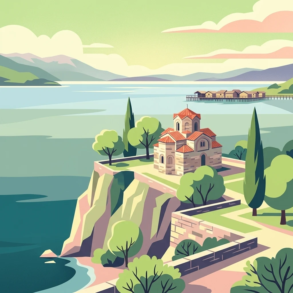
A stylized digital illustration showing a historic stone church with a red tiled roof situated on a cliff overlooking the calm blue waters of Lake Ohrid, with a wooden stilt structure visible in the distant background.

One of Europe's oldest and deepest lakes, shared between North Macedonia and Albania, celebrated for extraordinary endemic biodiversity.

Lake Ohrid

Lake Ohrid is a large, ancient tectonic lake straddling the mountainous border between southwestern North Macedonia and eastern Albania. It is widely regarded as one of the oldest and deepest lakes in Europe, with an evolutionary history that has allowed an exceptional freshwater ecosystem to develop in relative isolation. What truly distinguishes Lake Ohrid is its extraordinary level of endemism. More than 200 species found in or around the lake exist nowhere else on Earth, spanning the entire food web, from microscopic diatoms and algae through endemic fish, snails, sponges, crustaceans, and bottom-dwelling invertebrates. Comparable ancient lakes such as Baikal and Tanganyika share this pattern, but Lake Ohrid's biodiversity density on a relatively small surface area is remarkable. The lake is framed by mountain ranges, traditional lakeside towns, and centuries of cultural heritage. Its North Macedonian side was inscribed as a UNESCO World Heritage Site in 1979 and expanded to the Albanian side in 2019, while the surrounding region has also been added to UNESCO's World Network of Biosphere Reserves. Lake Ohrid stands as both a natural wonder of the Balkans and a deeply layered cultural landscape.

Location
North Macedonia
Park type
Nature reserve
Area
358 km²
Explore Lake Ohrid Nature Reserve Geography

Filter Lake Ohrid events by magnitude, depth, and distance

Investigate historical earthquake observations around Lake Ohrid

Lake Ohrid’s catalogue relates reported epicentres to the transboundary Balkan lake through calculated protected-area distance, without treating its ancient tectonic basin, deep waters, surrounding mountains, or endemic species as event evidence. Each entry retains a date, magnitude, depth, locality, source, and lake distance for historical comparison without asserting ecological effects, present risk, or recurrence.

Sort by
Magnitude
Location

This page describes catalogued earthquakes associated with the park by epicentre location and distance. It does not establish causation, assess current danger, or predict future earthquakes.

No earthquake records match the current filters

Park atlas

Continue from Lake Ohrid earthquake evidence to new places

Browse further protected park destinations after Lake Ohrid

From Lake Ohrid's earthquake catalogue, discovery continues beyond one ancient transboundary tectonic lake and freshwater-biodiversity landscape into other protected places. Nothing about the destination set implies shared lake status, border context, endemic species, distance, geology, seismic observations, hazards, risk, or matching documentation.
Watercolor painting of a river flowing through a valley with mountains and greenery
National parkKorçë County
4.6 km away#1 closest

Southeast

Prespa National Park: Protected Landscape and High-Altitude Lakes in Korçë County, Albania

Explore the geography and mapped boundaries of this vital national park.

Prespa National Park, located in Korçë County, Albania, is a protected area characterized by its significant high-altitude tectonic lakes, dramatic mountain landscapes, and vital wetland habitats. This entry provides a structured atlas-style overview of the park's geographic identity, its protected landscape features, and its ecological importance, serving as a key point of reference for understanding this unique Balkan region.

Area
276.131 km²
Established
1999
IUCN
II
Relief
Mountain
Watercolor illustration of mountains, a lake, and rolling hills with grassy vegetation.
National parkElbasan County
About 12 km away#2 closest

Northwest

Shebenik National Park: Mapped Protected Landscape and Glacial Terrain Atlas

Explore Elbasan County's significant mountain wilderness and protected natural features.

Shebenik National Park is a protected national park in Elbasan County, Albania, notable for its dramatic glacial terrain and extensive ancient forests. This park offers a deep dive into Albania's natural landscape, featuring 14 glacial lakes and serving as vital habitat. Its position within the Balkan Peninsula's geography makes it a key point of reference for understanding protected areas and mountain wilderness within a structured atlas.

Area
345.079 km²
Established
2008
IUCN
II
Relief
Mountain
A watercolor illustration of a landscape with soft green hills and a pinkish water area, set against a plain white background.
National parkWestern Macedonia
19 km away#3 closest

Southeast

Prespa National Park: Mapping the Biodiversity and Lake Landscapes of Western Macedonia

A Ramsar wetland reserve and transboundary protected area

Prespa National Park encompasses 32,700 hectares of diverse habitats, from the shallow waters of Small Prespa Lake to the surrounding forested uplands. This protected area acts as a vital sanctuary for migratory bird species and endemic plants, offering a rich look at the ecological interplay between water, floodplains, and mountain terrain in northern Greece.

Area
327 km²
Established
2009
IUCN
VI
Relief
Mixed relief
Watercolor painting of a landscape with green trees, rolling hills, and distant mountains under a light sky
National parkMunicipality of Bitola
20 km away#4 closest

East

Pelister National Park: North Macedonia's Oldest National Park and Alpine Protected Landscape

Explore unique glacial features and endemic forests within Municipality of Bitola.

Pelister National Park, a pioneering protected area in North Macedonia, offers a rich tapestry of alpine geography and unique geological formations. This page provides detailed information on the park's landscape, including its dramatic mountain massif within Municipality of Bitola, the rare Macedonian pine forests, the striking 'stone rivers' formed by ancient glacial processes, and the serene Pelister Eyes glacial lakes. Discover the park's mapped boundaries and its significance as a conservation heritage site within the Balkan Peninsula.

Area
171.5 km²
Established
1948
IUCN
II
Visitors
30K annual
A soft watercolor painting of layered rolling hills and mountains fading into the distance with small clusters of stylized trees in the foreground.
Protected landscapeAlbania
About 22 km away#5 closest

Southwest

Guri i Nikës-Lenie-Valamarë Protected Landscape: Albania Mountain and Forest Geography

A protected mosaic of Mediterranean woodlands and Pindus foothills

Spanning roughly 22 square kilometers near Pogradec, the Guri i Nikës-Lenie-Valamarë Protected Landscape protects a diverse array of forested slopes and freshwater habitats. This essential Balkan biological corridor provides a detailed look at the transition between dense woodland and scrub communities within the Pindus mountain system, highlighting its role as a key habitat for large carnivore populations.

Area
22 km²
Established
1996
IUCN
VI
Relief
Mountain
National parkNorth Macedonia
36 km away#6 closest

North

Mavrovo National Park: North Macedonia's Extensive Protected Alpine Terrain and Wildlife

Mapped geography of Alpine peaks, gorges, and unique endemic species.

Mavrovo National Park, North Macedonia's largest protected area, offers a deep dive into a complex Alpine geography. Dominated by the Šar, Korab, and Bistra mountain systems, the park features towering peaks and the dramatic Radika River gorge. This protected landscape is globally significant for its role in conserving the rare Balkan lynx and harbors endemic tertiary relic plant species like Macedonian pine. Explore the mapped boundaries, glacial lakes, and distinct terrain that define this vital conservation area.

Area
730.88 km²
Established
1949
IUCN
II
Relief
Mountain
Protected landscapeKorçë County
About 38 km away#7 closest

South

Fir of Drenovë-Sinicë Protected Landscape: Forest and Geological Map of Korçë County

Mapping Albania's protected Silver fir woodland ecosystems

Explore the structured geography of the Fir of Drenovë-Sinicë Protected Landscape, a diverse expanse in Korçë County defined by its ancient Silver fir stands and karst cave systems. This area showcases a varied landscape of rocky monoliths, mountain lakes, and tectonic valleys that serve as a vital ecological record for the southeastern Albanian mountains.

Area
10.3 km²
Established
1966
IUCN
V
Relief
Mountain
Watercolor painting showing mountains, a river, and vegetation
National parkAlbania
47 km away#8 closest

Southwest

Tomorr Mountain National Park: Sacred Peak & Karst Protected Landscape in Albania

Explore Albania's dramatic mountain geography and protected areas.

Tomorr Mountain National Park offers a unique exploration of southern Albania's dramatic limestone anticline. Dominated by the sacred Mount Tomorr and featuring the spectacular Osum Canyon, this national park provides insight into karst terrain, old-growth forests, and significant biodiversity. Discover its mapped boundaries and regional geographic context within the Pindus Mountains for structured atlas exploration.

Area
271.855 km²
Established
1956
IUCN
II
Relief
Mountain
MoriAtlas Explorer

Continue Exploring the Lake Ohrid Nature Reserve and Surrounding Balkan Terrain

Deepen your understanding of Lake Ohrid through a structured geographic lens. MoriAtlas provides the necessary data to examine the basin's tectonic origins, its unique freshwater ecosystem, and the mountainous topography that defines this protected area within North Macedonia and the broader Balkans.