
Mori Atlas logo
Nature reserveLake Ohrid

A deep tectonic basin defined by mountain ranges, endemic biodiversity, and centuries of history

Lake Ohrid Nature Reserve: Mapping the Geography and Ancient Ecosystems of the Balkans

(Natural and Cultural Heritage of the Ohrid region)

Lake Ohrid sits as a profound tectonic depression framed by the dramatic elevations of the Galičica and Jablanica mountains. This ancient freshwater system functions as a critical nature reserve, distinguished by its exceptional water clarity and a density of endemic species that persists nowhere else on Earth. By tracing the lake's steep submerged slopes and surrounding karstic topography, observers gain a clearer understanding of how this isolated mountain basin maintains its unique biological and geological integrity within the broader Balkan landscape.

ancient laketransboundary laketectonic basinendemic speciesfreshwater biodiversitymountain lake
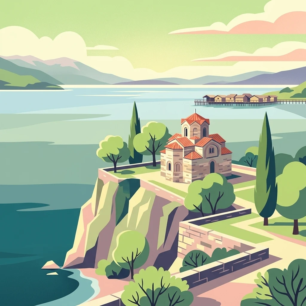
A stylized digital illustration showing a historic stone church with a red tiled roof situated on a cliff overlooking the calm blue waters of Lake Ohrid, with a wooden stilt structure visible in the distant background.

Lake Ohrid

Nature reserve

Park overview

Structured park overview, official facts, and landscape profile for Lake Ohrid

Lake Ohrid park facts, protected area profile, and essential visitor context

Review the core facts for Lake Ohrid, including designation, size, terrain, visitor scale, habitats, and operating context in one park-focused overview.

About Lake Ohrid

Lake Ohrid is a defining natural feature of the southwestern Balkans and a focal point of regional identity for both North Macedonia and Albania. It occupies a deep tectonic basin within the older Dinaric landscape and reaches considerable depth, with a maximum of roughly 288 meters and a mean depth of about 155 meters. Its elevation near 693 meters above sea level, combined with its surrounding mountain ranges, gives the lake a distinctly Alpine-mountain character despite its relatively southern location in Europe.

The lake's ecological identity is shaped by its extraordinary age and the stability of its environment. Sediments and tectonic evidence suggest origins dating back several million years, allowing complex evolutionary processes to unfold in isolation. The lake basin captures water from karstic springs along its eastern shore and, notably, from nearby Lake Prespa through underground channels, creating a hydrological link between two major Balkan lakes. The Black Drin River is the lake's primary outlet, carrying its waters northward through Albania toward the Adriatic.

Culturally, Lake Ohrid has been inhabited for thousands of years. Prehistoric pile dwellings along its shore are among the oldest in Europe, and the city of Ohrid has long served as a major religious, artistic, and intellectual center, giving the lake an exceptionally rich cultural dimension that complements its ecological significance. The combination of natural uniqueness and sustained human presence has shaped a landscape where biodiversity, archaeology, and traditional lakeside life are tightly intertwined.

Quick facts and research context for Lake Ohrid

Lake Ohrid is a transboundary lake shared by North Macedonia and Albania, with roughly two-thirds of its shoreline on the North Macedonian side. It sits in a tectonic basin at high elevation in the southwestern Balkans, framed by mountains and drained northward by the Black Drin River toward the Adriatic.

The lake is internationally protected through UNESCO World Heritage status, UNESCO Biosphere Reserve recognition, and Ramsar Wetland designation, reflecting both its natural and cultural significance. It is also formally designated as an Important Bird Area for both countries. A protected area known as the Ohrid-Prespa Transboundary Reserve links the lake to nearby Lake Prespa, reinforcing regional conservation cooperation.

Protection and recognition

Documented conservation history, transboundary scope, and official designations

Lake Ohrid Protection Status and International Recognition Data

Lake Ohrid features a documented mixed protection status established in 1979 across a transboundary setting. Official international recognition records include UNESCO World Heritage and Ramsar site designations.
Park context

Deeper park guide and search-rich context for Lake Ohrid

Lake Ohrid history, landscape, wildlife, and travel context

Explore Lake Ohrid through its history, landscape character, ecosystems, wildlife, conservation priorities, cultural context, and seasonal travel timing in a structured park guide built for atlas discovery and search intent.

Why Lake Ohrid stands out

Lake Ohrid is best known for the remarkable concentration of endemic species in its fresh waters, a signature trait it shares with only a handful of the world's truly ancient lakes. The lake functions as a long-term refuge where relict and unique organisms have persisted for millions of years. It is also known for being one of Europe's deepest and oldest lakes, and for the striking clarity of its water, supported by underground karstic springs. Together with the historic city of Ohrid on its shore, it forms a globally recognized natural and cultural landscape.
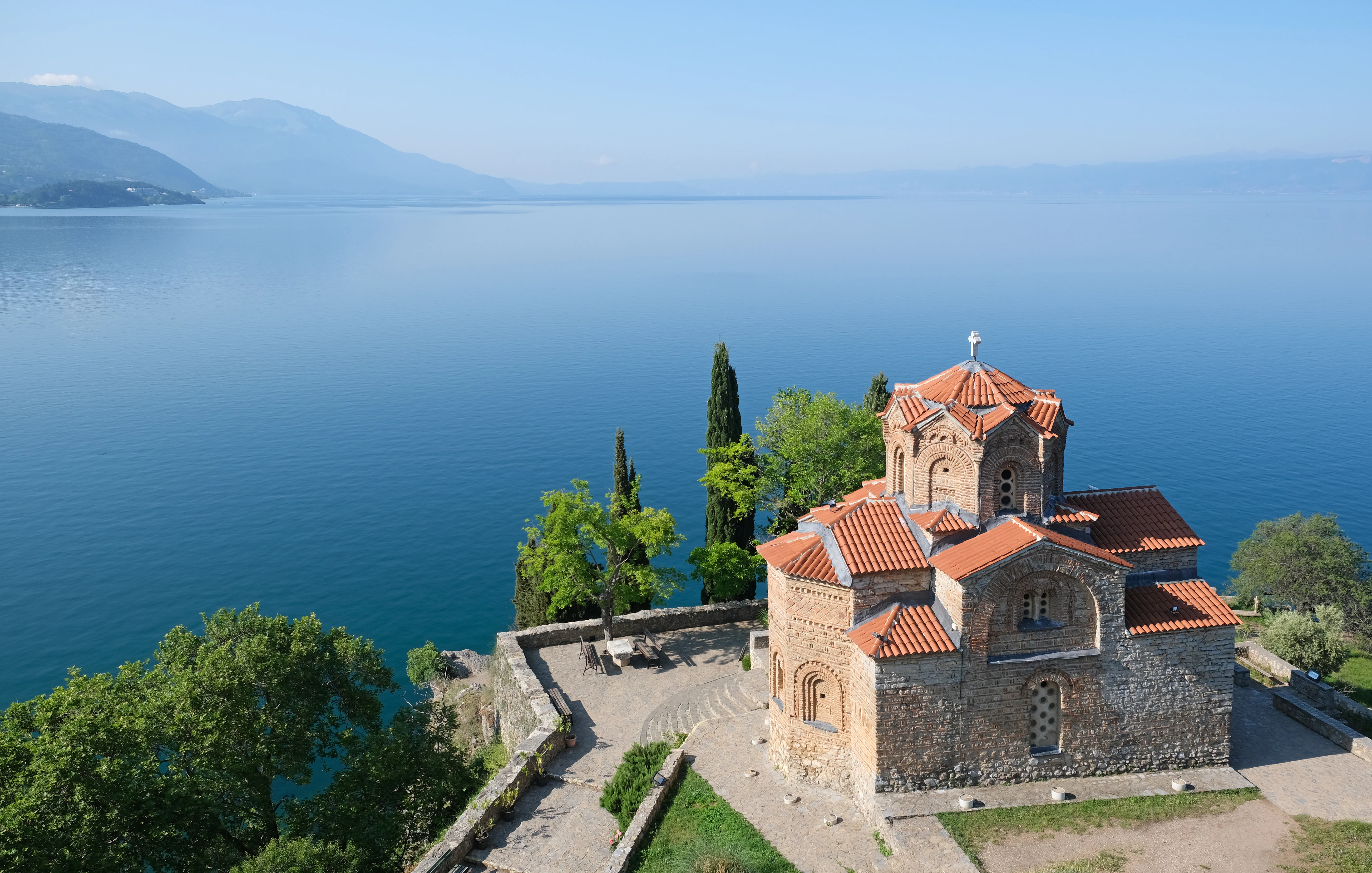
An elevated view of the stone-built Church of St. John at Kaneo with a terracotta roof, situated on a cliffside overlooking the expansive blue expanse of Lake Ohrid.
The historic Church of St. John at Kaneo overlooking the tranquil waters of Lake Ohrid.

Lake Ohrid history and protected-area timeline

The lake's history extends deep into geological time. Its basin formed as part of a tectonic system that produced a chain of graben structures across the central Balkans, with the oldest lake sediments dating back to the Pliocene. This tectonic framework combined with continuing subsidence and karstic hydrology has preserved the lake over millions of years, while many other lakes of comparable age have filled with sediment and disappeared.

Human history along the lake is similarly long. Neolithic communities inhabited its shores thousands of years ago, and prehistoric pile dwellings, including those documented near Lin in Albania, are among the oldest agricultural settlements discovered in Europe. The lake later lay near the ancient Roman Via Egnatia, connecting the Adriatic coast with Thessaloniki and Constantinople, and the city of Ohrid emerged as a significant cultural and ecclesiastical center through the medieval period, leaving a rich architectural and religious legacy on its shore.

Modern protection history began in 1979, when the North Macedonian side of the lake was inscribed as a UNESCO World Heritage Site, then expanded in 1980 to include the historic city of Ohrid. UNESCO later extended the designation to the Albanian side in 2019. Concerns over pollution, urban development, and tourism pressure led to joint monitoring missions, and the lake has been recognized through the UNESCO World Network of Biosphere Reserves and the Ramsar Convention. In the early 2020s, the Macedonian portion was formally designated as a Ramsar Wetland of International Importance.

Lake Ohrid landscape and geographic character

Lake Ohrid occupies a deep, enclosed basin within the mountainous southwestern Balkans. To the east rises Mount Galičica, and to the west rises Mount Jablanica, both reaching elevations over two thousand meters. These surrounding ranges give the lake a pronounced bowl-like setting and contribute to its relatively dry, Mediterranean-influenced mountain climate.

The basin itself is a tectonic graben, part of a broader chain of structurally related depressions that connects Ohrid with Lake Prespa further south and the Korçë plain. Despite its high elevation, the lake reaches great depth, with steep submerged slopes and a broad central basin. Its shoreline is irregular and indented, forming small bays, peninsulas, and gentle beaches that support both natural wetland remnants and centuries of human settlement.

The lake's water is unusually clear, with visibility reaching more than 20 meters in places, a quality linked to filtered karstic inflows and low nutrient status. The interplay of deep transparent water, pale limestone slopes, and forested mountains above gives the Ohrid basin its distinctive visual character and creates the strong scenic contrast for which the lake is widely known.
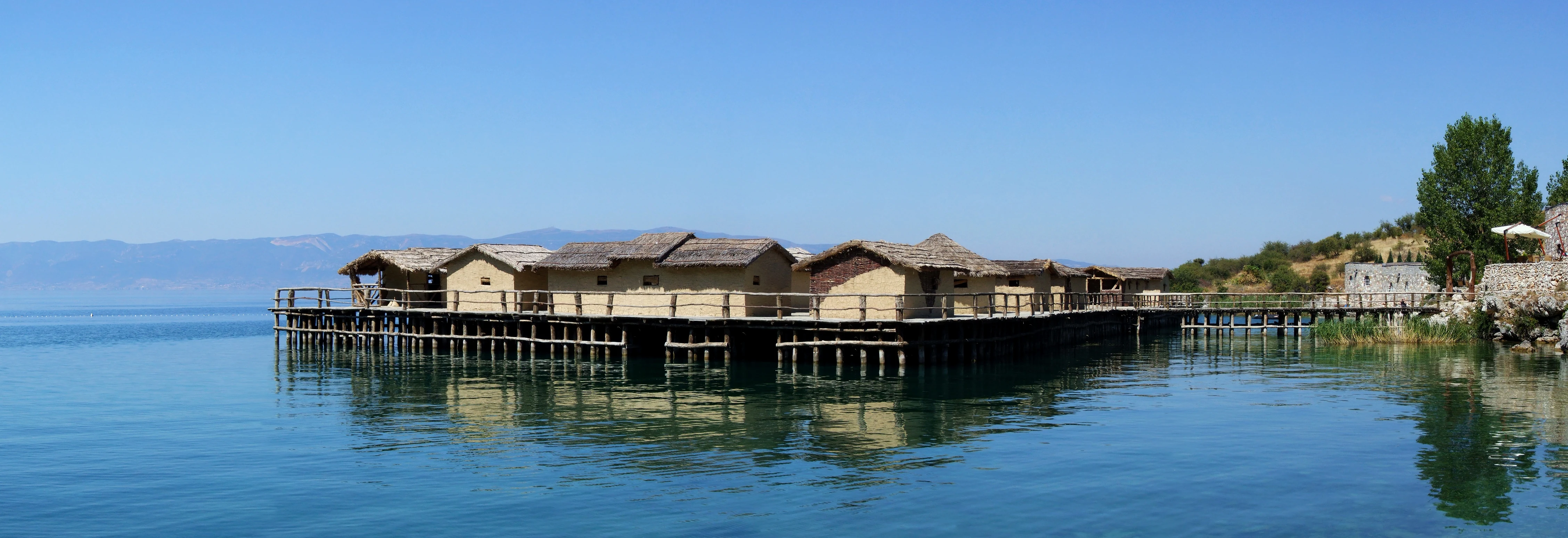
A reconstructed prehistoric pile dwelling village built on wooden stilts over the clear, calm blue water of Lake Ohrid.
The Museum on Water, a reconstructed prehistoric pile dwelling settlement on Lake Ohrid.

Lake Ohrid ecosystems, habitats, and plant life

The lake's ecological character is defined by its long evolutionary isolation and its extraordinary level of endemism. Endemic species are found across virtually every level of the food web, from microscopic diatoms and algae to benthic invertebrates, molluscs, sponges, and fish. Notable examples include the Ohrid sponge, multiple endemic snails, and several unique cyprinid fish adapted to the lake's cool, oxygen-rich deep waters.

Aquatic habitats are complemented by relict shoreline wetlands. Although much of the original marshland has been lost to drainage, agriculture, and urban expansion, fragments such as Studenchishte Marsh remain ecologically important. These wetlands act as buffers against eutrophication, provide spawning and nursery areas for native fish, and support rich birdlife, reinforcing the lake's ecological complexity at the interface of water and land.

The broader basin includes karstic springs and underground inflows that connect the lake hydrologically with nearby Lake Prespa. This subterranean linkage contributes to the lake's stable water chemistry, exceptional clarity, and the cool, oxygen-saturated conditions in its deeper layers that allow sensitive endemic organisms to thrive across a wide depth range.
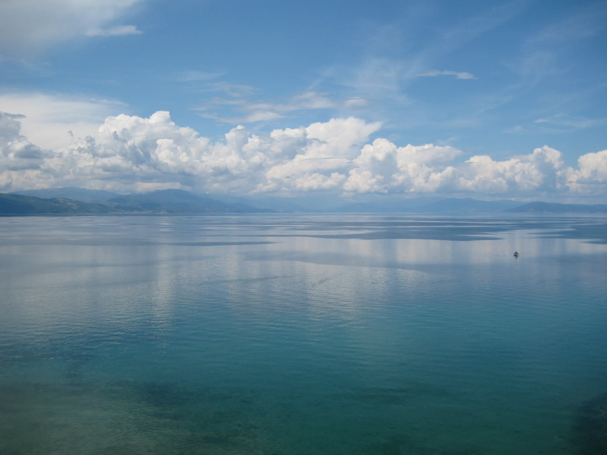
A wide, elevated view of a calm, expansive lake with clear blue water and distant hills under a partly cloudy sky.
A calm, expansive view of the clear blue waters of Lake Ohrid under a bright sky with scattered clouds.

Lake Ohrid wildlife and species highlights

Lake Ohrid is particularly notable for its endemic aquatic fauna. A substantial proportion of its native fish and a very high share of its mollusc species occur nowhere else, reflecting the lake's long evolutionary independence. Among the most iconic endemic vertebrates are the Ohrid trout and a related salmonid, both of which have faced strong fishing pressure and require ongoing conservation attention.

The lake's shoreline and remnant wetlands provide important habitat for wintering and migratory waterbirds. Rare and threatened species recorded around the lake include the Dalmatian pelican, ferruginous duck, and several eagles, while more common waterbirds such as coots, pygmy cormorants, goldeneyes, and red-crested pochards occur in significant numbers. The combination of open water, reed beds, and adjacent agricultural land supports rich seasonal bird communities that have helped secure the lake's recognition as a transboundary Important Bird Area.
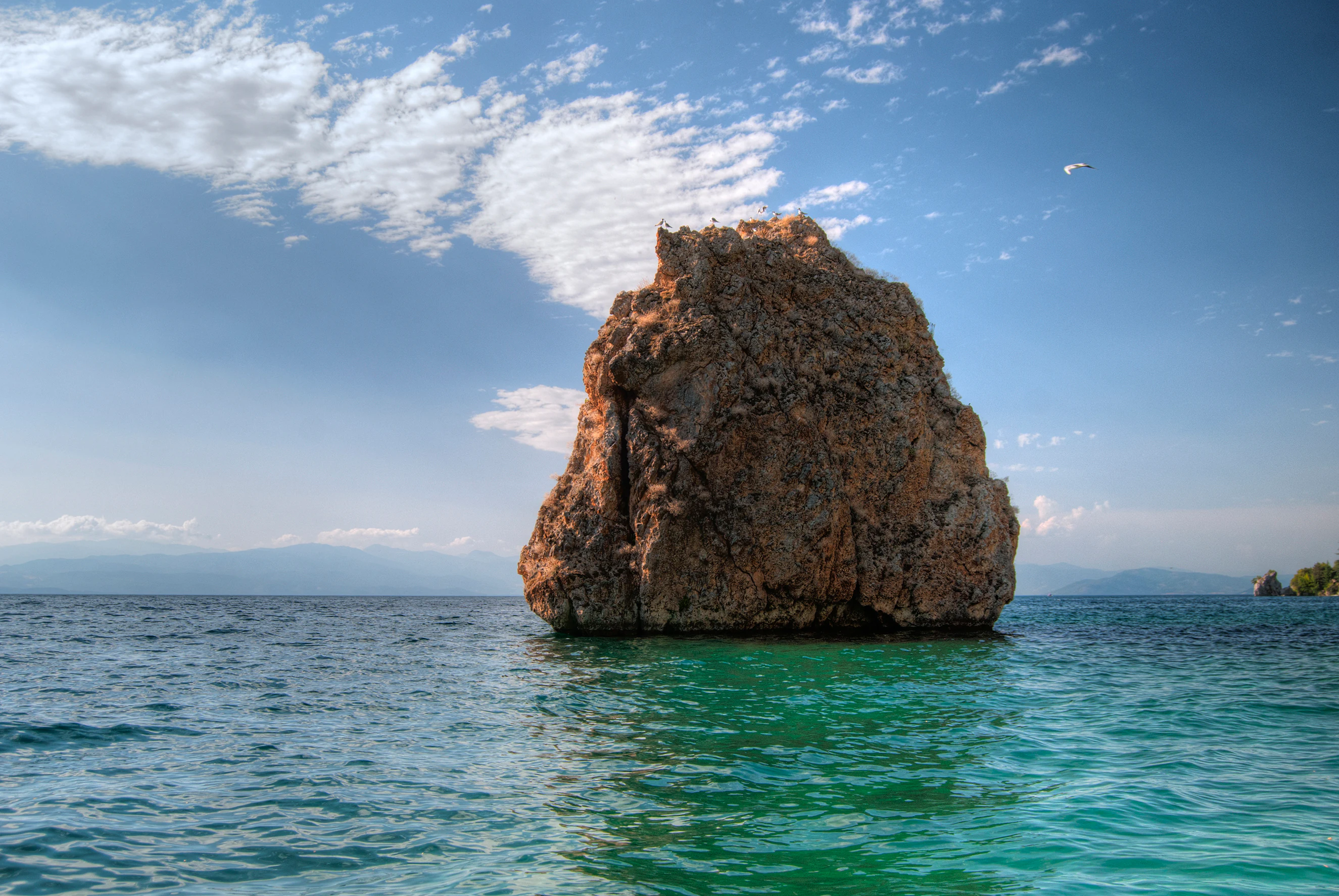
A large, weathered rock formation stands in the middle of clear turquoise lake water under a blue sky with scattered clouds.
A prominent rock formation rising from the turquoise waters of Lake Ohrid.

Lake Ohrid conservation status and protection priorities

Lake Ohrid's conservation significance is global. It is one of relatively few ancient lakes worldwide that has retained much of its original character, and its endemic biodiversity gives it exceptional scientific and ecological value. The lake and its surrounding region are protected through overlapping international instruments, including UNESCO World Heritage status, the UNESCO World Network of Biosphere Reserves, Ramsar Wetland designation, and Important Bird Area recognition for both basin countries.

Despite this protection, the lake faces serious pressures. Population growth in the catchment, urban expansion along the shore, tourism development, wastewater discharge, overfishing, and wetland drainage have all contributed to ecological stress. Phosphorus inputs have risen measurably over recent decades, and concerns about future eutrophication have prompted regional programs to upgrade sewage treatment and reduce pollution from tributaries.

International monitoring missions have underscored the need for stronger governance and integrated management. Designations as transboundary reserves and biosphere reserves reflect a cooperative approach between North Macedonia and Albania, recognizing that the long-term survival of Lake Ohrid's unique ecosystem depends on coordinated, science-based stewardship of the entire catchment.

Lake Ohrid cultural meaning and human context

Lake Ohrid has been a cradle of human settlement for millennia. Prehistoric pile dwellings near Lin in Albania, examined through Albanian and Swiss archaeological collaboration, represent some of the oldest documented agricultural communities in Europe and demonstrate that the lake has long supported sustained human life.

The city of Ohrid, on the North Macedonian shore, has served for centuries as a major religious, educational, and artistic center. Its medieval churches, monasteries, and fortifications reflect a layered history shaped by Byzantine, Slavic, and Ottoman influences, and the broader Ohrid region is recognized by UNESCO for both its natural and cultural heritage.

Traditional lakeside villages such as Struga and Pogradec, along with smaller fishing settlements, have historically depended on the lake for food and livelihoods. Although tourism now plays a major economic role, fishing remains culturally significant, and the lake continues to inspire regional literature, visual art, and folk traditions on both sides of the border.
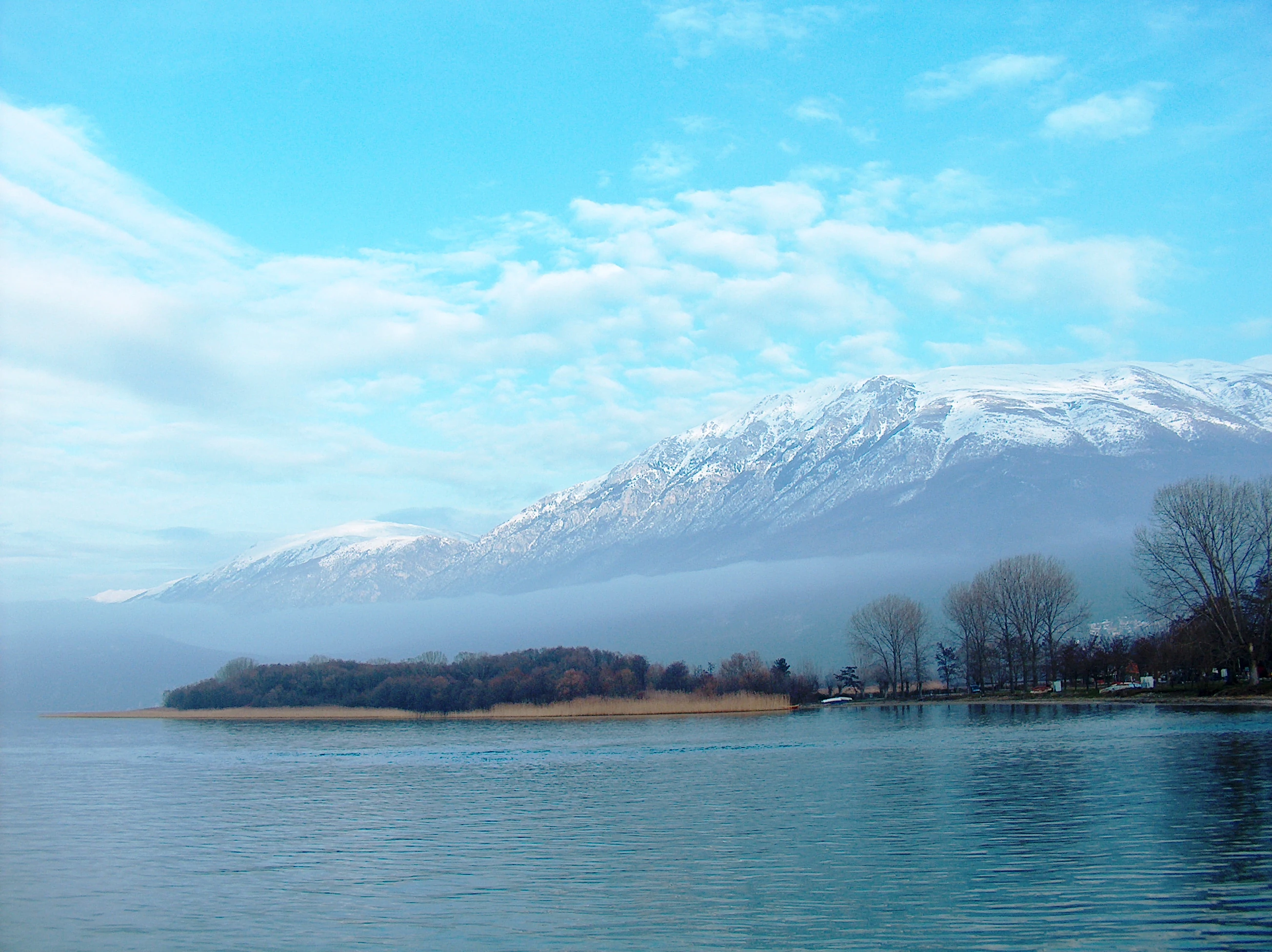
A wide shot of a calm blue lake under a light blue sky with wispy clouds, featuring a low-lying forested peninsula in the midground and a large, snow-dusted mountain range partially obscured by mist in the background.
A scenic view of Lake Ohrid with the snow-capped Galichitsa Mountain in the distance.

Top sights and standout views in Lake Ohrid

Lake Ohrid stands out for combining extraordinary ancient-lake biodiversity with a deep, continuous human cultural heritage in a single transboundary setting. Endemism across the food web, exceptional water clarity, and a tectonic basin framed by high mountains create a landscape that is both scientifically invaluable and visually striking.

Equally significant is the layered conservation architecture surrounding the lake, from UNESCO World Heritage and Biosphere Reserve status to Ramsar designation and transboundary reserves. This recognition reflects not only the lake's natural importance but also the concern of the international community for its future, given the multiple pressures of urbanization, tourism, and pollution that it continues to face.
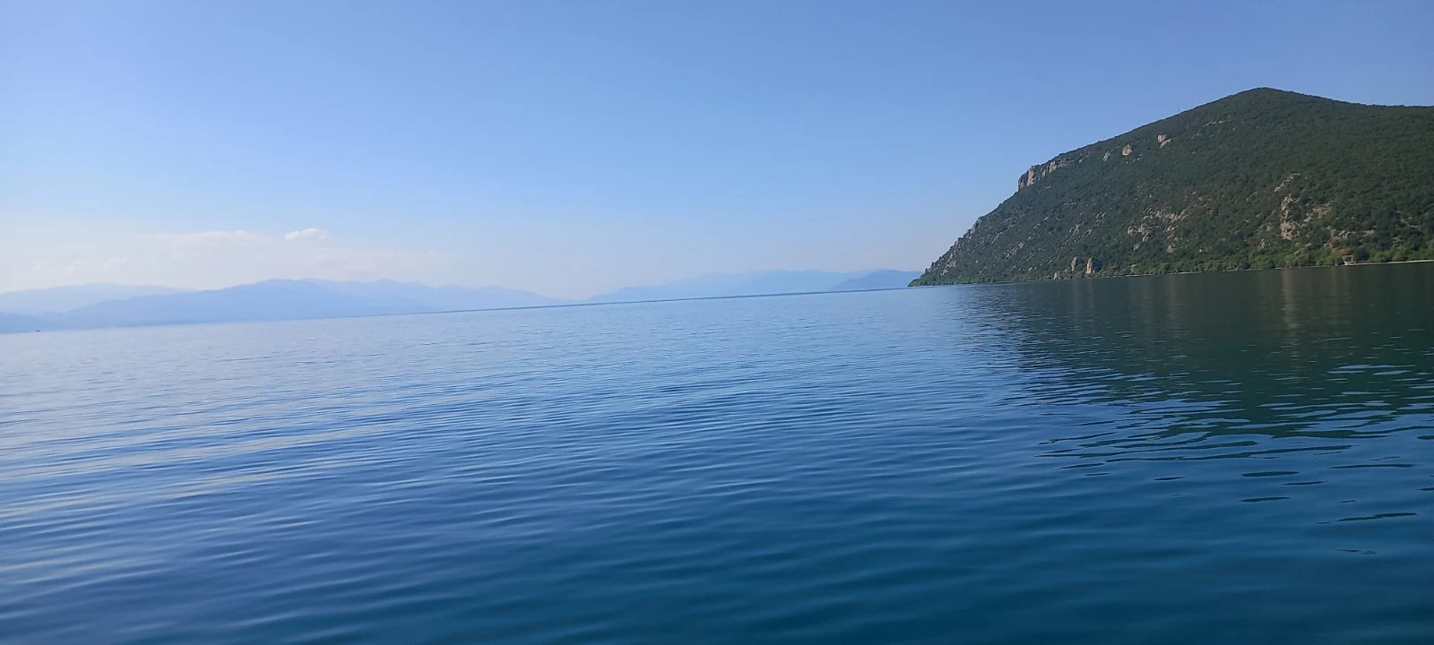
A expansive view of Lake Ohrid with deep blue water in the foreground and a green, sloping mountain rising from the shoreline on the right.
A wide view of Lake Ohrid featuring calm blue waters and a coastal hillside.

Best time to visit Lake Ohrid

Lake Ohrid experiences a relatively mild mountain-Mediterranean climate, with warm summers and cool, sometimes cold winters. Summer months bring comfortably warm temperatures, full recreational use of the shoreline, and the clearest atmospheric conditions for enjoying the lake and surrounding mountains.

Winter and shoulder seasons offer quieter atmospheres and may appeal to those interested in waterbird observation, since the lake hosts important wintering populations. Spring and early summer can be particularly rewarding for combining scenic visits with exploration of traditional settlements and cultural sites around the basin, before peak summer crowds arrive.
Monthly climate preview

Long-term representative measurements of monthly averages across the protected landscape

Lake Ohrid Climate Normals, Annual Temperature and Precipitation Rhythm

Measured temperature and precipitation normals outline a continuous annual rhythm based on historical NASA data from a representative coordinate at 1014 meters of elevation. Examining monthly weather patterns provides essential context for understanding long-term environmental conditions across the protected area.
Annual mean10 °C
0 °C22 °C
Jan
Feb
Mar
Apr
May13°
Jun18°
Jul22°
Aug22°
Sep16°
Oct11°
Nov
Dec
Warmest month
August

22 °C

Coolest month
January

-0.3 °C

Wettest month
November

3.4 mm/day

Driest month
August

0.9 mm/day

Park location guide

Geography guide, regional context, and park location map for Lake Ohrid

Lake Ohrid park geography, regions, and map view in North Macedonia

Understand where Lake Ohrid sits in North Macedonia through a broader geographic reading of the surrounding landscape, nearby location context, and its mapped position within the national park landscape.

How Lake Ohrid fits into North Macedonia

North Macedonia is a landlocked country in Southeast Europe, constituting the northern third of the historical region of Macedonia. It gained independence from Yugoslavia in 1991 and operates as a unitary parliamentary republic. The country is known for its diverse ethnic composition, with Macedonians forming the majority and Albanians as a significant minority, along with Turks, Roma, Serbs, and other groups.

Wider geography shaping Lake Ohrid in North Macedonia

North Macedonia is located in the central part of the Balkan Peninsula in Southeast Europe. It is landlocked, bordered by Greece to the south, Albania to the west, Bulgaria to the east, Kosovo to the northwest, and Serbia to the north. The terrain varies from mountainous regions to valleys and plains.

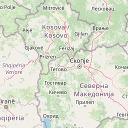
Map view of Lake Ohrid

Use this park location map to pinpoint Lake Ohrid in North Macedonia, understand its exact geographic position, and read its mapped placement within the surrounding landscape more clearly.

Pigeon | © OpenStreetMap contributors
Recorded earthquake history

Review the Historical Earthquake Catalogue for the Lake Ohrid Basin

Explore the recorded seismic history of Lake Ohrid through an organized collection of event data. This MoriAtlas resource allows for the focused review of historical earthquakes by magnitude, depth, and distance, providing a transparent view of recorded seismic activity within the surrounding mountain terrain.

Lake Ohrid Earthquake History

Catalogued events

615 events

Strongest magnitude

Magnitude 5.8

Most recent event

Sep 8, 2026

This history includes earthquakes recorded inside the park or within 50 km of its borders

Visual exploration of ancient lake waters, steep limestone slopes, and rare aquatic habitats

Lake Ohrid Photos and Mountain Landscapes in the Protected Balkans Basin

Visual records reveal the striking clarity of ancient lake waters alongside steep limestone mountain ridges and protected freshwater habitats. Examining field photography helps researchers interpret the geological terrain and ecological character of the transboundary basin.

An elevated view of the stone-built Church of St. John at Kaneo with a terracotta roof, situated on a cliffside overlooking the expansive blue expanse of Lake Ohrid.

A silhouette of a person fishing with a rod while standing in the shallow water of a lake, with the sun setting behind distant dark hills.

A reconstructed prehistoric pile dwelling village built on wooden stilts over the clear, calm blue water of Lake Ohrid.

A wide, elevated view of a calm, expansive lake with clear blue water and distant hills under a partly cloudy sky.

A large, weathered rock formation stands in the middle of clear turquoise lake water under a blue sky with scattered clouds.

High angle panoramic view overlooking the red tiled rooftops of Ohrid city, the forested hillside, and the blue expanse of Lake Ohrid under a partly cloudy sky.

A wide shot of a calm blue lake under a light blue sky with wispy clouds, featuring a low-lying forested peninsula in the midground and a large, snow-dusted mountain range partially obscured by mist in the background.

A expansive view of Lake Ohrid with deep blue water in the foreground and a green, sloping mountain rising from the shoreline on the right.

A high-angle view of a person operating a small motor boat moving across deep blue, sunlit lake water.

A person mid-air in a diving pose, jumping from a rocky cliff into the sparkling water of Lake Ohrid, with others visible on a nearby rock.

A panoramic high altitude view looking over green mountainous slopes and ridges towards a distant hazy lake.

A wide angle view of the Lake Ohrid shoreline, with a narrow pebble beach on the left, calm blue water on the right, and tree-covered mountains sloping into the lake in the background.

A black and white archival photograph showing several fishermen in a small, traditional wooden boat on Lake Ohrid, with low hills and distant shoreline buildings in the background.

A sepia-toned vintage photograph showing two men in a flat-bottomed wooden boat on Lake Ohrid, pulling in fishing nets. A shoreline and hills are visible in the background.

A sepia-toned archival photograph showing men in two small wooden boats on calm water, using oars and nets to fish.

Black and white historical photograph showing several men working with fishing nets from wooden boats on Lake Ohrid with hills in the background.

Park atlas

Compare adjacent mountain reserves and transboundary conservation landscapes

Explore Parks Near Lake Ohrid and Protected Areas in the Surrounding Region

Discover nearby national parks and related protected landscapes that share the mountainous terrain and regional geography of Lake Ohrid. Comparing adjacent reserves expands your understanding of the broader Balkan conservation network and tectonic basin ecosystems.
Watercolor painting of a river flowing through a valley with mountains and greenery
National parkKorçë County
4.6 km away#1 closest

Southeast

Prespa National Park: Protected Landscape and High-Altitude Lakes in Korçë County, Albania

Explore the geography and mapped boundaries of this vital national park.

Prespa National Park, located in Korçë County, Albania, is a protected area characterized by its significant high-altitude tectonic lakes, dramatic mountain landscapes, and vital wetland habitats. This entry provides a structured atlas-style overview of the park's geographic identity, its protected landscape features, and its ecological importance, serving as a key point of reference for understanding this unique Balkan region.

Area
276.131 km²
Established
1999
IUCN
II
Relief
Mountain
Watercolor illustration of mountains, a lake, and rolling hills with grassy vegetation.
National parkElbasan County
About 12 km away#2 closest

Northwest

Shebenik National Park: Mapped Protected Landscape and Glacial Terrain Atlas

Explore Elbasan County's significant mountain wilderness and protected natural features.

Shebenik National Park is a protected national park in Elbasan County, Albania, notable for its dramatic glacial terrain and extensive ancient forests. This park offers a deep dive into Albania's natural landscape, featuring 14 glacial lakes and serving as vital habitat. Its position within the Balkan Peninsula's geography makes it a key point of reference for understanding protected areas and mountain wilderness within a structured atlas.

Area
345.079 km²
Established
2008
IUCN
II
Relief
Mountain
A watercolor illustration of a landscape with soft green hills and a pinkish water area, set against a plain white background.
National parkWestern Macedonia
19 km away#3 closest

Southeast

Prespa National Park: Mapping the Biodiversity and Lake Landscapes of Western Macedonia

A Ramsar wetland reserve and transboundary protected area

Prespa National Park encompasses 32,700 hectares of diverse habitats, from the shallow waters of Small Prespa Lake to the surrounding forested uplands. This protected area acts as a vital sanctuary for migratory bird species and endemic plants, offering a rich look at the ecological interplay between water, floodplains, and mountain terrain in northern Greece.

Area
327 km²
Established
2009
IUCN
VI
Relief
Mixed relief
Watercolor painting of a landscape with green trees, rolling hills, and distant mountains under a light sky
National parkMunicipality of Bitola
20 km away#4 closest

East

Pelister National Park: North Macedonia's Oldest National Park and Alpine Protected Landscape

Explore unique glacial features and endemic forests within Municipality of Bitola.

Pelister National Park, a pioneering protected area in North Macedonia, offers a rich tapestry of alpine geography and unique geological formations. This page provides detailed information on the park's landscape, including its dramatic mountain massif within Municipality of Bitola, the rare Macedonian pine forests, the striking 'stone rivers' formed by ancient glacial processes, and the serene Pelister Eyes glacial lakes. Discover the park's mapped boundaries and its significance as a conservation heritage site within the Balkan Peninsula.

Area
171.5 km²
Established
1948
IUCN
II
Visitors
30K annual
A soft watercolor painting of layered rolling hills and mountains fading into the distance with small clusters of stylized trees in the foreground.
Protected landscapeAlbania
About 22 km away#5 closest

Southwest

Guri i Nikës-Lenie-Valamarë Protected Landscape: Albania Mountain and Forest Geography

A protected mosaic of Mediterranean woodlands and Pindus foothills

Spanning roughly 22 square kilometers near Pogradec, the Guri i Nikës-Lenie-Valamarë Protected Landscape protects a diverse array of forested slopes and freshwater habitats. This essential Balkan biological corridor provides a detailed look at the transition between dense woodland and scrub communities within the Pindus mountain system, highlighting its role as a key habitat for large carnivore populations.

Area
22 km²
Established
1996
IUCN
VI
Relief
Mountain
National parkNorth Macedonia
36 km away#6 closest

North

Mavrovo National Park: North Macedonia's Extensive Protected Alpine Terrain and Wildlife

Mapped geography of Alpine peaks, gorges, and unique endemic species.

Mavrovo National Park, North Macedonia's largest protected area, offers a deep dive into a complex Alpine geography. Dominated by the Šar, Korab, and Bistra mountain systems, the park features towering peaks and the dramatic Radika River gorge. This protected landscape is globally significant for its role in conserving the rare Balkan lynx and harbors endemic tertiary relic plant species like Macedonian pine. Explore the mapped boundaries, glacial lakes, and distinct terrain that define this vital conservation area.

Area
730.88 km²
Established
1949
IUCN
II
Relief
Mountain
Protected landscapeKorçë County
About 38 km away#7 closest

South

Fir of Drenovë-Sinicë Protected Landscape: Forest and Geological Map of Korçë County

Mapping Albania's protected Silver fir woodland ecosystems

Explore the structured geography of the Fir of Drenovë-Sinicë Protected Landscape, a diverse expanse in Korçë County defined by its ancient Silver fir stands and karst cave systems. This area showcases a varied landscape of rocky monoliths, mountain lakes, and tectonic valleys that serve as a vital ecological record for the southeastern Albanian mountains.

Area
10.3 km²
Established
1966
IUCN
V
Relief
Mountain
Watercolor painting showing mountains, a river, and vegetation
National parkAlbania
47 km away#8 closest

Southwest

Tomorr Mountain National Park: Sacred Peak & Karst Protected Landscape in Albania

Explore Albania's dramatic mountain geography and protected areas.

Tomorr Mountain National Park offers a unique exploration of southern Albania's dramatic limestone anticline. Dominated by the sacred Mount Tomorr and featuring the spectacular Osum Canyon, this national park provides insight into karst terrain, old-growth forests, and significant biodiversity. Discover its mapped boundaries and regional geographic context within the Pindus Mountains for structured atlas exploration.

Area
271.855 km²
Established
1956
IUCN
II
Relief
Mountain

Common questions about visiting, size, designation, and location context for Lake Ohrid

Lake Ohrid FAQs for park facts, access, geography, and protected area context

Find quick answers about Lake Ohrid, including protected-area facts, park geography, trail and visitor context, and how the park fits into its surrounding country and regional landscape.
MoriAtlas Explorer

Continue Your Protected Areas Search Across the Global Atlas

Deepen your exploration by continuing the structured search for national parks and protected areas worldwide. Utilize the comprehensive filtering capabilities to compare different conservation landscapes and refine your understanding of global park geography. Discover more about the distribution and characteristics of protected natural areas.

Global natural geography