

Mori Atlas logo
National parkLampi Island Marine National Park

Browse the mapped boundaries and regional park geography of this vital protected area.

Lampi Island Marine National Park: Protected Landscape Atlas and Geographic Context in Tanintharyi Region

Lampi Island Marine National Park represents a significant protected natural area within the Tanintharyi Region of Myanmar. As a national park, its primary value lies in its mapped boundaries and its contribution to the regional landscape context. This page provides detailed geographic information, focusing on the park's setting and its role within the broader atlas of protected lands, facilitating exploration of its terrain and conservation significance without visitor logistics.

Marine National ParkCoral ReefsMangrove ForestsASEAN Heritage ParkImportant Bird AreaMergui Archipelago

Lampi Island Marine National Park

National park

Park overview

Structured park overview, official facts, and landscape profile for Lampi Island Marine National Park

Lampi Island Marine National Park park facts, protected area profile, and essential visitor context
Review the core facts for Lampi Island Marine National Park, including designation, size, terrain, visitor scale, habitats, and operating context in one park-focused overview.

About Lampi Island Marine National Park

Lampi Island Marine National Park represents a remarkable convergence of terrestrial and marine ecosystems within the Mergui Archipelago off the coast of Tanintharyi Region in Myanmar. The park was officially established in 1996 as a marine national park, covering approximately 79 square miles of protected territory that includes multiple islands, their surrounding waters, and diverse coastal habitats. The park's ecological significance stems from its comprehensive protection of complete island ecosystems, where tropical evergreen rainforest meets coral reefs, seagrass beds, and mangrove forests in a seamless coastal interface. This variety of habitats creates one of Myanmar's most biodiverse protected areas, supporting both marine species dependent on reef and seagrass ecosystems and terrestrial wildlife inhabiting the island forests. The park's designation as an ASEAN Heritage Park acknowledges its regional importance, while its status as an Important Bird Area recognizes the avifauna diversity found within its boundaries. Management of the park falls under Myanmar's Nature and Wildlife Conservation Division, which maintains restrictions on visitor access to daytime-only activities to minimize disturbance to sensitive wildlife and habitats.

Quick facts and research context for Lampi Island Marine National Park

Lampi Island Marine National Park spans roughly 205 square kilometers across the Mergui Archipelago in southeastern Myanmar. The park was established in 1996 under the management of Myanmar's Nature and Wildlife Conservation Division. The islands feature tropical evergreen forest reaching elevations around 270 meters, with coastal mangroves, coral reefs, and seagrass beds supporting diverse marine life. The park is recognized as an ASEAN Heritage Park and Important Bird Area, reflecting its regional conservation importance.

Park context

Deeper park guide and search-rich context for Lampi Island Marine National Park

Lampi Island Marine National Park history, landscape, wildlife, and travel context
Explore Lampi Island Marine National Park through its history, landscape character, ecosystems, wildlife, conservation priorities, cultural context, and seasonal travel timing in a structured park guide built for atlas discovery and search intent.

Why Lampi Island Marine National Park stands out

Lampi Island Marine National Park is best known for its extensive coral reef systems that protect a wide range of aquatic ecosystems, and for being one of the few places in Myanmar where dugongs have been confirmed. The park's dual terrestrial-marine character is distinctive, combining lush tropical evergreen rainforest with vibrant coral reefs, seagrass beds, and mangrove environments. The presence of Lanbi Island as a core component adds riverine habitat diversity to the marine landscape.

Lampi Island Marine National Park history and protected-area timeline

Lampi Island Marine National Park was established in 1996 as Myanmar's marine national park, representing an early effort to protect the country's coastal and island ecosystems within a formal protected area framework. The creation of the park reflected growing recognition of the ecological value within the Mergui Archipelago, a vast island chain that had historically received limited conservation attention. Establishment as an ASEAN Heritage Park came as recognition of the park's significance within the regional network of protected areas, highlighting its role in protecting biodiversity across national boundaries. The designation as an Important Bird Area added another layer of conservation recognition, formalizing the park's importance for bird species conservation. Management authority rests with Myanmar's Nature and Wildlife Conservation Division, which has maintained the park's protected status while implementing access restrictions to balance conservation with limited tourism potential.

Lampi Island Marine National Park landscape and geographic character

The landscape of Lampi Island Marine National Park is characterized by a flat island terrain that rises steeply from sea level to elevations approaching 270 meters, creating a dramatic coastal profile. The park encompasses several beaches and sand-covered inlets along its coastlines, with freshwater sources and caves providing additional landscape diversity within the island interiors. The Mergui Archipelago setting places the park within a vast network of islands, with Lampi Island serving as one of the larger landmasses in the region. The combination of lowland forest covering the islands, mangrove forests along water channels, and the submerged reef environments creates a layered landscape from mountain to sea. Sand dunes appear in certain coastal areas, adding to the variety of landforms within the park's boundaries.

Lampi Island Marine National Park ecosystems, habitats, and plant life

The ecological character of Lampi Island Marine National Park reflects its position within a tropical marine environment, where diverse habitats support remarkable biodiversity. The tropical evergreen rainforest dominates the island interiors, featuring species including Dipterocarpus alatus, various Dillenia and Calophyllum trees, wild orchids, ferns, and epiphytes such as lianas. The coastal zones feature extensive mangrove forests growing along rivers and freshwater sources, with approximately 50 mangrove species documented within the park. Seagrass beds ring the eastern portions of the island, with species including Thalassianthus hemprichi, Cymodocea rotundata, Halodule uninervis, and Halophila ovalis, which provides critical forage for marine megafauna including dugongs. Coral reefs surround the islands, hosting approximately 60 coral species and supporting countless marine organisms. The park also supports significant botanical value with 17 endangered tree species recorded within its boundaries.

Lampi Island Marine National Park wildlife and species highlights

The wildlife of Lampi Island Marine National Park encompasses both terrestrial and marine species, with the park's diverse habitats supporting remarkable animal diversity. Marine megafauna presence was confirmed with dugong observations beginning in 2008, with repeated sightings and feeding trail evidence documented in subsequent years. Sea turtles are well represented, with leatherback sea turtle, green sea turtle, hawksbill sea turtle, and Oldham's leaf turtle all recorded within the park boundaries. Terrestrial mammals documented through camera trapping include smooth-coated otter, Asian palm civet, small-toothed palm civet, long-tailed macaque, northern pig-tailed macaque, dusky langur, Bengal slow loris, lesser mouse deer, wild boar, Sunda pangolin, and various squirrel species including black giant squirrel, grey-bellied squirrel, and Pallas's squirrel. Reptiles include reticulated python, water monitor, Tokay gecko, and Pope's tree pitviper. Bird species such as Nicobar pigeon and edible-nest swiftlet have been observed within the park.

Lampi Island Marine National Park conservation status and protection priorities

Lampi Island Marine National Park holds significant conservation importance as one of Myanmar's premier protected marine areas and a recognized member of the ASEAN Heritage Parks network. The park's dual protection of both terrestrial and marine ecosystems creates comprehensive conservation coverage that is relatively rare in the region. Its designation as an Important Bird Area formalizes recognition of avifauna conservation value. However, the park faces ongoing threats from fishing activities in surrounding waters, with habitat deterioration and fishing gear posing risks to marine species including sea turtles. Hunting pressure, both by local subsistence fishers and by outside hunters targeting valuable species such as mouse deer, pangolins, and wild pigs, represents a significant challenge to terrestrial wildlife populations. The restricted access policy, limiting visits to daytime hours, represents a management approach to minimize human disturbance to sensitive species and habitats.

Lampi Island Marine National Park cultural meaning and human context

Lampi Island exists within the traditional fishing grounds of local communities in the Tanintharyi Region, where fishing remains the primary source of income for coastal populations. The islands have been inhabited or used by local communities for generations, with traditional relationships between human communities and marine resources shaping the cultural landscape. Local hunting for subsistence purposes contrasts with commercial hunting by outside parties who target species for sale to fishing boats and inland markets. The park's isolation and limited access reflect both ecological sensitivity and the continuing presence of local communities within and around the protected area.

Top sights and standout views in Lampi Island Marine National Park

Lampi Island Marine National Park stands out for its comprehensive marine-terrestrial protection within the Mergui Archipelago, offering one of Myanmar's most biodiverse island ecosystems. The confirmed presence of dugongs represents a particular highlight, as these marine mammals are increasingly rare in the region. The extensive coral reef systems, supporting around 60 coral species, provide exceptional underwater environments. The combination of mangrove forests, seagrass beds, and tropical evergreen forest creates remarkable habitat diversity within a single protected area. Recognition as an ASEAN Heritage Park underscores the park's regional significance, while its status as an Important Bird Area highlights avian conservation value.

Best time to visit Lampi Island Marine National Park

The best time to visit Lampi Island Marine National Park aligns with the dry season in the Tanintharyi Region, typically from November through April, when weather conditions are most favorable for island exploration. The dry season offers clearer skies and calmer seas, making both marine activities and forest exploration more accessible. Visitors should note that access is restricted to daytime hours, requiring careful planning of activities within the park boundaries. The wet season from May through October brings heavier rainfall and potentially rougher marine conditions, which may limit access and visibility for marine activities.

Park location guide

Geography guide, regional context, and park location map for Lampi Island Marine National Park

Lampi Island Marine National Park park geography, regions, and map view in Myanmar
Understand where Lampi Island Marine National Park sits in Myanmar through a broader geographic reading of the surrounding landscape, nearby location context, and its mapped position within the national park landscape.

How Lampi Island Marine National Park fits into Myanmar

Myanmar is a Southeast Asian country with a rich history dating back to the Pagan Kingdom era. It is the largest country by area in Mainland Southeast Asia and is characterized by diverse ethnic groups, with the Bamar as the majority. The country operates under a military-led government and uses the Burmese language as its official language.

Wider geography shaping Lampi Island Marine National Park in Myanmar

Myanmar is located in northwest Southeast Asia, bordered by India and Bangladesh to the northwest, China to the northeast, Laos and Thailand to the east and southeast, and the Andaman Sea and Bay of Bengal to the south and southwest. The terrain includes mountains, plains, and river valleys centered around the Irrawaddy River.

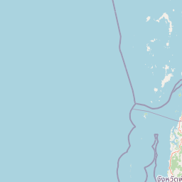
Map view of Lampi Island Marine National Park

Use this park location map to pinpoint Lampi Island Marine National Park in Myanmar, understand its exact geographic position, and read its mapped placement within the surrounding landscape more clearly.

Pigeon | © OpenStreetMap contributors

Location context for Lampi Island Marine National Park

Tanintharyi Region
Park atlas

Browse marine and terrestrial protected areas within the Mergui Archipelago, comparing diverse conservation landscapes.

Explore Nearby National Parks and Protected Areas Beyond Lampi Island Marine National Park
Continue your discovery after Lampi Island Marine National Park by browsing other national parks and protected areas across the Mergui Archipelago and its surrounding coastal regions. Compare their unique marine ecosystems, tropical island landscapes, and conservation significance to understand the broader network of protected areas in Myanmar and beyond.
National parkRanong

Laem Son National Park: A Protected National Park in Ranong's Geographic Landscape

Explore the mapped natural terrain and protected area boundaries.

Laem Son National Park is a key protected area within Thailand's Ranong province, offering valuable insights into regional geography and landscape preservation. This entry focuses on its status as a national park, providing a structured view of its protected boundaries and environmental context. Understand its unique position within the mapped geography, vital for any comprehensive atlas exploration of protected lands in the region.

Area
315 km²
Established
1983
IUCN
II
Visitors
21.9K annual
National parkPrachuap Khiri Khan Province

Ao Siam National Park: Protected Landscape and Regional Geography within Thailand

Discover the mapped boundaries and natural terrain of this Thai national park.

Ao Siam National Park is a designated national park in Thailand, located within the Prachuap Khiri Khan Province. This protected landscape offers valuable insights into the regional geography of the Kra Isthmus. Users can explore its mapped boundaries and understand its significance as a natural area within the atlas of Thai protected lands. The park's setting provides a concrete example of protected territory contributing to the region's overall geographic context.

Area
31.94 km²
IUCN
II
Relief
Lowland
Climate
Subtropical
National parkPrachuap Khiri Khan Province

Namtok Huai Yang National Park: Protected Mountain Terrain and Waterfall Atlas

Discover Prachuap Khiri Khan Province's significant natural landscape.

Namtok Huai Yang National Park is a key protected area in Thailand's Prachuap Khiri Khan Province, renowned for its distinctive montane geography shaped by the Tenasserim Hills. This national park offers a detailed view of forest ecosystems, watershed importance, and cascading waterfalls, all presented within a structured atlas framework. Users can explore the park's mapped boundaries and terrain characteristics, gaining a concrete understanding of its geographic significance and natural protected landscape.

Area
161 km²
Established
1991
IUCN
II
Visitors
26.9K annual
National parkPrachuap Khiri Khan Province

Hat Wanakon National Park: Mapped Protected Area within Prachuap Khiri Khan's Geography

Explore protected national park boundaries and regional landscape context.

Hat Wanakon National Park serves as a significant protected landscape entity within the Prachuap Khiri Khan Province region of Thailand. This national park's mapped boundaries offer insight into its territorial extent and its role within the country's network of conservation areas. Exploring this park provides a concrete example of protected land within the varied geography of the Kra Isthmus, enriching your atlas-based understanding of Thailand's natural reserves.

Area
38 km²
Established
1992
IUCN
II
Visitors
43.3K annual
National parkSurat Thani Province

Kaeng Krung National Park: Exploring Protected Area Boundaries and Regional Geography

A National Park within Surat Thani Province's diverse landscapes.

Kaeng Krung National Park is a distinct protected area situated in Surat Thani Province, Thailand. This page provides essential context for understanding the park's geographic significance, its mapped boundaries, and its contribution to the regional protected landscape atlas. Explore the fundamental geographic characteristics that define this important natural reserve and its surrounding terrain.

Area
541 km²
Established
1991
IUCN
II
Visitors
909 annual
National parkSurat Thani Province

Mu Ko Ang Thong National Park: National Park with Distinct Protected Landscape and Geographic Context

Explore mapped boundaries within Surat Thani Province, Thailand.

Mu Ko Ang Thong National Park serves as a key protected area, offering a focused study of its specific geography and landscape features within the broader atlas of Surat Thani Province. As a national park, its mapped boundaries are crucial for understanding conservation landscapes in this part of southern Thailand. Users exploring this destination will find detailed context on its natural terrain and regional geographic placement.

Area
102 km²
Established
1980
IUCN
II
Visitors
134.3K annual
National parkSurat Thani Province

Khao Sok National Park: Protected Landscape Atlas and Geographic Detail

Explore mapped boundaries and regional terrain in Surat Thani Province.

Khao Sok National Park represents a crucial protected landscape within the expansive geography of Surat Thani Province, Thailand. This detailed entry focuses on the park's identity as a national park, emphasizing its mapped boundaries and the surrounding natural terrain. Through structured information and geographic context, users can gain a clear understanding of Khao Sok National Park's place in the atlas, contributing to a more informed approach to landscape discovery.

Area
739 km²
Established
1980
IUCN
II
Visitors
419.5K annual
National parkPhang Nga Province

Khao Lak, Lam Ru National Park: Protected National Park Landscape and Geography

Explore its mapped boundaries and regional context in Phang Nga Province.

This entry focuses on Khao Lak, Lam Ru National Park, a designated national park offering a distinct protected landscape within Phang Nga Province, Thailand. It provides structured data and map context crucial for understanding its geographic scope and regional significance. Explore the park's mapped boundaries, its role as a protected area, and its contribution to the broader landscape of southern Thailand, fostering a deeper appreciation for its natural geography and atlas-derived insights.

Area
125 km²
Established
1991
IUCN
II
Visitors
72.2K annual

Common questions about visiting, size, designation, and location context for Lampi Island Marine National Park

Lampi Island Marine National Park FAQs for park facts, access, geography, and protected area context
Find quick answers about Lampi Island Marine National Park, including protected-area facts, park geography, trail and visitor context, and how the park fits into its surrounding country and regional landscape.
MoriAtlas Explorer

Continue Your Protected Areas Search Across the Global Atlas

Deepen your exploration by continuing the structured search for national parks and protected areas worldwide. Utilize the comprehensive filtering capabilities to compare different conservation landscapes and refine your understanding of global park geography. Discover more about the distribution and characteristics of protected natural areas.

Global natural geography