

Mori Atlas logo
National parkLeeuwin-Naturaliste National Park

Discover mapped natural terrain and protected boundaries within Western Australia's coastal region.

Leeuwin-Naturaliste National Park: Protected Landscape and Geography in Western Australia

Leeuwin-Naturaliste National Park stands as a significant protected area within the diverse geography of Western Australia. This page offers detailed exploration of its protected landscape identity, mapped park boundaries, and the regional geographic context it occupies. Uncover the natural terrain features that define this important national park and understand its place within the broader atlas of conservation lands in Australia.

Coastal landscapesLimestone cavesSurfing destinationsCape to Cape TrackWestern AustraliaGeological formations

Leeuwin-Naturaliste National Park

National park

Park overview

Structured park overview, official facts, and landscape profile for Leeuwin-Naturaliste National Park

Leeuwin-Naturaliste National Park park facts, protected area profile, and essential visitor context
Review the core facts for Leeuwin-Naturaliste National Park, including designation, size, terrain, visitor scale, habitats, and operating context in one park-focused overview.

About Leeuwin-Naturaliste National Park

Leeuwin-Naturaliste National Park represents one of Western Australia's most significant coastal conservation reserves, protecting a unique strip of landscape where ancient geology meets diverse ecosystems and remarkable biodiversity. The park's linear configuration follows the Leeuwin-Naturaliste Ridge, a distinctive geological formation that runs north-south parallel to the coast, comprising Tamala Limestone sitting atop the ancient Precambrian rocks of the Leeuwin Complex. This ridge forms the backbone of the park and creates a varied landscape of limestone outcrops, dunes, and coastal heath that supports remarkable ecological diversity despite the relatively narrow width of many reserve sections. The park encompasses approximately 160 kilometres of coastline, from Cape Naturaliste near Busselton to Cape Leeuwin at the southwestern tip of the Australian mainland. The coastal environment features dramatic cliffs, pristine beaches, and the famous surf breaks that have established the Margaret River region as a world-class surfing destination. Inland, the park contains numerous caves formed through the dissolution of the limestone, with over 150 known caves within the ridge system. The Margaret River itself flows through the park, feeding brackish and freshwater lakes and springs that add further ecological variety to the reserve. Since its establishment in 1957, the park has become the most visited in Western Australia, reflecting both its accessibility from Perth and the outstanding natural values it protects.

Quick facts and research context for Leeuwin-Naturaliste National Park

Leeuwin-Naturaliste National Park occupies a prominent position along Western Australia's southwestern coastline in the Augusta Margaret River and Busselton council areas. The park was established in 1957 and covers approximately 190 square kilometres across 28 separate reserves. It protects the Leeuwin-Naturaliste Ridge, a discontinuous strip of coastal dune limestone that runs parallel to the coast. The ridge is composed of Tamala Limestone, an eolianite formation, resting on the ancient metamorphic rocks of the Leeuwin Complex. The park contains over 150 caves carved into the limestone, six of which are accessible to the public. It supports diverse plant communities from coastal herblands through to tall karri and jarrah forests, and provides habitat for numerous bird and mammal species.

Park context

Deeper park guide and search-rich context for Leeuwin-Naturaliste National Park

Leeuwin-Naturaliste National Park history, landscape, wildlife, and travel context
Explore Leeuwin-Naturaliste National Park through its history, landscape character, ecosystems, wildlife, conservation priorities, cultural context, and seasonal travel timing in a structured park guide built for atlas discovery and search intent.

Why Leeuwin-Naturaliste National Park stands out

Leeuwin-Naturaliste National Park is best known for its spectacular coastal scenery where the Southern and Indian Oceans converge, world-renowned surfing beaches including Supertubes, Yallingup Beach and Smiths Beach, and the dramatic limestone rock formations of Sugarloaf Rock and Canal Rocks. The park is also famous for its extensive cave system, with six show caves open to the public including Ngilgi Cave, Mammoth Cave and Jewel Cave. The 135-kilometre Cape to Cape Track, one of Australia's great long-distance hiking trails, traverses the ridge through the park. The combination of ancient geological formations, diverse Mediterranean-type ecosystems, outstanding coastal landscapes, and exceptional outdoor recreation opportunities makes this park a cornerstone of Western Australia's natural heritage.

Leeuwin-Naturaliste National Park history and protected-area timeline

Leeuwin-Naturaliste National Park was established in 1957, created from crown lands along the Leeuwin-Naturaliste Ridge at a time when the region was transitioning from its primary industries of dairying and forestry. The establishment of the park came during a period of increasing land-use conflict as the South West region began experiencing expansion in winery development, hobby farms, and other agricultural activities that competed for the same coastal landscapes the park now protects. Prior to European settlement, the land was inhabited by Indigenous peoples, and the area retains cultural significance. The park was formally recognized as a national park under the IUCN Category II classification. In 2001, the Department of Environment and Conservation opened the Cape to Cape Track, a 135-kilometre walking trail that follows the ridge through the park and has since become one of Australia's most celebrated long-distance hikes. In December 2021, a significant bushfire began near Mammoth Cave within the park, burning more than 3,200 hectares before being contained. The fire was reported to have been deliberately lit and highlighted the ongoing management challenges facing the park in a region with increasing visitor numbers and complex land-use pressures.

Leeuwin-Naturaliste National Park landscape and geographic character

The landscape of Leeuwin-Naturaliste National Park is defined by the Leeuwin-Naturaliste Ridge, a distinctive geological corridor that runs parallel to the western coast of southern Western Australia. The ridge consists primarily of Tamala Limestone, an eolianite limestone formed from compacted coastal dunes during the Pleistocene epoch, which overlies the ancient Precambrian basement rocks of the Leeuwin Complex. The Leeuwin Complex comprises strongly metamorphosed igneous rocks, predominantly granitic and anorthositic gneisses, with the Dunsborough Fault marking its eastern boundary where it meets the sedimentary Perth Basin. The park's terrain varies considerably despite its relatively narrow coastal footprint, encompassing towering limestone and granite outcrops such as Sugarloaf Rock and Canal Rocks, dramatic coastal cliffs, and extensive aeolian dune systems. The coastline features numerous beaches backed by dunes, with well-known surf breaks including Supertubes and Yallingup Beach. The park contains brackish and freshwater lakes and springs, and is crossed by several waterways including the Margaret River, which flows through the landscape adding ecological diversity to the coastal reserve.

Leeuwin-Naturaliste National Park ecosystems, habitats, and plant life

The nature of Leeuwin-Naturaliste National Park reflects the remarkable diversity of the South West Australian floristic region, one of the world's biodiversity hotspots. The park supports a complex mosaic of plant communities that vary with soil type, elevation, and distance from the coast. Coastal areas feature herblands and grasslands, sedgelands, and heath communities that are adapted to the harsh maritime environment. Moving inland, the vegetation transitions through shrublands and woodlands to tall forests dominated by peppermint trees and Banksia shrubland. The park contains significant stands of the towering karri and jarrah eucalypts that characterise the South West forests, with karri being one of Australia's tallest tree species. The Leeuwin-Naturaliste Ridge creates a north-south ecological corridor that confines vegetation variations to narrow bands following the ridge's orientation, making it a unique linear habitat within the broader landscape. The park's geological diversity, with both limestone and granite substrates, further contributes to habitat variety and supports species adapted to different soil conditions.

Leeuwin-Naturaliste National Park wildlife and species highlights

Leeuwin-Naturaliste National Park supports a rich diversity of wildlife, particularly birdlife and native mammals that have adapted to the various habitats within the park. The park is home to a large variety of bird species, including numerous seabirds that utilise the coastal environment. Notable avian inhabitants include the red-eared firetail, white-breasted robin, rock parrot, and emu, Australia's largest bird. The diverse bird community reflects the range of habitats from coastal heath through to forest environments. Native mammals found within the park include southern brown bandicoots, western grey kangaroos, western ringtail possums, and western brush wallabies. The mammal fauna represents both ground-dwelling and arboreal species, with the western ringtail possum being a particularly characteristic species of the South West forests. The cave systems within the park also provide habitat for specialized troglobitic species adapted to the underground environment.

Leeuwin-Naturaliste National Park conservation status and protection priorities

Leeuwin-Naturaliste National Park faces significant conservation challenges stemming from its location in one of Western Australia's most sought-after coastal regions. The park was created from crown lands at a time when the main primary industries of dairying and forestry were giving way to increased land-use conflict from the expansion of wineries, hobby farms, and residential development. The national park occupies land considered among the most vulnerable in the region due to its coastal setting, fragmented nature, and the pressures of surrounding agricultural and viticultural activities. Managing the park requires balancing its high visitation levels, with over two million annual visitors, against the need to protect the delicate limestone ecosystems, cave systems, and diverse vegetation communities. The 2021 bushfire that burned more than 3,200 hectares demonstrated the vulnerability of the park to fire and the complexity of managing a reserve that exists within a modified landscape. Conservation efforts focus on maintaining the integrity of the ridge system as an ecological corridor while accommodating the significant public use the park receives.

Leeuwin-Naturaliste National Park cultural meaning and human context

The Leeuwin-Naturaliste National Park sits within the traditional lands of the Noongar people, the Indigenous custodians of the South West region of Western Australia. The area holds cultural significance for Aboriginal peoples, and the park contains or passes through several historic sites including the Cape Leeuwin water wheel, which represents European settlement-era development along the coast. The two capes that bookend the park, Cape Leeuwin and Cape Naturaliste, have historically served as navigation points for maritime activity along the southern Western Australian coast. Cape Leeuwin marks the point where the Indian and Southern Oceans meet and has been an important location for maritime signalling and settlement. The region's more recent history involves the development of the Margaret River wine region, which surrounds portions of the park and creates a complex interface between protected natural landscape and agricultural land use.

Top sights and standout views in Leeuwin-Naturaliste National Park

Leeuwin-Naturaliste National Park offers exceptional highlights that make it Western Australia's flagship coastal reserve. The Cape to Cape Track provides one of Australia's premier long-distance hiking experiences, winding 135 kilometres along the ridge between the two namesake capes. The six show caves, including the semi-guided Ngilgi Cave, self-guided Calgardup and Mammoth caves, and guided Lake, Giants, and Jewel caves, offer visitors the chance to explore the underground world carved into the limestone. The coastal features including Sugarloaf Rock, Canal Rocks, and the famous surf breaks of Supertubes and Yallingup attract both surfers and sightseers. The park's position at the meeting point of the Indian and Southern Oceans at Cape Leeuwin holds particular geographic significance. The diversity from coastal cliffs and beaches through to tall karri and jarrah forests provides remarkable scenic variety within a single protected area.

Best time to visit Leeuwin-Naturaliste National Park

Leeuwin-Naturaliste National Park can be visited year-round, though the optimal time for experiencing the park depends on desired activities. The Southern Hemisphere summer from December through February offers warm conditions ideal for beach activities and surfing, with average temperatures in the mid-20s Celsius, though this period also coincides with peak visitor numbers. Autumn from March to May brings milder temperatures and fewer crowds, making it an excellent time for bushwalking on the Cape to Cape Track and exploring the caves. Winter from June to August sees cooler temperatures and increased rainfall, which can make some trails muddy but also brings the landscape to life with wildflowers beginning to bloom in spring. Spring from September to November offers pleasant weather, increasingly wildflower displays, and moderate visitor numbers, making it a good all-round time to visit. The cave environments remain relatively stable year-round, making them suitable for visiting in any season.
Park location guide

Geography guide, regional context, and park location map for Leeuwin-Naturaliste National Park

Leeuwin-Naturaliste National Park park geography, regions, and map view in Australia
Understand where Leeuwin-Naturaliste National Park sits in Australia through a broader geographic reading of the surrounding landscape, nearby location context, and its mapped position within the national park landscape.

How Leeuwin-Naturaliste National Park fits into Australia

Australia is a constitutional monarchy and federal parliamentary democracy comprising six states and ten territories. With a population of nearly 28 million, it is one of the world's most urbanised countries, with most people concentrated on the eastern seaboard. The country has a high Human Development Index and is known for its cultural diversity, ancient Aboriginal heritage, and unique wildlife.

Wider geography shaping Leeuwin-Naturaliste National Park in Australia

Australia occupies the entire Australian continent, the island of Tasmania, and numerous smaller islands. It is the world's flattest and driest inhabited continent, featuring vast deserts in the interior (the Outback), tropical rainforests along the eastern coast, and a coastline bordering the Indian and Pacific Oceans.

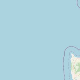
Map view of Leeuwin-Naturaliste National Park

Use this park location map to pinpoint Leeuwin-Naturaliste National Park in Australia, understand its exact geographic position, and read its mapped placement within the surrounding landscape more clearly.

Pigeon | © OpenStreetMap contributors

Location context for Leeuwin-Naturaliste National Park

Western Australia
Park atlas

Map the diverse protected landscapes and regional park context around Western Australia's famed coast.

Explore Other Coastal Protected Areas and National Parks Near Leeuwin-Naturaliste National Park
Browse an atlas of national parks and protected areas adjacent to Leeuwin-Naturaliste National Park, tracing the distinct coastal ecosystems and geological features across Western Australia. Compare the regional spread of conservation efforts, trace connected protected landscapes, and expand your understanding of Western Australia's diverse natural heritage.
National park

Forest Grove National Park: Mapped Boundaries of a Jarrah Forest Protected Landscape

Western Australia's National Park in the Margaret River Region.

Forest Grove National Park represents a vital protected area within Western Australia's Jarrah Forest bioregion, offering a clear look at the characteristic tall open forest and woodland ecosystems of the region. While nearby areas are known for their dramatic coastlines, this national park highlights the inland natural terrain and its unique ecological importance. Its mapped boundaries are integral to understanding the contiguous forest corridors developed to preserve these valuable Southwest Australian habitats.

Area
13.79 km²
Established
2004
Relief
Lowland
Climate
Temperate
National parkWestern Australia

Scott National Park National Park: Mapped Protected Landscape in Western Australia

Geographic Context and Natural Terrain Discovery

Scott National Park serves as a significant protected area within the diverse geography of Western Australia. This national park provides a focal point for understanding regional landscape patterns and mapped natural features. Explore its role as a protected land, offering insight into the state's broad natural heritage and supporting detailed geographic discovery for atlas enthusiasts.

Area
32.73 km²
Established
1959
IUCN
II
Relief
Lowland
National parkWestern Australia

Wooditjup National Park: Protected Forest Landscape and Regional Geographic Context

Explore mapped boundaries of this Western Australia national park.

Wooditjup National Park stands as a testament to Western Australia's unique forest ecosystems, specifically within the Jarrah Forest bioregion. This protected area offers a distinct natural landscape contrasting with the nearby coastal attractions of Margaret River. Delve into the park's mapped geography, understand its role as a national park, and appreciate its position within the broader South West Australian landscape and its traditional Wardandi Country heritage.

Area
38.92 km²
Established
2004
IUCN
II
Relief
Lowland
National parkWestern Australia

Blackwood River National Park: Protected Area in Western Australia's Geography

Explore mapped boundaries and natural terrain.

Blackwood River National Park is a key protected area within the vast geographic expanse of Western Australia. This park's designation as a national park underscores its importance for conservation and landscape preservation. Users can explore its precisely mapped boundaries to understand its footprint and its contribution to the regional natural landscape context, offering a grounded perspective on protected lands within Australia.

Area
204.75 km²
Established
2004
IUCN
II
Relief
Upland
National park

Wiltshire-Butler National Park: Mapped Jarrah Forest Landscape in Western Australia

Explore protected boundaries and regional geographic context

Wiltshire-Butler National Park stands as a protected natural area celebrated for its representation of Western Australia's iconic jarrah forest ecosystems. This National Park, created in 2004, offers rich opportunities for atlas-based discovery, focusing on its distinct landscape character, mapped park boundaries, and its geographical placement within the broader South West region. Understanding its terrain and conservation significance provides valuable insight into the protected lands of the Jarrah Forest bioregion.

Area
116.45 km²
Established
2004
IUCN
II
Relief
Highland
National park

Yelverton National Park National Park: Mapped Protected Area & Biodiversity Refuge

Focusing on rare species and diverse vegetation communities.

Yelverton National Park, situated in the South West region of Western Australia, serves as a vital protected area dedicated to preserving ecological significance. Established from former timber reserves, its 729 hectares capture diverse vegetation types crucial for rare and priority species. This park's landscape identity lies in its role as a biodiversity refuge, distinct from nearby tourism hubs, offering a unique insight into conservation-driven land management and the mapped protected geography of the region.

Area
7.29 km²
Established
2004
IUCN
II
Scope
Terrestrial
National park

Hilliger National Park: Western Australian Protected Jarrah Forest and Memorial Landscape

Mapped boundaries of a vital national park in the South West region.

Hilliger National Park stands as a testament to forest conservation in Western Australia's South West. This 16,962-hectare national park, established in 2004, protects representative old-growth jarrah forest ecosystems and honors a significant firefighting legacy. Explore its terrain and its geographic placement within a broader network of protected lands, offering a concrete example of conservation strategy in the region. The park's mapped area contributes valuable data to the understanding of regional natural landscapes.

Area
169.62 km²
Established
2004
Climate
Temperate
Scope
Terrestrial
National parkAustralia

Milyeannup National Park: Explore its Protected Landscape and Geographic Atlas Context

Discover the mapped terrain and boundaries of this Australian national park.

Milyeannup National Park offers a unique focus for atlas-based geographic exploration. This entry details the park's identity as a protected area, highlighting its landscape context and mapped geographic features within Australia. Use this resource to understand its role in the national park system and its specific place within the broader landscape.

Area
186.92 km²
Established
2004
Scope
Terrestrial
Forest
Mostly forested

Common questions about visiting, size, designation, and location context for Leeuwin-Naturaliste National Park

Leeuwin-Naturaliste National Park FAQs for park facts, access, geography, and protected area context
Find quick answers about Leeuwin-Naturaliste National Park, including protected-area facts, park geography, trail and visitor context, and how the park fits into its surrounding country and regional landscape.
MoriAtlas Explorer

Continue Your Protected Areas Search Across the Global Atlas

Deepen your exploration by continuing the structured search for national parks and protected areas worldwide. Utilize the comprehensive filtering capabilities to compare different conservation landscapes and refine your understanding of global park geography. Discover more about the distribution and characteristics of protected natural areas.

Global natural geography