
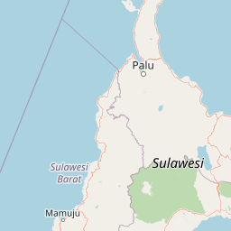
Peaks
Park geography
Detailed terrain analysis, peak elevation data, and regional land characteristics.
Comprehensive Geographic Profile and Mapped Boundaries of Lore Lindu National Park
Analyze the structural landscape of Lore Lindu National Park located within Central Sulawesi, Indonesia. This profile details the 2180 square kilometer protected area, featuring an elevation range from 200 to 2610 meters and diverse mountain, valley, and forest terrain across its 524 kilometer perimeter.
Related tags
UNESCO Biosphere ReserveEndemic Bird SpeciesMegalithic SitesMontane ForestsTropical Rainforest
Sulawesi's forest sanctuary of endemic wildlife and ancient megaliths
Lore Lindu National Park
Lore Lindu National Park is a protected forest area in the heart of Sulawesi, Indonesia, spanning approximately 2,180 square kilometers across both lowland and montane ecosystems. The park rises from 200 meters to over 2,600 meters above sea level, encompassing a remarkable range of tropical forest environments from valley floors to sub-alpine zones. Located in Central Sulawesi province, the national park serves as a critical refuge for the island's extraordinary endemic biodiversity, providing habitat for 77 bird species found nowhere else on Earth. Beyond its ecological significance, Lore Lindu contains one of Indonesia's most important archaeological landscapes, with over 400 granite megaliths scattered through its valleys dating from 3000 BC to 1300 AD. The park was designated a UNESCO Biosphere Reserve in 1978, recognizing its dual importance as both a conservation champion and a living cultural landscape.
- Location
- Indonesia
- Park type
- National park
- Established
- 1982
- Area
- 2,180 km²
Location overview
Administrative boundaries and regional classification within Indonesia
Geographic Location of Lore Lindu National Park in Central Sulawesi
Lore Lindu National Park is situated within Central Sulawesi, Indonesia and associated with American Samoa. Registered records verify its status as an inland, non-transboundary protected area.
- Countries
- Indonesia
- Regions
- Central Sulawesi
- Primary location
- Central Sulawesi
- Geographic setting
- Inland
Boundary and coordinates
Lore Lindu’s park outline maps a recorded 2,180 km²
Lore Lindu National Park mapped boundary and 2,180 km² area
Lore Lindu National Park’s geometry maps a protected extent of 2,180 km². It gives the national park a clear spatial frame for discovery while avoiding any claim of official survey authority.
- Boundary area
- 2,155.1 km²
- Boundary perimeter
- 524.7 km
- Northernmost point
- 1.0701° S
- Southernmost point
- 1.968° S
- Easternmost point
- 120.37° E
- Westernmost point
- 119.9304° E
- Geographic centre
- 1.4903° S, 120.1576° E
- North–south span
- 99.3 km
- East–west span
- 48.9 km
Elevation and terrain
Recorded vertical relief ranges across mountain peaks and streams.
Lore Lindu National Park Elevation and Terrain Summary
Elevation records show a mixed terrain profile spanning from two hundred meters to two thousand six hundred ten meters. Associated feature cards detail individual peaks and streams located within protected boundaries.
- Minimum elevation
- 200 m
- Maximum elevation
- 2,610 m
Selected named natural features
Peaks
Bulu Bomba
Peaks
Bulu Popotondoa
Peaks
Bulu Busanga
Peaks
Bulu Kalamunti
Peaks
Bulu Tolipo
Environmental setting
Analysis of tropical relief zones, forest cover, and habitat classifications
Lore Lindu National Park Environmental Settings and Mapped Classifications
Recorded landscape features, habitat types, and climate classifications provide structured insight into physical settings across Lore Lindu National Park. Associated atlas entries connect these baseline environmental categories to broader geographic contexts.
- Relief
- Mixed relief
- Climate
- Tropical
- Water
- Minor water
- Forest cover
- Mostly forested
- Seasonality
- Year-round
Landscape features
Forest · Valleys · Mountains · Lakes
Habitat types
Tropical forest · Montane forest · Riverine habitat · Lacustrine habitat
Park atlas
Map the Regional Spread of Protected Areas Surrounding Lore Lindu National Park in Central Sulawesi
Discover Other National Parks and Protected Areas Near Lore Lindu National Park
Extend your atlas-style exploration beyond Lore Lindu National Park to discover other national parks and protected areas within Central Sulawesi and its surrounding landscapes. Trace how conservation efforts connect diverse lowland and montane forest ecosystems across the region.
National parkWest Sulawesi
About 135 km away#1 closest
Southwest

Gandang Dewata National Park: Protected Area Identity and Geographic Context in West Sulawesi
Explore mapped boundaries and regional landscape.
Delve into the protected landscape of Gandang Dewata National Park, a key national park situated in West Sulawesi. This resource offers a detailed geographic perspective, emphasizing its mapped boundaries and its position within the regional atlas. Understand the park's protected-area status and its contribution to the natural geography of Indonesia, serving as a vital point for atlas exploration.
- Area
- 793.42 km²
- Established
- 2016
- IUCN
- II
- Relief
- Mountain
National parkTojo Una-Una Regency
About 209 km away#2 closest
Northeast
Kepulauan Togean National Park: Protected Marine Atlas and Island Landscape Geography
Explore Tojo Una-Una Regency's vital coral reef ecosystems and mapped island geography.
Kepulauan Togean National Park is a critically important marine protected area located within the Tojo Una-Una Regency of Indonesia. This national park is celebrated globally for its position at the center of the Coral Triangle, housing the most diverse array of coral species found anywhere on Earth. The park's landscape is defined by an archipelago of islands featuring a complex interplay of coral reefs, seagrass beds, and mangrove forests, creating a rich tapestry of marine habitats. Its geographic location also makes it a significant biogeographical crossroads, influencing the distribution of marine fauna between Asian and Australian regions.
- Area
- 3,626 km²
- Established
- 2004
- IUCN
- II
- Relief
- Lowland
National parkSouth Sulawesi
About 328 km away#3 closest
South
Bantimurung-Bulusaraung National Park: National Park Protected Landscape Identity and Geographic Setting
Mapped boundaries and regional atlas context for this South Sulawesi park.
Bantimurung-Bulusaraung National Park is an important protected area in South Sulawesi, Indonesia, designated as a national park. This entry provides a focused look at its geographic scope, mapped outlines, and the characteristics that define it as a protected landscape. Understanding this park's specific terrain and regional setting is key to appreciating its role within the broader atlas of natural areas and conservation efforts.
- Area
- 437 km²
- Established
- 2004
- IUCN
- II
- Visitors
- 600K annual
National parkSouth East Sulawesi
About 333 km away#4 closest
Southeast
Rawa Aopa Watumohai National Park: Geographic Atlas and Protected Landscape Overview
Explore Rawa Aopa Watumohai National Park's mapped boundaries.
Gain a clear understanding of Rawa Aopa Watumohai National Park, a designated national park in South East Sulawesi. This entry offers insight into its protected landscape identity, mapped geographic features, and its specific location within the regional atlas. It serves as a focused point for comprehending the park's protected area context and its contribution to Indonesian natural geography.
- Area
- 1,050 km²
- Established
- 1989
- IUCN
- II
- Relief
- Mixed relief
National parkEast Kalimantan
About 337 km away#5 closest
Northwest
Kutai National Park: Protected Area Details and East Kalimantan Geography
Explore the mapped boundaries and regional landscape context.
Kutai National Park, a designated national park in Indonesia's East Kalimantan region, offers rich opportunities for geographic discovery. This resource focuses on the park's protected area status, its distinct landscape characteristics, and its mapped distribution within the broader regional geography. Gain a structured understanding of Kutai National Park's environmental significance and its contribution to conservation landscapes through detailed map context and geographic analysis.
- Area
- 1,986 km²
- Established
- 1982
- IUCN
- II
- Relief
- Lowland
National parkSulawesi
About 423 km away#6 closest
Northeast
Bogani Nani Wartabone National Park: A National Park Within Sulawesi's Geographic Atlas
Explore mapped protected landscape and regional terrain.
Bogani Nani Wartabone National Park represents a vital protected area within Sulawesi, Indonesia. This dedicated page provides an atlas-oriented view, focusing on its distinct landscape character, geographic placement, and mapped boundaries. Understand the park's role as a conservation landscape and how its terrain contributes to the regional geography, forming a crucial component of mapped natural areas.
- Area
- 2,871.15 km²
- Established
- 1991
- IUCN
- II
- Climate
- Tropical
National parkIndonesia
About 533 km away#7 closest
South
Taka Bonerate National Park: National Park Geography and Protected Landscape Atlas
Understand the mapped boundaries and regional context of Taka Bonerate National Park
Explore Taka Bonerate National Park as a key protected area within Indonesia, focusing on its geographic identity and atlas significance. This entry provides structured information on the park's role as a national park, highlighting its landscape context and mapped terrain. Users can gain a clear understanding of Taka Bonerate National Park's place within Indonesia's diverse geography and its protected land features through detailed map-oriented discovery.
National parkNorth Sulawesi
About 579 km away#8 closest
Northeast
Bunaken National Park: Indonesian National Park Geography and Mapped Boundaries
Explore North Sulawesi's protected marine landscape.
Bunaken National Park stands as a key protected area within Indonesia's North Sulawesi region, offering essential insights for geographic discovery and atlas exploration. This page focuses on the park's mapped boundaries and its identity as a national park, providing a structured view of its landscape context. Understand the distribution and significance of conservation areas in North Sulawesi through detailed, fact-based information.
- Area
- 890.65 km²
- Established
- 1991
- IUCN
- II
- Visitors
- 35K annual
MoriAtlas Explorer
Continue Exploring Lore Lindu National Park's Protected Landscape and Geography
Further your understanding of Lore Lindu National Park by delving into its specific geographic context and protected area attributes. Examining its mapped terrain and regional landscape elements offers essential insights into conservation significance and the unique natural and cultural heritage of Central Sulawesi. This exploration into the park's atlas-defined features provides a deeper appreciation of its role as a vital protected landscape.
Browse next
Global natural geography
Explore related park routes
Explore MoriAtlas Global ParksBrowse All MoriAtlas ParksGlobal Park Map DiscoveryMoriAtlas: Browse All CountriesBrowse All MoriAtlas ContinentsNational Park Environment AtlasGrand Canyon National Park AtlasYellowstone National Park AtlasYosemite National Park Atlas and GeographySerengeti National Park AtlasGalápagos National Park Protected LandscapeBanff National Park Geography and AtlasKruger National Park Atlas EntryUluṟu-Kata Tjuṯa National Park AtlasExplore Uluru-Kata Tjuta National Park GeographyPlitvice Lakes National Park AtlasFiordland National Park Protected LandscapeGreat Smoky Mountains National Park AtlasAfghanistan National Parks and Protected AreasAlbania National Parks and Protected AreasAlgeria National Parks and Protected AreasAmerican Samoa National Parks and Protected AreasAndorra National Parks and Protected AreasAngola National Parks and Protected AreasAntarctica National Parks and Protected AreasAntigua and Barbuda Park List