
Rivers
Park geography
Mapped boundaries, terrain elevation, and environmental feature distribution
Geography and Physical Profile of Los Katíos National Natural Park in Colombia
This geographic profile details the physical landscape of Los Katíos National Natural Park, spanning the Chocó and Antioquia departments of Colombia. Discover data regarding its 720 square kilometer area, elevation range from 50 to 600 meters, and diverse forest and wetland habitats.
Related tags
Tropical RainforestWetlandsBiodiversity HotspotUNESCO World Heritage SiteBirdwatching
A biodiversity-rich protected area in Colombia's Darién Gap, protecting crucial habitats where Central and South American species intersect
Los Katíos National Natural Park
Los Katíos National Natural Park is a protected area spanning approximately 720 square kilometers along the border region of northwestern Colombia, encompassing parts of both Antioquia and Chocó departments. The park sits within the famous Darién Gap, a vast tract of contiguous tropical forest that extends into Panama, forming one of the most ecologically significant corridors in the Americas. Established in 1974, Los Katíos protects a remarkably diverse landscape ranging from the rugged Serranía del Darién mountains in the western portion to the fertile Atrato River floodplains in the east, with extensive swampy marshes covering nearly half of its total area. The park's extraordinary biodiversity earned it UNESCO World Heritage status in 1994, recognizing its role as a critical center of endemism where species from North and South America converge. The region's position on the southern edge of the Central American land bridge has made it a natural pathway for species exchange throughout geological time, creating a unique ecological blend found nowhere else in South America.
- Location
- Colombia
- Park type
- National park
- Established
- 1974
- Area
- 720 km²
- Highest point
- 600 m
Location overview
Transboundary Landscape Spanning the Chocó and Antioquia Regions
Geographic Setting of Los Katíos National Natural Park in Colombia
Los Katíos National Natural Park is located in Colombia, spanning Chocó Department and Antioquia Department. Regional records document its status as a transboundary protected area with no coastal or marine zones.
- Countries
- Colombia
- Regions
- Antioquia Department, Chocó Department
- Primary location
- Colombia
- Geographic setting
- Transboundary · Inland
Boundary and coordinates
Mapped spatial geometry and derived boundary measurements
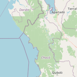
Los Katíos National Natural Park Boundary Map and Geographic Extent
Visual boundary mapping establishes reliable spatial context for the protected territory. Accompanying measurements detail total geographic area, coordinate limits, and regional span.
- Boundary area
- 779.6 km²
- Boundary perimeter
- 184 km
- Northernmost point
- 7.9695° N
- Southernmost point
- 7.6787° N
- Easternmost point
- 77.0058° W
- Westernmost point
- 77.3981° W
- Geographic centre
- 7.8105° N, 77.1843° W
- North–south span
- 32.2 km
- East–west span
- 43.3 km
Elevation and terrain
Mixed relief elevation range spanning fifty to six hundred meters
Los Katíos National Natural Park Elevation and Terrain Features
Recorded elevation summaries outline a mixed vertical range reaching six hundred meters across the protected terrain. Linked natural feature cards detail peaks, rivers, streams, and wetlands located within the boundaries.
- Minimum elevation
- 50 m
- Maximum elevation
- 600 m
- Highest point
- 600 m
Selected named natural features
Streams
Quebrada Tembladera
Streams
Quebrada Gertrudiz
Streams
Río Tilupo
Rivers
Caño Posturero
Peaks
Alto de la Guillermina
613.8 m
Environmental setting
Tropical climate zones, dominant forest cover, and mixed relief classifications
Los Katíos National Natural Park Environmental Classification and Physical Setting
Recorded landscape features and habitat types serve as interpretive categories for the physical setting of Los Katíos National Natural Park. Stored classifications connect recorded environmental traits to relevant atlas destinations.
- Relief
- Mixed relief
- Climate
- Tropical
- Water
- Water-dominated
- Forest cover
- Dense forest cover
Landscape features
Mountains · Hills · Forest · Wetland · Rivers · Waterfalls · Marsh
Habitat types
Tropical forest · Wetland · Riverine habitat
Park atlas
Beyond Los Katíos, discover contiguous protected areas and compare the diverse landscapes of the Colombia-Panama border region.
Explore Other National Parks and Protected Areas Near Los Katíos National Natural Park
Browse other significant national parks and protected areas located near Los Katíos National Natural Park, including those within the expansive Darién Gap and along the Colombia-Panama border. This curated selection allows for direct comparison of diverse regional ecosystems, offering deeper insights into transboundary conservation efforts and varied protected landscapes.
National parkDarién Province
Park boundaries overlap#1 closest
West

Darién National Park: Darién Province National Park Geographic and Map Exploration
Discover its protected landscape and regional geographic context.
Darién National Park serves as a key protected area within Darién Province, offering an essential focus for geographic and atlas-based discovery. This dedicated park detail page provides insights into its mapped boundaries and its significance as a national park. Users can explore the park's specific geographic footprint and its place within the regional landscape, facilitating a structured understanding of protected natural areas. Dive into the mapped terrain and conservation landscape context that defines Darién National Park for comprehensive atlas exploration.
- Area
- 5,790 km²
- Established
- 1980
- IUCN
- II
- Relief
- Mountain
Wildlife reserveColombia
About 56 km away#2 closest
North

Playona Acandí Fauna and Flora Sanctuary: Colombia's Wildlife Reserve Atlas and Protected Landscape
Explore protected area boundaries and natural terrain.
Delve into the geographic identity of Playona Acandí Fauna and Flora Sanctuary, a protected wildlife reserve in Colombia. This destination offers detailed mapping of its protected landscape, providing context for its natural terrain and its significance within the national atlas of conservation areas. Understand the specific geographic features that define this important wildlife sanctuary.
- Area
- 262.32 km²
- Relief
- Lowland
- Climate
- Tropical
- Scope
- Mixed
National parkColombia
About 135 km away#3 closest
Southeast
Paramillo National Natural Park: Colombia's National Park Geographic Identity and Protected Landscape
Mapped protected area within Colombia's natural geography.
Gain a structured understanding of Paramillo National Natural Park, a significant protected landscape within Colombia. This detailed entry focuses on the park's geographic context, its role as a national park, and its mapped boundaries. It serves as a crucial reference point for exploring Colombia's diverse protected areas and understanding their placement within the nation's regional geography.
- Scope
- Terrestrial
National parkColombia
About 154 km away#4 closest
Southeast
Las Orquídeas National Natural Park: Colombia's Biodiversity Hotspot and Andean Ecosystem Atlas
Explore its unique elevational gradient and protected terrain.
Las Orquídeas National Natural Park in Colombia is renowned for its dramatic elevational range, compressing multiple distinct ecosystems into a single protected area. This national park offers an exceptional view of Andean geography and Chocó biogeographic region biodiversity, transitioning from tropical rainforest to high-altitude páramo. Investigate the mapped landscape and the conservation significance of this unique natural treasure.
- Area
- 287.53 km²
- Established
- 1974
- IUCN
- II
- Relief
- Mountain
National parkChocó Department
About 186 km away#5 closest
South
Utría National Natural Park: National Park Protected Landscape and Geography
Explore its mapped boundaries and regional context in Chocó.
As a designated national park, Utría National Natural Park offers a unique lens for understanding Colombia's protected landscapes. This entry provides essential geographic context, detailing the park's location within the Chocó Department and highlighting its significance as a mapped natural area. Discover the protected boundaries and regional landscape character through structured atlas data.
- Area
- 543.8 km²
- Established
- 1987
- IUCN
- II
- Relief
- Mountain
National parkColombia
231 km away#6 closest
Northeast
Rosario and San Bernardo Corals National Natural Park: Colombia's National Natural Park Protected Landscape
Explore the mapped geography and protected natural areas of this Colombian national park.
Delve into the geographical details and protected landscape identity of Rosario and San Bernardo Corals National Natural Park, a significant national park within Colombia. This resource provides a structured atlas view of its mapped boundaries and natural terrain, contributing essential context to the broader Colombian geography and its protected areas.
- Area
- 1,200 km²
- Established
- 1977
- IUCN
- II
- Visitors
- 318.5K annual
Wildlife reserveGuna Yala
About 231 km away#7 closest
Northwest
Nargana Wilderness Area: Protected Landscapes of the Guna Yala Caribbean Slope
A vertical transect of tropical rainforest and mountain terrain
The Nargana Wilderness Area represents a significant wildlife reserve in Panama, encompassing 954 square kilometres of diverse tropical ecosystems. Stretching from sea level to the San Blas ridge, the reserve showcases a continuous sequence of coastal lowlands and submontane habitats. This indigenous-governed region offers a unique geographic study of forest stratification and ecological connectivity along the Continental Divide, providing a protected mosaic of habitats that are essential to the broader Guna Yala landscape.
- Area
- 954.14 km²
- Established
- 1994
- Relief
- Mountain
- Climate
- Tropical
National parkPanama
About 272 km away#8 closest
Northwest
Metropolitan Natural Park: Urban Protected Area and Forest Geography in Panama
Tracing the boundaries of a rare city-based wildlife refuge
Metropolitan Natural Park offers a significant study of urban conservation in Panama, protecting 265 hectares of Pacific tropical dry forest. Situated along the Panama Canal watershed, the terrain provides essential forest connectivity and diverse microhabitats, serving as a critical sanctuary within the dense metropolitan fabric of Panama City.
- Area
- 2.65 km²
- Established
- 1985
- IUCN
- II
- Relief
- Upland
MoriAtlas Explorer
Continue Exploring Los Katíos National Natural Park's Geographic Context
Further your understanding of Los Katíos National Natural Park by examining its specific geographic setting and mapped protected land features. This exploration helps contextualize the park within Colombia's diverse regions, providing deeper insights into its natural terrain and its role as a conservation landscape for detailed atlas study.
Browse next
Global natural geography
Explore related park routes
Explore MoriAtlas Global ParksBrowse All MoriAtlas ParksGlobal Park Map DiscoveryMoriAtlas: Browse All CountriesBrowse All MoriAtlas ContinentsNational Park Environment AtlasGrand Canyon National Park AtlasYellowstone National Park AtlasYosemite National Park Atlas and GeographySerengeti National Park AtlasGalápagos National Park Protected LandscapeBanff National Park Geography and AtlasKruger National Park Atlas EntryUluṟu-Kata Tjuṯa National Park AtlasExplore Uluru-Kata Tjuta National Park GeographyPlitvice Lakes National Park AtlasFiordland National Park Protected LandscapeGreat Smoky Mountains National Park AtlasAfghanistan National Parks and Protected AreasAlbania National Parks and Protected AreasAlgeria National Parks and Protected AreasAmerican Samoa National Parks and Protected AreasAndorra National Parks and Protected AreasAngola National Parks and Protected AreasAntarctica National Parks and Protected AreasAntigua and Barbuda Park List