

Mori Atlas logo
National parkMahatma Gandhi Marine National Park

Discover the mapped geography and protected boundaries of this key national park in India.

Mahatma Gandhi Marine National Park: India's Protected Marine National Park Landscape

Mahatma Gandhi Marine National Park stands as a significant protected national park within India, offering a unique lens for exploring marine geography and conservation landscapes. This page provides detailed atlas-style context for understanding the park's specific mapped boundaries, its natural terrain, and its role within the broader geographic tapestry of India, empowering structured discovery for those interested in protected areas.

marine national parkcoral reefsAndaman Islandsisland ecosystemssea turtle nestingmangrove forests

Mahatma Gandhi Marine National Park

National park

Park overview

Structured park overview, official facts, and landscape profile for Mahatma Gandhi Marine National Park

Mahatma Gandhi Marine National Park park facts, protected area profile, and essential visitor context
Review the core facts for Mahatma Gandhi Marine National Park, including designation, size, terrain, visitor scale, habitats, and operating context in one park-focused overview.

About Mahatma Gandhi Marine National Park

Mahatma Gandhi Marine National Park represents a cornerstone of marine conservation in the Andaman and Nicobar Islands, protecting a unique archipelago where tropical island ecosystems meet the rich marine biodiversity of the Bay of Bengal. The park's creation in 1983 reflected growing recognition of the ecological significance of these coastal waters, which support extensive coral reef systems, mangrove forests, and critical habitats for marine species including nesting sea turtles. The park encompasses 17 named islands ranging from large landmasses like Tarmugli, which exceeds 1,200 hectares, to small islets and rocks. The marine area includes open sea creeks that flow through the archipelago, creating complex tidal and ecological dynamics that support diverse marine communities. Administration falls under the South Andaman district's Port Blair Tehsil, with management oversight provided by the Chief Wildlife Warden of the Andaman and Nicobar Islands forest department. The park has been developed as an ecotourism destination, with regulated access to certain islands allowing visitors to experience the reef ecosystems while minimizing impacts on sensitive habitats. The combination of coral conservation, turtle protection, and sustainable tourism makes this park a model for island-based marine protected area management in India.

Quick facts and research context for Mahatma Gandhi Marine National Park

The park covers 281.5 square kilometers of marine territory with 29.043 square kilometers of land spread across 17 islands. Tarmugli Island is the largest at 78 meters elevation and features extensive mangrove vegetation. The park is known for fringing coral reefs, with Jolly Buoy and Red Skin islands serving as primary ecotourism destinations. The Twin Islands provide critical breeding grounds for sea turtles. The park was formally established on May 24, 1983, to conserve coral ecosystems and protect nesting sea turtles in the region.

Park context

Deeper park guide and search-rich context for Mahatma Gandhi Marine National Park

Mahatma Gandhi Marine National Park history, landscape, wildlife, and travel context
Explore Mahatma Gandhi Marine National Park through its history, landscape character, ecosystems, wildlife, conservation priorities, cultural context, and seasonal travel timing in a structured park guide built for atlas discovery and search intent.

Why Mahatma Gandhi Marine National Park stands out

Mahatma Gandhi Marine National Park is best known for its vibrant fringing coral reefs, which thrive in the clear waters of the Bay of Bengal surrounding the Andaman Islands. The park protects significant nesting populations of sea turtles, particularly at the Twin Islands, which serve as important breeding grounds within the marine protected area. The distinctive island landscapes feature mangrove-covered shores on larger islands like Tarmugli, while the popular ecotourism islands of Jolly Buoy and Red Skin offer visitors opportunities to observe coral formations and marine life through glass-bottom boat excursions and snorkeling. The park's labyrinth of islands creates a complex marine environment that supports diverse coastal and reef ecosystems.

Mahatma Gandhi Marine National Park history and protected-area timeline

Mahatma Gandhi Marine National Park was established on May 24, 1983, through notification under the Wildlife Protection Act of 1972, marking a significant expansion of India's marine conservation framework. The legislation provided the legal foundation for protecting the coral reefs and marine ecosystems that had been under increasing pressure from development and resource extraction in the Andaman Islands. The park was created specifically to conserve coral communities and protect nesting sea turtles that had historically used the islands as breeding grounds. Management authority was delegated to the Chief Wildlife Warden of the Andaman and Nicobar Islands forest department, establishing the institutional framework for ongoing conservation and enforcement. The creation of the park also acknowledged the ecological importance of the open creeks running through the island group, which were recognized as special attractions and integral components of the marine ecosystem. Prior to formal protection, these waters had been subject to limited regulatory oversight, and the establishment of the national park status provided clearer boundaries and enforcement mechanisms for preserving these marine resources.

Mahatma Gandhi Marine National Park landscape and geographic character

The park's landscape is defined by its island archipelago setting in the Bay of Bengal, where 17 islands of varying sizes rise from tropical marine waters. The islands exhibit diverse physical characteristics, from the largest island Tarmugli at 78 meters elevation with its thick mangrove vegetation, sand beaches, and sheet rock formations, to smaller islets with minimal development. The Labyrinth Islands and Twin Islands represent the two major island groups within the park, each with distinct geographic and ecological characteristics. Coastlines range from mangrove-lined shores to sandy beaches, with surrounding coral reefs extending as fringing reefs that parallel island margins. The marine terrain includes open sea creeks that create complex water circulation patterns between islands, influencing both ecological dynamics and visitor navigation. The clear waters of the Bay of Bengal provide excellent conditions for coral growth and underwater visibility, supporting the fringing reef ecosystems that characterize much of the park's marine environment. Island vegetation varies significantly, with tourist-accessible islands showing more anthropocentric modification while more isolated islands retain more pristine character.

Mahatma Gandhi Marine National Park ecosystems, habitats, and plant life

The ecological character of Mahatma Gandhi Marine National Park centers on its marine and coastal ecosystems, with coral reefs and mangroves serving as the dominant habitat types. Fringing reefs predominate throughout the park, developing along island margins and creating rich underwater environments that support high marine biodiversity. These reef systems vary in composition and condition across different islands, with some more exposed to weather influences from the Bay of Bengal than others. Mangrove vegetation is especially well-developed on Tarmugli Island, where dense mangrove forest covers substantial areas and creates critical nursery habitat for marine species. The vegetation patterns across the islands reflect both natural environmental gradients and human influence, with tourist-frequented islands showing more modification than remote, less-visited islands. The Twin Islands hold particular ecological significance as important breeding grounds for sea turtles, representing a critical link in the species' life cycle within the broader Andaman region. The combination of reef, mangrove, and sandy beach habitats creates a mosaic of coastal and marine environments that supports diverse ecological communities.

Mahatma Gandhi Marine National Park wildlife and species highlights

The wildlife of Mahatma Gandhi Marine National Park is dominated by marine species associated with coral reef and coastal ecosystems. Sea turtles represent the most notable wildlife feature, with the Twin Islands serving as significant nesting grounds for turtle populations within the park. The surrounding marine waters support diverse fish species, invertebrates, and other organisms that inhabit the coral reef systems. While the Wikipedia source emphasizes coral reefs and sea turtles as the primary wildlife focus, the broader Andaman marine environment is known to include numerous fish species, crustaceans, mollusks, and marine mammals that may utilize the park's waters. The mangrove forests on islands like Tarmugli provide habitat for various coastal and estuarine species, while sandy beaches support turtle nesting activities. The fringing reefs create underwater environments that support complex food webs and biodiversity patterns typical of tropical marine ecosystems.

Mahatma Gandhi Marine National Park conservation status and protection priorities

Mahatma Gandhi Marine National Park serves as an important conservation designation for protecting the marine and island ecosystems of the Andaman Islands region. The park's establishment under the Wildlife Protection Act of 1972 provided formal protection for coral reefs that were facing increasing threats from development and resource pressures in the archipelago. The protection of sea turtle nesting grounds at the Twin Islands addresses conservation concerns for these migratory marine species that rely on island beaches for reproduction. The park's IUCN Category II designation reflects its dual role in protecting both natural ecosystems and enabling sustainable visitor use through ecotourism. The management framework under the Chief Wildlife Warden balances conservation objectives with regulated tourism access to select islands, attempting to minimize human impacts while allowing public appreciation of the park's natural values. The park also contributes to the broader Andaman and Nicobar Islands' reputation as a region of significant biodiversity and ecological importance within India's protected area network.

Mahatma Gandhi Marine National Park cultural meaning and human context

The cultural context of Mahatma Gandhi Marine National Park reflects the broader human geography of the Andaman Islands, where indigenous communities and more recent settlers have shaped regional identity. While the islands within the park are uninhabited, the adjacent villages of Manglutan and Wandoor contain populations of approximately 6,237 people who maintain connections to the marine environment surrounding the protected area. The park's name honors Mahatma Gandhi, reflecting the Indian practice of commemorating national leaders through place names. The Andaman Islands have a complex cultural history involving indigenous peoples, colonial settlement, and post-independence development, though the park's marine focus limits direct engagement with these historical layers. The local communities maintain fishing and maritime traditions that interact with the park's marine boundaries, creating both economic connections and potential management challenges around sustainable resource use.

Top sights and standout views in Mahatma Gandhi Marine National Park

Mahatma Gandhi Marine National Park stands out for its accessible coral reef ecosystems, which allow visitors to observe vibrant underwater environments through guided snorkeling and glass-bottom boat excursions. The park offers rare opportunities to experience island mangrove forests on Tarmugli, the largest island with elevations reaching 78 meters. The Twin Islands provide ecological significance as sea turtle nesting grounds, representing critical conservation value for these protected marine reptiles. Jolly Buoy Island has become the park's most recognized tourism destination, offering beaches, coral viewing, and a popular anchor point for park visitors. The combination of 17 islands spanning marine and land habitats creates a diverse protected area that showcases multiple coastal ecosystem types within a single park boundary.

Best time to visit Mahatma Gandhi Marine National Park

The park can be visited throughout the year given its tropical location, though the optimal period generally spans from October through April when weather conditions are more favorable and sea conditions allow safer boat travel between islands. The post-monsoon months typically offer clearer underwater visibility for coral viewing and snorkeling activities. Monsoon season from approximately May through September brings heavier rainfall and rougher sea conditions that may limit boat access and reduce visitor experiences. The Andaman Islands maintain relatively consistent temperatures year-round, but the dry season from December to March tends to provide more comfortable conditions for outdoor activities and island exploration. Visitors interested in turtle nesting should note that peak nesting periods may vary, and consultation with local authorities can help align visits with optimal wildlife observation opportunities.
Park location guide

Geography guide, regional context, and park location map for Mahatma Gandhi Marine National Park

Mahatma Gandhi Marine National Park park geography, regions, and map view in India
Understand where Mahatma Gandhi Marine National Park sits in India through a broader geographic reading of the surrounding landscape, nearby location context, and its mapped position within the national park landscape.

How Mahatma Gandhi Marine National Park fits into India

India is a South Asian country bordered by the Indian Ocean, Arabian Sea, and Bay of Bengal. It shares land borders with Pakistan, China, Nepal, Bhutan, Bangladesh, and Myanmar. The country has a population of over 1.4 billion people and operates as a federal parliamentary republic with its capital in New Delhi.

Wider geography shaping Mahatma Gandhi Marine National Park in India

India occupies the Indian subcontinent in South Asia, bordered by the Arabian Sea to the southwest, the Bay of Bengal to the southeast, and the Indian Ocean to the south. It shares land borders with Pakistan to the west, China, Nepal, and Bhutan to the north, and Bangladesh and Myanmar to the east. The territory also includes the Andaman and Nicobar Islands in the Indian Ocean.

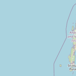
Map view of Mahatma Gandhi Marine National Park

Use this park location map to pinpoint Mahatma Gandhi Marine National Park in India, understand its exact geographic position, and read its mapped placement within the surrounding landscape more clearly.

Pigeon | © OpenStreetMap contributors

Location context for Mahatma Gandhi Marine National Park

Andaman and Nicobar IslandsSouth Andaman District
Park atlas

Expand your atlas view of India's coastal conservation landscapes and regional protected areas.

Explore Other National Parks and Protected Areas Near Mahatma Gandhi Marine National Park
After exploring Mahatma Gandhi Marine National Park, browse other national parks and protected areas across the Andaman and Nicobar Islands and surrounding Bay of Bengal geography. Compare diverse marine and island ecosystems, tracing the regional spread of India's coastal conservation landscapes for deeper atlas discovery.
National parkAndaman and Nicobar Islands

Mount Harriet National Park: National Park Mapping and Protected Landscape Identity

Explore its endemic biodiversity and mountain forest terrain.

Mount Harriet National Park provides a deep dive into a unique protected landscape, offering detailed insights into its geography, terrain, and ecological significance within the Andaman and Nicobar Islands. As a national park, it showcases a remarkable combination of mountainous forest ecosystems and coastal environments, serving as a vital habitat for numerous endemic species. Understanding its mapped boundaries and regional geographic context reveals why this protected area is a key point of interest for atlas-based natural landscape exploration.

Area
46.62 km²
Established
1979
IUCN
II
Relief
Mountain
National parkAndaman and Nicobar

Middle Button Island National Park: National Park within Andaman and Nicobar's Geography

Explore protected landscape context and mapped park boundaries.

Middle Button Island National Park represents a significant protected natural landscape, offering users a focused entry point for geographic discovery. As a designated national park, it contributes distinct mapped boundaries and terrain characteristics to the Andaman and Nicobar region's atlas data. Understanding its specific identity helps contextualize the broader protected-area network and regional geography. This page details the park's role as a conserved territory, vital for those seeking structured landscape and geography information.

Area
64 km²
Established
1979
Relief
Lowland
Climate
Tropical
National parkAndaman and Nicobar Islands

Galathea National Park: National Park Protected Landscape and Geography

Explore mapped boundaries within the Andaman and Nicobar Islands.

Galathea National Park serves as a vital protected landscape, contributing to the rich geographic tapestry of the Andaman and Nicobar Islands. This canonical MoriAtlas entry provides essential atlas-driven details about the park's identity as a national park. Focus is placed on its mapped presence and regional geographic context, allowing for structured exploration of its protected status and landscape features for users interested in detailed geographic and conservation mapping.

Area
110 km²
Established
1992
IUCN
II
Relief
Lowland
National parkTanintharyi Region

Lampi Island Marine National Park National Park: Geographic Atlas and Protected Landscape Overview

Discover mapped boundaries and regional park geography.

Lampi Island Marine National Park is a designated national park offering a focused lens on protected landscapes and regional geography. Explore its precise mapped boundaries and understand its place within the Tanintharyi Region's natural terrain. This profile is designed for atlas-based discovery, providing essential geographic context for the park and its role as a conservation area.

Area
204.8 km²
Established
1996
IUCN
II
Relief
Mixed relief
National parkRanong

Laem Son National Park: A Protected National Park in Ranong's Geographic Landscape

Explore the mapped natural terrain and protected area boundaries.

Laem Son National Park is a key protected area within Thailand's Ranong province, offering valuable insights into regional geography and landscape preservation. This entry focuses on its status as a national park, providing a structured view of its protected boundaries and environmental context. Understand its unique position within the mapped geography, vital for any comprehensive atlas exploration of protected lands in the region.

Area
315 km²
Established
1983
IUCN
II
Visitors
21.9K annual
National parkPhang Nga Province

Khao Lak, Lam Ru National Park: Protected National Park Landscape and Geography

Explore its mapped boundaries and regional context in Phang Nga Province.

This entry focuses on Khao Lak, Lam Ru National Park, a designated national park offering a distinct protected landscape within Phang Nga Province, Thailand. It provides structured data and map context crucial for understanding its geographic scope and regional significance. Explore the park's mapped boundaries, its role as a protected area, and its contribution to the broader landscape of southern Thailand, fostering a deeper appreciation for its natural geography and atlas-derived insights.

Area
125 km²
Established
1991
IUCN
II
Visitors
72.2K annual
National parkPhang Nga Province

Khao Lampi, Hat Thai Mueang National Park: Mountain Rainforest and Andaman Coast Atlas

Explore the mapped geography and protected boundaries.

Delve into Khao Lampi, Hat Thai Mueang National Park, a key protected area within Phang Nga Province, Thailand. This unique national park showcases a striking dichotomy: the lush, waterfall-adorned slopes of the Khao Lampi mountains contrast with the pristine Andaman Sea coastline of Hat Thai Mueang beach, a critical site for sea turtle nesting. The park's mapped landscape encompasses dense tropical rainforest, significant mangrove ecosystems, and important natural terrain, offering a comprehensive view of diverse protected environments for atlas exploration.

Area
72 km²
Established
1986
IUCN
II
Visitors
50.5K annual
National parkSurat Thani Province

Khao Sok National Park: Protected Landscape Atlas and Geographic Detail

Explore mapped boundaries and regional terrain in Surat Thani Province.

Khao Sok National Park represents a crucial protected landscape within the expansive geography of Surat Thani Province, Thailand. This detailed entry focuses on the park's identity as a national park, emphasizing its mapped boundaries and the surrounding natural terrain. Through structured information and geographic context, users can gain a clear understanding of Khao Sok National Park's place in the atlas, contributing to a more informed approach to landscape discovery.

Area
739 km²
Established
1980
IUCN
II
Visitors
419.5K annual

Common questions about visiting, size, designation, and location context for Mahatma Gandhi Marine National Park

Mahatma Gandhi Marine National Park FAQs for park facts, access, geography, and protected area context
Find quick answers about Mahatma Gandhi Marine National Park, including protected-area facts, park geography, trail and visitor context, and how the park fits into its surrounding country and regional landscape.
MoriAtlas Explorer

Continue Your Protected Areas Search Across the Global Atlas

Deepen your exploration by continuing the structured search for national parks and protected areas worldwide. Utilize the comprehensive filtering capabilities to compare different conservation landscapes and refine your understanding of global park geography. Discover more about the distribution and characteristics of protected natural areas.

Global natural geography