

Mori Atlas logo
National parkMount Harriet National Park

Discover the mapped boundaries and endemic biodiversity of this unique mountain forest national park.

Mount Harriet National Park: Protected Landscape and Geography in Andaman and Nicobar Islands

(Mount Manipur National Park)

Mount Harriet National Park represents a significant protected landscape within India's Andaman and Nicobar Islands. This national park, situated on South Andaman Island, offers a rich geographic context with its mountainous terrain reaching approximately 481 meters at Mount Manipur, the archipelago's third-highest peak. Users can explore the park's diverse tropical evergreen and coastal forest ecosystems, trace its mapped boundaries, and understand its role as a critical habitat for endemic species, providing a detailed atlas-style view of this unique natural area.

national parkAndaman and Nicobar Islandsmountain forestendemic speciesbutterfly hotspotcoastal ecosystem

Mount Harriet National Park

National park

Park overview

Structured park overview, official facts, and landscape profile for Mount Harriet National Park

Mount Harriet National Park park facts, protected area profile, and essential visitor context

Review the core facts for Mount Harriet National Park, including designation, size, terrain, visitor scale, habitats, and operating context in one park-focused overview.

About Mount Harriet National Park

Mount Harriet National Park represents a significant conservation area within the Andaman and Nicobar Islands, a remote archipelago in the Bay of Bengal that forms India's easternmost union territory. The park's landscape spans from sea level along its eastern coastline up to the summit of Mount Manipur at approximately 481 meters, creating a vertical gradient that supports diverse ecological communities. The mountains within the park are aligned in a north-south direction with ridges and spurs extending east-west, while numerous streams descend from the highlands to empty into the eastern sea. The eastern face of the park features steep slopes and rocky beaches interspersed with small sandy areas. The park experiences marine climatic conditions typical of its equatorial proximity, characterized by hot and humid conditions throughout the year. A notable historical site within proximity is Kalapathar, a location associated with the colonial penal system where prisoners were reportedly executed. The park remains accessible from Port Blair, the union territory capital, and has developed as a destination for trekking enthusiasts who can traverse the approximately 7-kilometer trail from Bambooflat to the mountain top, encountering endemic wildlife and diverse forest habitats along the way.

Quick facts and research context for Mount Harriet National Park

Mount Harriet National Park covers approximately 46.62 square kilometers of diverse terrain ranging from coastal beaches to mountain ridges. The park features three distinct forest types: tropical evergreen, hilltop tropical evergreen, and littoral forests, supporting around 134 documented plant and tree species. The park is home to several endemic species including the Andaman wild pig, various endemic reptiles, amphibians, and a remarkable butterfly population. The Andaman and Nicobar Islands sit in the Bay of Bengal approximately 1,200 kilometers east of the Indian mainland, placing Mount Harriet within a region of significant biogeographical importance.

Protection and recognition

Examining the official boundary designations and registered global conservation frameworks

Mount Harriet National Park Protection Status and Conservation Designations

Reviewing the official protection status and management framework of Mount Harriet National Park helps clarify its status within global conservation networks. Accessing verified environmental registry datasets and designation history offers clear insights into the managed ecological status of protected forest landscapes.

Protection details

Transboundary protection
No
Park context

Deeper park guide and search-rich context for Mount Harriet National Park

Mount Harriet National Park history, landscape, wildlife, and travel context

Explore Mount Harriet National Park through its history, landscape character, ecosystems, wildlife, conservation priorities, cultural context, and seasonal travel timing in a structured park guide built for atlas discovery and search intent.

Why Mount Harriet National Park stands out

Mount Harriet National Park is best known as a butterfly biodiversity hotspot and as the site of Mount Manipur, the third-highest peak in the Andaman and Nicobar Islands. The park is distinguished by its combination of mountain forest ecosystems and coastal terrain, supporting a remarkable concentration of endemic species. Its fauna includes endangered Andaman wild pigs, saltwater crocodiles, and numerous endemic reptile and amphibian species. The park also stands out for featuring on the Indian twenty-rupee banknote, representing one of the few Indian protected areas to achieve such cultural prominence.

Mount Harriet National Park history and protected-area timeline

Mount Harriet National Park was formally established as a protected national park in 1979, though the area had previously been designated as a reserve forest. The park was named in commemoration of Harriet C. Tytler, the second wife of Robert Christopher Tytler, a British army officer who served as Superintendent of the Convict Settlement at Port Blair from April 1862 to February 1864. Harriet Tytler is remembered for her significant work in documenting the monuments of Delhi and for her contemporaneous notes during the Revolt of 1857 in India. The park was officially renamed as Mount Manipur National Park, reflecting the local name for Mount Harriet, though it is commonly still referred to by its original designation. The mountain itself, Mount Manipur, was depicted on the reverse side of the Indian twenty-rupee banknote prior to the 2019 currency redesign, granting the park significant cultural recognition at the national level.

Mount Harriet National Park landscape and geographic character

The landscape of Mount Harriet National Park is characterized by its mountainous terrain forming part of the larger hill ranges of South Andaman Island. The park's elevation ranges from sea level along the coastal areas to approximately 481 meters at the summit of Mount Manipur. The mountains are oriented in a north-south alignment, with ridges and spurs projecting eastward and westward from the central spine. The eastern face of the park features notably steep slopes, while the coastline consists of rocky shores with intermittent sandy beach formations. Several streams originate in the higher elevations and flow eastward through the park before entering the sea. The terrain supports diverse forest types including tropical evergreen forests in the lowland areas, hilltop tropical evergreen forests on the upper slopes, and littoral forests along the coastal zone. This combination of mountain and coastal environments within a relatively compact area creates a distinctive landscape character.

Mount Harriet National Park ecosystems, habitats, and plant life

The ecological character of Mount Harriet National Park is defined by its three primary forest types: tropical evergreen, hilltop tropical evergreen, and littoral forests. The tropical evergreen forests feature species from the Dipterocarpus genus including Dipterocarpus gracilis, Dipterocarpus grandiflorus, and Dipterocarpus kerrii, along with Hopea odorata and the distinctive conifer Araucaria columnaris. The hilltop tropical evergreen vegetation includes Canarium denticulatum, Cratoxylum formosum, and Dipterocarpus costatus. The littoral forest areas are characterized by species adapted to coastal conditions. Overall, approximately 134 plant and tree species have been documented within the park, including 74 native species and 51 introduced species. At Chiriyatapu, the forest type transitions to mixed deciduous, representing a combination of primary and secondary forest growth. The park's location near the equator and its marine climatic conditions create an environment favorable for high biodiversity and continuous vegetation growth throughout the year.

Mount Harriet National Park wildlife and species highlights

Mount Harriet National Park supports a diverse faunal community with notable concentrations of endemic species. The mammal population includes the Andaman wild pig, an endangered species, as well as introduced Asian elephants and chital deer. The park is home to saltwater crocodiles and various turtle species that utilize the coastal areas. Robber crabs are present in the forest environments. The avian fauna is particularly significant, with Bird Life International identifying seven near-threatened bird species: the Andaman wood pigeon, Andaman cuckoo-dove, Andaman scops-owl, Andaman boobook, Andaman woodpecker, Andaman drongo, and Andaman treepie, along with two least-concern species including the Andaman coucal and white-headed starling. The reptile population includes 28 recorded species, with 14 being endemic to the Andaman Islands, comprising various lizards and snakes. Six amphibian species have been documented, including two endemic species: the Andaman bull frog and the Andaman paddy field frog. The aquatic fauna in the park's streams includes 16 species of eels, catfish, gobies, sleepers, and snakeheads. The invertebrate population is particularly diverse, with 355 species recorded, insects comprising approximately 70 percent of this total. The park has been identified as a significant butterfly hotspot, and the well-known silkmoth Samia cynthia has been recorded in lowland forest areas.

Mount Harriet National Park conservation status and protection priorities

Mount Harriet National Park holds significant conservation value as a protected area within the Andaman and Nicobar Islands, a region recognized as a biodiversity hotspot. The park protects critical forest ecosystems including tropical evergreen, hilltop tropical evergreen, and littoral forest types that support numerous endemic species. Conservation attention focuses on protecting the endangered Andaman wild pig population and the various endemic reptile and amphibian species that occur within the park boundaries. The protection of habitat for seven near-threatened bird species identified by Bird Life International further underscores the park's conservation importance. The diverse invertebrate community, particularly the butterfly populations, represents an additional conservation asset. There have been proposals to extend the park's boundaries to include additional mountain ranges and adjacent marine ecosystems along the eastern coast, potentially expanding protection to approximately 1,700 hectares of additional territory. The park's inclusion on Indian currency has helped raise awareness about the conservation significance of this Andaman protected area.

Mount Harriet National Park cultural meaning and human context

The cultural context of Mount Harriet National Park is closely tied to its naming after Harriet C. Tytler, whose connection to the Andaman Islands came through her husband Robert Christopher Tytler's appointment as Superintendent of the Convict Settlement at Port Blair. Harriet Tytler's work in documenting the monuments of Delhi and her contemporaneous accounts of the 1857 Revolt have preserved her historical significance beyond the Andamans. The local Negrito people, a tribal community traditionally practicing hunting and gathering, have historically inhabited the tropical forest areas within the park's boundaries. The Andaman and Nicobar Islands have a complex colonial history as a British penal settlement, and sites like Kalapathar in the vicinity of the park reflect this challenging past. The park's depiction on Indian currency has embedded it within the broader cultural fabric of the nation, making it one of the more culturally recognized Indian national parks.

Top sights and standout views in Mount Harriet National Park

The highlights of Mount Harriet National Park include the challenging yet rewarding trekking experience from Bambooflat to the mountain summit, offering views across the Andaman archipelago. The park's butterfly diversity makes it a significant destination for nature enthusiasts interested in observing these insects in their natural habitat. The endemic wildlife, particularly the Andaman wild pig and numerous endemic reptile and amphibian species, provides compelling reasons for biological interest. The combination of coastal and mountain ecosystems within a single protected area creates a distinctive landscape character not commonly found in other Indian national parks. The cultural connection to Harriet C. Tytler and the park's representation on Indian currency add historical and cultural dimensions to the natural attractions. The proximity to Port Blair makes the park accessible for day trips while still offering a genuine wilderness experience.

Best time to visit Mount Harriet National Park

The best time to visit Mount Harriet National Park corresponds to the Andaman Islands' cooler and drier season, typically from November through April, when conditions are more comfortable for trekking and outdoor exploration. The monsoon season from May to October brings heavy rainfall to the archipelago, which can restrict access to trails and increase humidity levels significantly. The hot and humid conditions prevailing for much of the year make the cooler dry season considerably more favorable for visitors. Trekking is most popular during the winter months when temperatures are moderate and rainfall is minimal. Wildlife observation, particularly for birds and butterflies, can be productive throughout the year though conditions vary with seasonal changes. Visitors planning treks to the mountain summit should account for the terrain difficulty and ensure appropriate physical preparation regardless of the season chosen.
Monthly climate preview

Long term temperature averages and seasonal precipitation cycles in the Andaman and Nicobar Islands

Mount Harriet National Park Weather by Month and Climate Profiles

Long-term representative data from a coastal coordinate indicate warm temperatures hovering between 26 and 29 degrees Celsius alongside a major seasonal shift in rainfall. Analyzing the complete twelve-month profile reveals detailed monthly averages to map out precipitation patterns and temperature shifts across the annual calendar.
Annual mean28 °C
27 °C29 °C
Jan27°
Feb27°
Mar28°
Apr29°
May29°
Jun29°
Jul28°
Aug28°
Sep28°
Oct28°
Nov28°
Dec27°
Warmest month
April

29.2 °C

Coolest month
January

26.9 °C

Wettest month
September

13.1 mm/day

Driest month
February

0.4 mm/day

Park location guide

Geography guide, regional context, and park location map for Mount Harriet National Park

Mount Harriet National Park park geography, regions, and map view in India

Understand where Mount Harriet National Park sits in India through a broader geographic reading of the surrounding landscape, nearby location context, and its mapped position within the national park landscape.

How Mount Harriet National Park fits into India

India is a South Asian country bordered by the Indian Ocean, Arabian Sea, and Bay of Bengal. It shares land borders with Pakistan, China, Nepal, Bhutan, Bangladesh, and Myanmar. The country has a population of over 1.4 billion people and operates as a federal parliamentary republic with its capital in New Delhi.

Wider geography shaping Mount Harriet National Park in India

India occupies the Indian subcontinent in South Asia, bordered by the Arabian Sea to the southwest, the Bay of Bengal to the southeast, and the Indian Ocean to the south. It shares land borders with Pakistan to the west, China, Nepal, and Bhutan to the north, and Bangladesh and Myanmar to the east. The territory also includes the Andaman and Nicobar Islands in the Indian Ocean.

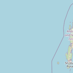
Map view of Mount Harriet National Park

Use this park location map to pinpoint Mount Harriet National Park in India, understand its exact geographic position, and read its mapped placement within the surrounding landscape more clearly.

Pigeon | © OpenStreetMap contributors

Location context for Mount Harriet National Park

Andaman and Nicobar IslandsFerrargunj
Recorded earthquake history

Explore Recorded Earthquake History Near Mount Harriet National Park

Review documented seismic records associated with Mount Harriet National Park through the MoriAtlas catalogue. Explore the historical distribution of epicentres and magnitude data to understand the seismic context of this protected landscape in the Andaman and Nicobar Islands.

Mount Harriet National Park Earthquake History

Catalogued events

130 events

Strongest magnitude

Magnitude 6.1

Most recent event

Jul 20, 2026

This history includes earthquakes recorded inside the park or within 50 km of its borders

Park atlas

Explore the Surrounding Andaman and Nicobar Islands, Comparing Coastal and Mountain Protected Landscapes

Discover Other National Parks and Protected Areas Near Mount Harriet National Park

After exploring Mount Harriet National Park, continue your geographic discovery by browsing other national parks and protected areas in the Andaman and Nicobar Islands. Compare diverse protected landscapes, from the coastal ecosystems and dense tropical evergreen forests to the varied mountain terrain across the archipelago, tracing the spread of conservation efforts.
Marine protected areaIndia
About 6.7 km away#1 closest

Northwest

Rani Jhansi Marine National Park: An Indian Marine Protected Area for Geographic Discovery

Explore mapped marine boundaries and regional landscape context.

Rani Jhansi Marine National Park stands as a crucial marine protected area within India, offering a unique focus on aquatic ecosystems and coastal geography. This dedicated space allows for detailed exploration of its specific marine protected boundaries and its significance within the broader landscape of India's natural heritage. Delve into the mapped geography and protected areas of this vital conservation zone for a deeper understanding of its environmental role.

Area
256 km²
Established
1996
IUCN
II
Climate
Tropical
Wildlife reserveAndaman and Nicobar Islands
About 20 km away#2 closest

Northwest

Defence Island Wildlife Sanctuary: Protected Geography and Island Ecosystems in the Andaman Archipelago

A remote wildlife reserve within the South Andaman district

Defence Island Wildlife Sanctuary represents a key protected landform within the Andaman and Nicobar union territory. Characterized by its coastal littoral habitats and dense tropical interior, this uninhabited island reserve serves as a significant site for regional biodiversity and landscape conservation efforts in the Bay of Bengal.

Area
5.04 km²
Water
Water-dominated
Season
Year-round
National parkIndia
About 28 km away#3 closest

Southwest

Mahatma Gandhi Marine National Park: India National Park Protected Landscape and Geography

Explore mapped boundaries and regional geographic context.

Gain a detailed understanding of Mahatma Gandhi Marine National Park, a designated national park in India. This entry focuses on its protected area status, the mapped extent of its natural landscape, and its significance within India's diverse geography. Discover the park's spatial context and contribution to the nation's protected lands through an atlas-focused lens, providing essential geographic details for informed exploration.

Area
281.5 km²
Established
1983
IUCN
II
Relief
Lowland
National parkAndaman and Nicobar Islands
About 47 km away#4 closest

Northeast

South Button Island National Park: Mapped Boundaries and Regional Protected Landscape

Key National Park in the Andaman and Nicobar Islands

South Button Island National Park is a protected natural area offering critical insight into the geography of the Andaman and Nicobar Islands. This detailed view focuses on its mapped boundaries and its significance as a national park within this Indian archipelago. Understanding its position within the regional geography provides essential context for exploring protected lands and natural landscapes across the Andaman and Nicobar Islands.

Area
5 km²
Relief
Lowland
Climate
Tropical
Access
Moderate access
National parkAndaman and Nicobar
About 52 km away#5 closest

Northeast

Middle Button Island National Park: National Park within Andaman and Nicobar's Geography

Explore protected landscape context and mapped park boundaries.

Middle Button Island National Park represents a significant protected natural landscape, offering users a focused entry point for geographic discovery. As a designated national park, it contributes distinct mapped boundaries and terrain characteristics to the Andaman and Nicobar region's atlas data. Understanding its specific identity helps contextualize the broader protected-area network and regional geography. This page details the park's role as a conserved territory, vital for those seeking structured landscape and geography information.

Area
64 km²
Established
1979
Relief
Lowland
Climate
Tropical
National parkAndaman and Nicobar Islands
About 58 km away#6 closest

Northeast

North Button Island National Park: Protected Landscape and Mapped Geographic Identity

Explore the mapped boundaries and regional natural terrain.

Gain a clear understanding of North Button Island National Park as a distinct protected landscape within the Andaman and Nicobar Islands region. This entry offers detailed geographic context, focusing on the park's mapped boundaries and its role within the archipelago's natural terrain. It serves as a foundational element for understanding this Indian National Park's place in a broader atlas of conservation areas.

Area
114 km²
Established
1979
Wildlife reserveAndaman and Nicobar Islands
About 74 km away#7 closest

North

Flat Island Wildlife Sanctuary: Protected Island Geography in the Andaman and Nicobar Islands

Coastal wildlife reserve and isolated island terrain

Flat Island Wildlife Sanctuary stands as a distinct, low lying protected area within the Andaman and Nicobar Islands. Its compact oval shape and shoreline focused landscape provide a clear example of the archipelago's small scale, uninhabited marine reserves. This protected island serves as a vital geographic marker for those mapping the diverse coastal habitats found across the Bay of Bengal.

Area
2.48 km²
Relief
Lowland
Climate
Tropical
Access
Remote access
Wildlife reserveAndaman and Nicobar Islands
About 95 km away#8 closest

North

Cuthbert Bay Wildlife Sanctuary: Coastal Habitat and Sea Turtle Nesting Ground

Eastern Middle Andaman protected coastal geography

Cuthbert Bay Wildlife Sanctuary covers 5.8 square kilometres of critical coastal terrain along the eastern Middle Andaman coastline. Renowned for its concentration of sea turtle nesting beaches, the reserve supports diverse coastal ecosystems ranging from open sand to inland forest patches. It serves as a compact but vital ecological anchor within the broader landscape of the Andaman and Nicobar Islands.

Area
5.8 km²
Established
1997
IUCN
IV
Scope
Terrestrial

Common questions about visiting, size, designation, and location context for Mount Harriet National Park

Mount Harriet National Park FAQs for park facts, access, geography, and protected area context

Find quick answers about Mount Harriet National Park, including protected-area facts, park geography, trail and visitor context, and how the park fits into its surrounding country and regional landscape.
MoriAtlas Explorer

Continue Your Protected Areas Search Across the Global Atlas

Deepen your exploration by continuing the structured search for national parks and protected areas worldwide. Utilize the comprehensive filtering capabilities to compare different conservation landscapes and refine your understanding of global park geography. Discover more about the distribution and characteristics of protected natural areas.

Global natural geography