

Mori Atlas logo
National parkMangroves National Park

Explore the distinct marine and brackish water ecosystems defining the Atlantic coast of Central Africa

Mangroves National Park: A Protected Coastal Wetland and Estuarine Landscape in the Congo River Delta

(Parc national des Mangroves)

Mangroves National Park preserves a unique coastal landscape at the confluence of the massive Congo River and the Atlantic Ocean. This protected area features dense mangrove forests, tidal mudflats, and intricate channels that provide critical habitats for the endangered African manatee and other wildlife. As the sole marine park in the Democratic Republic of the Congo, this Ramsar wetland offers a significant glimpse into the ecological dynamics of a Central African estuarine environment.

Mangrove forestsMarine parkRamsar wetlandAfrican manateeCoastal wetlandEstuary
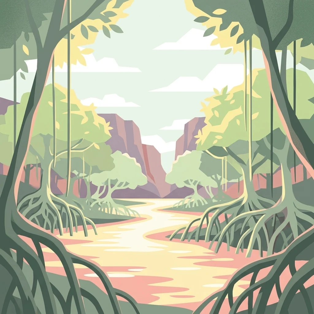
Stylized illustration of mangrove trees with exposed roots, a winding waterway, and rocky cliffs in the background

Mangroves National Park

National park

Park overview

Structured park overview, official facts, and landscape profile for Mangroves National Park

Mangroves National Park park facts, protected area profile, and essential visitor context

Review the core facts for Mangroves National Park, including designation, size, terrain, visitor scale, habitats, and operating context in one park-focused overview.

About Mangroves National Park

Mangroves National Park occupies a strategic position at the mouth of the Congo River, where fresh water from Africa's second-longest river mixes with the Atlantic Ocean to create a complex brackish environment. This location has produced a mangrove ecosystem of exceptional ecological importance, characterized by dense forest canopies adapted to daily tidal fluctuations and variable salinity levels. The park's designation as a Ramsar site in 1996 reflects international recognition of its wetland values, while its classification as a Category II protected area under IUCN guidelines affirms its national park status. The mangroves here differ fundamentally from the Indo-Pacific systems that dominate global mangrove literature, representing a distinct biogeographic province with endemic species adapted to West African coastal conditions. Beyond their ecological significance, these mangrove forests provide vital ecosystem services including storm protection, water filtration, and carbon storage, while serving as nurseries for fish and other marine species that support local fishing communities.

Quick facts and research context for Mangroves National Park

Mangroves National Park covers 768 square kilometers along the Atlantic coast at the Congo River estuary in the Democratic Republic of the Congo. Established in 1992, it holds Ramsar Convention designation as an internationally significant wetland and operates under management by the Institut Congolais pour la Conservation de la Nature. The park represents the only marine protected area in the country and features a distinctive mangrove ecosystem that differs from tropical Asian mangrove forests, being adapted to the Atlantic African coastal conditions. The area provides crucial protection for the endangered African manatee, one of the park's flagship species.

Protection and recognition

Explore documented conservation scope and international recognition records

Mangroves National Park Protection Status and Official Designation History

Mangroves National Park maintains a mixed protection scope established through official designation in 1996. Structured records outline the documented management framework and conservation history associated with this protected area.

Protection details

Protection scope
Mixed
Designated year
1996
Park context

Deeper park guide and search-rich context for Mangroves National Park

Mangroves National Park history, landscape, wildlife, and travel context

Explore Mangroves National Park through its history, landscape character, ecosystems, wildlife, conservation priorities, cultural context, and seasonal travel timing in a structured park guide built for atlas discovery and search intent.

Why Mangroves National Park stands out

Mangroves National Park is best known for its extensive mangrove forests that form a unique ecological system native to the Atlantic coast of Central Africa. The park serves as a critical refuge for the endangered African manatee, a species facing significant population pressures throughout its range. As the Democratic Republic of the Congo's sole marine park, it represents the country's primary coastal conservation asset and provides important ecological services through its mangrove wetlands, including coastal protection, sediment stabilization, and carbon sequestration. The distinctive West African mangrove composition, featuring species such as Rhizophora and Avicennia, sets this ecosystem apart from the more familiar Indo-Pacific mangrove systems.
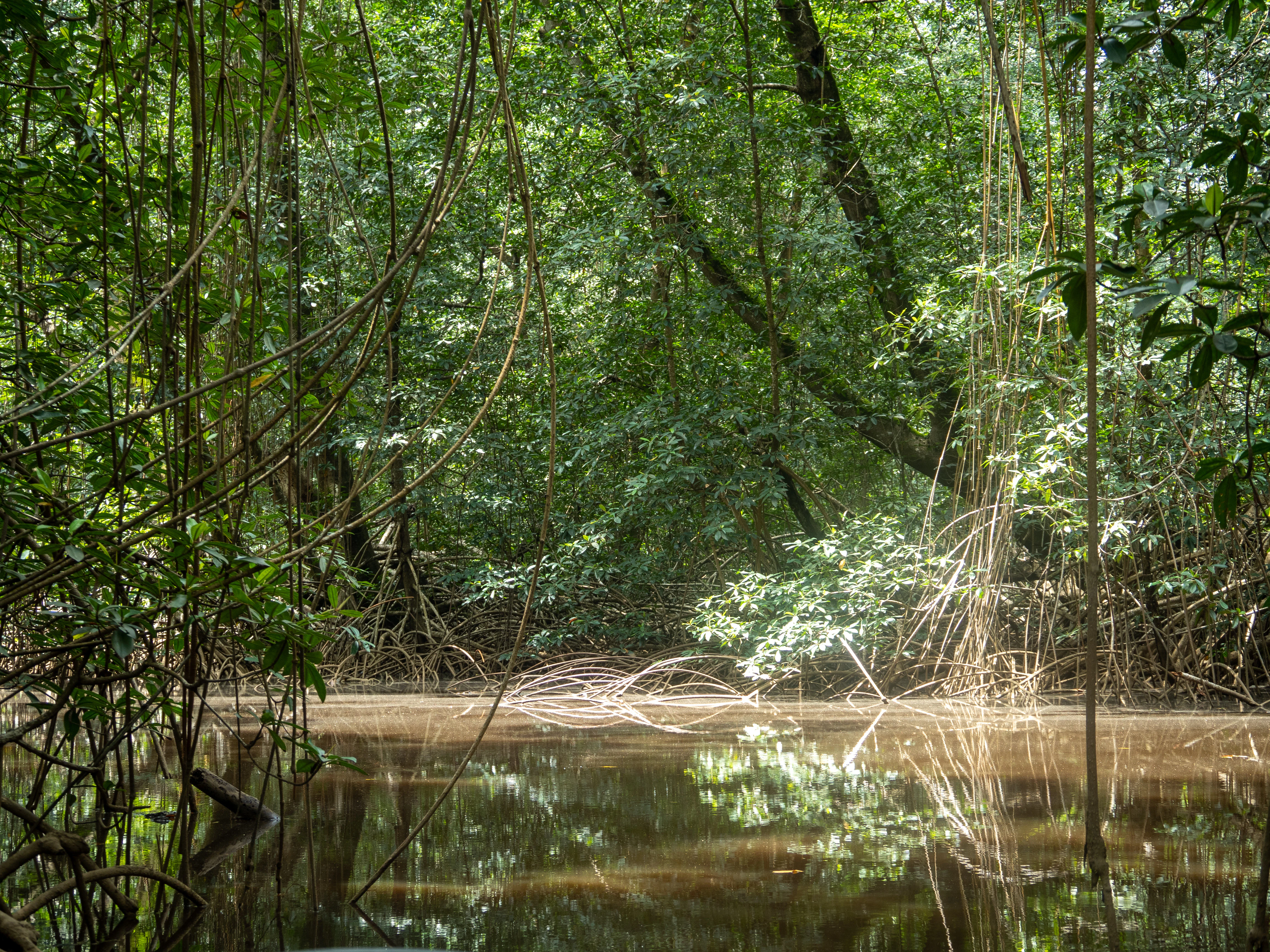
Mangrove trees with tangled roots and branches reflected in a calm body of water
Dense mangrove forest with calm water reflecting foliage at Mangroves National Park

Mangroves National Park history and protected-area timeline

Mangroves National Park was established in 1992 as the Democratic Republic of the Congo's first and only marine protected area. The designation reflected growing recognition of the ecological importance of the country's coastal wetlands and the need to conserve the unique mangrove ecosystems found at the Congo River mouth. In 1996, the park received additional international recognition through its designation as a Ramsar Wetland of International Importance, joining a global network of protected wetlands that are recognized for their ecological significance. Management responsibility falls to the Institut Congolais pour la Conservation de la Nature, the Congolese institute for nature conservation, which oversees protection and management activities within the park boundaries. The establishment of this marine park represented a significant step in the Democratic Republic of the Congo's efforts to conserve its coastal and marine biodiversity, though the park remains the country's smallest protected area despite its international importance.

Mangroves National Park landscape and geographic character

The park encompasses a dynamic coastal landscape where the massive Congo River delta meets the Atlantic Ocean, creating extensive intertidal zones ideal for mangrove development. The terrain is predominantly flat and low-lying, characterized by tidal channels, mudflats, and brackish water lagoons that crisscross the mangrove forest. The mangrove trees themselves form dense, almost impenetrable walls along the water's edge, with their distinctive prop roots visible above the water surface during high tide. Behind the mangrove fringe, the forest extends inland, while open water channels provide navigation routes through the system. The landscape experiences twice-daily tidal inundation, with water levels fluctuating to expose mudflats and submerge the forest floor in regular cycles that shape the entire ecosystem. This estuarine environment produces a complex mosaic of marine, brackish, and freshwater habitats within a relatively compact area.

Mangroves National Park ecosystems, habitats, and plant life

The mangrove ecosystem of Mangroves National Park represents one of the most ecologically distinctive wetland types in Africa. The forest is dominated by mangrove species including Rhizophora racemosa and Rhizophora mangle, which employ their characteristic above-ground prop roots for stability in soft mud and to access oxygen during tidal immersion. The park also features Avicennia nitida and Avicennia germinans, species that utilize specialized root systems to filter salt from water, and Laguncularia racemosa, adding to the forest's species diversity. The understory and surrounding areas support additional plant species such as Hibiscus tiliaceus and the fern Acrostichum aureum, creating a layered vegetation structure. This complex habitat creates optimal conditions for brackish water species and serves as a highly productive ecosystem that supports intricate food webs ranging from microorganisms to large mammals.

Mangroves National Park wildlife and species highlights

Mangroves National Park provides crucial habitat for several notable wildlife species, most prominently the African manatee, an endangered marine mammal that relies on the park's protected waters. These gentle herbivores graze on submerged aquatic vegetation within the mangroves and adjacent channels, finding shelter among the tangled root systems. Hippopotamuses also inhabit the area, utilizing both the water channels and adjacent land areas for foraging and resting. The park supports crocodile populations that navigate the tidal channels and rest on mud banks, while various snake species move through the forest canopy and water edges. Southern reedbuck occupy the more terrestrial portions of the ecosystem, and Cape bushbuck may also be present in the forest understory. This assemblage of species demonstrates the park's role as a biodiversity hotspot where terrestrial and aquatic ecosystems converge.

Mangroves National Park conservation status and protection priorities

The conservation significance of Mangroves National Park extends far beyond its modest 768 square kilometer area. The park provides essential protection for the endangered African manatee, a species that has experienced significant population declines throughout much of its range due to hunting, habitat loss, and accidental capture in fishing gear. The mangrove forests themselves represent important conservation targets, serving as carbon sinks that sequester significant amounts of atmospheric carbon in their sediments and biomass. These ecosystems also provide critical protection services for the coastline, buffering storm surges and preventing erosion that could otherwise impact coastal communities. The Ramsar designation underscores the site's international importance as a wetland ecosystem, while the park's status as the Democratic Republic of the Congo's only marine protected area makes it a cornerstone of the nation's coastal conservation strategy.

Mangroves National Park cultural meaning and human context

The park's location at the mouth of the Congo River places it within a region of historical significance for Central African coastal communities. The estuary has long served as a zone of interaction between inland river communities and coastal populations, with traditional fishing activities forming an important part of local livelihoods. While the source material does not provide detailed information on indigenous or local communities within the park boundaries, the broader region has been inhabited by various ethnic groups who have maintained connections to the river and its resources for generations. The marine protected area designation aims to balance conservation objectives with sustainable use of natural resources, recognizing that local communities depend on the ecosystem for their wellbeing.

Top sights and standout views in Mangroves National Park

Mangroves National Park stands as a unique conservation achievement in Central Africa as the only marine park in the Democratic Republic of the Congo. Its mangrove forests represent a distinct biogeographic type not found in South Asia, with species compositions that are typical to the Atlantic coast of Africa. The park provides critical refuge for the endangered African manatee, one of Africa's least-known large mammals, while also supporting hippopotamus, crocodile, and diverse bird populations. The Ramsar designation highlights the international importance of this wetland ecosystem, which delivers significant ecological services including coastal protection and carbon sequestration. Visitors to the park can experience one of Africa's most unusual coastal environments, where massive riverine inputs create productive brackish waters that sustain rich biodiversity within a labyrinthine mangrove landscape.

Best time to visit Mangroves National Park

The equatorial location of Mangroves National Park means that visiting conditions remain relatively consistent throughout the year, with a hot and humid tropical climate dominating the region. The dry season, typically from May to September, often provides easier access to certain areas as water levels recede and wildlife becomes more concentrated around remaining water sources. However, the mangrove environment remains accessible year-round, and the wet season brings the ecosystem to life with increased fish activity and bird presence. The park's tidal cycles, rather than seasonal changes, most significantly influence the visitor experience, as twice-daily inundation transforms the landscape dramatically between high and low tide. Travelers interested in observing manatees may find the dry season particularly rewarding, as reduced water volumes concentrate these marine mammals in deeper channels where they can be more readily observed.
Monthly climate preview

Long-term temperature and precipitation records measured across twelve months

Mangroves National Park Climate Normals and Annual Weather Patterns

Mangroves National Park exhibits a measured annual rhythm defined by consistent warmth and distinct monthly precipitation variations across a representative coordinate. Reviewing the complete twelve-month climatology provides deeper insight into long-term temperature ranges and rainfall cycles.
Annual mean25 °C
23 °C27 °C
Jan26°
Feb27°
Mar27°
Apr26°
May26°
Jun24°
Jul23°
Aug24°
Sep25°
Oct26°
Nov26°
Dec26°
Warmest month
March

26.7 °C

Coolest month
July

23.1 °C

Wettest month
November

6.2 mm/day

Driest month
July

0.1 mm/day

Park location guide

Geography guide, regional context, and park location map for Mangroves National Park

Mangroves National Park park geography, regions, and map view in Democratic Republic of the Congo

Understand where Mangroves National Park sits in Democratic Republic of the Congo through a broader geographic reading of the surrounding landscape, nearby location context, and its mapped position within the national park landscape.

How Mangroves National Park fits into Democratic Republic of the Congo

The Democratic Republic of the Congo is a Central African country bordered by the Republic of the Congo, Angola, Zambia, Tanzania, Uganda, Rwanda, Burundi, and the Central African Republic, with a small Atlantic coastline. It occupies the Congo Basin, one of the world's largest tropical rainforest regions. French is the official language, though over 200 indigenous languages are spoken. Kinshasa is the capital and largest city.

Wider geography shaping Mangroves National Park in Democratic Republic of the Congo

The DRC occupies a central position in Central Africa, bordering the Republic of the Congo and the South Atlantic Ocean to the west, the Central African Republic and South Sudan to the north, Uganda, Rwanda, Burundi, and Tanzania to the east (across Lake Tanganyika), and Zambia and Angola to the south. The country's terrain is dominated by the Congo Basin, a vast lowland plain covered in equatorial rainforest, while the eastern and southeastern regions feature highlands and mountains including the Albertine Rift.

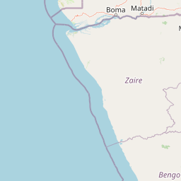
Map view of Mangroves National Park

Use this park location map to pinpoint Mangroves National Park in Democratic Republic of the Congo, understand its exact geographic position, and read its mapped placement within the surrounding landscape more clearly.

Pigeon | © OpenStreetMap contributors

Visualizing the coastal terrain, tidal channels, and protected marine habitats

Mangroves National Park Photos and Landscape Scenery Exploration

Visual documentation of Mangroves National Park reveals dense coastal forests, intricate tidal channels, and brackish estuarine lagoons where the Congo River meets the Atlantic Ocean. Examining national park photography helps researchers and visitors understand unique West African mangrove ecosystems, intertidal mudflats, and crucial wildlife habitats.

Mangrove trees with tangled roots and branches reflected in a calm body of water

Park atlas

Compare adjacent coastal landscapes and regional protected areas in Central Africa

Exploring Other Parks Near Mangroves National Park and Surrounding Protected Areas

Browse other parks near Mangroves National Park to examine related coastal wetlands and estuarine habitats across the surrounding region. Extending the geographic comparison reveals broader protected-area patterns within the Congo River basin.
National parkDemocratic Republic of the Congo
Mapped park locations coincide#1 closest

Mangroves National Park: Geographic Boundaries and Regional Landscape Discovery

Coastal wetland and estuarine protected area in the Democratic Republic of the Congo

Access a structured geographic overview of Mangroves National Park, an essential coastal protected area in the Democratic Republic of the Congo. This analysis covers the park's wetland habitat, delta geography, and the broader environmental context of this tropical maritime landscape for focused regional exploration.

IUCN
II
Watercolor painting showing a river with green hills and pink flowers in the foreground
National parkKouilou Department
About 249 km away#2 closest

Northwest

Conkouati-Douli National Park: Mapping Protected Landscape Boundaries and Regional Geography

Explore its national park status and geographic context.

Conkouati-Douli National Park is a protected area situated in the Kouilou Department, offering a focused point for geographic and landscape discovery. This detail provides an atlas-style perspective on its mapped boundaries and its contribution to the regional geography. Understand the park as a distinct natural landscape and a key component of conservation within its geographic setting.

Area
7,955 km²
Established
1999
IUCN
II
Relief
Lowland
National parkGabon
About 289 km away#3 closest

Northwest

Mayumba National Park: Gabon's Equatorial Protected Area and Geographic Atlas

Explore mapped park boundaries and regional landscape context.

Delve into the geographic identity of Mayumba National Park, a significant protected area situated in Gabon. This detail page provides atlas-style insights into the park's mapped boundaries, its position within the equatorial geography of Central Africa, and its role as a national park. Understand the protected landscape's environmental context and its atlas significance.

Area
870 km²
Established
2002
IUCN
II
Relief
Lowland
National parkHaut-Ogooué Province
About 418 km away#4 closest

North

Batéké Plateau National Park: Mapped Geography of a Central African Forest-Savanna Mosaic

Discover the terrain and protected landscape of Haut-Ogooué Province.

Batéké Plateau National Park is defined by its expansive forest-savanna mosaic, a rare ecological formation across Central Africa. Located within Haut-Ogooué Province, this national park showcases unique terrain characterized by savanna grasslands interspersed with woodlands and forested corridors. Understanding its geographic context and protected boundaries provides valuable insight into the region's natural heritage and conservation significance.

Area
2,034 km²
Established
2002
IUCN
II
Relief
Upland
National parkGabon
About 426 km away#5 closest

North

Ogooué-Leketi National Park National Park: A Protected Landscape in Gabon's Geography

Mapped boundaries and regional protected-area context.

Delve into the protected landscape of Ogooué-Leketi National Park, a national park situated in Gabon. This entry provides crucial context for understanding the park's geographic footprint and its role as a conservation area. Examine the mapped terrain and discover how Ogooué-Leketi National Park fits into the regional geography of Central Africa, offering an atlas-driven perspective on its protected status.

Protected areaGabon
About 443 km away#6 closest

North

Parc de la Lékédi: Protected Area Geography and Landscape Context in Southeastern Gabon

A managed savanna and forest mosaic reserve in the Haut-Ogooué province.

Spanning 14,000 hectares of sandstone terrain, Parc de la Lékédi represents a distinct protected landscape in Gabon. The reserve merges conservation goals with scientific research on primates, utilizing a network of lakes and riverine corridors that support a high concentration of forest and savanna species in a highly managed, ecologically significant environment.

Area
140 km²
Established
1990
Relief
Upland
Climate
Tropical
National parkGabon
About 444 km away#7 closest

North

Birougou National Park: Mapped Protected Landscape and Regional Geography in Gabon

Explore the geographic extent and conservation context of this national park.

Birougou National Park is an important protected area situated in Gabon, offering a distinct focus for geographic and atlas-based discovery. This national park serves as a significant element within the country's network of conservation landscapes, providing a focal point for understanding mapped terrain and regional geographic patterns. Users can explore its protected boundaries and gain insight into its specific environmental context within Central Africa, making it a vital entry for atlas exploration of Gabon's natural heritage.

Area
690 km²
Established
2002
IUCN
II
Relief
Mountain
National parkGabon
About 449 km away#8 closest

Northwest

Moukalaba-Doudou National Park: Protected Forest and Savanna Mosaic in Southeastern Gabon

Geographic overview of a key Central African protected area.

Moukalaba-Doudou National Park represents a significant protected area in southeastern Gabon, covering 4,500 square kilometers of diverse terrain. The park is defined by its unusual interaction between humid tropical rainforest and expansive savanna grasslands, marking it as a critical ecological transition zone in the Congo Basin region.

Area
4,500 km²
IUCN
II
Scope
Terrestrial
Water
Minor water

Common questions about visiting, size, designation, and location context for Mangroves National Park

Mangroves National Park FAQs for park facts, access, geography, and protected area context

Find quick answers about Mangroves National Park, including protected-area facts, park geography, trail and visitor context, and how the park fits into its surrounding country and regional landscape.
MoriAtlas Explorer

Continue Your Protected Areas Search Across the Global Atlas

Deepen your exploration by continuing the structured search for national parks and protected areas worldwide. Utilize the comprehensive filtering capabilities to compare different conservation landscapes and refine your understanding of global park geography. Discover more about the distribution and characteristics of protected natural areas.

Global natural geography

