Explore the mapped boundaries and regional context of this Central African protected area.
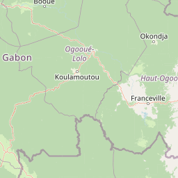
Ogooué-Leketi National Park stands as a significant protected area within Gabon, offering a distinct focus for geographic and protected landscape exploration. This page serves as an atlas-style entry point for understanding the park's precise boundaries, its placement within the broader natural geography of Central Africa, and its identity as a national park dedicated to conservation. Engage with the mapped context to grasp the park's regional significance and the characteristics of its protected terrain.
Ogooué-Leketi National Park
National park
Structured park overview, official facts, and landscape profile for Ogooué-Leketi National Park
Geography guide, regional context, and park location map for Ogooué-Leketi National Park
Gabon is a Central African country on the Atlantic coast, positioned on the equator. It gained independence from France in 1960 and is governed as a unitary presidential republic. The country has significant oil wealth and one of the highest Human Development Index rankings in Africa, though wealth distribution remains uneven.
Gabon is situated on the Atlantic coast of Central Africa, positioned along the equator. It borders Equatorial Guinea to the northwest, Cameroon to the north, and the Republic of the Congo to the east and south. The terrain includes coastal plains along the Atlantic, mountain ranges in the center (the Cristal Mountains and Chaillu Massif), and savanna zones in the east.
Common questions about visiting, size, designation, and location context for Ogooué-Leketi National Park
Deepen your exploration by continuing the structured search for national parks and protected areas worldwide. Utilize the comprehensive filtering capabilities to compare different conservation landscapes and refine your understanding of global park geography. Discover more about the distribution and characteristics of protected natural areas.