Mori Atlas logo
National parkOgooué-Leketi National Park

Explore the mapped boundaries and regional context of this Central African protected area.

Ogooué-Leketi National Park: Gabon's National Park Protected Landscape and Geography

Ogooué-Leketi National Park stands as a significant protected area within Gabon, offering a distinct focus for geographic and protected landscape exploration. This page serves as an atlas-style entry point for understanding the park's precise boundaries, its placement within the broader natural geography of Central Africa, and its identity as a national park dedicated to conservation. Engage with the mapped context to grasp the park's regional significance and the characteristics of its protected terrain.

GabonCentral AfricaNational ParkProtected AreaForest

Ogooué-Leketi National Park

National park

Park overview

Structured park overview, official facts, and landscape profile for Ogooué-Leketi National Park

Ogooué-Leketi National Park park facts, protected area profile, and essential visitor context

Review the core facts for Ogooué-Leketi National Park, including designation, size, terrain, visitor scale, habitats, and operating context in one park-focused overview.
Monthly climate preview

Long term temperature averages and precipitation rhythms across twelve recorded months

Ogooue-Leketi National Park Climate Normals and Monthly Weather Records

Representative coordinate data for Ogooue-Leketi National Park tracks consistent mean temperatures alongside pronounced shifts in monthly precipitation normals. Examining the complete twelve month profile provides deeper insight into measured meteorological patterns at elevation.
Annual mean24 °C
24 °C25 °C
Jan24°
Feb25°
Mar25°
Apr25°
May24°
Jun24°
Jul24°
Aug24°
Sep24°
Oct24°
Nov24°
Dec24°
Warmest month
February

24.7 °C

Coolest month
November

23.7 °C

Wettest month
November

10 mm/day

Driest month
July

0.4 mm/day

Park location guide

Geography guide, regional context, and park location map for Ogooué-Leketi National Park

Ogooué-Leketi National Park park geography, regions, and map view in Gabon

Understand where Ogooué-Leketi National Park sits in Gabon through a broader geographic reading of the surrounding landscape, nearby location context, and its mapped position within the national park landscape.

How Ogooué-Leketi National Park fits into Gabon

Gabon is a Central African country on the Atlantic coast, positioned on the equator. It gained independence from France in 1960 and is governed as a unitary presidential republic. The country has significant oil wealth and one of the highest Human Development Index rankings in Africa, though wealth distribution remains uneven.

Wider geography shaping Ogooué-Leketi National Park in Gabon

Gabon is situated on the Atlantic coast of Central Africa, positioned along the equator. It borders Equatorial Guinea to the northwest, Cameroon to the north, and the Republic of the Congo to the east and south. The terrain includes coastal plains along the Atlantic, mountain ranges in the center (the Cristal Mountains and Chaillu Massif), and savanna zones in the east.

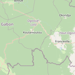
Map view of Ogooué-Leketi National Park

Use this park location map to pinpoint Ogooué-Leketi National Park in Gabon, understand its exact geographic position, and read its mapped placement within the surrounding landscape more clearly.

Pigeon | © OpenStreetMap contributors
Park atlas

Trace the regional spread of protected landscapes and compare adjacent park geography across Central Africa.

Explore National Parks and Protected Areas Near Ogooué-Leketi National Park

Continue your exploration from Ogooué-Leketi National Park by browsing other national parks and protected areas within Gabon and the wider Central African region. Compare varied protected landscapes, understand their geographic context, and discover the broader conservation efforts across this significant portion of the continent.
National parkHaut-Ogooué Province
About 49 km away#1 closest

Southeast

Batéké Plateau National Park: Mapped Geography of a Central African Forest-Savanna Mosaic

Discover the terrain and protected landscape of Haut-Ogooué Province.

Batéké Plateau National Park is defined by its expansive forest-savanna mosaic, a rare ecological formation across Central Africa. Located within Haut-Ogooué Province, this national park showcases unique terrain characterized by savanna grasslands interspersed with woodlands and forested corridors. Understanding its geographic context and protected boundaries provides valuable insight into the region's natural heritage and conservation significance.

Area
2,034 km²
Established
2002
IUCN
II
Relief
Upland
Protected areaGabon
About 68 km away#2 closest

Northwest

Parc de la Lékédi: Protected Area Geography and Landscape Context in Southeastern Gabon

A managed savanna and forest mosaic reserve in the Haut-Ogooué province.

Spanning 14,000 hectares of sandstone terrain, Parc de la Lékédi represents a distinct protected landscape in Gabon. The reserve merges conservation goals with scientific research on primates, utilizing a network of lakes and riverine corridors that support a high concentration of forest and savanna species in a highly managed, ecologically significant environment.

Area
140 km²
Established
1990
Relief
Upland
Climate
Tropical
National parkGabon
About 152 km away#3 closest

West

Birougou National Park: Mapped Protected Landscape and Regional Geography in Gabon

Explore the geographic extent and conservation context of this national park.

Birougou National Park is an important protected area situated in Gabon, offering a distinct focus for geographic and atlas-based discovery. This national park serves as a significant element within the country's network of conservation landscapes, providing a focal point for understanding mapped terrain and regional geographic patterns. Users can explore its protected boundaries and gain insight into its specific environmental context within Central Africa, making it a vital entry for atlas exploration of Gabon's natural heritage.

Area
690 km²
Established
2002
IUCN
II
Relief
Mountain
Watercolor painting of a landscape with grassy areas, a lake, and distant hills under a light sky
National parkGabon
About 239 km away#4 closest

Northwest

Lopé National Park: Gabon's Protected Landscape and National Park Geography

Explore mapped boundaries and natural terrain in Central Africa.

Delve into Lopé National Park, a designated national park situated in Gabon. This protected area serves as a crucial point for understanding the nation's geography and the distribution of its conservation landscapes. As an entry in the MoriAtlas, it offers a detailed view of its mapped territory and its contribution to the broader regional context of Central Africa, emphasizing its role in protected area atlas exploration.

Area
4,910 km²
Established
2002
IUCN
II
Relief
Mixed relief
National parkGabon
About 256 km away#5 closest

Northwest

Ivindo National Park: A Protected Rainforest Landscape in Gabon

Explore its waterfalls, diverse ecosystems, and mapped geographic context.

Ivindo National Park represents a significant protected landscape within Gabon, spanning a vast area of intact tropical rainforest. Recognized as a UNESCO World Heritage Site, the park is defined by the Ivindo River and its dramatic waterfalls, including the famous Kongou and Mingouli Falls. Its geography includes mountainous terrain and vital riverine ecosystems, supporting critical populations of forest elephants and great apes. This page offers a gateway to understanding the park's protected status, its unique natural features, and its role in the broader geography of Central Africa.

Area
3,000 km²
Established
2002
IUCN
II
Relief
Mixed relief
National parkGabon
About 270 km away#6 closest

West

Waka National Park: A Mapped Protected Landscape in Gabon's Geography

Explore the natural terrain and park boundaries of this national park.

Waka National Park in Gabon represents a vital protected landscape for geographic exploration. This dedicated detail page offers insight into the park's specific mapped area and its place within the country's broader natural terrain. Understand its context as a national park, contributing to the atlas of protected areas in Central Africa. Discover the geographic identity of this significant natural reserve.

Area
1,060 km²
Established
2002
IUCN
II
Relief
Mountain
National parkGabon
About 275 km away#7 closest

North

Mwangné National Park: Gabon's Protected Landscape for Geographic Discovery

Explore the mapped boundaries and regional context.

Gain a detailed understanding of Mwangné National Park, a key protected area within Gabon. This page offers an atlas-centric view, highlighting its geographic significance and the characteristics of its protected landscape. Delve into the park's mapped boundaries and its role within the broader natural terrain of Central Africa, providing essential context for geographic exploration.

National parkCuvette-Ouest Department
About 276 km away#8 closest

Northeast

Odzala-Kokoua National Park National Park: Mapped Protected Landscape in Cuvette-Ouest

Explore its geographic boundaries and regional terrain.

Odzala-Kokoua National Park is a key national park entity, offering a distinct protected landscape within the Cuvette-Ouest Department. This page provides an atlas-style exploration of its mapped boundaries and geographic context. Delve into the specifics of this protected area to understand its contribution to the regional geography and natural landscape, facilitating structured discovery of its terrain.

Area
13,500 km²
Established
1935
IUCN
II
Visitors
50 annual

Common questions about visiting, size, designation, and location context for Ogooué-Leketi National Park

Ogooué-Leketi National Park FAQs for park facts, access, geography, and protected area context

Find quick answers about Ogooué-Leketi National Park, including protected-area facts, park geography, trail and visitor context, and how the park fits into its surrounding country and regional landscape.
MoriAtlas Explorer

Continue Your Protected Areas Search Across the Global Atlas

Deepen your exploration by continuing the structured search for national parks and protected areas worldwide. Utilize the comprehensive filtering capabilities to compare different conservation landscapes and refine your understanding of global park geography. Discover more about the distribution and characteristics of protected natural areas.

Global natural geography