

Mori Atlas logo
Marine protected areaParc national marin Manyange na Elombo-Campo

Mapping the vast coastal and open ocean boundaries of this landmark Central African marine reserve

Parc national marin Manyange na Elombo-Campo: An Essential Marine Protected Area in Cameroon

Parc national marin Manyange na Elombo-Campo stands as the first national marine park in Cameroon, safeguarding a vast stretch of the Atlantic Ocean off the South Region. This protected area plays a crucial role in the Gulf of Guinea, preserving continental shelf ecosystems and serving as a critical corridor for humpback whales, sea turtles, and the Atlantic humpback dolphin. Its geography integrates with the Rio Campo river system and neighboring cross-border conservation zones to sustain marine productivity.

marine national parkmarine protected areaAtlantic OceanGulf of Guineasea turtlescetaceans

Parc national marin Manyange na Elombo-Campo

Marine protected area

Park overview

Structured park overview, official facts, and landscape profile for Manyange na Elombo-Campo Marine National Park

Manyange na Elombo-Campo Marine National Park park facts, protected area profile, and essential visitor context

Review the core facts for Manyange na Elombo-Campo Marine National Park, including designation, size, terrain, visitor scale, habitats, and operating context in one park-focused overview.

About Manyange na Elombo-Campo Marine National Park

Manyange na Elombo-Campo Marine National Park is the cornerstone of Cameroon's marine conservation framework. Situated along the Atlantic coastline of the South Region, the park protects a substantial expanse of open ocean south of Kribi, reaching down to the maritime boundary with Equatorial Guinea and extending well beyond the limits of Cameroon's exclusive economic zone.

Established in 2021, the park closes a long policy and scientific chapter that began in the 1990s, when regional programs such as ECOFAC, COMIFAC, and RAPAC began encouraging Gulf of Guinea states to develop shared conservation strategies. President Paul Biya publicly committed to creating marine protected areas at the 2003 IUCN World Parks Congress in Durban, but it took nearly two decades for Cameroon's first marine reserve to be formally decreed.

The park's stated objectives are to reduce the impact of industrial fishing on fish populations, safeguard spawning zones, and protect emblematic marine species including sea turtles, the West African manatee, and humpback dolphins. While the reserve keeps a short distance from the coast to allow traditional, low-impact local fishing, its core value lies in the protection of open-sea habitats that are essential for migratory and wide-ranging marine species.

From an ecological perspective, the park sits within a mosaic that extends beyond national boundaries. To the north lies the forest-dominated Campo-Ma'an National Park, while Equatorial Guinea's Rio Campo Reserve protects the coastal stretch on the other side of the border. Together with the Rio Campo river, these protected areas form a continuous land sea corridor that is one of the most important coastal ecosystems in Central Africa.

Quick facts and research context for Manyange na Elombo-Campo Marine National Park

Manyange na Elombo-Campo is Cameroon's inaugural marine national park, formally established in July 2021 through a national decree. It lies in the Atlantic Ocean off the South Region of Cameroon, with its closest coastal town being Campo, near the maritime boundary with Equatorial Guinea.

The protected area covers a very large marine zone of regional significance within the Gulf of Guinea. While it stops a short distance from the shoreline to allow local fishing activities, it extends well into open sea, making it a true offshore reserve rather than a narrow coastal strip. The park functions alongside the adjacent Campo-Ma'an forest park and Equatorial Guinea's Rio Campo reserve, forming a transboundary ecosystem complex.

Protection and recognition

Examine documented marine protection scope and formal recognition history for this protected area.

Parc national marin Manyange na Elombo-Campo Protection Status and Designation Records

Marine protection status and management scope details define the conservation framework for Parc national marin Manyange na Elombo-Campo. Official designation records outline international recognition sources and administrative context for this marine reserve.

Protection details

Protection scope
Marine
Transboundary protection
No
Park context

Deeper park guide and search-rich context for Manyange na Elombo-Campo Marine National Park

Manyange na Elombo-Campo Marine National Park history, landscape, wildlife, and travel context

Explore Manyange na Elombo-Campo Marine National Park through its history, landscape character, ecosystems, wildlife, conservation priorities, cultural context, and seasonal travel timing in a structured park guide built for atlas discovery and search intent.

Why Manyange na Elombo-Campo Marine National Park stands out

The park is best known for being Cameroon's first officially designated marine protected area, and for the exceptional marine biodiversity found along this stretch of the Gulf of Guinea. Its waters are recognised as a critical breeding and calving ground for humpback whales traveling between Cameroon and Gabon, with a notable share of the global humpback population using these coastal waters. It is also distinctive for hosting threatened and emblematic Gulf of Guinea species, including several species of sea turtles, the vulnerable West African manatee, and the Atlantic humpback dolphin, an endemic cetacean whose rediscovery in the region was a major motivation for creating the reserve. The park's combination of large open-sea protection and its position within a cross-border conservation corridor gives it strong regional ecological weight beyond Cameroon's borders.
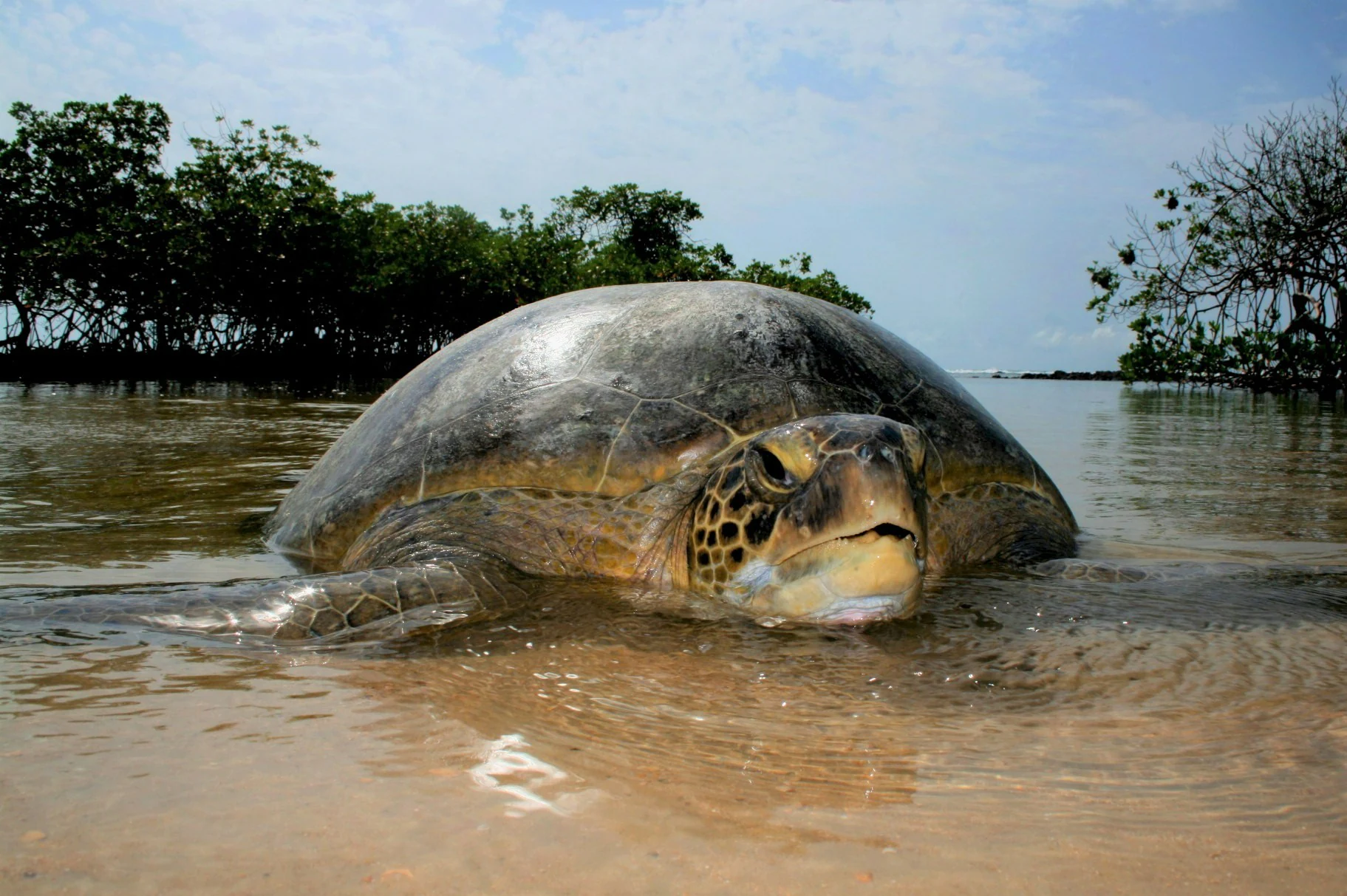
A green sea turtle partially submerged in shallow water, facing the camera, with a line of trees in the background.
A green sea turtle at the surface of shallow coastal waters near a mangrove shoreline.

Manyange na Elombo-Campo Marine National Park history and protected-area timeline

The origins of Manyange na Elombo-Campo lie in the regional conservation movements of the 1990s. Programs such as ECOFAC, the Central African Forests Commission (COMIFAC), and the Central Africa Protected Areas Network (RAPAC) encouraged Gulf of Guinea nations to develop protected areas, both inland and at sea. Researchers and environmental organisations, including WWF and Tropenbos International, documented the ecological and economic value of these zones, while nearby Gabon established coastal national parks beginning in 2002.

Despite these regional efforts, only a few marine protected areas materialised for many years. Equatorial Guinea strengthened its protected area system with a National Biodiversity Strategy and Action Plan in 2014, and São Tomé and Príncipe created the Obô Forest National Park in 2006, but Cameroon's first marine reserve remained an unrealised commitment for decades.

At the Fifth IUCN World Parks Congress in Durban in September 2003, President Paul Biya announced the intention to create marine protected areas in Cameroon. It was not until July 2021, via national decree, that this promise finally took shape with the creation of Manyange na Elombo-Campo as Cameroon's first national marine park. Shortly after, in 2022, the UNDP began supporting the park with dedicated annual funding for community education programs and the assessment of human pressures on the marine environment.

Manyange na Elombo-Campo Marine National Park landscape and geographic character

The landscape of Manyange na Elombo-Campo is dominated by open Atlantic Ocean rather than terrestrial scenery. The protected zone sits along the equatorial Atlantic coast of Cameroon's South Region, roughly 30 kilometers south of the coastal city of Kribi.

The marine area begins a few hundred meters from the shoreline, leaving the immediate coastal strip available for traditional local fishing activities, and stretches far out to sea, covering a vast offshore territory. The seafloor in this part of the Gulf of Guinea includes continental shelf ecosystems, river-mouth environments, and deeper open waters that are used by migratory marine species.

At the park's southern edge, the maritime frontier with Equatorial Guinea follows the Rio Campo river, whose mouth and coastal drainage influence water quality and marine productivity in the reserve. While visitors will not find dramatic cliffs or mountain scenery here, the underwater topography and the interplay between river outflow, coastal currents, and Atlantic conditions define the park's distinctive physical setting.

Manyange na Elombo-Campo Marine National Park ecosystems, habitats, and plant life

Manyange na Elombo-Campo protects a particularly rich section of the Gulf of Guinea marine ecosystem. The waters combine coastal, estuarine, and open-ocean habitats, with the outflow of the Rio Campo shaping nutrient cycles and supporting a variety of marine life.

Four species of sea turtles, including leatherback, hawksbill, green, and olive ridley turtles, frequent the park's waters, and several of these species are considered threatened with extinction. The marine zone also serves as an essential corridor and habitat area for cetaceans, large pelagic fish, and coastal marine fauna that depend on the productive waters of the Gulf of Guinea.

By restricting industrial fishing activity and protecting spawning grounds, the park helps maintain the biological productivity of the broader Gulf of Guinea, linking Cameroon's marine ecosystems to those of Equatorial Guinea and Gabon. This regional ecological role makes the reserve an important node in the wider Central African marine biodiversity network.

Manyange na Elombo-Campo Marine National Park wildlife and species highlights

The wildlife profile of Manyange na Elombo-Campo is one of its most powerful conservation arguments. The park is particularly notable for its cetaceans, which include humpback, long-beaked common, bottlenose, and striped dolphins, among others. The waters off Cameroon and Gabon are a major calving and breeding area for humpback whales, and these coastal waters are used by an estimated ten percent of the global population.

The Atlantic humpback dolphin, an endemic species once thought to have disappeared from the region, is one of the species whose presence justified the creation of the marine park. The reserve's waters also host the West African manatee, a vulnerable coastal mammal that depends on shallow, productive marine and estuarine habitats.

Sea turtles are another centerpiece of the park's wildlife value. Leatherback, hawksbill, green, and olive ridley turtles all occur in these waters, with several species facing serious extinction risk. Together, these varied marine fauna make Manyange na Elombo-Campo an area of considerable regional importance for threatened marine biodiversity.

Manyange na Elombo-Campo Marine National Park conservation status and protection priorities

Manyange na Elombo-Campo represents Cameroon's first formal commitment to marine protected area governance and is therefore a landmark in the country's conservation policy. The park was explicitly designed to limit industrial overfishing, safeguard spawning zones, and protect threatened marine species whose survival depends on the Gulf of Guinea's ecological integrity.

Its significance extends beyond Cameroon. The reserve is part of a cross-border ecosystem that includes Cameroon's forest-based Campo-Ma'an National Park and Equatorial Guinea's Rio Campo reserve, creating a continuous land-sea corridor around the Rio Campo river mouth. Although the formal integration of these protected areas is not yet legally settled, the ecological realities on the ground already link them as a single conservation landscape.

International support has been an important part of the park's early stage. Since 2022, the UNDP has contributed annual funding and technical assistance for educational programs and for assessing the human pressures affecting the marine environment. Together with governmental commitment and regional cooperation frameworks, this international backing positions the park as a key site for marine biodiversity protection in Central Africa.

Manyange na Elombo-Campo Marine National Park cultural meaning and human context

The coastal communities along the South Region of Cameroon have long relied on the sea for fishing and small-scale livelihoods, and the park's design reflects this cultural relationship with the ocean. By leaving a narrow coastal strip available for traditional, low-impact fishing, the reserve deliberately accommodates the practices of local populations rather than excluding them.

This recognition of local dependence on marine resources is part of a broader regional narrative in which Gulf of Guinea states have promoted sustainable, community-aware conservation models, blending ecosystem protection with the maintenance of traditional ways of life along the coast.

Top sights and standout views in Manyange na Elombo-Campo Marine National Park

Cameroon's first marine national park, created in 2021 and covering a vast Atlantic zone off the South Region.

Important calving and breeding area for humpback whales and home to the endemic Atlantic humpback dolphin, the West African manatee, and multiple threatened sea turtle species.

A cross-border conservation mosaic with Campo-Ma'an National Park and Equatorial Guinea's Rio Campo Reserve, safeguarding a continuous land-sea corridor around the Rio Campo river.

The park reflects a long regional effort led by ECOFAC, COMIFAC, and RAPAC, supported since 2022 by UNDP funding and technical assistance.

Best time to visit Manyange na Elombo-Campo Marine National Park

Marine parks in the Gulf of Guinea are best appreciated in the dry season, when sea conditions are calmer, visibility is more reliable, and shore-based access from the South Region is easier. Coastal Cameroon has a relatively consistent tropical climate, but reduced rainfall periods between late autumn and early spring often offer the most favorable conditions for observing marine wildlife and enjoying the coast.

For cetacean encounters, humpback whales are known to use Cameroon's waters as a breeding and calving zone, with their presence tied to specific seasonal movements along the Gulf of Guinea. Sea turtles, dolphins, and manatees can be encountered throughout much of the year, though sightings of nesting and feeding activity may concentrate around particular months tied to marine biological cycles.

Monthly climate preview

Long term temperature and monthly precipitation patterns measured at representative coordinates

Parc National Marin Manyange Na Elombo Campo Climate Normals And Weather By Month

Representative coordinate records show consistent monthly temperature variations alongside shifting precipitation averages throughout the annual cycle at Parc national marin Manyange na Elombo Campo. Detailed monthly climate profiles provide deeper analytical context for long term temperature and rainfall distributions across the marine protected area.
Annual mean27 °C
25 °C28 °C
Jan27°
Feb28°
Mar28°
Apr28°
May27°
Jun26°
Jul25°
Aug25°
Sep26°
Oct26°
Nov27°
Dec27°
Warmest month
March

27.8 °C

Coolest month
August

25.3 °C

Wettest month
October

10.8 mm/day

Driest month
January

2.9 mm/day

Park location guide

Geography guide, regional context, and park location map for Manyange na Elombo-Campo Marine National Park

Manyange na Elombo-Campo Marine National Park park geography, regions, and map view in Cameroon

Understand where Manyange na Elombo-Campo Marine National Park sits in Cameroon through a broader geographic reading of the surrounding landscape, nearby location context, and its mapped position within the national park landscape.

How Manyange na Elombo-Campo Marine National Park fits into Cameroon

Cameroon is a Central African country spanning coastal, highland, and forest regions. It has a population of nearly 31 million people who speak 250 native languages alongside English and French as official languages. The country gained independence from France in 1960 and unified with British Southern Cameroons in 1961.

Wider geography shaping Manyange na Elombo-Campo Marine National Park in Cameroon

Cameroon is located in Central Africa, bordering Nigeria and Chad to the west and north, the Central African Republic to the east, and Equatorial Guinea, Gabon, and the Republic of the Congo to the south. The country has a coastline on the Bight of Biafra, part of the Gulf of Guinea. Terrain includes coastal plains, mountainous highlands (including Mount Cameroon), plateaus, and dense rainforest regions.

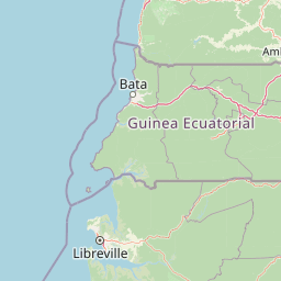
Map view of Manyange na Elombo-Campo Marine National Park

Use this park location map to pinpoint Manyange na Elombo-Campo Marine National Park in Cameroon, understand its exact geographic position, and read its mapped placement within the surrounding landscape more clearly.

Pigeon | © OpenStreetMap contributors

Visual exploration of coastal waters, marine habitats, and Gulf of Guinea scenery

Parc national marin Manyange na Elombo-Campo Photos and Protected Marine Landscapes

Visual records reveal the vast Atlantic expanse and crucial marine habitats of Parc national marin Manyange na Elombo-Campo. Examining these protected waters provides deeper insight into coastal ecosystems and regional conservation geography.

A green sea turtle partially submerged in shallow water, facing the camera, with a line of trees in the background.

A Hawksbill sea turtle swimming underwater with its patterned brown shell and flippers clearly visible against the blue background.

Park atlas

Compare adjacent coastal reserves and cross-border marine conservation corridors

Parks Near Parc national marin Manyange na Elombo-Campo and Regional Protected Areas

Explore other national parks and protected areas sharing ecological ties with Parc national marin Manyange na Elombo-Campo. Compare neighboring coastal habitats and marine zones to understand regional biodiversity patterns across the Gulf of Guinea.
National parkCameroon
5.7 km away#1 closest

Southeast

Campo Ma'an National Park: Essential Protected Landscape in Cameroon's Atlantic Biafran Forest

Mapped evergreen canopy and vital great ape habitat in a key conservation area.

Campo Ma'an National Park is a crucial protected area in Cameroon, spanning 2,680 square kilometers of dense Atlantic Biafran forest. Established for environmental compensation, it safeguards critical habitat for western lowland gorillas and central chimpanzees, alongside forest elephants and diverse birdlife. The park's landscape is defined by a persistent evergreen canopy ecosystem, offering a unique context for understanding Central African rainforest geography and protected land status.

Area
2,680 km²
Established
2000
IUCN
II
Climate
Tropical
National parkCameroon
64 km away#2 closest

North

Douala-Edéa National Park: Coastal Mangrove and Tropical Forest Protected Landscape

Explore Cameroon's vital protected national park geography.

Douala-Edéa National Park is a protected national park in Cameroon's Littoral Region, defined by its extensive coastal geography where tropical lowland equatorial forests merge with significant Atlantic mangrove ecosystems. This area, encompassing roughly 2,715 square kilometers along the Bight of Biafra and the Sanaga River estuary, offers rich context for understanding Central Africa's coastal protected lands and diverse natural landscapes.

Area
2,715.12 km²
Established
2018
IUCN
II
Relief
Lowland
National parkEquatorial Guinea
About 96 km away#3 closest

Southeast

Monte Alén National Park National Park: Mapped Protected Landscape in Equatorial Guinea

Explore regional geography and park boundaries.

Monte Alén National Park, a designated national park in Equatorial Guinea, offers a unique focal point for understanding protected landscapes. This entry provides detailed geographic context, highlighting the park's mapped boundaries and its significance within the atlas of Central African natural terrain. Investigate the terrain and regional setting of Monte Alén National Park for structured geographic discovery.

Area
2,000 km²
Established
1990
IUCN
II
Relief
Mountain
National parkBioko Norte
About 130 km away#4 closest

Northwest

Pico Basilé National Park: Volcanic Peak National Park and Protected Landscape

Explore Bioko Norte's unique montane terrain and rich avifauna.

Pico Basilé National Park is a critical conservation zone encompassing Equatorial Guinea's highest point, Pico Basilé volcano. This national park protects unique montane forest ecosystems and their diverse inhabitants, including several threatened primate species and a significant bird population, making it a key protected area on Bioko Island. Understand its geographic setting within Bioko Norte and its role as a vital natural landscape.

Area
300 km²
Established
2000
IUCN
II
Relief
Mountain
National parkWoleu-Ntem Province
153 km away#5 closest

South

Crystal Mountains National Park: National Park Protected Area and Geographic Context in Woleu-Ntem Province

Explore its mapped boundaries and regional landscape.

Crystal Mountains National Park is a designated national park offering critical insights into its protected landscape and geographic setting. Users can explore the mapped boundaries of this protected area, understand its regional terrain, and gain context within Woleu-Ntem Province through structured geographic data. This page provides the foundational atlas information for comprehending the park's conservation significance and natural features.

Area
1,200 km²
Established
2002
IUCN
II
Relief
Mountain
National parkCameroon
About 178 km away#6 closest

North

Mount Cameroon National Park: A National Park within Cameroon's Geographic Atlas

Explore its protected landscape and mapped terrain.

This dedicated entry for Mount Cameroon National Park provides essential atlas-based information for understanding its significance as a protected area. Users can explore the park's geographic identity, mapped boundaries, and its role within the diverse landscapes of Cameroon. Gain structured insight into the natural terrain and protected land context that defines this national park, offering a clear view of its atlas-relevant features.

National parkGabon
183 km away#7 closest

South

Akanda National Park: A Key Protected Landscape on Gabon's Atlantic Coast

Explore Gabon's vital mangrove ecosystems and coastal protected areas.

Akanda National Park in Gabon is a significant protected area celebrated for its expansive mangrove forests and critical role in supporting migratory bird populations. Located along the Atlantic coast, this park's unique landscape at the nexus of tidal waters and coastal terrain makes it a valuable site for understanding regional ecology and mapped protected lands. It serves as a primary destination for exploring the natural geography and conservation significance of West African coastal environments.

Area
540 km²
Established
2002
IUCN
II
Relief
Lowland
National parkEquatorial Guinea
About 196 km away#8 closest

Southeast

Altos de Nsork National Park: Equatorial Guinea's Protected Landscape and Map Context

Explore the mapped boundaries of this national park.

Altos de Nsork National Park stands as a designated national park within Equatorial Guinea, offering a distinct protected landscape. This entry provides essential atlas-driven details, emphasizing its geographic setting and mapped park boundaries. Understand its regional context and its significance as part of the conservation network in Central Africa, contributing to a richer understanding of mapped natural terrains.

Area
700 km²
Established
2000
IUCN
II
Relief
Highland

Common questions about visiting, size, designation, and location context for Manyange na Elombo-Campo Marine National Park

Manyange na Elombo-Campo Marine National Park FAQs for park facts, access, geography, and protected area context

Find quick answers about Manyange na Elombo-Campo Marine National Park, including protected-area facts, park geography, trail and visitor context, and how the park fits into its surrounding country and regional landscape.
MoriAtlas Explorer

Continue Your Protected Areas Search Across the Global Atlas

Deepen your exploration by continuing the structured search for national parks and protected areas worldwide. Utilize the comprehensive filtering capabilities to compare different conservation landscapes and refine your understanding of global park geography. Discover more about the distribution and characteristics of protected natural areas.

Global natural geography
