Mori Atlas logo
Nearby park discovery

Understanding regional landscape context and mapped proximity in the Antarctic

Geographic Distribution of Protected Areas and Parks Near Mawson's Huts

Examine the geographic distribution of protected lands surrounding Mawson's Huts in the Australian Antarctic Territory. This data provides a comparative look at the regional landscape and the proximity of other identified protected sites within the broader Antarctic coastal environment.

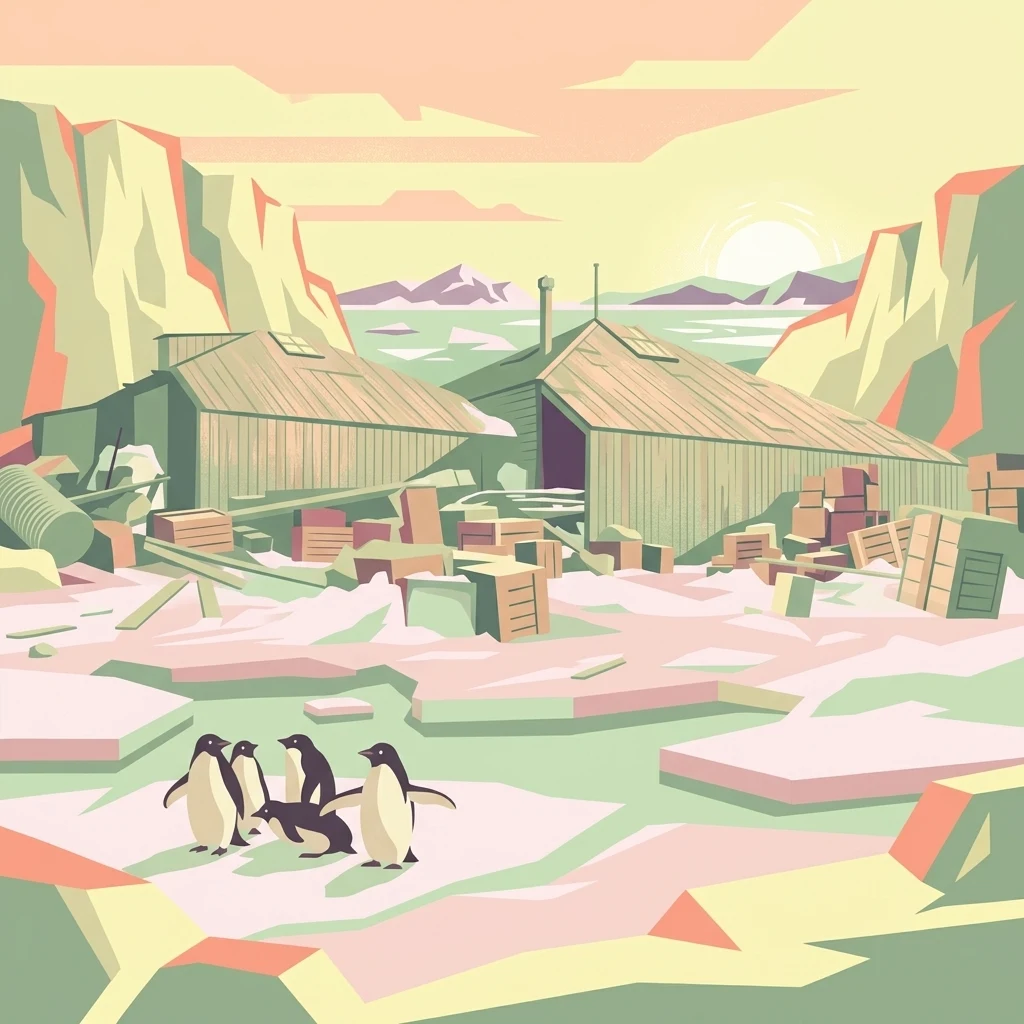
A stylized flat-design illustration of historic wooden expedition buildings with stacks of crates outside, set in a snowy landscape with a small group of penguins in the foreground and a pale sun on the horizon.

A rare surviving relic of Antarctica's Heroic Age of exploration at Cape Denison.

Mawson's Huts

Mawson's Huts is a cluster of historic buildings standing at Cape Denison in the far eastern part of the Australian Antarctic Territory, roughly 3,000 kilometres south of Hobart, Tasmania. Erected in 1912 for the Australasian Antarctic Expedition of 1911 to 1914, the site is one of only six surviving locations from the so-called Heroic Era of Antarctic exploration, and the only one from that era that was organised, manned and supported primarily by Australians. The most prominent structure is the winter quarters known as Mawson's Hut, a pyramid-roofed building prefabricated in Sydney and Melbourne and assembled on site. It sheltered the eighteen members of the main base party during 1912 and seven men (including expedition leader Douglas Mawson) during an unplanned second year in 1913. Supporting structures include a magnetograph hut, an absolute magnetic hut and a transit hut used as an astronomical observatory, together forming a tightly clustered working base on a remote, storm-battered coastline. Mawson's Huts is significant not only as a frozen-in-time scientific and living base, but also as a heritage landmark of international standing. The site is recognised under the Antarctic Treaty as a Historic Site and Monument and is protected within Antarctic Specially Protected and Managed Area frameworks. It has been the subject of sustained conservation work by the Australian Antarctic Division, the Mawson's Huts Foundation and earlier Project Blizzard expeditions, all aimed at preserving the huts as a tangible link to one of the defining chapters of polar exploration.

Location
Antarctica
Park type
Protected area
Established
1912
Mawson's Huts Protected Area Map
Regional park map

See the ranked park cluster in its geographic setting

Nearby parks around Mawson's Huts

This regional map shows the same 20 nearby parks ranked below around Mawson's Huts. Select a ranked marker to highlight that park’s boundary where boundary data is available.
Reference park: Mawson's HutsRanked nearby park20 nearby parks shown
20 nearby parks

Distance-ranked conservation areas and surrounding polar geography

Parks and Protected Areas Geographically Near Mawson's Huts

Examine the ranked collection of protected areas situated geographically close to Mawson's Huts using mapped spatial separation and direction. These regional park records provide structured comparison signals to evaluate surrounding terrain without implying shared environmental conditions.
Marine protected areaAustralia
About 1,247 km away#1 closest

Northeast

Macquarie Island Marine Park: Subantarctic Seafloor and Marine Conservation Geography

A remote Australian marine protected area and ocean atlas

This expansive marine protected area encompasses deep ocean habitats and productive surface waters in the remote subantarctic. The park features diverse seafloor topography, such as abyssal plains and submarine canyons, while providing vital foraging grounds for penguins, seals, and diverse marine wildlife across the southwest Pacific.

Area
475,465 km²
Established
1999
IUCN
IV
Relief
Lowland
Protected areaAntarctica
About 1,409 km away#2 closest

West

Clark Peninsula: Antarctic Protected Landscape and Coastal Geographic Atlas

Ice-free rocky terrain on the Budd Coast of Wilkes Land

Clark Peninsula provides a window into the unique geography of East Antarctica, featuring exposed rocky outcrops, coastal coves, and significant glacial moraines. As a dedicated protected area, the site supports long-term ecological research and provides a critical habitat for seabird colonies, offering a detailed look at the interface between continental ice and the Southern Ocean.

Area
9.4 km²
Relief
Lowland
Climate
Polar
Access
Remote access
Protected areaAntarctica
About 1,409 km away#3 closest

West

Ardery Island: Protected Coastal Geography and Antarctic Seabird Habitats

Rugged terrain and avian conservation in the Windmill Islands

Ardery Island represents a compact, rocky protected area within the Antarctic landscape. Known for its steep cliffs and essential seabird colonies, this island serves as a focal point for ecological study along the Budd Coast, offering a distinct example of high-latitude coastal geography.

Relief
Upland
Climate
Polar
Access
Remote access
Scope
Mixed
Protected areaAntarctica
About 1,426 km away#4 closest

West

Frazier Islands Protected Area: Geographic Boundaries and Antarctic Coastal Context

Rocky island terrain within the Vincennes Bay coastal region

Examine the rugged profile of the Frazier Islands, a group of three ice-free rocky outcrops rising from the Southern Ocean. Their protected status and specialized role as a rare continental seabird breeding ground offer a distinct lens into the regional geography and conservation landscapes of East Antarctica.

Relief
Lowland
Climate
Polar
Access
Remote access
Scope
Marine
Marine protected areaNew Zealand Subantarctic Islands
About 2,133 km away#5 closest

Northeast

Moutere Ihupuku / Campbell Island Marine Reserve: Protected Marine Landscape and Map

Subantarctic marine geography in the New Zealand island chain.

Moutere Ihupuku / Campbell Island Marine Reserve safeguards a remote underwater wilderness defined by its volcanic origins. From its basalt pinnacles to the vast sponge gardens and boulder fields, the reserve functions as a vital protected area for Southern Ocean biodiversity. Map the connections between these extreme coastal environments and the world's largest population of southern royal albatross residing within the New Zealand Subantarctic Islands.

Established
2014
Relief
Mixed relief
Access
Remote access
Scope
Marine
Marine protected areaTasmania
About 2,222 km away#6 closest

North

South Tasman Rise Commonwealth Marine Reserve Marine Protected Area and Geological Atlas

Deep-sea submarine landscapes and Australian offshore geography.

The South Tasman Rise Commonwealth Marine Reserve represents a vital offshore protected area, defined by its remote location and significant deep-sea geological features. Users can examine the reserve's unique bathymetry, including the distinctive truncated peaks of submerged seamounts and broad submarine plateaus that characterize this southern marine frontier far beyond the continental shelf.

Area
27,704 km²
Established
2007
IUCN
VI
Climate
Subpolar
Marine protected areaNew Zealand
About 2,232 km away#7 closest

Northeast

Auckland Islands Marine Mammal Sanctuary: Subantarctic Protected Area and Marine Geography

Mapping remote marine mammal habitats in the New Zealand southern Pacific

Covering over half a million hectares of oceanic terrain, the Auckland Islands Marine Mammal Sanctuary acts as a cornerstone of New Zealand conservation. The area protects complex underwater ecosystems, ranging from sheltered fjord-like inlets to deep-sea abyssal zones, while providing a stable recovery environment for vulnerable whale and sea lion populations in the subantarctic region.

Area
5,605.64 km²
Established
1993
Climate
Subpolar
Access
Highly restricted
Nature reserveNew Zealand
About 2,236 km away#8 closest

Northeast

Auckland Islands: Protected Subantarctic Geography and Volcanic Archipelago Map

An uninhabited island wilderness and nature reserve in southern New Zealand.

The Auckland Islands comprise a rugged, uninhabited volcanic archipelago south of New Zealand. This expansive nature reserve features deeply indented coastlines, sheltered harbours like Carnley Harbour, and complex subantarctic ecosystems. Gain detailed insights into this protected marine and land sanctuary, home to vital seabird colonies, endemic wildlife, and significant southern right whale gathering grounds.

Area
570 km²
Relief
Mountain
Climate
Subpolar
Access
Highly restricted
Marine protected areaTasmania
About 2,239 km away#9 closest

North

Tasman Fracture Commonwealth Marine Reserve: Mapping Deep Ocean Protected Landscapes

Offshore Tasmania marine habitat and seafloor geography overview.

Spanning over 42,500 square kilometres of deep ocean, the Tasman Fracture Commonwealth Marine Reserve protects diverse marine life and complex bathymetry off the south-west coast of Tasmania. Discover the geological significance of the Tasman Fracture itself and how the reserve supports deepwater hard corals, seabirds, and marine mammals within a transitional oceanic zone influenced by the Zeehan Current.

Area
42,502 km²
Established
2007
IUCN
VI
Access
Remote access
Marine protected areaTasmania
About 2,479 km away#10 closest

North

Huon Commonwealth Marine Reserve: Deep Ocean Topography and Tasmanian Marine Protected Areas

Exploring underwater mountain peaks and protected seafloor habitats.

Situated in the Pacific Ocean south of Tasmania, the Huon Commonwealth Marine Reserve is defined by a dense cluster of seventy submerged seamounts. These massive cone-shaped structures provide rare structural complexity on the deep seafloor, acting as critical nodes for biodiversity, foraging marine life, and protected benthic communities. This atlas entry provides a detailed look at the reserve's topography and its role in the broader South-east Commonwealth Marine Reserve Network.

Area
9,991 km²
Established
1999
IUCN
VI
Relief
Mixed relief
National parkTasmania
About 2,590 km away#11 closest

North

Southwest National Park: Tasmania's Core Wilderness National Park and World Heritage Landscape

Mapping the remote buttongrass moorlands and rugged terrain of this expansive park.

Southwest National Park represents a significant protected area in Tasmania, Australia, spanning over 6,183 square kilometers. As the heart of the Tasmanian Wilderness World Heritage Area, it showcases an extraordinary landscape characterized by vast buttongrass moorlands, ancient temperate rainforests, and dramatic mountainous terrain. This park is vital for its wilderness character and conservation significance, offering a unique opportunity to explore one of the Southern Hemisphere's last remaining untouched temperate wildernesses through its mapped geography and protected boundaries.

Area
6,182.67 km²
Established
1968
IUCN
II
Relief
Mountain
Protected areaEast Antarctica
About 2,616 km away#12 closest

Southwest

Amanda Bay Protected Area: Geography and Coastal Ice Mapping in East Antarctica

Glacial inlets, emperor penguin colonies, and stable sea ice

Amanda Bay offers a focused look at the remote East Antarctic coastline, characterized by the Hovde Glacier, Flatnes Ice Tongue, and recurring stable sea ice. This protected area serves as a vital habitat for thousands of emperor penguins and illustrates the complex relationship between glacial cliffs and coastal marine environments across the Prydz Bay margin.

Area
18 km²
Established
1957
Relief
Lowland
Climate
Polar
National parkNew Zealand
About 2,621 km away#13 closest

Northeast

Rakiura National Park: New Zealand's Remote Protected Wilderness & Landscape Atlas

Explore its rugged terrain and unique subantarctic ecosystem.

Rakiura National Park encompasses the majority of Stewart Island, offering a unique glimpse into one of New Zealand's most remote and undisturbed natural environments. This protected landscape features rugged forested hills, extensive coastlines with isolated beaches, and is globally recognized for its abundant kiwi populations. Discover the park's geographic setting and its significance as a protected area for both wildlife and cultural heritage within the broader atlas of New Zealand's natural wonders.

Area
1,399.6 km²
Established
2002
IUCN
II
Relief
Lowland
National parkTasmania
About 2,628 km away#14 closest

North

South Bruny National Park: Tasmania's Protected Area Geography and Mapped Landscape Context

Discover the geographic identity and mapped boundaries of this Tasmanian National Park.

South Bruny National Park is a key protected landscape located in Tasmania, Australia, offering critical insights into regional conservation efforts. As a designated National Park, its identity is tied to the preservation of its unique geographic features and natural terrain. This entry provides detailed information on its mapped boundaries and its place within Tasmania's broader atlas of protected areas, facilitating a deeper understanding of its protected landscape significance.

Area
50.59 km²
Established
1997
IUCN
II
Visitors
9.2K annual
National parkTasmania
About 2,652 km away#15 closest

North

Hartz Mountains National Park: Tasmania's National Park Protected Landscape

Mapped geography and regional landscape context.

Delve into the specific protected landscape identity of Hartz Mountains National Park, situated in Tasmania, Australia. This page provides a detailed geographic breakdown, focusing on mapped park boundaries and its unique regional setting. Understand the atlas value of this national park by exploring its terrain and its role within Tasmania's broader conservation landscape.

Area
71.4 km²
Established
1939
IUCN
II
Visitors
11.8K annual
National parkTasmania
About 2,664 km away#16 closest

North

Tasman National Park: Discover Its National Park Geography and Protected Landscape

Explore mapped boundaries and regional context within Tasmania.

Tasman National Park represents a key protected area for exploration within Tasmania's distinctive geography. This page facilitates a detailed look at its national park identity, focusing on its mapped natural landscapes and its contribution to the protected area network of the Australian island state. Gain structured geographic insight into this significant conservation landscape.

Area
107.5 km²
Established
1999
IUCN
II
Relief
Mixed relief
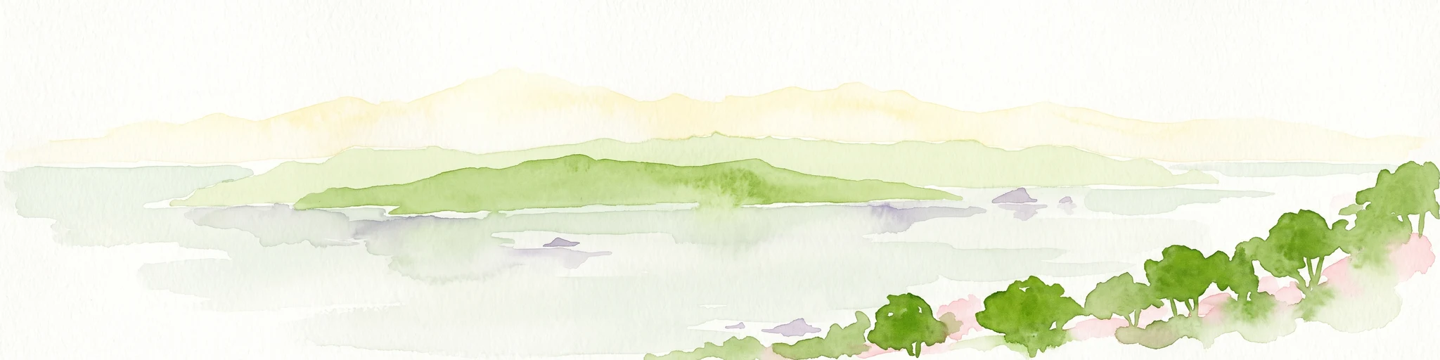
A soft watercolor illustration showing an island with green rolling hills rising from the water, with a line of trees along the shoreline in the foreground.
Nature reserveSouthland Region
About 2,677 km away#17 closest

Northeast

Codfish Island / Whenua Hou: A Protected Nature Reserve in the Southland Region

Coastal terrain and island geography in New Zealand

Located off the coast of Stewart Island, Codfish Island / Whenua Hou functions as an essential nature reserve. The island features moderate terrain, temperate coastal forests, and a protected landscape that preserves rare species and seabird colonies. Its geography is defined by a remote maritime setting, making it a globally significant site for predator-free wildlife conservation in the Tasman Sea.

Area
14 km²
Established
1987
Relief
Upland
Climate
Temperate
Wildlife reserveNew Zealand
About 2,678 km away#18 closest

Northeast

Ulva Island Wildlife Reserve: Mapped Geography and Protected Forest Landscapes

An open sanctuary located in Paterson Inlet, New Zealand

Explore the unique geography of Ulva Island, a 2.7 square kilometre wildlife reserve within Rakiura National Park. This predator free island features dense temperate rainforest, sheltered coastal bays, and vital recovery habitats for native bird species, offering a distinct study in southern New Zealand's protected forest terrain.

Area
2.67 km²
Relief
Lowland
Climate
Temperate
Access
Easy access
Marine protected areaTasmania
About 2,686 km away#19 closest

North

Freycinet Commonwealth Marine Reserve: Protected Marine Landscapes and Bathymetry in the Tasman Sea

Offshore Australian marine geography and deep-sea protected areas

Freycinet Commonwealth Marine Reserve serves as a monumental example of marine conservation in the Tasman Sea. Stretching far from the Tasmanian coast, this reserve protects substantial offshore seamounts and pelagic waters. Its submarine landscape is shaped by ancient volcanic activity, creating varied seafloor environments that support deep-sea biodiversity and wide-ranging marine species.

Area
57,942 km²
Established
2007
IUCN
II
Climate
Temperate
National parkSouthland Region
About 2,707 km away#20 closest

Northeast

Fiordland National Park: A Protected Landscape of Glacier-Carved Fiords and Alpine Wilderness

Explore its vast boundaries and unique temperate rainforest.

Fiordland National Park, located in the Southland Region of New Zealand, is a testament to dramatic geological forces, featuring fifteen major fiords like Milford Sound, whose Mitre Peak rises majestically from the water. This protected national park encompasses an immense wilderness of alpine terrain, ancient beech forests, and numerous waterfalls, fueled by exceptional rainfall. Its inclusion in the Te Wāhipounamu World Heritage Area underscores its global significance for biodiversity and natural landscape preservation.

Area
12,607 km²
Established
1952
IUCN
II
Visitors
500K annual
Distance methodology

Geographic measurements, not driving distances

How nearby park distances are calculated

Distances use park boundaries whenever the available geometry allows it. When one or both boundaries are missing, the mapped park locations provide a clearly labelled estimate. Every value represents straight-line geographic separation and does not use roads or routing.

Boundary distance

Calculated between the nearest points of both park boundaries.

Location-to-boundary estimate

Estimated from one mapped park location to the nearest boundary of the other park.

Mapped-location estimate

Estimated between the mapped locations of both parks.

MoriAtlas Explorer

Continue Exploring the Geography of Mawson's Huts and Cape Denison

Examine the specific environmental conditions and historical placement of Mawson's Huts through the MoriAtlas collection. Gain deeper insight into the protected landscape features and regional topography of this remote East Antarctic coastal landmark.

Global natural geography