
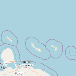
Peninsulas
Park geography
Structured terrain analysis, administrative location, and natural feature distribution
Comprehensive Geographic Profile and Mapped Boundaries of Médanos de Coro National Park
This geographic profile details the physical scope and environmental characteristics of Médanos de Coro National Park in Falcón State, Venezuela. Access precise boundary-derived dimensions, elevation data reaching 40 meters, and a catalog of internal natural features including coastal dunes, riverine systems, and diverse capes.
Related tags
Desert DunesCoastal WetlandsXeric ScrubImportant Bird AreaCaribbean Coast
Venezuela's Desert Dunes and Coastal Marshes on the Paraguana Peninsula
Médanos de Coro National Park
Médanos de Coro National Park is a protected desert and coastal landscape in northwestern Venezuela, situated on the Médanos Isthmus that connects the Paraguana Peninsula to the mainland. The park was established in 1974 and encompasses approximately 91 square kilometers of extraordinary sand dune formations, salt marshes, mangrove swamps, and xeric scrub terrain. It protects a portion of the Paraguana xeric scrub ecoregion, one of the most arid environments in northern South America. The park's defining feature is the massive sand dunes known as médanos, which spread across an area roughly 5 by 30 kilometers and can reach heights of 40 meters. These dunes are continuously reshaped by relentless coastal winds, creating a dynamic and ever-changing landscape unique among Venezuelan protected areas.
- Location
- Venezuela
- Park type
- National park
- Established
- 1974
- Area
- 91 km²
- Highest point
- 40 m
Location overview
Regional positioning and coastal status in Falcón State
Geographic Setting of Médanos de Coro National Park in Venezuela
Médanos de Coro National Park is located within Falcón State in northern Venezuela. The protected landscape features a coastal classification and lies entirely within a single national territory.
- Countries
- Venezuela
- Regions
- Falcón State
- Primary location
- Falcón State
- Geographic setting
- Coastal
Boundary and coordinates
Interactive boundary geometry and recorded spatial measurements
Médanos de Coro National Park Boundary Map and Spatial Extent
Mapped park outlines provide clear spatial context for analyzing protected area boundaries. Accompanying facts detail total land area measurements, coordinate limits, and geographic spans.
- Boundary area
- 750.5 km²
- Boundary perimeter
- 185 km
- Northernmost point
- 11.8086° N
- Southernmost point
- 11.3848° N
- Easternmost point
- 69.5867° W
- Westernmost point
- 69.9813° W
- Geographic centre
- 11.5725° N, 69.7502° W
- North–south span
- 46.9 km
- East–west span
- 43 km
Elevation and terrain
Lowland relief classification and recorded natural features
Médanos de Coro National Park Terrain and Elevation Profile
Recorded elevation records place the highest point at forty meters across lowland terrain. Linked natural feature cards detail specific capes, peninsulas, bays, and watercourses located within the protected boundary.
- Maximum elevation
- 40 m
- Highest point
- 40 m
Selected named natural features
Capes
Punta Cayama
Capes
Punta Los Bajitos
Capes
Punta Cabecera
Capes
Punta Médano Blanco
Capes
Punta El Portillo
Environmental setting
Arid lowlands, sparse forest cover, and coastal dune habitats shaping the protected terrain
Environmental Classifications and Physical Settings of Médanos de Coro National Park
Recorded landscape features, habitat types, and climate zones offer complementary ways to read the physical setting of Médanos de Coro National Park. Structured categories connect specific environmental properties to relevant atlas destinations across the protected area.
- Relief
- Lowland
- Climate
- Arid
- Water
- Major water bodies
- Forest cover
- Sparse forest
- Seasonality
- Seasonal
Landscape features
Coast · Dunes · Lakes · Rivers · Wetland
Habitat types
Coastal habitat · Desert habitat · Dune habitat · Riverine habitat · Shrubland · Wetland
Park atlas
Explore the regional context of protected areas, comparing landscapes surrounding Médanos de Coro National Park.
Continue Your Discovery: Other National Parks Near Médanos de Coro National Park
Beyond Médanos de Coro National Park, browse a selection of nearby national parks and protected areas, mapping diverse desert dunes, coastal wetlands, and xeric scrub ecoregions in northwestern Venezuela. Comparing these protected landscapes offers valuable geographic context on regional conservation efforts, deepening atlas-style understanding of South American natural terrain.
National parkFalcón
About 26 km away#1 closest
South

Parque nacional Juan Crisóstomo Falcón: Karst Geology and Sierra de Falcón Geography
Protected karst mountains, cave systems, and water networks in northern Venezuela.
Parque nacional Juan Crisóstomo Falcón encompasses a distinct limestone landscape within the Sierra de Falcón. This protected area is recognized for vertical sinkholes, sprawling subterranean galleries, and the Fosa de San Luis. As a key water source for the region, the park presents a compact mosaic of varied mountain terrain, encompassing both cloud forest and arid woodland zones across its mountainous expanse.
- Area
- 200 km²
- Established
- 1987
- IUCN
- II
- Relief
- Mountain
National parkVenezuela
About 26 km away#2 closest
South
Juan Crisóstomo Falcón National Park: Venezuela's Protected Area and Landscape Geography
Mapped boundaries and regional context for this Venezuelan national park.
Juan Crisóstomo Falcón National Park represents a distinct protected area within Venezuela, offering specific insights into its geographic identity and mapped landscape. This entry facilitates a deeper understanding of the park's protected boundaries and its place within the national and regional atlas of South America. Explore the terrain and natural context that define this significant Venezuelan national park for structured geographic discovery.
National parkAruba
About 79 km away#3 closest
North

Arikok National Park: Mapping the Protected Landscapes and Geological Features of Northern Aruba
Exploring the terrain, coastal cliffs, and cultural heritage of Aruba's premier reserve.
Spanning over 7,000 acres, Arikok National Park forms the core of Aruba's conservation landscape. The park showcases a complex geological story, from the ancient volcanic Aruba Lava Formation and Batholith to the younger, porous limestone plateaus of the south. This protected zone provides a vital refuge for endemic species such as the Aruban rattlesnake and burrowing owl, while preserving layered cultural remnants from Arawak petroglyphs to early gold mining ruins.
- Area
- 32 km²
- Established
- 2000
- IUCN
- II
- Visitors
- 10K annual
Marine protected areaAruba
About 80 km away#4 closest
North
Marine Park Aruba: An Atlas of Protected Coastal Waters and Marine Conservation Zones
Mapping the four-part reserve network across the island coastline
Marine Park Aruba consists of four separate marine protected areas that safeguard the most ecologically significant coastal waters of the island. The reserves protect a diverse array of marine landscapes, ranging from calm mangrove lagoons and seagrass beds to intricate fringing coral reefs. This data-driven overview tracks the park boundaries and regional distribution of these critical Caribbean habitats.
- Area
- 60.2 km²
- Established
- 2019
- Relief
- Lowland
- Climate
- Tropical
National parkCuracao
About 90 km away#5 closest
Northeast

Christoffelpark National Park: Curacao's Volcanic Terrain and Protected Landscape Atlas
Explore mapped boundaries and unique dry forest ecosystems.
Christoffelpark represents Curacao's most vital protected natural area, offering a deep dive into its unique geography and landscape. This national park preserves the island's highest peak, Christoffelberg, alongside distinctive dry forest ecosystems, endemic species, and the remnants of colonial plantations. Explore the mapped terrain, understand the regional context, and appreciate the rich natural and cultural heritage that defines this important protected landscape on Curacao.
- Area
- 10.4 km²
- Established
- 1978
- IUCN
- II
- Relief
- Mixed relief
National parkVenezuela
About 94 km away#6 closest
Southeast
Cueva de la Quebrada del Toro National Park: Venezuelan National Park Protected Landscape
Explore its mapped boundaries and regional geographic context.
This page details Cueva de la Quebrada del Toro National Park, highlighting its status as a national park within Venezuela. Understand the park's geographic setting, its role as a protected landscape, and its mapped presence within the country's natural reserves. It provides essential context for exploring its protected boundaries and regional significance for atlas-based discovery.
- Area
- 48.85 km²
- Established
- 1961
- IUCN
- II
- Relief
- Upland
National parkLara State
About 133 km away#7 closest
South
Cerro Saroche National Park: A National Park within Lara State's Geography
Explore the protected landscape and mapped boundaries.
Cerro Saroche National Park in Lara State, Venezuela, is a distinct protected area offering a valuable perspective for geographic and atlas exploration. This page provides essential details about its identity as a national park, highlighting its place within the regional landscape. Understanding Cerro Saroche National Park helps in appreciating the distribution of protected lands and their geographical significance across Venezuela.
- Area
- 322.94 km²
- Established
- 1989
- IUCN
- II
- Relief
- Mountain
National parkVenezuela
145 km away#8 closest
Southeast
Morrocoy National Park: Venezuela's Coastal National Park with Distinct Protected Geography
Explore the mapped protected landscape and regional context.
Morrocoy National Park stands as a key protected area within Venezuela, offering a distinct focus for geographic exploration. As a national park, its mapped boundaries delineate a significant natural landscape critical for understanding regional conservation and the country's broader atlas of protected lands. Discover the unique geographic characteristics and the atlas-driven context of this important Venezuelan protected area.
- Area
- 320.9 km²
- Established
- 1974
- IUCN
- II
- Relief
- Mixed relief
MoriAtlas Explorer
Continue Atlas Exploration of Médanos de Coro National Park's Unique Geography
Delve deeper into the geographic context and protected landscape identity of Médanos de Coro National Park. Understanding this park's unique arid terrain and dynamic sand dunes provides valuable insight into regional landforms and conservation areas within South America. Explore its mapped boundaries and discover its place within the broader atlas of protected territories.
Browse next
Global natural geography
Explore related park routes
Explore MoriAtlas Global ParksBrowse All MoriAtlas ParksGlobal Park Map DiscoveryMoriAtlas: Browse All CountriesBrowse All MoriAtlas ContinentsNational Park Environment AtlasGrand Canyon National Park AtlasYellowstone National Park AtlasYosemite National Park Atlas and GeographySerengeti National Park AtlasGalápagos National Park Protected LandscapeBanff National Park Geography and AtlasKruger National Park Atlas EntryUluṟu-Kata Tjuṯa National Park AtlasExplore Uluru-Kata Tjuta National Park GeographyPlitvice Lakes National Park AtlasFiordland National Park Protected LandscapeGreat Smoky Mountains National Park AtlasAfghanistan National Parks and Protected AreasAlbania National Parks and Protected AreasAlgeria National Parks and Protected AreasAmerican Samoa National Parks and Protected AreasAndorra National Parks and Protected AreasAngola National Parks and Protected AreasAntarctica National Parks and Protected AreasAntigua and Barbuda Park List