
Lakes
Park geography
Structured data covering terrain elevation, spatial extent, and protected natural features
Geographic Profile and Mapped Boundaries of Mount Field National Park, Tasmania
Examine the physical characteristics of Mount Field National Park, an expansive 162.65 square kilometer protected area located in Tasmania. The mapped boundaries encompass diverse alpine meadows, temperate forests, and high-altitude peaks, including Mount Field West and Mount Mawson. This profile provides comprehensive data on spatial dimensions, elevation profiles, and the distribution of internal natural landmarks.
Related tags
Temperate RainforestAlpine EnvironmentGlacial LakesWaterfallsWorld Heritage Area
Tasmania's oldest national park with temperate rainforests, alpine peaks, and glacial tarns
Mount Field National Park
Mount Field National Park is one of Tasmania's oldest and most ecologically diverse protected areas, established in 1916. Located approximately 64 kilometers northwest of Hobart on the Australian island state of Tasmania, the park encompasses 162.65 square kilometers of remarkably varied terrain. The landscape transitions dramatically from lush eucalyptus temperate rainforest in the lower valleys to alpine moorland and craggy peaks at higher elevations, with Mount Field West rising to 1,434 meters. This ecological diversity makes the park a remarkable showcase of Tasmania's natural heritage, protected as part of the broader Tasmania Wilderness World Heritage Area. The park holds the distinction of being one of the first areas in Tasmania set aside for nature conservation, with the Russell Falls region protected as early as 1885.
- Location
- Australia
- Park type
- National park
- Established
- 1916
- Area
- 162.7 km²
- Highest point
- 1,434 m
Location overview
Island park status within the state of Tasmania in Australia
Mount Field National Park Geographic Location and Regional Context
Mount Field National Park is positioned within the territory of Tasmania, Australia. Geographic records detail the administrative placement and official island park status of the reserve.
- Countries
- Australia
- Regions
- Tasmania
- Primary location
- Tasmania
- Geographic setting
- Island
Boundary and coordinates
Interactive boundary geometry and recorded area measurements
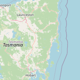
Mount Field National Park Boundary Map and Spatial Extent
Mapped park outlines provide precise spatial context for exploring protected territory. Accompanying boundary facts detail total surface area, coordinate limits, and geographic spans.
- Boundary area
- 225.3 km²
- Boundary perimeter
- 111.7 km
- Northernmost point
- 42.5416° S
- Southernmost point
- 42.7327° S
- Easternmost point
- 146.7234° E
- Westernmost point
- 146.471° E
- Geographic centre
- 42.652° S, 146.5832° E
- North–south span
- 21.2 km
- East–west span
- 20.7 km
Elevation and terrain
Mountain relief metrics and recorded interior natural features
Mount Field National Park Terrain and Elevation Geography Profile
Recorded elevation metrics establish a peak elevation of 1434 meters within the mountain relief classification. Linked feature cards supply names, types, measurements, and spatial relationships for interior lakes, peaks, streams, and viewpoints.
- Maximum elevation
- 1,434 m
- Highest point
- 1,434 m
Selected named natural features
Viewpoints
Lake Seal Lookout
Peaks
The Knobs (North)
1,100 m
Peaks
Davis Lookout
1,206 m
Lakes
Lake Dobson
Lakes
Lake Nicholls
Environmental setting
Temperate climate zones, mountain relief, and forest cover patterns
Mount Field National Park Environmental Classifications and Physical Settings
Recorded landscape features, habitat types, and seasonal classifications frame the physical setting of Mount Field National Park across diverse terrain. Stored environmental categories connect directly to relevant atlas destinations to support structured regional park discovery.
- Relief
- Mountain
- Climate
- Temperate
- Forest cover
- Mostly forested
- Seasonality
- Strongly seasonal
Landscape features
Lakes · Mountains · Valleys · Waterfalls · Forest · Glacier · Cliffs · Islands
Habitat types
Alpine meadow · Glacial habitat · Lacustrine habitat · Temperate broadleaf forest
Park atlas
Compare regional protected landscapes and diverse ecosystems surrounding Mount Field National Park across Tasmania's wilderness geography.
Explore Other National Parks and Protected Areas Near Mount Field National Park, Tasmania
After exploring Mount Field National Park, browse an expanded selection of nearby national parks and significant protected areas to trace Tasmania's diverse ecological spread. Compare alpine environments, glacial features, and temperate rainforests within their regional context, offering deeper atlas-style discovery of connected conservation landscapes.
National parkTasmania
2.2 km away#1 closest
Southwest

Southwest National Park: Tasmania's Core Wilderness National Park and World Heritage Landscape
Mapping the remote buttongrass moorlands and rugged terrain of this expansive park.
Southwest National Park represents a significant protected area in Tasmania, Australia, spanning over 6,183 square kilometers. As the heart of the Tasmanian Wilderness World Heritage Area, it showcases an extraordinary landscape characterized by vast buttongrass moorlands, ancient temperate rainforests, and dramatic mountainous terrain. This park is vital for its wilderness character and conservation significance, offering a unique opportunity to explore one of the Southern Hemisphere's last remaining untouched temperate wildernesses through its mapped geography and protected boundaries.
- Area
- 6,182.67 km²
- Established
- 1968
- IUCN
- II
- Relief
- Mountain
National parkTasmania
About 41 km away#2 closest
Northwest
Franklin, Gordon Wild Rivers National Park: Mapped Protected Landscape Identity in Tasmania's Geography
Explore the mapped boundaries of this Tasmanian National Park.
Franklin, Gordon Wild Rivers National Park stands as a testament to Tasmania's commitment to preserving its natural heritage. This national park provides a unique opportunity to examine protected land boundaries and understand its specific geographic setting within the Australian state. Its landscape context is integral to the regional atlas, offering a clear representation of conservation priorities and natural geographic features for detailed study.
- Area
- 4,463.42 km²
- Established
- 1908
- Relief
- Mountain
- Climate
- Temperate
National parkTasmania
45 km away#3 closest
South
Hartz Mountains National Park: Tasmania's National Park Protected Landscape
Mapped geography and regional landscape context.
Delve into the specific protected landscape identity of Hartz Mountains National Park, situated in Tasmania, Australia. This page provides a detailed geographic breakdown, focusing on mapped park boundaries and its unique regional setting. Understand the atlas value of this national park by exploring its terrain and its role within Tasmania's broader conservation landscape.
- Area
- 71.4 km²
- Established
- 1939
- IUCN
- II
- Visitors
- 11.8K annual
National parkTasmania
50 km away#4 closest
Northwest
Cradle Mountain, Lake St Clair National Park: Tasmania's Mapped Protected Landscape and Geography
Explore national park boundaries and regional natural terrain.
Gain insight into Cradle Mountain, Lake St Clair National Park, a protected national park in Tasmania, Australia. This entry provides a foundational understanding of its mapped terrain, geographic setting, and protected area status. Delve into the specific landscape characteristics that define this significant conservation zone and its place within the national atlas.
- Area
- 1,614.43 km²
- Established
- 1922
- IUCN
- II
- Visitors
- 209K annual
National parkTasmania
55 km away#5 closest
North
Walls of Jerusalem National Park: A Mapped Alpine Wilderness in Tasmania
Explore protected landscapes with biblical place names.
Walls of Jerusalem National Park in Tasmania is a distinguished national park characterized by its rugged alpine terrain and dramatic quartzite formations, most notably King Davids Peak. The park's landscape is further distinguished by a unique series of features named after biblical locations, offering an evocative exploration for those interested in geographic discovery. As a protected wilderness area within the Tasmanian Wilderness World Heritage Area, it provides valuable insight into Australia's significant natural landscapes and their mapped representation.
- Area
- 518 km²
- Established
- 1978
- IUCN
- II
- Relief
- Mountain
National parkTasmania
83 km away#6 closest
Southeast
South Bruny National Park: Tasmania's Protected Area Geography and Mapped Landscape Context
Discover the geographic identity and mapped boundaries of this Tasmanian National Park.
South Bruny National Park is a key protected landscape located in Tasmania, Australia, offering critical insights into regional conservation efforts. As a designated National Park, its identity is tied to the preservation of its unique geographic features and natural terrain. This entry provides detailed information on its mapped boundaries and its place within Tasmania's broader atlas of protected areas, facilitating a deeper understanding of its protected landscape significance.
- Area
- 50.59 km²
- Established
- 1997
- IUCN
- II
- Visitors
- 9.2K annual
National parkTasmania
96 km away#7 closest
East
Tasman National Park: Discover Its National Park Geography and Protected Landscape
Explore mapped boundaries and regional context within Tasmania.
Tasman National Park represents a key protected area for exploration within Tasmania's distinctive geography. This page facilitates a detailed look at its national park identity, focusing on its mapped natural landscapes and its contribution to the protected area network of the Australian island state. Gain structured geographic insight into this significant conservation landscape.
- Area
- 107.5 km²
- Established
- 1999
- IUCN
- II
- Relief
- Mixed relief
Nature reserveTasmania
About 98 km away#8 closest
North
Liffey Valley Reserve: Geographic Overview of a Tasmania Nature Reserve and Landscape
Protected sclerophyll forest and temperate rainforest sequences
Liffey Valley Reserve in Tasmania provides a focused look at how protected land boundaries align with natural elevation gradients. Its four component parcels protect a complete sequence of Tasmanian vegetation, spanning from ridge-top alpine heath to mossy rainforest depressions. This site acts as a key reference for understanding private conservation geography and the rugged terrain characterizing the eastern edge of the central highlands.
- Area
- 2.75 km²
- Established
- 1991
- Water
- Major water bodies
- Season
- Year-round
MoriAtlas Explorer
Continue Exploring Mount Field National Park's Mapped Geography and Landscape Context
Deepen your understanding of Mount Field National Park's protected area significance and its unique geographic setting. Through structured atlas exploration, you can trace its mapped boundaries and comprehend its role within Tasmania's broader natural landscapes. This detail page provides the factual foundation for comprehending the park's distinct identity and landscape features for comprehensive geographic discovery.
Browse next
Global natural geography
Explore related park routes
Explore MoriAtlas Global ParksBrowse All MoriAtlas ParksGlobal Park Map DiscoveryMoriAtlas: Browse All CountriesBrowse All MoriAtlas ContinentsNational Park Environment AtlasGrand Canyon National Park AtlasYellowstone National Park AtlasYosemite National Park Atlas and GeographySerengeti National Park AtlasGalápagos National Park Protected LandscapeBanff National Park Geography and AtlasKruger National Park Atlas EntryUluṟu-Kata Tjuṯa National Park AtlasExplore Uluru-Kata Tjuta National Park GeographyPlitvice Lakes National Park AtlasFiordland National Park Protected LandscapeGreat Smoky Mountains National Park AtlasAfghanistan National Parks and Protected AreasAlbania National Parks and Protected AreasAlgeria National Parks and Protected AreasAmerican Samoa National Parks and Protected AreasAndorra National Parks and Protected AreasAngola National Parks and Protected AreasAntarctica National Parks and Protected AreasAntigua and Barbuda Park List