Mori Atlas logo
Park earthquake history

Review recorded seismic events, magnitudes, and epicentre proximity within the regional landscape context.

Historical Catalogue of Earthquakes Near Mugii Murum-ban State Conservation Area in New South Wales

Access a structured collection of historical earthquake records associated with the geography of Mugii Murum-ban State Conservation Area. This catalogue tracks seismic events by epicentre distance, providing technical data on magnitude and occurrence for the sandstone mesas and the surrounding Capertee Valley region. All entries derive from established geological databases to offer clarity on the seismic history of this protected area.

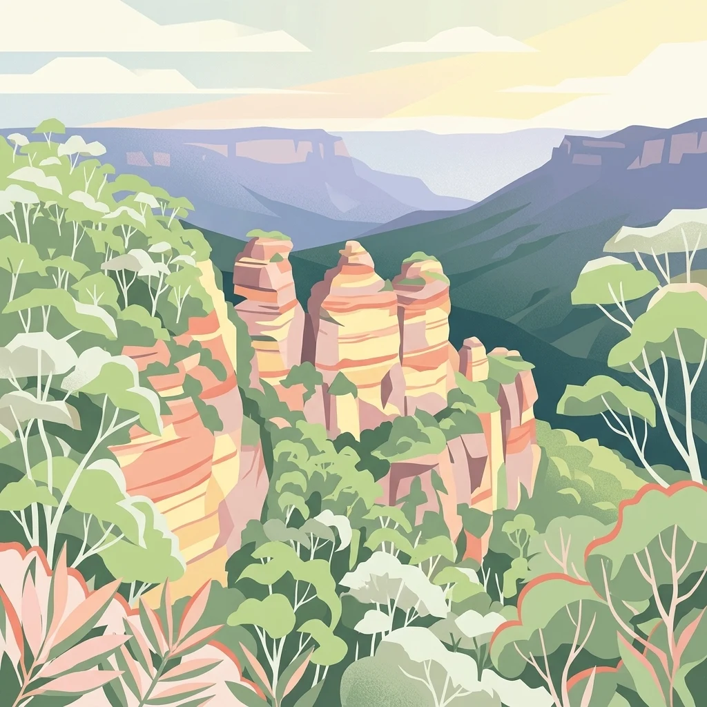
A stylized illustration of layered sandstone cliffs and rock formations surrounded by green eucalyptus trees with a mountain range in the distance.

Mesa country of the Capertee Valley, with pagoda cliffs, sandstone canyons, and a strong Wiradjuri story.

Mugii Murum-ban State Conservation Area

Mugii Murum-ban State Conservation Area is a compact protected area in New South Wales, Australia, covering approximately 3,650 hectares of rugged country on the northern edge of the Capertee Valley. It sits between Lithgow to the south, Capertee to the northeast, and Mudgee to the northwest, with cleared farmland and remnant bushland running off to the east and west. The conservation area is bounded by the Glen Davis Road and Gardens of Stone National Park to the south and by Capertee National Park to the north, giving it a clear place within the broader network of sandstone reserves around the Capertee Valley. The park is defined by two striking mesas, Genowlan Mountain and Mount Airly, which rise around 500 metres above the valley floor. Between and around these mesas are deep canyons, sandstone cliffs, and the distinctive erosion columns locally called pagodas. Despite its small area, the reserve protects a wide range of ecosystems, two threatened ecological communities, and several threatened plant and animal species, including a relict plant community on the narrow headland of Genowlan Point. The name itself reflects the cultural significance of the place. Mugii Murum-ban is the Wiradjuri name of Charlie Riley, combining words for the southern boobook owl and 'eldest son'. The area carries strong meaning for the Wiradjuri people and also preserves a layered industrial history, most visibly the remains of late-nineteenth-century oil shale mining around Mount Airly and the heritage-listed ruins of the New Hartley ghost town.

Location
Australia
Park type
Protected landscape
Established
2011
Area
36.5 km²
Mugii Murum-ban State Conservation Area Map

Filter Mugii Murum-ban State Conservation Area records by distance

Explore earthquakes near Mugii Murum-ban State Conservation Area

Earthquakes near Mugii Murum-ban State Conservation Area are associated through their epicentres and distance from the conservation area, not confirmed boundary placement. Explore dates, magnitudes, depths, localities, distances, and sources as historical evidence without attributing seismicity to protected-area features, evaluating current danger, or forecasting activity.

Sort by
Magnitude
Location

This page describes catalogued earthquakes associated with the park by epicentre location and distance. It does not establish causation, assess current danger, or predict future earthquakes.

No earthquake records match the current filters

Park atlas

Move beyond Mugii Murum-ban State Conservation Area earthquake data

Discover other parks after Mugii Murum-ban State Conservation Area

After the Mugii Murum-ban State Conservation Area earthquake data, continue to a separately chosen set of protected places. Inclusion does not establish common conservation status, terrain, geological history, seismic records, geographic closeness, hazards, risk, or equal documentation.
National parkNew South Wales
0 km away#1 closest

Southwest

Gardens of Stone National Park: National Park Protected Landscape and Geographic Atlas

New South Wales protected area and mapped terrain exploration.

Delve into the protected landscape of Gardens of Stone National Park, an important national park situated in New South Wales, Australia. This page offers an atlas-centric view, focusing on the park's distinct geographic identity, its mapped protected boundaries, and its contribution to the regional context of protected lands. Understand the fundamental landscape character and terrain that define this significant natural area for structured geographic discovery.

Area
150.8 km²
Established
1994
IUCN
II
Relief
Highland
National parkAustralia
About 2.5 km away#2 closest

Northwest

Capertee National Park: Detailed Geographic Context and Protected Landscape Mapping

Australia's National Park Terrain and Mapped Boundaries

Gain a structured understanding of Capertee National Park as a key protected area within Australia. This exploration focuses on its geographic significance, mapping its boundaries and detailing the natural landscape context. Discover how this national park contributes to the broader atlas of Australia's protected lands, offering insights into its unique terrain and regional setting.

Area
67.96 km²
Established
2010
Scope
Terrestrial
Water
Minor water
National parkNew South Wales
5.6 km away#3 closest

Southwest

Turon National Park National Park: Protected Landscape and Geographic Atlas Details

Mapped boundaries and regional context within New South Wales.

Turon National Park is a protected national park in New South Wales, Australia, offering a distinct geographic identity for atlas exploration. This entry focuses on its mapped boundaries, natural terrain, and its role as a conservation landscape. Users can discover its specific features and regional context, enhancing their understanding of Australia's protected areas.

Established
2002
IUCN
II
Relief
Mixed relief
Climate
Temperate
National parkNew South Wales
9.5 km away#4 closest

Northeast

Wollemi National Park: Mapping Australia's Protected Natural Landscape in New South Wales

Detailed geographic context and protected area exploration.

Wollemi National Park is a critical component of New South Wales' protected natural areas, offering rich opportunities for geographic discovery. This national park provides a distinct focus for understanding the mapped terrain and regional landscape context of Australia. Explore its position within New South Wales, uncovering the details that define its unique protected status and natural geography for dedicated atlas exploration.

Area
5,017.03 km²
Established
1979
IUCN
Ib
Relief
Mountain
National parkNew South Wales
54 km away#5 closest

East

Yengo National Park: Protected Landscape Identity and Geographic Context

Explore its mapped terrain and wilderness character.

Yengo National Park in New South Wales, Australia, is a vast protected area known for its remote wilderness character and significant geographical landmarks such as Mount Yengo. As a vital part of the Greater Blue Mountains World Heritage Site, the park showcases rugged mountainous terrain and diverse natural landscapes. This entry focuses on its atlas-value, detailing the park's mapped boundaries, regional geography, and its identity as a significant protected landscape for nature exploration.

Area
1,543.28 km²
Established
1988
IUCN
Ib
Relief
Mountain
National parkNew South Wales
61 km away#6 closest

South

Kanangra-Boyd National Park: A Protected Landscape within New South Wales' Geography

Mapped boundaries and regional park context.

Kanangra-Boyd National Park represents a significant protected area, offering valuable insights into the natural landscapes and geographic context of New South Wales. As a national park, it provides a clear example of mapped terrain and protected land distribution, crucial for anyone exploring the atlas of Australian conservation areas. Understanding this park contributes to a broader appreciation of its regional geography and specific landscape identity.

Area
686.6 km²
Established
1969
IUCN
Ib
Relief
Mountain
National parkNew South Wales
About 64 km away#7 closest

Southeast

Blue Mountains National Park National Park: Mapped Protected Landscape Atlas

Explore New South Wales park geography and natural terrain.

Blue Mountains National Park, designated as a national park in New South Wales, offers a rich subject for geographic discovery and atlas exploration. This entry details its specific mapped boundaries and natural landscape features, providing essential context for understanding its place within Australia's protected areas. Engage with the park's core geographic identity and explore its protected terrain within a structured, map-focused dataset.

Area
2,679.54 km²
Established
1959
IUCN
II
Visitors
8.4M annual
Watercolor illustration of a soft, pastel-colored landscape featuring rolling hills, gentle slopes, and sparse woodland against a light background.
Regional parkNew South Wales
About 66 km away#8 closest

South

Ngula Bulgarabang Regional Park: Geography and Protected Land Profile

Upper Blue Mountains plateau and escarpment terrain

Located in the upper Blue Mountains of New South Wales, Ngula Bulgarabang Regional Park encompasses a distinct plateau characterized by both natural eucalypt bushland and a twentieth-century radiata pine plantation. This protected area overlooks the Megalong Valley, providing a vital connection between local escarpment ecosystems and the broader heritage-listed terrain of the region.

Area
3.06 km²
Established
2020
Relief
Upland
Climate
Temperate
MoriAtlas Explorer

Continue Exploring the Protected Landscapes of Mugii Murum-ban State Conservation Area

Deepen your understanding of the Capertee Valley by analyzing the mapped terrain of Mugii Murum-ban State Conservation Area. Through MoriAtlas, trace the intersection of ancient sandstone erosion, rare ecological niches, and industrial history within this unique New South Wales protected area.