Mori Atlas logo
National parkNahuel Huapi National Park

Discover the geographic context and protected boundaries of this significant Patagonian natural area.

Nahuel Huapi National Park: Argentina's Premier National Park and Mapped Protected Landscape

(Parque Nacional Nahuel Huapi)

Nahuel Huapi National Park stands as a cornerstone of Argentina's protected lands, situated within the diverse geography of Río Negro Province. As a designated national park, it represents a vital conservation landscape for Patagonia, offering a unique lens through which to explore mapped natural terrain and regional geography. This page serves as the dedicated entry point for understanding its protected boundaries and environmental significance within the broader South American atlas.

National ParkPatagoniaAndes MountainsGlacial LakesTemperate RainforestMountain Wilderness

Nahuel Huapi National Park

National park

Park overview

Structured park overview, official facts, and landscape profile for Nahuel Huapi National Park

Nahuel Huapi National Park park facts, protected area profile, and essential visitor context
Review the core facts for Nahuel Huapi National Park, including designation, size, terrain, visitor scale, habitats, and operating context in one park-focused overview.

About Nahuel Huapi National Park

Nahuel Huapi National Park represents the crown jewel of Argentina's national park system, established as the country's first protected area in 1922 through the vision of explorer Francisco Moreno (known as Perito Moreno). The park's creation marked a pivotal moment in Argentine conservation history and set the precedent for the protection of Patagonia's unique natural heritage. The park's territory encompasses a spectacular mosaic of landscapes shaped by glacial processes, with the dominant feature being Nahuel Huapi Lake, a glacial fjord extending 100 kilometres toward the Chilean border and surrounded by the rugged Andean cordillera. The park's western portion near the Chilean border receives exceptional precipitation, with Puerto Blest recording up to 4,000 millimetres annually, supporting lush temperate rainforests, while eastern sections transition to the semi-arid Patagonian steppe receiving only 600 millimetres. This dramatic environmental gradient supports remarkable biodiversity, from Andean condors soaring above glacial valleys to river otters in the lake's interconnected waterways. The park's establishment in 1934 coincided with a deliberate effort to develop San Carlos de Bariloche as a model Patagonian city, with the iconic Llao Llao Hotel constructed as a showcase of the national parks vision. Today the park welcomes visitors seeking mountaineering challenges, wilderness trekking, ski adventures, and immersion in one of the world's most distinctive temperate wilderness landscapes.

Quick facts and research context for Nahuel Huapi National Park

Nahuel Huapi National Park spans 7,050 square kilometres across Río Negro and Neuquén provinces in Argentine Patagonia, making it the largest national park in the north Patagonian region. The park surrounds Nahuel Huapi Lake, the largest and deepest clearwater lake in Argentina, reaching 425 metres in depth and covering 544 square kilometres. Elevation ranges from 720 metres at the lake surface to 3,574 metres at Cerro Tronador, the park's highest peak. The park operates under IUCN Category II (National Park) designation with a parallel Management Reserve zone. San Carlos de Bariloche, known as the Gateway to Patagonia and the Honeymoon Capital of Argentina, serves as the primary access point and tourism hub.

Park context

Deeper park guide and search-rich context for Nahuel Huapi National Park

Nahuel Huapi National Park history, landscape, wildlife, and travel context
Explore Nahuel Huapi National Park through its history, landscape character, ecosystems, wildlife, conservation priorities, cultural context, and seasonal travel timing in a structured park guide built for atlas discovery and search intent.

Why Nahuel Huapi National Park stands out

Nahuel Huapi is best known for its dramatic Patagonian Andean landscapes where towering snow-clad peaks, glaciers, and pristine lakes create one of South America's most iconic wilderness settings. The park protects the legendary Nahuel Huapi Lake, famed for its glacial origins, deep clear waters, and the local legend of Nahuelito, a lake monster said to inhabit its depths. The region encompasses the Argentine Lake District with its chain of spectacular glacial lakes and the transition between temperate rain forests and Patagonian steppe. Cerro Tronador dominates the skyline at 3,491 metres, while Cerro Catedral offers world-class skiing just outside Bariloche. The park also preserves critical habitat for the endangered South Andean huemul, Argentina's national faunal symbol.

Nahuel Huapi National Park history and protected-area timeline

The history of Nahuel Huapi National Park is intertwined with the exploration and colonization of Argentine Patagonia. European discovery of the area occurred in 1552-1553 when Francisco de Villagra, dispatched by Chilean Governor Pedro de Valdivia, crossed the Andes through Mamuil Malal Pass and reached the Limay River near Nahuel Huapi Lake. During colonial times, explorers searching for the legendary Ciudad de Los Cesares and Jesuit missionaries from Chiloé Archipelago visited the region, with a precarious mission established on the lake's shores where quinoa was cultivated. The modern era of protection began with Perito Moreno's exploration expeditions in the 1870s and 1880s, which were fundamental for establishing Argentine sovereignty over the Nahuel Huapi area. As compensation for his services, Perito Moreno received a vast tract of land around the lake, and in 1903 he donated 75 square kilometres to the federal government while proposing the creation of a national park. A 1909 decree recognized the area's need for protection, and after works commenced in 1916, the park finally opened in 1922 as Parque Nacional del Sur. It was renamed Nahuel Huapi National Park on October 9, 1934, the same year Iguazú National Park was established, marking the formal creation of Argentina's national park system. The establishment brought significant development to San Carlos de Bariloche, including railway connections and the construction of the Llao Llao hotel, as part of a broader vision to colonize and develop Patagonia.

Nahuel Huapi National Park landscape and geographic character

The landscape of Nahuel Huapi National Park exemplifies the dramatic beauty of Patagonian Andes terrain shaped by glacial processes over millions of years. The park is dominated by the high mountain chain of the Andes, with soaring peaks, extensive glaciers, and permanent snowfields above the tree line. Cerro Tronador rises to 3,491 metres as the park's highest mountain, an extinct volcano where ice falls produce thunderous sounds giving it the name Thunderer. Cerro Catedral reaches 2,388 metres and hosts one of South America's premier ski resorts. The terrain features numerous rapid rivers, spectacular waterfalls, and a chain of glacial lakes including Nahuel Huapi, Mascardi, Gutiérrez, Traful, Guillelmo, Fonck, and Perito Moreno lakes. The geology consists primarily of tertiary volcanic rocks including andesites and porphyries. The San Pedro Peninsula displays eroded glacial features, and the lakes themselves are products of glacial carving, with the prominent Llao Llao peninsula jutting into Nahuel Huapi Lake. Eastern portions transition from the mountainous core to the Patagonian Desert, creating a landscape of remarkable diversity within a single protected area.

Nahuel Huapi National Park ecosystems, habitats, and plant life

The nature of Nahuel Huapi National Park reflects the complex ecological transitions between Patagonian biomes. At lower elevations, the Patagonian steppe dominates with xerophytic vegetation adapted to semi-arid conditions, while the western portions receive sufficient moisture to support the lush Valdivia temperate rain forest. The park's ecological diversity stems from its dramatic elevation range from 720 to 3,574 metres and the corresponding climatic gradients. The dominant tree species include lenga beech, coihue (Nothofagus dombeyi), and ñires, with Chilean cedar, Winter's bark, arrayanes, and various ferns also prevalent. The rainforests near the Chilean border support ancient trees, including 450-year-old coihue specimens and Fitzroya cypress trees up to 1,500 years old. The llao llao fungus, with its irregular growth patterns on trees, has become a symbol of the region. The park's numerous biotopes, resulting from varied altitudes and precipitation levels, create conditions supporting exceptional biodiversity across multiple habitat types.

Nahuel Huapi National Park wildlife and species highlights

The wildlife of Nahuel Huapi National Park reflects the park's diverse habitats and its position in the Patagonian ecosystem. The park protects several endangered or notable mammal species including the South Andean huemul (Hippocamelus bisulcus), Argentina's national symbol, along with pudus (small deer), guanacos, cougars, foxes, and the southern river otter (huellin). The park's avifauna includes Magellanic woodpeckers, austral parakeets, various waterfowl including geese, ducks, and swans, blue-eyed cormorants (imperial shags), and the iconic Andean condor soaring above the peaks. The green-backed firecrown, a hummingbird species, inhabits the forest zones. Amphibians include Hylorina sylvatica and other species adapted to the aquatic environments. Nahuel Huapi Lake itself supports diverse plankton communities, with Dictyosphaerium pulchellum as a dominant species. The lake's legendary creature, Nahuelito, has been reported since the 1920s, predating the Loch Ness Monster phenomenon and becoming a cultural phenomenon in Argentine media.

Nahuel Huapi National Park conservation status and protection priorities

Nahuel Huapi National Park holds significant conservation importance as Argentina's oldest national park and a cornerstone of Patagonian environmental protection. The park's IUCN Category II designation provides full protection to the core national park area while the parallel Management Reserve allows for sustainable development in designated zones. The park protects critical habitat for the endangered South Andean huemul, which has become a flagship species for Patagonian conservation efforts. The variety of protected ecosystems, from high Andean environments through temperate rainforests to Patagonian steppe, creates a living laboratory for understanding ecological processes in southern South America. The park also preserves portions of the Valdivia temperate rain forest, a globally significant ecoregion facing ongoing pressures from logging and development. The creation of Los Arrayanes National Park as a separate protected area on the Quetrihué Peninsula demonstrates the continuing expansion of conservation in the lake district.

Nahuel Huapi National Park cultural meaning and human context

The cultural context of Nahuel Huapi National Park is deeply rooted in Mapuche heritage and the history of Argentine Patagonia. The park's name derives from the Mapuche language, where "Nahuel" means jaguar and "huapi" means island, referencing the lake's largest island. The Mapuche people inhabited this region long before European contact, and their presence is reflected in the place names throughout the area. The colonial period saw Jesuit missionaries from Chiloé Archipelago establish missions on the lake's shores, and the legendary search for the Ciudad de Los Cesares brought explorers to the region. The park's establishment in the early 20th century came amid the final phases of the military conquest of Patagonia and the displacement of indigenous communities, a context that shapes the region's complex cultural history. Today, San Carlos de Bariloche serves as the cultural centre for the region, famous for its chocolate-making tradition and as a destination for honeymoons, with the park forming the natural backdrop for this urban identity.

Top sights and standout views in Nahuel Huapi National Park

Nahuel Huapi National Park offers exceptional highlights for visitors seeking Patagonian wilderness experiences. The iconic Llao Llao peninsula with its famous hotel provides one of the most photographed viewpoints in Patagonia. Victoria Island, accessible by boat from the main lake, hosts a forest research station within a natural reserve. The Seven Lakes road (Ruta de los Siete Lagos) connects Bariloche with Villa La Angostura, offering spectacular scenic driving through the heart of the park. Cerro Tronador presents formidable mountaineering challenges, with trails leading to impressive glaciers. The Arrayanes Peninsula, now protected separately as Los Arrayanes National Park, preserves stands of the distinctive arrayan tree with its white peeling bark. Skiing at Cerro Catedral provides world-class winter sports opportunities. Trekking routes range from accessible day hikes to multi-day wilderness expeditions through some of Patagonia's most spectacular terrain.

Best time to visit Nahuel Huapi National Park

The best time to visit Nahuel Huapi National Park depends on the desired activities, with each season offering distinct advantages. Summer months from December to March bring the warmest temperatures (averaging 14-16°C) and longest days, making this the peak season for trekking, mountaineering, and lake-based activities. This period offers excellent conditions for multi-day backcountry expeditions and wildlife observation. Winter from June to September transforms the park into a skiing destination, with Cerro Catedral offering extensive runs and the landscape draped in snow. Spring and autumn offer smaller crowds and the possibility of witnessing seasonal transformations, though weather becomes less predictable. The cold temperate climate means that visitors should be prepared for variable conditions regardless of season, with the western portions near the Chilean border receiving significantly more precipitation than eastern areas. The lake district's beauty is consistent throughout the year, though the dramatic contrast between snow-capped peaks and forested slopes is most striking in winter and spring.
Park location guide

Geography guide, regional context, and park location map for Nahuel Huapi National Park

Nahuel Huapi National Park park geography, regions, and map view in Argentina
Understand where Nahuel Huapi National Park sits in Argentina through a broader geographic reading of the surrounding landscape, nearby location context, and its mapped position within the national park landscape.

How Nahuel Huapi National Park fits into Argentina

Argentina is a federal republic located in the southern cone of South America, bordering Chile, Bolivia, Paraguay, Brazil, Uruguay, and the Atlantic Ocean. With an area of 2,780,085 km², it is the second-largest country in South America and the eighth-largest globally. The capital and largest city is Buenos Aires, and the official language is Spanish. The country claims sovereignty over the Falkland Islands, South Georgia and the South Sandwich Islands, and a portion of Antarctica.

Wider geography shaping Nahuel Huapi National Park in Argentina

Argentina occupies the southern portion of South America, sharing the Southern Cone region with Chile to the west. The country borders Bolivia and Paraguay to the north, Brazil to the northeast, Uruguay and the South Atlantic Ocean to the east, and the Drake Passage to the south. The Andes mountain range runs along the western border, while the Pampas plains dominate the central region. Argentina also claims territories in Antarctica.

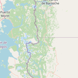
Map view of Nahuel Huapi National Park

Use this park location map to pinpoint Nahuel Huapi National Park in Argentina, understand its exact geographic position, and read its mapped placement within the surrounding landscape more clearly.

Pigeon | © OpenStreetMap contributors

Location context for Nahuel Huapi National Park

Neuquén ProvinceRío Negro Province
Park atlas

Discover the diverse protected landscapes and regional park geography surrounding Argentina's oldest national park in Patagonia.

Explore Nearby National Parks and Protected Areas around Nahuel Huapi National Park
After exploring Nahuel Huapi National Park, you can browse a curated list of other national parks and protected areas located in the vast Patagonian Andean region. Compare their unique terrain, glacial lakes, and conservation features to trace the broader protected-area spread in this dramatic South American geography.
National parkNeuquén Province

Los Arrayanes National Park: Neuquén Province's Protected Arrayán Forest Atlas

Explore the ancient arrayán forest and mapped terrain.

Los Arrayanes National Park, nestled in Neuquén Province, is celebrated for its exceptional arrayán forest, one of the world's most concentrated stands of Luma apiculata. This protected area showcases a unique landscape where ancient, gnarled trees with striking cinnamon bark thrive on the Quetrihué Peninsula, overlooking Nahuel Huapi Lake. Its protected status ensures the preservation of this botanical marvel, offering a distinct geographical and ecological profile within the Patagonian region.

Area
17.53 km²
Established
1971
IUCN
II
Relief
Upland
National parkLos Lagos Region

Vicente Pérez Rosales National Park: Protected Landscape & Regional Geography Atlas

Mapped park boundaries and natural terrain in Los Lagos Region.

Delve into the protected area identity of Vicente Pérez Rosales National Park, a significant national park situated in Chile's Los Lagos Region. This detailed exploration focuses on understanding the park's geographic setting, its mapped landscape features, and its contribution to the regional atlas of protected territories. Discover the natural terrain and boundary context that define this unique Chilean landscape.

Area
2,530 km²
Established
1926
IUCN
II
Visitors
332.3K annual
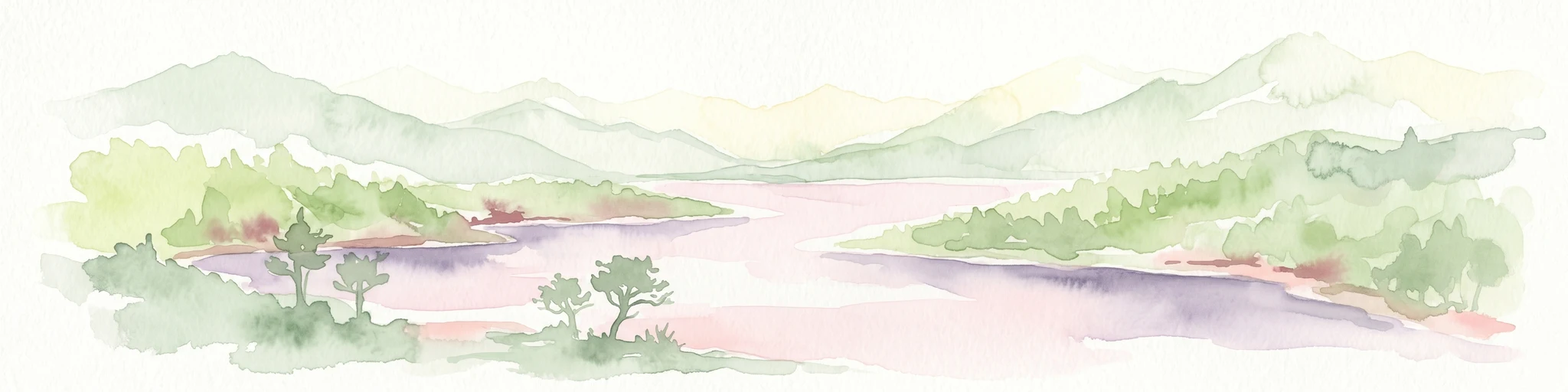
Watercolor illustration of a mountain range with a lake and forested hills in soft green, pink, and beige tones
National parkLos Lagos Region

Puyehue National Park: Mapped Boundaries and Volcanic Landscape in Los Lagos Region

Explore Chile's dramatic Andean protected area.

Puyehue National Park is a key protected area in the Los Lagos Region of Chile, recognized for its distinctive volcanic landscapes and geothermal features. This detail page offers an atlas-centric view, highlighting the park's mapped boundaries, the terrain shaped by volcanoes like Puyehue, and its ancient temperate rainforest ecosystems. Understand its geographic context within the Andes and its significance as a protected national park.

Area
1,070 km²
Established
1941
IUCN
II
Visitors
133K annual
National parkNeuquén Province

Lanín National Park: Volcanic Landscapes and Ancient Forests in Neuquén Province

Explore the protected area's mapped terrain and glacial lakes.

Lanín National Park offers a deep dive into the dramatic geography of Argentine Patagonia, centered around the prominent Lanín volcano. This national park preserves ancient araucaria forests, diverse ecosystems, and breathtaking glacial lakes like Huechulafquen and Lácar. Its extensive protected landscape provides critical habitat and opportunities to explore unique Andean terrain through map-driven discovery.

Area
3,790 km²
Established
1937
IUCN
II
Relief
Mountain
National parkLos Lagos Region

Alerce Andino National Park: Protected Landscape Within Los Lagos Region Geography

Explore the national park's mapped boundaries and regional context.

Delve into the protected landscape of Alerce Andino National Park, a distinct national park entity situated in Chile's Los Lagos Region. This focus provides a clear understanding of its geographic setting, highlighting its importance within regional conservation efforts and offering a detailed view of its mapped terrain. Understand the park's place in the southern Chile geography through this detailed exploration.

Area
393 km²
Established
1982
IUCN
II
Visitors
12.2K annual
National parkLos Lagos Region

Hornopirén National Park: Mapped Protected Landscape and Geographic Identity

Explore the national park's mapped boundaries and regional context.

Hornopirén National Park serves as a crucial protected landscape within Chile's Los Lagos Region. This dedicated park page offers detailed insight into its geographic setting, emphasizing mapped boundaries and its identity as a national park. Users can explore how Hornopirén National Park contributes to the regional geography and protected-area framework, providing a grounded point for landscape discovery.

Area
482 km²
Established
1988
IUCN
II
Relief
Mountain
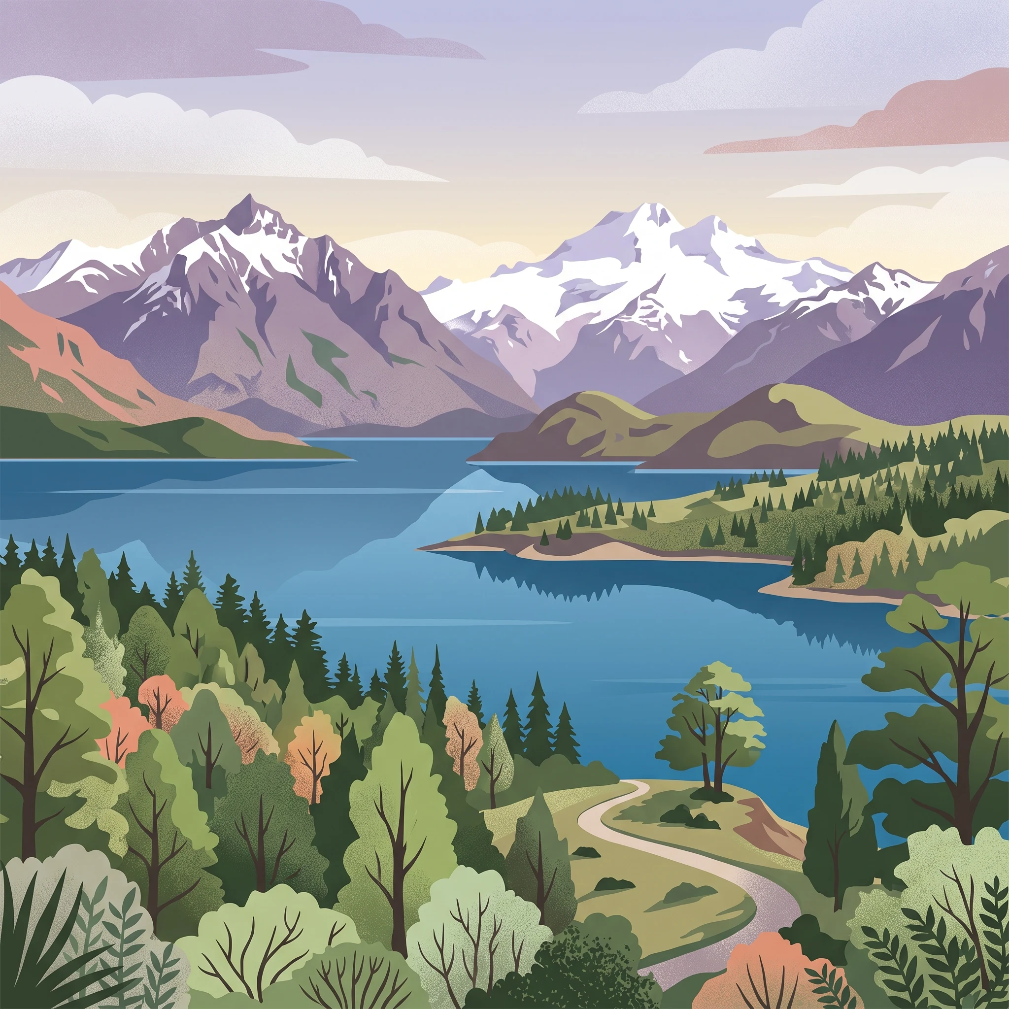
Watercolor illustration showing a lake surrounded by forested hills and mountains
National parkChubut Province

Lago Puelo National Park: A Unique Protected Landscape at the Intersection of Biomes

Explore its glacial terrain and Andean-Patagonian geographic context.

Lago Puelo National Park, located in Argentina's Chubut Province, stands out as a significant protected area due to its remarkable ecological diversity. This park is distinguished by its rare transition zone where the Patagonian forest converges with the Andean steppe, incorporating flora typically found in the Valdivian temperate rainforest. The mountainous landscape, carved by glaciers, features the striking turquoise waters of Puelo Lake and surrounding river systems. Understanding Lago Puelo National Park's geography provides insight into the complex natural systems of Patagonia and its unique protected biomes.

Area
276.74 km²
Established
1971
IUCN
II
Relief
Mountain
National parkLos Ríos Region

Alerce Costero National Park: Explore Protected Landscapes and Ancient Forests in Los Ríos Region

Discover mapped terrain and unique Valdivian ecosystem geography.

Alerce Costero National Park stands as a significant protected landscape in Chile's Los Ríos Region, celebrated for its ancient Fitzroya trees and as a sanctuary for the Valdivian temperate rainforest. The park's protected boundaries encompass rugged terrain within the Cordillera Pelada, offering insights into unique watershed geography and the resilience of an ancient forest ecosystem. Its diverse landscape, a mosaic of old-growth woods and natural clearings, provides essential habitat and a remarkable geographic context for atlas exploration.

Area
139.75 km²
Established
2010
IUCN
III
Relief
Mountain

Common questions about visiting, size, designation, and location context for Nahuel Huapi National Park

Nahuel Huapi National Park FAQs for park facts, access, geography, and protected area context
Find quick answers about Nahuel Huapi National Park, including protected-area facts, park geography, trail and visitor context, and how the park fits into its surrounding country and regional landscape.
MoriAtlas Explorer

Continue Your Protected Areas Search Across the Global Atlas

Deepen your exploration by continuing the structured search for national parks and protected areas worldwide. Utilize the comprehensive filtering capabilities to compare different conservation landscapes and refine your understanding of global park geography. Discover more about the distribution and characteristics of protected natural areas.

Global natural geography