Why Vicente Pérez Rosales National Park stands out
Vicente Pérez Rosales is best known for its dramatic volcanic scenery, particularly the perfect conical profile of Volcan Osorno rising directly from the shores of Todos los Santos Lake. The park's iconic Petrohué Waterfalls, where the river cascades over ancient lava flows, represent another signature feature. The park protects a remarkable diversity of habitats within the Valdivian temperate rain forest ecoregion, including old-growth forests of coihue, ulmo, and arrayan. The trans-Andean location provides connectivity to neighboring protected areas in Argentina, creating one of South America's largest continuous conservation landscapes.
Vicente Pérez Rosales National Park history and protected-area timeline
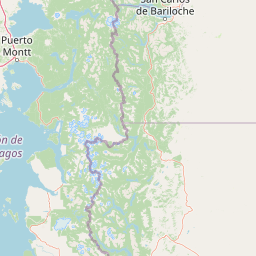
The territory now within Vicente Pérez Rosales National Park has a rich historical legacy extending back centuries. The area around Todos los Santos Lake was originally inhabited by indigenous peoples who utilized the trans-Andean passages for trade and movement. Jesuit missionaries from Chiloé Island discovered the lake while seeking a route to establish missions in the pampas region, traveling through the Reloncaví inlet to Ralún and then eastward through what became known as the Pérez Rosales international pass. The Jesuits maintained this route until abandoning their Nahuel Huapi mission in 1718, after which the lake fell from general knowledge. The lake was rediscovered in the mid-19th century by expeditions that climbed Volcan Osorno and observed the body of water to the east. Formal protection came in 1926 when the park was established, making it Chile's first national park and the second in South America after Iguazú. The creation of the park honored Vicente Pérez Rosales, a 19th-century politician instrumental in Chile's colonization of the southern territories. The park's establishment set a precedent for protected area management in Chile and contributed to the broader development of conservation policy in the region.
Vicente Pérez Rosales National Park landscape and geographic character
The landscape of Vicente Pérez Rosales National Park is defined by the interplay of volcanic construction and glacial erosion, creating a terrain of exceptional visual drama. The stratovolcanoes Osorno, Puntiagudo, and Tronador dominate the skyline, their snow-capped peaks providing year-round contrast against the forested slopes below. Volcan Osorno presents a near-perfect conical form that rises directly from the waters of Todos los Santos Lake, creating one of Chile's most photographed vistas. The volcano's summit reaches 2,652 meters and sits atop the remnants of an older caldera structure. The Puntiagudo volcano features a sharper, more angular profile with its summit at 2,493 meters, while Tronador reaches 3,491 meters as the highest point in the park. Glacial action during the Pleistocene shaped the Todos los Santos valley, with ice masses descending from Tronador far into Chile's Central Valley. Glacial scratches remain visible on exposed granite surfaces where the ice removed earlier sediment deposits. The Petrohué River flows from Todos los Santos Lake through the park, dropping over the Petrohué Waterfalls where the water cascades over andesite lava flows. The terrain exhibits strong climatic gradients, with western slopes receiving substantially more precipitation than eastern exposures.
Vicente Pérez Rosales National Park ecosystems, habitats, and plant life
The park lies within the Valdivian temperate rain forest ecoregion, displaying the characteristic biodiversity of southern Chile's forest ecosystems. Vegetation composition varies with altitude and substrate, but the most common large tree species is coihue (Nothofagus dombeyi), which forms the visual backbone of the forest in many areas. Coihue occurs in association with ulmo (Eucryphia cordifolia) and tineo (Weinmannia trichosperma), creating diverse forest compositions. At lower elevations near the lake, thickets of tique (Aextoxicon punctatum) occur, while particularly humid locations support canelo (Drimys winteri), also known as Winter's bark. Above 900 meters elevation, coihue gives way to deciduous Nothofagus species as the forest transitions toward alpine conditions. The Myrtaceae family is particularly well-represented, with nine species present in the park, including the conspicuous arrayan (Luma apiculata) recognizable by its bright orange bark. The Proteaceae family, with Australian and New Zealand relatives, includes the firebush (Embothrium coccineum) with its striking red tubular flowers. The introduced retamo (Spanish broom) has become invasive in certain areas, particularly around Osorno and along the road from Ensenada to Petrohué.
Vicente Pérez Rosales National Park wildlife and species highlights
Approximately 30 species of mammals inhabit Vicente Pérez Rosales National Park, though most are shy and difficult to observe. The park provides habitat for puma (Puma concolor), the largest terrestrial predator in South America, with the local subspecies relatively small compared to other populations. The park also supports pudu (Pudu puda), a small deer species that inhabits dense forest understory, as well as the kodkod (Leopardus guigna), one of the world's smallest wild cats. The fox-like chilla (Pseudalopex griseus) represents the canid presence in the park. Introduced species including European red deer and wild boar have created conservation challenges by impacting native forest regeneration. Three native mustelids occur here: Molina's hog-nosed skunk, lesser grison, and the endangered southern river otter. The American mink, introduced for fur farming, has had devastating impacts on ground-nesting bird populations. Bird diversity includes approximately 80 species, with resident birds such as chucao tapaculo and black-throated huet-huet among the most readily heard. The firecrown hummingbird is common and easily observed. The native fish community of Todos los Santos Lake has been significantly altered by introductions of trout and salmon for sports fishing.
Vicente Pérez Rosales National Park conservation status and protection priorities
Vicente Pérez Rosales National Park forms part of a critical trans-Andean conservation corridor connecting Chilean and Argentine protected areas. Together with Puyehue, Nahuel Huapi, and Lanín National Parks, the park creates a continuous protected landscape of nearly 15,000 square kilometers, representing one of South America's most significant conservation achievements. The park is recognized within the Southern Andes Temperate Rain Forests biosphere reserve, acknowledging its role in protecting globally significant biodiversity. The park's protection extends to subsurface geological resources, designated as a place of scientific interest for mining purposes under Chile's mining code, with any extraction requiring presidential permission. Conservation challenges include managing visitor impacts from the approximately half-million annual visitors, controlling invasive species such as retamo, and addressing the ecological effects of introduced deer and wild boar on forest regeneration. The park also provides ecosystem services including watershed protection and carbon storage within its old-growth forests.
Vicente Pérez Rosales National Park cultural meaning and human context
The park's territory holds significance in the cultural history of southern Chile, particularly regarding indigenous movement patterns and missionary activity. The area around Todos los Santos Lake was part of a traditional trans-Andean route used by indigenous peoples for trade and communication between the coast and the eastern pampas. Jesuit missionaries from Chiloé Island utilized this route in the 17th and early 18th centuries, seeking to establish religious missions in the interior. The discovery of Todos los Santos Lake by Jesuits in search of a route to the pampas represents an important historical episode, though their activities ended with the abandonment of the Nahuel Huapi mission in 1718. The park is named for Vicente Pérez Rosales, a 19th-century politician who played a key role in Chile's colonization of the Los Lagos region. The area's cultural landscape reflects centuries of human interaction with the environment, from pre-colonial indigenous use through colonial-era exploration to modern conservation.
Top sights and standout views in Vicente Pérez Rosales National Park
The iconic landscape of Volcan Osorno rising from the emerald waters of Todos los Santos Lake stands as the park's most recognizable feature and one of Chile's premier scenic attractions. The Petrohué Waterfalls, where the lake's outlet cascades over volcanic rock formations, provide another signature experience accessible to visitors. The network of hiking trails, including the Sendero Paso Desolacion on Osorno's eastern slope and the Sendero Laguna Margarita in Peulla, allows exploration of the forest and volcanic terrain. The contiguous protected area network connecting this park to others in Chile and Argentina creates one of the largest protected landscape corridors in South America. The combination of volcanic peaks, glacial valleys, temperate rain forests, and significant biodiversity makes this park a cornerstone of Chilean conservation history and a major destination for nature-based tourism.
Best time to visit Vicente Pérez Rosales National Park
The park can be visited year-round, though each season offers distinct experiences tied to southern Chile's climate patterns. The wettest period occurs during the winter months of June through August, when precipitation is heaviest and higher elevations receive substantial snowfall, creating dramatic winter scenery but potentially limiting access to some trails. The driest and warmest months fall between January and March, offering the most stable weather conditions for hiking and sightseeing, with average maximum temperatures reaching around 25 degrees Celsius during summer. The shoulder seasons of spring and autumn provide intermediate conditions and can offer good visibility with fewer crowds than peak summer months. The park's high annual precipitation, ranging from 3,000 to 5,000 millimeters depending on location, means that visitors should be prepared for rain at any time of year. Snow persists above 1,000 meters throughout the year, ensuring the volcanic peaks maintain their white caps regardless of season. The summer months typically offer the best combination of accessibility and weather for experiencing the full range of park attractions.