
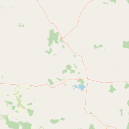
Streams
Park geography
Analyzing the physical dimensions, regional location, and terrain within the Great Dividing Range
Comprehensive Geographic Profile and Mapped Boundaries for Narrien Range National Park
Examine the detailed geographic structure of Narrien Range National Park located in Queensland, Australia. This profile details the 40.2 square kilometer area, the 58.2 kilometer boundary perimeter, and the park location within the broader context of the Great Dividing Range. Additional landscape features identified include Campoven Mountain, Narrien Creek, and Spring Creek.
Related tags
mountain reservesQueensland national parkscentral QueenslandIUCN Category IIprotected areas
Remote central Queensland wilderness protecting the Narrien Range
Narrien Range National Park
Narrien Range National Park is a protected wilderness area in central Queensland, Australia, situated approximately 796 kilometers northwest of Brisbane. The park encompasses the Narrien Range, a mountainous landscape characterized by rugged terrain and scenic ridgelines within the broader semi-arid interior of the state. Established as a national park under Queensland's protected area framework, the reserve covers an area of 40.20 square kilometers and is managed by the Queensland Parks and Wildlife Service. The region represents a remote and relatively undeveloped portion of Queensland's national park network, offering protection to natural landscapes that might otherwise face pressure from pastoral or resource development activities.
- Location
- Australia
- Park type
- National park
- Area
- 40.2 km²
Location overview
Administrative and regional positioning within Queensland, Australia
Geographic Setting of Narrien Range National Park in Australia
Narrien Range National Park sits entirely within the state of Queensland, Australia. Records confirm its status as an inland protected area situated within a single national jurisdiction.
- Countries
- Australia
- Regions
- Queensland
- Primary location
- Queensland
- Geographic setting
- Inland
Boundary and coordinates
Interactive spatial geometry and calculated area metrics
Narrien Range National Park Boundary Map and Geographic Extent
Mapped park boundaries provide precise spatial context for the protected terrain. Derived area measurements and geographic coordinate limits outline the complete regional footprint.
- Boundary area
- 74.5 km²
- Boundary perimeter
- 58.2 km
- Northernmost point
- 22.8659° S
- Southernmost point
- 22.9745° S
- Easternmost point
- 147.0116° E
- Westernmost point
- 146.8959° E
- Geographic centre
- 22.9249° S, 146.9518° E
- North–south span
- 12 km
- East–west span
- 11.9 km
Terrain and natural features
Mapped streams, mountain ranges, and peaks within the protected landscape
Narrien Range National Park Terrain and Named Natural Features
Explore recorded natural features located within Narrien Range National Park, including Campoven Mountain and the Great Dividing Range. Associated records display specific types and spatial relationships for each mapped waterway and peak.
Selected named natural features
Mountain ranges
Great Dividing Range
Streams
Spring Creek
Peaks
Campoven Mountain
Environmental setting
Analysis of recorded hill formations and physical terrain categories
Narrien Range National Park Environmental Classification and Landscape Settings
Recorded hill classifications provide complementary ways to read the physical setting of Narrien Range National Park without uniform spatial coverage. Stored categories link directly to relevant atlas destinations for broader regional context.
- Water
- No major water
Landscape features
Hills
Park atlas
Browse more protected landscapes in Queensland's semi-arid interior, comparing their regional geography.
Discover Other National Parks and Protected Areas Near Narrien Range National Park
After exploring Narrien Range National Park, continue your geographic discovery by browsing other national parks and protected areas across central Queensland, Australia. Compare different mountainous landscapes, semi-arid terrains, and conservation zones to understand the regional spread of protected lands in this remote part of Australia.
National parkQueensland
55 km away#1 closest
West

Cudmore National Park: Mapped Protected Area in Queensland's Geography
Explore the unique landscape and regional context.
Cudmore National Park represents a distinct protected landscape within the vast geographic expanse of Queensland, Australia. This national park offers a valuable point of entry for understanding regional conservation efforts and the mapped distribution of protected lands. Examine its specific location within Queensland's natural terrain and appreciate its role in the broader atlas of Australian protected areas, focusing on its geographic identity and landscape features.
- Area
- 204 km²
- Established
- 1998
- IUCN
- II
- Climate
- Arid
National parkQueensland
About 61 km away#2 closest
North
Epping Forest National Park: Queensland National Park Protected Landscape Identity
Explore its mapped boundaries and regional geography.
Delve into the protected landscape of Epping Forest National Park, a designated national park situated in Queensland, Australia. This entry provides critical atlas-level information, focusing on the park's geographic setting and its role within the regional landscape. Understand its precise location, mapped protected area boundaries, and its contribution to the natural geography of northeastern Australia, offering a factual basis for geographic discovery.
- Area
- 31.6 km²
- Established
- 1971
- IUCN
- Ia
- Relief
- Lowland
National parkQueensland
About 78 km away#3 closest
Northeast
Mazeppa National Park: Queensland's Semi-Arid Gidgee Scrub Protected Landscape
Explore mapped boundaries of this Central Queensland national park.
Mazeppa National Park preserves critical examples of semi-arid gidgee scrub, a vegetation type significantly reduced across inland Queensland. This protected woodland ecosystem, situated in Central Queensland, offers a glimpse into the region's natural heritage with its characteristic terrain of gently undulating plains and dense gidgee tree stands. Discover its mapped geographic context and the unique outback landscape identity that makes it a noteworthy conservation area among Australia's national parks.
- Area
- 41.3 km²
- Established
- 1972
- IUCN
- II
- Scope
- Terrestrial
National parkQueensland
93 km away#4 closest
Northeast
Peak Range National Park: Mapped Protected Landscape and Regional Geography in Queensland
Explore Queensland's protected areas and natural terrain context.
Peak Range National Park is presented here as a key protected landscape within the diverse geography of Queensland, Australia. Users can explore its specific mapped boundaries and understand its regional setting, contributing to a structured overview of natural areas. This provides essential geographic context and supports deeper atlas-based discovery of Queensland's protected lands and varied terrain.
- Area
- 25 km²
- Established
- 1983
- IUCN
- II
- Relief
- Mountain
National parkQueensland
About 132 km away#5 closest
Southeast
Snake Range National Park: Queensland Protected Area and Landscape Mapping
Explore the geographic boundaries and natural terrain.
Snake Range National Park is a significant protected national park entity within Queensland, Australia. This detailed entry provides essential geographic context, focusing on the park's mapped boundaries, its role as a conservation landscape, and its integration into the wider regional geography. For users interested in atlas exploration, understanding the specific natural terrain and protected area distribution of Snake Range National Park is paramount.
- Area
- 26.88 km²
- Established
- 1972
- IUCN
- II
- Relief
- Mountain
National parkQueensland
About 157 km away#6 closest
North
Blackwood National Park: Queensland National Park Protected Landscape and Geography
Mapped protected area boundaries in northeastern Australia.
Blackwood National Park, identified as a national park, offers a distinct protected landscape within Queensland's expansive geography. This entry focuses on its specific mapped boundaries and its role as a conservation area in northeastern Australia. Users can delve into the park's geographic context, understanding its significance as part of Queensland's diverse natural heritage and contributing to a comprehensive atlas of protected lands in the region.
- Area
- 16 km²
- Established
- 1991
- IUCN
- II
- Relief
- Upland
National parkQueensland
About 163 km away#7 closest
Southeast
Minerva Hills National Park: Queensland National Park Atlas and Mapped Landscape
Explore its protected boundaries and geographic setting in northeastern Australia.
Minerva Hills National Park is a distinct protected area offering valuable insights into Queensland's natural geography. This detail page provides essential context for understanding the park's landscape character, its mapped natural terrain, and its significance as a national park within the northeastern Australian region. Engage with its geography to understand its place in the larger atlas of protected lands.
- Area
- 27.9 km²
- Established
- 1994
- IUCN
- II
- Relief
- Mountain
National parkMaranoa Region
178 km away#8 closest
Southeast
Carnarvon National Park: Mapped Geography and Protected Landscape Identity
Explore the sandstone gorges and ancient sites of Queensland's natural heritage.
Carnarvon National Park represents a significant protected area within the Maranoa Region of Queensland, Australia. This national park encompasses a vast expanse of approximately 2,980 square kilometers, primarily celebrated for its dramatic sandstone gorges, particularly Carnarvon Gorge, and its globally significant Aboriginal rock art sites. Positioned across the Great Dividing Range, the park's landscape features a compelling mix of deep valleys, sandy plains, and basalt-capped tablelands, offering rich cartographic and geographic context. Its designation as a national park underscores its importance for preserving these unique natural and cultural landscapes for atlas-based discovery.
- Area
- 2,980 km²
- Established
- 1932
- IUCN
- II
- Visitors
- 65K annual
MoriAtlas Explorer
Continue Exploring Narrien Range National Park's Geographic and Protected Landscape Context
Deepen your understanding of Narrien Range National Park by exploring its specific place within Queensland's broader geographic framework. This dedicated detail page offers a focused view on the park's protected landscape, mapped boundaries, and its significance as a national park. Use this as a foundation to further investigate the regional park context and natural terrain that defines this important Australian conservation area.
Browse next
Global natural geography
Explore related park routes
Explore MoriAtlas Global ParksBrowse All MoriAtlas ParksGlobal Park Map DiscoveryMoriAtlas: Browse All CountriesBrowse All MoriAtlas ContinentsNational Park Environment AtlasGrand Canyon National Park AtlasYellowstone National Park AtlasYosemite National Park Atlas and GeographySerengeti National Park AtlasGalápagos National Park Protected LandscapeBanff National Park Geography and AtlasKruger National Park Atlas EntryUluṟu-Kata Tjuṯa National Park AtlasExplore Uluru-Kata Tjuta National Park GeographyPlitvice Lakes National Park AtlasFiordland National Park Protected LandscapeGreat Smoky Mountains National Park AtlasAfghanistan National Parks and Protected AreasAlbania National Parks and Protected AreasAlgeria National Parks and Protected AreasAmerican Samoa National Parks and Protected AreasAndorra National Parks and Protected AreasAngola National Parks and Protected AreasAntarctica National Parks and Protected AreasAntigua and Barbuda Park List