
Lakes
Park geography
A comprehensive analysis of alpine terrain, hydrological features, and land area
Padjelanta National Park: Detailed Geographic Profile and Mapped Regional Boundaries
Examine the structured geographic data for Padjelanta National Park in Norrbotten County, Sweden. This profile details the 1984 square kilometer boundary, subpolar climate, and diverse highland relief, including major lakes, rivers, and peaks found throughout the protected territory.
Sweden's largest national park, a vast arctic plateau of lakes, mountain birch, and Sámi heritage
Padjelanta National Park
Padjelanta National Park is Sweden's largest national park, encompassing 1,984 square kilometers of subarctic wilderness in Norrbotten County in northern Sweden. The park occupies a vast plateau landscape centered around two remarkably large lakes—Vastenjávrre and Virihávrre—the latter often celebrated as the most beautiful lake in Sweden. Unlike the dramatic alpine terrain of neighboring Sarek National Park to the east, Padjelanta presents a relatively flat and open expanse of rolling hills with few prominent peaks. The park derives its name from the Lule Sami word Badjelánnda, meaning "the higher land," reflecting both its elevated position and its cultural significance. Padjelanta forms a core component of the UNESCO World Heritage Site known as Laponia, recognized in 1996 for its outstanding natural and cultural values.
- Location
- Sweden
- Park type
- National park
- Established
- 1963
- Area
- 1,984 km²
Location overview
Exploring the regional location and transboundary status in Sweden
Geographic Position of Padjelanta National Park in Sweden
Padjelanta National Park is situated within Norrbotten County in Sweden. A recorded transboundary status highlights its direct geographic integration with neighboring international protected landscapes.
- Countries
- Sweden
- Regions
- Norrbotten County
- Primary location
- Norrbotten County
- Geographic setting
- Transboundary · Inland
Boundary and coordinates
Interactive outline mapping and 1984 square kilometer area data.
Padjelanta National Park Boundary Map and Spatial Extent Explorer
Mapped park geometry provides spatial context for understanding the protected territory. Accompanying boundary facts detail recorded area, coordinate limits, and geographic spans without survey precision.
- Boundary area
- 2,000 km²
- Boundary perimeter
- 238.6 km
- Northernmost point
- 67.7428° N
- Southernmost point
- 67.1043° N
- Easternmost point
- 17.2283° E
- Westernmost point
- 16.0899° E
- Geographic centre
- 67.41° N, 16.7219° E
- North–south span
- 71.2 km
- East–west span
- 48.8 km
Terrain and natural features
Stored highland classification and recorded natural feature records
Padjelanta National Park Terrain Geography and Named Natural Features
Highland relief classification defines the terrain across Padjelanta National Park alongside recorded lakes, peaks, rivers, and streams. Linked feature cards supply names, types, measurements, and spatial relationships where recorded.
Selected named natural features
Lakes
Kutjaure
530 m
Lakes
Gálbejávrre
Peaks
Máhttoajvve
Lakes
Tsiekkimjávrre
Lakes
Jållejávrre
Environmental setting
Highland relief, subpolar climate zones, and alpine habitat classifications
Padjelanta National Park Environmental Classification and Physical Setting
Recorded landscape features and habitat types outline the physical setting of Padjelanta National Park across varied terrain. Structured categories connect individual environmental attributes to related atlas destinations.
- Relief
- Highland
- Climate
- Subpolar
- Water
- Major water bodies
- Forest cover
- Sparse forest
- Seasonality
- Seasonal
Landscape features
Plateau · Hills · Lakes · Valleys
Habitat types
Boreal forest · Alpine meadow · Wetland
Park atlas
Trace the regional spread of protected landscapes across northern Sweden and the broader Laponia World Heritage Site.
Explore National Parks and Protected Areas Near Padjelanta National Park
Discover other national parks and protected areas near Padjelanta National Park, highlighting significant conservation landscapes within the broader Laponia World Heritage Site. Compare adjacent subarctic plateau ecosystems with dramatic alpine regions and trace how these protected lands form a cohesive northern Scandinavian wilderness.
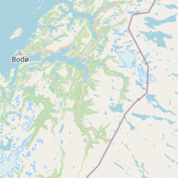
National parkNorrbotten County
Park boundaries overlap#1 closest
East

Sarek National Park: Mapping Sweden's Rugged Alpine Wilderness and Glacial Terrain
Explore the mapped geography of Norrbotten County's largest alpine national park.
Sarek National Park represents the heart of Sweden's alpine wilderness, a protected landscape defined by its towering mountain peaks, expansive glaciers, and deeply carved glacial valleys. Situated in Norrbotten County, the park's geography is characterized by a remote and rugged terrain, making it a prime destination for understanding high-altitude natural environments through mapped context. Discover the unique contours of this iconic national park and its place within the broader regional geography of Swedish Lapland.
- Area
- 1,970 km²
- Established
- 1909
- IUCN
- II
- Relief
- Mountain
National parkNorrbotten County
Park boundaries overlap#2 closest
East
Stora Sjöfallet National Park: Protected Arctic Landscape in Norrbotten County
Explore mapped terrain and regional geography.
Stora Sjöfallet National Park stands as a significant protected landscape within Norrbotten County, Sweden, renowned for its striking Arctic mountain scenery centered on the Áhkká massif. As a key component of the Laponian Area UNESCO World Heritage Site, its vast expanse of over 1,278 square kilometers offers critical insights into subarctic ecosystems, glacial terrain, and the mapped boundaries of a protected natural territory. Discover the unique geographic features and ecological value of this expansive national park.
- Area
- 1,278 km²
- Established
- 1909
- IUCN
- II
- Relief
- Mountain
National parkNordland
0 km away#3 closest
West

Rago National Park: Northern Norway's Protected Mountain Wilderness and Transboundary Atlas
Explore the mapped terrain and unique landscape context of this significant protected area.
Rago National Park is a protected national park in Nordland, Norway, recognized for its challenging mountainous terrain and its crucial role as part of a vast transboundary protected area complex spanning into Sweden. The park's landscape features alpine lakes and glaciers, offering a stark representation of northern Scandinavian mountain wilderness. Understanding Rago National Park provides insight into regional conservation efforts and the geographic significance of large-scale protected lands in Europe.
- Area
- 171 km²
- Established
- 1971
- IUCN
- II
- Relief
- Mountain
National parkNordland
17 km away#4 closest
Southwest
Junkerdal National Park: Protected Arctic-Alpine Landscape in Nordland, Norway
Explore mapped boundaries and unique geographic context.
Delve into Junkerdal National Park, a significant protected area within Nordland county, Norway. This national park is celebrated for its rich arctic-alpine flora, including rare plant species that thrive at their southernmost European range. The varied landscape, shaped by glacial activity, features dramatic mountain valleys and alpine plateaus, offering a distinct geographic profile. Understand its protected status and mapped terrain, providing a critical point of discovery for regional landscape context.
- Area
- 682 km²
- Established
- 2004
- IUCN
- II
- Relief
- Mountain
National parkNordland
26 km away#5 closest
West
Sjunkhatten National Park: Norway's Protected National Park Identity and Geographic Atlas
Mapped landscape context and regional geography details.
Explore the structured geographic data and protected landscape context for Sjunkhatten National Park, a significant national park in Nordland, Norway. This page provides detailed insights into its mapped boundaries and regional setting, offering an atlas-driven view of its natural terrain. Understand how this protected area contributes to the broader geography of Norway through factual, map-oriented discovery.
- Area
- 417.5 km²
- Established
- 2010
- IUCN
- II
- Relief
- Mountain
National parkNorway
59 km away#6 closest
Southwest
Saltfjellet, Svartisen National Park: Glacial Terrain & Protected Arctic Wilderness
Norway's vast national park with Svartisen glacier and unique flora.
Saltfjellet, Svartisen National Park spans over 2,100 square kilometers of diverse protected wilderness in Northern Norway. Renowned for Svartisen, Scandinavia's second-largest glacier, its landscape transitions from coastal influences to alpine plateaux. The park's calcareous bedrock supports a rich flora, rare in the region, contributing to its distinct geographic identity. Explore the mapped boundaries and natural terrain of this significant protected landscape.
- Area
- 2,192 km²
- Established
- 1989
- IUCN
- II
- Relief
- Mixed relief
Marine protected areaNordland
About 67 km away#7 closest
West
Saltstraumen Marine Protected Area: Geographic Mapping and Tidal Landscape Features
Coastal fjord passage and protected marine terrain in Nordland
Located in Nordland, Saltstraumen represents a critical marine protected area where extreme tidal forces carve a dramatic, narrow passage between fjord systems. Explore the intersection of tidal currents, island geography, and protected marine habitat through a focused look at this Northern Norwegian natural wonder and its surrounding coastal topography.
- Visitors
- 150K annual
- Access
- Easy access
- Scope
- Marine
- Water
- Water-dominated
National parkNorrbotten County
77 km away#8 closest
South
Pieljekaise National Park: Ancient Birch Woodland and Glacial Terrain in Norrbotten
Explore Sweden's protected landscape and mapped geography.
Pieljekaise National Park, a historic protected area in Norrbotten County, showcases one of Scandinavia's most intact boreal birch woodlands. Its landscape is shaped by ancient glacial activity, featuring a U-shaped valley, rolling hills covered in primeval-like birch forests, and distinctive twin peaks. Positioned along the renowned Kungsleden trail, this national park serves as a vital point for understanding the mapped geography and protected natural heritage of Sweden's Lapland region.
- Area
- 153.4 km²
- Established
- 1909
- IUCN
- II
- Relief
- Upland
MoriAtlas Explorer
Continue Mapping Padjelanta National Park's Protected Geography and Landscape
Deepen your understanding of Padjelanta National Park by exploring its specific geographic context within Norrbotten County and the broader Laponia region. Examine the park's unique plateau terrain, the mapped extent of its protected boundaries, and its ecological significance as a vital component of the arctic wilderness. MoriAtlas provides the structured data to trace the mapped features and understand the regional atlas of this expansive natural reserve.
Browse next
Global natural geography
Explore related park routes
Explore MoriAtlas Global ParksBrowse All MoriAtlas ParksGlobal Park Map DiscoveryMoriAtlas: Browse All CountriesBrowse All MoriAtlas ContinentsNational Park Environment AtlasGrand Canyon National Park AtlasYellowstone National Park AtlasYosemite National Park Atlas and GeographySerengeti National Park AtlasGalápagos National Park Protected LandscapeBanff National Park Geography and AtlasKruger National Park Atlas EntryUluṟu-Kata Tjuṯa National Park AtlasExplore Uluru-Kata Tjuta National Park GeographyPlitvice Lakes National Park AtlasFiordland National Park Protected LandscapeGreat Smoky Mountains National Park AtlasAfghanistan National Parks and Protected AreasAlbania National Parks and Protected AreasAlgeria National Parks and Protected AreasAmerican Samoa National Parks and Protected AreasAndorra National Parks and Protected AreasAngola National Parks and Protected AreasAntarctica National Parks and Protected AreasAntigua and Barbuda Park List