Peaks
Cerro Heros
2,084 m

Structured insights into mountain terrain, alpine elevations, and river systems
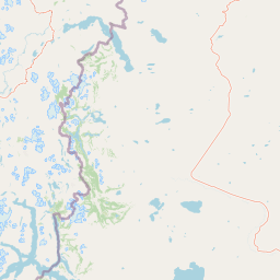
Examine the physical geography of Perito Moreno National Park, a protected area spanning over 1268 square kilometers in Argentina. This resource provides technical details on the park boundary, elevation metrics reaching 2770 meters, and the distribution of internal peaks, lakes, and river systems within this alpine landscape.
Related tags
Patagonian mountain wilderness at the foot of glaciers
Perito Moreno National Park is a vast protected area in the southern Patagonian region of Argentina, established in 1937 and making it one of the oldest national parks in the country. The park spans 126,830 hectares of mountainous terrain in western Santa Cruz Province, bordering Chile. Situated at approximately 900 meters above sea level, the landscape is characterized by dramatic mountain chains that create an amphitheater-like valley system, with peaks reaching nearly 2,800 meters within the protected area. The park lies in the rain shadow of the Andes, resulting in a climatic gradient from wet conditions in the western zone near the border to significantly drier conditions toward the eastern plains. Named for the renowned Argentine explorer Francisco Moreno, the park protects a representative sample of Patagonian ecosystems including lenga forests, Andean steppe, and alpine meadows.
Country membership and transboundary status within the global atlas
Interactive boundary geometry and recorded spatial measurements
Mountain relief metrics and recorded natural features
Peaks
2,084 m
Peaks
2,254 m
Rivers
Peaks
1,960 m
Lakes
Lakes
Alpine relief, major water presence, and strongly seasonal mountain terrain
Mountains · Valleys · Lakes · Rivers
Compare the diverse mountain terrain and conservation landscapes within Patagonia's protected areas.
Northwest

A National Park within Aysén del General Carlos Ibáñez del Campo Region.
Laguna San Rafael National Park stands as a key protected area within the vast geography of the Aysén del General Carlos Ibáñez del Campo Region. This entry provides an atlas-focused perspective, detailing the park's geographic significance, mapped natural landscapes, and its role as a vital conservation territory. Understand how this national park fits into the broader context of Patagonia's unique terrain and protected areas.
North
Mapped boundaries and natural terrain in Aysén Region.
Patagonia National Park, situated within the Aysén Region of Chile, serves as a significant protected area offering rich opportunities for atlas-based geographic exploration. This national park's specific landscape identity and mapped boundaries provide a clear focal point for understanding regional conservation and natural terrain. Discover the geographic context of this protected land and its place within the broader landscape of southern Chile through structured data and map exploration.
Southwest
Chile's largest protected area: a map of vast ice caps and fjords.
Bernardo O'Higgins National Park is a colossal protected landscape in Chile, safeguarding much of the Southern Patagonian Ice Field and its colossal glacial features like the Pío XI Glacier. Explore the dramatic terrain of towering granite peaks and intricate fjord systems that define this remote national park. This page provides essential context for understanding its geography, mapped boundaries, and significance as a vast wilderness preservation.
Northeast

Explore the mapped boundaries of this semi-arid grassland ecosystem.
Patagonia National Park is a protected national park in Argentina established to preserve the representative Patagonian steppe ecosystem. Covering 528.11 square kilometers, it offers a deep dive into the unique semi-arid grassland environment, known for its rolling plains and wind-shaped terrain. This park provides crucial context for understanding the broader geography of southern Argentina and the conservation of its distinctive natural landscapes.

Northeast
Archaeological mapping in the Pinturas River Canyon
Situated in the deep ravines of the Pinturas River Canyon, Cueva de las Manos is a primary protected area illustrating the intersection of prehistoric human activity and Patagonian geology. This site serves as a vital anchor for regional archaeology, featuring rock art layered across volcanic cliff walls that define the unique topography of northwestern Santa Cruz Province.
South
Explore glacial terrain and iconic Andes peaks.
Los Glaciares National Park is a vast protected area in Argentina, dominated by a massive Patagonian ice cap and numerous descending glaciers, including the renowned Perito Moreno Glacier. Its dramatic landscape of ice fields, glacial lakes, and towering granite spires like Mount Fitz Roy provides critical context for understanding regional geography and the formation of glacial terrain. This park exemplifies the unique protected ecosystems of the southern Andes, offering rich detail for atlas-based discovery.
North
Mapped geography and huemul conservation in Chile's Aysén Region.
Cerro Castillo National Park is a premier protected area in southern Chile, celebrated for its iconic Cerro Castillo granite mountain that dominates the landscape. This national park, spanning over 1,700 square kilometers in the Aysén del General Carlos Ibáñez del Campo Region, showcases a dynamic Patagonian terrain shaped by glaciers and rivers. Its significance extends to being a vital corridor for endangered huemul, offering critical habitat within a broader regional conservation strategy and the famous Route of Parks.
East
Explore mapped fossil trees across the Patagonian steppe.
Bosques Petrificados de Jaramillo National Park is a protected national park in Argentina's Santa Cruz Province, celebrated for its extensive collection of Jurassic period fossilized trees. Spanning nearly 80,000 hectares of Patagonian steppe, the park's unique landscape is defined by exposed petrified trunks, some of remarkable size, providing crucial evidence of the region's ancient ecosystems and paleoclimatic history. Discover this extraordinary site through its mapped geography and protected landscape identity.
Delve deeper into the unique geography and protected-area context of Perito Moreno National Park. Understand its role within the broader Patagonian atlas by examining its distinctive terrain, dual watersheds, and the ecological transition it represents.