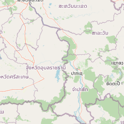
Why Phu Chong, Na Yoi National Park stands out
Phu Chong, Na Yoi National Park is best known for its dramatic mountain scenery at the convergence of three countries, its multi-tiered waterfalls with their distinctive turquoise pools, and the distinctive rock formations scattered throughout the park's terrain. The Huai Luang Waterfall, also called Bak Teo, drops 40 metres in three distinct steps, creating a popular swimming area with white sand and remarkably clear water. The rock gardens and viewpoints, particularly Pha Phueng, offer sweeping vistas across the forested mountains toward Laos and Cambodia. The discovery of the frog species Fejervarya triora in 2004 highlighted the park's biological significance, adding scientific recognition to its more established recreational appeal.
Phu Chong, Na Yoi National Park history and protected-area timeline
Phu Chong–Na Yoi National Park was established in 1987, becoming one of Thailand's later national park designations compared to the wave of protections that began in the 1960s and 1970s. The establishment came during a period when Thailand was expanding its protected area network to cover remaining significant ecosystems, and the Dângrêk Mountains region was recognized as holding forests and habitats not yet represented in the existing park system. The park was designated under Thailand's national park legislation and classified as an IUCN Category II protected area, reflecting its primary conservation objective of preserving natural ecosystems while permitting managed recreational use. The discovery of Fejervarya triora, a previously unknown frog species, in 2004 demonstrated that significant biodiversity continues to be documented within the park's boundaries, underscoring the scientific value of maintaining protection for these montane forest habitats.
Phu Chong, Na Yoi National Park landscape and geographic character
The physical landscape of Phu Chong–Na Yoi National Park is defined by the mountainous terrain of the Dângrêk Mountains, a range that extends roughly east-west forming the natural boundary between Thailand and Laos. The park encompasses steep slopes, ridgelines, and valleys carved by streams flowing southward from the highland areas. Prominent geological features include the coloured cliffs at Pha Phueng and Phu Hin Dang, where mineral deposits in ancient rock formations create vivid hues that geologists attribute to prehistoric dry conditions that concentrated mineral residues in the sediment. The rock garden areas feature scattered boulders and monolithic formations shaped by weathering and erosion. Several streams within the park create dramatic water features, with Huai Luang Stream descending through a series of waterfalls and cascades, including the prominent Bak Teo Yai falls which drops approximately 40 metres in a multi-step cascade. The stream at Kaeng Sila Thip flows over a rock terrace where the force of water has carved distinctive circular depressions known as kumphalak into the stone surface.
Phu Chong, Na Yoi National Park ecosystems, habitats, and plant life
The park protects montane forest ecosystems within the Dângrêk Mountains, representing a transitional zone between Thailand's northeastern highlands and the broader Mekong River basin. The forest cover varies with elevation, with taller evergreen and semi-evergreen species dominating the upper slopes and mixed deciduous vegetation occurring at lower elevations and in valleys. The relative remoteness of the area has allowed forest communities to persist more extensively than in surrounding regions where agricultural conversion has advanced. Stream systems within the park feed into the Lam Dom Noi catchment, connecting the protected area to broader watershed functions that influence water quality and flow patterns extending into lower-lying agricultural areas. The park's position at a biogeographic crossroads contributes to species assemblages that include elements from different regional faunas, though comprehensive species inventories for the area remain limited.
Phu Chong, Na Yoi National Park wildlife and species highlights
While detailed wildlife surveys for Phu Chong–Na Yoi National Park are not extensively published, the park supports populations of forest-dwelling species typical of the Dângrêk Mountain region. The discovery of Fejervarya triora in 2004 indicates the presence of amphibian communities that include species not found elsewhere, suggesting the montane habitats harbor endemic elements. Birdlife is present in the forest canopy and along stream corridors, though specific species documentation for the park is limited in accessible sources. The maintaining of forest cover across the park's mountainous terrain provides habitat for medium and small mammals including various squirrel species, civets, and deer that inhabit the region. The streams support aquatic fauna adapted to the flowing water environment.
Phu Chong, Na Yoi National Park conservation status and protection priorities
Phu Chong–Na Yoi National Park functions as a protected area preserving montane forest ecosystems in a region where conversion pressures from agriculture and infrastructure development have affected much of the original forest cover. The IUCN Category II designation reflects the park's primary purpose of ecosystem conservation, with management focused on maintaining natural processes and preventing habitat degradation. The protected status helps safeguard the watershed functions of the Dângrêk Mountains, where forests play roles in regulating water flow and protecting soils on steep terrain. The 2004 discovery of a previously undescribed amphibian species within the park demonstrates that significant biological knowledge remains to be documented from protected areas in this region, supporting the continued importance of maintaining protection for these habitats.
Phu Chong, Na Yoi National Park cultural meaning and human context
The Dângrêk Mountains region has historical connections to the broader Mekong River cultural sphere, with communities on both sides of the modern international boundary sharing linguistic and cultural affinities that predate the establishment of current borders. Within the park, certain sites such as Phlan Kong Kwian reflect historical patterns of travel and shelter use, with the name translating to cart terrace indicating its function as a resting point for travelers moving through the mountainous terrain. The landscape has been shaped by human movement and use over extended periods, though the park area itself does not encompass significant permanent settlements. The mountainous terrain created natural barriers that influenced the movement of peoples and the development of distinct regional identities within the broader Thai and Lao cultural areas.
Top sights and standout views in Phu Chong, Na Yoi National Park
The park's most prominent attraction is the Huai Luang Waterfall, also known as Bak Teo, where water descends approximately 40 metres through three distinct drops into a pool with notably clear turquoise water and a white sand beach. The rock garden formations at Phlan Yao present an unusual landscape of scattered boulders and weathered stone formations, complemented by the Pha Phueng viewpoint offering panoramic views toward the eastern mountains and neighboring countries. Phu Hin Dang provides an elevated viewpoint from which visitors can observe the forested landscapes of Laos and Cambodia while viewing the distinctive coloured cliff face. The nature trail to Namtok Koeng Mae Phong extends through forest habitat along the Lam Dom Noi Stream, allowing visitors to experience the park's interior landscapes. Kaeng Sila Thip showcases the power of flowing water as it has carved distinctive circular hollows into the rock terrace surface.
Best time to visit Phu Chong, Na Yoi National Park
The optimal period for visiting Phu Chong–Na Yoi National Park corresponds to the cooler dry season from November through February, when temperatures are more comfortable for hiking and the landscape retains green vegetation following the monsoon period. The monsoon season from May through October brings rainfall that can affect trail conditions and visibility, though the waterfall flows are typically strongest during and immediately after the rainy season. The hot season from March through May can make hiking challenging due to higher temperatures, though this period may offer clearer skies for viewpoint visits. The park's mountain setting provides some moderating effect on temperatures compared to lower-lying areas, making it a viable destination across much of the year when visitors prepare appropriately for the conditions.