

Mori Atlas logo
National parkPhu Pha Thoep National Park

Discover the mapped boundaries and geographic context of this protected area in Thailand.

Phu Pha Thoep National Park: Mukdahan Province National Park & Protected Landscape Atlas

Phu Pha Thoep National Park stands as a significant protected national park within Mukdahan Province, Thailand. This dedicated page serves as a comprehensive entry point for understanding its geographic identity, mapped protected boundaries, and role within the regional landscape. Explore its unique position for detailed atlas-based discovery, offering a clear view of its protected area context and natural terrain.

National ParkRock FormationsPrehistoric ArtCave ArtForest ConservationIsan Region

Phu Pha Thoep National Park

National park

Park overview

Structured park overview, official facts, and landscape profile for Phu Pha Thoep National Park

Phu Pha Thoep National Park park facts, protected area profile, and essential visitor context
Review the core facts for Phu Pha Thoep National Park, including designation, size, terrain, visitor scale, habitats, and operating context in one park-focused overview.

About Phu Pha Thoep National Park

Phu Pha Thoep National Park occupies a distinctive position among Thailand's network of protected areas, combining geological uniqueness with archaeological significance within a relatively compact territory. The park's landscape centers on a series of rugged hills and rocky outcrops that rise from the surrounding lowland terrain, creating a visual landmark visible from the nearby Mekong river valley. The park's namesake feature, Phu Pha Thoep, hosts the most impressive concentration of eroded rock formations, where wind and water have carved unusual shapes into sandstone exposures over millennia. Visitors exploring the mountain's trails encounter these formations scattered across the hillsides, their forms having inspired local naming traditions and cultural associations. Beyond the geological attractions, the park preserves important examples of mixed deciduous forest that once covered much of the Isan region before agricultural expansion transformed the landscape. These forest remnants provide habitat for wildlife species adapted to seasonal tropical environments, maintaining ecological processes in an area where natural habitats have become increasingly fragmented. The park's accessibility from Mukdahan city makes it a practical destination for visitors exploring northeastern Thailand, offering a concentrated experience of the region's natural and cultural heritage within a manageable area.

Quick facts and research context for Phu Pha Thoep National Park

Phu Pha Thoep National Park covers 48 square kilometers in Mukdahan Province, making it one of Thailand's smallest national parks. The highest point is Phu Jongsi peak at 420 meters above sea level. The park lies within Mueang and Don Tan districts, approximately 17 kilometers south of Mukdahan city along the Mekong river basin. The park's defining geological feature is the complex of eroded rock formations on Phu Pha Thoep mountain, while its most significant archaeological asset is Tham Fa Mue Daeng cave with ancient red hand paintings dating back 3,000 to 5,000 years. The park was formerly known as Mukdahan National Park before receiving its current designation.

Park context

Deeper park guide and search-rich context for Phu Pha Thoep National Park

Phu Pha Thoep National Park history, landscape, wildlife, and travel context
Explore Phu Pha Thoep National Park through its history, landscape character, ecosystems, wildlife, conservation priorities, cultural context, and seasonal travel timing in a structured park guide built for atlas discovery and search intent.

Why Phu Pha Thoep National Park stands out

Phu Pha Thoep is best known for two exceptional features that set it apart from other Thai protected areas. First, the mountain's dramatic rock formations present an extraordinary landscape of eroded sandstone pillars and boulders that have been shaped by natural forces into shapes resembling mushrooms, temples, and mythical creatures. These geological formations create a visually striking environment unlike typical Thai forest landscapes. Second, the park contains Tham Fa Mue Daeng cave, whose walls bear ancient hand paintings created between 3,000 and 5,000 years ago by prehistoric peoples. The cave's name translates as "red hand" in reference to the distinctive crimson hue of the pigment used in the artworks. This combination of remarkable geological beauty and significant prehistoric cultural heritage makes the park a destination of both natural and historical importance.

Phu Pha Thoep National Park history and protected-area timeline

The human history of Phu Pha Thoep National Park extends far deeper than its modern designation as a protected area. Archaeological evidence in the form of ancient hand paintings within Tham Fa Mue Daeng cave demonstrates human presence in this landscape between 3,000 and 5,000 years ago, placing the site within the prehistoric period of mainland Southeast Asia. These paintings, created using red pigment that has remained remarkably preserved on the cave's interior walls, represent artistic expression from societies that lived in the Mekong river valley long before the emergence of recorded history in the region. The cave's name, meaning "red hand" in Thai, directly references the distinctive color of the prehistoric artworks. The park's contemporary status as a protected area represents a more recent chapter in its history, with the territory originally designated as Mukdahan National Park before being renamed to reflect the prominence of the Phu Pha Thoep geological features. This transition in naming acknowledges the mountain's cultural and landscape significance while establishing the area's conservation framework under Thailand's national park system managed by the Department of National Parks, Wildlife and Plant Conservation.

Phu Pha Thoep National Park landscape and geographic character

The physical landscape of Phu Pha Thoep National Park presents a characteristic terrain of northeastern Thailand, defined by rolling hills and isolated rocky peaks that rise above the broader floodplain of the Mekong river system. The park's highest point, Phu Jongsi, reaches 420 meters above sea level, providing elevation relief from the surrounding lowlands that are typically only 100-200 meters in elevation. The most visually striking element of the park's topography is the complex of rock formations found on Phu Pha Thoep mountain, where erosion has produced an assortment of unusual shapes in exposed sandstone. These formations range from isolated pillars and balanced boulders to more complex arrangements that local interpretation has associated with mushrooms, temples, and various animal forms. The interplay of hard rock outcrops with softer forest-covered slopes creates a varied visual environment. Between the rocky hills, seasonal watercourses and small valleys support forest growth, while the lower elevations transition into agricultural landscapes as the park boundary is approached.

Phu Pha Thoep National Park ecosystems, habitats, and plant life

The ecological character of Phu Pha Thoep National Park reflects the broader vegetation patterns of Thailand's Isan region, though the park's protected status preserves forest types that have been extensively cleared across surrounding areas. The park supports mixed deciduous forest alongside areas of evergreen vegetation, creating a mosaic of habitat types that varies with topography, soil conditions, and moisture availability. These forests contain numerous tree species including Afzelia xylocarpa, Anisoptera costata, various Dalbergia species, Irvingia malayana, Lagerstroemia calyculata, Pterocarpus macrocarpus, and multiple Shorea species. The diversity of tree species provides structural complexity and ecological niches that support associated fauna. Dillenia, Barringtonia, and Cratoxylum genera add to the botanical diversity. The forest canopy varies in density across the park, with more open woodland on drier slopes and denser evergreen growth in drainage channels and sheltered valleys. This habitat diversity supports the animal species recorded within the park's boundaries.

Phu Pha Thoep National Park wildlife and species highlights

The wildlife community within Phu Pha Thoep National Park includes several mammal species typical of northeastern Thailand's forest environments. Northern pig-tailed macaques represent the most commonly observed primate species, often found in groups moving through the forest canopy. Sambar deer and wild boar maintain populations in the denser forest areas, while golden jackals and common palm civets occupy more secretive niches. Northern red muntjac, also known as the Indian muntjac, moves cautiously through undergrowth in the early morning and evening hours. The park's avifauna includes several notable species: junglefowl, the wild ancestor of domestic chickens, maintains presence in suitable habitat; green peafowl, a species of conservation concern in Thailand, has been recorded in the park; and various pheasant species add to the bird diversity. In 2005, researchers discovered specimens of a previously undescribed frog species, Fejervarya triora, within the park, demonstrating that even small protected areas can contribute to biodiversity documentation. This discovery highlights the potential for new species records in Thailand's forests, many of which remain poorly surveyed despite their proximity to populated areas.

Phu Pha Thoep National Park conservation status and protection priorities

Phu Pha Thoep National Park contributes to Thailand's protected area network by preserving a sample of the natural landscapes and ecosystems that once covered much of the Isan region. The park's relatively small size of 48 square kilometers makes it one of Thailand's smallest national parks, yet its conservation value is amplified by the combination of geological features, archaeological sites, and biological diversity it contains within this limited area. The forest communities within the park represent remnants of ecosystems that have been extensively converted to agricultural use, particularly for rice cultivation and cassava production. By maintaining forest cover, the park preserves habitat for wildlife species, protects watershed functions, and maintains soil stability on hillsides that would otherwise face erosion risk during the monsoon season. The ancient hand paintings in Tham Fa Mue Daeng cave represent a cultural heritage value that complements the ecological conservation mission, creating incentives for protection that extend beyond purely biological considerations. The park's classification as IUCN Category II reflects its management as a national park with both conservation and visitor use objectives.

Phu Pha Thoep National Park cultural meaning and human context

The cultural significance of Phu Pha Thoep National Park extends from prehistoric times through to the present day, creating multiple layers of human connection to this landscape. The ancient hand paintings in Tham Fa Mue Daeng cave represent the earliest cultural layer, created by prehistoric peoples between 3,000 and 5,000 years ago. These paintings, rendered in durable red pigment, demonstrate artistic and symbolic expression from societies that inhabited the Mekong river valley during the Neolithic or Bronze Age periods. The cave's name, translating as "red hand," preserves the local recognition of these ancient artworks. In more recent centuries, the landscape has been shaped by Buddhist practice, as evidenced by the Buddha image and numerous smaller wooden Buddha figures placed within the cave grotto above Phu Tam Pra waterfall. This religious addition represents the integration of the natural landscape into Buddhist spiritual practice, a pattern common throughout Thailand. The park's current name, Phu Pha Thoep, derives from the Thai words for the mountain's distinctive rock formations, preserving in nomenclature the geological feature that defines the park's visual identity.

Top sights and standout views in Phu Pha Thoep National Park

Phu Pha Thoep National Park offers visitors a concentrated combination of natural and cultural attractions within a compact territory easily explored in a day. The rock formations on Phu Pha Thoep mountain provide the park's most distinctive visual experience, with eroded sandstone shapes creating an almost surreal landscape unlike typical Thai forest environments. The ancient hand paintings in Tham Fa Mue Daeng cave represent a rare opportunity to view prehistoric art in its original setting, with the red-hued hand prints and markings estimated to be between 3,000 and 5,000 years old. The viewpoint at Phu Mano rewards visitors with sweeping views of Mukdahan city, the Mekong river, and the landscape of neighboring Laos beyond the international boundary. The seasonal Phu Tam Pra waterfall, while not a year-round water feature, adds another dimension to the park's attractions when conditions permit. These varied highlights make the park particularly suitable for visitors seeking to experience geological wonders and ancient cultural heritage within a single protected area.

Best time to visit Phu Pha Thoep National Park

The optimal time to visit Phu Pha Thoep National Park aligns with Thailand's cool dry season from November through February, when temperatures are comfortable for hiking and the landscape remains accessible. During this period, reduced rainfall makes trail conditions more favorable for exploring the park's hills and rock formations, while wildlife visibility improves as animals congreg more frequently at water sources. The hot season from March through May brings higher temperatures that can make midday hiking uncomfortable, though early morning excursions remain feasible. The monsoon season from June through October brings rainfall that can make trails slippery and some areas less accessible, though the landscape becomes more lush and waterfalls may flow more impressively during this period. The park remains open year-round, allowing visitors to choose timing based on their preferences for weather conditions and the type of experience they seek. Regardless of season, visitors should check current conditions and park status before planning trips, as seasonal variations can affect accessibility of specific attractions within the park.

Park location guide

Geography guide, regional context, and park location map for Phu Pha Thoep National Park

Phu Pha Thoep National Park park geography, regions, and map view in Thailand
Understand where Phu Pha Thoep National Park sits in Thailand through a broader geographic reading of the surrounding landscape, nearby location context, and its mapped position within the national park landscape.

How Phu Pha Thoep National Park fits into Thailand

Thailand is a Southeast Asian nation formerly called Siam, located in mainland Southeast Asia. It operates as a unitary parliamentary constitutional monarchy under King Vajiralongkorn. The country borders Myanmar, Laos, Cambodia, and Malaysia, with maritime boundaries involving Vietnam, Indonesia, and India. Thailand has a population of nearly 66 million and covers approximately 513,120 km². Historically, the Sukhothai Kingdom marks the beginning of Thai history, followed by the powerful Ayutthaya Kingdom.

Wider geography shaping Phu Pha Thoep National Park in Thailand

Thailand occupies mainland Southeast Asia with borders to Myanmar (west/northwest), Laos (east/northeast), Cambodia (southeast), and Malaysia (south). The country has coastline along the Gulf of Thailand to the southeast and the Andaman Sea to the southwest. The territory covers approximately 513,120 km².

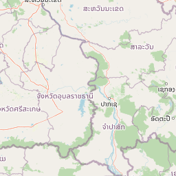
Map view of Phu Pha Thoep National Park

Use this park location map to pinpoint Phu Pha Thoep National Park in Thailand, understand its exact geographic position, and read its mapped placement within the surrounding landscape more clearly.

Pigeon | © OpenStreetMap contributors

Location context for Phu Pha Thoep National Park

Mukdahan Province
Park atlas

Discover the regional context of protected areas, mapping surrounding landscapes and geographic features near Phu Pha Thoep.

Explore National Parks and Protected Areas Near Phu Pha Thoep National Park
After exploring Phu Pha Thoep National Park's unique rock formations and ancient cave art, continue your protected area discovery by examining other national parks and forest reserves within Thailand's Isan region. This geographic comparison allows users to trace the spread of conservation landscapes and understand the regional biodiversity context beyond a single park entity.
National parkAmnat Charoen Province

Phu Sa Dok Bua National Park: National Park with Mapped Protected Boundaries

Explore protected landscapes in Amnat Charoen Province, Thailand.

Discover Phu Sa Dok Bua National Park, a designated national park situated within the geographic context of Amnat Charoen Province. This profile focuses on the park's protected area identity and its mapped boundaries, offering essential geographic information for atlas-based exploration and understanding its role within Thailand's conservation landscape.

Area
231 km²
Established
1992
IUCN
II
Visitors
1.8K annual
National parkSakon Nakhon Province

Phu Pha Yon National Park: Protected Landscape and Regional Geography in Sakon Nakhon Province

Explore the mapped boundaries and natural terrain of this Thai national park.

Phu Pha Yon National Park, situated in Sakon Nakhon Province, is a protected national park offering a focused point for geographic exploration. This park entity serves as a component of Thailand's broader protected area network, with its mapped boundaries and natural landscape providing essential context for regional geography studies. Understanding Phu Pha Yon National Park through its geographic setting and protected status enhances atlas-based discovery and appreciation of its place within the Khorat Plateau.

Area
829 km²
Established
1988
IUCN
II
Visitors
5K annual
National parkSakon Nakhon Province

Phu Phan National Park: Thailand's Protected Mountain Landscape and Natural Atlas Entry

Explore dry dipterocarp forest and unique terrain in Sakon Nakhon.

Phu Phan National Park offers a detailed look into Thailand's northeastern geography, characterized by its mountainous terrain and extensive dry dipterocarp forests. As a national park, it represents a vital protected landscape within Sakon Nakhon Province, showcasing unique geological formations and providing a rich context for atlas-based exploration. Discover the park's mapped boundaries, its ecological significance, and the distinct natural features that define this prominent Isan region protected area.

Area
665 km²
Established
1972
IUCN
II
Visitors
4.9K annual
National parkUbon Ratchathani Province

Pha Taem National Park: Mapped Protected Landscape in Ubon Ratchathani

National park exploration and geographic context

Pha Taem National Park serves as a distinct protected area within Ubon Ratchathani Province, offering a focused lens for geographic discovery. Understand its specific location, mapped boundaries, and the surrounding natural landscape context that defines this national park. This entry supports detailed atlas exploration of Thailand's protected territories.

Area
340 km²
Established
1991
IUCN
II
Visitors
180.2K annual
National parkUbon Ratchathani Province

Kaeng Tana National Park: Mapped Protected Landscape in Ubon Ratchathani Province

Explore Thailand's national park geography and boundaries.

Kaeng Tana National Park is a designated national park located in Ubon Ratchathani Province, Thailand. This atlas-focused content helps users understand its unique protected landscape identity and geographic setting. Explore the mapped context of Kaeng Tana National Park, contributing to a structured understanding of conservation areas and natural terrain within Thailand's broader geography.

Area
80 km²
Established
1981
IUCN
II
Visitors
31.2K annual
Watercolor illustration of a river flowing through a valley with green forests and distant mountains
National parkVietnam

Phong Nha, Kẻ Bàng National Park: Vietnam's Karst Terrain and Subterranean World

Explore protected landscapes, cave systems, and geological wonders.

Phong Nha, Kẻ Bàng National Park in Vietnam is a globally significant protected landscape, recognized by UNESCO for its exceptional karst topography and extensive cave networks. This national park features dramatic limestone mountains, deep river gorges, and some of the world's most impressive subterranean formations, offering a rich atlas of natural history and geological wonders to explore.

Area
857.54 km²
Established
2001
IUCN
II
Visitors
740K annual
National parkHà Tĩnh Province

Vũ Quang National Park: Protected Landscape Identity and Geographic Context in Hà Tĩnh

National Park Discovery and Mapped Terrain Exploration

Investigate Vũ Quang National Park, a key protected area situated in Hà Tĩnh Province. This page provides detailed insight into the park's designation as a national park, focusing on its mapped boundaries, surrounding natural landscapes, and contribution to the regional geography. It serves as a vital resource for understanding the park's protected landscape characteristics and its place within Vietnam's atlas of conservation areas.

Area
550.28 km²
Established
2002
IUCN
II
Relief
Mountain
National parkSisaket Province

Khao Phra Wihan National Park: Protected Landscape and Archaeological Atlas Gateway

Explore dramatic red sandstone cliffs and historic Khmer ruins.

Khao Phra Wihan National Park in Sisaket Province, Thailand, is a protected landscape distinguished by its dramatic Pha Mo I Daeng red sandstone cliff and its role as a gateway to significant Khmer archaeological sites. This national park offers a deep dive into the region's unique geography, featuring rugged terrain, distinctive forest ecosystems, and prehistoric rock art. As a key entry point for understanding the Preah Vihear Temple's context, the park provides rich material for atlas-based exploration of border landscapes and historical terrain.

Area
130 km²
Established
1998
IUCN
II
Visitors
202.6K annual

Common questions about visiting, size, designation, and location context for Phu Pha Thoep National Park

Phu Pha Thoep National Park FAQs for park facts, access, geography, and protected area context
Find quick answers about Phu Pha Thoep National Park, including protected-area facts, park geography, trail and visitor context, and how the park fits into its surrounding country and regional landscape.
MoriAtlas Explorer

Continue Your Protected Areas Search Across the Global Atlas

Deepen your exploration by continuing the structured search for national parks and protected areas worldwide. Utilize the comprehensive filtering capabilities to compare different conservation landscapes and refine your understanding of global park geography. Discover more about the distribution and characteristics of protected natural areas.

Global natural geography