
Mori Atlas logo
Protected areaPrimeiras and Segundas Islands Environmental Protected Area

Discover the mapped boundaries and regional atlas significance of this protected area.

Primeiras and Segundas Islands Environmental Protected Area: Protected Landscape and Geographic Context in Mozambique

The Primeiras and Segundas Islands Environmental Protected Area represents a distinct protected landscape located off the coast of Mozambique in Southeast Africa. This atlas-focused entry details the park's geographic scope and its role as a mapped conservation area within the region. Explore its protected boundaries and understand its contribution to the natural geography of Mozambique.

islandsmarine protected areacoastal ecosystemsMozambique protected areaEastern Africa wildlife

Primeiras and Segundas Islands Environmental Protected Area

Protected area

Park overview

Structured park overview, official facts, and landscape profile for Primeiras and Segundas Islands Environmental Protected Area

Primeiras and Segundas Islands Environmental Protected Area park facts, protected area profile, and essential visitor context
Review the core facts for Primeiras and Segundas Islands Environmental Protected Area, including designation, size, terrain, visitor scale, habitats, and operating context in one park-focused overview.
Park location guide

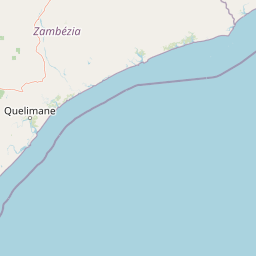
Geography guide, regional context, and park location map for Primeiras and Segundas Islands Environmental Protected Area

Primeiras and Segundas Islands Environmental Protected Area park geography, regions, and map view in Mozambique
Understand where Primeiras and Segundas Islands Environmental Protected Area sits in Mozambique through a broader geographic reading of the surrounding landscape, nearby location context, and its mapped position within the national park landscape.

How Primeiras and Segundas Islands Environmental Protected Area fits into Mozambique

Mozambique is a sovereign state in Southeast Africa spanning approximately 801,590 km² along the Indian Ocean. It borders Tanzania, Malawi, Zambia, Zimbabwe, Eswatini, and South Africa. The country gained independence in 1975 after Portuguese colonial rule and experienced a civil war from 1977 to 1992. Today it operates as a semi-presidential republic with a population of approximately 35 million people.

Wider geography shaping Primeiras and Segundas Islands Environmental Protected Area in Mozambique

Mozambique occupies a coastal position along the Indian Ocean in southeastern Africa. The country shares borders with Tanzania to the north, Malawi and Zambia to the northwest, Zimbabwe to the west, and Eswatini and South Africa to the southwest. The terrain ranges from coastal plains to highlands in the west. The Mozambique Channel separates the country from Madagascar, Comoros, and Mayotte to the east.

Common questions about visiting, size, designation, and location context for Primeiras and Segundas Islands Environmental Protected Area

Primeiras and Segundas Islands Environmental Protected Area FAQs for park facts, access, geography, and protected area context
Find quick answers about Primeiras and Segundas Islands Environmental Protected Area, including protected-area facts, park geography, trail and visitor context, and how the park fits into its surrounding country and regional landscape.
MoriAtlas Explorer

Continue Your Protected Areas Search Across the Global Atlas

Deepen your exploration by continuing the structured search for national parks and protected areas worldwide. Utilize the comprehensive filtering capabilities to compare different conservation landscapes and refine your understanding of global park geography. Discover more about the distribution and characteristics of protected natural areas.

Global natural geography