Mori Atlas logo
Protected areaPrimeiras and Segundas Islands Environmental Protected Area

Discover the mapped boundaries and regional atlas significance of this protected area.

Primeiras and Segundas Islands Environmental Protected Area: Protected Landscape and Geographic Context in Mozambique

The Primeiras and Segundas Islands Environmental Protected Area represents a distinct protected landscape located off the coast of Mozambique in Southeast Africa. This atlas-focused entry details the park's geographic scope and its role as a mapped conservation area within the region. Explore its protected boundaries and understand its contribution to the natural geography of Mozambique.

islandsmarine protected areacoastal ecosystemsMozambique protected areaEastern Africa wildlife

Primeiras and Segundas Islands Environmental Protected Area

Protected area

Park overview

Structured park overview, official facts, and landscape profile for Primeiras and Segundas Islands Environmental Protected Area

Primeiras and Segundas Islands Environmental Protected Area park facts, protected area profile, and essential visitor context

Review the core facts for Primeiras and Segundas Islands Environmental Protected Area, including designation, size, terrain, visitor scale, habitats, and operating context in one park-focused overview.
Monthly climate preview

Long term temperature and precipitation patterns across the protected coordinate

Primeiras and Segundas Islands Environmental Protected Area Climate Normals and Weather by Month

Historical records from 1991 to 2020 outline a consistent annual cycle of monthly temperatures and rainfall at a representative coordinate in Primeiras and Segundas Islands Environmental Protected Area. Detailed monthly breakdowns provide complete data on average minimum and maximum thresholds for rigorous geographic analysis.
Annual mean26 °C
24 °C28 °C
Jan28°
Feb28°
Mar28°
Apr27°
May26°
Jun25°
Jul24°
Aug24°
Sep25°
Oct26°
Nov27°
Dec28°
Warmest month
March

27.9 °C

Coolest month
July

24 °C

Wettest month
January

7.2 mm/day

Driest month
September

0.1 mm/day

Park location guide

Geography guide, regional context, and park location map for Primeiras and Segundas Islands Environmental Protected Area

Primeiras and Segundas Islands Environmental Protected Area park geography, regions, and map view in Mozambique

Understand where Primeiras and Segundas Islands Environmental Protected Area sits in Mozambique through a broader geographic reading of the surrounding landscape, nearby location context, and its mapped position within the national park landscape.

How Primeiras and Segundas Islands Environmental Protected Area fits into Mozambique

Mozambique is a sovereign state in Southeast Africa spanning approximately 801,590 km² along the Indian Ocean. It borders Tanzania, Malawi, Zambia, Zimbabwe, Eswatini, and South Africa. The country gained independence in 1975 after Portuguese colonial rule and experienced a civil war from 1977 to 1992. Today it operates as a semi-presidential republic with a population of approximately 35 million people.

Wider geography shaping Primeiras and Segundas Islands Environmental Protected Area in Mozambique

Mozambique occupies a coastal position along the Indian Ocean in southeastern Africa. The country shares borders with Tanzania to the north, Malawi and Zambia to the northwest, Zimbabwe to the west, and Eswatini and South Africa to the southwest. The terrain ranges from coastal plains to highlands in the west. The Mozambique Channel separates the country from Madagascar, Comoros, and Mayotte to the east.

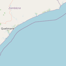
Map view of Primeiras and Segundas Islands Environmental Protected Area

Use this park location map to pinpoint Primeiras and Segundas Islands Environmental Protected Area in Mozambique, understand its exact geographic position, and read its mapped placement within the surrounding landscape more clearly.

Pigeon | © OpenStreetMap contributors
Park atlas

Trace the regional spread of marine and coastal protected areas, comparing similar island ecosystems and conservation landscapes.

Discover More Protected Areas Near Primeiras and Segundas Islands Environmental Protected Area in Mozambique

Expand your exploration beyond Primeiras and Segundas Islands Environmental Protected Area by browsing other national parks, marine conservation zones, and protected areas across Mozambique's coastline and Eastern Africa. Compare diverse island habitats, coastal ecosystems, and adjacent protected landscapes to understand regional conservation efforts and geographic distribution.
Nature reserveMalawi
About 401 km away#1 closest

West

Mulanje Mountain Forest Reserve: Protected Afromontane Landscapes in Southern Malawi

Geographic overview of the Mulanje Massif and its high-elevation plateau

This nature reserve covers an isolated mountain block in Malawi, rising sharply to 3,002 meters at Sapitwa Peak. The landscape features rugged granite cliffs, deeply carved valleys, and extensive Afromontane forests that provide sanctuary for numerous endemic species. Use this atlas resource to understand the massif's vertical relief, plateau characteristics, and its central role in the regional geography of southeastern Africa.

Area
563.17 km²
Established
1927
Relief
Mountain
Climate
Tropical
Protected areaZomba District
About 416 km away#2 closest

Northwest

Lake Chilwa Protected Area: Geography, Map, and Seasonal Wetland Landscape Analysis

Understanding the endorheic basin and floodplain dynamics in Malawi.

Lake Chilwa stands as a significant protected area and Ramsar wetland in Zomba District. This detail covers its unique closed-basin geography, the influence of seasonal rainfall on surface extent, and the distinct characteristics of its shallow open water and flooded grasslands. Explore the intersection of river inflows and basin drainage that defines this critical ecosystem.

Established
1996
Relief
Lowland
Scope
Terrestrial
Water
Water-dominated
Wildlife reserveNsanje District
About 442 km away#3 closest

West

Mwabvi Wildlife Reserve: Mapping the Protected Landscapes of the Nsanje District

Geography, woodland terrain, and regional biodiversity.

Located in the southernmost Nsanje District of Malawi, Mwabvi Wildlife Reserve encompasses a unique convergence of dry Brachystegia woodland, sandstone hills, and open savanna grasslands. This protected area offers a deep look into the varied topographies of the Lower Shire region, providing a comprehensive understanding of the reserve's historic ecological importance and its current role in regional conservation.

Area
135 km²
Established
1953
IUCN
IV
Relief
Upland
Nature reserveChiradzulu District
About 449 km away#4 closest

West

Chiradzulu Mountain Forest Reserve: Geography and Protected Area Profile

A rugged mountain landmark in the Shire Highlands of southern Malawi

Located in the heart of Chiradzulu District, this nature reserve protects a prominent mountain massif known for its unique silhouette and ecological importance. The site provides a vital reference point for understanding the mountainous terrain, regional reforestation progress, and the broader natural landscapes of the Shire Highlands.

Area
7.74 km²
Established
1924
Relief
Mountain
Scope
Terrestrial
Nature reserveMalawi
About 451 km away#5 closest

Northwest

Zomba Plateau Nature Reserve: Geographic Overview and Mapped Mountain Terrain

Protected montane landscapes in southern Malawi

Zomba Plateau stands as a significant granitic intrusion within the Shire Highlands, featuring high-altitude terrain and diverse forested patches. This record provides essential geographic context on its geological structure, forest reserves, and surrounding vistas across the southern Malawi landscape.

Area
130 km²
Established
1913
Relief
Mountain
Climate
Tropical
Marine protected areaMelaky
About 459 km away#6 closest

East

Barren Isles Marine Protected Area: Geographic Overview and Island Chain Mapping

Exploration of the nine islands in the Mozambique Channel.

The Barren Isles comprise a distinct chain of nine islands and sand banks stretching across the Mozambique Channel in Madagascar. This marine protected area offers a look into a complex coastal system that balances sensitive wetland habitats with seasonal maritime migration. Gain geographic perspective on this isolated archipelago located within the Melaky region, where shifting marine environments create a unique natural landscape.

Water
Water-dominated
National parkMalawi
About 475 km away#7 closest

West

Lengwe National Park: Malawi's Protected Landscape Atlas and Geographic Context

Mapped natural terrain and protected area boundaries in Malawi.

Lengwe National Park offers a focused look into Malawi's protected natural areas. As a designated national park, its geographic significance is highlighted through mapped boundaries and an understanding of the surrounding regional terrain. This entry provides essential context for exploring its identity as a protected landscape within southeastern Africa, contributing to a broader atlas of conservation areas.

Area
887 km²
Established
1970
IUCN
II
Climate
Tropical
National parkSouthern Region
About 476 km away#8 closest

Northwest

Liwonde National Park: National Park in Malawi's Southern Region

Mapped Protected Area Boundaries and Geographic Context

Liwonde National Park is a designated national park situated in Malawi's Southern Region. This entry provides detailed geographic information, focusing on the park's mapped boundaries and its role within the broader atlas of protected landscapes. Explore the unique regional geography and conservation context that defines this protected area.

Area
548 km²
Established
1973
Relief
Upland
Climate
Tropical

Common questions about visiting, size, designation, and location context for Primeiras and Segundas Islands Environmental Protected Area

Primeiras and Segundas Islands Environmental Protected Area FAQs for park facts, access, geography, and protected area context

Find quick answers about Primeiras and Segundas Islands Environmental Protected Area, including protected-area facts, park geography, trail and visitor context, and how the park fits into its surrounding country and regional landscape.
MoriAtlas Explorer

Continue Your Protected Areas Search Across the Global Atlas

Deepen your exploration by continuing the structured search for national parks and protected areas worldwide. Utilize the comprehensive filtering capabilities to compare different conservation landscapes and refine your understanding of global park geography. Discover more about the distribution and characteristics of protected natural areas.

Global natural geography