Mori Atlas logo
National parkRadom National Park

Discover the mapped boundaries and regional terrain of this protected area in Northeast Africa.

Radom National Park: Sudan's National Park with Distinct Protected Landscape Geography

Radom National Park stands as a designated national park within Sudan, contributing to the country's network of protected lands. This page serves as a primary entry point for understanding its specific geographic identity, mapped boundaries, and place within the broader atlas of natural landscapes in Northeast Africa. Explore the park's unique landscape context and its regional setting as a key protected area.

Biosphere ReserveWooded SavannaSudan Protected AreasTransboundary ConservationSudanian BiomeRiver Ecosystems

Radom National Park

National park

Park overview

Structured park overview, official facts, and landscape profile for Radom National Park

Radom National Park park facts, protected area profile, and essential visitor context
Review the core facts for Radom National Park, including designation, size, terrain, visitor scale, habitats, and operating context in one park-focused overview.

About Radom National Park

Radom National Park represents a critical conservation landscape in the western reaches of Sudan, situated within South Darfur state near the border with South Sudan and the Central African Republic. The park’s establishment in 1980 formalized protection for a vast expanse of wooded savanna that had long served as a habitat for migratory wildlife and as a cultural landscape for local communities. At approximately 12,500 square kilometers, the park ranks among Sudan’s largest protected areas and forms an important transboundary conservation link with Andre Felix National Park to the west. The park’s geography is defined by its river systems, with the Adda River marking the northern boundary and the Umblasha River marking the southern boundary. Numerous streams and permanent pools punctuate the landscape, providing crucial water sources throughout the year and supporting the park’s diverse ecological character. The habitat composition is predominantly shrubland, covering roughly 90 percent of the area, with forest patches comprising the remaining ten percent. This wooded savanna environment falls within the broader Sudanian biome, characterized by seasonal rainfall patterns and a mix of grassland and tree cover. The park contains multiple settlements within its boundaries, including villages such as Radom, Mesheitir, Bireikat, Um Gudul, Songo, al Hufra, Bimeza, and numerous others that have maintained traditional land use patterns within the protected area.

Quick facts and research context for Radom National Park

Radom National Park occupies roughly 1.25 million hectares in South Darfur, making it one of Sudan’s largest protected areas. The park sits at coordinates approximately 9°10′N 24°0′E, forming a contiguous protected zone with Andre Felix National Park across the border in the Central African Republic. The ecosystem is characterized as wooded savanna, with about 90 percent shrubland and the remaining area covered by forest. Annual rainfall ranges from 900 to 1,700 millimeters, supporting humidity levels between 57 and 65 percent and average temperatures between 16 and 27 degrees Celsius. The park was designated a biosphere reserve under the UNESCO Man and the Biosphere Programme in 1979, recognizing its ecological significance within the broader Sudanian savanna biome.

Park context

Deeper park guide and search-rich context for Radom National Park

Radom National Park history, landscape, wildlife, and travel context
Explore Radom National Park through its history, landscape character, ecosystems, wildlife, conservation priorities, cultural context, and seasonal travel timing in a structured park guide built for atlas discovery and search intent.

Why Radom National Park stands out

Radom National Park is best known as a biosphere reserve protecting one of Sudan’s last substantial tracts of wooded savanna ecosystem. The park’s extensive river system, including the Adda and Umblasha Rivers and numerous permanent pools, supports habitats that once sustained populations of large mammals including the Tora Hartebeest and defassa waterbuck, though both species have disappeared from the park due to poaching pressures. The park is also notable for its geopolitical significance, as the disputed Kafia Kingi area occupies the vast majority of the protected territory and remains a point of contention between Sudan and South Sudan.

Radom National Park history and protected-area timeline

Radom National Park was established in 1980, formalizing protection for a significant tract of Sudan’s western savanna landscapes. Prior to formal designation, the area served as an important ecological zone with wildlife populations that included substantial herds of large mammals. In 1979, prior to the park’s official establishment, the area was designated as a biosphere reserve under the UNESCO Man and the Biosphere Programme, joining the World Network of Biosphere Reserves and recognizing its ecological importance within the regional context. This dual status as both a national park and biosphere reserve has shaped the park’s management approach, balancing conservation objectives with sustainable use considerations. A significant historical development affecting the park concerns the territorial status of the Kafia Kingi area, which comprises the vast majority of the park’s territory. Following the Comprehensive Peace Agreement of 2005 between Sudan and South Sudan, the area was slated for transfer to South Sudan, though Sudan has maintained a degree of administrative control. This dispute has created uncertainty regarding the park’s future governance and has, according to reports from 2020, created conditions conducive to illicit activities including mineral smuggling.

Radom National Park landscape and geographic character

The landscape of Radom National Park is characterized by expansive wooded savanna stretching across flat to gently rolling terrain in South Darfur. The park’s terrain is marked by the presence of the Adda and Umblasha Rivers, which form the prominent northern and southern boundaries respectively, creating a roughly rectangular protected area that follows the course of these watercourses. Throughout the park, numerous smaller streams and permanent pools provide moisture and create ecological hotspots amid the broader savanna matrix. The vegetation is dominated by shrubland, with scattered trees and taller woody vegetation creating the characteristic park-like appearance of the Sudanian savanna. Forest patches occur in localized areas, adding diversity to the landscape. The flat to undulating terrain supports a landscape that, while not dramatically mountainous or rugged, provides important habitat continuity across a large geographical area. The presence of water bodies throughout the park creates linear corridors of denser vegetation that contrast with the surrounding savanna, supporting wildlife movement and providing critical resources for the park’s biodiversity.

Radom National Park ecosystems, habitats, and plant life

Radom National Park protects a representative example of the Sudanian savanna ecosystem, one of Africa’s major biomes characterized by a seasonal tropical climate and distinctive vegetation patterns. The park’s nature is defined by its extensive shrubland habitats, which cover approximately 90 percent of the protected area, interspersed with forest patches that make up the remaining ten percent. This wooded savanna supports a diversity of plant species adapted to the seasonal rainfall patterns, with annual precipitation ranging from 900 to 1,700 millimeters concentrated during a distinct wet season. The climate supports average annual temperatures ranging from 16 to 27 degrees Celsius, with relative humidity levels between 57 and 65 percent creating conditions conducive to biological productivity during the wet months. The park’s network of rivers, streams, and permanent pools creates aquatic and riparian habitats that contrast with the surrounding savanna, supporting different plant communities and providing critical water sources for wildlife. As a biosphere reserve, the park is recognized not only for its ecological value but also for its role in maintaining ecological processes and supporting biodiversity within the broader Sudanian region.

Radom National Park wildlife and species highlights

Radom National Park historically supported populations of large mammals typical of the Sudanian savanna, though the park has experienced significant wildlife declines. The park was once home to the Tora Hartebeest, a species of alcelaphine antelope adapted to savanna environments, which completely disappeared from the park following the country’s famine era in 1985. Similarly, the defassa waterbuck, a large marsh-loving antelope species, has also disappeared from the park. These losses reflect the broader pattern of wildlife depletion that has affected many of Sudan’s protected areas, driven primarily by commercial game poaching that has targeted large mammals for meat and trophy hunting. The park’s rivers and permanent pools historically supported aquatic wildlife and provided important watering points for larger mammals, though the ecological integrity of these water bodies has been affected by broader environmental pressures. While the park’s current wildlife status is diminished from its historical baseline, the protected area retains importance as a habitat within the Sudanian savanna corridor and as part of a transboundary conservation network extending into the Central African Republic.

Radom National Park conservation status and protection priorities

Radom National Park holds dual conservation status as both an IUCN Category II national park and a UNESCO biosphere reserve, placing it within international frameworks for protected area management. The park’s designation as a biosphere reserve in 1979 recognized its ecological significance within the Sudanian savanna biome and its potential to serve as a model for balancing conservation with sustainable human use. However, the park faces significant conservation challenges, primarily from commercial game poaching that has devastated populations of large mammals. The disappearance of the Tora Hartebeest and defassa waterbuck represents a significant conservation failure, with these species now absent from what was once their recognized habitat. The park’s transboundary location, adjacent to Andre Felix National Park in the Central African Republic, creates opportunities for regional conservation coordination but also presents challenges related to cross-border wildlife management and law enforcement. The disputed status of much of the park’s territory between Sudan and South Sudan has further complicated conservation efforts, with reports indicating that the contested area has become a locus for illegal activities including mineral smuggling.

Radom National Park cultural meaning and human context

Radom National Park contains numerous settlements within its boundaries, reflecting the long history of human habitation in this region of South Darfur. Villages including Radom, Mesheitir, Bireikat, Um Gudul, Songo, al Hufra, Bimeza, Deim Gushara, Chili West, Majid, Dafag, Titribi, Kafindibei West, Kafindibei East, Amara, Um Hugaar, Kafiakingi, Karmandoura, and Shioulla represent communities that have maintained traditional land use patterns within the protected area. The park’s name derives from the Arabic term Radom, and the alternate designation Al-Radom Reserve reflects the area’s historical identity prior to national park establishment. The region has experienced significant human upheaval, particularly during the famine era of 1985 that affected not only human populations but also wildlife through associated hunting pressures and habitat disturbance. The contemporary context is shaped by the broader Darfur conflict and the unresolved territorial dispute regarding Kafia Kingi, which has created conditions of instability that affect both human communities and conservation efforts.

Top sights and standout views in Radom National Park

Radom National Park stands as Sudan’s largest protected area and a biosphere reserve protecting one of the last substantial tracts of wooded savanna in the Darfur region. The park’s extensive river system, formed by the Adda and Umblasha Rivers, creates a distinct aquatic environment amid the savanna landscape and supports ecological diversity across the protected area. Its transboundary position adjacent to Andre Felix National Park in the Central African Republic establishes it as a node in a regional conservation network spanning the Central African savanna belt. The park’s dual protected area designation, combining national park status with biosphere reserve recognition, reflects its ecological significance within the UNESCO Man and the Biosphere Programme. The landscape’s mix of shrubland and forest, sustained by annual rainfall between 900 and 1,700 millimeters, supports an ecosystem that, despite wildlife declines, retains important conservation value.

Best time to visit Radom National Park

The optimal time to visit Radom National Park corresponds to the dry season, typically from November through April, when wildlife concentrations increase around permanent water sources and vegetation is less dense, improving wildlife viewing opportunities. The wet season from May to October brings seasonal flooding that can affect access to some areas of the park and makes road travel more difficult, though the landscape becomes more lush and bird activity increases during this period. The climate features average temperatures ranging from 16 to 27 degrees Celsius, with the cooler months coinciding with the dry season providing more comfortable conditions for exploration. Visitors should note that the park’s political context, including the disputed status of the Kafia Kingi area, may affect access and travel arrangements, and current conditions should be verified prior to planning any visit to this remote region of South Darfur.

Park location guide

Geography guide, regional context, and park location map for Radom National Park

Radom National Park park geography, regions, and map view in Sudan
Understand where Radom National Park sits in Sudan through a broader geographic reading of the surrounding landscape, nearby location context, and its mapped position within the national park landscape.

How Radom National Park fits into Sudan

Sudan is a large African nation spanning 1.89 million km² in Northeast Africa with a population of approximately 51.8 million people. It is Africa's third-largest country by area and is governed as a federal republic with Khartoum as its capital and largest city.

Wider geography shaping Radom National Park in Sudan

Sudan is located in Northeast Africa with coastline along the Red Sea. It shares borders with Egypt to the north, Libya to the northwest, Chad to the west, the Central African Republic to the southwest, South Sudan to the south, and Eritrea and Ethiopia to the southeast.

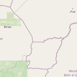
Map view of Radom National Park

Use this park location map to pinpoint Radom National Park in Sudan, understand its exact geographic position, and read its mapped placement within the surrounding landscape more clearly.

Pigeon | © OpenStreetMap contributors

Location context for Radom National Park

South Darfur
Park atlas

Explore regional protected areas and savanna landscapes adjacent to Radom National Park.

Explore Other National Parks and Protected Areas Near Radom National Park, Sudan
After exploring Radom National Park, continue your discovery of adjacent protected areas and national parks across the Sudanian savanna biome. Comparing these interconnected landscapes offers valuable insight into regional conservation efforts, shared river ecosystems, and the broader geographic context of Central Africa's protected territories.
National parkChad

Aouk National Park National Park: Mapped Protected Landscape and Regional Geography

Explore Chad's Aouk National Park boundaries and terrain.

Investigate Aouk National Park, a significant national park in Chad, through its detailed mapping and protected landscape attributes. This entry provides insight into the park's geographic placement within Central Africa, emphasizing its role as a conservation area. Users can explore the mapped boundaries and regional geographic context, facilitating a structured understanding of this protected territory for atlas-based research and discovery.

Area
7,400 km²
IUCN
II
Access
Moderate access
Scope
Terrestrial
National parkSila Province

Goz Beïda National Park: National Park Protected Landscape and Geographic Context

Explore mapped boundaries and regional terrain.

Gain a structured understanding of Goz Beïda National Park, a key protected area within Sila Province. This detail page provides insights into its geographic setting, offering mapped landscape context for atlas-based discovery. Learn about the park's specific protected area identity and its position within the regional geography.

Area
3,000 km²
IUCN
II
Scope
Terrestrial
Water
No major water
National parkGuéra Region

Zakouma National Park: Chad's Premier National Park and Protected Landscape

Explore the mapped savanna, acacia forests, and wildlife geography.

Zakouma National Park is Chad's oldest and most ecologically vital protected area, spanning 3,000 square kilometers of Sudano-Sahelian landscape. Situated within the Guéra Region, it is globally recognized for its exceptional Kordofan giraffe population, significant elephant recovery, and ongoing conservation successes, offering a unique view into African wildlife and protected area management.

Area
3,000 km²
Established
1963
IUCN
II
Relief
Lowland
National parkSouth Sudan

Southern National Park National Park: An Extensive Protected Landscape in South Sudan's Nile Basin

Mapped floodplains, savanna woodlands, and large mammal conservation.

Southern National Park stands as a significant protected area within South Sudan, celebrated for its immense scale and rich ecological tapestry. This national park features a complex mosaic of savanna woodlands, extensive seasonal floodplains carved by the Gel and Ibba rivers, and gallery forests lining river corridors. Its designation as a protected landscape highlights its importance for conserving large mammal populations and preserving the unique wetland ecosystems characteristic of the Nile basin's western reaches, offering a prime focus for geographic and atlas exploration.

Area
23,000 km²
Established
1939
IUCN
II
Relief
Lowland
National parkMoyen-Chari Region

Manda National Park: National Park Protected Landscape and Geographic Identity in Moyen-Chari

Discover mapped terrain and regional context for this Chad national park.

Manda National Park, a protected natural area within Chad's Moyen-Chari Region, offers valuable insights into regional geography and mapped protected landscapes. This detail page provides focused information on the park's identity as a national park, emphasizing its geographic setting and the importance of its mapped boundaries for structured atlas exploration. Understand how this protected area contributes to the diverse natural terrain of the Moyen-Chari Region.

Area
1,140 km²
Established
1969
IUCN
II
Climate
Tropical
National parkDemocratic Republic of the Congo

Garamba National Park: Protected Landscape Atlas and Geographic Context in DRC

Explore Mapped Boundaries of Africa's Historic Savanna Sanctuary

Garamba National Park is a foundational protected area within the Democratic Republic of the Congo, spanning nearly 5,200 square kilometers of distinctive tropical savanna. Established in 1938, this national park is recognized globally as a UNESCO World Heritage Site due to its exceptional biodiversity and role as a critical habitat. The park's landscape is characterized by rolling grasslands, scattered woodlands, and a unique ecological position that supports a rich variety of wildlife, including significant populations of elephants and the DRC's last giraffes. Exploring Garamba National Park through MoriAtlas provides insight into its mapped boundaries, regional geography, and its status as a vital sanctuary for endangered species.

Area
5,200 km²
Established
1938
IUCN
II
Relief
Lowland
National parkSouth Sudan

Lantoto National Park: A Protected National Park in South Sudan's Geography

Explore its mapped boundaries and regional landscape context.

Lantoto National Park represents a critical protected area within the vast geography of South Sudan. As a designated national park, it serves as a focal point for understanding landscape features and conservation efforts within East Africa. This atlas-centric view highlights its mapped presence and the broader regional context it occupies, offering a structured approach to exploring South Sudan's natural terrain and protected lands.

Area
760 km²
Established
1986
IUCN
II
Relief
Mountain
National parkSouth Sudan

Bandingilo National Park: South Sudan's Protected National Park Identity

Explore its mapped boundaries and East African landscape.

Bandingilo National Park stands as a distinct protected area within South Sudan, contributing to the nation's catalog of national parks. This entry offers a focused atlas perspective, detailing the park's geographic setting and its mapped features. Understand the landscape context and its relation to the surrounding regional geography of East Africa, providing a foundation for structured discovery of protected lands.

Area
10,000 km²
Established
1992
IUCN
II
Relief
Lowland

Common questions about visiting, size, designation, and location context for Radom National Park

Radom National Park FAQs for park facts, access, geography, and protected area context
Find quick answers about Radom National Park, including protected-area facts, park geography, trail and visitor context, and how the park fits into its surrounding country and regional landscape.
MoriAtlas Explorer

Continue Your Protected Areas Search Across the Global Atlas

Deepen your exploration by continuing the structured search for national parks and protected areas worldwide. Utilize the comprehensive filtering capabilities to compare different conservation landscapes and refine your understanding of global park geography. Discover more about the distribution and characteristics of protected natural areas.

Global natural geography