Mori Atlas logo
National parkRío Viejo San Camilo National Park

Discover the mapped boundaries and regional terrain of this significant national park.

Río Viejo San Camilo National Park: Venezuela's Protected Landscape and Geographic Context

(Parque nacional Río Viejo-San Camilo)

Río Viejo San Camilo National Park represents a distinct protected natural area within Apure State, Venezuela. As a designated national park, its importance lies in its contribution to the regional atlas and its mapped geographic identity. This page provides a focused entry point for understanding the park's protected landscape, its place within the broader terrain of Apure State, and its value for structured geographic discovery.

Venezuelan national parksSavanna ecosystemsApure StateOrinoco basinTropical savannaRiparian habitats

Río Viejo San Camilo National Park

National park

Park overview

Structured park overview, official facts, and landscape profile for Río Viejo San Camilo National Park

Río Viejo San Camilo National Park park facts, protected area profile, and essential visitor context

Review the core facts for Río Viejo San Camilo National Park, including designation, size, terrain, visitor scale, habitats, and operating context in one park-focused overview.

About Río Viejo San Camilo National Park

Río Viejo San Camilo National Park represents a significant protected area in the Venezuelan llanos, established in 1993 to conserve the region's natural heritage. The park occupies a substantial territory in Apure State, Venezuela's southwestern frontier region bordering Colombia. This lowland tropical park encompasses savanna ecosystems that define much of the Orinoco plains, together with riparian corridors along its many rivers that provide critical habitat diversity. The protected area serves as a conservation unit within Venezuela's national park system, maintaining ecological processes in a region where agricultural expansion and grazing pressure have transformed much of the original landscape. The park's savanna vegetation, characterized by seasonal flooding patterns and scattered tree cover, supports a distinctive assemblage of wildlife adapted to these dynamic conditions.

Quick facts and research context for Río Viejo San Camilo National Park

Río Viejo San Camilo National Park is located in Apure State, southwestern Venezuela, near the Colombian border. Established on July 1, 1993, the park covers roughly 800 square kilometers of predominantly savanna terrain. The landscape features low elevations between 34 and 225 meters above sea level, with several rivers traversing the protected area. The vegetation is characterized by tropical savanna with scattered trees including samán, ceiba, apamate, and palm macanilla. Wildlife in the park includes turtles, herons, and parrots, supported by the combination of grassland and riparian habitats.

Park context

Deeper park guide and search-rich context for Río Viejo San Camilo National Park

Río Viejo San Camilo National Park history, landscape, wildlife, and travel context

Explore Río Viejo San Camilo National Park through its history, landscape character, ecosystems, wildlife, conservation priorities, cultural context, and seasonal travel timing in a structured park guide built for atlas discovery and search intent.

Why Río Viejo San Camilo National Park stands out

The park is best known for its extensive savanna landscapes in the Venezuelan llanos, protected river systems, and the transition between lowland tropical ecosystems. Its position near the Colombian border places it in a biogeographically significant zone. The park protects characteristic savanna vegetation with iconic tropical trees like the ceiba and samán, while its waterways support wetland-dependent wildlife including waterfowl and reptile populations.

Río Viejo San Camilo National Park history and protected-area timeline

Río Viejo San Camilo National Park was established as a national park on July 1, 1993, becoming part of Venezuela's system of protected areas. The park's creation reflected growing recognition of the need to preserve the savanna ecosystems of the llanos region, which had faced increasing human pressure from ranching and agriculture. The protected area was named for the Río Viejo and San Camilo, two geographical features within its boundaries that contribute to its ecological identity. As a relatively recent addition to Venezuela's national park network, the park represents mid-20th-century conservation priorities focused on protecting representative examples of the country's diverse ecosystems.

Río Viejo San Camilo National Park landscape and geographic character

The park's landscape is defined by its position in the Venezuelan llanos, a vast region of tropical savanna that covers much of central Venezuela. Elevations within the park range from 34 to 225 meters above sea level, creating a predominantly flat to gently undulating terrain. Numerous rivers cross the protected area, providing hydrological connectivity and creating habitat diversity through their riparian corridors. The savanna landscape features open grassland with scattered trees, characteristic of seasonally wet tropical savannas. The combination of flat terrain, seasonal water regimes, and tree-covered savanna creates a distinctive landscape typical of the Orinoco basin plains.

Río Viejo San Camilo National Park ecosystems, habitats, and plant life

The vegetation of Río Viejo San Camilo National Park consists primarily of tropical savanna, with tree species including samán (Pithecellobium saman), ceiba (Ceiba pentandra), apamate (Tabebuia rosea), and the palm macanilla. These species create a park-like landscape where tall trees are scattered across grassland, a characteristic visual pattern of neotropical savannas. The presence of multiple rivers through the park creates ecological diversity, supporting riparian forests along watercourses that contrast with the surrounding savanna. This habitat combination, linking savanna grasslands with riverine forest, provides the foundation for the park's biodiversity.

Río Viejo San Camilo National Park wildlife and species highlights

The park supports diverse wildlife associated with savanna and riverine habitats. The river systems through the park sustain populations of turtles, while the wetlands and waterways attract waterbirds including herons. The savanna and forest habitats support parrot populations, with these colorful birds visible in the park's trees. The combination of open savanna, riparian forest, and wetlands creates conditions supporting a variety of species, though detailed species inventories for the park remain limited. The rivers provide critical aquatic habitat, while the surrounding landscapes offer feeding and breeding grounds for wildlife adapted to the seasonal patterns of the llanos.

Río Viejo San Camilo National Park conservation status and protection priorities

As a national park with IUCN category II designation, Río Viejo San Camilo provides formal protection for the savanna ecosystems of southwestern Venezuela. The protected area conserves representative samples of the Orinoco basin llanos, a biome that has faced significant transformation from cattle ranching and agriculture across its range. The park's river systems and associated riparian corridors receive protection within the national park boundary, preserving aquatic habitat and connecting ecosystems. Conservation of this savanna landscape also maintains ecological processes important for regional biodiversity, including seasonal flooding regimes and habitat connectivity for wildlife populations.

Río Viejo San Camilo National Park cultural meaning and human context

The park is situated in Apure State, a frontier region of Venezuela that has historically been shaped by cattle ranching and agricultural expansion. The area's proximity to the Colombian border gives it strategic significance within Venezuela. The landscape has been influenced by human activity over extended periods, though the park itself focuses on natural values rather than specific cultural heritage sites. The regional identity of Apure is closely tied to its llanos landscape, with ranching traditions and a frontier character that contrasts with Venezuela's more urbanized regions.

Top sights and standout views in Río Viejo San Camilo National Park

Río Viejo San Camilo National Park protects one of Venezuela's significant savanna ecosystems in the llanos region near the Colombian border. The park's combination of open savanna with scattered ceiba and samán trees, traversed by multiple rivers, creates a distinctive tropical plains landscape. Protected wildlife includes river turtles, herons, and parrots, supported by the habitat diversity created by the park's waterways and riparian corridors. The park's lowland position at elevations between 34 and 225 meters places it within the heart of the Orinoco basin savanna zone.

Best time to visit Río Viejo San Camilo National Park

The optimal period to visit Río Viejo San Camilo National Park corresponds to the dry season in the Venezuelan llanos, typically from December through April, when reduced rainfall makes terrain more accessible and wildlife concentrates around remaining water sources. The wet season from May to November transforms the landscape with seasonal flooding, creating different viewing conditions and affecting accessibility. The park's savanna ecosystems follow pronounced seasonal patterns that influence both landscape appearance and wildlife behavior, making the timing of a visit relevant to the experience sought.

Monthly climate preview

Long-term representative measurements of monthly temperature and precipitation rhythm

Río Viejo San Camilo National Park Climate Normals and Annual Weather Patterns

Historical data records recorded monthly temperature and precipitation averages across the representative park coordinate from 1991 to 2020. Examining the full twelve-month climate profile reveals complete statistical distributions for regional temperature ranges and precipitation variations.
Annual mean24 °C
23 °C26 °C
Jan24°
Feb25°
Mar26°
Apr25°
May24°
Jun23°
Jul23°
Aug23°
Sep24°
Oct24°
Nov23°
Dec23°
Warmest month
March

25.8 °C

Coolest month
July

22.8 °C

Wettest month
June

5.8 mm/day

Driest month
January

1 mm/day

Park location guide

Geography guide, regional context, and park location map for Río Viejo San Camilo National Park

Río Viejo San Camilo National Park park geography, regions, and map view in Venezuela

Understand where Río Viejo San Camilo National Park sits in Venezuela through a broader geographic reading of the surrounding landscape, nearby location context, and its mapped position within the national park landscape.

How Río Viejo San Camilo National Park fits into Venezuela

Venezuela is a country in northern South America with coastline along the Caribbean Sea and Atlantic Ocean. It borders Colombia, Brazil, Guyana, and Trinidad and Tobago. The country has an area of approximately 916,445 km² and a population of about 31.8 million. Caracas is the capital and largest city. Venezuela consists of 23 states and the Capital District.

Wider geography shaping Río Viejo San Camilo National Park in Venezuela

Venezuela is located on the northern coast of South America. The continental territory is bordered by the Caribbean Sea and Atlantic Ocean to the north, Colombia to the west, Brazil to the south, and Guyana to the east. Trinidad and Tobago lies to the northeast. The country includes various islands and islets in the Caribbean Sea known as the Federal Dependencies.

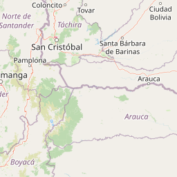
Map view of Río Viejo San Camilo National Park

Use this park location map to pinpoint Río Viejo San Camilo National Park in Venezuela, understand its exact geographic position, and read its mapped placement within the surrounding landscape more clearly.

Pigeon | © OpenStreetMap contributors

Location context for Río Viejo San Camilo National Park

Apure State
Park atlas

Trace the regional spread of protected areas, comparing diverse savanna ecosystems and wetland habitats across the Orinoco basin.

Explore Other National Parks Near Río Viejo San Camilo National Park and Venezuela's Llanos Region

After exploring Río Viejo San Camilo National Park, discover other national parks and protected areas within Venezuela's Apure State and the broader Orinoco basin. Compare these mapped protected landscapes to understand their shared savanna ecosystems, lowland tropical terrain, and regional context within the South American llanos.
National parkTáchira State
About 13 km away#1 closest

West

El Tamá National Park: A National Park in Venezuela's Táchira State for Geographic Discovery

Mapped protected area boundaries and regional landscape context.

El Tamá National Park serves as a primary point of interest for understanding Venezuela's protected lands. Located within Táchira State, this national park offers a distinct geographic profile for atlas exploration. Users can investigate the park's mapped features and its position within the regional natural landscape, gaining insight into its role as a conservation area and a component of Venezuela's broader geography.

Area
1,390 km²
Established
1978
IUCN
II
Relief
Mountain
National parkTáchira State
About 30 km away#2 closest

North

Chorro El Indio National Park: Protected National Park in Táchira State's Geography

Explore mapped boundaries and regional landscape context.

Chorro El Indio National Park serves as a key protected landscape within Táchira State, Venezuela. This national park offers users detailed insights into its specific geographic setting, mapped park boundaries, and the natural terrain it encompasses. Understanding Chorro El Indio National Park through the MoriAtlas platform provides a foundation for exploring regional protected areas and their ecological significance.

Area
170 km²
Established
1989
IUCN
II
Relief
Mountain
National parkNorte de Santander
About 34 km away#3 closest

Southwest

Tamá National Natural Park: Colombia's Protected Landscape and Regional Geography

Explore mapped natural features and protected area context.

Delve into the protected landscape of Tamá National Natural Park, a key national park situated in Colombia's Norte de Santander region. This resource provides an atlas-style overview of the park's geographic setting, emphasizing its mapped boundaries and its role within the broader regional geography. Understand the inherent natural context and protected status of this significant Colombian conservation area through detailed landscape information.

Area
480 km²
Established
1977
IUCN
II
Relief
Mountain
National parkVenezuela
About 55 km away#4 closest

North

General Juan Pablo Peñaloza National Park: Venezuela National Park Atlas Entry

Mapped boundaries and regional geographic context for a protected natural area.

Explore General Juan Pablo Peñaloza National Park, a key protected area designated as a national park in Venezuela. This detailed entry focuses on its landscape identity, mapped boundaries, and its contribution to Venezuela's broader regional geography. Understand the park's significance as a protected natural area and its atlas context for in-depth geographic study.

Area
752 km²
Established
1989
Relief
Mountain
Climate
Alpine
National parkMérida
About 55 km away#5 closest

North

Parque nacional General Juan Pablo Peñaloza: Andean Paramo and Highland Geography Atlas

Protected mountainous terrain and glacial water networks

Spanning elevations from 1,800 meters to the 3,942-meter summit of Pico El Púlpito, this national park preserves an expansive mosaic of paramo and montane forest. The terrain features over 130 periglacial lakes, including Laguna Blanca and Laguna Grande, which sustain regional river systems and support unique species like the Andean bear and mountain tapir.

Area
752 km²
Established
1989
IUCN
II
Relief
Mountain
Natural monumentMérida
About 113 km away#6 closest

Northeast

Monumento natural Meseta la Galera: Protected Andean Plateau and Geography Map

Analyzing the fluvial terrain and forest landscape of Tovar, Merida.

Monumento natural Meseta la Galera serves as a vital geographic landmark near Tovar, Merida. This protected natural monument preserves a rare flat topped plateau rising over the Mocoties River valley. Examine the structured map context of this 95 hectare forest refuge and its defined topographical boundaries within the Andean mountain foothills.

Area
0.95 km²
Established
1992
IUCN
III
Relief
Highland
National parkBarinas
About 125 km away#7 closest

Northeast

Tapo-Caparo National Park: Mapped Boundaries and Geographic Context in Barinas, Venezuela

Explore Venezuela's Tapo-Caparo National Park's protected terrain.

Tapo-Caparo National Park is a vital protected area located in the Barinas region of Venezuela. This page offers an atlas-focused exploration of its mapped natural landscape and geographic significance within the country. Understand the protected boundaries and the specific terrain features that define Tapo-Caparo National Park, providing essential context for regional geography and protected land discovery.

Area
2,050 km²
Established
1992
IUCN
II
Relief
Mountain
Natural monumentMérida
About 133 km away#8 closest

Northeast

Laguna de Urao Natural Monument: Geographic Profile and Protected Andean Landscape

Saline tectonic lake located in the Mérida region of Venezuela

Laguna de Urao is a singular protected natural feature of tectonic origin situated in the semi-arid Andean landscape of Mérida. Known for the accumulation of the urao mineral, this saline water body serves as an important geographic landmark that anchors the cultural and geological identity of the local surroundings.

Established
1979
Relief
Upland
Water
Major water bodies

Common questions about visiting, size, designation, and location context for Río Viejo San Camilo National Park

Río Viejo San Camilo National Park FAQs for park facts, access, geography, and protected area context

Find quick answers about Río Viejo San Camilo National Park, including protected-area facts, park geography, trail and visitor context, and how the park fits into its surrounding country and regional landscape.
MoriAtlas Explorer

Continue Your Protected Areas Search Across the Global Atlas

Deepen your exploration by continuing the structured search for national parks and protected areas worldwide. Utilize the comprehensive filtering capabilities to compare different conservation landscapes and refine your understanding of global park geography. Discover more about the distribution and characteristics of protected natural areas.

Global natural geography