
Mori Atlas logo
Nature reserveRiserva naturale speciale della Bessa

Mapping the distinctive stone plateaus and prehistoric archaeological landscapes in Biella, Italy

Riserva naturale speciale della Bessa: An Atlas of Glacial Geology and Roman Mining Heritage

The Riserva naturale speciale della Bessa sits as a unique protected plateau at the foot of the Biellese Alps in northern Piedmont. This nature reserve documents the intersection of Quaternary glaciation and extensive Roman-era gold mining across a stark, cobble-strewn landscape. Our geographic data maps the erratic boulders, erosional bunde channels, and historical mining terraces that define this exceptional cultural and natural site.

Pleistocene moraineSerra d'Ivreaalluvial gold miningRoman archaeologyprehistoric rock arterratic boulders
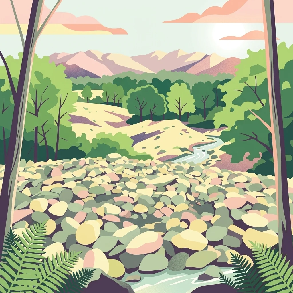
A vibrant digital illustration shows a landscape view of a rocky, boulder-filled field, characteristic of an ancient mining site, leading toward a small stream, green trees, and mountains in the distance.

Riserva naturale speciale della Bessa

Nature reserve

Park overview

Structured park overview, official facts, and landscape profile for Riserva naturale speciale della Bessa

Riserva naturale speciale della Bessa park facts, protected area profile, and essential visitor context

Review the core facts for Riserva naturale speciale della Bessa, including designation, size, terrain, visitor scale, habitats, and operating context in one park-focused overview.

About Riserva naturale speciale della Bessa

The Riserva naturale speciale della Bessa occupies a stretch of the Biellese foothills in northern Piedmont that is unusual in both geological and historical terms. Although the region is more commonly associated with forested Alpine valleys and textile-producing towns, the Bessa presents an open, almost barren plateau, the product of Quaternary glaciers advancing out of the Aosta Valley and depositing an immense morainic ridge known as the Serra d'Ivrea. The reserve lies on the Biellese flank of that structure, where meltwater channels and later fluvial action sorted and concentrated gold-bearing sediments.

Today, the protected landscape is defined by what observers describe as an austere surface of piled cobbles, locally called ciapei, interspersed with deep erosional trenches known as bunde. Hundreds of large erratic boulders, transported by ice and later freed from surrounding sediment, dot the plateau and give the area an almost monumental character. The reserve's elevation runs roughly between 270 and 430 meters, and its shape is an elongated northwest to southeast lobe about eight kilometers long and between 800 meters and 1.7 kilometers wide.

The defining human chapter of the Bessa belongs to antiquity. Roman armies under Appius Claudius took control of the territory between 143 and 140 BC, and contractors known as publicani are reported to have employed up to around 5,000 workers at any one time to wash glacial gravels for gold. By the second half of the 1st century BC, the operations had effectively been abandoned, as later Roman gold came mainly from Iberia and Gaul. Yet the surface of the plateau still preserves the visible imprint of those workings, combined with prehistoric cup-marked stones that suggest an even older human relationship with the land.

Modern recognition of this combined natural and archaeological value came relatively recently. The reserve was formally established by Piedmontese regional law in 2009, integrating the area into the broader Biellese protected-area system and providing a framework for visitor access, education, and the protection of both its geological features and its archaeological remains.

Quick facts and research context for Riserva naturale speciale della Bessa

The Riserva naturale speciale della Bessa was established by regional law in June 2009 and covers approximately 750 hectares in the province of Biella, northern Piedmont. The reserve occupies part of the Biellese flank of the Serra morainic ridge, a Quaternary glacial landform often cited as among the most extensive moraine systems in Europe. Its terrain lies between roughly 270 and 430 meters in elevation, developed largely as a stony plateau scattered with erratic boulders and crossed by deep erosional channels. Paleontological and archaeological evidence shows that the area was exploited for alluvial gold by Roman contractors between the 2nd and 1st centuries BC, and possibly visited much earlier by prehistoric communities.

The reserve is managed by the same authority that oversees the Ticino and Lake Maggiore protected areas, integrating it into the broader Biellese regional park network. Visitor infrastructure includes hiking and mountain biking routes across the cobble fields, as well as a visitor center and equipped area at Vermogno, a hamlet of Zubiena, which also hosts the local Gold and Bessa Museum.

Protection and recognition

Examine official designation history and recorded protection framework details.

Riserva naturale speciale della Bessa protection status and records

Riserva naturale speciale della Bessa protection status documentation aggregates recorded administrative identifiers and designation frameworks. Official database records provide verified baseline parameters for tracking protected area classification.

Protection details

WDPA ID
15283
Park context

Deeper park guide and search-rich context for Riserva naturale speciale della Bessa

Riserva naturale speciale della Bessa history, landscape, wildlife, and travel context

Explore Riserva naturale speciale della Bessa through its history, landscape character, ecosystems, wildlife, conservation priorities, cultural context, and seasonal travel timing in a structured park guide built for atlas discovery and search intent.

Why Riserva naturale speciale della Bessa stands out

The Bessa is best known for one defining feature: the overlapping imprint of Quaternary glaciation and Roman-era gold mining on a single landscape. The huge morainic amphitheater of the Serra d'Ivrea, deposited by Aosta Valley glaciers roughly one million years ago, concentrated gold-bearing material across the Biellese plateau, where Roman laborers between the 2nd and 1st centuries BC reworked those glacial sediments to extract placer gold. That double geological and archaeological signature is what gives the reserve its distinctive identity. The terrain remains visibly shaped by both forces: enormous erratic boulders released from the ice sit among piled heaps of cobbles left by ancient washing operations, while prehistoric cup-and-groove carvings on many of the boulders hint at even older human presence. The result is a stark, open plateau whose cultural and natural history are essentially inseparable, making the Bessa one of the most recognizable heritage landscapes in Piedmont.
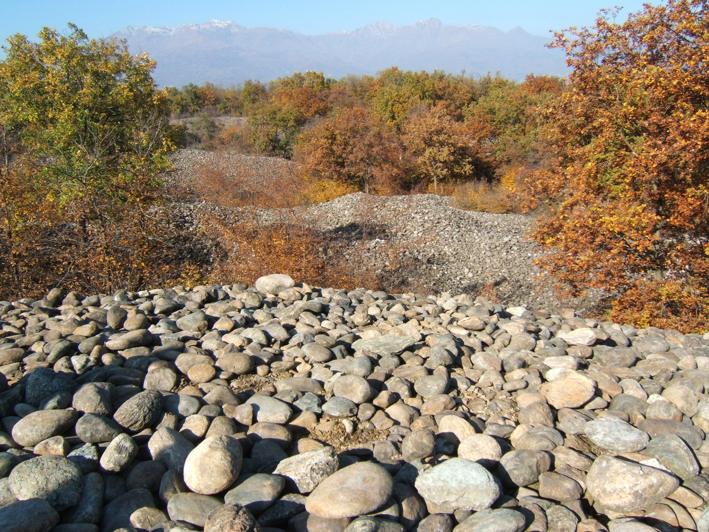
A landscape view featuring piles of rounded grey river stones covering the ground, surrounded by trees with autumn foliage and distant mountains under a clear sky.
Pebble mounds remaining from historical Roman-era mining operations at Riserva naturale speciale della Bessa.

Riserva naturale speciale della Bessa history and protected-area timeline

The prehistorical and ancient history of the Bessa is written directly into its stones. Many of the large erratic boulders scattered across the plateau are marked with prehistoric rock carvings, predominantly cup-shaped depressions, suggesting repeated human presence long before organized mining began. By the 5th to 4th centuries BC, the territory was controlled by the Salassi, a Celtic-speaking people of the western Alps.

The period that gave the Bessa its lasting historical identity began in the mid-2nd century BC. Between 143 and 140 BC, Roman legions under the consul Appius Claudius Pulcher conquered the area, and mining rights were granted to publicani, private contractors of the Roman state. These operators organized the systematic reworking of the gold-bearing fluvioglacial deposits, employing, by some ancient accounts, as many as 5,000 laborers simultaneously. The miners constructed two fluvioglacial terraces: an upper terrace covered with heaps of cobbles and a lower one of sand and gravel, the washed residues of the extraction process.

By the second half of the 1st century BC, the geographer Strabo records that the Bessa mines had been abandoned or exhausted, and the Roman economy had shifted to gold sources in Iberia and Gaul. A local legend maintains that enslaved laborers, unpaid for their work, secretly melted their own small share of the gold into a horse-shaped figurine said to remain hidden somewhere among the stones; whether or not the legend is literally true, it captures the social memory of a vast and exploitative ancient industry.

Modern protection of the area came only in the 21st century. The Riserva naturale speciale della Bessa was established by Piedmontese Regional Law no. 19, passed on 29 June 2009. The reserve was placed under the management of the regional authority responsible for the Ticino and Lake Maggiore protected areas, integrating it into the wider Biellese protected-area network that also includes the Gold and Bessa Museum run from Vermogno.

Riserva naturale speciale della Bessa landscape and geographic character

The landscape of the Bessa is the visual documentation of two immense forces: Quaternary glaciation and subsequent alluvial erosion. The reserve lies on the Biellese slope of the Serra morainica di Ivrea, an enormous amphitheater of glacial deposits left by Aosta Valley glaciers as they expanded southward beginning roughly one million years ago. Within the protected area, the deposits form a distinctive elongated plateau running northwest to southeast, parallel to the upper Viona valley, for about eight kilometers.

North and south of the plateau, the reserve is bounded by remnants of an early Pleistocene moraine and by the alluvial systems of the Elvo and Olobbia streams. Inside the protected perimeter, the terrain falls gently from about 450 meters at its northwestern end to around 300 meters at its southeastern edge, giving an elevation range that locals and visitors usually describe as between roughly 270 and 430 meters across the broader valley setting.

The surface itself is the most visually striking feature. Instead of forest or meadow, the Bessa offers a stark expanse of rounded stones: the ciapei, cobble heaps piled by both glacial sorting and the washing processes of ancient miners. Deep erosional channels, called bunde locally, cut across the cobble fields, sometimes opening onto small springs. Scattered across this surface are hundreds of large erratic boulders, ice-transported blocks of crystalline rock that now stand isolated against the gravel plain like natural monoliths. The combination of cobble fields, deep gullies, and isolated boulders produces an almost lunar quality that contrasts sharply with the surrounding Alpine foothills.
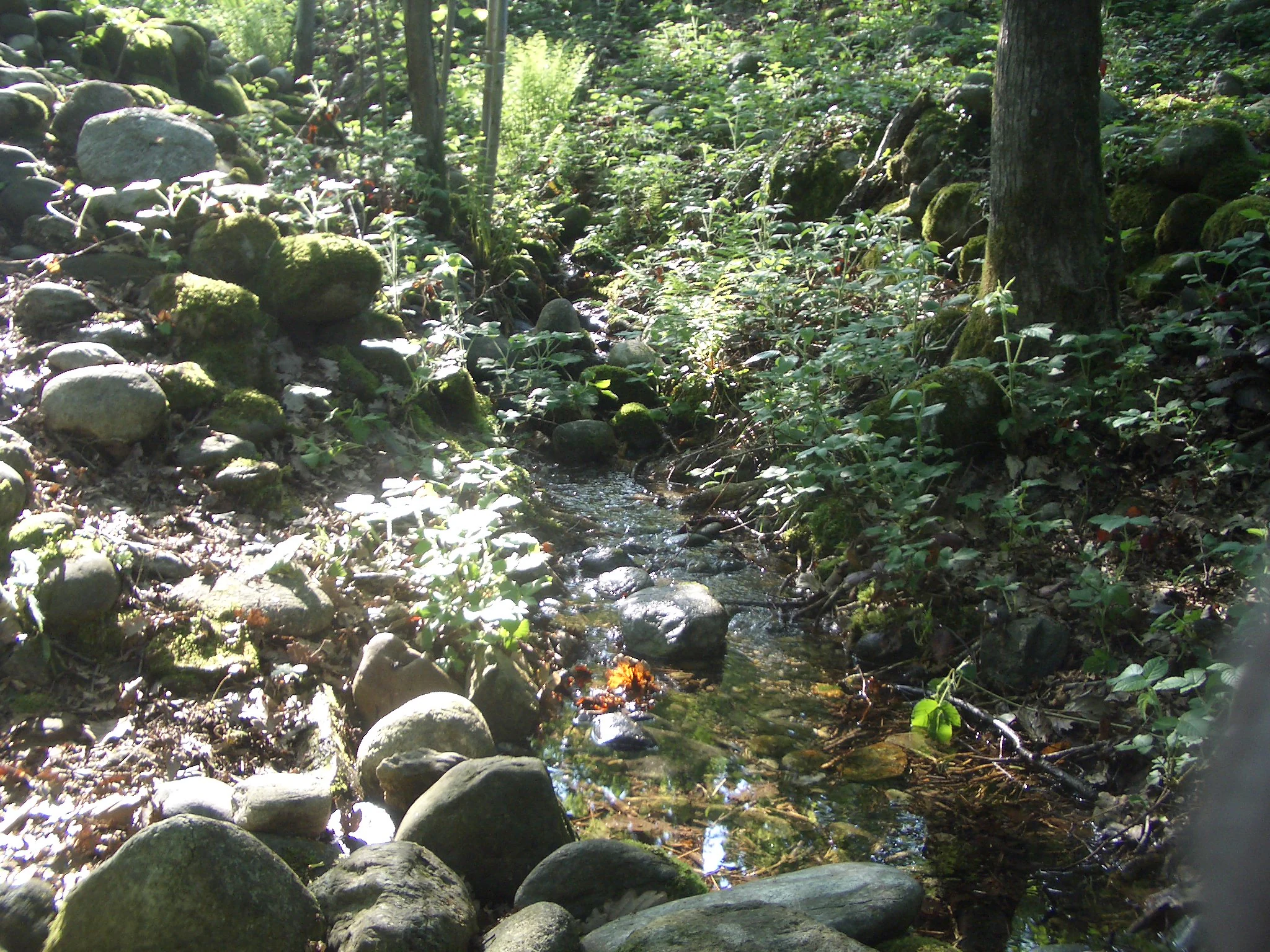
A small forest stream flows between moss-covered rocks and dense vegetation in a wooded area.
A small water spring flowing through the stony landscape of the Bessa nature reserve.

Riserva naturale speciale della Bessa ecosystems, habitats, and plant life

Ecologically, the Bessa occupies an unusual niche within the Biellese foothills, where most of the surrounding landscape is dominated by broadleaf woodland, chestnut and hazel groves, and Alpine pastures. The reserve's defining environmental feature is its open, mineral-dominated surface, the result of extremely thin soils derived from fluvioglacial cobbles and gravels. These poor substrates and the area's exposure limit tree cover, producing a mosaic of dry grassland, scrub patches, and bare stony ground rather than continuous forest.

This open, rocky habitat, locally rare in the lower Biellese Alps, supports a distinct plant community adapted to thin, well-drained, often acidic soils. Vegetation tends to colonize the edges of cobble piles and the more stable surfaces between the bunde, creating microhabitats of contrasting exposure that shift from dry, sun-baked gravels to small shaded shelters behind boulders. The mosaic nature of the terrain, alternating stony fields, narrow gullies, and patches of scrub, gives the reserve a steppe-like character within a region otherwise defined by forest and water.

Wildlife in the reserve reflects both its open character and its position at the junction of plain and mountain. Birds typical of open ground and scrubby habitats are common, while the surrounding woodlands and the nearby Elvo corridor provide additional habitat for typical Piedmontese forest and riparian species. The reserve's ecological value lies less in species-richness statistics and more in the conservation of a rare, semi-natural open landscape with strong geological and archaeological values attached.
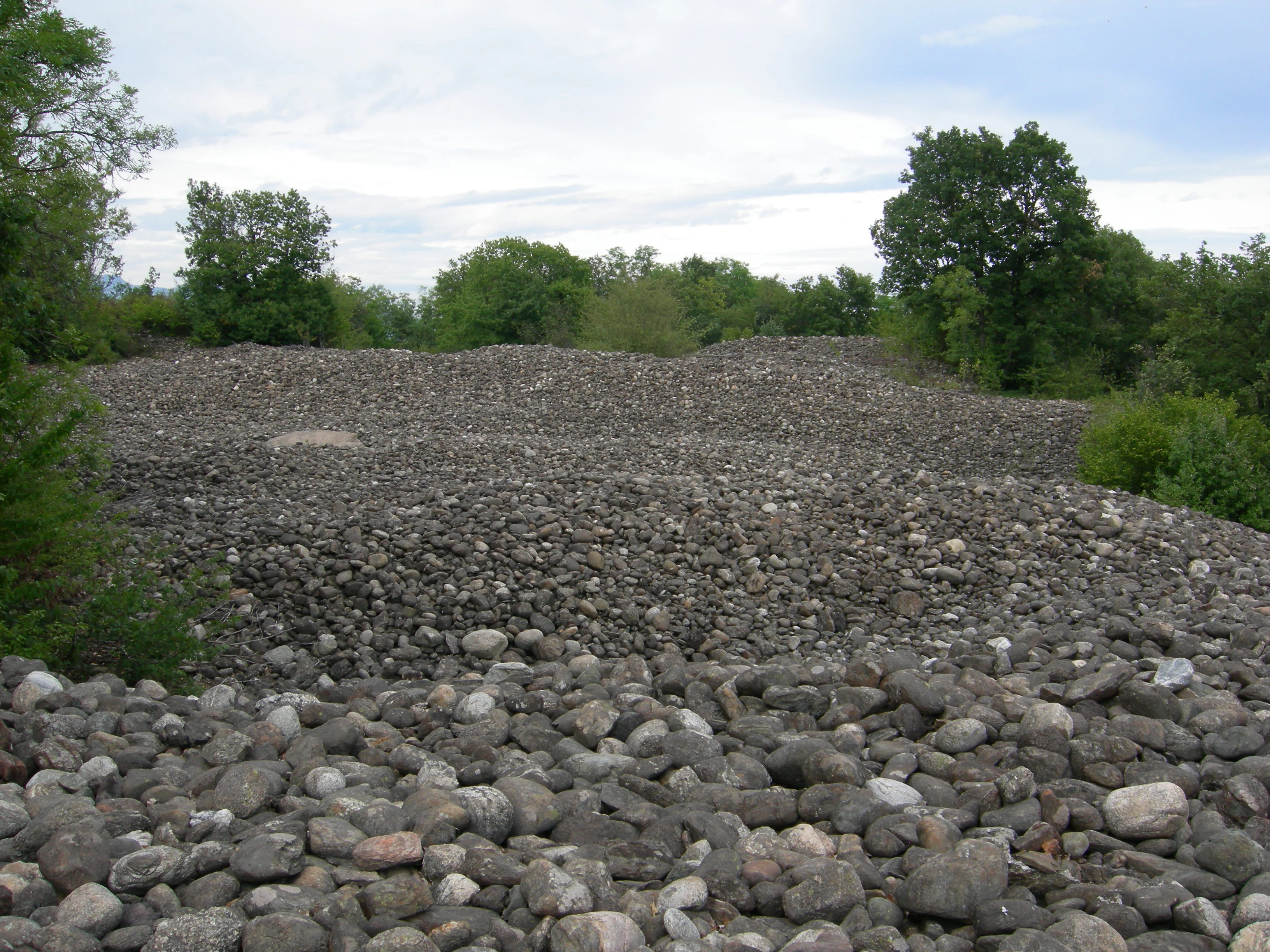
A vast, slightly hilly field covered in grey rounded river stones, bordered by green deciduous trees under a cloudy sky.
A wide expanse of stones and gravel typical of the ancient mining landscape in the Riserva naturale speciale della Bessa.

Riserva naturale speciale della Bessa wildlife and species highlights

The wildlife profile of the Bessa is closely tied to its unusual open, cobble-dominated habitat. Within the reserve itself, the dry grasslands, scrub patches, and stony clearings create conditions that favor bird and insect species adapted to open ground rather than dense woodland. Reptiles and small mammals typical of warm, well-drained, south-facing slopes in the Biellese foothills also find refuge among the boulders and along the edges of the bunde.

The surrounding environment enriches the reserve's fauna further. To the south, the broader protected-area network includes stretches of woodland, agricultural land, and waterways such as the Elvo and Olobbia torrents, which bring forest birds, riparian species, and amphibians into the ecological orbit of the Bessa. As a result, the reserve supports a transitional fauna shaped by both its open, mineral-rich core and the more conventional habitats that surround it.

For visitors, the most visible wildlife experience at the Bessa tends to be ornithological, with open-country birds, scrub birds, and raptors hunting over the plateau and adjacent slopes. The combination of open ground and surrounding forest cover gives a relatively high diversity of birdlife for a protected area of its size, even when compared with the heavily forested Alpine and pre-Alpine landscapes that dominate the rest of the region.
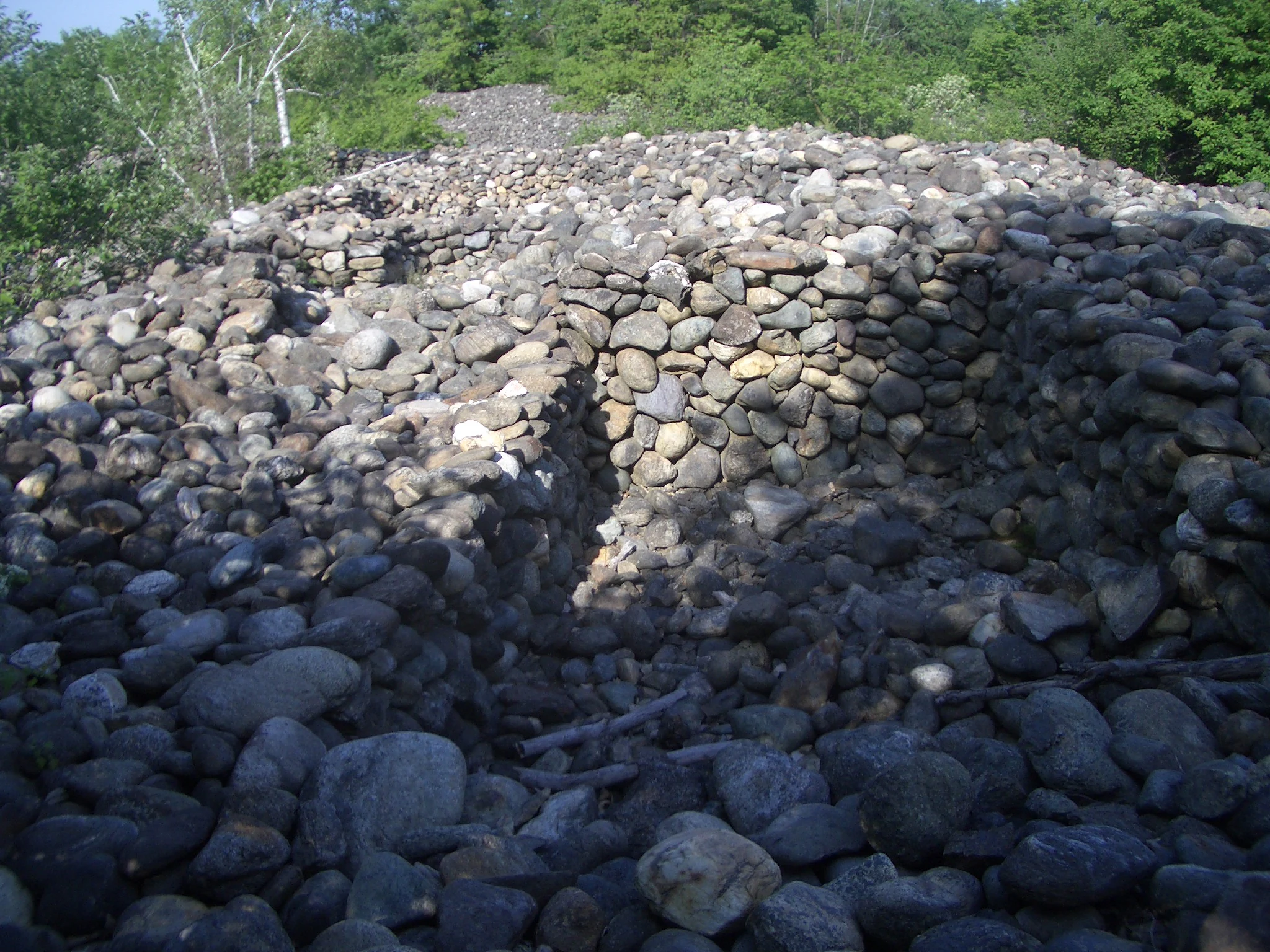
A close up view of ancient stone walls and rubble composed of round, grey river stones, set among green trees.
Remains of ancient stone structures within the Roman gold mine area of Riserva naturale speciale della Bessa.

Riserva naturale speciale della Bessa conservation status and protection priorities

The conservation significance of the Riserva naturale speciale della Bessa lies in the protection of a rare convergence of geological heritage, archaeological heritage, and a distinctive semi-natural open landscape. The reserve safeguards a segment of the Serra morainica di Ivrea, a Pleistocene landform that is widely recognized as one of the most extensive morainic systems in Europe. Without protection, this surface would be vulnerable both to quarrying pressure, given the gravel and cobble resources it represents, and to loss of archaeological context as the ancient mining features continue to weather.

By placing the area under a unified legal framework in 2009 and assigning it to an established regional parks authority, the designation also ensures ongoing monitoring and management of the cobble fields, the erratic boulders, the prehistoric rock carvings, and the Roman-era terraces. The management body, the same authority that oversees the Ticino and Lake Maggiore protected areas, integrates the Bessa into the broader Biellese protected-area network, allowing for coordinated conservation with neighboring natural and cultural-heritage sites.

In international classification terms, the reserve is categorized as an IUCN Category IV area, designated for the conservation of particular habitats or species. In practice, this means its conservation priority is twofold: protecting the geological and archaeological fabric of the plateau, and maintaining the open, low-productivity habitats that distinguish the Bessa from the surrounding forested Alpine landscape. The Gold and Bessa Museum, located in the hamlet of Vermogno within the reserve, also plays an important role in conservation by anchoring public awareness of the area's natural and cultural value.

Riserva naturale speciale della Bessa cultural meaning and human context

The cultural context of the Bessa is dominated by its role as one of the most substantial surviving traces of Roman gold mining in the Alps. The reserve's surface preserves two fluvioglacial terraces modified by systematic 2nd- and 1st-century BC extraction, alongside the cobble heaps and washed gravels left behind by that labor. This makes the area a significant point of reference for understanding how the Roman economy reached into remote Alpine territories and mobilized large numbers of workers for placer gold extraction.

Layered onto that Roman horizon is an older human presence. Cup-marked and otherwise engraved erratic boulders are found throughout the reserve, pointing to repeated prehistoric visits and possible ritual or territorial use of the plateau well before Roman conquest. The pre-Roman Salassi controlled the territory in the 5th to 4th centuries BC, just before Roman annexation, meaning that the modern landscape preserves archaeological evidence from at least two distinct cultural phases.

Local memory reinforces these ancient layers. A local legend tells of unpaid Roman-era laborers whom tradition credits with secretly melting a small horse-shaped golden figurine from their concealed share of the gold, a story that remains part of how the area is publicly interpreted. The medieval village of Magnano, on the edge of the broader cultural landscape, contributes another historically significant layer, with its medieval ricetto and the Romanesque church of San Secondo, host today to summer classical-music festivals, tying the reserve's ancient landscape to a living regional cultural identity.

Top sights and standout views in Riserva naturale speciale della Bessa

The reserve's defining highlight is the visible interplay between glacial geology and ancient mining. Visitors walking the Ciapei Parfundù itinerary and similar routes cross cobble fields where rounded stones are piled in patterns that reflect ancient washing rather than natural sedimentation, and pass hundreds of erratic boulders, some bearing prehistoric cup markings, released by the same glaciers that originally concentrated the gold.

Other standout features include the two Roman-era mining terraces along the upper Viona valley axis, the deep erosional channels known as bunde that cut across the plateau, and the springs, such as the Funta-na dla canala, that emerge among the stones. The visitor center and equipped area at Vermogno anchor the modern experience for hikers and mountain bikers, while the nearby Gold and Bessa Museum provides context for the area's geological and archaeological significance.

Best time to visit Riserva naturale speciale della Bessa

The Bessa's open, stony landscape is accessible year-round, but its character shifts noticeably with the seasons. Spring brings milder temperatures and the greening of scrub patches and edges between cobble fields, which makes walking the trails and reading the subtle topography of the plateau easier and more visually varied.

Summer, especially late spring through early autumn, is the most popular period for hiking and mountain biking across the cobble fields, and it coincides with classical-music events in the nearby medieval village of Magnano. Winters tend to be quieter and can feel more austere, with the mineral-dominated terrain taking on a stark, exposed quality under low light. Because the reserve lies at relatively low elevation within Piedmont and is largely treeless, weather conditions on the plateau can feel more open than in surrounding forested valleys.

Monthly climate preview

Examine long-term representative temperature ranges and monthly precipitation averages for Riserva naturale speciale della Bessa.

Riserva naturale speciale della Bessa Climate Normals and Annual Temperature Patterns

Representative coordinates record measured monthly temperature ranges and precipitation rates spanning a multi-year climatology baseline. Analyzing the complete twelve-month profile reveals detailed long-term variations across the protected landscape.
Annual mean11 °C
1 °C21 °C
Jan
Feb
Mar
Apr10°
May15°
Jun19°
Jul21°
Aug21°
Sep16°
Oct11°
Nov
Dec
Warmest month
July

21.4 °C

Coolest month
January

1 °C

Wettest month
November

3.7 mm/day

Driest month
January

1.3 mm/day

Park location guide

Geography guide, regional context, and park location map for Riserva naturale speciale della Bessa

Riserva naturale speciale della Bessa park geography, regions, and map view in Italy

Understand where Riserva naturale speciale della Bessa sits in Italy through a broader geographic reading of the surrounding landscape, nearby location context, and its mapped position within the national park landscape.

How Riserva naturale speciale della Bessa fits into Italy

Italy is a unitary parliamentary republic in Southern and Western Europe, located on the Italian Peninsula with the Alps to the north. It borders France, Switzerland, Austria, Slovenia, Vatican City, and San Marino, and shares maritime boundaries with several Mediterranean countries. The country has approximately 59 million residents and uses the Euro as its currency.

Wider geography shaping Riserva naturale speciale della Bessa in Italy

Italy occupies a boot-shaped peninsula in southern Europe, bordered by the Alps to the north. It shares land borders with France, Switzerland, Austria, Slovenia, Vatican City, and San Marino. The country includes the Mediterranean islands of Sicily and Sardinia, along with approximately 800 smaller islands.

Map view of Riserva naturale speciale della Bessa

Use this park location map to pinpoint Riserva naturale speciale della Bessa in Italy, understand its exact geographic position, and read its mapped placement within the surrounding landscape more clearly.

Pigeon | © OpenStreetMap contributors

Location context for Riserva naturale speciale della Bessa

BiellaPiemonte
Natural feature types

Explore the Geological Features of Riserva naturale speciale della Bessa

Continue your geographic research by viewing the complete set of named natural features associated with the Riserva naturale speciale della Bessa. MoriAtlas provides a mapped record of the plateau, moraine deposits, and alluvial terrain that define this protected landscape.
Recorded earthquake history

Explore Historical Earthquake Records for Riserva naturale speciale della Bessa

Review a comprehensive collection of documented seismic events associated with the Riserva naturale speciale della Bessa. This archive allows for the exploration of historical earthquake records, providing insights into the seismic background of this specific Piedmont protected area through verified geographic data.

Riserva naturale speciale della Bessa Earthquake History

Catalogued events

23 events

Strongest magnitude

Magnitude 4.2

Most recent event

Mar 31, 2007

This history includes earthquakes recorded inside the park or within 50 km of its borders

Visual exploration of glacial moraines, ancient mining terrain, and protected reserve habitats.

Riserva naturale speciale della Bessa Photos and Landscape Scenery

Visual documentation captures the stark highland terrain, erratic boulders, and stone-strewn plateaus of Riserva naturale speciale della Bessa. Examining these protected area photographs reveals the unique geological imprints and archaeological heritage shaping the northern Piedmont landscape.

A landscape view featuring piles of rounded grey river stones covering the ground, surrounded by trees with autumn foliage and distant mountains under a clear sky.

A dirt hiking trail winding through a dense forest with a wooden information sign standing on the left.

A small forest stream flows between moss-covered rocks and dense vegetation in a wooded area.

A vast, slightly hilly field covered in grey rounded river stones, bordered by green deciduous trees under a cloudy sky.

A close up view of ancient stone walls and rubble composed of round, grey river stones, set among green trees.

Park atlas

Compare regional geography, glacial moraines, and adjacent protected areas across northern Piedmont.

Other Parks Near Riserva naturale speciale della Bessa and Surrounding Protected Landscapes

Continue exploring protected areas near Riserva naturale speciale della Bessa to compare regional topography and geological features. Analyzing adjacent reserves helps place distinctive glacial and archaeological landscapes into a broader geographical context.
Watercolor painting of a soft, green landscape with hills, a meandering river, and trees against a pale background.
Nature reservePiemonte
About 22 km away#1 closest

West

Riserva naturale dei Monti Pelati: A Protected Nature Reserve in Northern Italy

Geological landscape context and peridotite terrain in Piemonte.

Riserva naturale dei Monti Pelati is a vital protected area in Italy known for its unusual peridotite bedrock. This ridge provides a stark contrast to the nearby Ivrea Morainic Amphitheater, serving as an essential site for studying specialized flora and the geological history of the Western Alps in the Piedmont region.

Area
1.46 km²
Established
1993
Relief
Upland
Climate
Temperate
Nature reservePiemonte
About 28 km away#2 closest

East

Riserva naturale speciale dell'Isolone di Oldenico: Geography and Riverine Conservation Atlas

Protected riparian corridors in the Po Plain region of Northern Italy

This nature reserve preserves a distinct island feature formed by the Sesia river system. As a vital component of the lower Sesia valley network, the protected area contrasts sharply with the surrounding agricultural land by maintaining indigenous riverine vegetation, marshy habitat pockets, and natural levees within the flat terrain of the Province of Vercelli.

Area
0.52 km²
Established
1978
IUCN
IV
Watercolor illustration depicting green valleys, forests, and distant mountain peaks
National parkItaly
32 km away#3 closest

West

Gran Paradiso National Park: Italy's National Park Protected Landscape Atlas

Mapped boundaries and regional geography for a key Italian protected area.

Gran Paradiso National Park is a distinct national park entity within Italy, offering rich potential for atlas-driven geographic discovery. This MoriAtlas profile focuses on its protected landscape identity, providing essential context for understanding its mapped boundaries and its role within the regional geography of Italy. Explore the structured geographic details that make Gran Paradiso National Park a valuable component of any mapped landscape analysis.

Area
703 km²
Established
1922
IUCN
II
Relief
Mountain
A soft watercolor illustration depicting rolling green hills, a small winding river, and a light-filled sky, set against a white background.
Nature reservePiemonte
About 39 km away#4 closest

Northeast

Riserva speciale del Sacro Monte di Varallo: Nature Reserve and Woodland Geography

Exploring the protected boundaries and forest terrain in Piemonte

Riserva speciale del Sacro Monte di Varallo is a compact nature reserve in the Piedmont region, distinguished by its Renaissance-inspired woodland and elevation above the Valsesia valley. This protected landscape combines ecological richness with historic chapel architecture, offering a study in the intersection of natural terrain, cultural heritage, and Alpine foothill geography.

Area
0.217 km²
Established
1990
IUCN
V
Relief
Upland
Watercolor illustration showing green mountains, forests, a river, and snow-capped peaks in the distance
National parkPiedmont
59 km away#5 closest

Northeast

Val Grande National Park: National Park Protected Landscape in Piedmont

Explore its mapped boundaries and regional geographic context.

Val Grande National Park represents a key protected landscape within the Piedmont region of northwest Italy. This canonical page offers detailed insights into the park's designated status as a national park, its specific geographic placement, and its mapped protected boundaries. Users can navigate its atlas-level details to understand its role in the regional geography and conservation landscape, providing a structured foundation for further discovery of Italy's natural protected areas.

Area
170.21 km²
Established
1992
IUCN
II
Relief
Mountain
Watercolor painting depicting mountains, a river, and trees under a light sky
National parkSavoie
64 km away#6 closest

West

Vanoise National Park: Explore France's Original National Park in the Savoie Alps

Mapped Alpine geography, glacial terrain, and protected landscape.

Vanoise National Park is France's pioneering national park, a protected landscape of immense alpine beauty situated in the Savoie department. Renowned for its dramatic glacial terrain, over 100 peaks above 3,000 meters, and the iconic Alpine ibex, this park offers a profound geographic context. Explore its mapped boundaries and discover the unique atlas-level insights into France's mountainous protected areas and their ecological significance.

Area
534 km²
Established
1963
IUCN
II
Relief
Mountain
Nature reserveLombardia
About 94 km away#7 closest

East

Riserva naturale garzaia di Porta Chiossa: Protected Woodland and Heronry in Lombardia

Historic lowland forest and bird sanctuary geography

Located in the heart of the Po Plain, this nature reserve maintains an essential mosaic of wet woodland and riverine trees. Explore the boundaries of this ecological sanctuary, which remains one of the few surviving sections of the ancient Visconti hunting grounds, offering a unique window into the natural history of the Lombardy region.

Area
0.8 km²
Established
1984
IUCN
IV
A watercolor painting of a panoramic mountain landscape featuring a foreground of green trees and distant purple mountain ridges under a soft light.
Nature reserveValais
About 97 km away#8 closest

North

Aletschwald Nature Reserve: Geographic Insights and Protected Alpine Landscape Context

An ancient high-elevation forest ecosystem in the Swiss Valais.

Situated between 1,600 and 2,200 meters, Aletschwald represents one of the few remaining managed-free subalpine forests in the Alps. The reserve maps the interaction between glacial retreat and forest advancement, featuring a dense mosaic of Arolla pines, larch, and pioneer mosses across diverse lateral moraine formations.

Area
4 km²
Established
1933
Relief
Mountain
Climate
Alpine

Common questions about visiting, size, designation, and location context for Riserva naturale speciale della Bessa

Riserva naturale speciale della Bessa FAQs for park facts, access, geography, and protected area context

Find quick answers about Riserva naturale speciale della Bessa, including protected-area facts, park geography, trail and visitor context, and how the park fits into its surrounding country and regional landscape.
MoriAtlas Explorer

Continue Your Protected Areas Search Across the Global Atlas

Deepen your exploration by continuing the structured search for national parks and protected areas worldwide. Utilize the comprehensive filtering capabilities to compare different conservation landscapes and refine your understanding of global park geography. Discover more about the distribution and characteristics of protected natural areas.

Global natural geography