

Mori Atlas logo
Protected landscapeShilin Scenic Area

Examining the expansive limestone pinnacle formations and subterranean water systems across the Yunnan plateau.

Shilin Scenic Area: Analyzing the Geological Foundations of China's Iconic Karst Protected Landscape

(Yunnan Shilin Stone Forest Scenic Area)

Shilin Scenic Area serves as a primary reference for global karst morphology, featuring thousands of vertical limestone pinnacles that project from the Yunnan plateau. This protected landscape encompasses dense stone forests, complex subsurface cave systems, and diverse hydrological features that demonstrate long term tectonic and erosional processes. Beyond the iconic pinnacle fields of the Greater and Lesser Stone Forest, the area integrates a wide spectrum of geological heritage zones including dolomite towers and active cave networks.

karst landscapelimestone pinnaclesstone forestgeological heritageUNESCO World Heritageglobal geopark
A stylized vector illustration showing tall, pillar-like karst rock formations in pink and green hues, surrounded by trees and reflecting in a calm body of water under a sunny sky.

Shilin Scenic Area

Protected landscape

Park overview

Structured park overview, official facts, and landscape profile for Shilin Scenic Area

Shilin Scenic Area park facts, protected area profile, and essential visitor context

Review the core facts for Shilin Scenic Area, including designation, size, terrain, visitor scale, habitats, and operating context in one park-focused overview.

About Shilin Scenic Area

Shilin Scenic Area sits on the Yunnan-Guizhou Plateau in southwest China, within Shilin Yi Autonomous County, and represents one of the world's most extensive displays of pinnacle karst topography. The landscape developed over long geological timescales through the dissolution of thick Paleozoic limestone sequences under a warm, humid climate, producing a vast field of isolated, blade-like and tower-like rock columns. These stone pillars vary from a few meters to several tens of meters in height and are densely packed across the plateau surface, separated by narrow fissures, sunken pathways, and occasional pools. The resulting scenery feels architectural and otherworldly, and has shaped both local identity and global geological understanding of tropical-subtropical karst evolution.

The scenic area is not a single site but a composite landscape. The Greater and Lesser Stone Forest, including the Lizijing section, holds the densest concentrations of pinnacles and the most visited walking routes. Naigu Stone Forest is set apart by its older, darker dolomitic rocks and more rugged silhouettes. Zhiyun Cave provides a striking underground dimension with stalactites and stalagmites, while Long Lake adds open-water scenery and Dadieshui offers a broad waterfall. Together these sections illustrate the breadth of karst processes, from surface dissolution and collapse to active underground river systems.

Culturally, the area is closely tied to the Yi people and the romantic legend of Ashima, a heroine whose story has become inseparable from the stone forest landscape in popular imagination. Modern visibility was further boosted by the site's appearance in the CCTV adaptation of Journey to the West, where the dramatic pinnacles stood in for Mount Five Elements beneath which Sun Wukong is imprisoned. In 1982 the State Council recognized the area as one of China's first batch of national key scenic areas, under the official name Lunan Stone Forest Scenic Area, and subsequent decades brought additional layers of protection as a national geopark, a World Geopark, and a UNESCO World Heritage component. The combination of geological significance, scenic scale, cultural resonance, and easy access from Kunming has made Shilin one of Yunnan's defining landmarks.

Quick facts and research context for Shilin Scenic Area

Shilin Scenic Area is a long-protected karst landscape in Yunnan province, southwestern China, administered as part of Shilin Yi Autonomous County near Kunming. It was established as a national key scenic area in 1982 and later reinforced in 1991 with the Lunan Stone Forest Scenic Area Protection Regulations. In 2001 it gained national geopark status, in 2004 it joined the UNESCO Global Geopark network, and in 2007 it was inscribed as a component of the South China Karst World Heritage Site under natural criteria vii, viii, ix, and x. The site belongs to China's 5A-rated tourist景区 tier and is among the country's most visited geological attractions.

Protection and recognition

Documented conservation status and international designation records

Shilin Scenic Area Protection Status and International Recognition

Shilin Scenic Area maintains documented protection status and international recognition through the South China Karst designation. Official records compile conservation history, management scope, and verified international status for research and analysis.
Park context

Deeper park guide and search-rich context for Shilin Scenic Area

Shilin Scenic Area history, landscape, wildlife, and travel context

Explore Shilin Scenic Area through its history, landscape character, ecosystems, wildlife, conservation priorities, cultural context, and seasonal travel timing in a structured park guide built for atlas discovery and search intent.

Why Shilin Scenic Area stands out

Shilin is best known for its spectacular karst pinnacle forest, a sweeping expanse of sharp limestone towers protruding from the plateau like a sea of natural stone spires. The most iconic views come from the Greater and Lesser Stone Forest, with the smaller Lizijing section offering particularly concentrated groupings of sculptured rock. Beyond the main forest, the greater scenic area includes the Naigu Stone Forest with darker dolomitic formations, the Zhiyun Cave system, the Long Lake, and the Dadieshui waterfall. Together these features make Shilin a global reference point for pinnacle karst, combining dramatic surface scenery with rich subsurface cave and water systems.
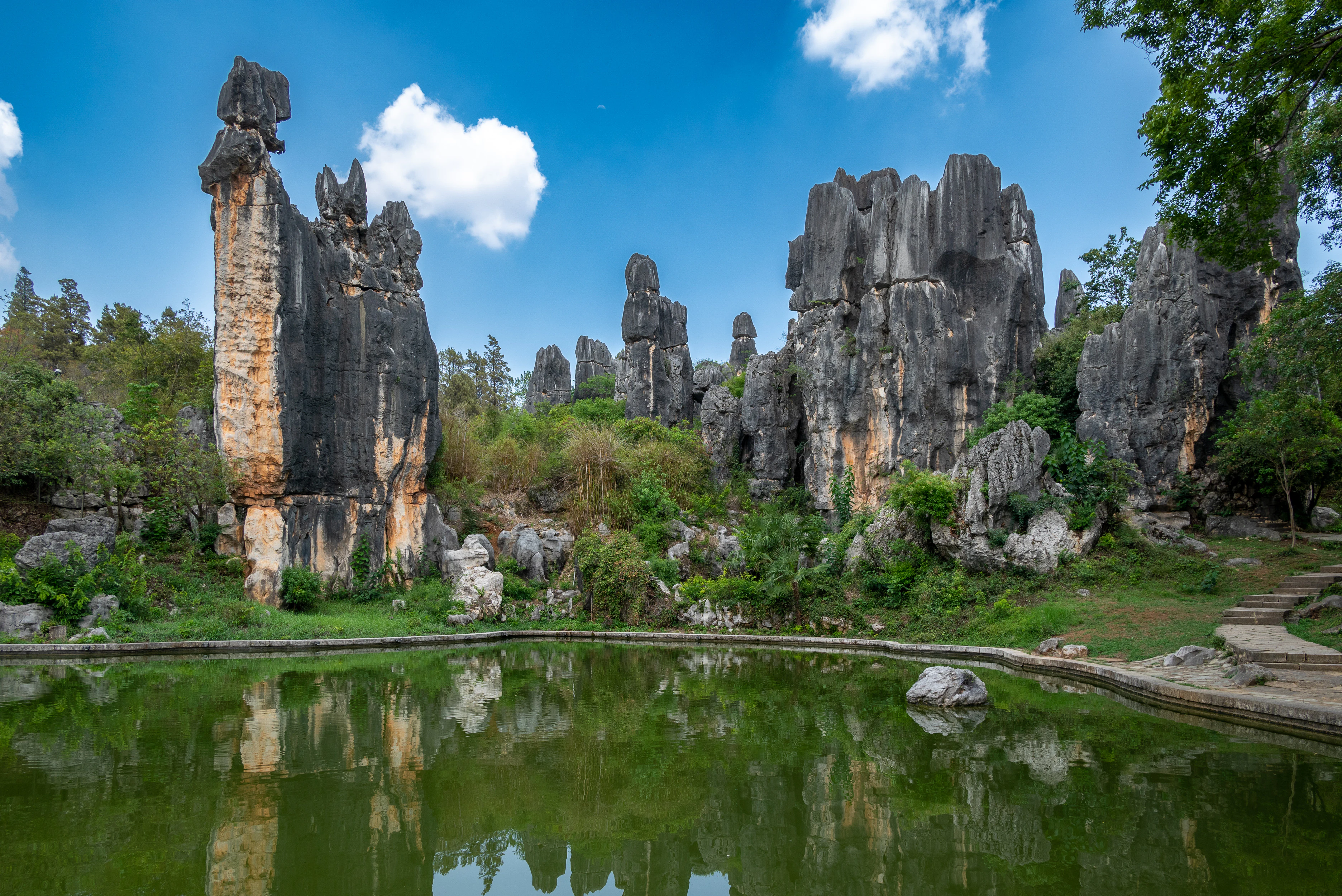
Vertical grey limestone rock formations rising from green vegetation, reflected in a green pond in the foreground, under a blue sky with white clouds.
Towering karst limestone formations of the Stone Forest reflected in a calm pond under a blue sky.

Shilin Scenic Area history and protected-area timeline

The geological foundations of Shilin reach back more than 200 million years to thick marine limestone deposits, but the modern protection and identity of the site begins in the twentieth century. In 1931, Yunnan provincial chairman Long Yun passed through the area and gave the landscape the name Shilin, meaning Stone Forest, an act that helped popularize the imagery now used worldwide. Carved calligraphy by Zhou Zhongyue subsequently marked the site, though the original inscription was destroyed during the Cultural Revolution and later reconstructed from character forms preserved on a stele at a Qujing school, with a re-inscribed signature added by Long Yun's son in 1985.

Protection arrived in 1982, when the State Council designated the area, then legally named Lunan Stone Forest Scenic Area, among China's first batch of national key scenic areas. In 1991 the Lunan Stone Forest Scenic Area Protection Regulations came into effect, providing a formal management framework. A major phase of recognition followed in 2001, when the Ministry of Land and Resources approved Shilin as the Yunnan Shilin Karst Peak Forest National Geopark, and then in 2004, when UNESCO accepted the area into its Global Geopark network. In 2007 the site was inscribed on the World Heritage List as part of the South China Karst transnational nomination, meeting four natural criteria and firmly establishing Shilin as an internationally significant karst landscape.

Shilin Scenic Area landscape and geographic character

The defining landform of Shilin is a vast karst peak forest, sometimes more descriptively called a stone forest, in which thousands of limestone pinnacles project vertically from a gently undulating plateau surface. These pinnacles are typically narrow at the base and broaden into irregular caps, producing blade-like, mushroom-like, and tower-like silhouettes that stand shoulder to shoulder across broad tracts of land. Between the larger standing rocks, narrow corridors and small clearances create a labyrinthine ground surface, while a few openings reveal deep solution fissures and collapsed dolines.

The broader scenic area extends this character across several distinct landscape zones. The Greater and Lesser Stone Forest, anchored by the Lizijing section, presents the most concentrated clusters of pale limestone pinnacles and the classic walking routes. Naigu Stone Forest introduces darker dolomitic rock, producing heavier, more weathered forms. Subsurface scenery appears at Zhiyun Cave, where solution cavities have produced long chambers of dripstone formations. Surface water features include Long Lake and the Dadieshui waterfall, which provide contrasting open-water and cascade views within the karst terrain. Together these zones demonstrate the full range of karst morphology typical of the Yunnan-Guizhou Plateau, from exposed pinnacle fields to enclosed caves and active hydrological systems.
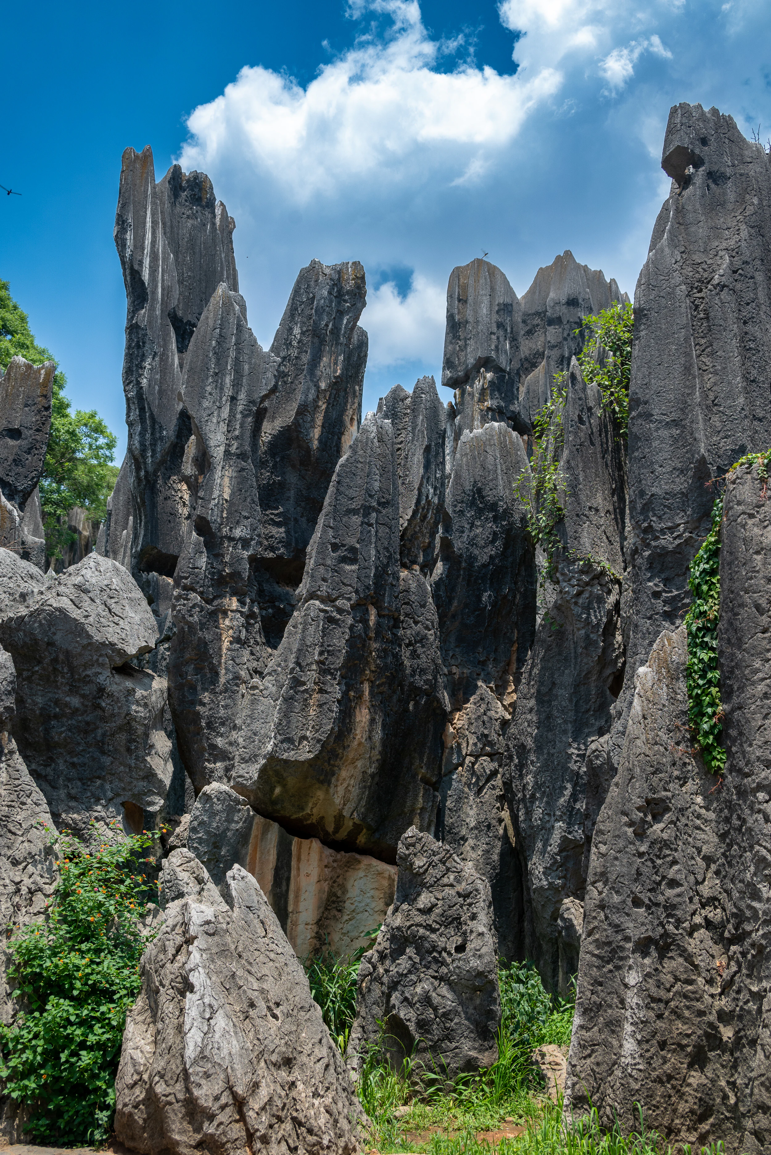
Vertical grey limestone rock formations with green vegetation at the base under a blue sky with white clouds.
Towering grey limestone pillars of the Shilin Stone Forest rise against a bright blue sky with scattered clouds.

Shilin Scenic Area ecosystems, habitats, and plant life

The ecological context of Shilin reflects the broader Yunnan-Guizhou Plateau environment, with a subtropical highland climate, seasonal summer monsoon rainfall, and a mix of rocky outcrops and intervening soils that support patchy but distinctive vegetation. Exposed limestone is largely bare, while soil-filled pockets and shaded crevices between pinnacles sustain shrubs, grasses, and small trees. Vegetation patterns are highly controlled by the underlying rock and available moisture, producing a fragmented mosaic of dry rocky surfaces, sheltered woody patches, and small seasonal wet zones.

Karst landscapes of this type are biologically significant because substrate variability within short distances creates a wide range of micro-habitats. Even though the most photographed areas of Shilin appear nearly barren of vegetation, the broader scenic area, including Long Lake, the waterfall zone, and surrounding woodland, includes more continuous plant cover and richer wildlife habitat. The combination of high geological complexity and relatively undisturbed surroundings gives Shilin value both as a geological reference site and as a contributor to regional biodiversity on the Yunnan-Guizhou Plateau.
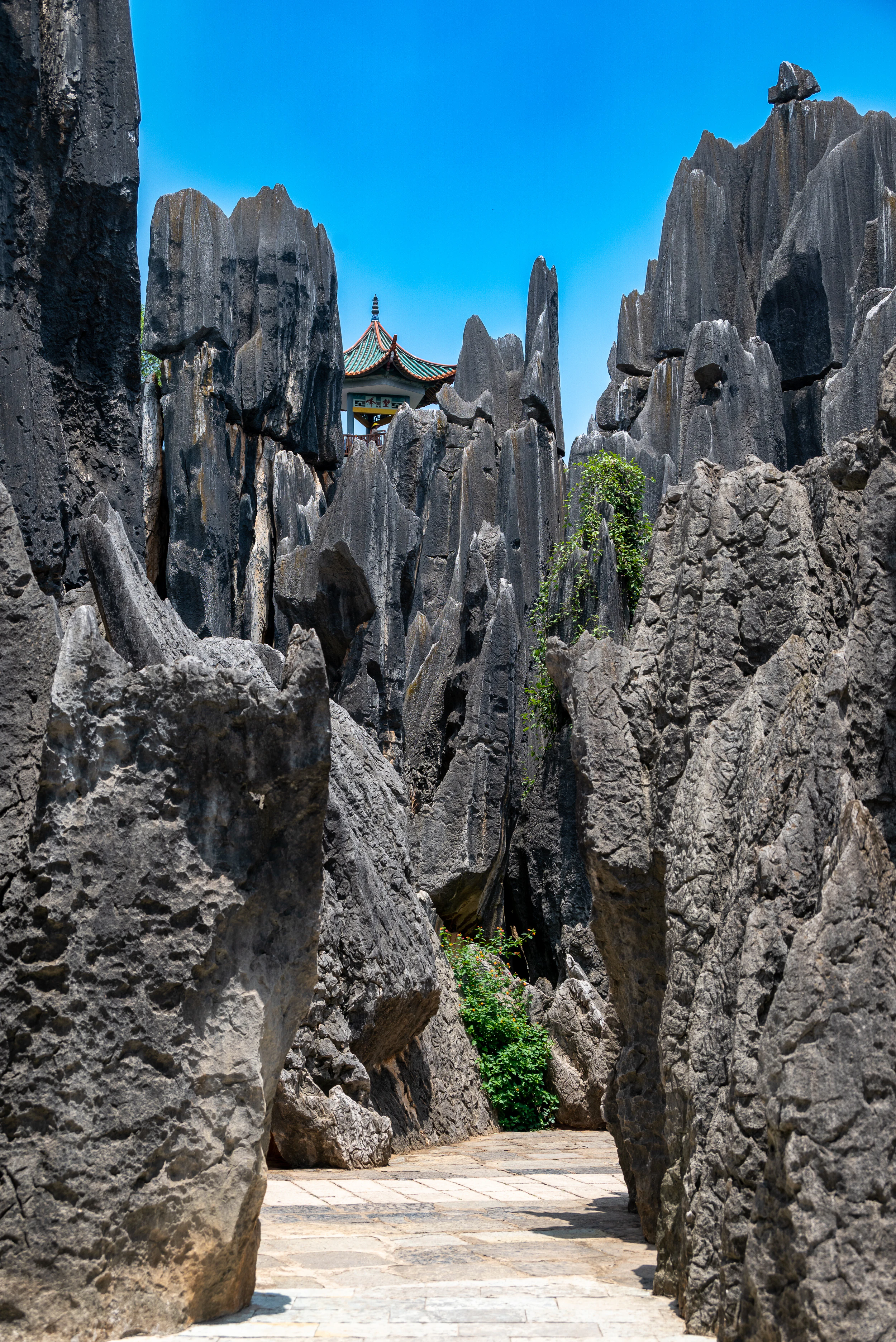
A low-angle view of a paved stone path winding between tall, jagged grey limestone rock formations under a clear blue sky, with a traditional Chinese pavilion visible in the background.
A paved pathway winds through towering grey karst rock formations at the Shilin Stone Forest, with a traditional Chinese pavilion visible in the distance under a clear blue sky.

Shilin Scenic Area conservation status and protection priorities

Shilin holds a layered conservation status that reflects its mixed identity as a scenic landmark, a geological reference site, and a globally significant karst environment. As a national key scenic area since 1982, it is administered within China's protected scenic area system with formal regulations introduced in 1991. Its designation as a national geopark in 2001 and its acceptance into the UNESCO Global Geopark network in 2004 strengthened its profile as a protected geological heritage site. The 2007 inscription of the South China Karst as a World Heritage Site, in which Shilin is a core component, added international-level protection under criteria covering superlative natural phenomena, geological features, ecological processes, and biodiversity.

The deeper scientific value of the site lies in what it reveals about karst formation in tropical and subtropical environments. The pinnacles document long-term dissolution processes acting on massive limestone sequences, providing a reference case for understanding similar karst terrains elsewhere in the world. Preservation of the area, including its caves, water systems, and surrounding soils, supports both ongoing geological research and the maintenance of the ecological communities that depend on the karst substrate, making Shilin an important node in the global network of protected karst landscapes.

Shilin Scenic Area cultural meaning and human context

Shilin sits within Shilin Yi Autonomous County and is closely associated with the cultural identity of the Yi people. The most enduring cultural symbol of the area is Ashima, the heroine of a famous Yi love legend whose rocky form is identified with one of the standing pinnacles, giving the stone forest a strong narrative presence beyond its geological interest. Each year, the Yi Torch Festival held on the twenty-fourth day of the sixth lunar month brings vibrant traditional celebration to the area and is considered a particularly atmospheric time to experience Shilin. Beyond folklore, Shilin has entered modern Chinese popular culture through its striking use as a filming location for the 1982 CCTV adaptation of Journey to the West, where the peak forest stood in for the mythical Mount Five Elements. The combination of folk legend, minority cultural presence, and modern media reference gives the park a cultural identity as distinctive as its geology.
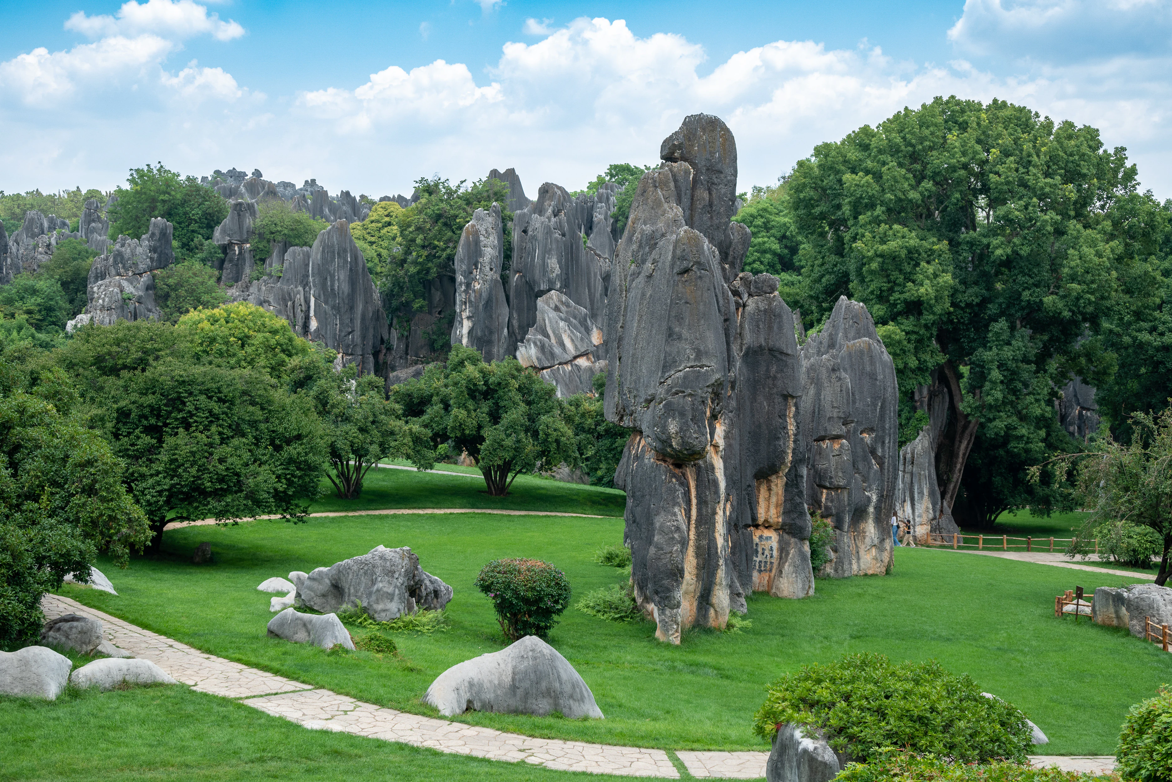
A landscape view of the Shilin Scenic Area featuring tall grey rock formations rising from a green lawn with a paved path and trees under a blue sky with clouds.
Tall karst limestone formations rising from a green lawn in the Shilin Scenic Area, Yunnan.

Top sights and standout views in Shilin Scenic Area

Shilin's highlights revolve around the sheer visual power of its pinnacle karst. The Greater Stone Forest offers the densest concentration of towering limestone columns and includes the iconic Ashima Rock, while the Lesser Stone Forest and Lizijing section provide more intimate, maze-like walking experiences among sculpted rocks. Naigu Stone Forest adds variety through its older, darker dolomitic formations. Zhiyun Cave allows visitors to enter the subsurface karst environment, and Long Lake and Dadieshui waterfall provide complementary scenic anchors within the broader scenic area. The combination of geology, Yi cultural heritage, and the legend of Ashima gives Shilin both natural significance and a strong cultural narrative identity.
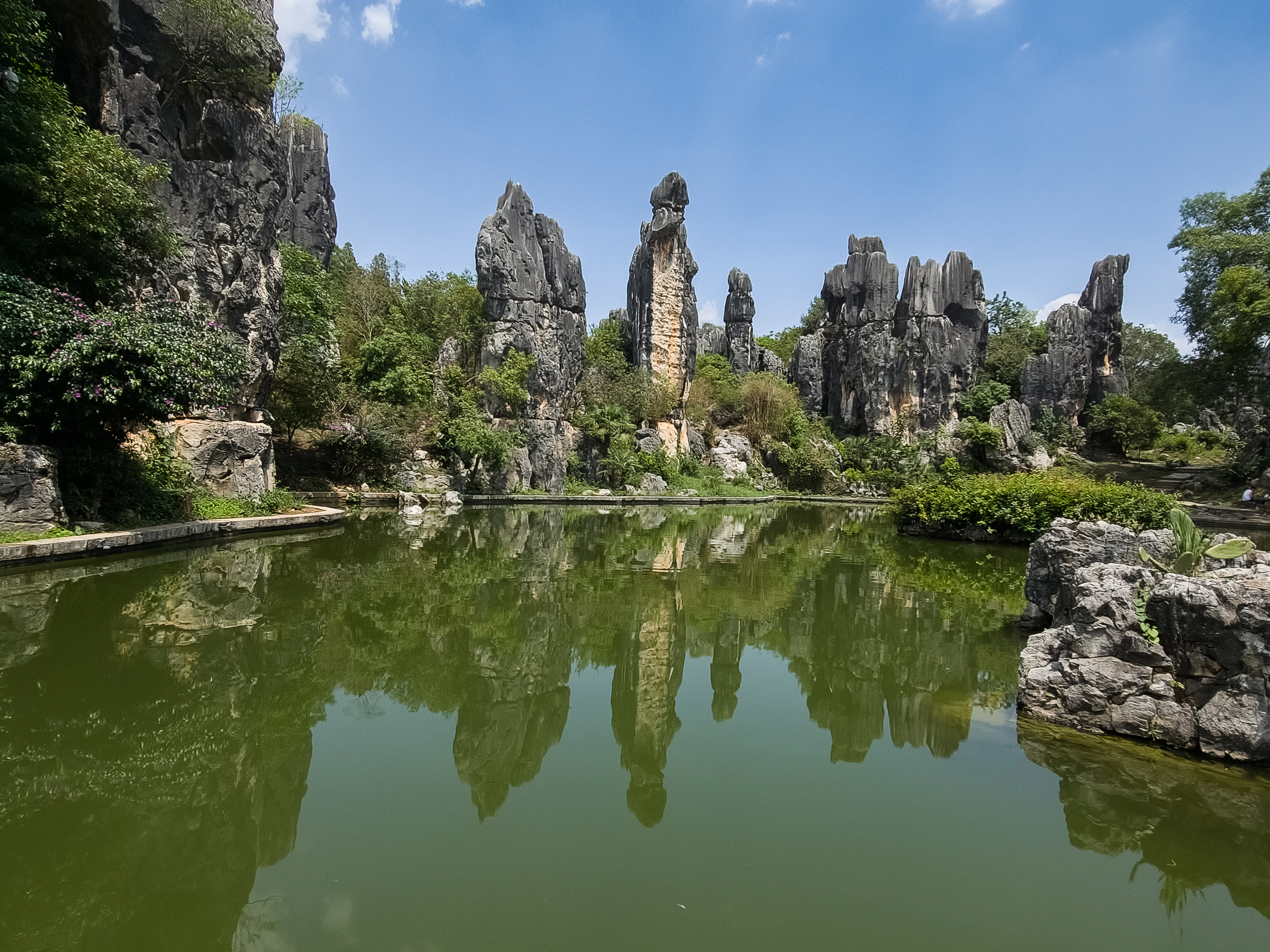
Tall gray limestone rock formations rising from green vegetation, reflected in a calm green pond under a blue sky.
Limestone karst formations reflected in a calm pond at Shilin Scenic Area.

Best time to visit Shilin Scenic Area

Shilin has a subtropical highland climate marked by mild temperatures year-round and a clear seasonal pattern. Spring and autumn are generally the most comfortable seasons for walking through the stone forest, with moderate temperatures, attractive light on the pale limestone, and the surrounding plateau vegetation in pleasant condition. Summer brings the main monsoon rains, which can make walking surfaces wet but also dramatically emphasize the vertical relief of the karst towers.

Visitors interested in experiencing Shilin as a cultural as well as natural landscape may consider aligning their visit with the Yi Torch Festival on the twenty-fourth day of the sixth lunar month, when the area comes alive with traditional celebration. For those focused on geology and photography, the long daylight hours and softer light of spring and autumn offer the most rewarding conditions for exploring the Greater and Lesser Stone Forest, Naigu Stone Forest, and the broader scenic sections.

Monthly climate preview

Long term temperature and precipitation patterns across representative Yunnan elevations

Shilin Scenic Area Climate Normals and Measured Weather by Month

Representative coordinates record measured monthly temperature swings and precipitation variation across the landscape throughout the year. Reviewing the complete twelve month profile clarifies long term climate averages and regional weather normals for Shilin Scenic Area.
Annual mean15 °C
8 °C21 °C
Jan
Feb10°
Mar14°
Apr17°
May20°
Jun21°
Jul21°
Aug20°
Sep19°
Oct16°
Nov12°
Dec
Warmest month
June

21 °C

Coolest month
January

7.6 °C

Wettest month
July

5.7 mm/day

Driest month
December

0.4 mm/day

Park location guide

Geography guide, regional context, and park location map for Shilin Scenic Area

Shilin Scenic Area park geography, regions, and map view in China

Understand where Shilin Scenic Area sits in China through a broader geographic reading of the surrounding landscape, nearby location context, and its mapped position within the national park landscape.

How Shilin Scenic Area fits into China

China is a unitary communist state in East Asia, governed by the Chinese Communist Party. The country's capital is Beijing, while Shanghai is the largest city by urban population. China has 33 province-level divisions including provinces, autonomous regions, municipalities, and special administrative regions. The nation has a long history spanning thousands of years, with achievements including the invention of gunpowder, paper, printing, and the compass.

Wider geography shaping Shilin Scenic Area in China

China is located in East Asia, bordering fourteen countries: Russia, North Korea, Vietnam, Laos, Myanmar, India, Bhutan, Nepal, Pakistan, Afghanistan, Tajikistan, Kyrgyzstan, Kazakhstan, and Mongolia. The country spans diverse terrain including deserts, mountains, plateaus, and river valleys. Major river systems include the Yellow River and Yangtze River. The coastline stretches along the East China Sea, South China Sea, and Yellow Sea.

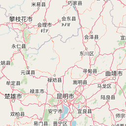
Map view of Shilin Scenic Area

Use this park location map to pinpoint Shilin Scenic Area in China, understand its exact geographic position, and read its mapped placement within the surrounding landscape more clearly.

Pigeon | © OpenStreetMap contributors

Location context for Shilin Scenic Area

Yunnan

Examine limestone pinnacles, geological formations, and protected terrain.

Shilin Scenic Area Photos and Landscape Scenery Visual Exploration

Visual records illustrate the dramatic pinnacle karst topography and towering stone spires defining Shilin Scenic Area. Photographic documentation reveals the intricate landscape morphology and geological formations shaping this protected natural environment.

Vertical grey limestone rock formations rising from green vegetation, reflected in a green pond in the foreground, under a blue sky with white clouds.

A view of large, dark grey karst rock formations in a stone forest, surrounded by green grass, a wooden fence, and a paved path under a blue sky with white clouds.

Vertical grey limestone rock formations with green vegetation at the base under a blue sky with white clouds.

A low-angle view of a paved stone path winding between tall, jagged grey limestone rock formations under a clear blue sky, with a traditional Chinese pavilion visible in the background.

Tall, jagged gray karst rock formations rising above green trees and reflecting in a calm green pond under a blue sky, with a large rock in the foreground water.

A landscape view of the Shilin Scenic Area featuring tall grey rock formations rising from a green lawn with a paved path and trees under a blue sky with clouds.

Tall gray limestone rock formations rising from green vegetation, reflected in a calm green pond under a blue sky.

A large yellow drum with blue and white patterns and a giant yellow stringed instrument on a stand, set on a red carpet with limestone rock formations and green trees in the background under a blue sky.

Tall, jagged grey and brown limestone rock formations standing in a green grassy field with trees in the background under a blue sky with white clouds.

Vertical view of dark grey limestone karst rock formations rising against a blue sky. A traditional Chinese pavilion with a curved roof and viewing platform sits among the rocks in the midground, with several people standing on it. Large red Chinese characters are painted vertically on the prominent rock formation in the right foreground. Green trees and vegetation grow around the base and between the rocks.

Tall gray limestone rock pillars rising from a green grassy field with scattered trees and bushes under a clear blue sky.

Tall dark grey karst rock pillars and formations rising above a paved plaza with green trees and shrubs, under a bright blue sky with white clouds. A few visitors are visible in the foreground, some holding umbrellas.

Tall gray karst limestone rock pillars rising against a bright blue sky, with red Chinese characters inscribed on the central rock face, a traditional Chinese pavilion visible to the left, green trees on the sides, and a few visitors with a red umbrella at the base on a paved pathway

A landscaped garden with red flower beds and a wooden fence in the foreground, manicured green hedges in the midground, and large dark karst stone formations with golden Chinese characters and a circular emblem in the background under a blue sky.

Vertical view looking up at tall gray karst rock pillars with patches of green moss and a dark circular cave opening near the bottom center.

Wide landscape view of tall gray karst limestone rock formations rising from a green grassy lawn with trimmed round bushes and trees, under an overcast sky, with a few small figures visible near the base of the rocks.

Park atlas

Compare surrounding geological formations and connected protected areas

Explore Other Parks Near Shilin Scenic Area and Regional Protected Landscapes

Browsing parks near Shilin Scenic Area allows visitors to discover related protected landscapes across the Yunnan plateau. Comparing nearby geological formations provides broader context for regional karst topography and diverse natural terrain.
National parkLào Cai Province
About 285 km away#1 closest

South

Hoàng Liên National Park: Vietnam's Highest Mountain and Botanical Treasure in Lào Cai Province

Discover exceptional mountain terrain and unique endemic species habitat.

Hoàng Liên National Park stands as a critical protected landscape in Lào Cai Province, Vietnam, centered around the iconic Fansipan mountain, the highest point in the Indochinese Peninsula. This national park is renowned as a globally important center for plant diversity, showcasing varied mountain terrain from lush evergreen forests to subalpine ecosystems. Explore the mapped boundaries and geographic context of this significant highland protected area, a key destination for understanding Southeast Asian botanical richness.

Area
685.69 km²
Established
2002
IUCN
II
Relief
Mountain
Nature reserveZhaotong
About 286 km away#2 closest

North

Dashanbao Black-necked Crane National Nature Reserve Geographic and Atlas Overview

Protected highland wetlands within the Zhaotong regional geography.

Dashanbao Black-necked Crane National Nature Reserve is a nationally significant protected area in Zhaotong, representing a rare high-elevation wintering habitat for migratory cranes. This rugged plateau landscape features shallow marshlands, alpine grasslands, and an interconnected system of lakes that support delicate highland ecological zones. Use this atlas resource to understand the park terrain and its formal conservation boundaries within the broader context of northeast Yunnan.

Area
192 km²
Established
1990
Relief
Mountain
Climate
Subtropical
Wildlife reservePhongsaly Province
About 331 km away#3 closest

South

Phou Den Din National Protected Area: Atlas View of Northern Laos Protected Landscapes

Highland wildlife reserve and remote forest mountain terrain.

Spanning the rugged hills of Phongsaly Province, Phou Den Din National Protected Area represents a major conservation anchor in northern Laos. This reserve is defined by its steep mountain ridges, dense forest cover, and rich riparian habitats that support regional wildlife populations. Its position along the international border creates a transboundary forest landscape, offering significant value for biodiversity monitoring and geographical study within the Indochinese mountain network.

Area
2,200 km²
Established
1993
IUCN
VI
Relief
Mountain
Watercolor painting depicting a lake with green hills and vegetation
National parkBắc Kạn Province
About 346 km away#4 closest

Southeast

Ba Bể National Park: Vietnam's Largest Freshwater Karst Lake and Protected Landscape

Discover the mapped geography of this unique protected wetland in Bắc Kạn.

Ba Bể National Park is distinguished by Vietnam's largest natural freshwater lake, a perennial karst water body set within a dramatic limestone landscape. This national park in Bắc Kạn Province protects a vital wetland ecosystem and its surrounding highland forests, offering a rich geographic context for atlas exploration. Explore the park's unique terrain, mapped boundaries, and the remarkable biodiversity it preserves, making it a cornerstone of regional natural landscape discovery.

Area
100.48 km²
Established
1992
IUCN
II
Relief
Mixed relief
National parkVĩnh Phúc Province
About 411 km away#5 closest

Southeast

Tam Dao National Park: Vietnam's Mountain National Park and Biodiversity Hotspot

Explore mapped boundaries and regional landscape context.

Tam Dao National Park is a key protected area in northern Vietnam, defined by its rugged mountain terrain featuring over 20 peaks exceeding 1,000 meters. This national park is a vital habitat for diverse flora and fauna, including numerous endemic species, and showcases transitional forest ecosystems from tropical to montane zones. Understanding Tam Dao National Park involves exploring its geographic setting within Vĩnh Phúc Province and appreciating its role as a significant protected landscape.

Area
368.83 km²
Established
1996
IUCN
II
Relief
Mountain
National parkPhú Thọ Province
About 430 km away#6 closest

South

Xuân Sơn National Park: Protected Mountain Landscape and Regional Geography

Mapping the southeastern edge of the Hoang Lien Mountains.

Delve into the protected landscape of Xuân Sơn National Park, a key national park situated in Phú Thọ Province, Vietnam. This area, covering about 150 square kilometers, is defined by its rugged mountainous terrain, featuring steep forested slopes and distinct ridgelines that contribute to the region's varied topography. As a protected national park, Xuân Sơn plays a crucial role in preserving the natural characteristics of the southeastern Hoang Lien Mountains. Its geographic setting is significant, acting as a transition zone between higher montane environments and the nearby lowland river systems, offering a unique perspective on Vietnam's diverse natural heritage.

Area
150.48 km²
Established
1986
IUCN
II
Relief
Mountain
National parkChina
About 458 km away#7 closest

North

Giant Panda National Park: China's Premier Panda Habitat and Protected Landscape

Mapped terrain and conservation significance in the mountains of western China.

Giant Panda National Park is a critically important protected area in China, established to conserve the primary habitat for the giant panda. This national park, spanning a vast mountainous region across Sichuan, Gansu, and Shaanxi, integrates numerous former reserves into a unified landscape. It serves as a vital sanctuary, protecting approximately 80 percent of the world's wild panda population and offering deep insights into the geographic distribution and ecological requirements of these endangered animals.

Area
27,134 km²
Established
2020
IUCN
II
Relief
Mountain
National parkHanoi
About 464 km away#8 closest

Southeast

Ba Vì National Park: Ancient Volcanic Mountains and Protected Landscape Near Hanoi

Discover the mapped geography and biodiversity of this national park.

Ba Vì National Park, a protected natural area near Hanoi, showcases a dramatic landscape shaped by ancient volcanic activity. The park features three significant peaks, including Vua Mountain, creating a distinct topographical profile. Spanning over 10,800 hectares, it is recognized for its ecological diversity, harboring a wealth of plant and animal species. This national park serves as a vital protected landscape, offering a unique opportunity for geographic exploration and understanding the natural terrain surrounding the Vietnamese capital.

Area
108.15 km²
Established
1991
IUCN
II
Relief
Mountain

Common questions about visiting, size, designation, and location context for Shilin Scenic Area

Shilin Scenic Area FAQs for park facts, access, geography, and protected area context

Find quick answers about Shilin Scenic Area, including protected-area facts, park geography, trail and visitor context, and how the park fits into its surrounding country and regional landscape.
MoriAtlas Explorer

Continue Your Protected Areas Search Across the Global Atlas

Deepen your exploration by continuing the structured search for national parks and protected areas worldwide. Utilize the comprehensive filtering capabilities to compare different conservation landscapes and refine your understanding of global park geography. Discover more about the distribution and characteristics of protected natural areas.

Global natural geography