
Mori Atlas logo
National parkBa Bể National Park

Discover the mapped geography and protected natural boundaries of this unique national park in Bắc Kạn Province.

Ba Bể National Park: Vietnam's Premier Karst Lake and Protected Wetland Landscape

Ba Bể National Park represents a significant protected landscape in Vietnam's Bắc Kạn Province, centered around Vietnam's largest natural freshwater lake. This national park preserves a vital wetland ecosystem and a dramatic karst limestone terrain, offering a unique geographic profile for atlas exploration. The park's commitment to safeguarding its perennial lake, highland evergreen forests, and remarkable biodiversity makes it a key destination for understanding regional conservation and natural geography.

karst landscapewetland ecosystemlimestone forestfreshwater lakeRamsar sitecave systems
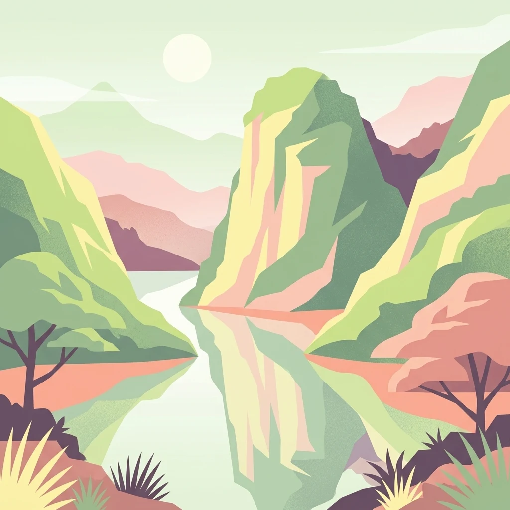
Stylized illustration of a lake surrounded by green and pinkish mountains, with trees and vegetation in foreground

Ba Bể National Park

National park

Park overview

Structured park overview, official facts, and landscape profile for Ba Bể National Park

Ba Bể National Park park facts, protected area profile, and essential visitor context

Review the core facts for Ba Bể National Park, including designation, size, terrain, visitor scale, habitats, and operating context in one park-focused overview.

About Ba Bể National Park

Ba Bể National Park occupies a distinctive position in Vietnam's protected area network as a Ramsar-designated wetland that combines significant geological, ecological, and cultural values. The park is situated in Bắc Kạn Province, approximately 70 kilometers northwest of the provincial capital and about 14 kilometers west of the town of Cho Ra. The landscape is dominated by karst limestone formations that create a complex terrain of steep cliffs, caves, and underground river systems. Ba Bể Lake forms the ecological heart of the park, a natural lake of remarkable hydrological stability despite its karst setting. The lake's water levels fluctuate between 3 and 5 square kilometers between dry and wet seasons, and the lake serves as a natural flood buffer, reversing its outflow during high flood periods to absorb water from the Nang River. The protected area includes both limestone forests on steep mountain slopes with thin soil cover and evergreen forests in areas with thicker soil, each supporting distinct ecological communities.

Quick facts and research context for Ba Bể National Park

Ba Bể National Park spans 10,048 hectares in Bắc Kạn Province, Northeast Vietnam. The park centers on Ba Bể Lake, Vietnam's largest natural freshwater lake and highest lake, lying at approximately 150 meters elevation. The lake reaches maximum depths of 35 meters with average depths between 17 and 23 meters. The park was officially designated as a Ramsar Wetland in February 2011. The landscape is characterized by limestone karst formations, with the Ta Han, Bo Lu, and Leng Rivers feeding the lake from the south and west. The ecosystem supports 65 mammal species, 233 bird species, 43 reptile and amphibian species, 106 fish species, and 354 butterfly species.

Protection and recognition

Documenting terrestrial conservation boundaries and official global recognition

Ba Bể National Park Protected Area Status and International Recognition

Established in 2011 as a terrestrial protected landscape, Ba Bể National Park maintains a defined conservation boundary to safeguard regional ecological values. The park holds distinguished international recognition as an active Ramsar site, allowing detailed verification of official environmental protection status.

International recognition

Protection details

Protection scope
Terrestrial
Designated year
2011
Transboundary protection
No
Park context

Deeper park guide and search-rich context for Ba Bể National Park

Ba Bể National Park history, landscape, wildlife, and travel context

Explore Ba Bể National Park through its history, landscape character, ecosystems, wildlife, conservation priorities, cultural context, and seasonal travel timing in a structured park guide built for atlas discovery and search intent.

Why Ba Bể National Park stands out

Ba Bể National Park is best known for protecting Ba Bể Lake, Vietnam's largest and highest natural freshwater lake, which is a rare example of a perennial karst lake that never dries. The park's limestone karst landscape features dramatic cliffs, the impressive Puong Cave where the Nang River flows through, and the Dau Dang waterfall with its sequence of rapids stretching nearly a kilometer. The park protects significant populations of rare primates including François' langur, as well as diverse wildlife such as Asian black bear, Owston's palm civet, and the Vietnamese salamander. The cave systems, particularly Puong Cave with its population of 5,000 to 10,000 bats representing 18 species, add another dimension to the park's ecological significance.
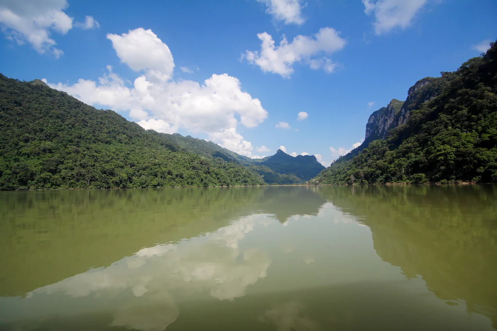
A calm lake reflecting a bright blue sky with white clouds, surrounded by lush green mountains
Ba Bể Lake reflecting mountains and sky in Bắc Kạn Province, Vietnam

Ba Bể National Park history and protected-area timeline

Ba Bể National Park was established in 1992 to protect the Ba Bể Lake ecosystem and surrounding forested landscapes. The park covers an area of 100.48 square kilometers and was designated as a Ramsar Wetland of International Importance on February 2, 2011, recognizing its significant ecological functions particularly as a wetland ecosystem. An ecological research station was opened within the park in 2004 to support scientific study and monitoring. The park infrastructure includes an information center, guest houses, and a lake management station that supports both visitor services and conservation activities. The designation as a Ramsar site elevated the park's international conservation profile and brought additional attention to the need for sustainable management of its wetland resources.

Ba Bể National Park landscape and geographic character

The physical landscape of Ba Bể National Park is defined by its karst limestone terrain, creating a visually striking environment of steep cliffs, rocky outcrops, and forested slopes descending to the lake shore. Ba Bể Lake occupies a significant portion of the park, stretching approximately 8 kilometers north to south with a surface area that varies between 3 and 5 square kilometers depending on season. The lake's three named sections, Pe Leng, Pe Lu, and Pe Lam, form a continuous water body framed by limestone hills. Puong Cave in the northern part of the park is a major geological feature, with a main chamber reaching 50 meters in height and extending about 300 meters in length, through which the Nang River flows. The Dau Dang Waterfall consists of a sequence of rapids along the Nang River, stretching nearly one kilometer in length. Widow Island, a small cone-shaped islet, rises near the center of the southern portion of the lake, adding to the scenic diversity.
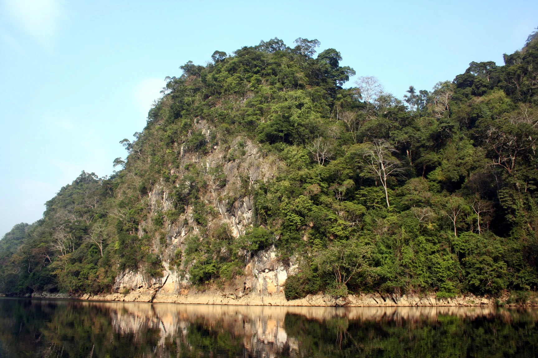
Karst cliffs with dense forest vegetation reflecting in calm lake waters
Karst cliffs reflecting in Ba Bể Lake under a clear sky

Ba Bể National Park ecosystems, habitats, and plant life

The park's ecological character is shaped by the intersection of limestone and evergreen forest ecosystems. Limestone forest covers steep mountain slopes where thin soil restricts vegetation to more specialized species, while evergreen forest in areas with deeper soil supports higher species diversity. Dominant tree species in the limestone forest include Burretiodendron hsienmu and Streblus tonkinensis. Climbing bamboo, a regional endemic plant, is common on hill slopes near the lake shore. The lake's hydrology is remarkable for a karst area, as Ba Bể Lake maintains water year-round despite typical limestone terrain that often results in seasonal drying. The lake sits at approximately 150 meters above sea level and receives inflow from the Ta Han, Bo Lu, and Leng Rivers, with outflow reversing during wet seasons to buffer flooding downstream.
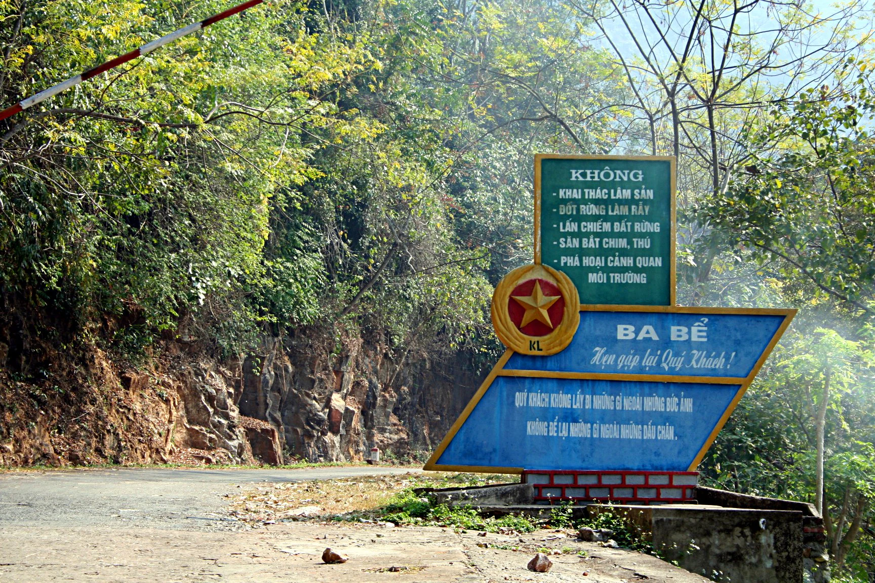
Green and blue entrance sign for Ba Bể National Park with Vietnamese text, red star emblem, and barrier arm, surrounded by forest and road
Entrance sign of Ba Bể National Park during dry season, featuring Vietnamese text and red star emblem

Ba Bể National Park wildlife and species highlights

Ba Bể National Park supports impressive biodiversity across multiple taxonomic groups. The mammal fauna includes 65 recorded species, notably the Chinese pangolin, slow loris, rhesus macaque, stump-tailed macaque, François' langur, Asian black bear, European otter, Owston's palm civet, Asian golden cat, mainland serow, and several flying squirrel species, along with 27 bat species. Bird diversity includes 233 species, while reptiles and amphibians number 43 species, including the king cobra and the Vietnamese salamander. The lake supports 106 fish species from 61 genera, 17 families, and 5 orders. The park is particularly notable for butterfly diversity, with 354 species recorded. The bat population in Puong Cave, numbering between 5,000 and 10,000 individuals representing 18 species, forms a significant component of the park's cavern-dwelling fauna.
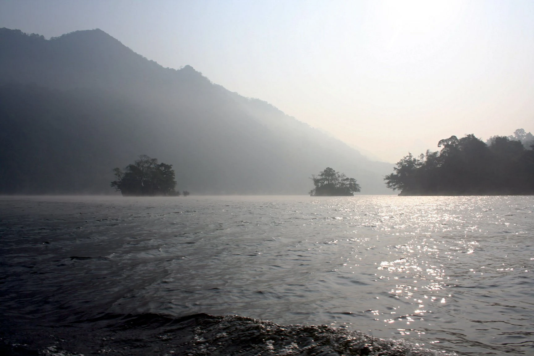
Large body of water with mist, two small forested islands, and mountains in the background under a hazy sky
Morning mist on Ba Bê Lake in Ba Bể National Park during dry season

Ba Bể National Park conservation status and protection priorities

Ba Bể National Park holds significant conservation value as a Ramsar Wetland of International Importance, designated in 2011 under the Ramsar Convention. The park protects Vietnam's largest natural freshwater lake and highest lake, representing a rare and ecologically important karst wetland system. The protected area preserves critical habitat for several threatened species including François' langur, Asian black bear, and the Vietnamese salamander. The cave systems with their substantial bat populations contribute to ecological processes beyond the park boundaries. The lake's role as a natural flood buffer provides important ecosystem services, regulating water flow and mitigating downstream flooding during wet seasons. The establishment of an ecological research station in 2004 reflects ongoing commitment to scientific monitoring and conservation management.

Ba Bể National Park cultural meaning and human context

The area around Ba Bể Lake has cultural significance for local communities, particularly the Tay ethnic group. The lake's name originates from the Tay language, where Ba Bể means "Three Lakes," referencing the three connected sections of the lake. Local legend tells of Widow Island, a cone-shaped islet in the southern lake, as the former home of an elderly widow who was saved from a flood through divine intervention, giving the feature its name. The Tay people have historically inhabited the surrounding landscape, maintaining traditional relationships with the lake and its resources. These cultural connections add depth to the park's identity beyond its purely ecological values.

Top sights and standout views in Ba Bể National Park

Ba Bể National Park combines Vietnam's largest natural freshwater lake with dramatic karst limestone scenery and exceptional biodiversity. The park's Puong Cave, traversed by the Nang River and housing significant bat colonies, offers a striking underground landscape. The Dau Dang waterfall provides another scenic attraction with its nearly kilometer-long sequence of rapids. The diversity of wildlife, from François' langur and Asian black bear to 106 fish species and 354 butterfly species, reflects the ecological richness preserved within the park. The lake's unusual hydrological stability in a karst setting makes it particularly notable, as it never dries despite seasonal variations.

Best time to visit Ba Bể National Park

The park can be visited throughout the year, with each season offering different experiences. The wet season brings higher water levels in Ba Bể Lake and surrounding rivers, creating lusher landscapes and fuller waterfalls. Morning mist over the lake is a characteristic sight, particularly during cooler months. The dry season reveals more of the shoreline and limestone cliffs, with clearer visibility for cave exploration. Wildlife viewing opportunities exist year-round, though dry season conditions may make some species more accessible as they frequent water sources. The lake's level fluctuations between 3 and 5 square meters between seasons demonstrate the dynamic character of this karst wetland system.

Monthly climate preview

Long-term average temperature and precipitation measurements for Ba Bể National Park

Ba Bể National Park Climate Normals and Representative Monthly Weather Patterns

Representative coordinate data records sustained shifts in average temperature and monthly precipitation across the year at Ba Bể National Park. Detailed climate normal profiles provide complete twelve-month breakdowns for thorough regional analysis.
Annual mean21 °C
13 °C26 °C
Jan13°
Feb15°
Mar19°
Apr23°
May25°
Jun26°
Jul26°
Aug26°
Sep24°
Oct21°
Nov17°
Dec13°
Warmest month
July

26 °C

Coolest month
January

12.6 °C

Wettest month
July

8.2 mm/day

Driest month
December

0.8 mm/day

Park location guide

Geography guide, regional context, and park location map for Ba Bể National Park

Ba Bể National Park park geography, regions, and map view in Vietnam

Understand where Ba Bể National Park sits in Vietnam through a broader geographic reading of the surrounding landscape, nearby location context, and its mapped position within the national park landscape.

How Ba Bể National Park fits into Vietnam

Vietnam, officially the Socialist Republic of Viet Nam, is a unitary communist state in Southeast Asia. It occupies roughly 331,000 square kilometres along the eastern edge of Mainland Southeast Asia, with a population exceeding 102 million. The country is bordered by China to the north, Laos and Cambodia to the west, and has maritime boundaries in the Gulf of Thailand and South China Sea.

Wider geography shaping Ba Bể National Park in Vietnam

Vietnam occupies the eastern edge of Mainland Southeast Asia, stretching along the Gulf of Thailand to the southwest and the South China Sea to the east. The country is bordered by China to the north, and Laos and Cambodia to the west. It has a diverse landscape ranging from the Red River Delta in the north to the Mekong Delta in the south.

Map view of Ba Bể National Park

Use this park location map to pinpoint Ba Bể National Park in Vietnam, understand its exact geographic position, and read its mapped placement within the surrounding landscape more clearly.

Pigeon | © OpenStreetMap contributors

Location context for Ba Bể National Park

Bắc Kạn Province
Natural feature types

Browse the Natural Features and Geographic Landmarks of Ba Bể National Park

Navigate the complete dataset of named natural landforms and hydrological sites within Ba Bể National Park. Use this collection to understand the specific karst and wetland structures that define this protected region through the MoriAtlas framework.

Visualize the unique limestone terrain, vast lake ecosystem, and diverse protected area habitats of this significant Vietnamese national park.

Ba Bể National Park Photos: Explore Vietnam's Distinctive Karst Landscapes and Freshwater Lake Scenery

Explore this gallery of Ba Bể National Park imagery to visually grasp its remarkable limestone mountains, expansive freshwater lake, and lush highland evergreen forests. These park photos provide essential context for understanding the unique protected landscape, diverse ecosystems, and the overall geographic identity of this significant Vietnamese national park.

A calm lake reflecting a bright blue sky with white clouds, surrounded by lush green mountains

Calm lake reflecting dense forested hills under a clear sky

Karst cliffs with dense forest vegetation reflecting in calm lake waters

Green and blue entrance sign for Ba Bể National Park with Vietnamese text, red star emblem, and barrier arm, surrounded by forest and road

Large body of water with mist, two small forested islands, and mountains in the background under a hazy sky

Park atlas

Compare the geographic spread of national parks and protected areas across Vietnam's northern karst region.

Explore Nearby National Parks and Protected Areas Near Ba Bể National Park, Vietnam

Discover other national parks and protected areas in the region surrounding Ba Bể National Park, revealing similar karst landscapes, limestone forests, and wetland ecosystems. Compare these conservation areas to understand regional park distribution, trace connected habitats, and deepen your atlas-based geographic exploration.
National parkVĩnh Phúc Province
76 km away#1 closest

South

Tam Dao National Park: Vietnam's Mountain National Park and Biodiversity Hotspot

Explore mapped boundaries and regional landscape context.

Tam Dao National Park is a key protected area in northern Vietnam, defined by its rugged mountain terrain featuring over 20 peaks exceeding 1,000 meters. This national park is a vital habitat for diverse flora and fauna, including numerous endemic species, and showcases transitional forest ecosystems from tropical to montane zones. Understanding Tam Dao National Park involves exploring its geographic setting within Vĩnh Phúc Province and appreciating its role as a significant protected landscape.

Area
368.83 km²
Established
1996
IUCN
II
Relief
Mountain
National parkHanoi
About 144 km away#2 closest

South

Ba Vì National Park: Ancient Volcanic Mountains and Protected Landscape Near Hanoi

Discover the mapped geography and biodiversity of this national park.

Ba Vì National Park, a protected natural area near Hanoi, showcases a dramatic landscape shaped by ancient volcanic activity. The park features three significant peaks, including Vua Mountain, creating a distinct topographical profile. Spanning over 10,800 hectares, it is recognized for its ecological diversity, harboring a wealth of plant and animal species. This national park serves as a vital protected landscape, offering a unique opportunity for geographic exploration and understanding the natural terrain surrounding the Vietnamese capital.

Area
108.15 km²
Established
1991
IUCN
II
Relief
Mountain
National parkPhú Thọ Province
145 km away#3 closest

Southwest

Xuân Sơn National Park: Protected Mountain Landscape and Regional Geography

Mapping the southeastern edge of the Hoang Lien Mountains.

Delve into the protected landscape of Xuân Sơn National Park, a key national park situated in Phú Thọ Province, Vietnam. This area, covering about 150 square kilometers, is defined by its rugged mountainous terrain, featuring steep forested slopes and distinct ridgelines that contribute to the region's varied topography. As a protected national park, Xuân Sơn plays a crucial role in preserving the natural characteristics of the southeastern Hoang Lien Mountains. Its geographic setting is significant, acting as a transition zone between higher montane environments and the nearby lowland river systems, offering a unique perspective on Vietnam's diverse natural heritage.

Area
150.48 km²
Established
1986
IUCN
II
Relief
Mountain
National parkVietnam
209 km away#4 closest

Southeast

Cát Bà National Park: Vietnam's Critically Endangered Species Sanctuary & Karst Landscape

Mapped protected area with diverse terrestrial and marine ecosystems.

As a critical national park in Vietnam, Cát Bà National Park protects a remarkable limestone karst landscape central to the Hạ Long Bay region. This area is renowned for its steep peaks, narrow valleys, and coastal mangrove environments, supporting a uniquely diverse array of flora and fauna. Its status as a protected area highlights its global importance for conservation, particularly as the exclusive habitat of the Cát Bà langur. Explore the mapped geography and ecological significance of this vital Vietnamese protected land.

Area
161.968 km²
Established
1986
IUCN
II
Relief
Highland
National parkLào Cai Province
About 212 km away#5 closest

West

Hoàng Liên National Park: Vietnam's Highest Mountain and Botanical Treasure in Lào Cai Province

Discover exceptional mountain terrain and unique endemic species habitat.

Hoàng Liên National Park stands as a critical protected landscape in Lào Cai Province, Vietnam, centered around the iconic Fansipan mountain, the highest point in the Indochinese Peninsula. This national park is renowned as a globally important center for plant diversity, showcasing varied mountain terrain from lush evergreen forests to subalpine ecosystems. Explore the mapped boundaries and geographic context of this significant highland protected area, a key destination for understanding Southeast Asian botanical richness.

Area
685.69 km²
Established
2002
IUCN
II
Relief
Mountain
National parkNinh Bình Province
About 225 km away#6 closest

South

Cúc Phương National Park: National Park Atlas and Mapped Protected Landscape Details

Explore its geographic setting and protected area boundaries.

Gain structured insight into Cúc Phương National Park, a designated national park in Vietnam situated within Ninh Bình Province. This entry provides detailed geographic context, focusing on the park's mapped boundaries and its identity as a protected landscape. It is designed to support atlas-driven exploration and understanding of Vietnam's natural geography.

Established
1962
Relief
Mountain
Climate
Tropical
Access
Moderate access
Watercolor painting showing a coastal landscape with distant islands, green vegetation, and a horizon line
National parkQuảng Ninh Province
About 245 km away#7 closest

Southeast

Bái Tử Long National Park: Protected Island Archipelago and Marine Landscape Discovery

Explore the geography and mapped protected boundaries.

Bái Tử Long National Park, located in Vietnam's Quảng Ninh Province, is a protected national park distinguished by its archipelago of approximately 40 limestone islands and significant marine environments. As one of Vietnam's few national parks designated to protect both land and sea, it provides critical atlas-level insights into coastal karst topography, marine biodiversity, and the interconnectedness of island ecosystems. Discover the park's unique geographic features and its role as a vital protected landscape within the broader regional context.

Area
157.83 km²
Established
2001
IUCN
II
Relief
Mixed relief
Watercolor illustration of a wetland landscape with green trees and a pale sky
National parkNam Định Province
About 251 km away#8 closest

South

Xuân Thủy National Park: Protected Landscape Identity and Mapped Geography in Nam Định

Explore the national park's protected boundaries and regional landscape.

Xuân Thủy National Park serves as a vital protected landscape within Nam Định Province, Vietnam, offering users a clear point of entry for understanding its geographic identity. This page facilitates detailed exploration of its mapped park boundaries and the surrounding natural terrain, providing essential context for anyone interested in the regional geography of protected areas. Discover the specific landscape characteristics that define this national park and its place within Vietnam's conservation network.

Area
7,100 km²
Established
2003
IUCN
II
Relief
Lowland

Common questions about visiting, size, designation, and location context for Ba Bể National Park

Ba Bể National Park FAQs for park facts, access, geography, and protected area context

Find quick answers about Ba Bể National Park, including protected-area facts, park geography, trail and visitor context, and how the park fits into its surrounding country and regional landscape.
MoriAtlas Explorer

Continue Your Protected Areas Search Across the Global Atlas

Deepen your exploration by continuing the structured search for national parks and protected areas worldwide. Utilize the comprehensive filtering capabilities to compare different conservation landscapes and refine your understanding of global park geography. Discover more about the distribution and characteristics of protected natural areas.

Global natural geography