Peaks
Butchers Peak
605 m

A comprehensive analysis of topographic features and island terrain within this Tasmanian coastal park.
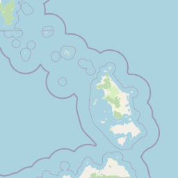
Examine the geographic foundation and mapped spatial extent of Strzelecki National Park, located on Flinders Island in the Bass Strait. This structured profile maps the internal distribution of mountain peaks and coastal environments, including Fotheringate Creek and Trousers Point Beach, to provide context for the park's distinct topography and temperate forest habitats.
Related tags
Flinders Island's mountain wilderness with coastal trails and diverse ecosystems
Strzelecki National Park is a protected wilderness area on Flinders Island, the largest island in the Furneaux Group off the northeastern coast of Tasmania, Australia. Established in 1967, the park encompasses approximately 42 square kilometers of rugged island terrain, serving as a critical conservation reserve for Tasmania's island ecosystems. The park is named after Sir Paul Edmund Strzelecki, the renowned Polish explorer and geologist who conducted extensive explorations across the Australian continent during the nineteenth century. The reserve protects a remarkable diversity of landscapes, from mountain peaks and forested ridges to coastal headlands and sandy beaches, making it one of Tasmania's most geographically varied island protected areas.
Regional administration and coastal island park classifications
Strzelecki National Park’s mapped outline frames 42.16 km²
Mixed terrain classifications and recorded landscape features within the park
Peaks
605 m
Streams
Straits
Peaks
782 m
Beaches
Peaks
Temperate climate zones, mixed relief, and coastal broadleaf forest classifications
Mountains · Forest · Coast · Beach
Temperate broadleaf forest · Coastal habitat
Discover additional protected landscapes and regional park geography surrounding Flinders Island within broader Australia.
East

A protected offshore marine environment in the Tasman Sea
Spanning from shelf waters into the deep ocean, this Commonwealth-managed reserve represents a critical marine protected area off the Tasmanian coast. It features unique benthic environments and prominent seamounts that support diverse deep-sea life far beyond the reach of traditional coastal exploration.
South
Discover mapped geography and protected area context within Tasmania.
Mount William National Park stands as a vital protected area within Tasmania's vast network of natural landscapes. This detailed entry focuses on its identity as a national park, providing essential geographic context and mapped boundaries for atlas exploration. Understanding Mount William National Park's place in Tasmania's regional geography allows for a richer appreciation of Australia's protected lands.
Northwest
Submerged continental shelf and Bassian Plain geography
The Beagle Commonwealth Marine Reserve protects nearly 3,000 square kilometres of the Bass Strait seabed. This site offers deep insight into the region's submerged landscape history, featuring geological remnants of the ancient Bassian Plain and a series of rugged island archipelagos that frame this temperate marine environment.
Northwest
National Park mapping and geographic context.
Kent Group National Park is an essential protected natural area situated within Tasmania, Australia. This national park offers a clear example of a mapped protected landscape, contributing to the understanding of regional geography and conservation efforts in Tasmania. MoriAtlas provides structured data to explore its boundaries and geographic significance, aiding in a comprehensive atlas-style discovery of its protected natural identity.

South
Explore unique dolerite geology, plateau scenery, and alpine ecosystems.
Ben Lomond National Park is a premier alpine protected area within Australia, known for its dramatic dolerite geology and extensive plateau terrain. This national park offers a distinct mountain landscape shaped by glacial history, featuring notable peaks and significant alpine ecosystems. Discover the mapped boundaries and regional geographic context of this unique Australian protected land, understanding its place within the broader atlas of natural landscapes.
Southwest
Explore mapped boundaries, heathland, woodland, and intertidal bird habitats.
Narawntapu National Park showcases a remarkable protected coastal landscape on Tasmania's north coast, renowned for its exceptional density of marsupial wildlife and significant intertidal bird populations. Its diverse terrain, including heathland, woodland, and extensive mudflats, offers unique opportunities for geographic discovery and understanding the park's ecological importance. Examine its mapped natural features and protected status within the broader atlas of Australian reserves.

South
Mapped boundaries and regional terrain of a key Tasmanian national park.
Delve into the geographic details of Douglas-Apsley National Park, a designated national park situated in Tasmania, Australia. This entry provides insight into the park's protected landscape identity, its mapped boundaries, and its contribution to the rich regional geography of Tasmania. Understanding its place within the island's natural terrain is crucial for comprehensive atlas-driven exploration and appreciating Australia's protected areas.
Southeast
Offshore Australian marine geography and deep-sea protected areas
Freycinet Commonwealth Marine Reserve serves as a monumental example of marine conservation in the Tasman Sea. Stretching far from the Tasmanian coast, this reserve protects substantial offshore seamounts and pelagic waters. Its submarine landscape is shaped by ancient volcanic activity, creating varied seafloor environments that support deep-sea biodiversity and wide-ranging marine species.
Deepen your understanding of Strzelecki National Park by examining its specific geographic features and mapped protected area context. This national park entry provides the foundation for comprehending its place within Tasmania's extensive network of protected lands and natural terrains, aiding structured atlas discovery.