Why Kent Group National Park stands out
Kent Group National Park is best known for its dual terrestrial and marine protected character, representing some of the more isolated island landscapes in southeastern Australia. The park is recognized for its high marine biodiversity, particularly fish species diversity attributed to the mixing of warm East Australian Current waters with the cooler flows of Bass Strait. The islands hold significant Aboriginal heritage with occupation dating back an estimated 8,000 to 13,000 years, making them among the earliest occupied sites in the Bass Strait region. The park is also notable for the historic Deal Island lighthouse, constructed in 1848 and representing one of the earliest European installations in the area.
Kent Group National Park history and protected-area timeline
The history of human occupation at Kent Group spans a significant period, with archaeological evidence indicating Aboriginal presence on the islands dating back between 8,000 and 13,000 years. This makes the Kent Group islands among the longest continuously occupied sites in the Bass Strait region, representing a remarkable continuity of cultural connection to Country for the Aboriginal Tasmanian peoples. The islands would have provided resources including seafood, marine mammals, and birdlife for these early inhabitants.
European interest in the Kent Group islands began with the establishment of sealing operations in the early nineteenth century, making these among the earliest European settlements in Eastern Bass Strait outside Sydney Cove. The economic importance of seal harvesting in the region led to regular seasonal occupation of the islands by sealers. In 1848, a lighthouse was constructed on Deal Island, introducing permanent European habitation to the island group. The lighthouse remained operational until 1992, representing over 140 years of continuous human presence on Deal Island.
Grazing by cattle occurred on parts of the islands until as recently as 1996, representing a relatively recent phase of agricultural use that has since been removed as the islands returned to full protected status. The establishment of the national park in 1971 formalized the conservation protection of these islands, with subsequent expansion of marine protections to create the comprehensive reserve that exists today. This progression from Aboriginal heritage through European exploitation to contemporary conservation reflects the broader narrative of many Australian island environments.
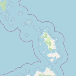
Kent Group National Park landscape and geographic character
The Kent Group islands present a landscape defined by their maritime setting in Bass Strait. The islands feature rocky coastlines with dramatic sea cliffs, wave-cut platforms, and numerous small beaches and coves where the islands meet the sea. The terrain is generally hilly, with the highest points offering panoramic views across the strait toward both mainland Australia and Tasmania.
The coastal landscape is characterized by exposed headlands battered by the often rough waters of Bass Strait, a channel notorious for its unpredictable weather and powerful swells. Inland, the terrain rises to more sheltered areas where heathlands and forests develop. The islands lack the dramatic alpine landscapes found in some Tasmanian parks, instead offering a more intimate scale of exposed island terrain with twisted trees shaped by persistent coastal winds.
The marine landscape surrounding the islands is equally distinctive, with clear waters supporting kelp forests and diverse benthic communities. The sea floor around the islands features a mix of rocky reefs, sandy bottoms, and areas of seagrass, creating varied underwater environments that contribute to the park's marine biodiversity. The productive waters support the fish and marine life that make the marine reserve component so ecologically significant.
Kent Group National Park ecosystems, habitats, and plant life
The nature of Kent Group National Park is defined by its position at a biogeographic boundary between mainland and Tasmanian ecosystems, combined with the unique pressures of an isolated island environment. The park encompasses both terrestrial and marine habitats, each supporting distinctive ecological communities. The marine environment is particularly notable, with the mixing of warm and cool water influences creating conditions favorable for high species diversity, especially among fish communities.
Terrestrial habitats include coastal heathland communities adapted to the harsh, wind-exposed island conditions, button grass dominated moorlands in wetter areas, and eucalyptus forest communities in more sheltered locations. These vegetation types support birdlife including various seabirds that use the islands for nesting, and land birds adapted to island life. The isolation of the islands has led to some species differentiation from mainland populations, reflecting the evolutionary pressures of island isolation.
The marine component of the park represents a significant conservation achievement, protecting productive waters that would otherwise face fishing pressure. The waters around the islands support diverse fish assemblages, marine mammals including seals that haul out on rocky shores, and seabirds that feed in the productive surrounding waters. The prohibition of fishing in the marine reserve area east of Deal Island helps maintain ecological integrity and allows marine communities to function with minimal human disturbance.
Kent Group National Park wildlife and species highlights
Wildlife at Kent Group National Park reflects its dual island and marine character. The marine waters support diverse fish communities, with the park recognized for its high fish species diversity likely attributable to the convergent influences of the East Australian Current and Bass Strait flows. The protected marine environment provides important habitat for commercially and ecologically significant fish species.
Seabirds represent a prominent component of the park's wildlife, with the islands providing nesting habitat for various species that rely on the isolated island environment for breeding success. The surrounding waters offer feeding grounds for pelagic seabirds. Marine mammals, particularly seals, use the rocky coastlines for resting and hauling out, taking advantage of the protected status that limits disturbance in key areas.
On land, the birdlife includes species adapted to heathland and forest habitats, with some populations showing adaptations to the island environment. The islands support both resident bird species and seasonal visitors that utilize the islands as stopover points during migration. The diverse habitats from exposed coastal heath to more sheltered forest patches support varying bird communities across the island group.
Kent Group National Park conservation status and protection priorities
Kent Group National Park represents an important conservation outcome for Bass Strait island ecosystems and the marine environment of the strait. The dual protection of both terrestrial and marine environments within a single protected area framework addresses the interconnected nature of island and ocean ecosystems. The marine reserve component, covering approximately 290 square kilometers, provides meaningful protection for productive waters that might otherwise face significant fishing pressure.
The park's conservation significance is enhanced by its role in protecting Aboriginal cultural heritage, with the islands representing continuous occupation for thousands of years. This cultural dimension adds another layer of conservation value beyond purely ecological considerations. The protection of the islands also preserves geological and geomorphological features that contribute to understanding Bass Strait's evolutionary history.
The progressive removal of grazing pressure, which continued on some island areas until 1996, has allowed ecological recovery and restoration of natural vegetation communities. This recent history of human use means the park continues to benefit from ongoing recovery, with vegetation and soils gradually returning to more natural conditions following the removal of cattle. The long-term management by Tasmania Parks and Wildlife Service ensures ongoing conservation of these significant island and marine environments.
Kent Group National Park cultural meaning and human context
The Kent Group islands hold deep cultural significance for Aboriginal Tasmanian peoples, with archaeological evidence demonstrating continuous human occupation spanning an estimated 8,000 to 13,000 years. This remarkable time depth places the islands among the earliest continuously occupied sites in the Bass Strait region, representing a long and enduring relationship between Aboriginal peoples and this island landscape. The islands would have provided important resources for coastal and maritime subsistence, with the rich marine environment supporting communities over millennia.
European history on the islands began with sealers establishing temporary settlements in the early nineteenth century, making this among the earliest European presence in Eastern Bass Strait. The Deal Island lighthouse, constructed in 1848 and operational until 1992, represents the most substantial period of European habitation and remains an important historical feature of the island group. This layered history, from Aboriginal heritage through colonial exploitation to contemporary conservation, gives the park a complex cultural narrative that contributes to its significance beyond purely natural values.
The islands exist within a broader cultural landscape of Bass Strait, which holds particular importance for Aboriginal Tasmanian communities as the land bridge connecting the island to mainland Australia during lower sea levels. This deep history of connection adds cultural resonance to the contemporary protected status of the Kent Group islands.
Top sights and standout views in Kent Group National Park
Kent Group National Park offers a distinctive combination of remote island wilderness and marine protection that sets it apart from most other Australian national parks. The opportunity to experience the unique Bass Strait island environment, with its rich Aboriginal heritage and European history, provides cultural dimension alongside natural values. The marine reserve component, with its diverse fish communities and productive waters, represents significant conservation protection in the temperate marine environment.
The historical Deal Island lighthouse, operational for over 140 years, remains an evocative feature of the park landscape. The park's relative remoteness and limited visitor infrastructure contribute to a sense of wilderness that contrasts with more accessible protected areas. The convergence of warm and cool water influences in the surrounding marine environment creates conditions supporting exceptional marine biodiversity within the protected waters.
Best time to visit Kent Group National Park
Visiting Kent Group National Park is influenced by the maritime climate of Bass Strait, which can present challenging conditions for travel to the islands. The summer months typically offer more stable weather conditions and calmer seas, making this the most reliable period for accessing the islands. However, Bass Strait is known for its variable conditions, and even during summer periods, weather can change rapidly.
The winter months can bring more active weather systems and rougher seas, potentially limiting access opportunities. However, the island environment has its own character in different seasons, with winter bringing different atmospheric conditions and wildlife viewing opportunities. The park's remote location means that planning around weather windows is an important consideration for any visit.
The shoulder seasons of spring and autumn may offer a balance between more favorable conditions and fewer visitors, though these periods can also present variable weather patterns. Visitors should be prepared for the possibility of weather-related changes to travel plans and should check current conditions before attempting to access the islands.