Mori Atlas logo
Park earthquake history

Review documented earthquake data points associated with the surrounding outback landscape

Historical Catalogue of Recorded Seismic Events Near Sturt National Park in New South Wales

This comprehensive collection provides a record of seismic events identified in proximity to Sturt National Park. The data includes documented dates, event magnitudes, and epicentre locations to assist in understanding the regional seismic history. Each entry reflects USGS-derived coordinates calculated by their distance from the park boundaries, offering an objective view of past activity in this arid region of New South Wales.

Related tags

OutbackDesertArid LandscapesMesa FormationsWildlife Conservation

Vast arid outback reserve protecting fragile desert ecosystems in far northwestern New South Wales

Sturt National Park

Sturt National Park is a sprawling 325,329-hectare protected area located in the arid far north-western corner of New South Wales, Australia. Established in 1972, the park was created from five former pastoral properties and honors Charles Sturt, the colonial explorer who spent a year in the area during his search for a fabled inland sea. The landscape is quintessential outback, featuring flat reddish-brown plains, distinctive mesas called the Olive Downs or Jump Ups, gibber stony plains, and in the far west, the sandhills of the Strzelecki Desert. The park is notable for its ecological significance, hosting a remarkable diversity of wildlife despite the harsh desert environment, and for the Wild Deserts conservation program that is reintroducing several locally extinct mammal species. The Dingo Fence runs along the park's northern boundary, and Cameron Corner, where three Australian states meet, is a popular remote destination within the park.

Location
Australia
Park type
National park
Established
1972
Area
3,253.3 km²
Sturt National Park New South Wales Atlas

Search Sturt National Park events by depth and distance

Browse historical earthquake data around Sturt National Park

Earthquake data around Sturt National Park is associated with the park through epicentre positions and calculated distances, not treated as events within its boundary. Browse dates, magnitudes, depths, location descriptions, distance figures, and references without presenting desert or park characteristics as seismic causes, defining hazard, or predicting later activity.

Sort by
Magnitude
Location

This page describes catalogued earthquakes associated with the park by epicentre location and distance. It does not establish causation, assess current danger, or predict future earthquakes.

No earthquake records match the current filters

Park atlas

Go beyond Sturt National Park earthquake observations

Continue to more protected places beyond Sturt National Park

Sturt National Park earthquake observations are followed by a separate collection of parks and protected places. Selection does not imply common desert environments, national park standing, ecology, geology, seismic experience, geographic proximity, hazard exposure, risk, or comparable source coverage.
National parkNew South Wales
6.4 km away#1 closest

East

Narriearra Caryapundy Swamp National Park: National Park Protected Landscape and Geographic Atlas

Explore mapped boundaries and regional context within New South Wales.

Narriearra Caryapundy Swamp National Park is a designated national park focused on preserving its unique protected landscape. This entry provides essential geographic context, detailing the park's mapped boundaries and its role within the regional atlas of New South Wales. Understand the protected natural area's identity and its place within the broader geographic framework for atlas exploration.

Area
1,534 km²
Established
2020
Relief
Lowland
Climate
Arid
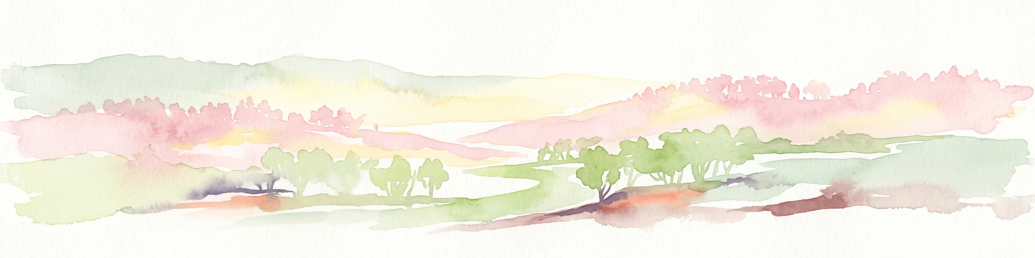
A horizontal watercolor painting showing abstract, soft-edged rolling hills in shades of pink, pale green, and yellow, with light green clusters representing trees or bushes in the foreground.
Nature reserveNew South Wales
159 km away#2 closest

East

Nocoleche Nature Reserve: Mapping the Paroo River Floodplains in New South Wales

A large-scale protected wetland and arid-zone woodland ecosystem.

Nocoleche Nature Reserve preserves the largest wetland network of its kind in New South Wales, characterized by its position along the unregulated Paroo River. The landscape transitions from vibrant riverine corridors with rare yapunyah woodlands to dry mulga and box shrublands. This protected expanse is an essential refuge for wildlife in the surrounding pastoral outback, offering a distinct study in arid-zone hydrology and land management.

Area
711.08 km²
Established
1979
IUCN
Ia
Relief
Lowland
National parkNew South Wales
166 km away#3 closest

Southeast

Mutawintji National Park: New South Wales Protected Area for Atlas Exploration

Mapping rugged outback terrain, gorges, and ancient rock art.

Mutawintji National Park in New South Wales offers a profound exploration of Australia's outback geography, significant Indigenous heritage, and protected landscapes. Discover the park's unique terrain, defined by the Byngnano Range, vibrant gorges, and river red gum-lined creeks, all rich with ancient Aboriginal rock art. This national park is a prime example of mapped protected area discovery, highlighting both natural beauty and critical conservation achievements.

Area
689.12 km²
Established
1998
IUCN
II
Relief
Mountain
National parkAustralia
168 km away#4 closest

Southeast

Paroo-Darling National Park: Mapped Boundaries and Protected Landscape Geography

Explore the geographic context of this Australian national park.

Paroo-Darling National Park is a protected national park offering insights into Australia's natural geography. This section provides details on its mapped protected area, highlighting the landscape and regional context. Understand the park's geographic footprint and its importance as a conservation landscape within the Australian continent.

Area
1,780.53 km²
Established
2000
IUCN
II
Relief
Upland
National parkSouth Australia
About 193 km away#5 closest

Southwest

Lake Frome National Park: Mapped Protected Area and Regional Geographic Identity in South Australia

Explore South Australia's unique landscape and park boundaries.

Lake Frome National Park offers a distinct focus for exploring the geography and protected landscape of South Australia. As a national park, it contributes to the mapped conservation network of the region, allowing for detailed study of its environmental context and geographic positioning. Discover the mapped terrain and regional park boundaries that define this significant protected area, crucial for a comprehensive atlas-based understanding of South Australia's natural heritage.

Area
2,582.4 km²
Established
1991
IUCN
VI
Relief
Lowland
National parkSouth Australia
195 km away#6 closest

Southwest

Vulkathunha-Gammon Ranges National Park: South Australia National Park Atlas Exploration

Mapped boundaries and regional geographic context.

Dive into the specifics of Vulkathunha-Gammon Ranges National Park, a designated national park situated in South Australia. This detailed resource focuses on its role as a protected landscape, providing users with critical geographic information. Understand the park's mapped boundaries and its relation to the broader regional geography, perfect for anyone engaged in atlas-based exploration of Australia's natural areas.

Area
1,257.23 km²
Established
1970
IUCN
II
Relief
Mountain
National parkSouth Australia
197 km away#7 closest

Northwest

Malkumba-Coongie Lakes National Park: A Protected Landscape in South Australia

Explore its mapped geography and regional park context.

Malkumba-Coongie Lakes National Park stands as a protected natural area within South Australia. This national park offers specific insights into the mapped landscape and regional geography of the Australian state. Understanding its boundaries and protected status contributes to a broader atlas view of conservation landscapes. Discover the unique geographic identity of this area for structured exploration and geographic context.

Area
266.69 km²
Established
2005
IUCN
II
Relief
Lowland
National parkQueensland
About 215 km away#8 closest

East

Currawinya National Park: Queensland's Ramsar Wetland and Mulga Lands National Park

Discover its arid landscape and protected area identity.

Currawinya National Park is a major protected area in Queensland, Australia, recognized for its significant Ramsar-listed wetland system, including Lakes Numalla and Wyara. These ephemeral lakes are vital drought refuges for waterbirds across inland Australia and represent a unique ecological feature within the park's expansive mulga lands landscape. The park also champions conservation initiatives, notably a large predator-exclusion enclosure for the greater bilby, showcasing its commitment to arid-zone biodiversity and landscape preservation.

Area
1,513 km²
Established
1991
IUCN
II
Relief
Lowland
MoriAtlas Explorer

Continue Exploring Sturt National Park's Geographic Identity and Mapped Boundaries

Deepen your understanding of Sturt National Park's specific landscape characteristics and its regional placement. By continuing, you can trace the park's mapped geography and learn more about its protected area designation. This exploration supports a structured atlas-based discovery of natural landscapes across New South Wales and beyond.