
Mori Atlas logo
Nearby park discovery

Map-based regional geography and proximity analysis for surrounding protected lands

National Forests and Protected Landscapes Near Talladega National Forest in Alabama

This geographic overview visualizes parks and protected areas situated within the vicinity of Talladega National Forest. The mapped data identifies neighboring protected landscapes and regional topography, allowing for a structured comparison of forest environments and wilderness zones across the Alabama landscape.

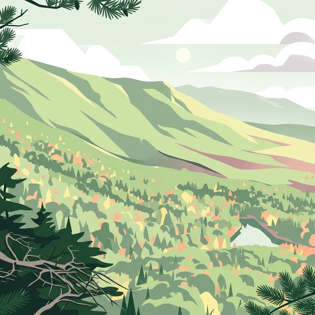
A flat-style digital illustration showing a lush, green mountain range under a light sky with simple clouds, with pine tree boughs framing the top and bottom corners.

A recovering Appalachian landscape in central and northeastern Alabama

Talladega National Forest

Talladega National Forest is one of four national forests in Alabama and stretches across the southern edge of the Appalachian Mountains. It covers roughly 392,567 acres in two physically separated blocks, one centered on the Oakmulgee District in the central part of the state and another on the Shoal Creek and Talladega Districts in the northeast. The forest includes some of Alabama's most prominent high country, including Cheaha Mountain, the state's highest point, and Dugger Mountain, the state's second-highest peak. The land was heavily logged and badly eroded before federal acquisition in the 1930s. Today it has grown back into a mix of pine, oak, and Appalachian hardwood forests that host a wide range of native wildlife and several protected species. Several long-term threats to southeastern forests, including the decline of the American chestnut, still play out across this landscape.

Location
United States of America
Park type
Protected landscape
Established
1936
Area
1,588.7 km²
Talladega National Forest Geography
Regional park map

See the ranked park cluster in its geographic setting

Nearby parks around Talladega National Forest

This regional map shows the same 20 nearby parks ranked below around Talladega National Forest. Select a ranked marker to highlight that park’s boundary where boundary data is available.
Reference park: Talladega National ForestRanked nearby park20 nearby parks shown
20 nearby parks

Distance-ranked regional park geography and surrounding landscape comparison

Parks and Protected Areas Geographically Near Talladega National Forest

Geographic distance measurements establish a ranked collection of nearby protected areas surrounding Talladega National Forest for systematic comparison. Country context and recorded environmental characteristics reveal broader regional landscape patterns without implying shared terrain.
Watercolor painting of a mountain landscape with soft layers of green hills, trees, and a foreground area, rendered in a pale and minimalist style.
Wildlife reserveAlabama
About 104 km away#1 closest

Northeast

Dugger Mountain Wilderness: Mapping Alabama's Appalachian Ridge and Forest Landscapes

Protected mountain terrain and regional Appalachian geography

Dugger Mountain Wilderness acts as a primary anchor for ecological preservation in Alabama. This wildlife reserve preserves over 9,000 acres of steep, roadless ridges near the Appalachian margin. By studying the topographic boundaries and forest cover of this area, observers can better understand the regional mountain characteristics and the critical role this terrain plays in maintaining intact, uninterrupted natural corridors.

Area
37 km²
Established
2000
IUCN
Ib
Relief
Mountain
Protected landscapeAlabama
About 108 km away#2 closest

Northwest

William B. Bankhead National Forest: Cumberland Plateau Landscapes and Geography

Protected river gorges and forested ridges in northwestern Alabama

Covering extensive tracts across Lawrence, Winston, and Franklin counties, William B. Bankhead National Forest anchors the regional geography of the Cumberland Plateau. This atlas entry provides a detailed look at the forest's stream-carved terrain, limestone geology, and its central role in preserving the riparian corridors of the Sipsey Fork and its surrounding protected wilderness.

Area
733.4 km²
Established
1918
Relief
Upland
Scope
Terrestrial
Protected landscapeMacon County
About 113 km away#3 closest

Southeast

Tuskegee National Forest: A Protected Landscape in Macon County, Alabama

Mapped geography and forest terrain in the American South

Tuskegee National Forest represents a concentrated pocket of protected land in Macon County, Alabama. As the smallest national forest in the country, it provides a dense network of trails and stream terraces that demonstrate how compact forests sustain regional biodiversity and outdoor recreation.

Area
45.54 km²
Established
1959
Relief
Upland
Climate
Subtropical
A pale, soft-focus watercolor painting showing a river with gentle banks and distant hills, with tree branches hanging in the top right corner.
Protected landscapeGeorgia
About 201 km away#4 closest

Northeast

Chattahoochee River National Recreation Area: Protected Landscape Map and Regional Geography

River corridors, Piedmont forest, and historic tributary gorges

This protected landscape in northern Georgia preserves a vital 48-mile corridor along the Chattahoochee River. The terrain shifts from vertical palisade cliffs to wide shoals and forested tributary gorges, weaving through the metropolitan landscape of Atlanta. The area serves as a significant regional anchor for natural river ecosystems and historic industrial remnants.

Area
42.69 km²
Established
1978
IUCN
V
Visitors
3.5M annual
Protected landscapeMississippi
About 227 km away#5 closest

West

Tombigbee National Forest: Geographic Atlas and Protected Landscape Overview

Mapping the forest terrain and regional watershed in Mississippi

Tombigbee National Forest represents a complex protected landscape divided into two non-contiguous sections across northeastern Mississippi. From the pine-and-hardwood ridges of its northern unit to the reservoir-anchored southern portion, the forest offers a detailed case study in regional topography and watershed management within the southeastern United States.

Area
271.16 km²
Established
1959
Relief
Upland
Climate
Subtropical
A wide watercolor painting showing a landscape of green rolling hills with trees in the foreground and layers of purple mountains in the background against a white background.
Protected areaGilmer County
About 254 km away#6 closest

Northeast

Rich Mountain Wilderness: Mapping Appalachian Ridges and Protected Terrain in Georgia

Explore the high-elevation forests of Gilmer County.

Rich Mountain Wilderness encompasses nearly 9,500 acres of undisturbed Appalachian mountain landscape. Characterized by its signature 4,050-foot peak and unique porter's loam soils, the area supports a diverse forest ecosystem shielded under federal wilderness protection within the Chattahoochee National Forest.

Area
38.35 km²
Established
1986
IUCN
Ib
Relief
Mountain
A soft watercolor illustration depicting a landscape of rolling hills and mountain silhouettes in shades of green, yellow, and faint red against a white background.
Protected landscapeGeorgia
About 263 km away#7 closest

Northeast

Ed Jenkins National Recreation Area and Southern Appalachian Mountain Geography

Protected forested ridges and trail gateway in northern Georgia

Covering over 23,000 acres, this protected area features the iconic southern terminus of the Appalachian Trail at Springer Mountain. The unit preserves a dense tapestry of hardwood forests, rolling ridges, and spring-fed stream valleys, representing a core portion of the Blue Ridge mountain range's continuous landscape in northern Georgia.

Area
94.4 km²
Established
1991
Relief
Mountain
Climate
Temperate
Watercolor painting of a green landscape featuring rolling hills, small clusters of trees, and a calm water feature in the foreground.
Protected landscapeMississippi
About 286 km away#8 closest

Northwest

Holly Springs National Forest: Geographic Context and Protected Landscape Boundaries

Northern Mississippi forest topography and ecological restoration geography.

Holly Springs National Forest occupies the rolling hills of north central Mississippi, where federal land tracts form a complex mosaic with private holdings. This protected area features diverse forest types including loblolly and shortleaf pine uplands alongside bottomland hardwood swamps. It serves as an essential watershed region, hosting multiple reservoirs like Chewalla Lake and Puskus Lake while protecting the headwaters of the Wolf River.

Area
629.94 km²
Established
1936
Relief
Upland
Climate
Subtropical
Wildlife reserveTennessee
About 288 km away#9 closest

Northeast

Gee Creek Wilderness: Geographic Atlas of an Appalachian Forested Wildlife Reserve

Protected mountain terrain in the Tennessee foothills

Gee Creek Wilderness is a federally protected area in southeastern Tennessee characterized by its small, roadless footprint and rich Appalachian forest composition. The reserve showcases the dramatic intersection of forested ridgelines and stream-carved valleys, providing a concentrated look at the ecological character of the Cherokee National Forest's lower Appalachian zone.

Area
10.09 km²
Established
1975
IUCN
Ib
Relief
Upland
A pale, minimalist watercolor painting showing layers of soft green hills and a gentle stream against a white background.
Wildlife reserveGeorgia
About 290 km away#10 closest

Northeast

Raven Cliffs Wilderness: Exploring the Appalachian Ridges and Protected Forest Landscapes

High-elevation wilderness area in northern Georgia.

Spanning steep ridges and narrow valleys, Raven Cliffs Wilderness represents a significant protected area within the Chattahoochee National Forest. The landscape transitions from high, exposed ridgelines to dense hardwood forest, offering a compact yet varied study in Appalachian mountain geography.

Area
36.89 km²
Established
1986
IUCN
Ib
Relief
Mountain
A horizontal watercolor painting depicting a soft green landscape with rolling hills, a meandering stream, and foreground grasses against a light white background.
Protected landscapeNorth Carolina
About 295 km away#11 closest

Northeast

Nantahala National Forest: Geographic Overview of Protected Appalachian Mountain Landscapes

Mapping deep river gorges and temperate rainforests in North Carolina

The Nantahala National Forest represents a significant conservation achievement, encompassing diverse southern Appalachian mountain terrain. The landscape features deep river gorges, ancient old-growth forests, and extensive networks of waterfalls. This overview provides mapped context on its vast wilderness areas, including Joyce Kilmer-Slickrock, and the long-distance trail corridors that traverse this temperate rainforest region.

Area
2,150 km²
Established
1920
Relief
Mountain
Climate
Temperate
A watercolor illustration of a coastal landscape with a sandy shoreline, soft green dunes, and a gentle pink horizon against a white background.
Protected landscapeFlorida
About 310 km away#12 closest

South

Gulf Islands National Seashore: Mapped Landscapes and Protected Coastal Geography

Coastal terrain across Florida, Alabama, and Mississippi.

Spanning diverse units across the Gulf Coast, Gulf Islands National Seashore preserves dynamic barrier islands and mainland reserves. This geographic profile traces the quartz-sand beaches, maritime ecosystems, and historic defense networks that form this protected landscape, providing context on its unique geologic and environmental evolution.

Area
548.179 km²
Established
1971
IUCN
V
Visitors
8.3M annual
A horizontal watercolor painting showing a soft, impressionistic landscape with mature trees in the foreground, rolling green hills in the midground, and faded purple mountain silhouettes in the distance against a white background.
Wildlife reserveNorth Carolina
About 331 km away#13 closest

Northeast

Joyce Kilmer-Slickrock Wilderness: Mapped Topography and Protected Forest Boundaries

Old-growth Appalachian wilderness in North Carolina

Analyze the dramatic valley-and-ridge geography of the Joyce Kilmer-Slickrock Wilderness. This protected area, encompassing the rare Joyce Kilmer Memorial Forest, serves as a vital reference for eastern forest conservation, featuring ancient hardwood groves and sweeping mountain vistas across the Unicoi range.

Area
70 km²
Established
1975
IUCN
Ib
Relief
Mountain
Protected landscapeSouth Carolina
About 334 km away#14 closest

East

Sumter National Forest: Mapping Protected Landscapes and Terrain in South Carolina

Bridging Piedmont forests and Appalachian mountain foothills

Sumter National Forest offers a study in geographic contrast, as its three districts span the transition from South Carolina Piedmont ridges to the rugged spurs of the Blue Ridge Mountains. This protected area features the Chattooga Wild and Scenic River corridor, expansive hardwood-conifer mosaics, and complex mountain watersheds. The forest provides a window into regional land restoration, where reclaimed farmland and mountain ridges now form a continuous network of protected natural terrain.

Area
1,500.98 km²
Established
1936
Relief
Mixed relief
Climate
Temperate
National parkTennessee
About 342 km away#15 closest

Northeast

Great Smoky Mountains National Park: Exploring Its Protected Landscape and Regional Geography

Tennessee's premier national park, mapped for landscape discovery.

Delve into the protected area identity of Great Smoky Mountains National Park, a significant natural landmark within Tennessee. This page provides detailed context on its mountainous terrain, mapped ecological zones, and its foundational role in the broader geography of eastern North America. Understanding the park's specific protected landscape features and its geographic setting is essential for appreciating its unique conservation value.

Area
2,114.15 km²
Established
1934
IUCN
II
Visitors
12.2M annual
A horizontal watercolor painting depicting a flat, green coastal marsh with distant purple hills under a pale sky.
Wildlife reserveMississippi
About 364 km away#16 closest

Southwest

Grand Bay National Estuarine Research Reserve: Mississippi Coastal Protected Area Geography

Mapping estuarine ecosystems and coastal forest mosaics

Focusing on the interface between the Mississippi Sound and terrestrial habitats, this reserve protects a vital expanse of estuarine waters, oyster reefs, and pine savanna. Its geography highlights the dynamic interaction of tidal channels, shoreline erosion, and fire-dependent ecosystems within the broader Gulf of Mexico coastal region.

Area
74 km²
Established
1999
IUCN
IV
Relief
Lowland
A soft watercolor illustration depicting a winding river, a small waterfall over layered rocks, and distant rolling mountains in muted green, blue, and brown tones.
Wildlife reserveUnited States of America
About 365 km away#17 closest

Northeast

Ellicott Rock Wilderness: Geographic and Historic Protected Landscape Overview

A rare tri-state wilderness in the Southern Appalachian Mountains

Discover the mapped terrain of Ellicott Rock Wilderness, a protected area defined by its steep river gorges, dense cove forests, and unique position at the tripoint of three U.S. states. This wilderness area preserves the Chattooga River corridor and historic survey landmarks within the southern Blue Ridge Mountains, offering deep insight into the regional geography of the American southeast.

Area
33.48 km²
Established
1975
IUCN
Ib
Relief
Mountain
Watercolor painting of a winding trail through grassy hills with mountains in the background, using a soft pastel color palette of greens, purples, and yellows.
Protected landscapeNorth Carolina
About 388 km away#18 closest

Northeast

Pisgah National Forest: Protected Appalachian Mountain Geography and Regional Mapping

An extensive mountain forest in western North Carolina

Pisgah National Forest represents a major protected landscape in the southern Appalachian Mountains of North Carolina. Its diverse terrain includes high peaks above 6,000 feet, dense hardwood forests, and deep river gorges. Recognized as a historic center for professional forestry, the area protects extensive watersheds and wilderness zones, offering a detailed case study in Appalachian geography, conservation science, and rugged mountain topography.

Area
2,075.06 km²
Established
1916
Relief
Mountain
Climate
Temperate
A watercolor painting showing a stylized landscape with rolling green hills, a band of trees, and a pale pink lake surface under a soft morning sky.
Protected landscapeUnited States of America
About 388 km away#19 closest

North

Land Between the Lakes National Recreation Area: Mapped Geography and Protected Landscapes

An inland peninsula preserved between two major river reservoirs.

Land Between the Lakes National Recreation Area occupies a distinct narrow land bridge between Kentucky Lake and Lake Barkley. This protected landscape contains a dense mix of forested ridges, stream valleys, and managed wildlife prairies. The area is integral to the lower Ohio River Valley geography, showcasing the results of long-term watershed management and large-scale ecological restoration within the United States.

Area
693.1 km²
Established
1963
Visitors
2M annual
Relief
Lowland
A pale, abstract watercolor painting depicting gentle, tree-covered mountain ridges against a white background.
Wildlife reserveNorth Carolina
About 399 km away#20 closest

Northeast

Middle Prong Wilderness: High-Elevation Appalachian Forest and Watershed Geography

Rugged ridges and headwaters in the Pisgah National Forest

Middle Prong Wilderness encompasses nearly 7,900 acres of protected southern Appalachian terrain. This rugged landscape, ranging from deep valley floors to wind-swept high-elevation ridges, serves as a vital protected corridor adjacent to Shining Rock Wilderness, showcasing a complex mosaic of hardwood and spruce-fir forest ecosystems within the Blue Ridge Mountains.

Area
32 km²
Established
1984
IUCN
Ib
Relief
Mountain
Distance methodology

Geographic measurements, not driving distances

How nearby park distances are calculated

Distances use park boundaries whenever the available geometry allows it. When one or both boundaries are missing, the mapped park locations provide a clearly labelled estimate. Every value represents straight-line geographic separation and does not use roads or routing.

Boundary distance

Calculated between the nearest points of both park boundaries.

Location-to-boundary estimate

Estimated from one mapped park location to the nearest boundary of the other park.

Mapped-location estimate

Estimated between the mapped locations of both parks.

MoriAtlas Explorer

Explore the Mapped Protected Landscapes of Talladega National Forest

Continue your geographic exploration into the ridges, mountain peaks, and recovering Appalachian ecosystems of Talladega National Forest. Use MoriAtlas to trace the protected boundaries and regional terrain that define this significant Alabama landscape.

Global natural geography