
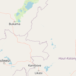
Streams
Park geography
Detailed spatial analysis covering regional boundaries, river systems, and terrain features
Geographic Profile and Landscape Mapping of Upemba National Park in Democratic Republic of the Congo
Examine the physical characteristics of Upemba National Park, spanning over 11,730 square kilometers across the Haut-Katanga, Haut-Lomami, and Lualaba provinces. This profile details the park's expansive boundary geometry, diverse river networks like the Lufira, and complex mountain and wetland terrain.
Related tags
wetlandsmiombo woodlandsmontane grasslandslake ecosystemsbirdwatching
DRC's largest protected wilderness spanning highlands, wetlands, and a chain of equatorial lakes
Upemba National Park
Upemba National Park is a vast protected wilderness area in the southeastern Democratic Republic of Congo, encompassing a remarkable range of ecosystems from mountainous highlands to extensive wetlands and freshwater lakes. Established in 1939, it was originally the largest national park in Africa, covering over 17,000 square kilometers, though its boundaries have been adjusted over the decades to its current extent of approximately 10,000 square kilometers of core protected land plus an additional annex zone. The park sits across Haut-Lomami, Lualaba Province, and Haut-Katanga Province, straddling two distinct geographic zones: the lush Upemba Depression with its chain of lakes and marshes centered around Lake Upemba, and the drier Kibara Plateau rising into mountainous terrain. This topographic diversity supports an extraordinary array of habitats, from Afromontane grasslands and forests through Miombo woodlands and tropical rainforests to papyrus-dominated wetlands, making it one of the most ecologically significant protected areas in central Africa.
- Location
- Democratic Republic of the Congo
- Park type
- National park
- Established
- 1939
- Area
- 11,730 km²
Location overview
Provincial placement within the Democratic Republic of the Congo
Upemba National Park Geographic Location and Regional Settings
Upemba National Park is located in the Democratic Republic of the Congo, spanning Haut-Katanga, Haut-Lomami, and Lualaba. Regional records outline its administrative layout across these three interior provinces.
- Countries
- Democratic Republic of the Congo
- Regions
- Haut-Katanga Province, Haut-Lomami, Lualaba Province
- Primary location
- Democratic Republic of the Congo
- Geographic setting
- Inland
Boundary and coordinates
Upemba National Park’s stored outline spans 11,730 km²
Upemba National Park mapped boundary and 11,730 km² area
Upemba National Park's stored boundary geometry conveys the vast shape and scale of its 11,730 km² protected footprint. The record holds this overall measurement without land and marine components and without a perimeter value.
- Boundary area
- 13,184 km²
- Boundary perimeter
- 734.7 km
- Northernmost point
- 8.2754° S
- Southernmost point
- 9.865° S
- Easternmost point
- 27.3129° E
- Westernmost point
- 25.9302° E
- Geographic centre
- 9.0211° S, 26.5824° E
- North–south span
- 175.8 km
- East–west span
- 152 km
Terrain and natural features
Mixed mountain terrain classification and recorded hydrographic features
Upemba National Park Terrain and Mapped Natural Features
Upemba National Park exhibits a mixed mountain terrain classification encompassing multiple recorded streams, rivers, and lakes situated within its boundaries. Linked feature cards supply specific names, types, and spatial relationships for each recorded natural hydrographic entry.
Selected named natural features
Streams
Buye-Bala
Streams
Lubumbwe
Streams
Kikete
Streams
Luangeji
Streams
Muninga
Environmental setting
Interpreting stored habitat types, water presence, and relief data
Upemba National Park Environmental Settings and Landscape Classifications
Recorded landscape features and habitat types provide complementary perspectives on the physical setting of Upemba National Park. Stored classifications connect directly to related protected area records across the geographic database.
- Relief
- Mixed relief
- Water
- Major water bodies
- Forest cover
- Mostly forested
Landscape features
Mountains · Valleys · Plateau · Lakes · Rivers · Wetland
Habitat types
Temperate broadleaf forest · Mediterranean forest · Tropical forest · Grassland · Wetland · Riverine habitat · Lacustrine habitat
Park atlas
Compare adjacent protected landscapes and trace the regional park geography around Upemba National Park.
Discover Other National Parks and Protected Areas Surrounding Upemba National Park
Continue your journey through central African protected areas by browsing other national parks and protected landscapes within the regional geography surrounding Upemba National Park. Compare their unique ecosystems, from wetlands to montane plateaus, and understand the broader conservation efforts across the Democratic Republic of Congo's diverse natural reserves.
National parkHaut-Katanga Province
16 km away#1 closest
Southeast

Kundelungu National Park National Park: Central Africa's Protected Savanna Landscape
Explore the mapped terrain and dramatic geography of this Haut-Katanga Province protected area.
Kundelungu National Park stands as a significant protected area within the Haut-Katanga Province, offering a deep dive into Central Africa's expansive savanna ecosystems and unique natural landmarks. This national park is defined by its rolling grasslands, dotted with characteristic forest galleries that trace the region's water systems, alongside the awe-inspiring Lofoi Falls. Understanding Kundelungu National Park through its mapped boundaries and geographic context reveals its importance as a protected landscape and a key component of regional conservation efforts within the DRC.
- Area
- 7,600 km²
- Established
- 1970
- IUCN
- II
- Relief
- Upland
National parkNorthern Province
209 km away#2 closest
East

Mweru Wantipa National Park: National Park in Northern Province, Zambia
Discover mapped boundaries and regional geography
Delve into Mweru Wantipa National Park, a protected national park located in Zambia's Northern Province. This entry provides detailed geographic context, focusing on the park's mapped boundaries and its role as a protected landscape. Understand its position within regional geography and explore its contribution to the broader atlas of natural areas.
- IUCN
- II
- Relief
- Lowland
- Climate
- Tropical
- Access
- Highly restricted
National parkLuapula Province
About 214 km away#3 closest
East
Lusenga Plain National Park: Zambia National Park Geographic Atlas
Mapped park boundaries and regional landscape context.
Gain a structured understanding of Lusenga Plain National Park, a dedicated national park situated in Zambia's Luapula Province. This resource details the park's geographic dimensions and its placement within the regional landscape, providing essential context for atlas exploration and a mapped view of protected lands.
- Area
- 800 km²
- Established
- 1972
- IUCN
- II
- Relief
- Lowland
National parkZambia
311 km away#4 closest
East
Nsumbu National Park: Zambia's Lakeside Protected Landscape, Map Atlas, and Geographic Context
Mapped terrain and unique shoreline geography.
Nsumbu National Park stands as a vital protected landscape in Zambia, defined by its prominent position on Lake Tanganyika. The park's approximately 2,026 square kilometers showcase a dramatic geographic interplay between terrestrial environments, including miombo woodlands and rare Itigi-Sumbu thicket, and the vast aquatic expanse of the lake. Users exploring this atlas entry will find detailed information on the park's mapped boundaries, distinctive shoreline features like rocky cliffs and sandy beaches, and its overall role in the regional geography of Southern Africa.
- Area
- 2,026 km²
- Established
- 1985
- IUCN
- II
- Relief
- Lowland
National parkZambia
About 355 km away#5 closest
Southwest
West Lunga National Park: Exploring Zambia's Sole Evergreen Forest Protected Area
Discover rare Cryptosepalum dry forests and unique mapped geography.
West Lunga National Park offers a distinct atlas exploration opportunity as Zambia's only national park primarily defined by its forest cover. This remote protected area safeguards the largest evergreen forest in Africa outside the equatorial zone, characterized by dense Cryptosepalum trees forming a closed canopy over sandy terrain. Understand the park's unique landscape, its geographic position within the region, and its importance as a conservation area with mapped protected boundaries.
- Area
- 1,700 km²
- IUCN
- II
- Relief
- Lowland
- Access
- Remote access
National parkUvinza District
375 km away#6 closest
Northeast

Mahale Mountains National Park: Tanzania's Remote Mountain Forest & Lake Tanganyika Landscape
Explore unique primate habitats and dramatic protected terrain.
Mahale Mountains National Park stands as a testament to unique ecological convergence, where the Mahale Mountains' dense forests dramatically meet the vast expanse of Lake Tanganyika. This protected area is globally recognized for harboring the largest wild population of eastern chimpanzees, offering a rare glimpse into their behavior within a pristine wilderness. The park's landscape is defined by steep mountain slopes, diverse woodland, and aquatic environments, creating a distinctive geographic context that sets it apart from typical savanna protected areas in Tanzania.
- Area
- 1,650 km²
- Established
- 1985
- IUCN
- II
- Visitors
- 1.1K annual
National parkNorthern Province
About 448 km away#7 closest
Southeast
Isangano National Park: Exploring Its Protected Landscape and Geographic Identity in Northern Province
Discover the mapped boundaries and regional context of this national park.
Isangano National Park stands as a protected national park within the vast geographic expanse of Zambia's Northern Province. This dedicated entry provides critical context for understanding the park's role as a conservation landscape, detailing its physical geography and its position within regional atlas data. Explore the mapped outlines and natural terrain features that define Isangano National Park, offering a foundational view for broader geographic exploration and protected-area research.
- Area
- 840 km²
- Established
- 1972
- Relief
- Lowland
- Climate
- Tropical
National parkMoxico Leste Province
456 km away#8 closest
Southwest

Cameia National Park: Unique Zambezi Basin Wetlands and Miombo Woodlands in Angola
Explore the mapped geography of Angola's sole Zambezi basin ecological sample.
Cameia National Park is a significant protected area in Moxico Leste Province, Angola, distinguished by its status as the country's only representation of Zambezi River basin ecosystems. The park features extensive seasonally inundated plains and characteristic miombo woodlands, offering a unique mosaic of wetland and forest landscapes. Understanding its geographic setting, hydrological connections to the Chifumage, Lumege, and Luena rivers, and its position within the broader Zambezi drainage system provides essential context for this irreplaceable protected territory.
- Area
- 1,445 km²
- Established
- 1938
- IUCN
- II
- Relief
- Lowland
MoriAtlas Explorer
Continue Exploring Upemba National Park's Protected Landscape and Geography
Discover the full geographic context and atlas significance of Upemba National Park. Understanding its unique wetland systems, lake ecosystems, and mountainous terrain provides crucial insights into protected area dynamics in central Africa. Continue your exploration to map its boundaries and appreciate its role as a vital natural landscape.
Browse next
Global natural geography
Explore related park routes
Explore MoriAtlas Global ParksBrowse All MoriAtlas ParksGlobal Park Map DiscoveryMoriAtlas: Browse All CountriesBrowse All MoriAtlas ContinentsNational Park Environment AtlasGrand Canyon National Park AtlasYellowstone National Park AtlasYosemite National Park Atlas and GeographySerengeti National Park AtlasGalápagos National Park Protected LandscapeBanff National Park Geography and AtlasKruger National Park Atlas EntryUluṟu-Kata Tjuṯa National Park AtlasExplore Uluru-Kata Tjuta National Park GeographyPlitvice Lakes National Park AtlasFiordland National Park Protected LandscapeGreat Smoky Mountains National Park AtlasAfghanistan National Parks and Protected AreasAlbania National Parks and Protected AreasAlgeria National Parks and Protected AreasAmerican Samoa National Parks and Protected AreasAndorra National Parks and Protected AreasAngola National Parks and Protected AreasAntarctica National Parks and Protected AreasAntigua and Barbuda Park List